

I have divided my Craig yr Aderyn (Bird Rock) walk into two posts, of which this is the first. The first focuses exclusively on the Iron Age hillfort. This one looks at the walk itself, how to approach it, incidental information about the environment and views from all the parts of the walk that I did. This has to be one of the most magnificent walks in the area. You might want to drive on to the 13th century ruins of Castell y Bere if you have energy left afterwards.
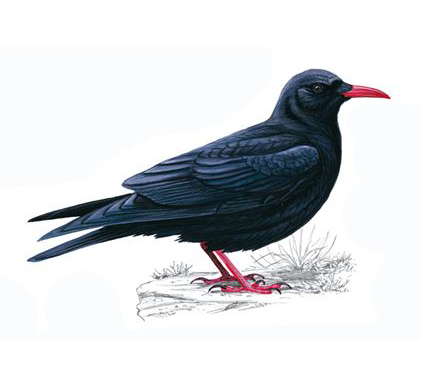
Chough. Source and more details: RSPB
As well as a destination for some of the most fabulous views in the area, it is also well known as the nesting site of cormorants (the furthest inland nesting ground for cormorants in Wales) and red-billed choughs (the latter on the endangered list). It is also houses a two-phase Iron Age hillfort. The hill used to be inhabited by feral goats, which were introduced in the 1960s, but slowly died out. In the more recent past the hill has been used as a quarry for road stone, but this has now been stopped. Today it is protected as a Site of Special Scientific Interest and a Special Protection Area. As the birds nest on the north face, they are undisturbed by walkers, and climbers are only allowed to scale that face outside the nesting season.
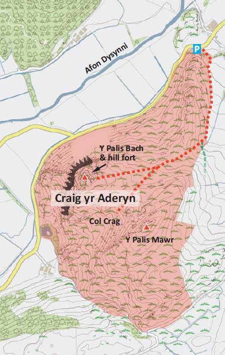
Map showing the parking area and the footpaths up Craig yr Aderyn. Source: Protected Landscapes of Wales
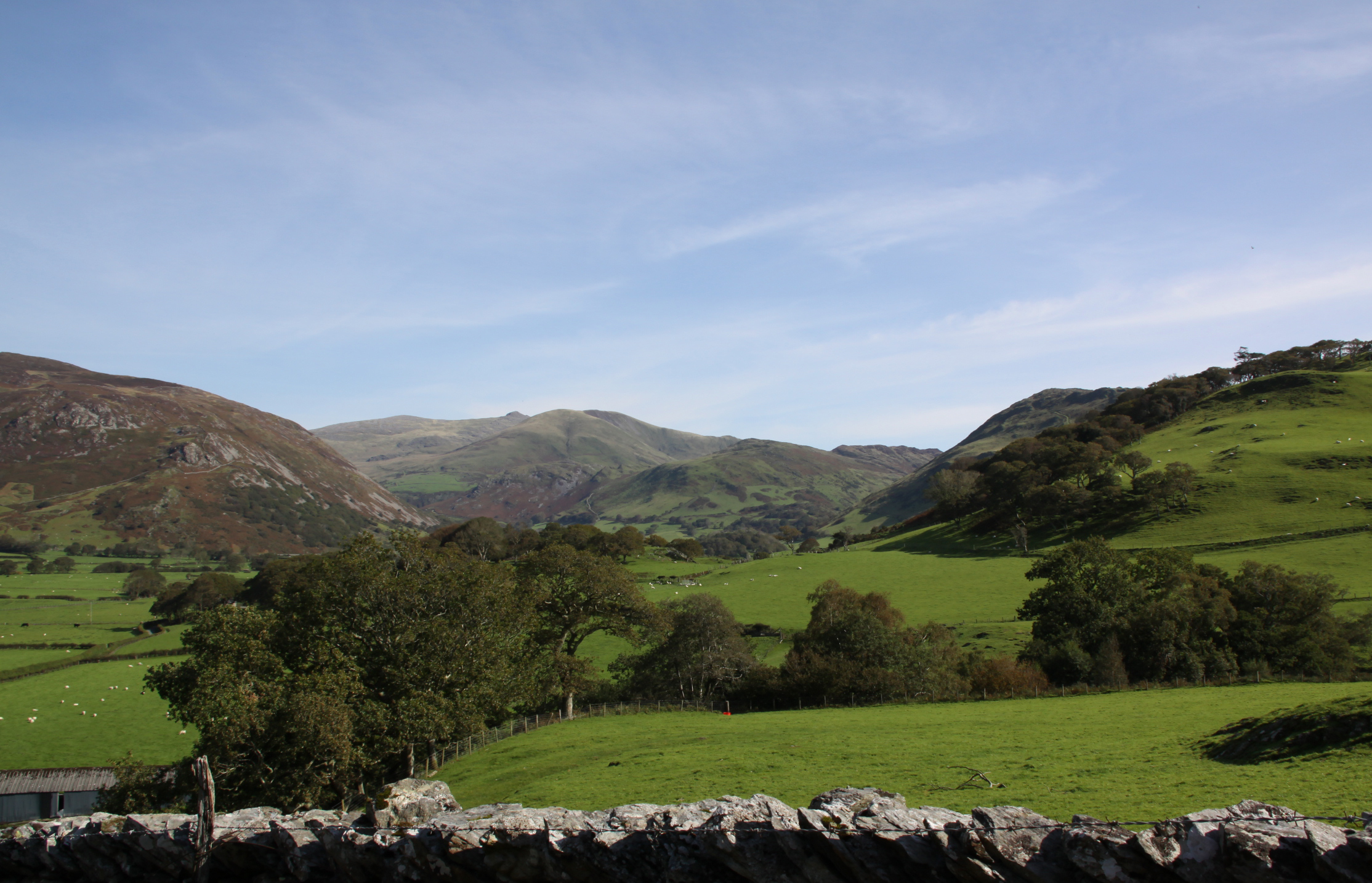
Craig yr Aderyn is a highly visible local landmark in the Dysynni valley (SH643068). A narrow road skirts its base, unfortunately not identified with a number on the Ordnance Survey map. If you are familiar with Happy Valley, where you can usually squeeze two cars past for most of the way, halve that. If you don’t like reversing, this may not be for you. From all directions, it is a single track road with occasional passing places, and I had to reverse three times for quite a way, once around some steep corners. From the west Craig yr Aderyn is best approached along the road from Bryncrug; from the east it can be approached from the B4405 from Abergynolwyn or via the very narrrow road through Abertrinant.
There is a small grassy parking area by the roadside at the foot of the hill, sufficient for about six or seven cars, and marked on the map above right, but not shown on the Ordnance Survey map. There is a farm gate here that opens onto a public footpath, a rocky farm track that starts off quite steeply before levelling out for a bit, although it inevitably rises again. After about 10 minutes, the track carries on beyond a gate across a field, just before which the footpath veers right, a grassy break in the bracken heading up the slope. If you find yourself pondering whether to go through another gate once out of the car park, you have gone too far. This fork is not signposted, just has a 2ft tall post on the right of the track to mark its presence, so look out for it.
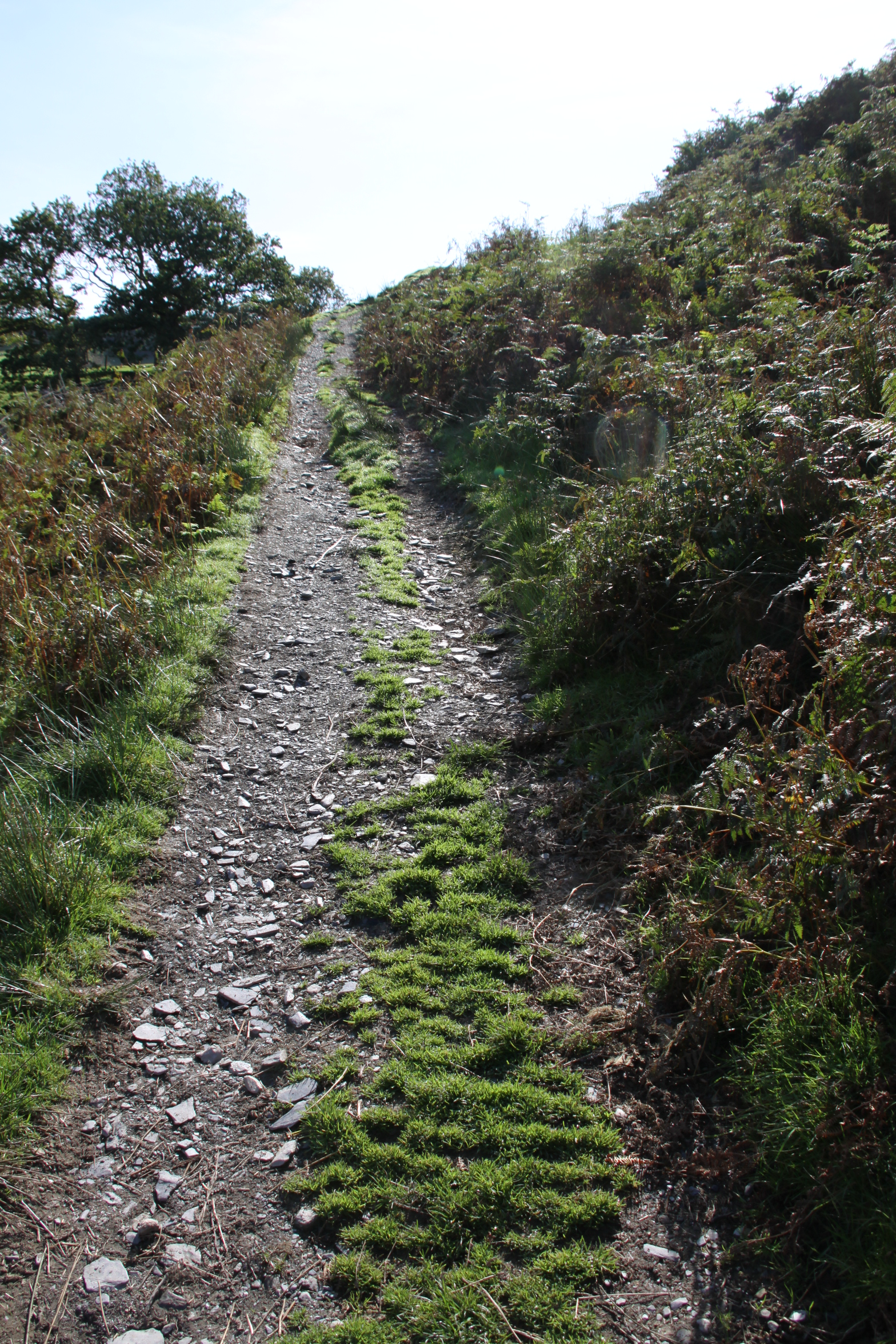
The path up from the car park
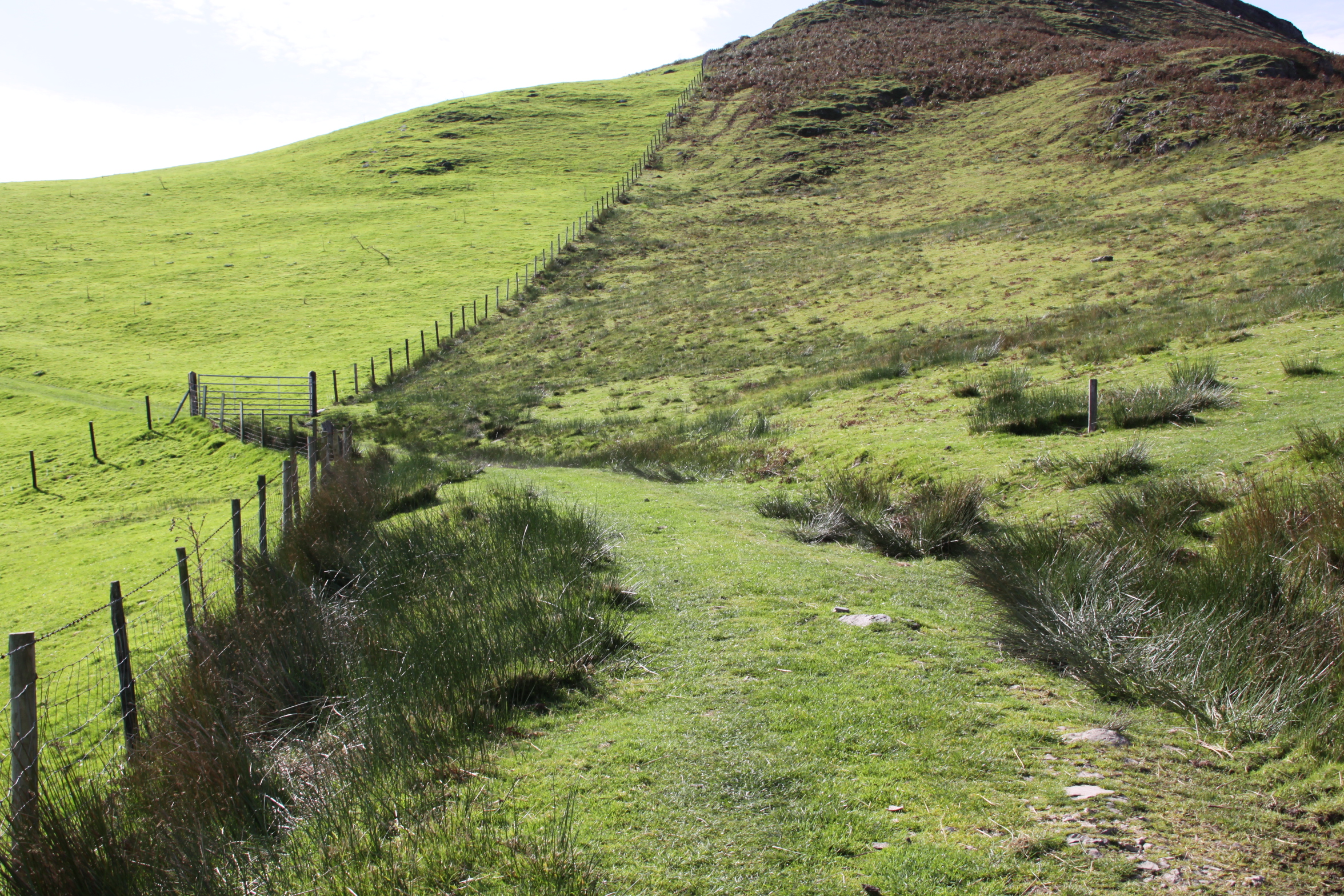
The gate in front of a track heading over the field, and the small post at the centre right of the photograph, where you turn up onto the hillside.
The public footpath that leads from the track up the hillside
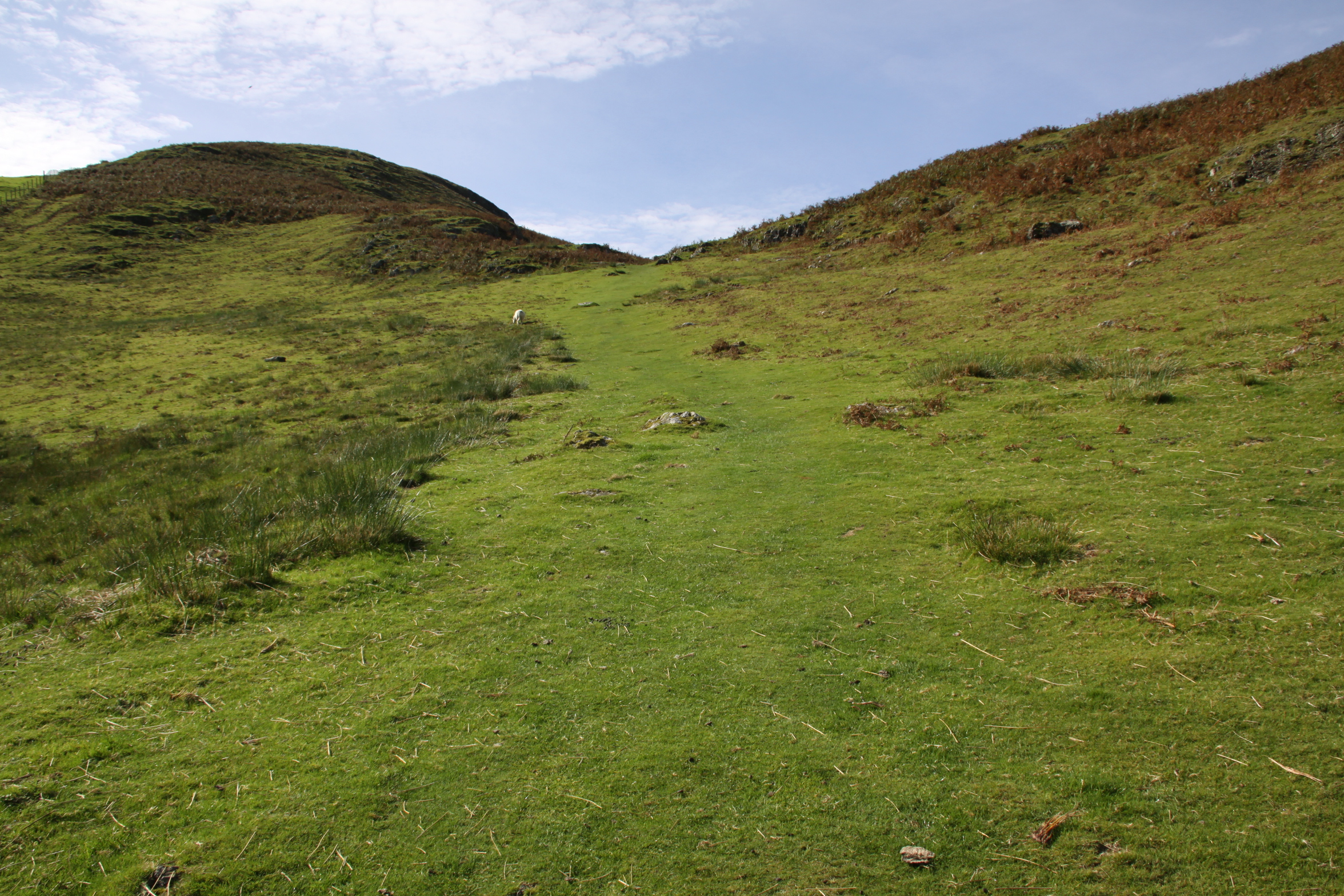
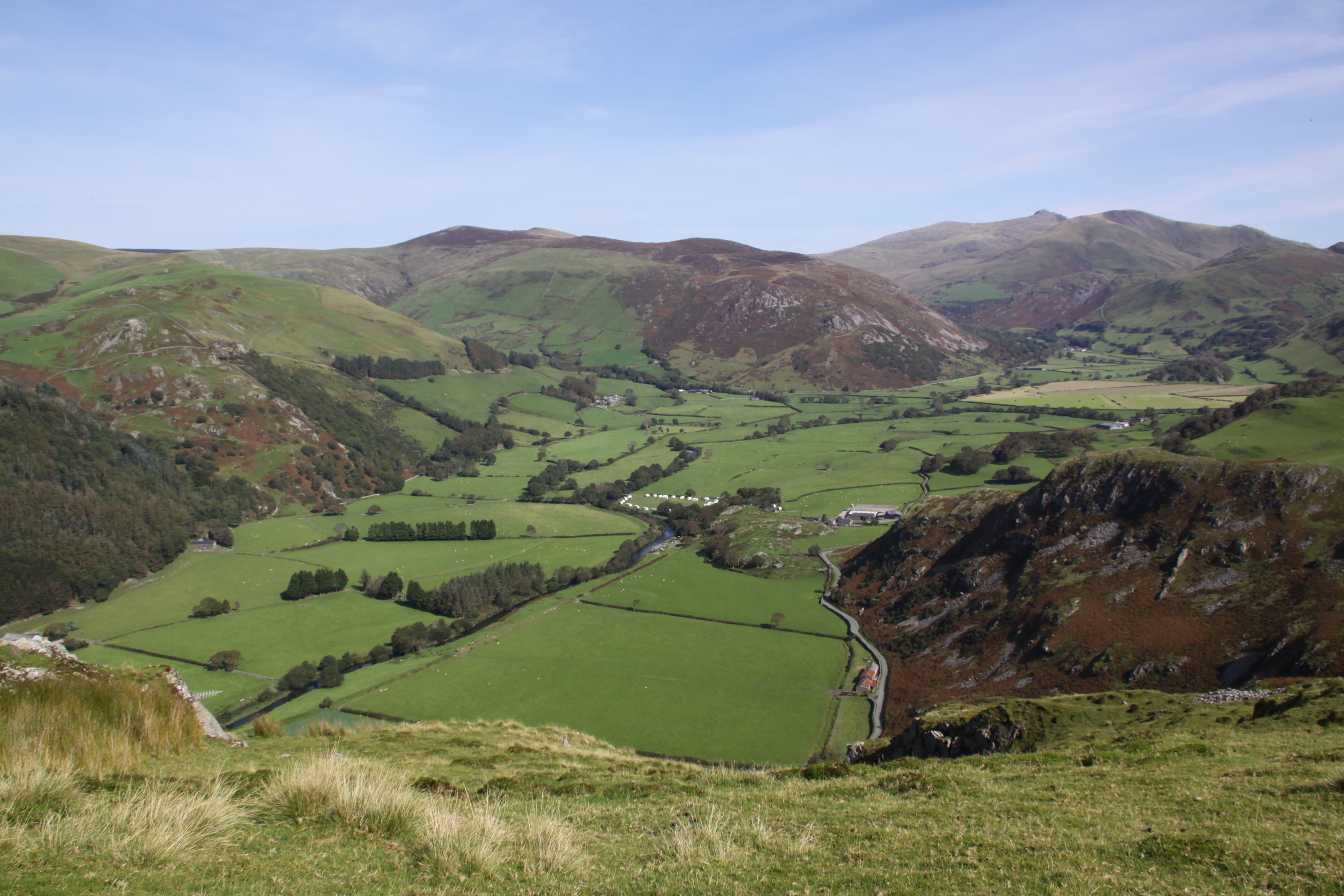
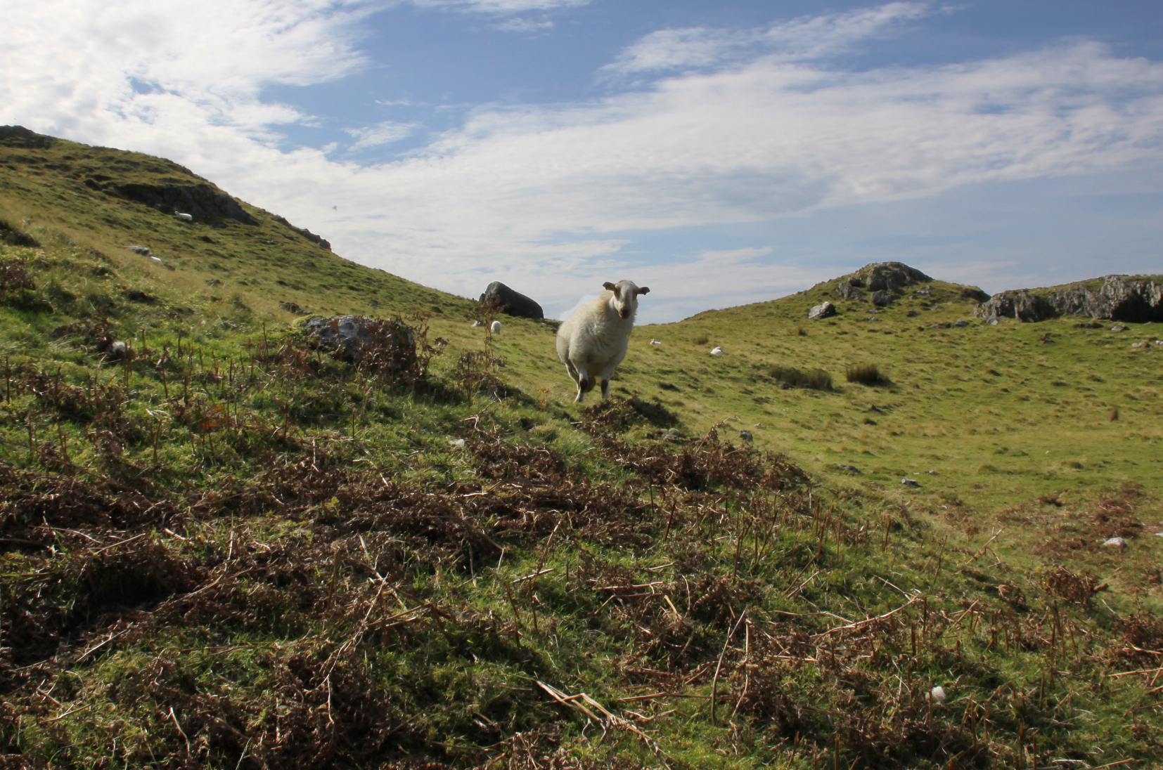
The path from here is good, but climbs a lot more steeply, and doesn’t let up much. In winter it is likely to be very wet, as even in Monday’s high heat, after two very dry days, it was distinctly soggy in places. Don’t forget to keep turning round to enjoy the fantastic views. There’s almost no sound up there except for the tiny birds that nest in the long grass, and some crows.
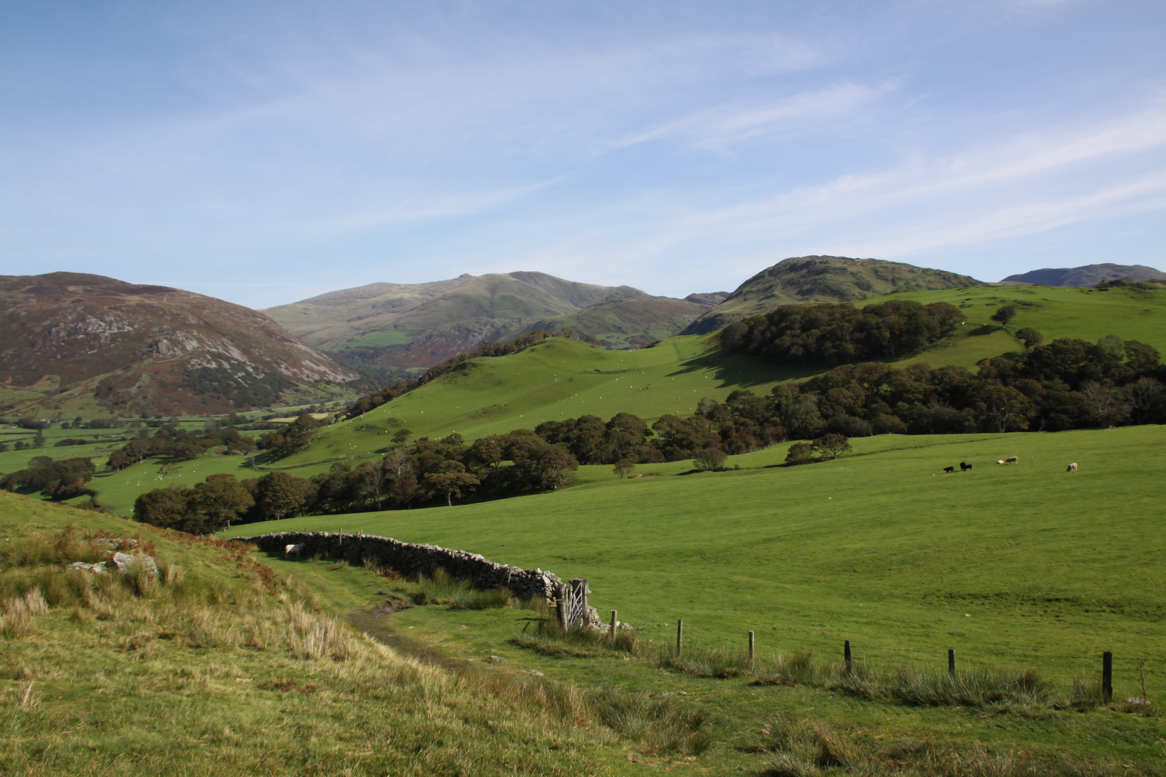
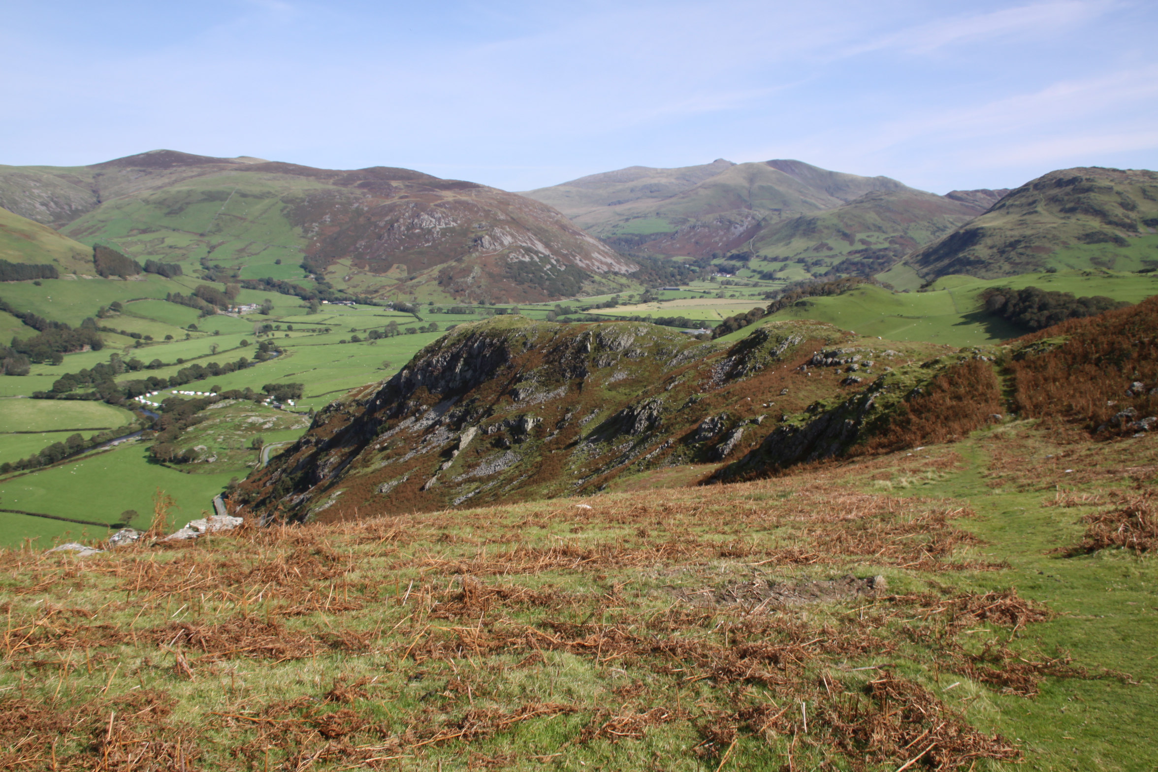
When you have been walking for perhaps another 15 minutes there is another fork, which is not signposted in any way, but is clearly visible on the ground as wide turf tracks that make their way through low bracken. One track leads to the hillfort on Y Pallis Bach (the low stockade) and the other leads to Col Crag, the foot of a small crag that sits on the saddle that connects Craig yr Aderyn (Bird Rock) with the main line of the hill behind.
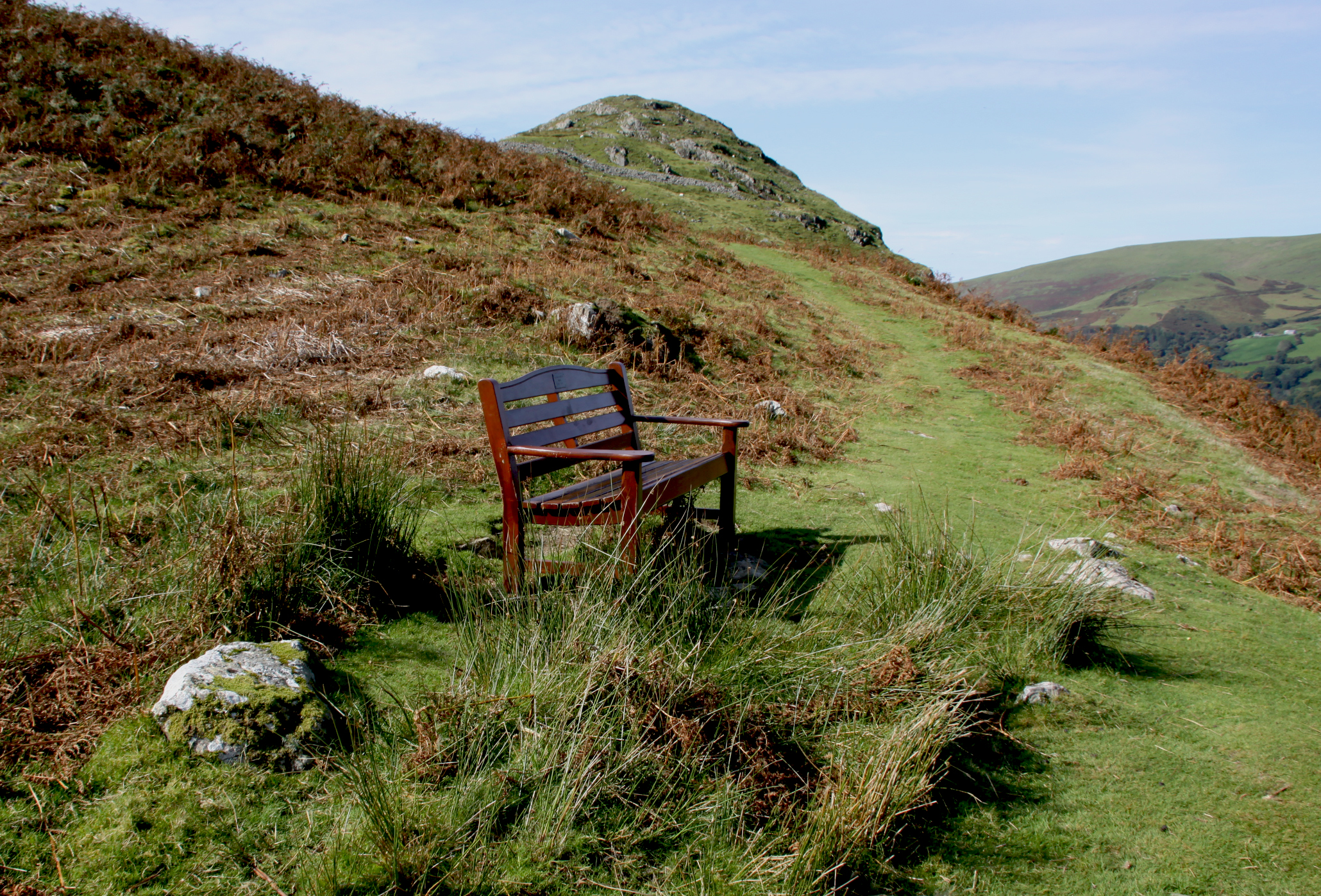
There’s a very well-timed bench at this fork in the path, dedicated to Nick (I don’t know who he was, but I love him), which is at the perfect point for taking a much-needed breather on a seriously hot day and admiring the views. I flopped with enthusiasm. Once you have enjoyed a slurp of water and enjoyed the scenerey, you simply follow the right hand fork beyond the bench to reach the hillfort, which you can see from the bench, or you can head left to go to Y Pallis Bach. I do recommend the views from Craig yr Aderyn.


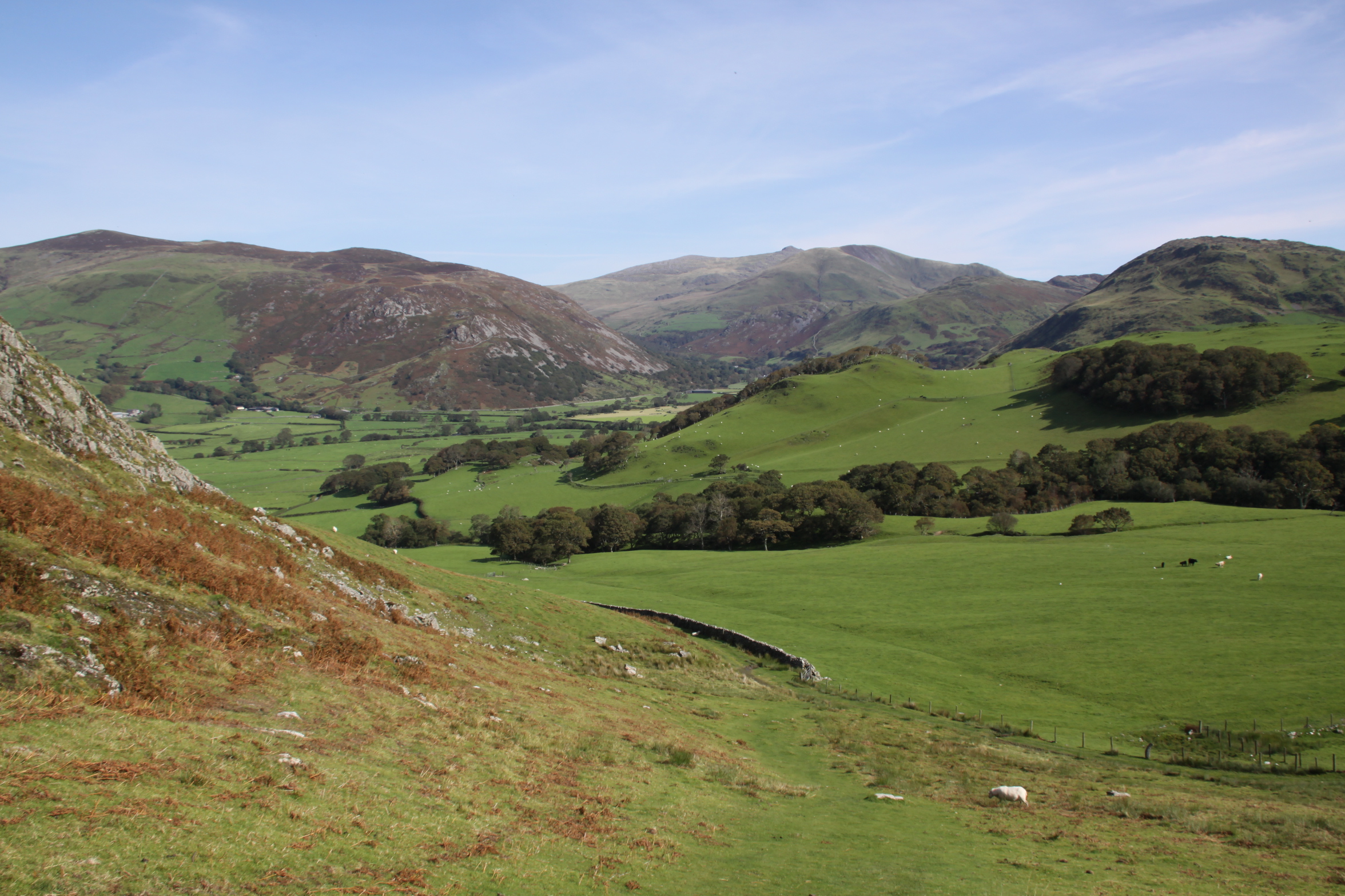
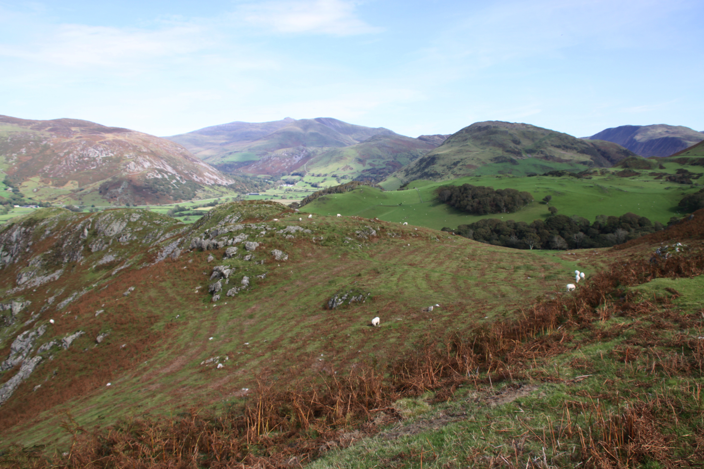
Thread your way up through the main entrance of the Iron Age hillfort, which is flanked by two great banks of local stones. This is the second phase entrance. Keep heading upwards for a couple minutes and you will very soon reach the summit. Pause and enjoy. The world is your thoroughly fantastic oyster – the whole of the western Dysynni valley rolls out before you, a truly astonishing sight. Head a little way down from the summit, nearer to the edge, and the view is even better. I plonked down on a convenient rock and was only sad that I hadn’t brought a picnic. This has to be the ultimate picnic spot. Next time.


After a very lazy sit in the sun and loving the view, I retraced my steps to the hillfort. I had an archaeological site plan for the hillfort and try to match up the plan with what is left on the ground. As I came down I bumped into a lovely couple who had left their car in Dolgellau and were on a six night camping hike, looping back to Dolgellau at the end of their holiday. Now that’s serious walking! Very impressive. They were looking for a way down the other side of the hillfort rather than retracing their steps. I didn’t see them again, so perhaps they found a route.
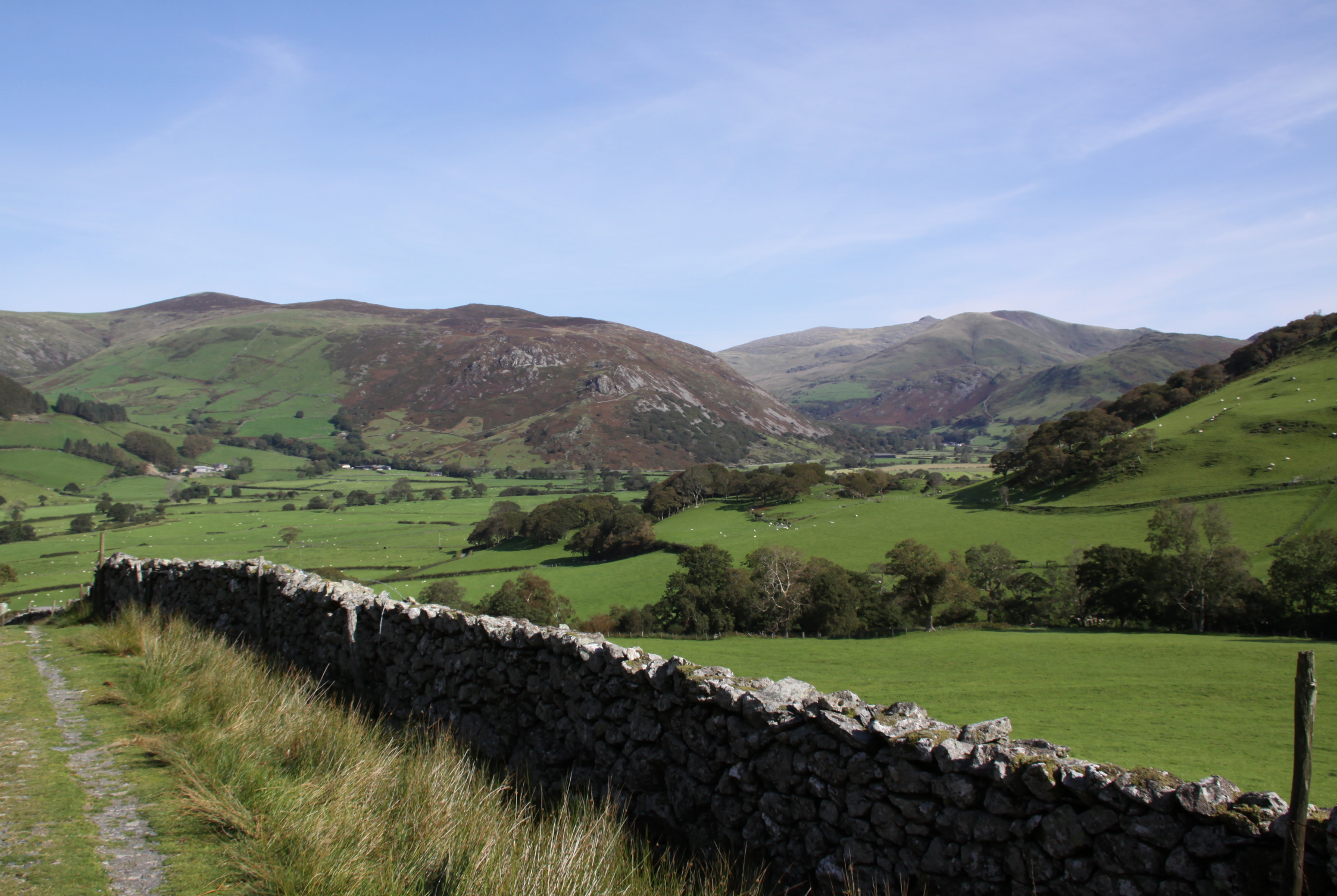
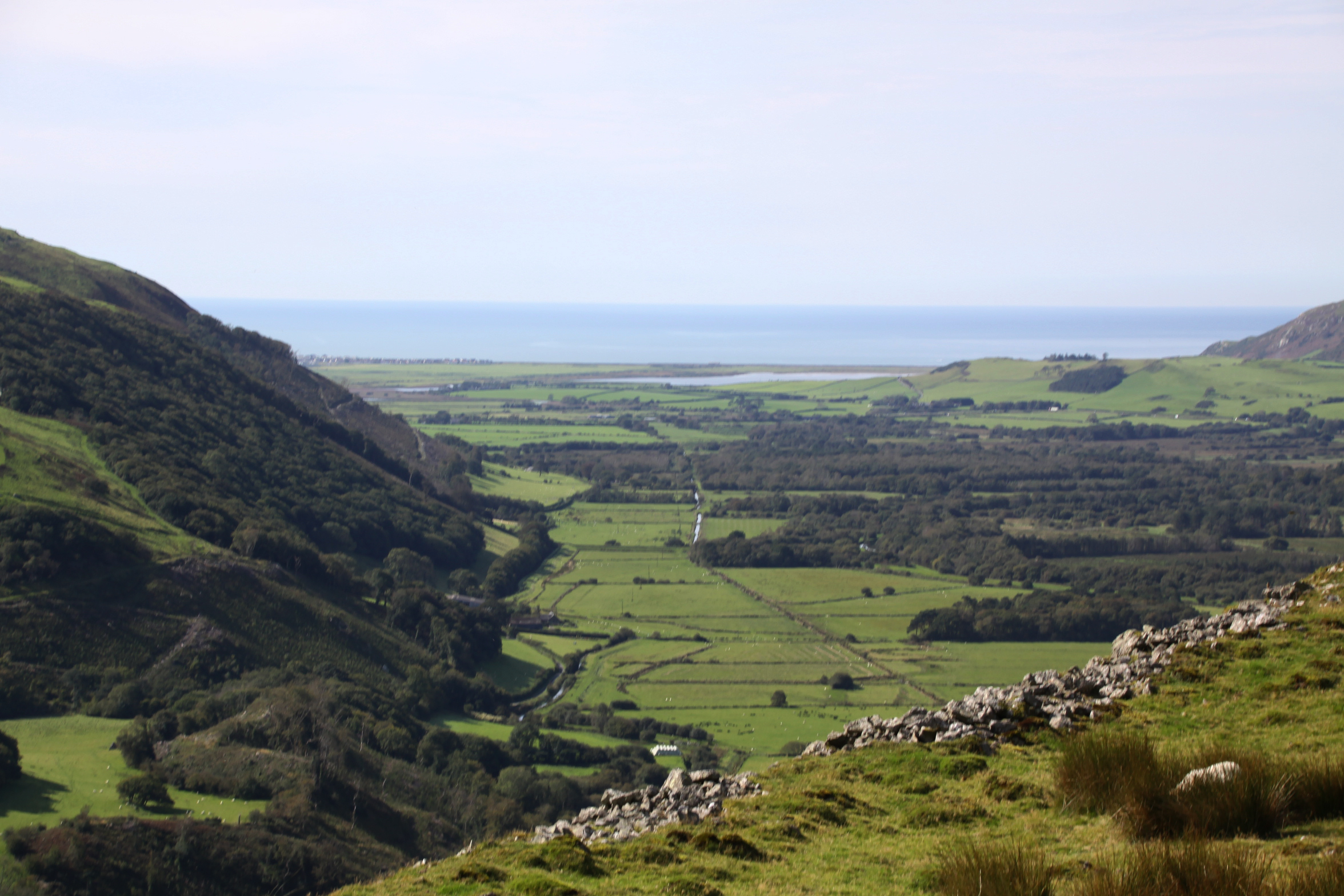
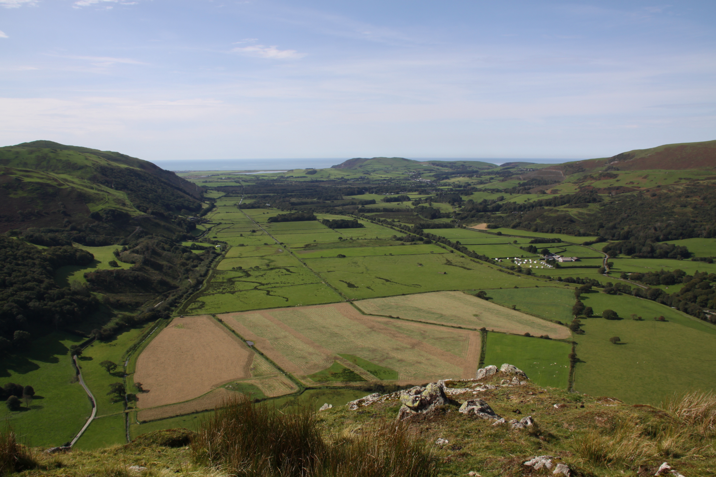
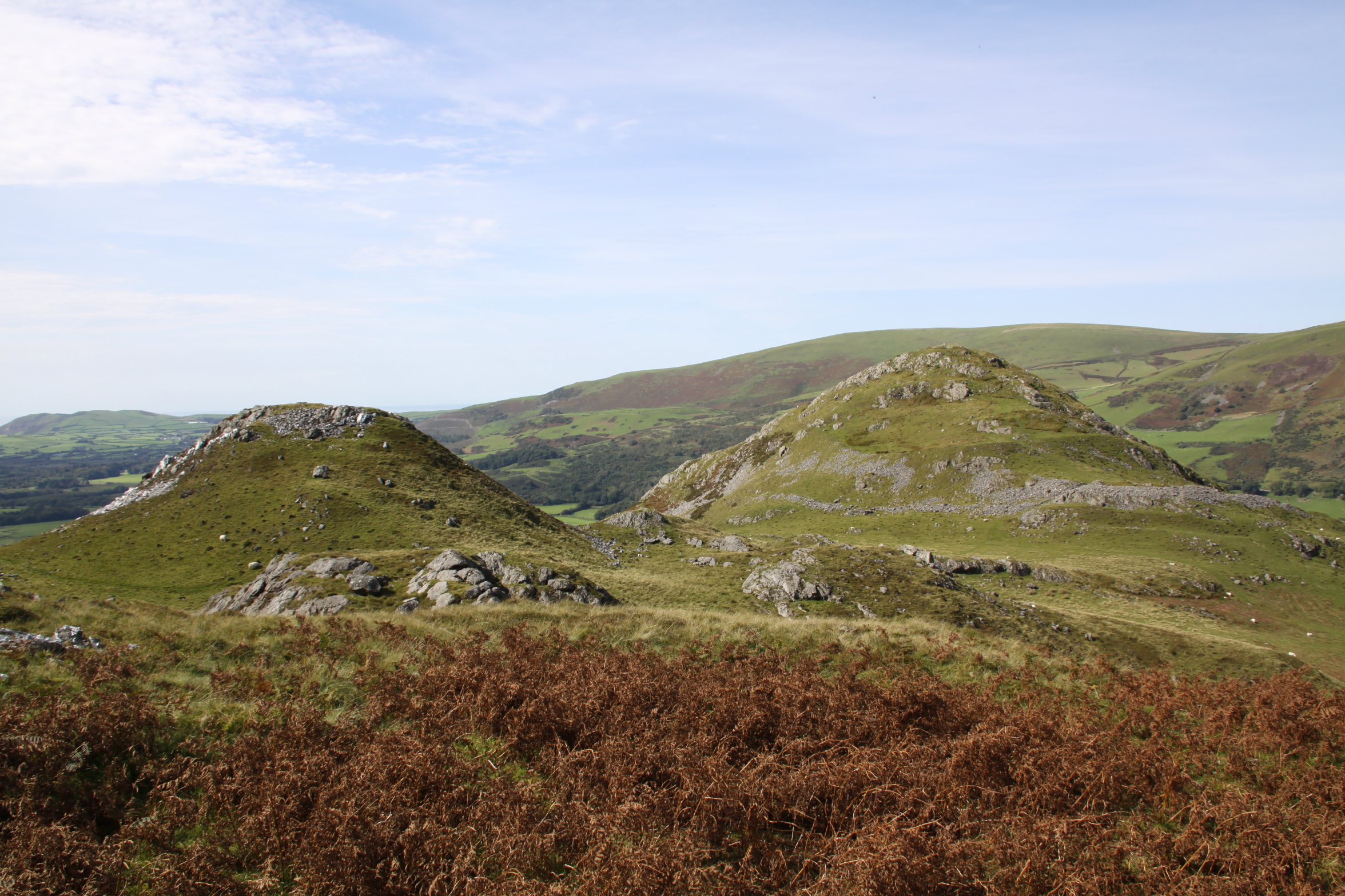 Having sorted out the hillfort features to my own satisfaction, I walked below the bottom wall towards the west to have a look at the view from there. It’s better from the top, but still very fine. If you’ve chosen to go to Craig yr Aderyn first and afterwards decide to go to Y Pallis Mawr, you can take a short cut by crossing towards it following sheep tracks rather than going back to the fork in the official footpath. The marsh symbols on the above map aren’t kidding, and there are big patches of beds of spiny rush (Juncus acutus) and a large pond surrounded by small birds enjoying a bath and a drink, so stay above the dark spiky tell-tales, following the sheep tracks, and you’ll hopefully retain dry feet. You rejoin the footpath and find yourself at the foot of a smaller, more conical peak between Craig yr Aderyn and the main hill’s peak. The public footpath stops here, but if you feel inclined to walk up to the high crag of the hill behind, be aware that it is steep and is a scramble over rocks alongside a barbed wire fence, with a fairly convincing drop immediately to your right. It convinced me to give it a miss.


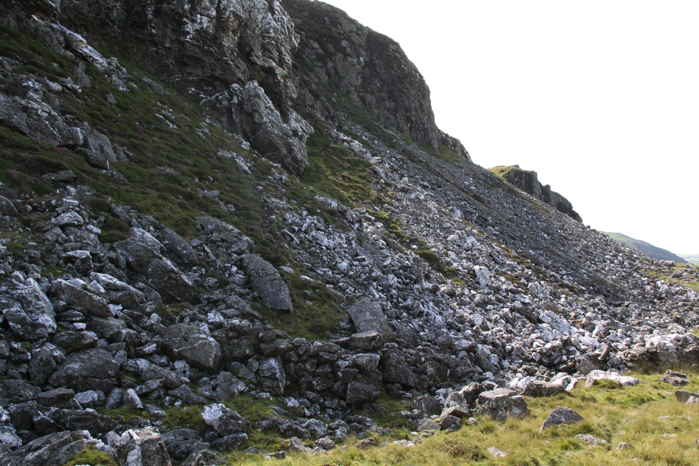
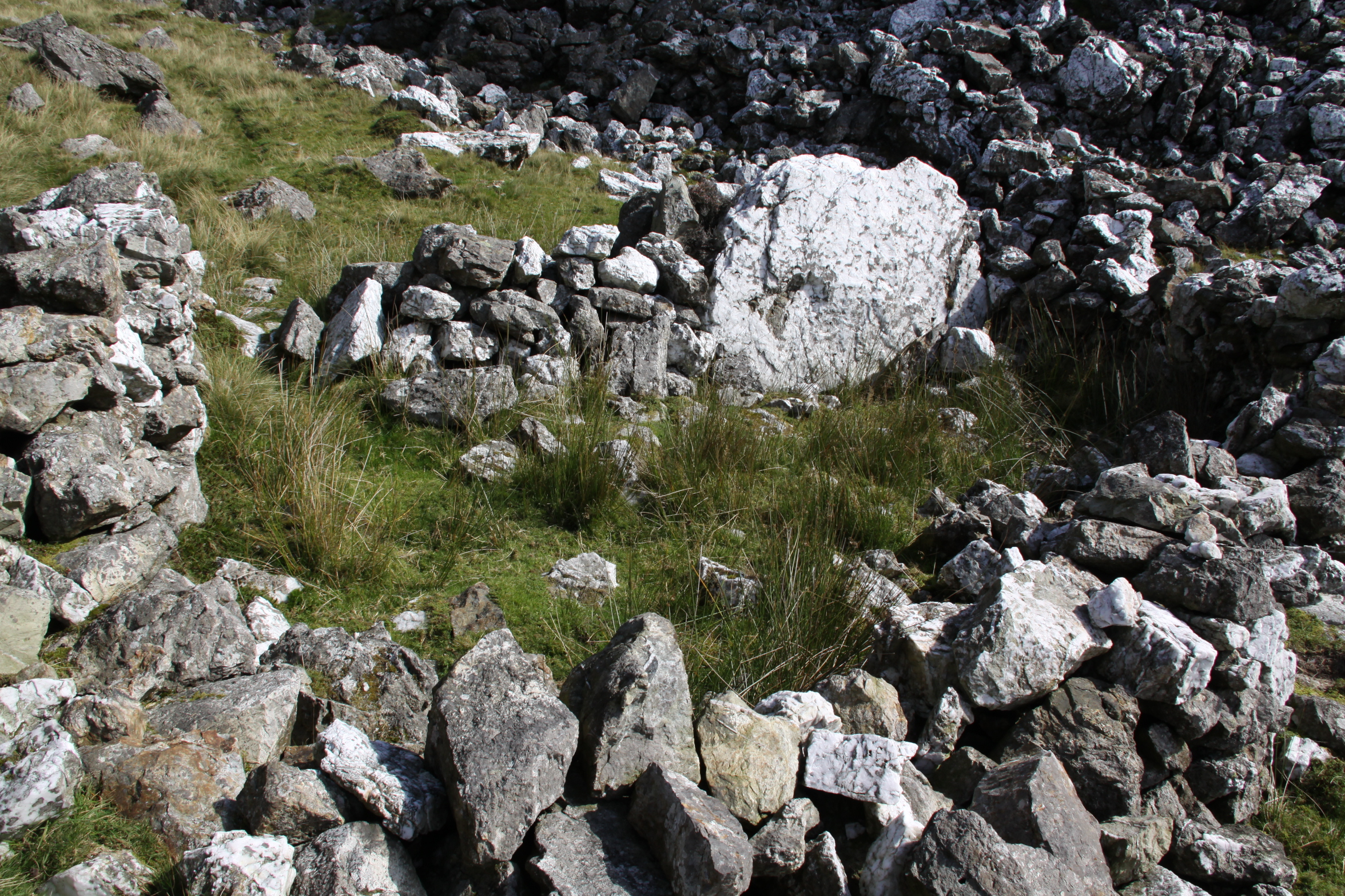
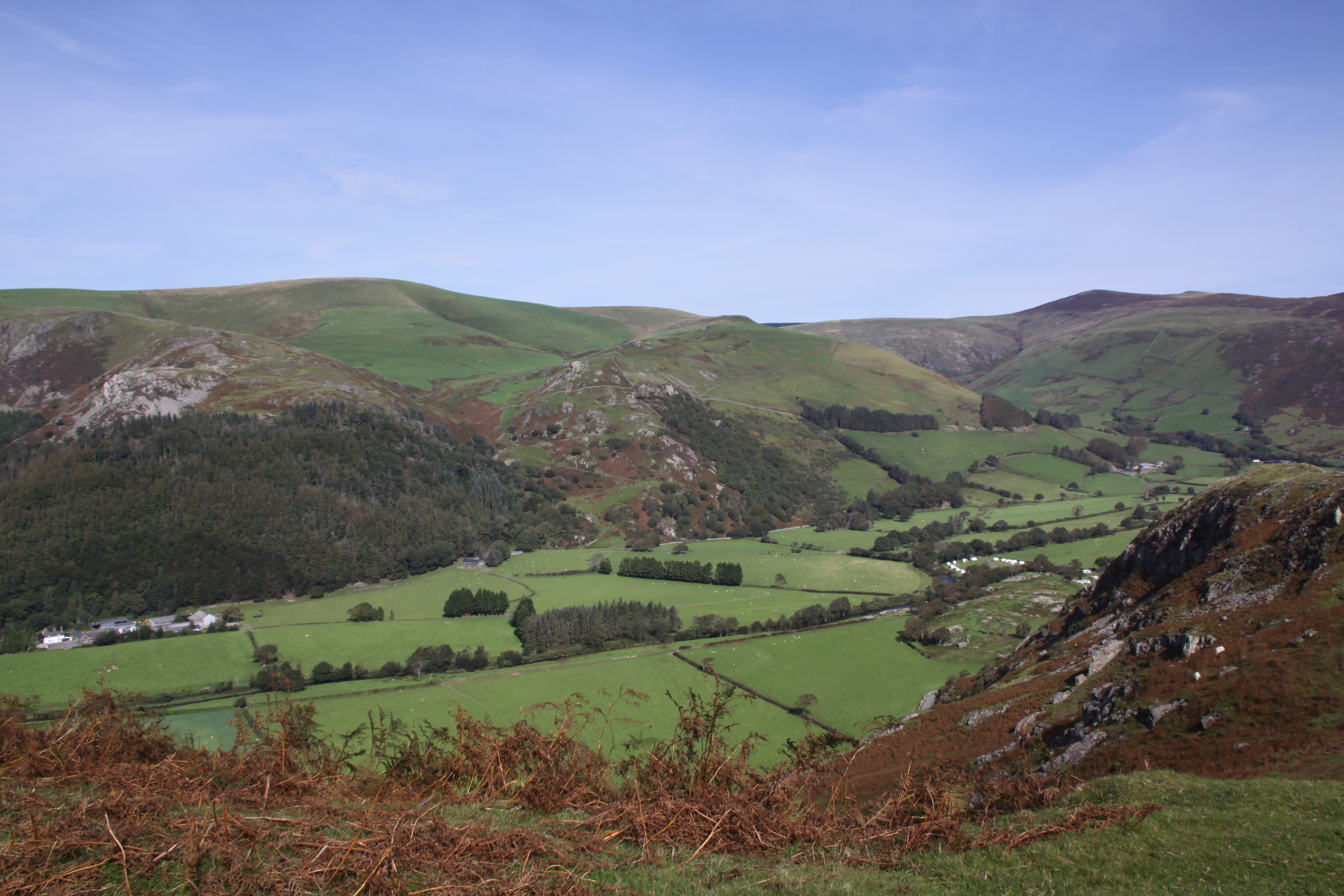
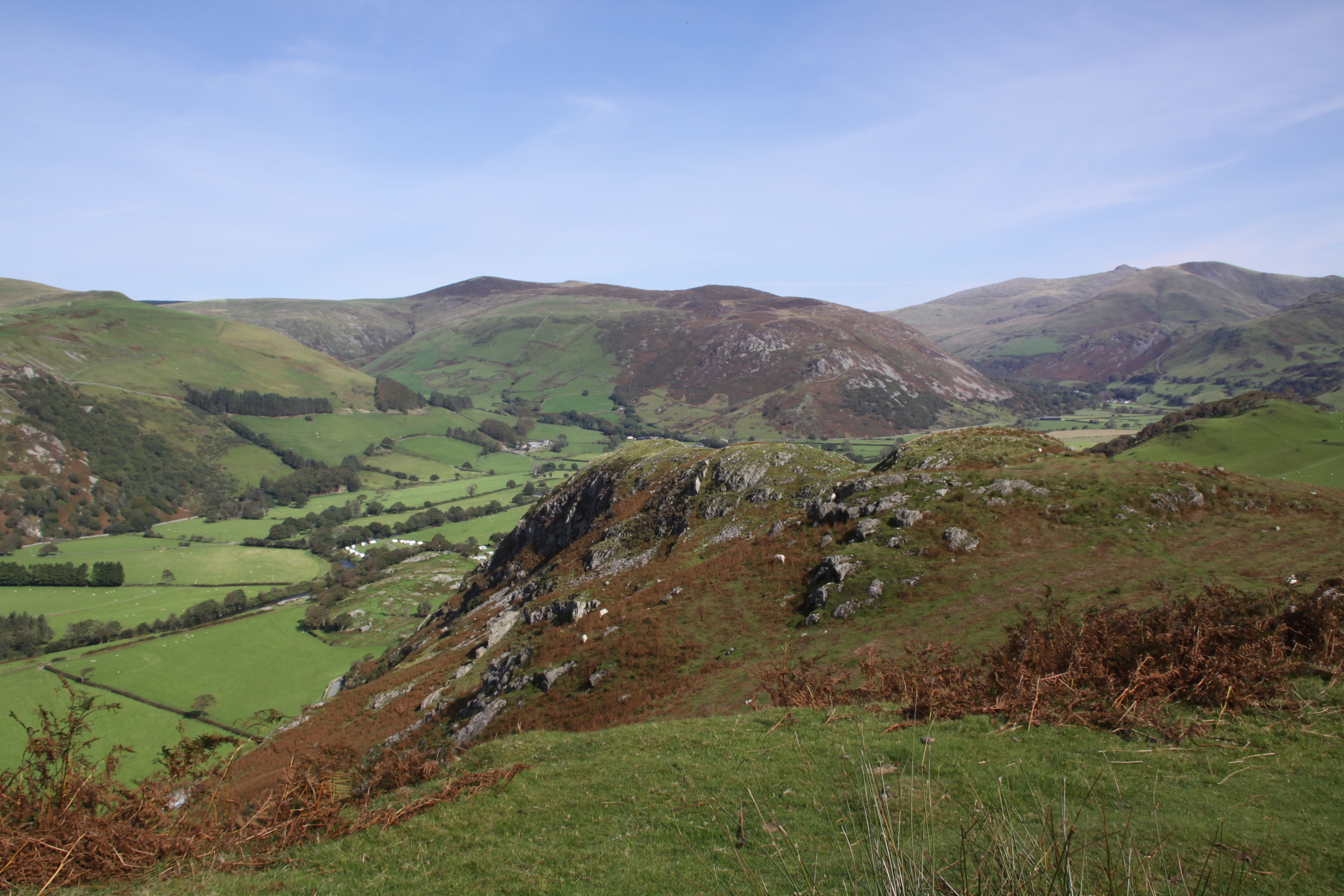
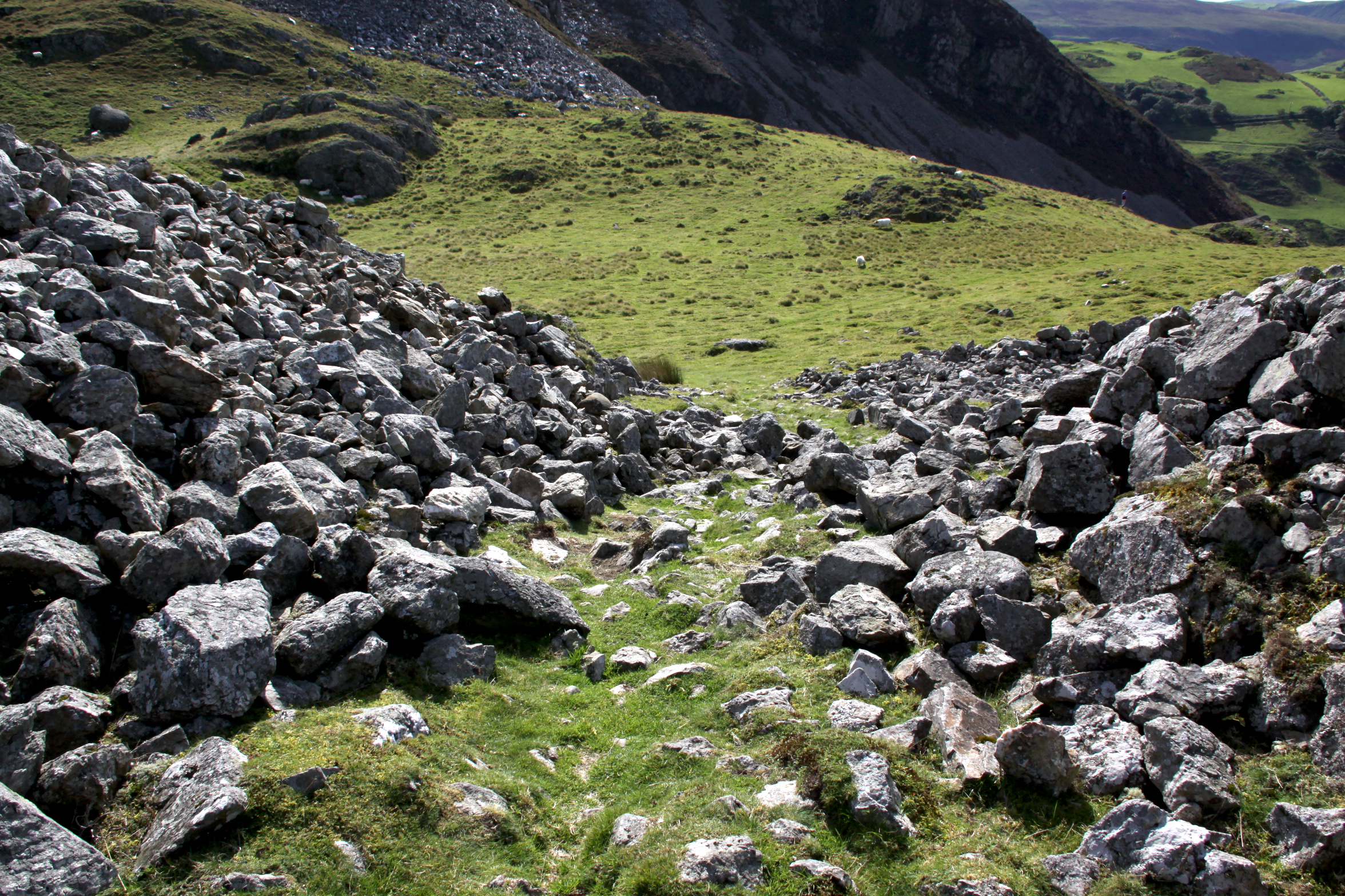
Instead, I turned to walk down the side the hillside where there is a huge rockfall, which I was guessing was the main source of stone for the stone-lined ramparts. These are enormous chunks of rock, with a lot of bright white quartz in amongst the dull grey. I rounded the base of the conical peak and returned back towards the footpath, heading down the hill to the carpark. The views were just as good on the way back. Bliss!

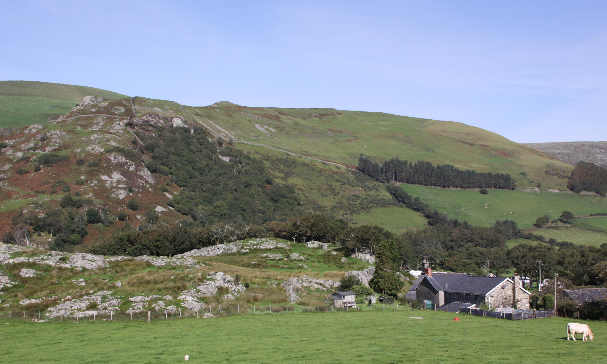
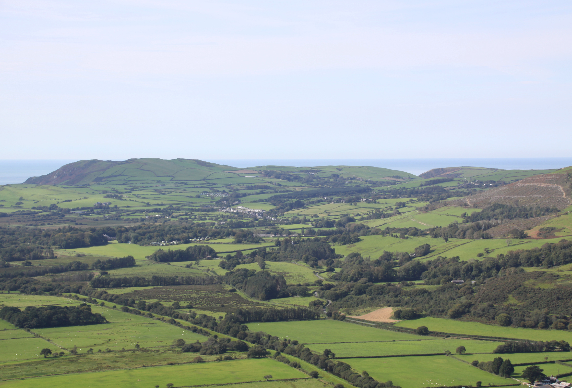
Craig yr Aderyn from Castell Mawr:


A breathtaking walk! I last did it in 2016. Hope to be able to do it again one day, but it was hard then, so might need more rests. Don’t remember seeing that seat before.
LikeLiked by 1 person
On Thursday, September 17, 2020, Aberdovey Londoner wrote:
> Andie posted: ” I have divided my Craig yr Aderyn (Bird Rock) walk into > two posts, of which this is the second. The first focuses exclusively on > the Iron Age hillfort. This one looks at the walk itself, how to approach > it, incidental information about the environment” >
LikeLiked by 1 person
Lovely account of your walk. Stayed at Dolgoch Easter time. Never got round to seeing Bird’s Rock. Hope to next Easter time and will follow your instructions. Thanks David Walker.. .
LikeLike
Thanks for this. Without it, I wouldn’t have had a clue where to park and I’m pretty sure I wouldn’t have turned right up that hill. Knowing that bench which was hidden just past that right fork was really good to know too. Thank you so much for your post and pictures!
LikeLike
I am chuffed to bits that you found it useful, and really hope that you really enjoyed the walk. It is such a good one.
LikeLike
Yes, it was a fabulous walk. My 7 year old son charged up the incline. My wife also loved it – she gets nervous going up high, but the walk wasn’t near any precipices or dangerous in any way. A 5* from us!
LikeLike