Category Archives: Ynysmaengwyn

Tonfanau Army Camp from 1938 to the present day

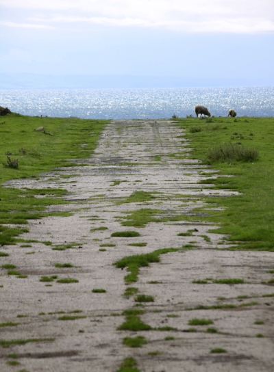
Some of the few surviving remains of Tonfanau Army Camp today, behind Tonfanau station, complete with grazing sheep, the sea just out of sight in the background


Tonfanau in the past and recent present. Source of upper image: AAJLR.org, ref tonp_067. Source of lower image: Coflein.

The first time I heard the name Tonfanau was when I was researching the Ynysmaengwyn Estate.  In the late 1870s John Corbett, who had purchased the estate, also invested in Tonfanau granite quarry to aid with his construction projects in Tywyn.  Recently I have also been doing research into the hillforts on the hill behind Tonfanau.  In both cases my searches came up with very little about either subject, but an awful lot of information about an army camp that I had known existed but knew nothing about. I became interested in the story of the camp.

The Tonfanau camp (pronounced ton-van-ow – the ow to rhyme with cow)  was established in the 1930s as an anti-aircraft artillery training centre, but it underwent many changes in role over time, before being nearly entirely demolished in the late 1980s or 1990s. One of the most arresting aspects of the subject is the remarkable number of accounts and photographs available online by those who were stationed at Tonfanau.  The camp is not merely a few ruins of the past, it is something that lives on in people’s memories, giving lie to the very few abandoned and desolate fragments that remain.

The impressive extent of Tonfanau camp shown on an Ordnance Survey map, circa 1960s. Source: AAJLR website, ref tonp_068

This is a short summary of why the camp was established, what it was used for at different times, how far it extended over the surrounding area, what it consisted of, and what remains today.

I have made considerable use of the resources that I have found on the web, all of which are credited below in “Sources” with my sincere thanks.  Particular thanks must go to the Tonfanau page on the AAJLR website and its many contributing volunteers for assembling such a magnificent collection of photos, many of which are reproduced here.

In terms of visiting, if you are aiming to incorporate the remains of the camp into a walk, the easiest and most attractive way is to drive down Sandilands Road, turning right just before the level crossing.  Follow the road to the Tonfanau footbridge, and it is about a 15 minute walk from there.  In summer it is a particularly nice walk as the verges from the Dysynni footbridge to the station are filled with a profusion of wildflowers.  Otherwise it is a matter of driving to Tonfanau station down bendy single track lanes and parking up there.  You can cross the railway to go down to the emplacements on the beach, or walk up the road opposite the station to see some of the other remaining structures.  Otherwise it’s a matter of wandering around the publicly accessible parts of fields to see more.

Tonfanau camp.  Source: AAJLR.org

The remains of Tonfanau camp are interesting, but be warned that they are really very ugly, a thorough blot on the landscape.  This sort of swiftly-built camp, of which there were several dotted around the country, must have been just as alien in their own ways as Roman camps imposed on an Iron Age landcsape, just as uncompromising and just as much as an imposition, but eventually becoming a fact of life.  Unlike the Roman armies of occupation, these invaders of the landscape were British, and the camps were there to serve the nation, giving their sudden arrival, even if unwanted and unwelcome, a positive reason for being.

Anti-Aircraft Training 1938s – 1957

Heavy ackack anti-aircraft gun at Tonfanau, ref tonp_274. Source: John Mills, AAJLR.org

Throughout its existence the camp consisted of a series of fairly basic buildings, including brick-built huts, wooden huts, hangars and so-called Nissen huts.  Nissen huts, like bailey bridges (of which more below) were assembled from pre-fabricated parts to enable very rapid construction.  Corrugate iron sheets were used to form half-cylinders that created lightweight buildings, useful in a variety of situations.  They looked like gigantic pigsties, half-tubes of corrugated iron blocked at either end, one end containing a door for access.

The camp was built beyond the immediate reach of the nearby villages, on a wide coastal plain beneath Tonfanau hill, spanning both sides of the railway line.  The Tonfanau railway station was added on the existing Cambrian Railway line, which itself linked into the national rail network, to serve the camp .  By train, the camp was a few minutes from Tywyn.  By road, it was a matter of negotiating some bendy B-roads and passing through Bryncrug before reaching Tywyn, some 30 minutes or so later.  The decision to put the site beyond the immediate vicinity of residential areas was probably connected directly to the noise that the camp would produce as an anti-aircraft gun range.  Either that, or this was the biggest flat-ish area available in the vicinity for the construction of this sort of camp.  Either way, the camp was neither a part of the village, nor completely isolated from it.  At some point a bailey bridge was established at the crossing over the River Dysynni where the railway also crosses, substantially reducing the time taken to get into Tywyn.  When an RAF camp was built at Sandilands in Tywyn in September 1940, partly to build on an existing relationship that the RAF already had with the Tonfanau camp, communication and visits between the two camps probably became quite frequent.

Anti-aircraft emplacements at Tonfanau camp from the air. Ref. tonp_067. Source: AAJLR.org

As an artillery training camp, Tonfanau had various sites to enable training on different types of weapon.  The big anti-aircraft (AA) guns were mounted on permanent emplacements just behind the beach, as shown on the above photograph.  The foundations of these can still be seen above the line of the beach, some of which are shown on the photographs at the end of this post.  These pointed out to sea for target practice.  The targets were initially supplied by RAF Tywyn’s, which had a camp in the Sandilands part of town and later became known as Morfa Camp, which is how it is usually known today.  Disposable gliders were towed using Hawker Henley planes near to the position of the anti-aircraft emplacements, and these gliders were used as targets.  All I can say is hats off to the pilots who took on that unenviable task!  Eventually these were replaced with an unmanned remote-controlled version of the Tiger Moth known as the Queen Bee, which must have been a lot safer all round.

Anti-aircraft guns in action, ref tonp_028. Source: AAJLR.org

A  first hand account of the Anti-Aircraft training is provided by Stanley Briggs, who found himself at Tonfanau in 1949 after initial training at Oswestry before shipping out to Egypt:

“After our initial training we were taken by train to Tonfanau on the West coast of Wales between Aberystwyth and Barmouth. This is the Cardigan Bay coastline area, the nearest town is Towyn. Only the beach, a railway line and a road separated us from the sea. We had the sea on one side and the Cader Idris mountain, inland, behind us.

That bay is massive and ideal for target practice for our 3.7 guns, but I have to say that I didn’t fancy the RAF pilots jobs of towing a sleeve behind their plane while National Servicemen were firing at them for practice with live rounds.

The Cader Idris was ideal for physical fitness too, which our physical fitness training instructor (PTI) put to good use, we were all eighteen years old and I have to say that personally I really enjoyed every minute of that part of it.

QF 3.7 inch anti-aircraft gun.  Source: Wikipedia

The same discipline training continued at Tonfanau. It was here that we were confronted with the 3.7 gun, the Sergent in charge gave us all a good knowledge of how to maintain, dismantle and fire it. We all had to learn each others position on the gun in case one of the members of the team was killed in action (that was a sobering thought!)

The gun had a large barrel and was transported on a trailer consisting of four legs and wheels, towed by an AEC Matador lorry. Each leg had to be raised for the travelling position and lowered for the firing position. Other positions for the team of gunners were Traverse Operator, Elevation Operator, Tannoy Operator, and Ammunition Operator who had to lift a round up and put it in the breach and finally, the Sergeant who had the responsibility of firing. The first time I lifted a round of ammunition, my knees buckled as they were very heavy for a nine stone weakling, which I was at the time.”

There seems to have been a second level of artillery training at the site during this period, which took place after the heavy anti-aircraft guns had left, as described by Frank Yates who, at the age of 21, served with the Royal Artillery, Light Anti-Aircraft Battery and was attending the Officer Cadet course.

Aerial view of the remains of a small-bore firing range. Source: Coflein

“The camp was large, with brick and concrete hutments and purpose built dining halls, garages and the like, with the Garrison Theatre dominating the landscape. The camp had been Heavy AA before we moved in, but there were now two separate factions, the bulk of the Heavies had returned to their base Artillery depot at Oswestry, leaving a nucleus to run the firing camp. On the firing apron, between the sea and the railway, was an ex Naval 3” Gun, a weapon which fulfilled a dual role in the Navy. It had the reputation of producing the loudest ‘bang’ of any British gun and they once fired it for our benefit. It certainly lived up to its reputation! Before leaving the “Heavies” may I mention that they did not fire at a towed drogue, the tow plane would not have survived. There was talk of them using a radio controlled, unmanned target, a project easily arranged nowadays, but too unreliable in those days. . . .

After various demonstrations, witnessed from a head down position in the trench, the sticky bomb was shown. This was an anti tank weapon, although it would need a very brave or a very lucky man to get near enough to use it! It was a glass ball, like a small goldfish bowl, full of TNT and covered in stockinette which was impregnated with very powerful glue. The thing was provided with a handle, containing the fuse and firing mechanism. The bomb was smashed down onto the tank, deforming into a dome shape, a ‘shaped charge.’ The handle is released, the bomber runs away and the charge explodes in 4 seconds.”

Frank Yates goes on to describe what the camp was like to live in whilst he was there, and what sort of other training took place at the camp.  It’s a very engaging read, so do have a look at his entry on the BBC WW2 website.

Bailey bridge over the Dysynni. Photograph by Edwin Lines 1990, ref. tonp_278. Source: AAJLR.org

I am assuming that the bailey bridge that used to cross the Dysynni dates to this period.  It was still in situ in 1990 when former camp resident Edwin Lines took this photo.  Bailey bridges were portable, pre-fabricated, truss bridges. The concept was developed between 1940 and 1941 by Sir Donald Bailey, a civil servant in the British War Office, for the military.  It was a portable, pre-fabricated, truss bridge that was was made up of prefabricated panels and easily assembled parts.  These could be carried by trucks and assembled by men without special equipment, using simple devices, such as ropes and pulleys, in a matter of hours.  Once a bridge has done its job it can be disassembled, moved and rebuilt elsewhere.  Bailey bridges proved their worth in the Second World War.  The Tonfanau bridge ran parallel to the railway bridge, where today the railway bridge and the 2013 Tonfanau footbridge cross the Dysynni.   As they were originally designed to be sufficiently robust to carry tanks, I assume that this one could carry light vehicles as well as pedestrians, which would have substantially improved access to the bright lights of Tywyn!

All Arms Junior Leaders’ Regiment 1959 – 1966

Entrance sign to the All Arms Junior Leader Regiment camp at Tonfanau.  Source: 28 Days

The All Arms Junior Leaders’ Regiment (AAJLR) was established at Tonfanau in May 1959 and was disbanded in August 1966.  Its purpose was to train boys aged between 15 and 17½ as future senior non-commissioned officers.  Boys were sourced from various points within the British army.

My thanks to Ken Hart’s excellent AAJLR.org website as the source of the information on this page, which talks about the activities that they boys were engaged in on a term by term basis:

Entrance to Tonfanau Camp in about 1964, complete with postbox. By Brenda Keens, ref tonp_265. Source: AAJLR.org

“The year was split into 3 terms with a fresh intake of boys each term. The first term of each boys service was completely dedicated to turning these 15 and 16 year olds into disciplined soldiers.  From the second term the prime emphasis was on education as all senior NCO’s were required to obtain the Army Certificate of Education [Class 1].  Alternate days were spent on Military Training which included Drill, Weapons Training, Driver Training, Map Reading and casually strolling over the gently rolling Brecon Beacons in wonderful Welsh weather fully equipped in thin denims, a poncho and carrying a webbing back pack.  The boys final term included specialist training according to the arm or corps he intended to serve in as a senior soldier.  Mixed in with all this there was sport, adventure training, outward bound courses and inter company competitions including the Rhyl cup.

Every boy also took part in the ‘Duke of Edinburgh’s Award scheme’ and to this end most evenings were spent doing a large number of hobbies. The rest of the time was spent cleaning the barracks or doing your personal kit whilst huddled round a coal burning pot-bellied stove in a futile attempt to keep warm.”

There’s a whole page on the AAJLR website dedicated memories of Lance Corporal Fagg who, in charge of the Guardhouse, was the terror of most of the boys at the site.  These short accounts bring daily existence at the camp to vivid life.  One contributor to the site, John Sabini, wrote the following, which is a nice introduction to an awe-inspiring individual.  Other accounts are often a lot more earthy!

The idea of over-wintering in one of those flimsy huts makes my All Arms Junior Leaders Regiment plaque (Photograph by Peter Woolridge, ref. cphoto_153.) Source: AAJLR.org

L/Cpl Fagg re-joined 3 RGJ sometime around 1967 in Iserlon Germany. Due to a quirk of fate I was allocated to a room with him (thankfully for only a couple of nights) when I moved from a Rifle Company to the Battalion Signals Platoon.
Did you know his first name was Hermes (a bit like being a boy named Sue) which could explain his bad attitude to his fellow human beings! He was a cookhouse NCO orderly in charge of tea urns and spud bashing. His nickname in the battalion was ‘Dog-End’. He disappeared mid way through our tour in Germany and I am not sure where he went; this was my last sighting of L/Cpl Hermes (Dog-End) Fagg, 3rd Green Jackets, The Rifle Brigade.
As he is probably now in the great guard room in the sky, I am sure he would appreciate that he is immortalised (!) on the AAJLR website and that he made such a lasting impression on all those who had the misfortune to cross his path.

The idea of over-wintering in one of those flimsy huts makes my blood run cold!

PYTHON site 1968

In 1968 the camp was one of the designated sites for the PYTHON project, a plan for continuity of government in Wales in the event of nuclear war.  There’s not much information on the web on the subject of PYTHON, and what is here comes from a Wikipedia article, the main source of which was the book The Secret State: Preparing For The Worst 1945 – 2010 by Peter Hennessy (Penguin 2014).  The idea was to disperse government officials to various locations instead of centralizing them in one place.   Sites were chosen on the basis of existing accommodation, independence from the national power and water grids, nuclear fallout protection and distance from likely targets.  Tonfanau Army Camp was temporarily designated as the PYTHON location for Wales.  Each PYTHON group would be supported by dispersed sections of the United Kingdom Supply Agency and the National Air Transport Agency.  Aberystwyth University replaced Tonfanau as the preferred location soon afterwards, which is probably just as well as I don’t see government ministers surviving a mid-Wales winter in those huts, never mind a nuclear war!

Uganda-Asia refugee camp 1972 – 1973

Photograph of Ugandan Asian family at Tonfanau by Jim Arnould, Nova (April 1973). Source: Oxford University Press blog

The camp was re-opened very briefly to house Uganda-Asian refugees.  Uganda had been a British colony, and while India was still also a British colony, the British government had encouraged Indian professionals to travel to Uganda to seek prosperity by helping with railway construction and the overall improvement of the economy.   The offer was taken up with enthusiasm, with thousands of Indian families settling in Uganda and making good livings.  Their successes were at first welcomed and then regarded with suspicion by Ugandan communities.  In 1962, Uganda was granted independence and in 1971, military leader Idi Amin staged a coup and came into power.  Only a year later, on August 5th 1972, Amin inaugurated a policy of economic reform, an “economic war” in his own words, that included the expropriation of properties owned by Asians and Europeans.  He gave Ugandan Asians 90 days noticed to leave the country, calling them “economic bloodsuckers,” claiming that they were draining the wealth of the nation at the expense of native Ugandans.  Their departure was hastened at gunpoint, giving them little doubt about their fate should they stay.

Of 80,000 Ugandan-Asian exiles, nearly 29,000 with UK passports came to Britain.  The official Ugandan Resettlement Board (URB) had the thankless task of providing them with temporary accommodation until permanent resettlement could be arranged, and took the decision to place them in refugee camps.  Tonfanau was one of sixteen refugee camps chosen for the task.

The entrance to the Cafe at the Tonfanau refugee camp, when the camp was in ruins. The bright, lively scene is very much at odds with the drab surroundings, and gives a sense of how hard it must have been to relocate to such a bleak place. Source: 28 Days website.

Tonfanau camp had been closed for nearly four years when it was suddenly dragged back into service to house over 3000 of these refugees for a period of six months, and must have been in somewhat poor condition. It was, in fact, only chosen as a last resort when other locations had been rejected.   Captain Freddy Fuller was put in charge of the camp, probably very well qualified as he had spent 25 years running an Outward Bound school.  Volunteers from the surrounding community formed a welcome group to provide the newcomers with essentials, including clothes and toys for the children, and each volunteer was instructed to assign themselves to individual families to assist them.  However, there was very little furniture and most of the exiles had to sit on the floor. It must have been a freezing, bleak and worrying winter in those bare huts, and Jordanna Bailkin’s book Unsettled repeats James Hamilton-Paterson’s poignant report on the camp, seeing “miserable people in their gorgeous saris” huddling in Tywyn’s two fish and chip shops for warmth.  Bailkin describes how donations of clothes resulted in some peculiar and probably difficult encounters:  “Adding to the bizarre atmosphere, most of the clothes donated to Tonfanau through the WRVS [Women’s Royal Voluntary Service] were from the 1960s.  Chandrika Joshi, whose family stayed at Tonfanau for five or six months when she was 14 years old, found herself dressed in a brown rubber minidress: “Such outfits went largely unnoticed in camp, where everyone was similarly attired, but more ‘out of place’ when she went to a school a few weeks later” (again quoted from Jordanna Bailkin’s book Unsettled – see Sources at end).

Fortunately, by the spring of 1973, all had been re-homed, hopefully in much better conditions, elsewhere in the UK.

Demolition of the site
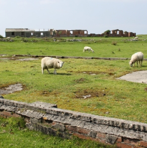
I have been unable to find when the site was finally demolished, or why some buildings were left in tact.  It was probably done between the late 1980s and early 90s.  Apart from a bare handful of surviving buildings that survived the demolition, it was a pretty thorough job.  What does survive gives a very good idea of both how ephemeral these buildings were intended to be, but also how enduring they proved to be before they were intentionally removed.

Part of the site is used, at the time of writing, by Tonfanau Road Racing for motorcycle racing on a 1-mile track during the summer, run by Crewe and South Cheshire Motor Club.  A 2010 proposal to use the land for a new prison never came to fruition.  Most of the land has been returned to farm use and sheep now roam freely over most of it.

Below are a couple more of my photographs of what’s left of the site today.  For many more from all periods, see the substantial collection contributed by many volunteers on the All Arms Junior Leaders Regiment website.

Sources:

Jordanna Bailkin 2018.  Unsettled: Refugee Camps and the Making of Multicultural Britain. Oxford University Press

Becky Taylor 2018.  Good Citizens? Ugandan Asians, Volunteers and ‘Race’ Relations in 1970s Britain. History Workshop Journal, Volume 85, Spring 2018, p.120–141
https://academic.oup.com/hwj/article/doi/10.1093/hwj/dbx055/4818096

Roy Sloan 1991.  Wings of War over Gywnedd.  Aviation in Gwynedd during the World War II. Gwasg Carreg Gwalch


Websites

28 Days Later Urban Exploration
https://www.28dayslater.co.uk/threads/tonfanau-military-camp-tonfanau-nr-tywyn-february-2015.94390/

40th Anniversary for Ugandan Asian Refugees in Wales
https://www.itv.com/news/wales/2012-07-31/40th-anniversary-for-ugandan-asian-refugees-in-wales/

Ken Hart’s All Arms Junior Leaders Regiment (AAJLR) website
About: http://www.aajlr.org/about/about_main.html
Tonfanau camp: http://www.aajlr.org/tonfanau/tonfanau_main.html

Memories of Frank Yates, Royal Artillery, Light Anti Aircraft Battery. Chapter 17, BBC World War 2 People’s War. Article ID A7375845
https://www.bbc.co.uk/history/ww2peopleswar/stories/45/a7375845.shtml

Stanley Briggs: Then and Now
http://www.stanleybriggs.com/art_nat_service1.html

Tonfanau Road Racing
https://www.tonfanauroadracing.co.uk/

Wikipedia article about PYTHON
https://en.wikipedia.org/wiki/PYTHON#Locations


A short history of the Ynysymaengwyn Estate, Ystumanner, including Tywyn, Aberdovey and Bryncrug

Any research into the Tywyn and Aberdovey areas in the 18th and 19th Centuries runs into the landowning Corbets and the Ynysymaengwyn Estate, one of the top eight estates of Merionnydd in its heyday.  The Ynysymaengwyn Estate owned much of the land in and around both Tywyn and Aberdovey well into the Twentieth Century.

The Ynysymaengwyn Estate, showing Ann Owen’s 18th Century house and the servants quarters and kitchens in a separate building to the right. Source: Coflein.

The few material remains of the Ynysymaengwyn Estate are located 1 mile from Tywyn on the road to Bryncrug.  The name of the estate (pronounced Inis mine gwin) means island or river meadow (of)  the white rock.  In 1949  the piece of land that retained the last echoes of the estate was bequeathed to the people of  Tywyn by Mary Corbett.   Although it is now dominated by a mobile home park and campsite, parts of the former estate now contain woodland walks and some of the original features of the estate survive, although the house and most of the accompanying buildings were dismantled in the late 1960s.  These remnants are discussed at the end of the post.

North wing at Ynysymaengwyn used in the 18th and 19th Centuries for kitchens and servants quarters

The Ynysymaengwyn estate included both highland and lowland areas, and extends down to the south bank of the river Dysynni, stretching along a portion of its valley.  The Dysynni has silted up considerably and it is thought that it may have provided a natural shelter for small boats.  One of the earliest buildings in the area is St Cadfan’s Church in Tywyn, parts of which date to the 12th Century probably developed out of the clas (a semi monastic church) that was founded near the shoreline.  There was also a small settlement at Bryncrug, where most of the land belonged to Ynysymaengwyn.  Llanegryn church is listed in the 1253 Taxatio, so must have been the centre for a small settlement before that time.  The core buildings of the Medieval Ynysymaengwyn estate would have been much nearer the sea than today.  A second estate that was present in the Medieval period was Peniarth, also on the Dysynni.  Gwynedd Archaeological Trust observes that “these two houses and their associated parks, together with the villages of Bryncrug and Llanegryn and the town of Tywyn emerges as focal points of this area in late Medieval and Modern times.”  There were also a number of early freehold properties such as Dolau Gwyn and Caer Berllan.

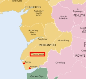
The commote of Ystumanner.  Source: Wikipedia

The history of the Estate can be traced back to the reign of Elizabeth I.  It passed through a number of families.  Like all these family histories, it is a bewildering succession of names that are quite meaningless to anyone not trying to trace their ancestry, and a substantial amount of this family history is captured in a well researched Wikipedia page dedicated to the Ynysymaengwyn Estate and and the Dictionary of Welsh Biography and will not be reproduced here, although some details are unavoidable.  The first name linked with certainty to Ynysymaengwyn was was Gruffydd ab Adda in the early 14th Century.  He was bailiff (legal custodian) in 1330 and 1334 of the Ystumanner cymwd (anglified as commote, an organizational division of an area into about 50 villages for the purposes of defence and justice).  His daughter Nêst married Llywelyn ap Cyunrig ab Osbwrn Wyddel, and from there the estate passed through the male line for over 200 years.

The family were noted patrons of Welsh poets.  Hywel, the great great grandson of Llywelyn was the subject of an elegy by Hywel ap Rheinallt when he died of the plague, and Hywel’s son Hwmffre ap Hywel ap Siencyn was in turn the subject of a famous cywydd (poem with a particular metrical form, in rhyming couplets) by Tudur Aled.  In the poem Tudur Aled (c.1465–1525) takes on the role of a conciliator between kinsmen.  Glanmor Williams describes the genre as follows:  “Quite apart from any disputes kindled by faction and war, there might be serious splits between kinsmen in ordinary circumstances.  Such quarrels could be more than usually bloodthirsty, ‘deadly feuds’ more dangerous than civil war . . . It was the intensity of such divisions that led poets to attach key importance to the role, which they shard with the priests, of being conciliators between kinsfolk.”  He says that the most celebrated of all the poems of this kind was Tudur Aled’s cywydd to reconcile Hwmffre with his kinsmen “by urging them to remember the tragic futilities of past internecine differences, from which only the English had benefited at Welsh expense (p.109).  I have been unable to find a translation of the poem, so please let me know if you have access to one.  Hywel ap Siencyn’s grandson Arthur ap Huw became vicar of St Cadfan’s Church in Tywyn between 1555 and 1570, and was another patron of Welsh poets.  He also translated Counter-Reformation literature into Welsh.

The raven at Ynysmaengwyn today

When Hwmffre died in 1545 his son John Wynn and then John’s son Humphrey each inherited the estate in turn.  On Humphrey’s death the estate passed to his daughter Elizabeth and her husband Sr James Pryse of Goderddon, who was high sheriff of Merioneth (married in 1601).  Both died in 1642 and and their daughter Bridget inherited.  Bridget Pryse married Robert Corbet of Moreton Corbet, Shropshire, in about 1612, which was the beginning of the long association of the name Corbet with the Ynysymaengwyn Estate, which endured for the best part of the next two centuries.  Robert Corbet was a passionate Royalist.  During the English Civil War, to prevent Parliamentarians taking the property, the estate’s mansion was burned down in 1635 and had to be rebuilt.  The coat of arms of the Corbets of Moreton, whose name means “little crow” was a black raven, and the name Corbet is itself French, derived from “corbeau,” from the Latin Corvus.  It eventually gave The Raven Inn in Aberdovey its name.  The family  motto was Deus Pascit Corvos, God feeds the ravens.

Ann Owen Corbet c.1720. Source: ArtUK

The estate passed to their great granddaughter Ann Owen (1684-1741), who had married Athelstan Owen.  Athelstan Owen clearly contributed new buildings to the estate, one of which is now the the Dovey Inn (formerly the Dovey Hotel and before that The Ship) built by Athelstan Owen in 1729.  Above the door is a plaque inscribed “This house was built by Athelstain Owen Esq, Anno Dom 1729.”  He died in 1755, leaving Ann with three children.  She lived for another 30 years and did not re-marry.  She was known locally as Madam Owen, a woman of considerable personality.  Anne purchased the Caethle Estate in Tywyn from Richard and Margaret Braithwaite, absorbing it into the Ynysymaengwyn Estate.  She also built the central block of buildings on the estate, added the dovecote for 800 birds that still stands and in 1717 donated almshouses for five widows in Tywyn.  According to Barbara Middlemass, however, her business methods could be ruthless:  “Her favourite method of adding to the estate was to lend money by way of mortgage to needy farmers and then, when she knew they could not pay, call in the mortgage and seize the land to swell the Ynys acreage.”

The dovecote and dog kennels

The interior of the dovecote

Ynysymaengwyn in c.1795 by etcher T. Bluck, T. Source: National Library of Wales

The two-storey house that Ann built in around 1758 was a built in a classic Eighteenth Century architectural style in local stone with details picked out in Portland stone, including an elegant pediment.  It was an unusual sight in Wales.  It was flanked by the two existing buildings, the north wing and the south wing, to make an impressive ensemble.  The stone-built dovecote has a truncated pyramidal slate roof, a deep segmental arch in the front wall inset with a much smaller flat-headed doorway.  She also appears to have been actively involved in building houses in Aberdovey.  A house on Copperhill Street bears a plaque reading “Built By Anne Owen Widow AD 1733,” and this was probably Madam Owen.  Although there’s a discrepancy on the dates (she could not have been a widow until 1755 if the date of Athelstan’s death is correct), the fanlight window on Anne’s plaque exactly mirrors the fanlights on the Dovey Inn, suggesting a close connection.

The Dovey Inn donated by Athelstan Owen and a row of three houses provided by Ann Owen

Richard Owen, second in line to inherit the estate after his elder brother Corbet, but both died childless so their younger sister Anne inherited. By Richard Wilson c.1748-50.  Source:  Richard Wilson Online

Of Anne and Athelstan Owen’s children, Corbet and Richard died childless so their daughter Ann Maurice (married to Pryce Maurice) inherited the estate.  To comply with Ann Owen’s wishes, the estate then passed to Henry Arthur Maurice, who was Ann and Pryce Maurice’s younger son, presumably chosen because Ann Owen disapproved of the elder son Edward’s youthful activities, which included fathering at least two illegitimate children.  An interesting twist in the tangle of family names is that when the property then passed to a male with a different last name (for example, where a daughter who inherited the estate married) those men were required in the terms of the bequest to change their last name to Corbet, ensuring that the name Corbet was always associated with Ynysymaengwyn.  This was the case even when the estate passed out of the Corbet bloodline.  Henry Arthur Maurice, grandson of Ann Owen, therefore changed his last name to Corbet.  When he died childless in 1782, his elder brother Edward Maurice (1741-1820) inherited the Ynysymaengwyn Estate against his grandmother Ann Owen’s wishes, and Edward also changed his name to Corbet.

Ynysymaengwyn mansion. Sources: Coflein (top) and Ynysymaengwyn Camping, Caravan and Woodlands Park (plan at bottom)

Although Ann Owen had disapproved of him in his feckless youth, to the extent of cutting him out of her will, the more mature Edward was not unlike her in terms of his urge to make improvements to the estate and to benefit its dependants.  Lewis Lloyd says that he had travelled to London to learn from a physician “to acquire sufficient knowledge to dispense medicine to his tenants and others.”  He was a loyal supporter of Britain’s role in the Napoleonic Wars, and was a captain in the local militia.  During this period, much of the lowland and upland parts of the estate were enclosed and marshy areas were drained.  Edward was noted for breeding horses, cattle and sheep, and beginning in 1788, the drainage of some 260 acres of peat land for conversion to hay fields for use as livestock fodder, eventually producing 500 tons of hay annually.  This denied poorer members of the community access to peat cutting (turbary) and communal pasture, and many people left the area, some emigrating to the United States.  The upland parts of the estate that Edward enclosed were of potential interest for their mineral content, and he established copper works and searched for coal.  His loyalty to the English government and the crown led, at least in part, to his suspicion of Methodism, which he thought radical and borderline seditious, and which was growing fast in Wales.  His persecution of Methodists in Aberdovey, for example, resulted in their eviction from their premises with bibles and benches thrown out onto the street, with fines imposed on anyone who gave them shelter for their meetings.  Edward Corbet’s obituary records that he “was a cynic and a wit, a man of the world and when he pleased a very polished gentleman.  he was by turns petulant and affable, entertaining everyone.  With the flashes of his wit and the bitter but often just severity of his satire.”

Griffith Owen, butler and harpist to the Corbets at Ynysymaengwyn, portrayed in the last 1820s or early 1830s by Benjamin Marshall (1768-1835). Source: ArtUK

When Edward died in 1820, the estate passed to Edward’s nephew Athelstan Maurice, son of Edward (Maurice) Corbet and Henry’s brother Price Maurice, and he too changed his name to Corbet.  Athelstan continued Edward’s work building enclosures and draining land.  His main achievement was to invest in the local road network, which was in very poor condition.  He built a new road between Pennal and Aberdovey that opened in 1827 and improved the road from Pennal to Machynlleth.  This improved communications and soon stagecoaches began to arrive with passengers, some in the area on business, some visiting as early tourists.  Interestingly, when the Wesleyan Methodists were looking for somewhere to build their chapel, it was rented from the Ynysymaengwyn Estate in 1828, suggesting that Athelstan did not share his uncle’s violent dislike of Methodists.  The portrait to the right shows Griffith Owen (1750-1833) who fascinatingly combined the roles of butler and harpist to the Corbets before be became the landlord of the Raven Arms in Aberdovey.

Corbet Arms Hotel 1829. Source: Hugh M. Lewis, Pages of Time.

In 1829 Athelstan built the Corbet Arms Family Hotel and Post House at the western end of Aberdovey to cater to the needs of visitors.  It was right on the edge of the sea before the construction of the sea wall.  A bowling green was laid out in the front of hotel, and on the beach bathing huts were installed and donkey rides were available.  Writing in 1833, Samuel Lewis described how horse races were held at Ynysymaengwyn every September by the side of the Dysynni, and one can imagine how perfect the wide flat floodplain would have been for this purpose.  By the 1840s the estate comprised some 7201 acres, eighth in size of the 21 south Meiryonnydd estates.  The nearest estate in size in the immediate area of Tywyn and Aberdovey was the Peniarth estate of 4421 acres.

Corbet Arms Hotel 1867. Source: Hugh M. Lewis, Pages of Time.

In his account of Ynysymaengwyn Lewis Lloyd says that from the mid 1850s the history of the estate “was increasingly troubled.”  When Athelstan Maurice Corbet died, the estate passed to his sister Henrietta Maurice, who married Charles Decimus Williams with whom she had a daughter also named Henrietta.  The younger Henrietta married John Soden of Bath, who duly changed his name to Corbet.  In 1862 a Trust was established for running the estate and the trustees were given leave to raise £5000 for harbour improvements.  In 1865 the harbour area, including the wharf and jetty, were leased to the Cambrian Railways Company.  The Corbet Arms Hotel was rebuilt in 1867 to accommodate the  visitors were anticipated would follow in the wake of the opening of the railway in the mid 1860s.  The opening of the railway was discussed on a previous post.

Ynysymaengwyn 18th Century mansion. Source: Commando Veterans Association

Lewis says that most of the stewards of Ynysymaengwyn were local men until the late 1860s, examples being two former ship captains, after which English agents were apparently preferred, but he adds that not much is known about who they were and that this is research yet to be undertaken.  In the 1860s the half-yearly rent audit of the estate was held in Tywyn and a dinner was given for the tenants in the Town Hall, and any important local issues were discussed.   In 1863 this included the opening of the railway.  It is quite clear that there is a lot of information about people who worked on the estate in various records held in the National Library of Wales and National Archives and elsewhere (see for example the results of a National Archives search on Ynysymaengwyn), so a major research project is awaiting someone.

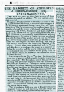
John Soden Corbet died in 1871 and his son Athelstan John Soden Corbet inherited.  Athelstan’s majority was celebrated lavishly in both Tywyn and Aberdyfi in July 1871, celebrations that were reported at length in the The Cambrian News and Merionethshire Standard on 7th July 1871.  Reading the account with hindsight, the optimism and happiness with which he was greeted seem rather sad.  Some highlights are copied here, but you can see the full account on the National Library of Wales website. The celebration shows just how important the Ynysymaengwyn Estate was to the local communities:

News report of Athelstan Soden Corbet attaining his majority. Source: National Library of Wales.

THE MAJORITY OF ATHELSTAN J. SODEN-CORBET, ESQ., YNYSYMAENGWYN.   Towyn and Aberdovey were on Thursday the scene of long to be remembered rejoicings in honour of the attainment of the majority of Athelstan J. Soden-Corbet, Esq., of Ynysymaengwyn. The Corbets are one of the best known and oldest families of which the county of Merioneth can boast; their connection with Towvn, Aberdovey, and their neighbour- hood can be traced back for a good many generations, and, upon the whole of the extensive estate connected with the family property, the name of Corbet is never mentioned but with feelings of the greatest respect, for the Corbets have always been identified as liberal, go d-hearted land- lords, who are respected by their tenantry, and held in high esteem throughout the length and breadth of the county. Liberal sums were subscribed both in Towyn and Aberdovey, to celebrate the event in a manner be- fitting the occasion, and the hearty enthusiasm which was evoked cannot but have testified to the young heir the good wishes which his tenantry and numerous friends entertain for him. Towyn was quite en fete on Thursday; the demonstrations were of a varied and pleasurable character in honour of the young heir. The decorations were of the gayest, and bunting was profusely displayed from the residences of the principal inhabitants. Handsome arches spanned the roads and bore flags, banners, and mottoes wishing health, long life, and happiness to Athelstan John Soden Corbet, Esq.

Here’s the account of the venue:

THE BANQUET, or complimentary dinner, given by the Ynys estate, to the friends and tenantry, took place in a large tent erected on the grounds adjoining the Corbet Arms, Towyn. The tent, with the decorations, was supplied by Mr Andrews, of Shrewsbury, and was embellished in a most tasteful manner. The sides were of scarlet, relieved with white and the supports were entwined with pink, blue, and white draperies, and suspended from them were festoons of coloured flowers. Each support bore a banner and armorial bearings of the county families, the principal being the shield of the Corbet family with motto Deus Pascit Corvos.

The food served must have been something to behold:

Soup.-Mock turtle, ox tail, green pea. Fish.-Salmon and lobster sauce, turbot, filleted soles. Entrees.-Yeal Cutlets, sweetbread, patties, steak and oyster pie, stewed pigeons, curried rabbit.  Champagne. Removes.-Haunch of venison, roast beef, boiled beef, roast mutton, boiled mutton, lamb, veal and ham, veal and pigeon pies, chicken and tongue, ducklings and green entremets, &c. -Sir Watkin’s pudding, plum pudding, strawberry, currant, and raspberry tarts, cheese cakes, jellies, blancmange, tipsy cake. Cheese and salad. Dessert.-Pine apples, grapes, strawberries, dried fruit. Claret, sherry, port.

The Corbet coat of arms, preserved today in the walls of the ballroom garden in the public area of Ynysmaengwyn today.

Athelstan married Mary Helen Annie Oldfied in 1873.  The marriage failed very quickly and divorce followed.  He was Justice of the Peace and became High Sheriff in 1875.  In spite of all the high hopes of the community, Athelstan Soden Corbet’s poor management of the estate combined with expensive renovations to the house, new furnishings, the costs of the divorce and heavy expenditure by Athelstan and his wife on luxurious lifestyles resulted in serious debts.  Lewis concludes that “he did not share the sense of duty and regard for his estate in Wales and its people which his predecessors had demonstrated.”  In 1875 he decided to sell the 9347 acre estate,  which earned an annual rent of £8241.  Athelstan fled his responsibilities by going overseas, living a rich life, but his letters to his agent demonstrate that he was suffering increasing financial stress, and the estate was barely able to support him.  Ynysymaengwyn was put up for sale in April 1876.  In 1877, still living vastly beyond his means, Athelstan was forced to take out a series of mortgages on the estate, which by 1878 had reached £42,000 (around £2,779,757.40 today, according to the National Archives Currency Converter). 

John Corbett. Source: Dodderhill Parish Survey Project.

Athelstan Soden Corbet must have been very relieved when John Corbett purchased the property for £51,000, which secured for Corbett the mansion, demesne and pleasure grounds.  John Corbett (1817-1901) was, somewhat confusingly, no relation to the Ynysymaengwyn Corbets.  He was a wealthy salt merchant who owned the Stoke Prior Salt Works near Droitwich, was the Liberal M.P. for Droitwich between 1874 and 1885 and the Liberal Unionist M.P. for Mid-Worcestershire between 1886-1892.  In Droitwich he was known as The Salt King.  He remained very involved with Worcestershire throughout his life, and like some of his predecessors  did not live at Ynysymaengwyn on a permanent basis, although his wife moved there with their children.  His Coat of Arms incorporated the symbol of the raven, an elephant and a castle.  It can be seen on the gate posts at the entrance to Ynysymaengwyn and on the porch of the Aberdovey Literary Institute.

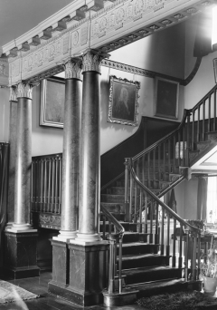
The main staircase at Ynysmaengwyn. Source: Coflein

The property when he bought it was described in detail in the Book of Sale of 1878, and this has been reproduced by Lewis Lloyd.  Anyone wanting to see the full description should see Lloyd’s book, but here are some of the highlights, which also indicate the extent to which Athelstan Soden Corbet was living beyond his means.  The mansion was described, in typical estate agent speak, as “a commodious stone-built residence of commanding elevation,” containing “a magnificent Central Hall, 42ft by 26ft, surrounded by the Reception Rooms, over which are the principal Bedrooms and in Two Detached Wings are the Secondary Apartments, Private and Domestic Offices, possessing all the conveniences necessary for a well-ordered establishment.”  Athelstan’s renovations “in the most substantial manner and regardless of cost” were “in the purest feeling of the Adams’s time and school.”  Furnishings were described as “of mediaeval style, most exquisite in design and unsurpassed in quality and workmanship.  It is practically new, having been recently supplied to the owner, and is in admirable order, and in perfect harmony with the elegant surroundings.”  A London upholstery firm had been imported to restore the fabrics. Outside it lauded the “gardens and pleasure grounds.”   The estate itself was described as “a sporting estate” including pheasant, partridge, duck, widgeon, teal and snipe, and offered fishing in the river Dysynni with salmon, sewin and trout.   Further attractions listed include yachting, sea-fishing, the seaside resorts of Aberystwyth, Aberdovey and Barmouth and “the unsurpassed beauty of the Welsh Mountain and River scenery.” Details of the farms attached to the property and the rent they paid were also detailed. The house was home to Belgian refugees during the First World War.  The Gwynedd Archaeological Trust says that in 1879 the estate began to be sold off piecemeal, and that this resulted in a period of land-speculation and development.  It would be interesting to know more about how this happened and took up the opportunities offered.

When John Corbett arrived at Ynysymaengwyn he made many improvements to the property, including connecting the south wing and the north wing, which housed the kitchens, via stone corridors to the main house, which underwent extensive improvements.  Remnants of these walls still remain at the estate.  The south wing was gutted and provided with a ballroom, stage, gallery and additional bedrooms.  He also invested heavily in the gardens and by the 1880s the gardens were were thought to be amongst the finest in Wales.  The estate was expanded by the purchase of additional estates, farms and the Tonfunau granite quarry.

Literary Institute Verandah, with the Corbett coat of arms showing an elephant carrying a tower or castle in red, with the black raven beneath

John Corbett became a significant investor in Tywyn’s physical, social and cultural infrastructure. His investments, most of which followed the sale of his salt business in 1888, included the development of Tywyn’s water and sewage system, the construction of the promenade in 1889 (at a cost of £30,000), the Intermediate School in 1894, improvements to the Corbet Arms Hotel (renamed the Corbett Arms Hotel) and the land for and £500 towards building of the new Market Hall as well as £70 towards the price for its clock. In Aberdovey he paid for the charming porch or verandah for the Literary Institute in 1897, topped with his crest showing a raven, an elephant and a castle.  He continued to invest in the school, as this short report in the Weekly Mail describes: “A meeting of the local managers of the Towyn Intermediate School was held on Saturday evening, Mr. Haydn Jones, J.P., presiding. Mr. J. Maethlon James announced that Mr. John Corbett, Ynysymaengwyn and Impney, Droitwich, had generously subscribed a sum of £100 per annum for three years towards enabling the managers to secure the services of an additional teacher and to increase the number of John Corbett’s Scholarships. The Chairman remarked that Mr. Corbett had already given over £2,000 in cash, towards the school.”  In January 1896 the Cambrian News and Merionethshire Standard reported “It is gratifying to find that Mr Corbett of Ynysymaengwyn, after having the matter brought under his notice, has given instructions that local tradesmen are to be allowed to lender for the work of constructing the Corbett Avenue and the Llechlwyd Tramroad. This gives a prospect of plenty of work for the spring and summer.”

John Corbett’s contributions to Ywyn. Top line, 1893 Assembly rooms (which he did not build, but to which he contributed) and the land and contribution to the building of the new Market Hall. Middle row: expansion and modernization of the Corbet Arms Hotel (renamed Corbett Arms Hotel) and its stables. Bottom row: plaque commemorating the new promenade and esplanade, and one of the gateposts into Ynysymaengwyn

Corbett’s convictions was completely consistent with 19th Century beliefs in philanthropy, public education, the promotion of healthy activities and the social obligation for the rich to invest on behalf of the relatively deprived. This tendency was particularly prominent in industrial cities, where manufacturers and merchants like John Corbett conducted business, but as these successful city entrepreneurs became landowners in their own right, many of these philanthropic ideas began to spread into more rural areas. It also did local landowners no harm to invest in infrastructure to improve the local economy and boost their own incomes.  John Corbett died 22nd April 1901.  The Towyn-on-Sea and Merioneth County Times reported on the funeral, listing estate workers who attended the funeral in Droitwich, stating that all flags in Tywyn were flown at half mast.

Rear aspect of Ynysymaengwyn mansion.  Source: Coflein.

In John Corbett’s will, the estate was left to his brother Thomas Corbett, who besides Ynysymaengwyn inherited “Impney Hall and estates in the Droitwich district, brine baths and four hotels,” (Welsh Gazette and West Wales Advertiser).  John had been alienated from his wife, from whom he was legally separated in 1884.  The will was contested, but although financial compensation was provided for John’s children, Thomas retained the estate. It only passed to John and his divorced wife Anna’s son Roger (1863–1942) on Thomas’s death in 1906, on the fifth anniversary of John Corbett’s death.  Roger and Anna moved back to the property in the same year, news received with considerable enthusiasm by the residents of Tywyn, although Roger only used it as a summer residence.  Barbara Middlemass says that in 1908 the house and grounds were “maintained by a housekeeper, eight maids, a chauffeur, seen gardeners and two game keepers.  Among the activities of the last mentioned were the rearing of 500 pheasants for a single season’s shooting”   The Corbett Arms Hotel in Aberdovey, which had been rebuilt in 1867, burned down in 1914, remaining in ruins until it was knocked down to create space for a new primary school in 1968.  In 1935 a Roman Catholic chapel dedicated to St David was established in a former Predbyterian Chapel in Brook Street.  It has a rather fine stained glass window decorated with the Corbett raven.  It only closed in 1989 when it was replaced with a new St David’s.

Ynysymaengwyn mansion, interior views.  Source:  Flickr, Richard Griffiths

When Roger died in 1942 the estate passed to his sister Mary Corbett, who remained unmarried, and ended the line of inheritance at the Ynysymaengwyn Estate.  During the Second World War the army occupied the Ynysymaengwyn Estate as a Royal Marines’ Camp, although I have not found a date for when they took it over.  When the Ministry of Defence handed the estate back to Mary Corbett in 1949 she transferred it in trust to Merioneth County Council, together with £3300, suggesting it might be converted to an agricultural college for the county.  The house was in a state of significant disrepair, with extensive dry rot,  and there was insufficient income from the estate to pay for repairs, which the council could not afford either, and the theft of lead from the roofs added to the speed of decay.  Given the extensive revamps carried out by Athelstan Soden Corbet in the 1870s and John Corbett in the 1880s, it is frightening how fast the property deteriorated.  One wonders to what extent the occupation by the army was responsible, but it is also clear that the estate was no longer in any condition to pay for itself, perhaps because of the war, and perhaps because of changing economic and social processes from earlier in the 20th Century.

The interior of the Ynysmaengwin ballroom wing. Source: Flickr, Richard Griffiths

Mary died in 1951.  In 1957, under the terms of the 1906 Open Spaces Act, Merioneth County Council transferred the property to the Urban District Council of Tywyn “for securing the enjoyment of the said open space.” New trees were planted between 1958 and 1962 and two fields were let out for livestock grazing. Initially the house was converted into a base for training and practice facility for the fire brigade and army, but was demolished in around 1965 (there is some disagreement about exactly when it was taken down).  It was set on fire as an exercise by the Fire Service, and was finished off by the Royal Engineers who blew it up during a demolition exercise.  It was a sad but far from prosaic end to its life.  In 1966, part of the grounds were turned over to 115 static caravans, with an additional 4.5 acres developed as a campsite for tents, caravans, and campervans.   This destroyed the mansion’s pleasure garden, of which according to the Gwynedd Archaeological Trust there are now no traces.  In 1984 the local government organization of the area was changed, and the following year a dispute erupted between Bryncrug Community Council and Tywyn Town Council regarding the management of Ynysymaengwyn, with the result that Tywyn Town Council took over the Caravan site, with profits being re-invested into the estate for its maintenance.  The ballroom wing was demolished in 1989.  In 2008 Tywn Town Council, with a £47,000 contribution from Cydcoed (Woods for All) completed the restoration of the woodlands, which had become dominated by conifers and were replanted with broadleaf trees, which are far more friendly to other wildlife, letting in more light and providing good mulch following leaf fall.

The video below shows the remains of the ballroom and the walled ballroom garden, some of the walled kitchen garden, and local scenery that would have been enjoyed by the occupants of Ynysymaengwyn (February 2019 – and sorry it’s a bit jerky, I am still new to a camcorder).

Of the projects that John Corbett initiated in Tywyn and Aberdovey, the Assembly Rooms are still in use as a cinema, the market hall has been divided into three retail properties, the promenade is still going strong, the porch at the Aberdyfi Literary Institute is in excellent condition, but the Corbett Arms Hotel in Tywyn, a Grade 2 listed building, is in an appalling state of disrepair and is empty.  I’ll talk about each of these buildings in more detail on future posts.

Finally, there are two puzzling carvings flanking the last surviving remnant of the north wing, its porch, shown in the image below.  The one on the right is still well preserved, but although there was also one on the left this is now very difficult to make out.  I have seen no suggestions about when they were added or what they were supposed to signify.

The carvings flanking the porch of the north wing.  Source of photograph at left: Coflein

A rather depressing adjunct to the story of modern Ynysymaengwyn was reported in the Cambrian News.  In 2016 the neighbouring Ysguboriau farm and campsite attempted to claim between five and seven acres of the bequeathed land, having grazed sheep there for sufficient time to attempt to legally sequester the land for themselves, planning to fence it off. As Tywyn town councillor and trustee of Ynysymaengwyn, Cllr John Pughe, said: “the land they are claiming should be for the benefit of everyone.” The dispute was still ongoing in 2018.

If you would like to visit, and I do sincerely recommend it, the surviving portion of the estate is open to the public as a woodland walk, with access to walks along the wonderful Dysynni river.  Just drive through the gate posts on the A493 and head down the short lane, watching out for a left turn that will take you into the carpark. In the bottom left hand there’s a map that shows you three woodland routes, the longest of which takes 30 minutes, but you can lengthen this by doing a section of the Dynsynni.

On the right is a noticeboard showing the walks, which are positioned at strategic places around the woodland. I have annotated a Google map on the left with approximate locations of some of the features (you can click to expand the view). The porch of the servants and admin quarters is to the right of the ballroom, minus the Corbet coat or arms, which was spectacular and is now preserved in on of the remaining walls of the ballroom garden.

One of the twin gateposts of the Ynysymaengwyn Estate today, with part of John Corbett’s coat of arms

There are a few features of the 19th Century estate still visible, most notably the dovecote, the former vast kitchen garden (now just an enclosed area of grass, the remains of the former ballroom and its garden, the old entrance to the big block of servants quarters with figures carved into the stonework each side of the entrance, and several sections of wall.  The snowdrops are splendid in February.  Take a bag full of bird seed with you if you like bird life – the wild birds are borderline tame, and all expect to be fed, and yell vociferously if you stand there looking at them and don’t provide sustenance!  Here’s the address:
Ynysymaengwyn Caravan & Camping Park
The Lodge, Ynysymaengwyn
Tywyn, Gwynedd
LL36 9RY
See the website for directions:
https://www.ynysy.co.uk


References:

The starting points for this post, with my thanks, were Lewis Lloyd’s A Real Little Seaport, and the Coflein website, supplemented extensively by other information resources, all listed below.

Anon. 1829. Wanderings in Wales. Cambrian Quarterly Magazine and Celtic Repertory, vol.1, 1829. https://bit.ly/2DujYjq
Eade, S. 2017.  Towyn on Sea, Merionethshire.  Volume 2.  Sara Eade
Gwynedd Archaeological Trust 2007.  Ports and Harbours of Gwynedd: Aberdyfi. A Threat Related Assessment.  GAT Project  No.1824, Report No.671.1, April 2007
Gwynedd Archaeological Trust 2011.  Conservation Area Appraisal: Aberdyfi, Gwynedd. GAT Project  No.2155, Report No.956, June 2007
Lewis, H.M. 1989. Pages of Time. A Pictorial History of Aberdyfi. Published by the Author.
Lewis, S. 1833.  A Topographical Dictionary of Wales. Brython Press
LLoyd, L.  1996.  A Real Little Seaport.  The Port of Aberdyfi and its People 1565-1920, Volume 1.  ISBN-1874786488
Marshall, D. 2009. Local Walks Around Tywyn in the Snowdonia National Park. (Walk 17).  Kittiwake Press
Middlemass, B. 2017 (second edition).  John Corbett.  Pillar of Salt 1817-1901. Saltway Press
Williams, G. 1987.  Renewal and Reformation Wales c.1415-1642.  Oxford University Press.

Cambrian News and Merionethshire Standard.  The Majority of Athelstan J. Soden-Corbet, Esq., Ynysymaengwyn. Welsh Newspapers Online – The National Library of Wales.
Coflein. Ynys-y-Maengwyn Estate Cottages. http://www.coflein.gov.uk/en/site/28895/details/ynysmaengwynynys-y-maengwyn-estate-cottages-bryn-crug
Geni.com.  Historic Buildings of Merionethshire. https://www.geni.com/projects/Historic-Buildings-of-Merionethshire/25169
Gwynedd Archaeological Trust. Dysynni Historical Themes. http://www.heneb.co.uk/hlc/dysynnithemes.html
Gwynedd Archaeological Trust. Tywyn. http://www.heneb.co.uk/hlc/dysynni/dysynni3.html
Jones, A.  2016. We’ll fight to keep land for the town. Cambrian News, 17/11/16. https://bit.ly/2N3dp79
Jones, A.  2017. Fence row erupts in Trust land dispute. Cambrian News, 02/01/17. https://bit.ly/2NJfav8
North Wales Daily Post 2008. New Life Breathed into Old Woods. Daily Post (North Wales) 03/07/08. https://www.dailypost.co.uk/news/north-wales-news/new-life-breathed-old-woods-2824545
Owen, Athelstan (1676-1731) of RHIWSAESON, LLANBRYN-MAIR, MONT.
https://Biography.wales/article/s-OWEN-ATH-1676
Wikipedia. Ynysymaengwyn. https://en.wikipedia.org/wiki/Ynysymaengwyn
Wynn, Pryse and Corbet families, Ynysmaengwyn, Mer., and Gwyn And Nanney  families, Dalau Gwyn, Mer.
https://biography.wales/article/s-WYNN-PRY-1275
The Ynysymaengwyn Papers. Archives Wales. https://archiveswales.llgc.org.uk/anw/get_collection.php?inst_id=38&coll_id=1246&expand=&L=1
Ynysymaengwyn Camping, Caravan and Woodland Park website, history page https://www.ynysy.co.uk/history.html


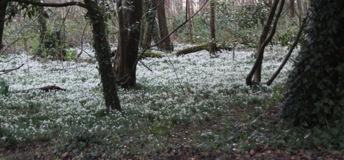
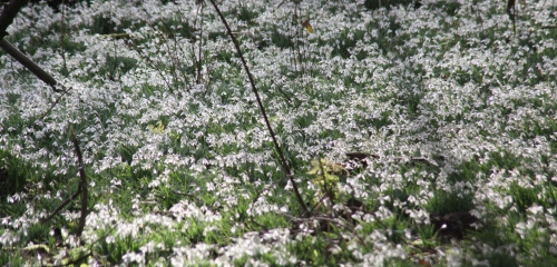
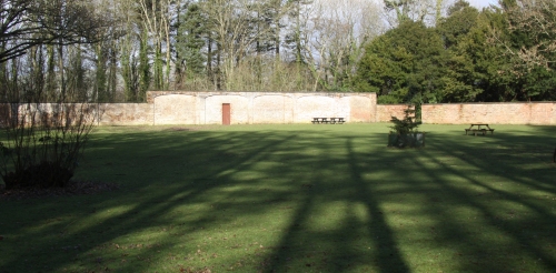
The woodland walks at Ynysymaengwyn

Ynysymaengwyn late 18th Century mansion. Source: Commando Veterans Association

I went over to Ynysymaengwyn today to take some photos for the article I’m writing about the history of the Ynysymaengwyn Estate.  Although it is now a caravan and camping site, it used to be the biggest landholding property in the area, dating back to the reign of Elizabeth I.  It is best known for its 18th and 19th Century history, when it owned most of Tywyn and Aberdovey, the fortunes of which were inextricably tied with those of the estate.  A splendid house was built in 1758 by the widow Ann Owen, and this was still standing together with a ballroom wing, a servants’ and administrative, kennels, a dovecote and kennels, as well as a vast kitchen garden in the 1960s.

When the last owner of Ynysymaengwyn signed the buildings and the remaining 40 acres of the estate over to Merioneth council, and it was then handed over to Tywyn Town Council, it fell into increasing disrepair it was decided that the buildings should be disposed of.

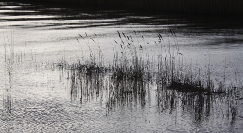
Only very few remnants of the buildings remain, but some of the woodland has been preserved as a series of very beautiful short walks.  I’ll write up full details of what is left of the original estate when I post the article, but in the meantime here are a few photos of the walks.  The snowdrops today were absolutely stunning, the walk down the Dynsynni was beautiful with the reeds rustling in the breeze, and the views across the hills from the Dysynni were wonderful.  The birds were all amazingly tame, and even a rabbit hopped across the path in sublime unconcern.

If you would like to visit, and I do sincerely recommend it, the surviving portion of the estate is open to the public as a woodland walk, with access to walks along the wonderful Dysynni river.  Just drive through the gate posts on the A493 and head down the short lane, watching out for a left turn that will take you into the carpark. In the bottom left hand there’s a map that shows you three woodland routes, the longest of which takes 30 minutes, but you can lengthen this by doing a section of the Dynsynni.  Take a bag full of bird seed with you if you like bird life – the wild birds are borderline tame, and all expect to be fed, and yell vociferously if you stand there looking at them and don’t provide sustenance!

Here’s the address:
Ynysymaengwyn Caravan & Camping Park
The Lodge, Ynysymaengwyn
Tywyn, Gwynedd
LL36 9RY
See the website for directions:
https://www.ynysy.co.uk


The railway arrives in Aberdovey in 1864

Welsh Coast Line. Source: Wikipedia, where you can see it as a single image, without rather than being split into two, as it is here.

Today the Cambrian Line runs from Shrewsbury (Shropshire) to Pwlleli (Gwynedd) with a branch just after Dovey Junction to Aberystwyth.  The section from Dovey Junction (to the southwest of Derwenlas) to Pwlleli in the north is known as the Cambrian Coast Line.  There are two stops in Aberdovey, one at Penhelig and the other at the far side of the village, behind the bowling club.  The arrival of the railway in the 1860s had a significant impact on Aberdovey, altering the economy and physically reshaping parts of the town.  The excellent legend to the left shows the final form of the railway line, complete with information about which stations remain in use.  I have split it into two to fit on the page, and Morfa Mawddach appears twice as a result.

The Aberystwith and West Coast Railway was authorised by a Private Act of Parliament on 22nd July 1861.  The spelling of Aberystwyth as Aberystwith was the name in which the company was registered.  To put this date into perspective, by the 1860s Aberdovey had a very successful shipbuilding industry, it was an important port for the transhipping of slate exports and was important for the import of grain and other goods.  Copper mines had been established in the hills around the village and a growing tourist industry based on the beach was flourishing even without a railway.  There were two Nonconformist chapels dating from the late 1820s and St Peter’s Church had been established for nearly two decades.

The railway routed around the back of the village, rather than along the seafront as originally planned. Source: Hugh M. Lewis.  Aberdyfi, A Glimpse of the Past.

The railway was intended to link north and mid Wales, to improve efficiencies in the export of local slate and to enable Aberdovey and Aberystwyth to serves as Irish ferry termini, linking Ireland with the Midlands.  These were boom years for Aberdovey, and it must have seemed like more in the way of progress.  Local people were not, however, blinded by the coming of the railway and significant disputes between Aberdovey residents, the owners of the land (the Ynynsymaengwyn Estate in Tywyn) and the representatives of the railway company over exactly where the railway should run and how the harbour would be developed.  The original plan was to send the line along the sea front but extensive disputes with Aberdovey business leaders and villagers, who were concerned about the impacts on shipping, ship building and tourism, lead to it being routed around the back of the village, an expensive compromise that required tunnelling through rock.  The dispute is described in Lewis Lloyd’s account on the subject in A Real Little Seaport.   The need for the tunnels meant that the railway’s contractor Thomas Savin’s estimate for the cost of the railway was unrealistically low, and this contributed to his personal bankruptcy in  1866.

Thomas Savin (1826-1889) was a well known railway engineer,  who built several railways in Wales.  Although the contractors for the new railway are listed as Thomas and John Savin, Thomas was clearly the driving force.  He had multiple business interests and often invested in his railway projects, meaning that he was far from impartial when local interests impacted business decisions, as happened in Aberdovey when villagers contested his plans to run the railway along the sea front and develop the harbour in ways that would have been harmful to local shipping and tourism interests.  Savin represented the railway company in most of his dealings with the villagers. A lot more about Savin can be found on a page dedicated to him on the Llanymynech Community Project website.

Penhelig shortly after the railway was laid, and before Penhelig Terrace was built, showing the railway tunnel and the shipyard just in front of the Penhelig Arms. Source: Hugh M. Lewis.  Aberdyfi, A Glimpse of the Past.

Savin had originally intended to build a bridge across the Dyfi to connect Aberdovey and Ynyslas by rail, and this remained the plan for some time, but due to the local geomorphology, civil engineers decided that the bridge could not be built and an additional 12 miles of rail had to be laid to go around the estuary, crossing the river just north of Gogarth instead. This meant that until the new stretch was built, southbound passengers had to cross the river by ferry between Aberdovey and Ynyslas, where a line had been built.  All the necessary materials for construction of the railway were carried into Aberdovey by ship, except for the locomotive and carriages that were carried from Ynyslas over the river Dyfi to Aberdovey.  Aberdovey served as the depot for most of the equipment and materials, including plant, sleepers and rails.  The construction work on the Aberystwith and West Coast Railway began at Aberdovey in April 1862, and was built in a number of stages,as follows:

  • By early September 1862 the line reached the river Dysynni and the first locomotive with 10 carriages was launched in South Merioneth and undertook the short trip from Aberdovey, stopping to pick up more passengers, to the river Dysynni and back again, carrying dignitaries and holiday makers.  In the evening a firework display celebrated the achievement.
  • In 1863 a track was laid down between Aberdovey and Llywyngwril to the north along the Welsh coast, including the three-span steel plate girder bridge over the Rivery Dysynni. This section of the line connected with the narrow gauge TalyLlyn slate quarry railway at Tywyn.  Before the railway, slates were offloaded from the TalyLlyn single gauge railway, loaded on to the new line and taken to Aberdovey for loading on to ships.
  • Before the section of line was built around the estuary, the s.s. Elizabeth was purchased to carry railway passengers across the river at Aberdovey to Ynyslas.  The Elizabeth was a 30 horse-power Blackwall paddle steamer that was rigged for sail.  She arrived in October 1863, and was captained by a Machynlleth resident Captain Edward Bell who was succeeded by his younger brother Captain John Bell.  But she was not a success.  At c.125ft long she was too long, and small boats had to be used to supplement the ferry service.  The Elizabeth was owned by Thomas Savin, who sold it in 1869 to an agent in Londonderry.
  • The section of railway between Machynlleth and Aberystwyth was completed by July 1864.
  • The stretch from Aberdovey to Pwllheli was completed in August 1867, the delay caused by the building of the viaduct across the estuary at Barmouth.  The line was originally intended to go along the Lleyn Peninsula to Porthdinllaen, but this plan was abandoned and the terminus was established at Pwllheli. This section of the line linked at Afonwen Junction to the Caernarfonshire Line to Caernarfon.
  • In 1867 the railway was also extended along the north bank of the river to Machynlleth.  The line split at Dovey Junction with two branches, one going to Machynlleth and one going to Aberystwyth.

Photograph of the Temperance Hotel in Chapel Square, showing the bridge over Copper Hill Street in the background in 1867. Source: Hugh M. Lewis. Pages of Time.

As the Newtown and Machynlleth Railway had opened at the beginning of 1863 and absorbed into Cambrian Railways the following year, the two lines were now linked.  Newtown was linked to the Oswestry and Newtown Railway (which opened in 1860), which in turn linked at Welshpool to the Shrewsbury and Welshpool Railway (which opened in 1862) and the Shrewsbury and Birmingham Railway (opened in 1847), the Shrewsbury to Hereford line (opened in 1853) and the Newport, Abergavenny and Hereford Railway (also opened in 1853) thereby linking mid and north Wales with the borders, south Wales the Midlands.

In 1866 the line had been integrated with Cambrian Railways under the Cambrian Railways Company, which was created by an Act of Parliament in July 1864 in order to amalgamate a number of companies operating in Wales.  The Aberystwith and West Coast Railway was still under construction at the time of the Act, so was not included in the original amalgamation, but was incorporated two years after the first part opened.  Cambrian Railways was head-quartered at Oswestry, where there is now a heritage museum celebrating the railway, the Cambrian Railways Museum (which has a website here).

Railway Tunnel on the other side of Penhelig

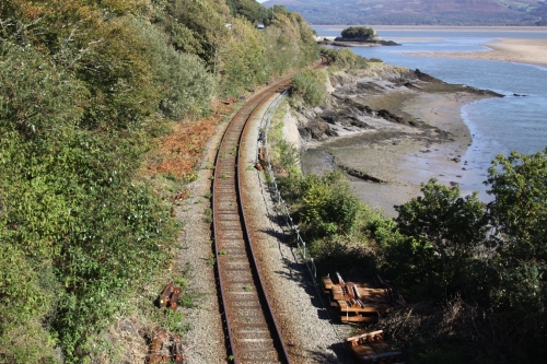
Heading to Aberdovey from Machynlleth, the line enters Aberdovey from the southeast at Penhelig Halt (added in 1933) where it emerges from a tunnel and is then carried over the road and follows a track through the back of the village before crossing the road again at the far end of Aberdovey, to continue along the coast to Tywyn.  The spoil from the tunnelling operation that was required to run the railway at the back of the village was deposited in Penhelig, on land cutting into a former shipbuilding yard, and this was the site of the future Penhelig Terrace, which was built c.1865.  Two tunnels were required to carry the railway through the hillside alongside the estuary, and four bridges were erected to carry it over the coast road  at Penhelig, under Church Street, behind St Peter’s Church, over Copper Hill Street and at the far end of Aberdovey by the modern fire station.  As soon as the line between Aberdovey and Machynlleth opened, the Corris and Aberllefenni slate carried on the Corris narrow gauge railway ceased to be loaded onto boats for transhipping onto seagoing vessels at Aberdovey, and was now transported instead by rail into Aberdovey.  Much of it the Welsh Coast Railway is raised only a few feet above sea level and it follows the coastline very closely for much of its length, making it one of the most scenic coastal railways in the UK.

The GWR Railway advert for Penhelig Halt. Source: Hugh M. Lewis. Aberdyfi, A Glimpse of the Past.

Aberdovey (Aberdyfi) Station was built in a location that was at that time just outside the main village.  It was equipped with two platforms flanking the tracks, and a fairly substantial single-storey railway building that survives in good order, but has been converted for residential use.  It is a charming red brick-built building with a slate roof, finished in stone around its doors and windows.  The front of the station has decorative black engineering bricks around the porch’s archway and in a parallel linear arrangement in the walls.  The porch is also equipped with twin stone columns.  Penhelig Station was added in 1933, by which time the railway was operated by the Great Western Railway, which absorbed Cambrian Railways in 1922, and was equipped with a single platform and an attractive little wooden shelter that remains today.

The railway clearly improved the economic stability of Aberdovey in some ways, but it also had negative impacts.  In its favour, it made it much easier for the evolving tourist industry to develop.  Efficiencies in cargo handling improved, and international trade continued to be important.  Cargoes that were not time sensitive still travelled by local ships, because their freight rates were so much lower, meaning that slate continued to travel by sea.  However, it a number of shipbuilding yards had to be destroyed for the railway to be completed, and over the two decades after the railway arrived the shipbuilding industry went into permanent decline, aggravated by the Great Depression in Britain between 1873 and 1896).  The last locally built ship was launched in 1880.  Derwenlas, which was an important inland port and shipbuilding centre, was cut off from the river by the railway embankment, almost completely closing it down.  Although transhipping to seagoing vessels still took place at Aberdovey for international trade, ships were no longer needed for national transportation.  It was was much more efficient to carry goods and livestock by train than by boat, so the previously coastal trade faded fast. The promised Irish ferry port never arrived, and as the railways expanded and improved, minor ports lost out to big ports with better facilities and connections.

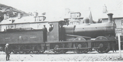
A Cambrian Railway steam engine shunting down at the modernized wharf in 1887. Source: Hugh M. Lewis. Pages of Time.

In spite of the Great Depression, the wharf and jetty were given a major overhaul in the early 1880s, and were provided with a tiny branch track that led into the wharf area and out on to the jetty.  The new wharf and jetty were built on land acquired by Cambrian Railways for the purpose, opening in 1882.  Two large buildings were used for the storage of cargo and building materials, the jetty was around 370ft long and allowed ships to be loaded and unloaded at both high and low tides and animal pens were erected on the foreshore to hold livestock that was offloaded from ships. Railway tracks linked the jetty and wharf to the railway so that the transhipping process was far more fluid than it ever had been before.  Exports included slate from local quarries.  Imports included limestone, coal and cattle from South Wales, potatoes and cattle from Ireland, grain from the Mediterranean, timber from Newfoundland, and phosphates and nitrates from South America.  This will be covered in detail on a future post.

Penhelig Halt as it is today

Both Penhelig and Aberdovey stations remain open today.  Penhelig Station retains its 19th Century wooden shelter in an excellent state of repair, but no other station buildings. The platform is reached by a fairly long flight of steps.  Aberdovey Station is at ground level, retaining the original single-storey long brick structure on the one remaining platform.  It has been converted into three cottages, with the rear facing on to the platform and the front now overlooking the football pitch and adjacent to the golf cub.  The short branch to the harbour that was added in the 1880s was later built over.  Neither of the stations is staffed.  Tickets are purchased on the train itself and there is an electronic display containing information about the next trains due to arrive.  Because the platform is very low, built before platform heights were standardized, in 2009 a raised section made from reinforced glass-reinforced polymer was added.  This type of solution is called a Harrington Hump after the first station to have one installed, and Aberdovey was only the third UK station to receive one, after a period of consultation with local residents.  It was funded by the Welsh Government.  The BBC website says that instead of the usual £250,000 to raise the level of a platform the Harrington Hump costs a mere £70,000.  In 2014 part of the embankment was washed away, with the Daily Post reporting that the track was left hanging in the air.  A photo gallery on the site shows repairs being carried out.

Penhelig Lodge is to the left and below the level of the railway track and the tunnel in about 1865.  The photograph also shows the newly built Penhelig Terrace, which is end-on in this photograph. Source: Source: Hugh M. Lewis. Pages of Time.

The following video was shot in the 1920s and shows a steam train on the Aberdovey section of track:

Main sources:
The main source for information about the railway and its relationship to Aberdovey is Lewis Lloyd’s excellent A Real Little Seaport.  The Port of Aberdyfi and its People 1565-1920. Volume 1, which makes extensive use of local newspaper reports and contemporary records.  For anyone interested in learning more, there is much more information about the disputes, issues and accidents concerning the railway in his section “The Advent of the Coastal Railway” in chapter 7.  Hugh M. Lewis also has some information in his book  Aberdyfi – Portrait of a Village and other invaluable Hugh M. Lewis publications provide super photographic records.  For more general background information two well-researched Wikipedia pages were useful sources: Aberystwith and West Coast Railway and Cambrian Railways.

Railway track as it leaves Aberdovey for Machynlleth


The Calvinistic Methodist Chapel, Chapel Square, Aberdovey (established 1828)

Methodist chapel (now Dovey Marine), Copper Hill Street front entrance

The Calvinistic Methodist Chapel (or Tabernacle) in Chapel Square, now occupied by Dovey Marine, has had a rich history, as did the Calvinistic Methodists who built it.   The chapel was their first dedicated premises, before which they used a number of temporary meeting places around the village, their lives made somewhat difficult by anti-Methodist persecution from the important Corbet landowners of Ynysymaengwyn (just outside Tywyn) who owned most of Aberdovey in the 18th Century.

Having arrived in the Aberdovey area in around 1790, it took the Calvinists nearly 30 years to a built a chapel, a significant accomplishment.  They were the first denomination to build a chapel in Aberdovey, although the Wesleyan Methodists were only a year behind them. It isn’t the prettiest or most impressive of the chapels in the village, but the Aberdovey Calvinistic Methodists have a very interesting history.

Portrait of John Calvin (1509-64)

The Calvinistic Methodists were a mainly Welsh movement that built on the 18th Century revivals of 17th Century Protestantism.  Calvinistic Methodism sounds like a bit of an oxymoron.  Methodism, or Wesleyan Methodism, began at Oxford University, where Charles Wesley (1707-88) and George Whitefield (1714-1770) formed a group to discuss religious ideas and methods, particularly the power of evangelism.  It was joined by Charles’s brother John Wesley (1703-91) and became known as the Holy Group, and later, based on the importance of procedures and methods in their approach, Methodists.  The three, all of whom were ordained, went to America in 1738 to  become missionaries, but George Whitefield returned a year later to focus on doing religious work in England, preaching extensively indoors and out, making himself very unpopular with the established church.  John Wesley returned three years after his departure to America to bring his ideas into the Church of England in an attempt at Anglican reform.  Like Whitefield, he found himself unpopular with the Anglican authorities and was denied preaching  access to some churches, so followed Whitefield’s example and began preaching out of doors, and began to travel extensively.  Wesley and Whitefield parted ways in 1741 over Whitefield’s  belief in Calvinist predestination, foreshadowing the later split between the Welsh Calvinistic and Wesleyan Methodists.  It was only after John Wesley’s death in 1791 that Methodism withdrew from the Church of England and became a doctrine in its own right.  The key difference was that John Wesley retained the Arminian (as opposed to the Calvinistic) belief that salvation is available to all.  In Wesleyan Methodism, the living of a good, altruistic, and selfless lives and absolute belief in and dedication to God is not a means of winning salvation but is actually a product of salvation.  Salvation is therefore by God’s grace alone, rather than something that can be achieved by human endeavour.  This is one of the core differences between Methodism and the Church of England.  In Wales a group of Welsh reformers had very similar ideas

The founders of Calvinistic Methodism. Clockwise from top left: Griffith Jones, Howell Harris, WIlliam Williams Pentycelyn and Daniel Rowland

The reform movement in Wales is thought to have begun in Carmarthenshire with Griffith Jones, the rector of Llanddowror, who was responsible for establishing circulating schools in 1731.  These schools taught the Welsh to read by studying the Bible and other Christian scripture.  Griffith Jones became something of a legend and an inspiration to other influential early preachers, like Howell Harris (1714-1773), Daniel Rowland (1730-1790) and William Williams Pantycelyn (1717-1791), all of whom had experienced spiritual awakening and became evangelists for a reformed church that had a high level of evangelism and an emphasis on hard work, moral behaviour and education of the poor.  William Williams became famous for his hymns, song and prayer being important in the religious practices of Calvinistic Methodism.

When the two groups met up they had so much in common that they initially joined forces under the heading of Methodism.  They shared belief in the burden of sin, the need for personal knowledge of God and the ability to feel him, assurance of salvation, recognition when or if sins have been forgiven and the knowledge that this had been felt.  They also believed that rebirth on Earth in the form of a better way of living life was fundamental.  There was, however, a fundamental point of doctrine on which the two branches differed.  Whereas Wesleyan Methodists believed that all people could be redeemed by faith, spreading the word of God and good deeds, the Welsh preachers followed Calvin, the radical French Protestant, who believed that the original sin of Adam made it impossible for people to redeem themselves, and only those who had been selected by God before Christ was sent to redeem them, the elect, would be raised to Heaven.  Because they still retained many of the other Methodist ideas about doctrine and felt just as strongly as the Methodists about the way in which religions should be practised, disseminated and organized, the Calvin followers separated from the Wesleyans and became Calvinistic Methodists.

Distribution of Calvinist Methodists pre-1851, showing the low levels of representation in Meirionnydd. Source: Welsh Religious Buildings Trust

Calvinistic Methodists put enormous emphasis on itinerant preaching, either indoors or in the open, considered song and active prayer to be important to developing a personal relationship with God, and believed that God would arise and display his glory. Hard work was a core component of their religion because only by hard work and business success could the elect be known and recognize themselves.   By 1750 there were over 400 gatherings of converts who became groups or fellowships known as “seiadau.”

Hugh M. Lewis describes Aberdovey as suffering “a certain amount of religious deprivation” prior to the last decade of the 18th Century.  The main centre of social and economic activity in the area was Tywyn, where St Cadfan’s Anglican Church, dating back to the 14th Century, was the main centre of religious life.  Even itinerant nonconformist preachers who were very active in other parts of Meirionnydd did not reach Aberdovey.   In about 1790, however, a group of Calvinistic Methodists established themselves about a mile outside Aberdovey at a building called Hen Felin, which has since become a ruin.  They next moved to lodgings in a building that belonged to the Raven Arms called The Store House on Sea View Terrace, which was used as a warehouse facility and had an upper room that could be used for Calvinistic meetings.  Unfortunately, Edward Corbet who “feared them as radicals if not revolutionaries” (Lloyd, A Real Little Seaport) was informed of their activities and evicted them, throwing all their property including benches and bibles out onto the road.  The Calvinists were lucky to find a sympathizer in Mr Scott, the owner of the row of three cottages now known as Penhelig lodge, who from 1796 gave them the use of an outbuilding called Ty Coch on the edge of the ravine where there is now a road called Nantiesyn, in Penhelig.  In 1811 the Calvinist Methodist movement established its (Yr Hen Gorff – The Old Body) formally, detached itself from the Anglican Church, and became the leading nonconformist Meiryonnydd religion, giving the Aberdovey preachers a solid foundation.

Calvinistic Methodist Chapel, New Street rear entrance

Aberdovey’s population increased in the late years of the 18th Century and the early years of the 19th Century.The discovery of copper and lead in the mid-18th Century and the importance of the port for handling imports of wheat, barley and corn significant contributors to the growth the the village. As Aberdovey prospered, the Calvinist congregation also grew, making it necessary to look for premises that was not owned by the Ynysmaengwyn estate.  In 1827, recognizing the growth of Aberdovey, the Turnpike Trust finished a road that linked Aberdovey with Machynlleth, raising its importance, and increasing the number of visitors.

In 1828 a plot of land in what is now Chapel Square was acquired on a 99 year lease, and volunteers built their chapel to seat 124 worshippers in 1828, at a cost of £400.00 (c. £27,120.52 in today’s money, or 26 horses/74 cows, according to the National Archive’s Currency Convertor website).  It did so well that in 1855 a gallery was added at a cost of £120.00 (c.£8,136.16). The Coflein website says that the new chapel, which they named Tabernacle, was designed by Reverend Richard Humphreys of Dyffryn.   The façades are characterized by large rectangular windows beneath dripstones (mouldings to shelter windows from dripping water), a line of three on the first floor on the Copper Hill Street (front) side and two on the ground floor and two on the first floor at the New Street (rear) side.  The arched Copper Hill Street doorway is lined with stone blocks and a keystone.  The New Street entrance door has a stucco frame.  Stuccoed quoins (masonry corner blocks) are on all four corners of the building and there are wide recessed strips in the gables of both frontages.  A plaque reads: “Tabernacl/adeiladwyd ir Methodistiaid Calfinaidd yn y flwyddin 1828” (Tabernacle / built by Calvinistic Methodists in the year 1828).  Once they had established their chapel the Calvinist Methodists set up a Sunday school.

Calvinistic-Methodist Chapel of 1864

In 1864 the Calvinists left the building in favour of new, much larger premises on Sea View Terrace, also called Tabernacl, which will be covered on future post shortly.  The original 1828 building was immediately adopted as a temporary school whilst a new school was being built.  When it was again vacated the former chapel was renamed the Assembly Rooms and became a resource for villagers and a central location for village activities.  Shops were later established on the ground floor, the first floor was used for meeting space, and the building became know as the Market Hall.  In 1920 it was renamed the Imperial Hall.  In 1931 Roman Catholics, who had no premises of their own in the village, used one of the meeting rooms.  During the Second World War the building became the headquarters for the Home Guard.  Today, the has been occupied for over two decades by the excellent Dovey Marine.


Main sources:
Welsh Calvinist Methodism is usefully described on the Welsh Religious Buildings website.  Wesleyan Methodism and some of the features that distinguish it from Calvinistic Methodism are described in straight forward terms on the Welsh Religious Buildings website and on the BBC Religion web pages.  Hugh M. Lewis, local resident and collector of Aberdovey information and images, is the source of most of the information in this post about the early activities of the Aberdovey Calvinistic Methodists, telling the fascinating story of the establishment of the chapel in his book Aberdyfi, Portrait of a Village (his best book, in my opinion).  Lewis Lloyd’s A Real Little Seaport was also useful, and Hugh M. Lewis’s Aberdyfi, Pages of Time added some additional information.