Category Archives: Meirionnydd

The peaceful ruins of the 1198 Cymer Cistercian Abbey, Dolgellau

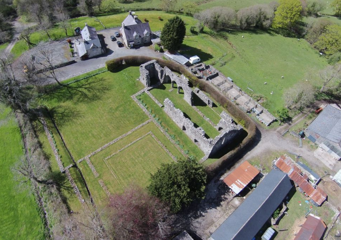
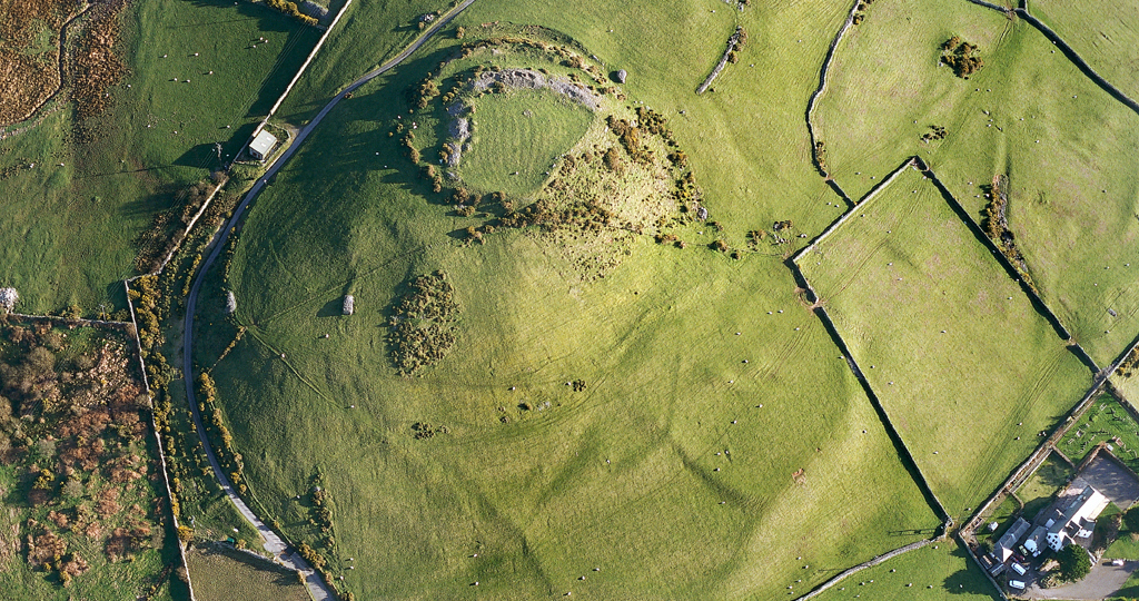
Cymer Abbey. Source: Coflein

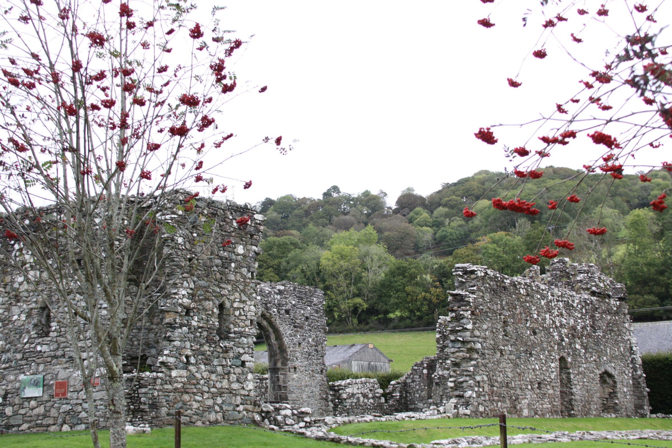
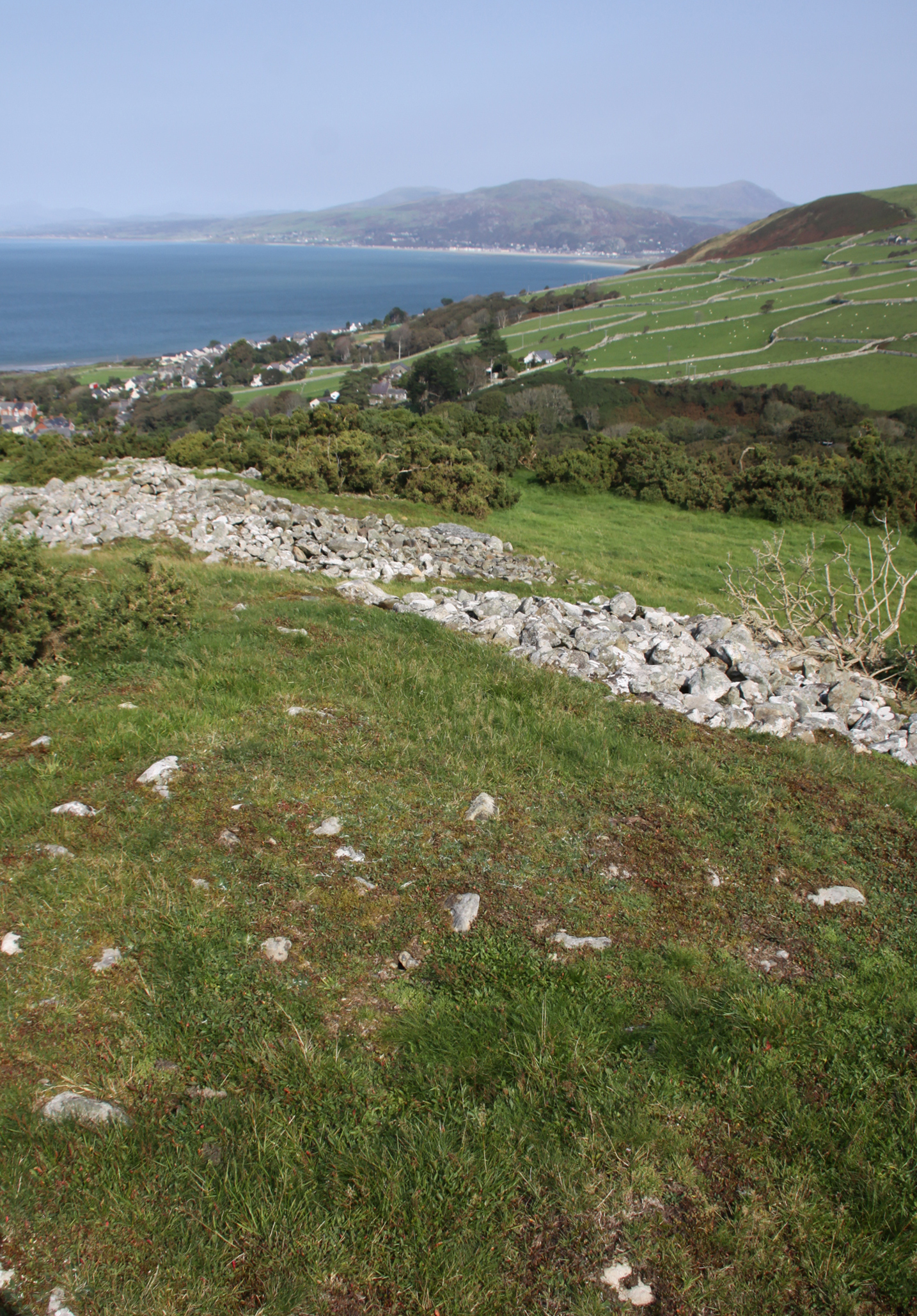
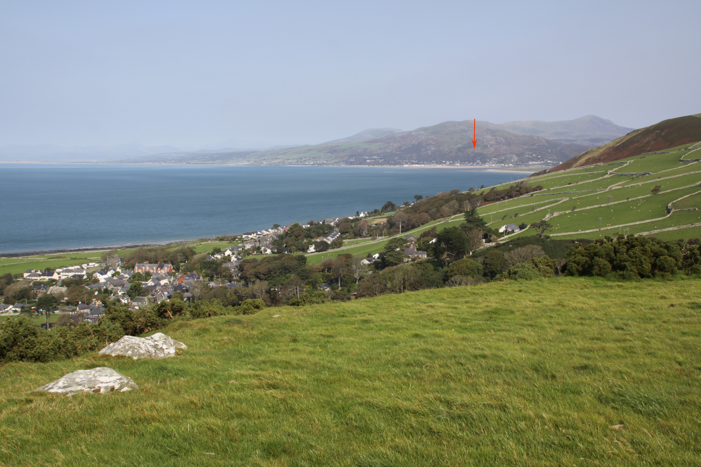
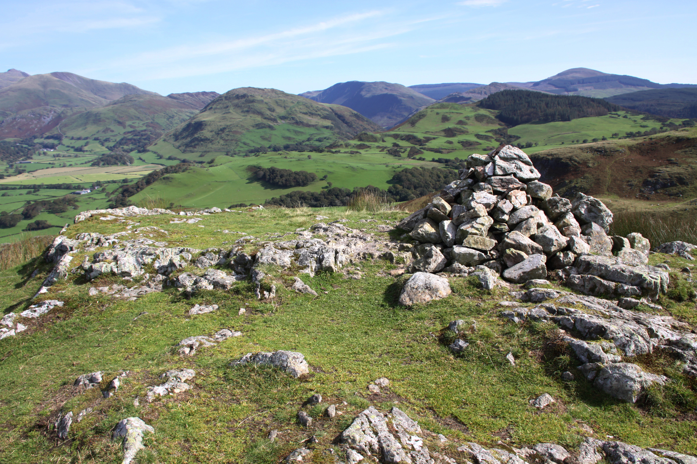
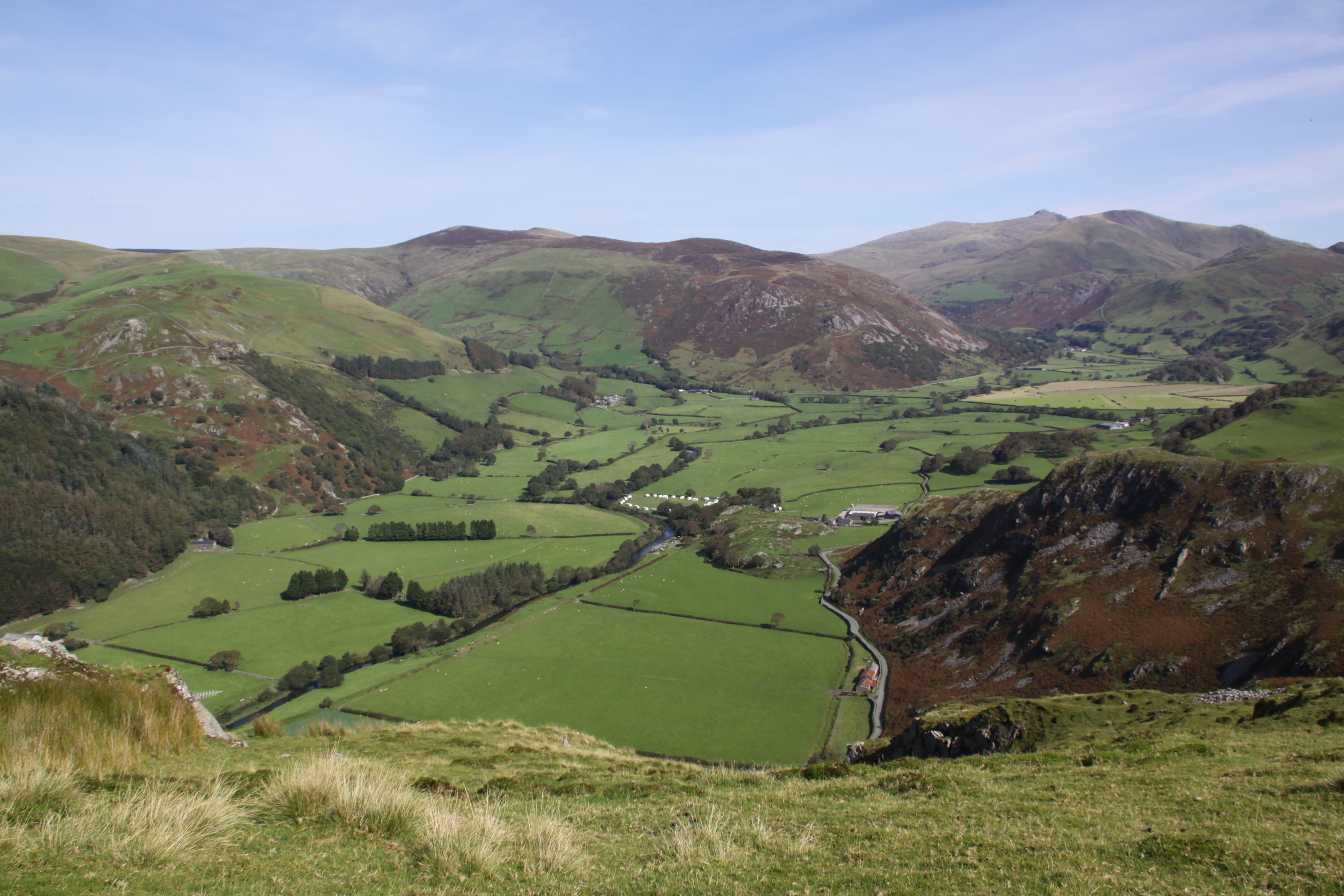
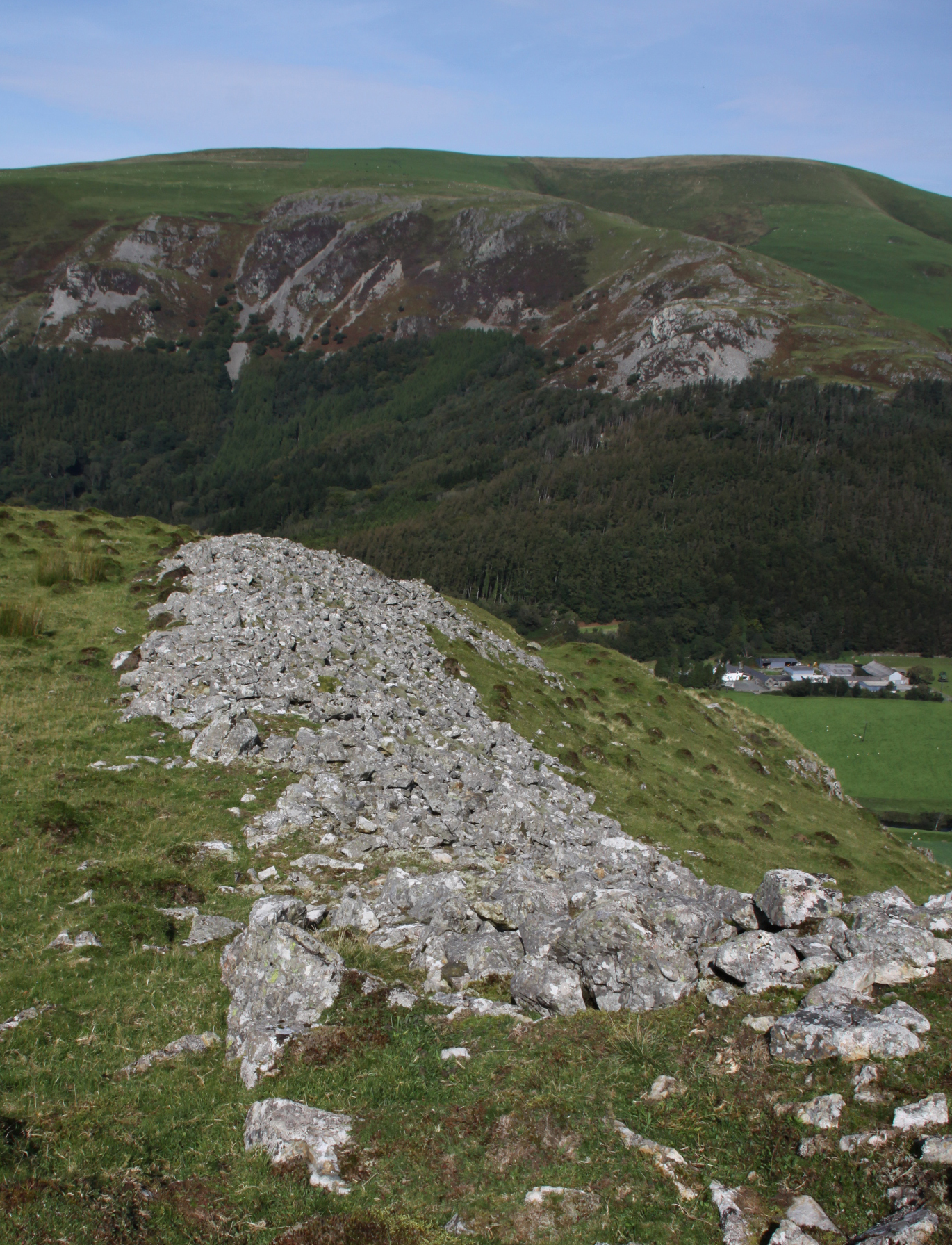
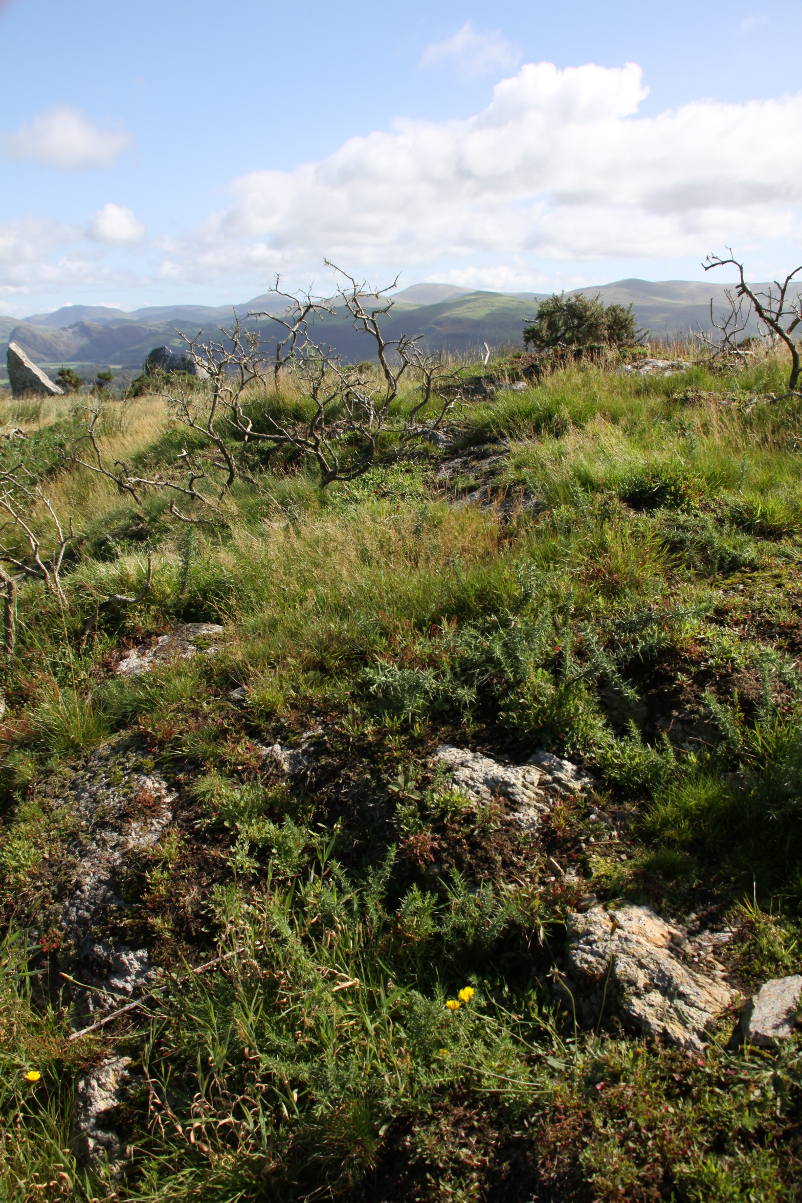
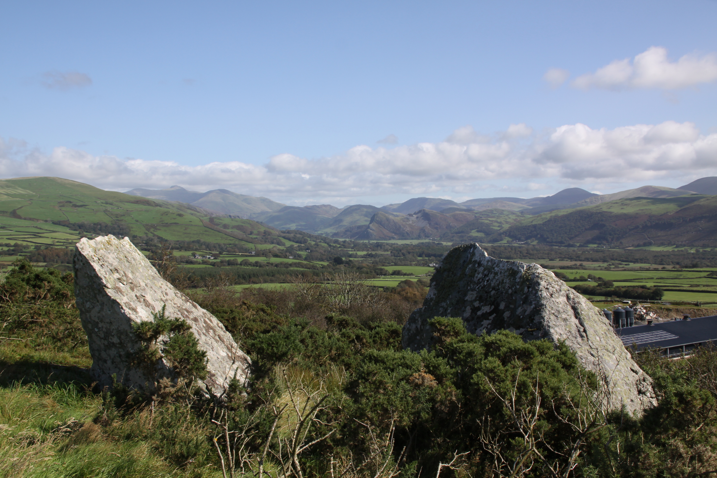
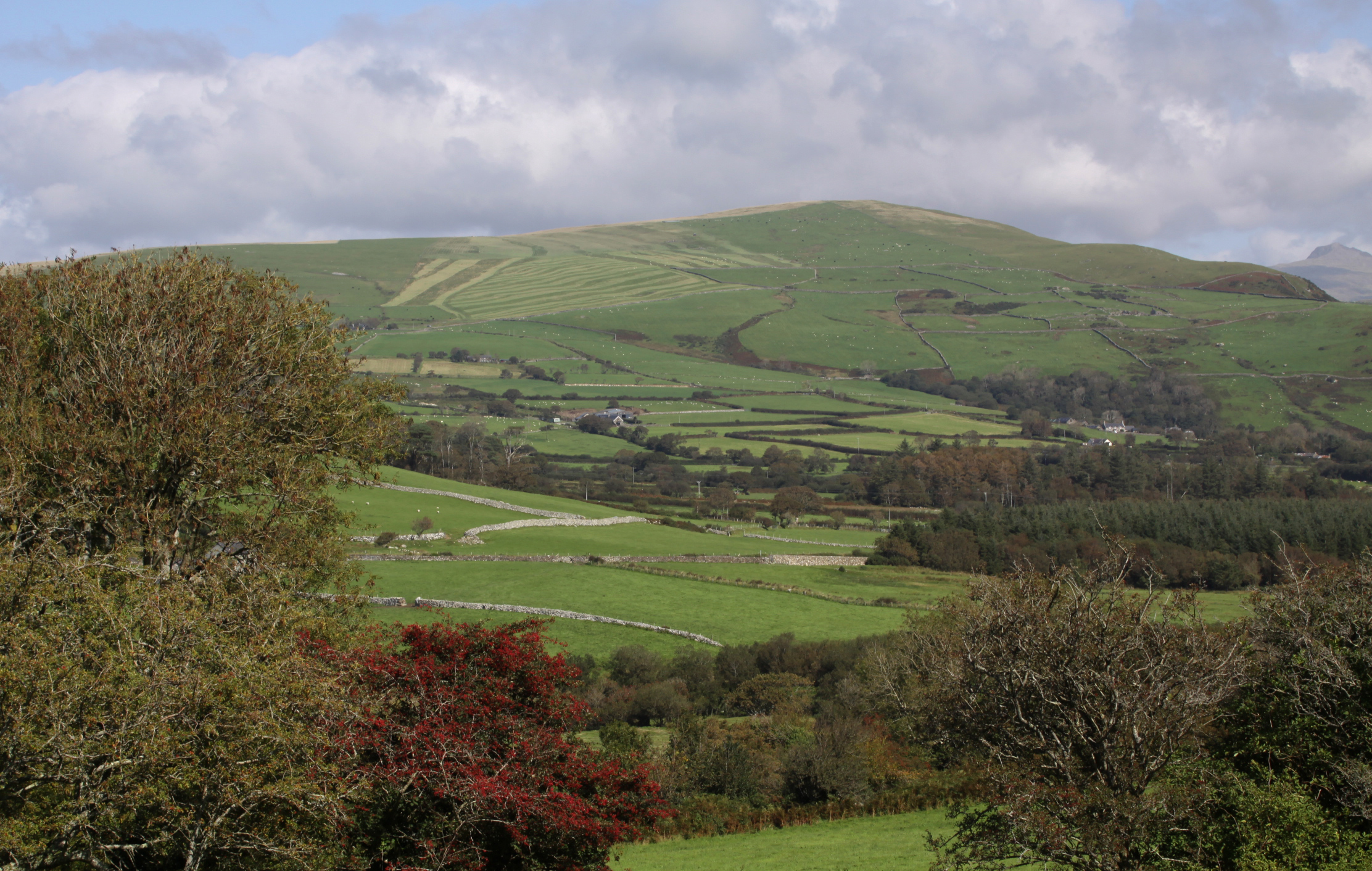
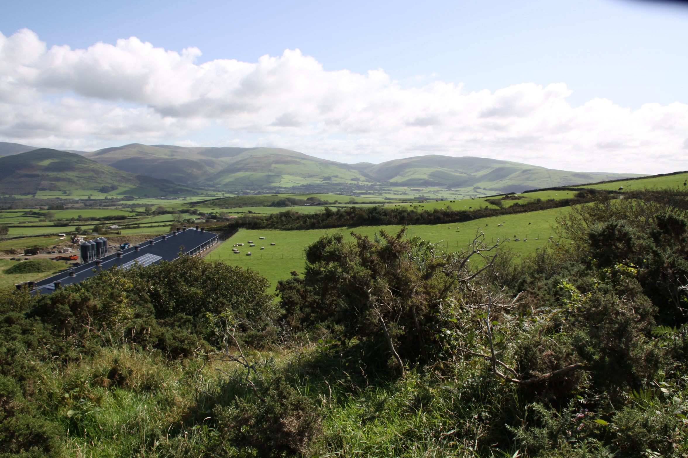
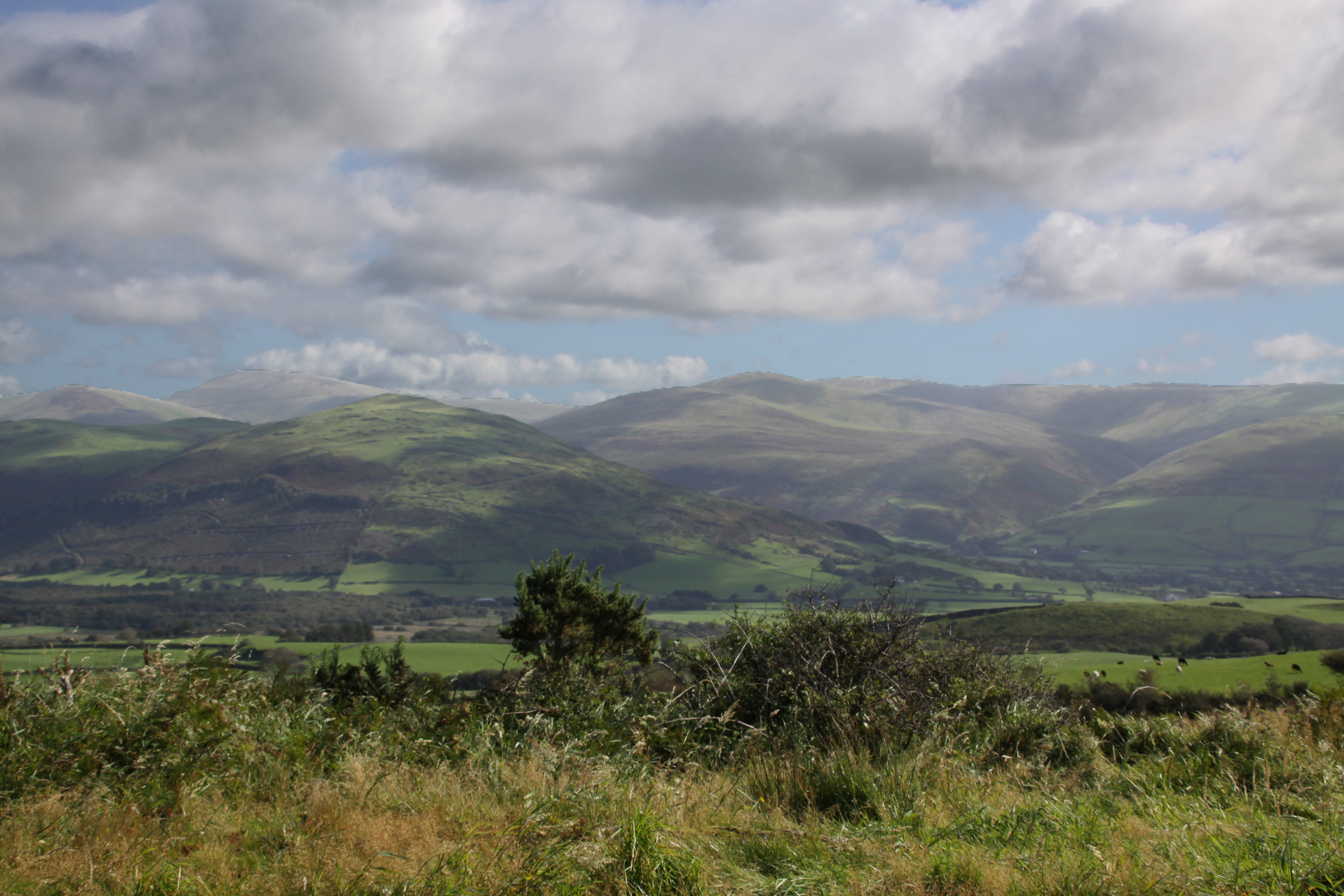
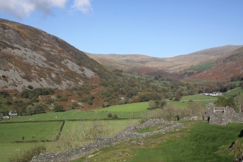
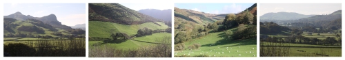
The quiet remains of Cymer Abbey lie in a scenic valley on the edge of a shallow, bubbling stretch of the river Mawddach, which itself evokes tranquillity and peace.   In spite of being approached via a caravan park, it is a truly idyllic spot.  Cymer Abbey, Kymer deu dyfyr, meaning “meeting of the waters” and dedicated to the Virgin Mary was founded in 1198 and was one of the northernmost Cistercian abbeys in Wales.

An abbey consists of a  church and monastery headed by an abbot and populated by monks.  Because the monks were resident, usually for life, an abbey contains not merely the architectural components required for worship and contemplation, but the structures required for everyday living and self-improvement, including premises for cooking, eating, sleeping, meeting, learning and punishing.  An abbey was designed to be self-sufficient, and therefore had an important economic component to support its religious and cultural endeavours.

The Cistercians

A 12th Century interpretation of St Benedict delivering his monastic rule in the 6th Century AD.  Source:  Wikipedia, via Monastery of St. Gilles, Nimes France (1129)

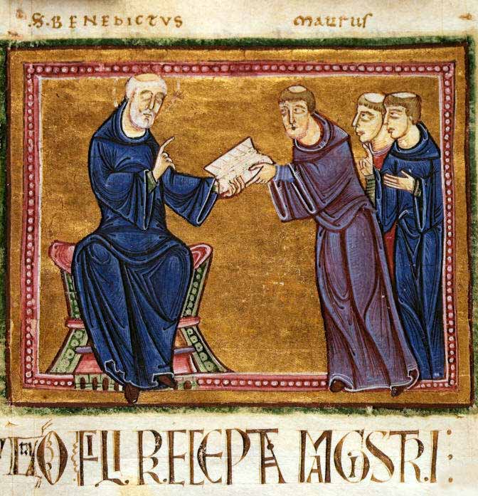
The Cistercian order of monks spread through Wales during the 12th Century AD.   The European tradition of monastic living had a long heritage, based on the teachings of St Benedict of Monte Cassino in Italy in the 6th Century AD, who set down rules for monastic life, the standards to which subsequent Benedictine monastic orders adhered.  As the monastic life spread through Europe, new orders were brought into being, most of them adaptations of the Benedictine rules, but modified to reflect their own ideologies and beliefs about how best to serve God.  During the early Middle Ages, the Cistercians believed in devotion combined with hard work, an ethic at odds with the more opulent and self-indulgent Benedictine Cluniac order that was becoming dominant in France, and believed, unlike St Benedict himself, that hard work deterred from the celebration of God, and instead invested in ostentatious architecture decorated with stained glass windows, art works and precious metals, carrying out extensive and elaborate liturgical rituals, using music and song, as ways of glorifying god.

Johann Petr Molitor, Cistercian monks, murals in the Capitular Hall, Cistercian Abbey Osek, North Bohemia, before 1756. Source: Wikipedia, from the Cistercian Abbey of Osek, North Bohemia

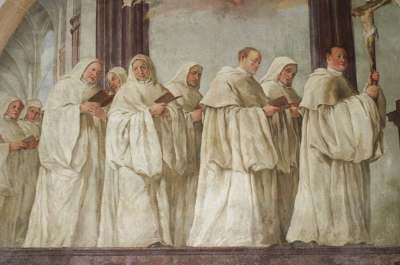
The prosperous and comfortable Cluniac repelled many for whom the initial Benedictine vision was nearer to Christ.  The Carthusians and Cistercians were both breakaway orders that sought to return to a more honest monastic life in which humility, obedience and hard work were combined with prayer and learning.  Initially, the Cistercians embraced a much simpler way of life than contemporary orders, inspired directly by St Benedict and by the simple and sacrificial life described by Christ himself.  They established their abbeys in very remote areas, isolated themselves from urban life, and from the associated temptations.  Their undyed white tunics and cowls were an instant visual differentiator from the black tunics of other Benedictine orders, and lead to them being referred to as the White Monks.  Different roles were assigned to different monks, such as the cellarer who controlled all food and drink for the entire abbey, the novice master, and the sacrist who was responsible for the upkeep of the church.  All were were considered to be equal in status.   The abbot was in overall charge of the monastery, and his orders were law, but he slept in the same dormitory as the other monks.

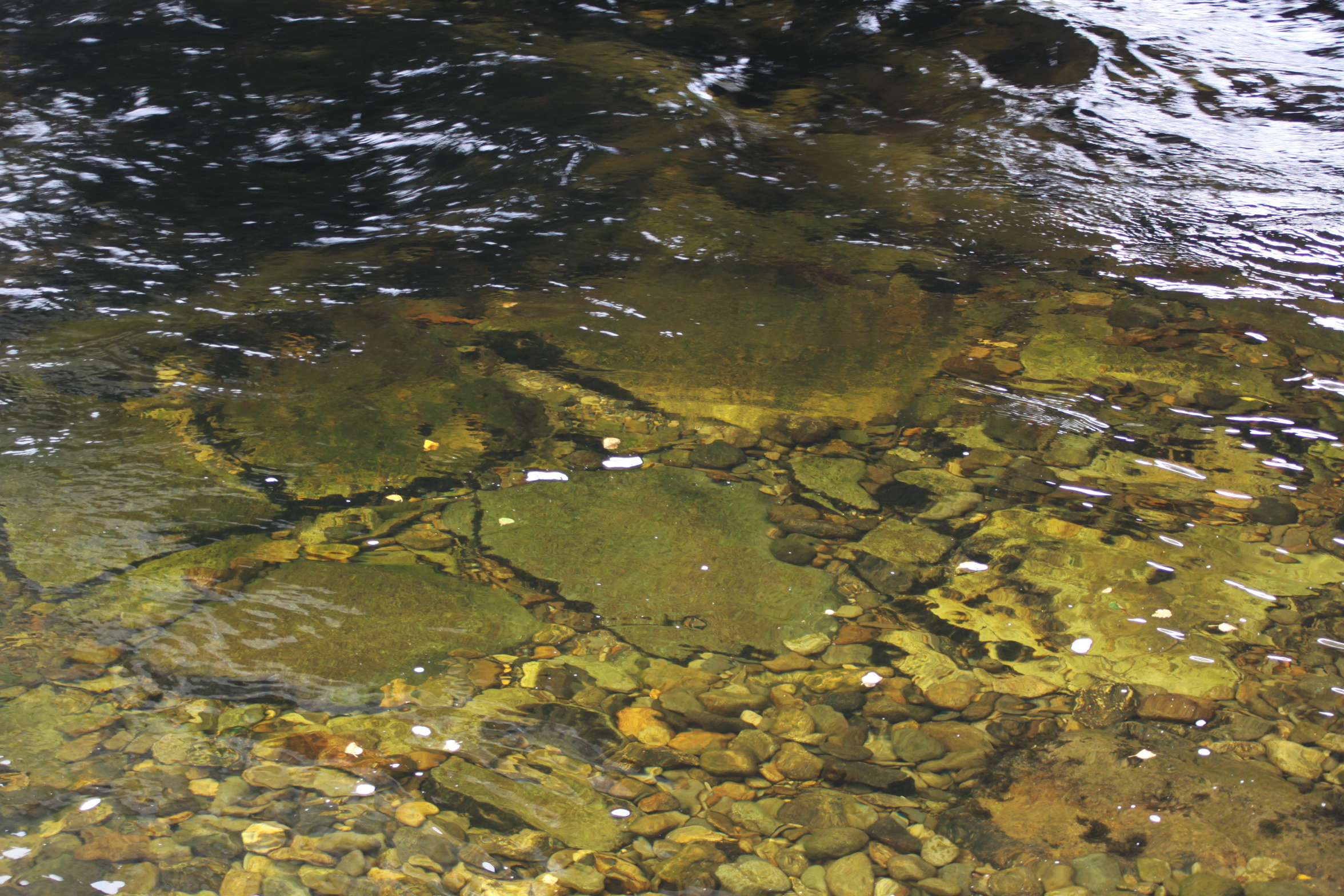
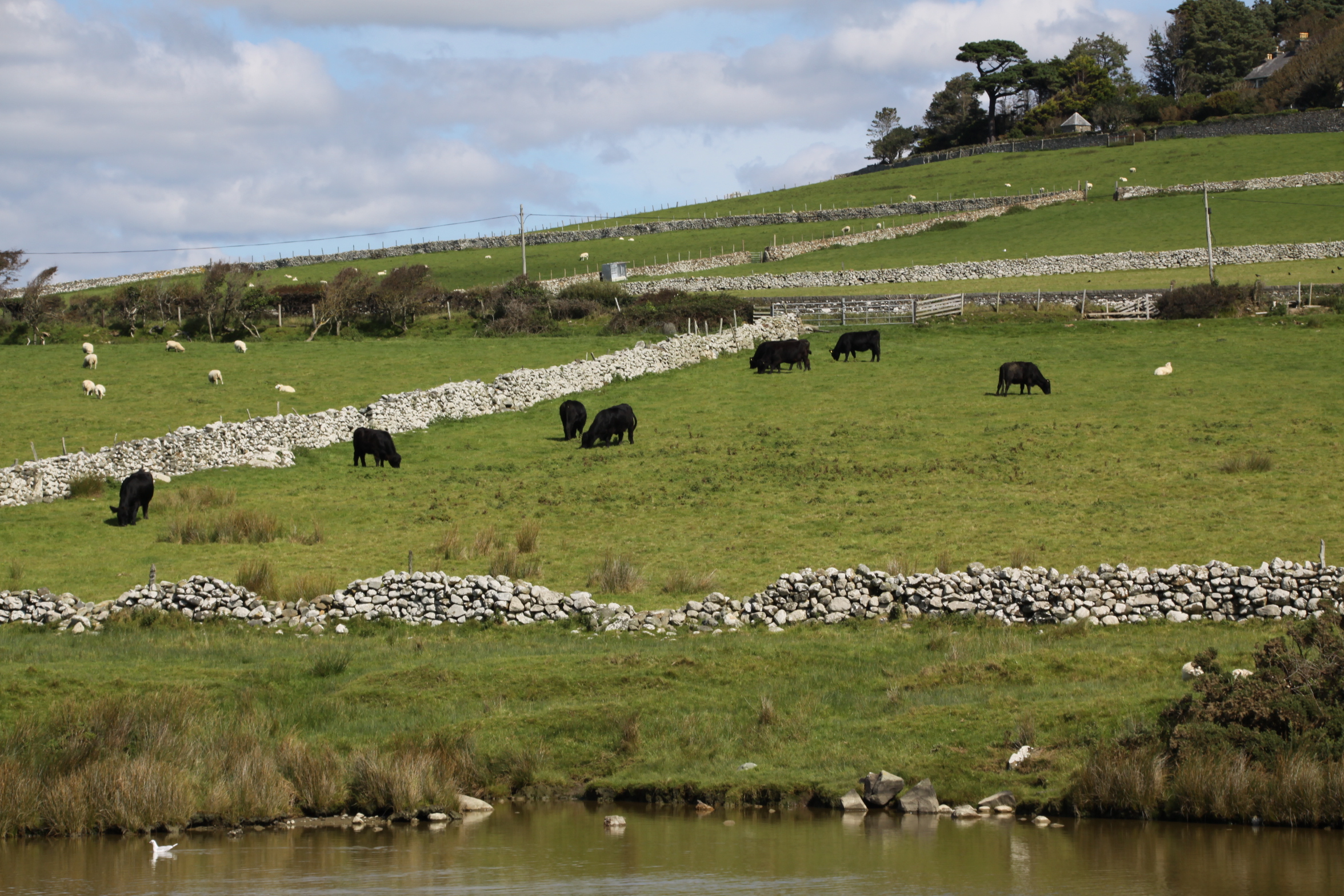
The river Mawddach at Cymer Abbey

The monks worked the fields, engaged in building projects, and processed the harvest.  They were assisted by lay brothers, uneducated and lower order members of the monastic community who ate, slept and worshipped in different places from the monks, and were not given access to certain parts of the abbey.  Food was simple and plain.  Meat was not consumed, and most of the protein consumed by monks came from beans, fish, eggs and cheese.  Meat was banned by the Benedictines due to the dangers of its encouraging carnal passions, because monks were required to be celibate.  The importance of fish in the diet, as well as the requirement for fresh drinking water, meant that many abbeys, like Cymer, were built near to rivers.

By the later Middle Ages, most of the stricter Cistercian rules were relaxed, and the abbot slept in his own quarters, sometimes a separate building altogether, the monks rarely worked the land themselves, and meat was consumed along with a much more elaborate selection of foodstuffs.  The plagues of the 14th Century wiped out what remained of the lay brotherhood, and their work was carried out by servants.

The Welsh Cistercians

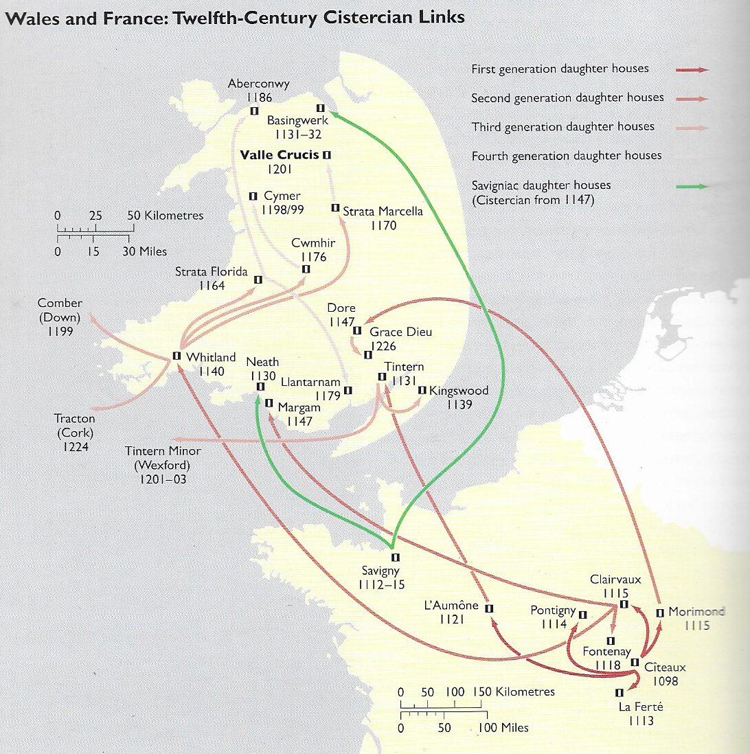
12th Century links between Cistercian monasteries. Source: Evans, D.H. Valle Crucis Abbey (Cadw).  Although Citeaux, the node for all Cistercian abbeys, established early new bases in France, it was Clairvaux under the lead of St Bernard that was responsible for the earliest new abbeys in Wales.  Of these Whitland was the most important for the northward spread of monasticism.  The green lines emanating from Savigny reflect the Savignac order, which merged with the Cistercians after only 20 years, in 1147. So although Basingwerk in the north and Neath in the south were founded as Savignac orders, after 1147 they were brought under the rule of  the Cistercians at Citeaux.

In southwest Wales, Whitland Abbey, which had been established from France in 1140, provided monks for new abbeys for the southwest of Wales, mid Wales, north Wales and southwest Ireland.  A new abbey required an endowment by a donor, someone with enough land and wealth to give some of it away in return for the prayers offered by the monks for the souls of the donor and his family.   Monks were considered to have a hotline to God.  Having dedicated their lives to Him, and living sin-free lives, they built up a surplus of virtue and influence that could be employed on behalf of the living in order to provide for them in the afterlife, an intercession to minimize the impact of sins committed in life.  Many early abbeys in England were sponsored by English royalty, but two distinct strands of monastic tradition were established in Wales after the Norman conquest.

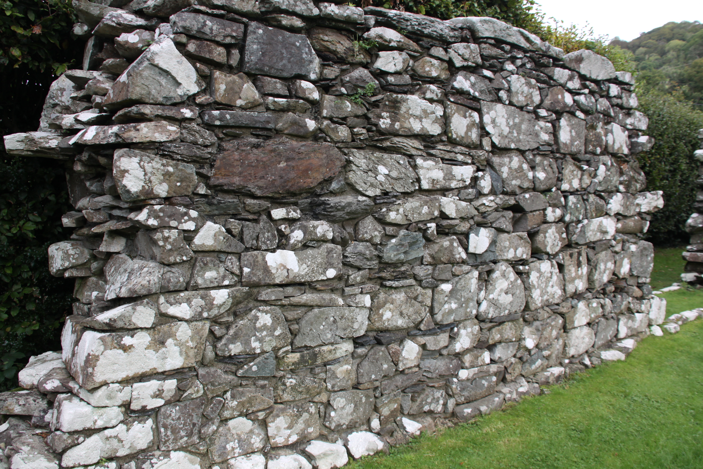
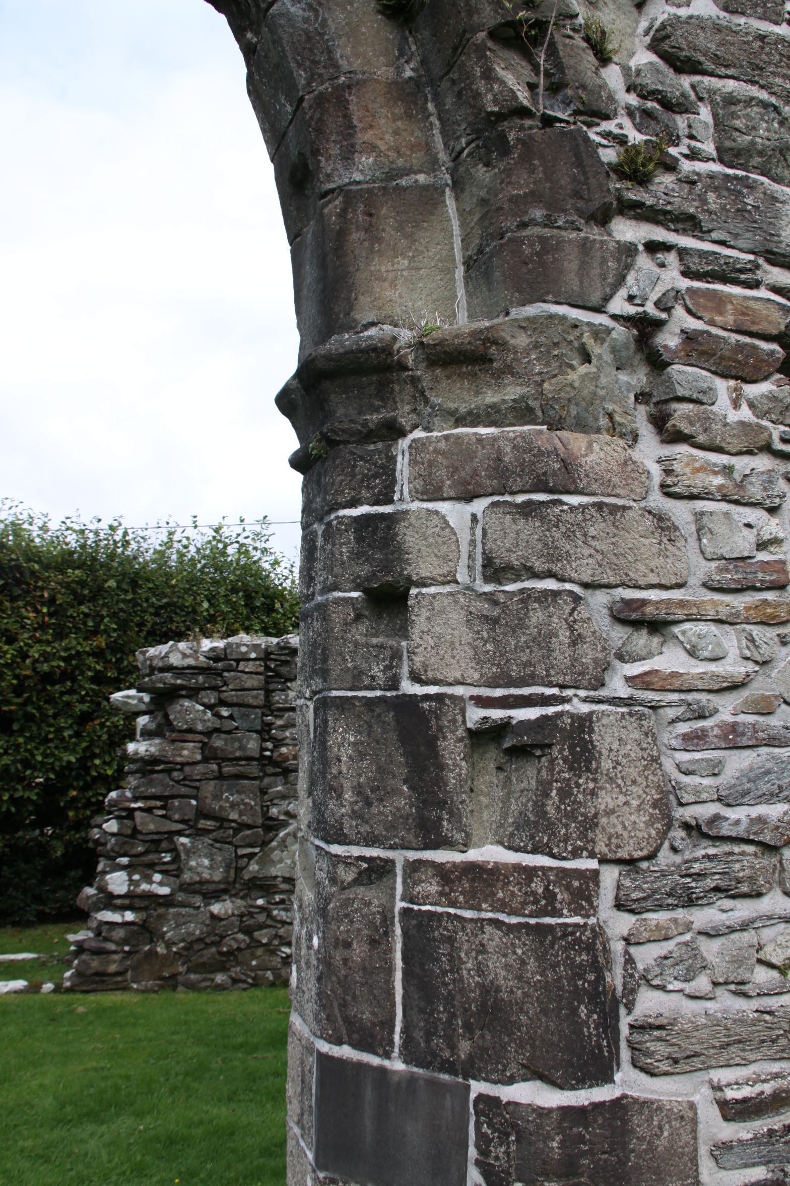
Alternating courses of thin and big stone in the north wall

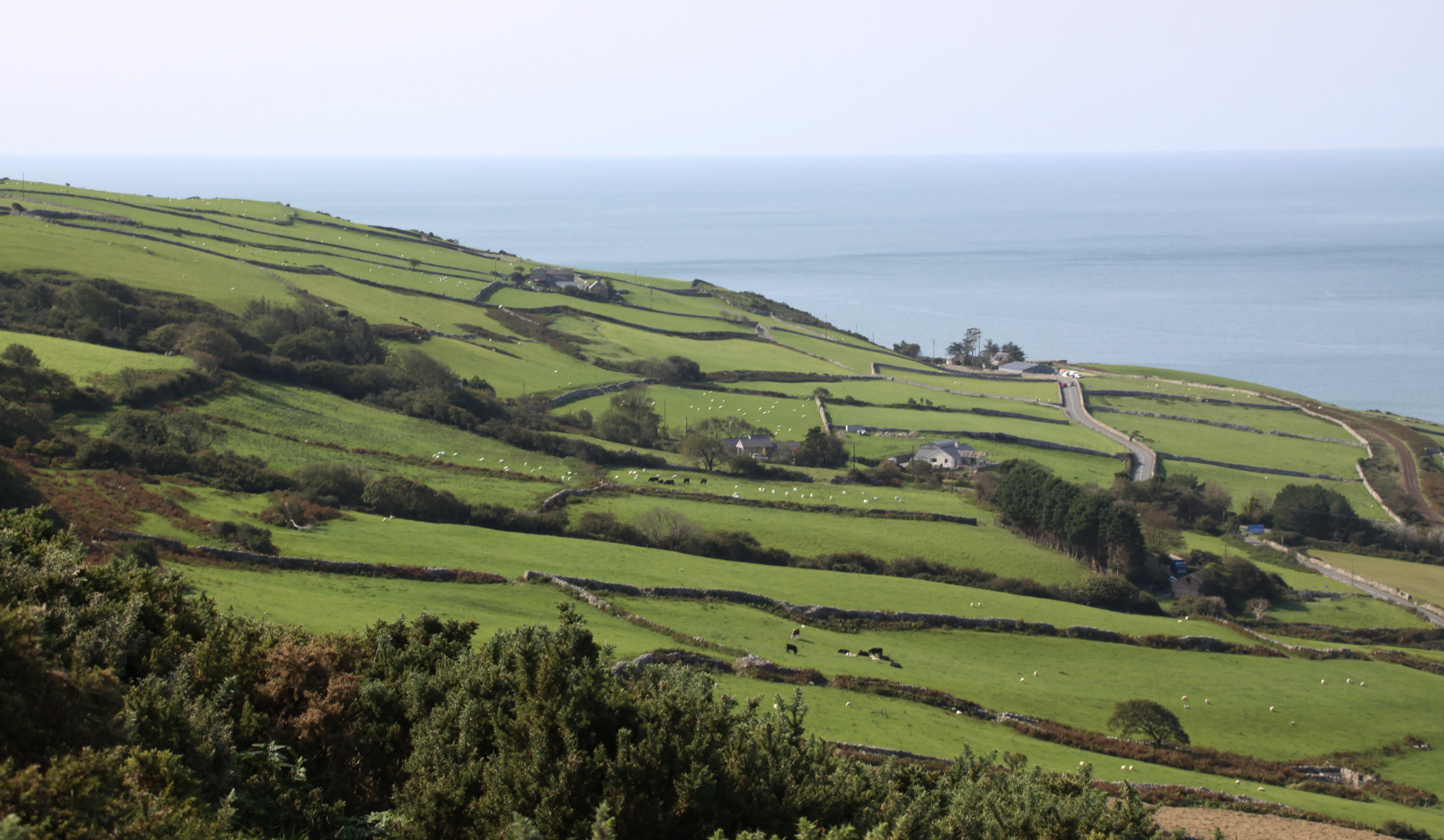
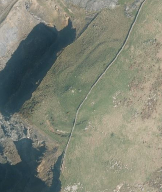
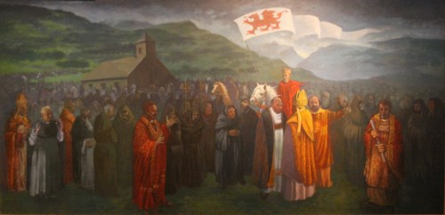
In Wales, earlier versions of monasticism predated the Benedictines, but were much more modest in scope.  The Benedictine version of monastic life, based on the model of the abbey, came to Wales in two movements.  In southeast Wales, new abbeys were established in the wake of the Norman conquest and had a distinctly Anglo-Norman flavour.   A second strand of monastic spread in Wales began at the Cistercian Whitland (Abaty Hendy-gwyn ar Daf) founded in 1140 by monks from St Bernard’s abbey at Clairvaux, second only to the Cistercians’ founding abbey at Citeaux.  Whitland spawned a series of abbeys that were funded by the native Welsh princes and were populated almost exclusively by Welsh monks, a pura Wallia (Welsh Wales) version of Cistercian monasticism.  By establishing new daughter abbeys under its authority, Whitland spread the Cistercian order into the poorer and more remote areas of Wales, where monks could practise their devotions in isolation but were still near enough to manors and villages to enable them to trade their produce, mainly agricultural, in exchange for the basics required for sustaining the abbey.  Cymer, for example, traded its wool and horses to the court of Llewyllyn ap Gruffud.

Cymer Abbey

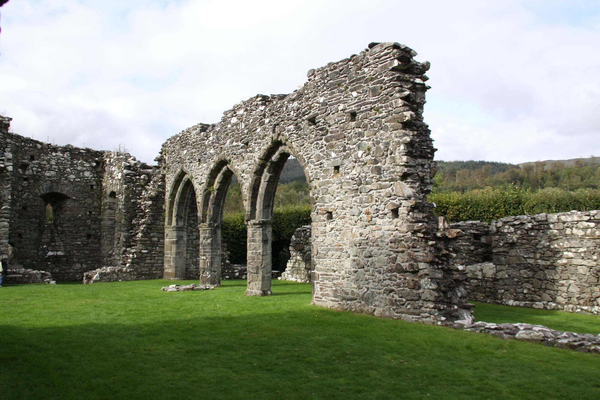
Arches defining the north aisle of the church

Although the foundation charter has been lost, it is known that Cymer was founded with an endowment by Maredudd ap Cynan, Lord of Merioneth, and possibly his brother Gruffudd ap Cynan.  A charter of 1209, issued by Llewellyn ap Iorwerth, confirmed the grants and privileges of the abbey and validating its claims of ownership.

In the usual pattern, the first monks for the new abbey came from an existing abbey, in this case Cwmhir Abbey in mid Wales, itself founded from the mother house at Whitland in 1176.  Other monks could then join from the local area, paying a single fee for their clothing, food and to begin their training as novices.  The fee was not insubstantial, and although the monks took a vow of poverty, they were not themselves poor people before joining the abbey.   As it happens, Cymer was one of the less economically viable of the Welsh abbeys and was therefore unable to support a large number of monks, and these monks would have lead a relatively impoverished lifestyle compared with those in wealthier Welsh abbeys like Strata Florida or Abbey Crucis.

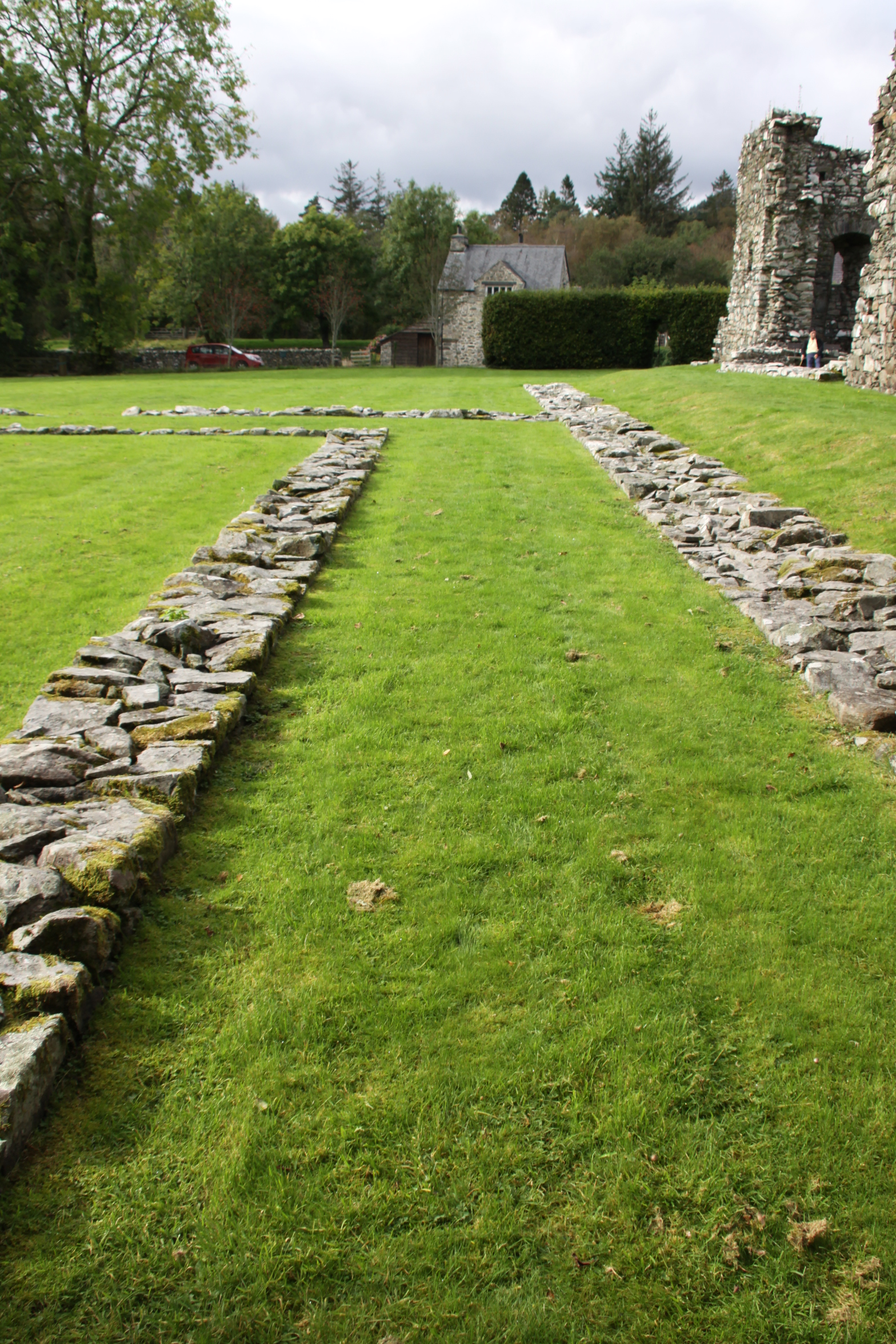
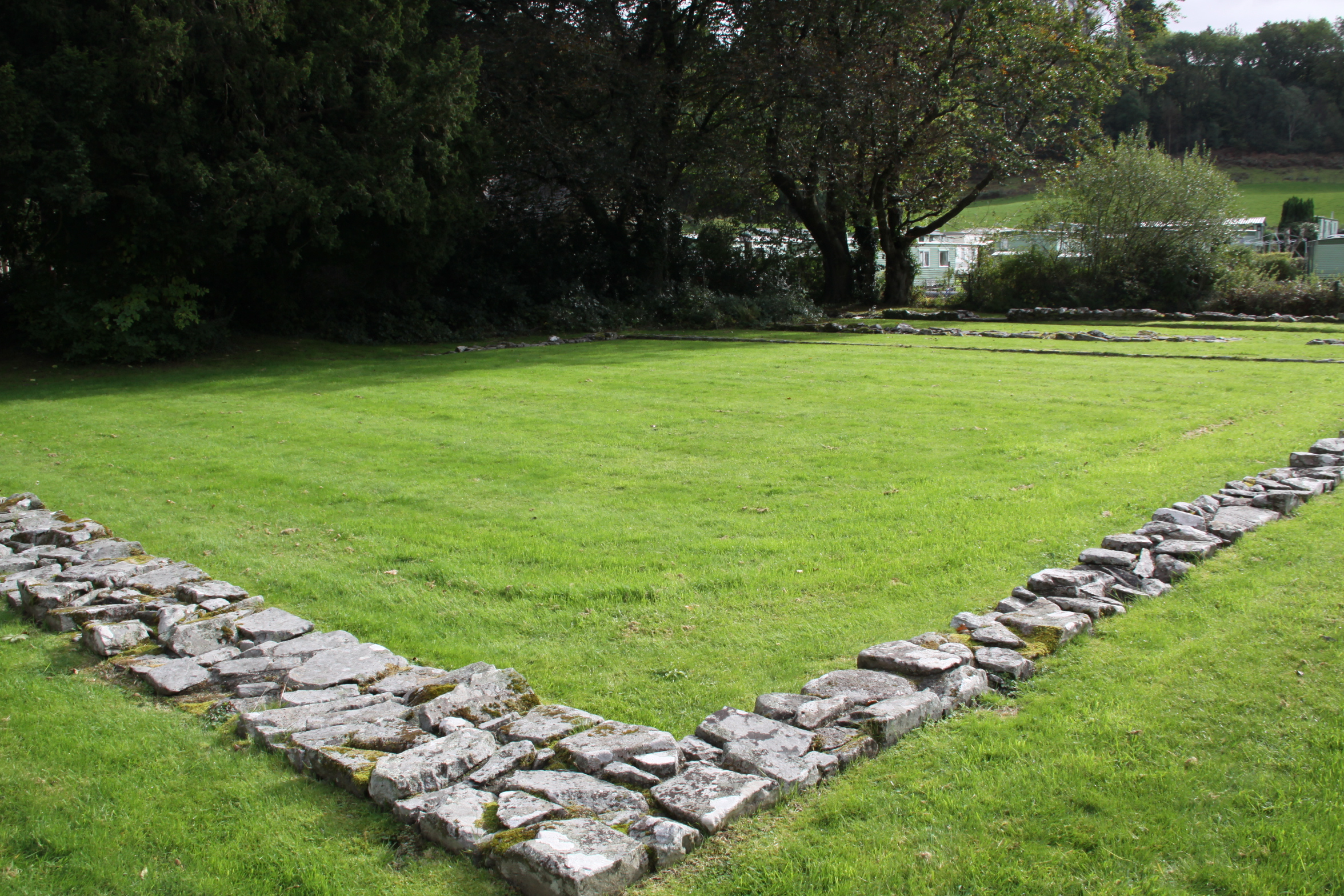
Abbeys followed a standardized plan, with a cruciform church making up one side of a four-sided complex that surrounded a square section of grass or garden (the garth).  Around the garth was a walkway, usually covered, called the cloister.  This connected all the buildings, and also served as a processional way. Cymer differs from the standard layout in a number of ways.

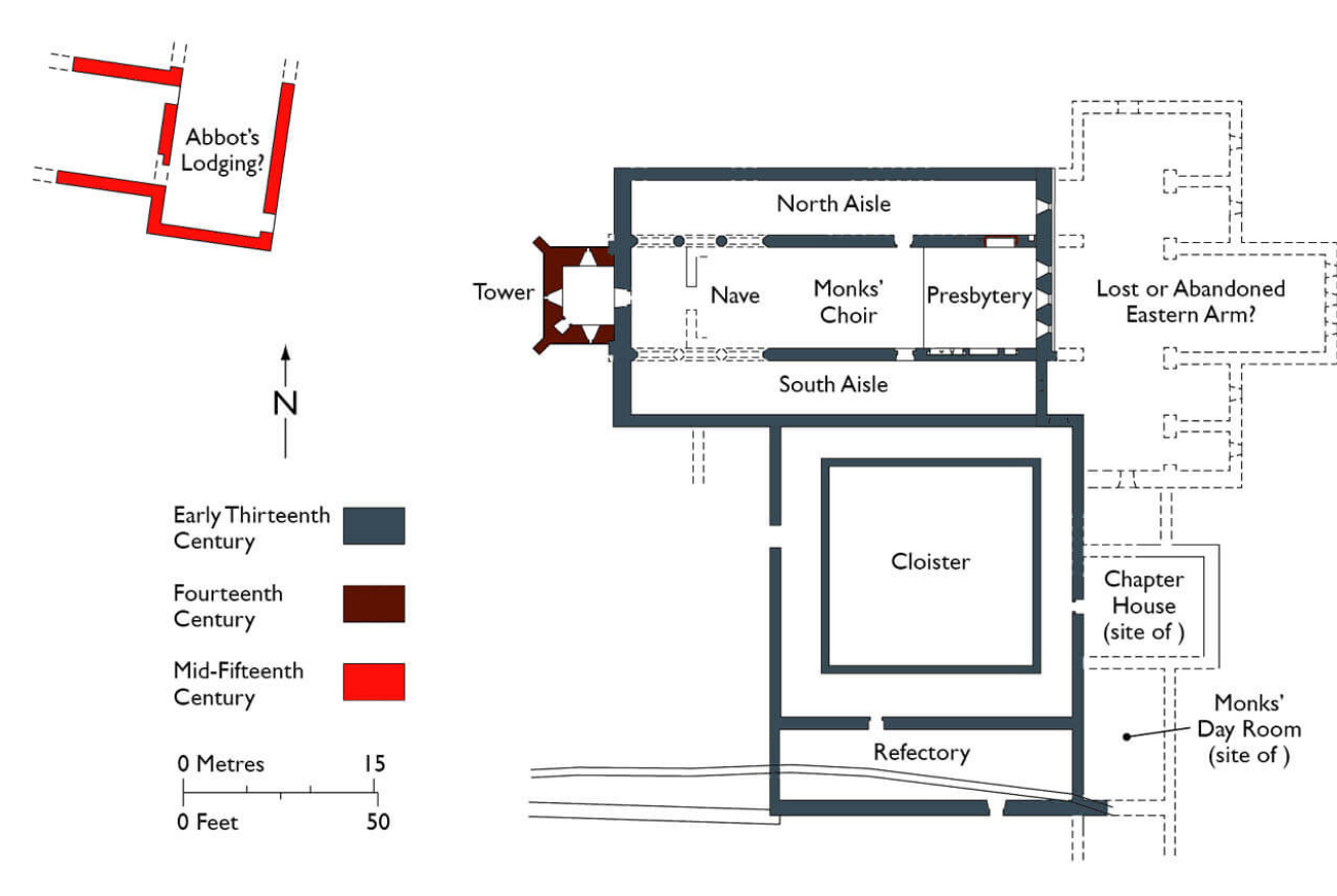
Cadw site plan showing the surviving stonework in grey and brown, and the possible abbots lodging, as well as the missing section of the abbey

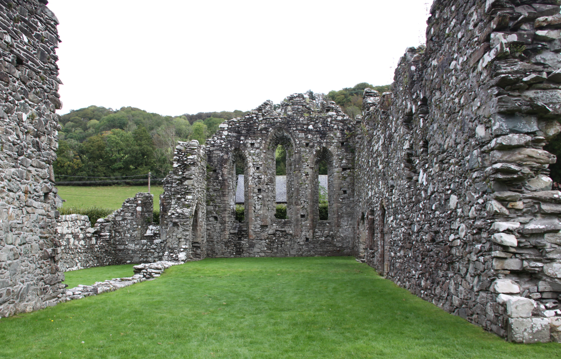
First, the abbey had both church and cloister, as well as the required buildings around the cloister, but the church as it survives today was not the standard cross-shaped arrangement.  This is significant.  Only the nave and the choir section, the piece that made up the long part of the cross has been found, even after 19th Century and more recent excavations.  The nave was where the lay brethren prayed.  Beyond a division across the nave to separate the public area from the private (the pulpitum), were usually the opposing transepts, two wings that made up the arms of the cross, with a tower built over the central section.  Then, beyond this section, were the all-important choir and high altar where the most important rituals were enacted.  These parts were exclusive to the monks, and provided access to the cloister and the upstairs dormitory.  At Cymer the nave served the multiple role of nave, choir and chancel/sanctuary.  The missing, exclusive section of the church (transepts, tower, choir and high altar) means either that this was destroyed in the past, or that it was never built.  Most analysts favour the latter explanation, which suggests that the abbey was not endowed with a sufficient initial investment, and that its estates were not sufficiently profitable to enable the abbey to be built.

Truncated abbey church, seen from the refectory.

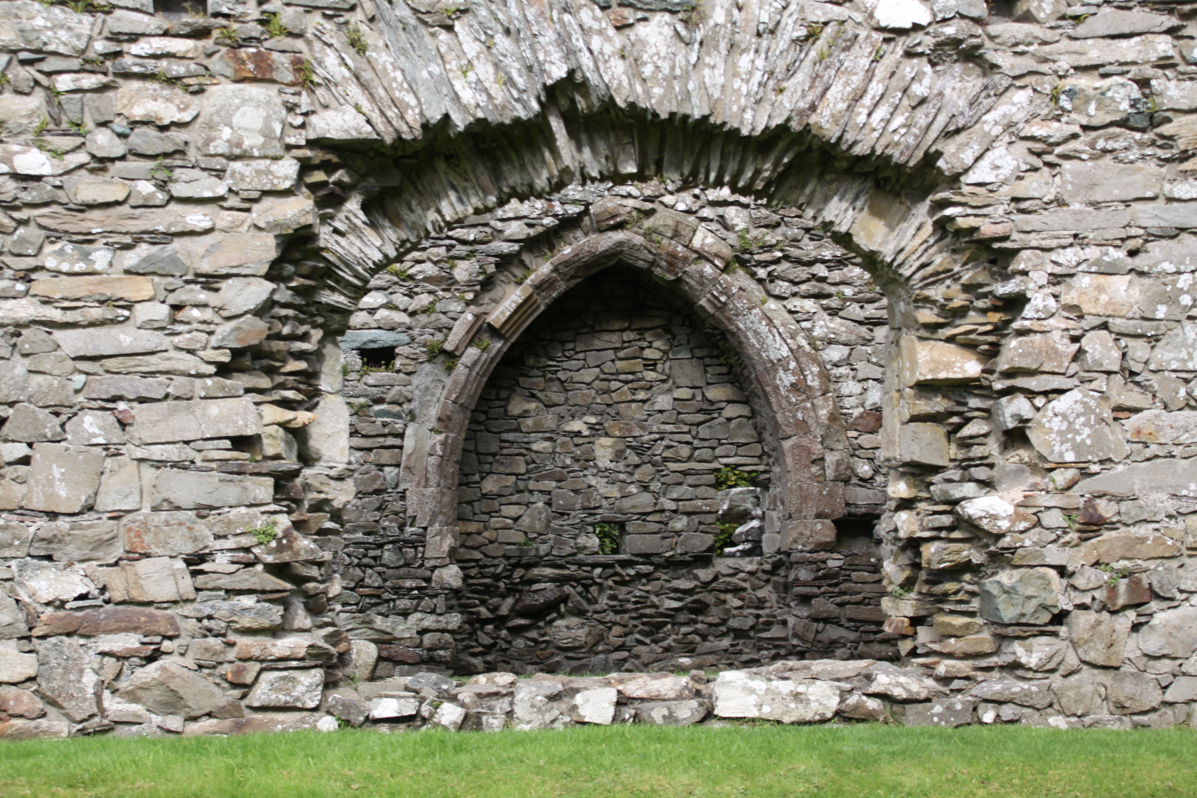
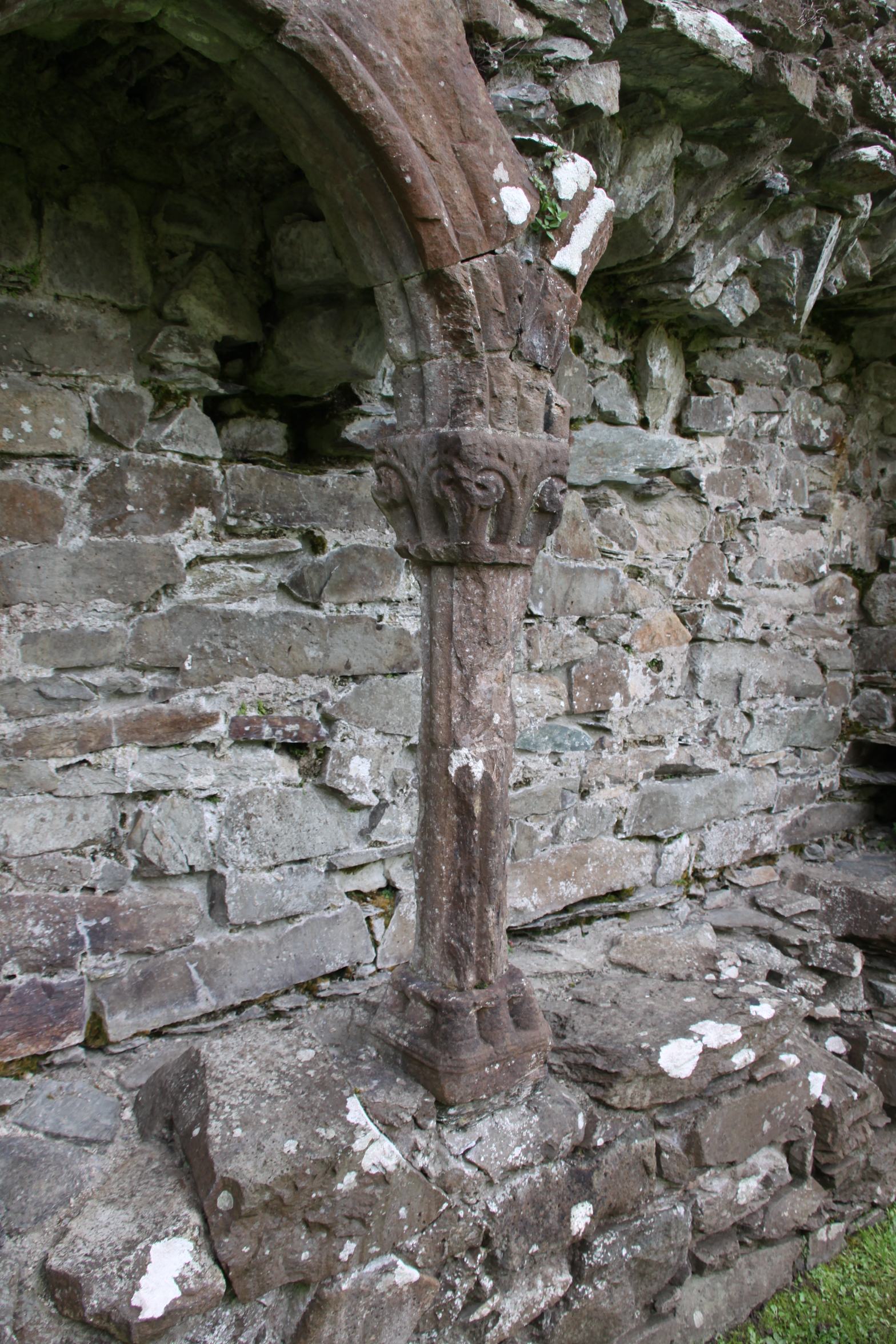
Normally, the church was the first building to be constructed in stone, with other accommodation built of wood until the church was complete, but at Cymer the ancillary buildings were built in stone even though the church was apparently incomplete, so it is all something of a puzzle.  However, the small rectangle that made up the 13th Century church seems to have done the job of a larger entity, with the nave (reserved for the laity and visitors) at the west end, the monk’s choir in the middle, and the presbytery / chancel / sanctuary (the area around the high altar) at the end.  The church was also divided into three sections length-ways by two aisles flanking the main central portion of the church (known as a basilica layout), achieved by adding columns and arches.  At the business end of the church, where the monks worshipped eight times during the day and night, were some small decorative features, such as ornamental capitals at the top of columns.  The main arch into the cloister was also slightly ornamental, and a tiny rose window topped the east end, but in keeping with Cistercian principles, there were few other ornamental flourishes, and although the abbey had a few pieces of fine silver ware, there would have been no stained glass, art works or tapestries.

The 14th Century tower

At a later date, in the fourteenth century, it was quite clearly thought that a tower was a basic requirement and that its absence was a detriment, so a small tower was added (shown on the above plan in brown).  Bizarrely, however, it was added at the wrong end.  The church was usually orientated west to east, the entrance at the west and the choir and high altar at the east.  The tower sat between east and west ends, at the point where the arms of the cross intersected with the main run of the church.  The new tower, however, was put at the west end where the  main entrance from the outside world would have been positioned.  It was small and understated in terms of its overall dimensions, but its walls were immensely thick.  It was provided with corner buttresses and was clearly built to last.

The cloister appears to have followed the standard Cistercian format.  The most important room was the Chapter House, which was on the east side of the cloister.  Here, every day for around 15-30 minutes, the monks sat on benches along the walls to hear the abbot, who sat on a raised platform, read a chapter from the rules of the order, and to discuss the upcoming business of the day.  Confessions were made and punishments decided upon.  Next to the Chapter House was often a book cupboard, where important religious texts and treatises were kept, and in some abbeys copied for wider distribution.  Between the Chapter House and the church was usually a sacristy, which held the vestments and other essentials for the daily liturgies that took place in the church.  At the other end of the Chapter House was the day room, a heated room where monks could seek respite in the cold winter months.

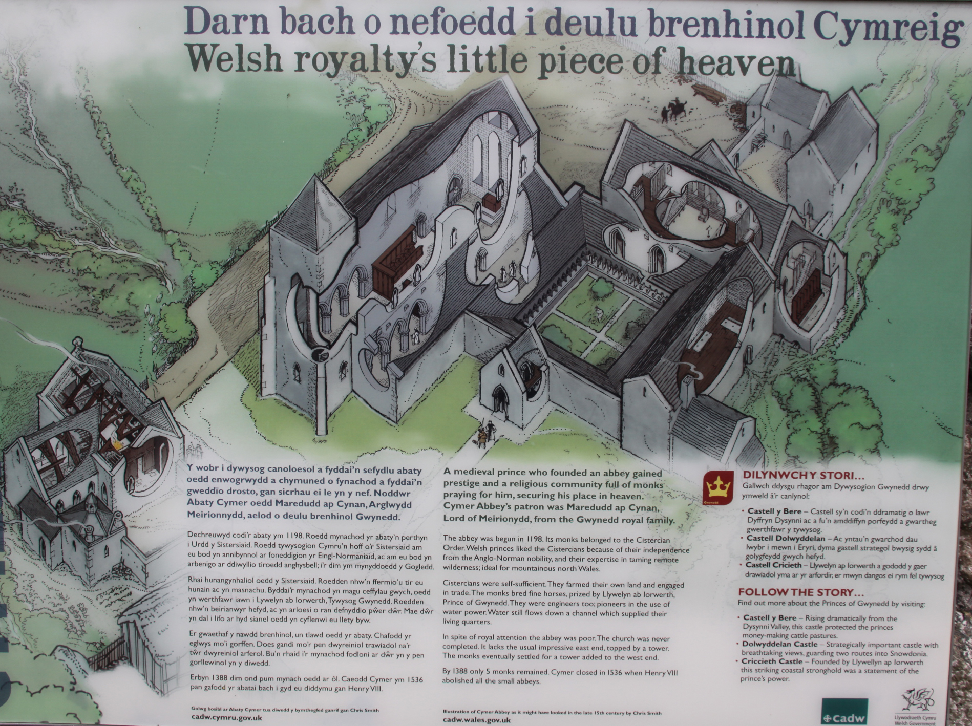
Cadw sign at Cymer Abbey showing an artist’s impression of the 14th Century abbey

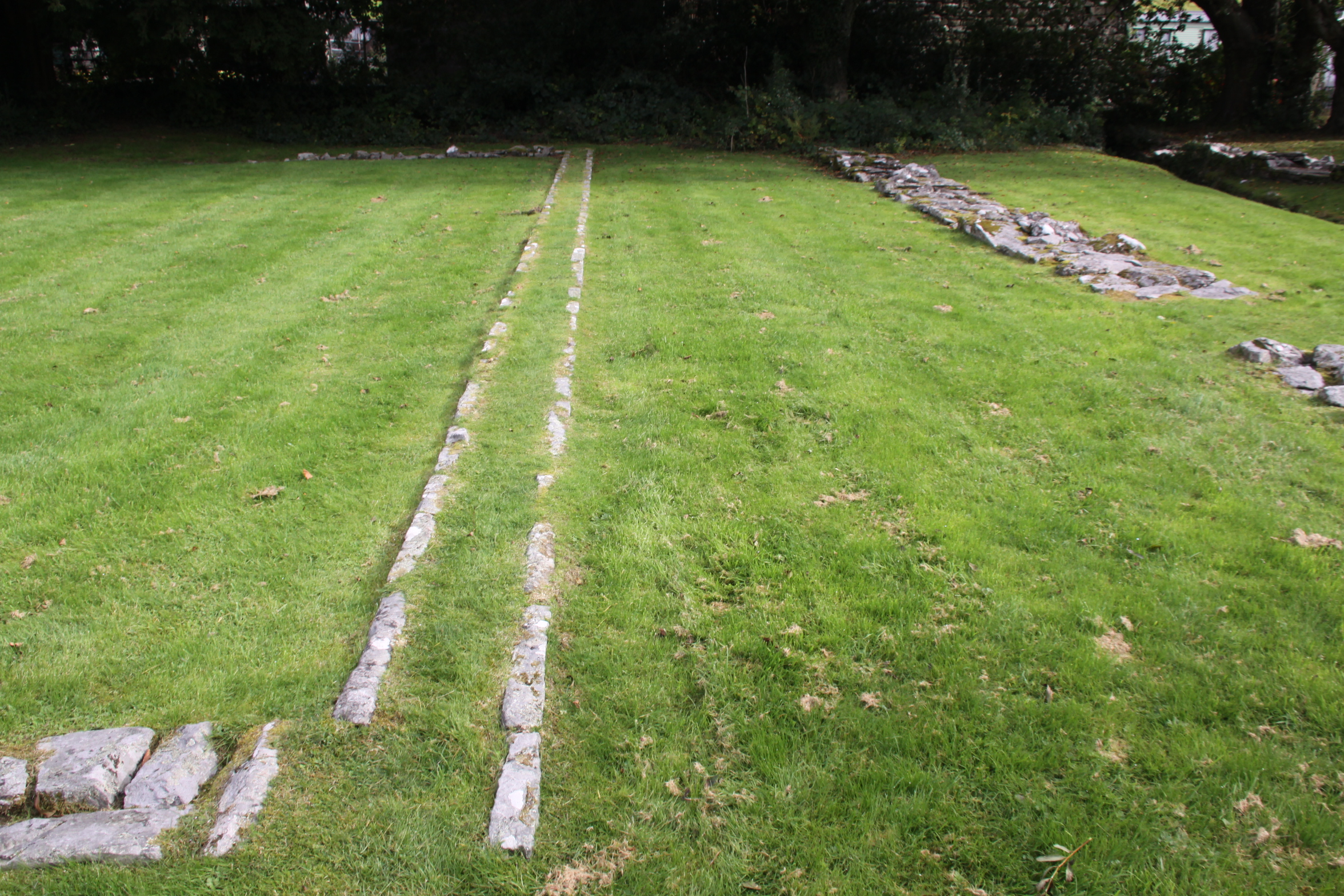
Above this east range of rooms was usually the monks’ dormitory and latrines.  Although the abbot would have slept with the monks in the early years, by the 15th Century at Cymer he had his own house, over the site of which a farmhouse now stands.  Against the cloister wall shared with the church were often desks to enable reading and copying.    At the far end of the cloister, opposite the church, was the refectory.  At some abbeys this is perpendicular to the line of the cloister, sticking out, but at Cymer it lies along the cloister.  A stone lavatorium (washing trough or bowl) would have been close by, often in the garth, and monks ritually purified their hands with water before eating.   It is not clear what made up the west range, but it could have included, for example, the kitchen, the cellarer’s office and the lay brothers’ day room and refectory

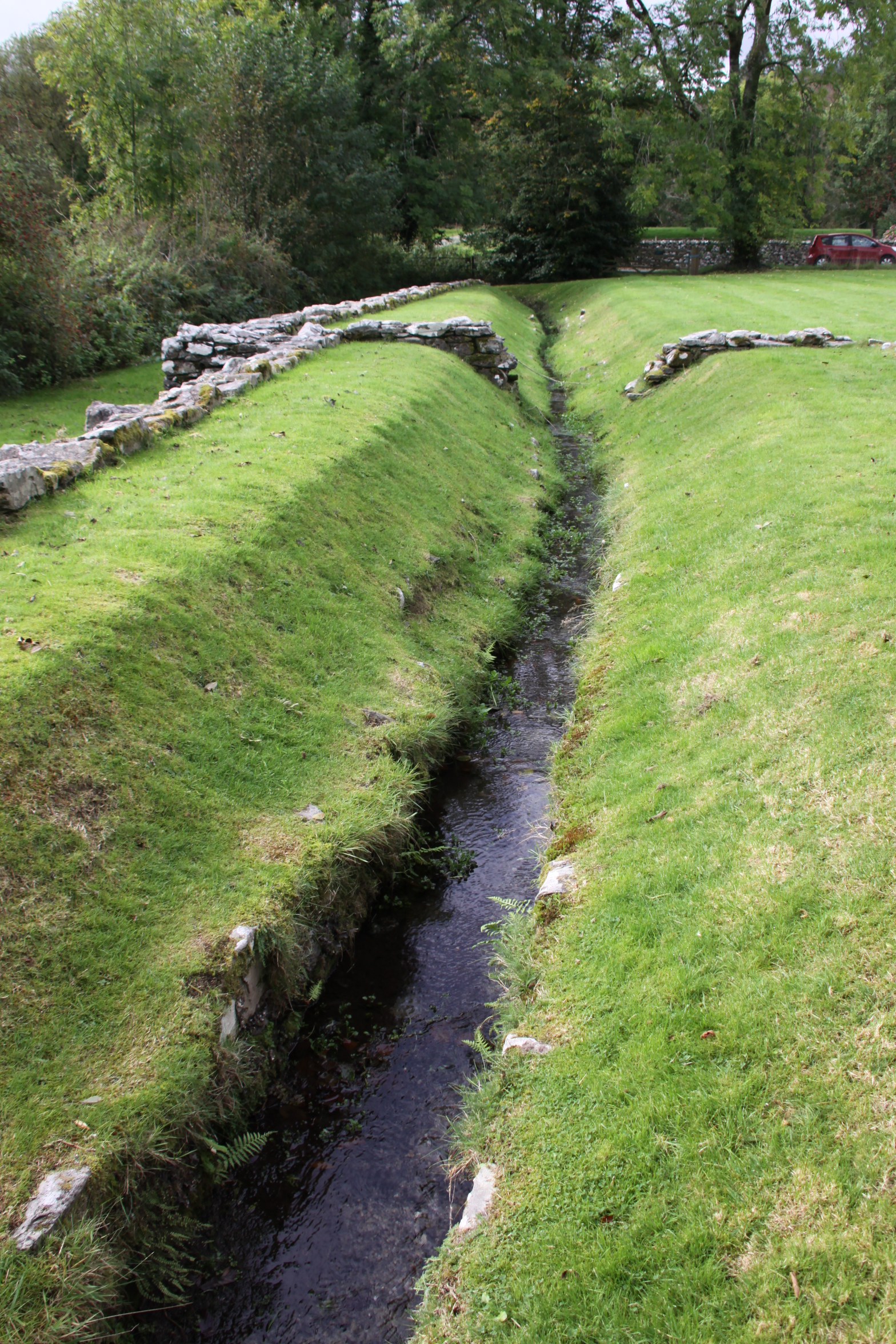
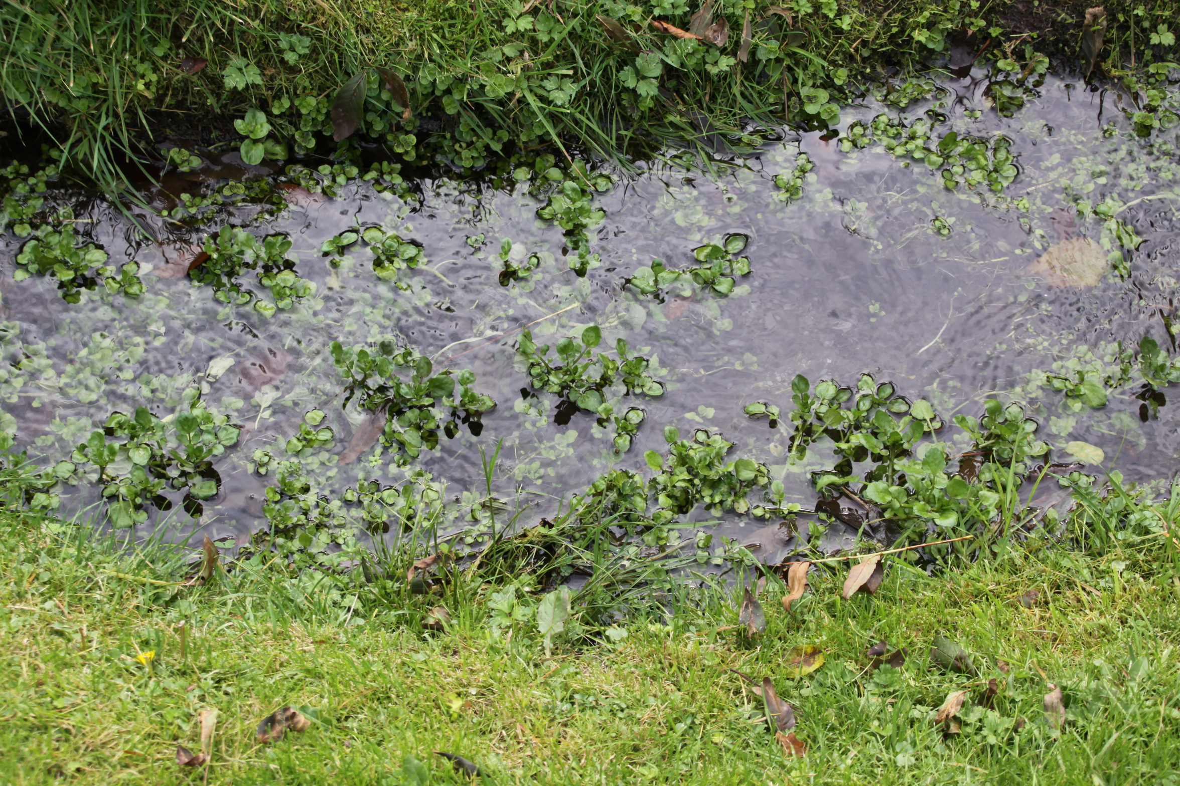
Water channel running down the middle of the refectory

Cistercian abbeys were known for their skills diverting and using water.  At Cymer a v-shaped channel drew water off the river and diverted it through the refectory.  It still flows today.

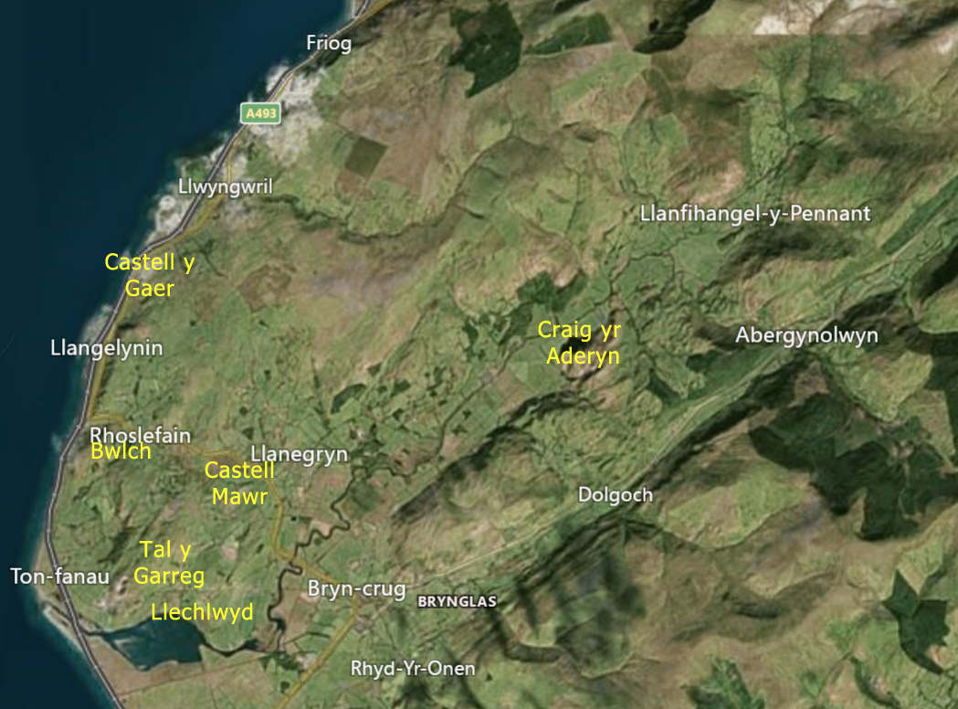
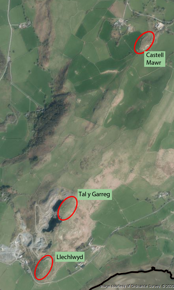
The monastery was never one of the Cistercians’ more successful establishments.  In fact, it was probably one of the most understated and impoverished of the abbeys.  Most of the successful abbeys supported themselves by farming, selling wool from herds of sheep, horse breeding, tithes (a special tax on householders that supported church establishments), by taking income from estates that they owned, and by personal donations.  Its contemporary, Valle Crucis near Llangollen, founded in 1201, benefitted from all of these sources of income, but Cymer was always a very modest outpost of the Cistercian world.  Cymer lacked the big grange estates that supported Valle Crucis, had little agricultural land and few fishing rights, although it did sell its wool and horses to the prince Llewellyn ap Iorwerth (died 1240).  Most of its properties were in mountainous areas, including Llanelltyd, Llanfachreth, Llanegryn and Neigwl on the Lleyn peinsula.  Dairying seems to have been a primary activity, and Llewellyn’s charter mentions metallurgy and mining, which is surprising for such a small establishment.   Cistercian abbeys all owned loyalty to the founding abbey in France, Citeaux.   Cash was clearly short.  Every year abbots were required to visit Citeaux to participate in the General Chapter, a vast gathering of abbots and other monastic leaders that served to ensure obedience to the order and to reinforce its rules.  In 1274, the abbot of Cymer had to borrow a sum of £12.00 (today about 8,757, the equivalent of 15 horses or 34 cows) from Llewellyn ap Gruffud (died c.1282) to enable him to undertake the expense of the journey.

There were multiple difficulties establishing an abbot who could be trusted to run the abbey, and these resulted in disputes that would not have helped the fortunes of the abbey:

In 1443, John ap Rhys left office at Cymer and appeared as an abbot in Strata Florida Abbey. In his place a John Cobbe was chosen, but Rhys did not think to give up Cymer and banished his successor. This led to the taking of the convent and his new abbot Richard Kirby under royal custody. Once again, the monarch’s supervision was necessary in 1453. During this period, the abbey’s income was valued at a very small amount of £ 15 of annual income. Despite the royal interventions, disputes over the appointment of the abbot’s office continued at the end of the 15th century. In 1487, there was even excommunication by the general chapter of one of the monks, William, because of his self-proclaimed election. Despite this, in 1491 he was again mentioned in the documents as abbot of Cymer. Lewis ap Thomas was the last superior of the monastery since 1517. [from Janusz Michalew’s Ancient and Medieval Architecture]

The entrance from the south aisle of the church into the cloister. Only monks were permitted to use this.

It is also clear that Cymer suffered during military conflicts, which cannot have helped its fortunes.  Some of its buildings were burned during one of Henry III’s campaigns.  Llewellyn ap Gruffud made the monastery his military headquarters in  both 1275 and 1279, and  only a few years later Edward I occupied the abbey in 1284.  There are records that Edward paid £80.00 compensation to Cymer for damages inflicted during the occupation.  Today this is equivalent to £55,525 (around 94 horses or 177 heads of cattle).  By 1379 only an abbot and four monks were resident at the abbey.   In Henry VIII’s 1536 evaluation of the value of abbeys, the abbey was valued at only £51 13s and 4d (around £6,913 today, enough to purchase 3 horses or 12 cows). [Currency conversions from the National Archives Currency Convertor].  

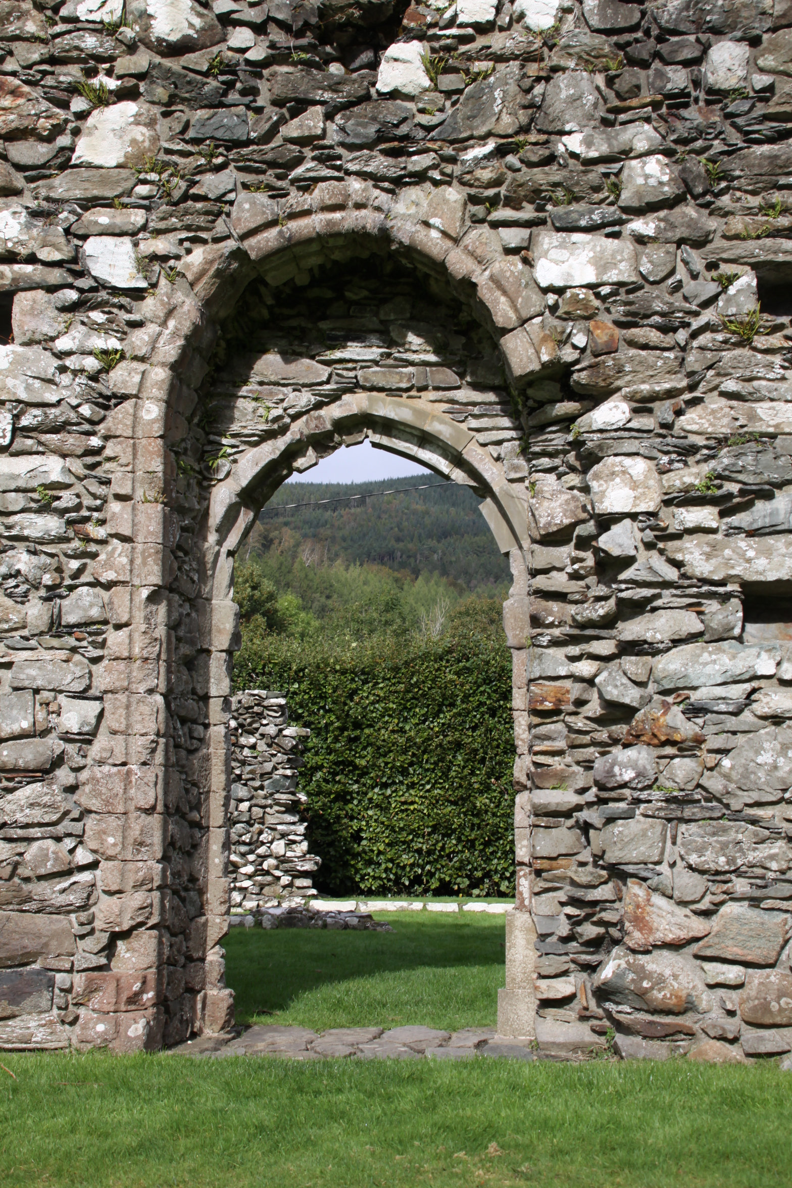
Double archway from the main body of the church into the north aisle.

In the early 16th Century Henry VIII had fallen out with the Pope over his wished-for divorce from Catherine of Aragon.  As the head of the church in England and Wales, Pope
Clement VII was the only person who could rubber stamp the divorce.  Henry was fortunate that the Protestant movement started by Luther was taking shape in Europe, and in order to remove himself from the power of the Pope, he aligned himself with the new movement and declared himself the head of the Church of England.  No longer owing any loyalty to Catholic institutions, he set out to value them as economic units, a survey called the Valor Ecclesiasticus, and in 1536 announced that any abbeys with an income less than £200.00 should be “suppressed” under the Act of Suppression.  This effectively meant that they were closed as monastic establishments, their valuables sold or melted down.  Some villages took over the church, whilst some were given or leased to new owners.  The grandeur of some of the abbeys proved to be very attractive to some new owners.  If abandoned, the lead used in roofs and drainage stripped, leaving them vulnerable to the weather.  As a small abbey, Cymer was a victim of this first round of suppressions, and was closed in 1536/37.  Other, much larger and prestigious abbeys were disbanded over the following years.

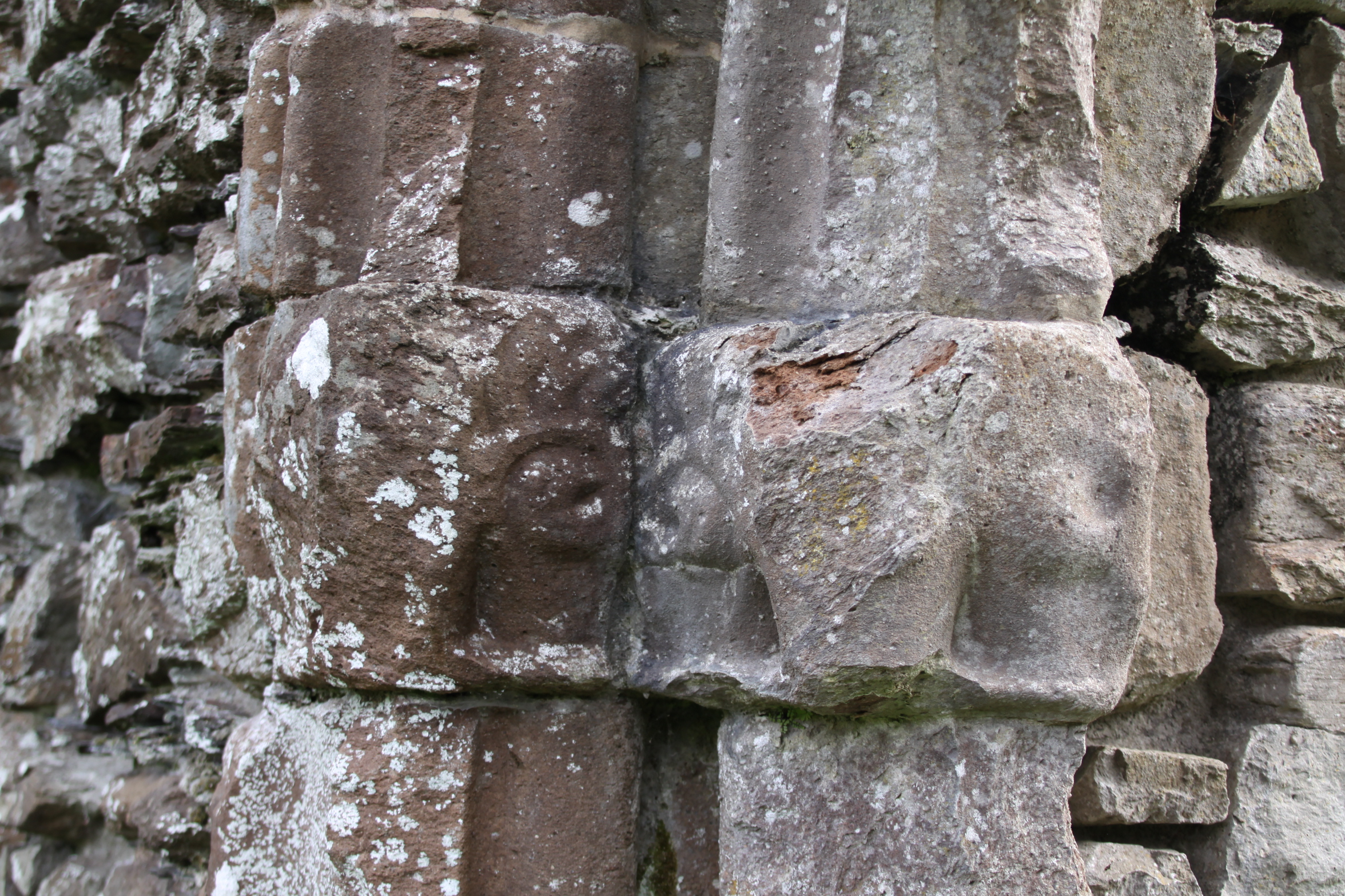
Facing stones on one of the arches dividing the main nave from the north aisle

Although Christianity and spiritual concerns were still important in both urban and village life, there does not appear to have been much public resistance to the closure of abbeys.  The  central role of monasteries in caring for the souls of the rich had gone into decline, but the abbeys were still important parts of economic and social life, engaging in trade, dispensing charity, caring for the sick and welcoming pilgrims.  It was still considered to be good to have all that spirituality on one’s doorstep.  Still, the rumblings generated by Martin Luther, whose views on all the liturgies, prayers and rituals that took place in abbeys were soon well known (he referred to them as “dumb ceremonies”), and his comments on the Catholic fixation on saints and relics as “mere superstition,” were finding attentive audiences throughout Europe.  In fact, the world was becoming rather less superstitious as time went on and knowledge began to supplement if not replace faith.   The world in which the monasteries operated was changing, and Henry VIII gave the world a far from subtle push in a completely new direction.

The left-side lancet window at the east end of the church

Although some abbots and priors stood up for their institutions against the Act of Suppression, that was always, in practical if not spiritual terms, a mistake – they were usually killed and their establishments destroyed.  In the north of England a 30,000-strong protest descended on York demanding that their monasteries remained open.  Henry VIII promised that the grievances of the protestors would be heard if they would return to their homes, but 200 people regarded as central to the protest were rounded up and killed.

Other religious leaders and their followers, either due to fear or pragmatism, counted their blessings and accepted the radical change if not happily, at least without active resistance.  Some abbots and priors jumped on Henry’s bandwagon and went to work elsewhere in the new church structure, whilst the remainder of the individuals in the monastic community, male and female, were pensioned off.  The immense wealth that Henry amassed with the sudden acquisition of the abbeys, their lands and their treasures was eventually spent on wars.

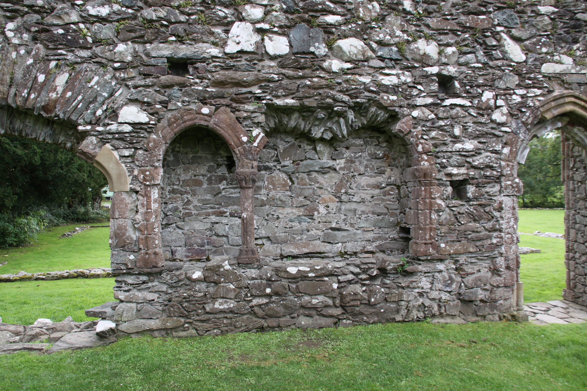
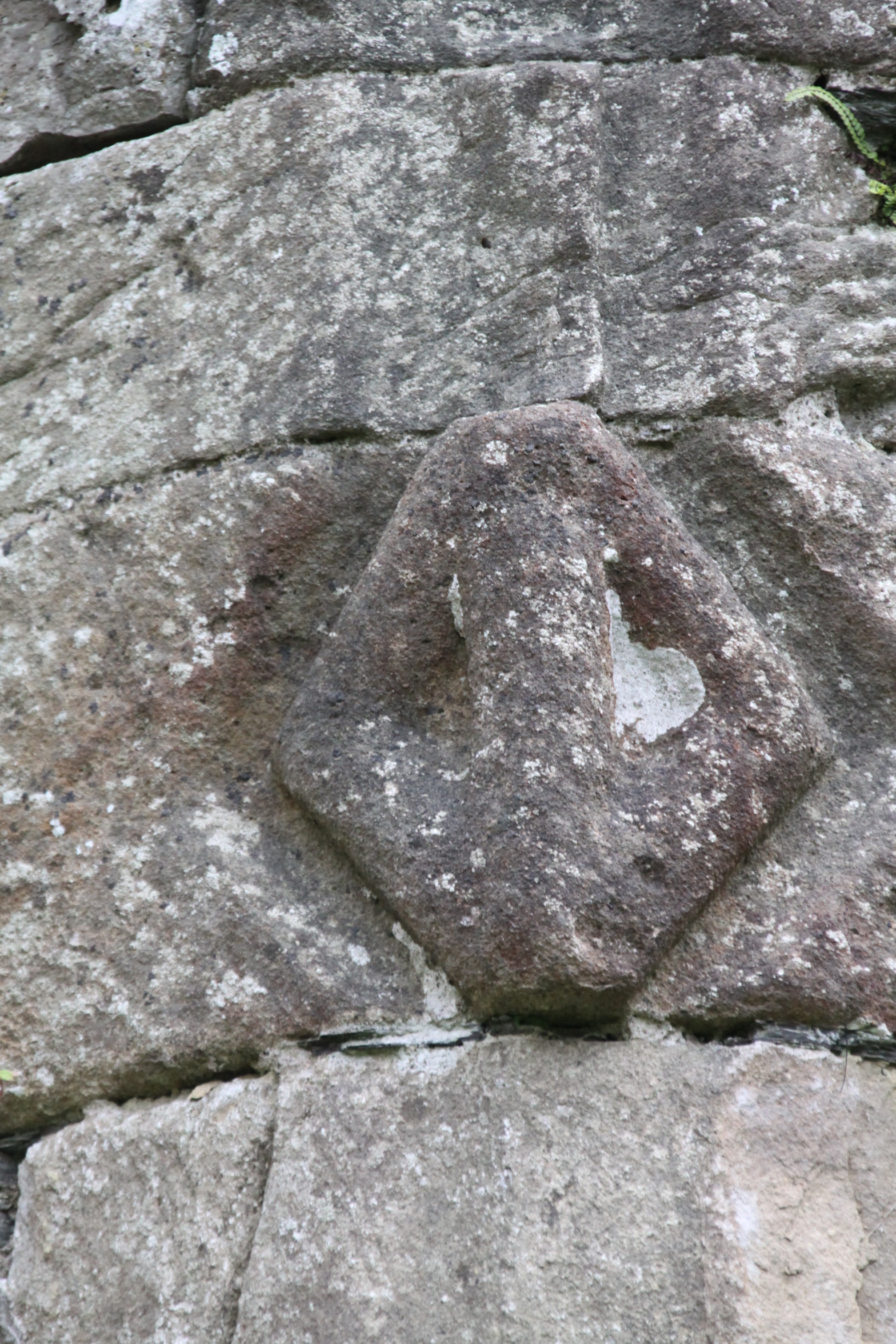
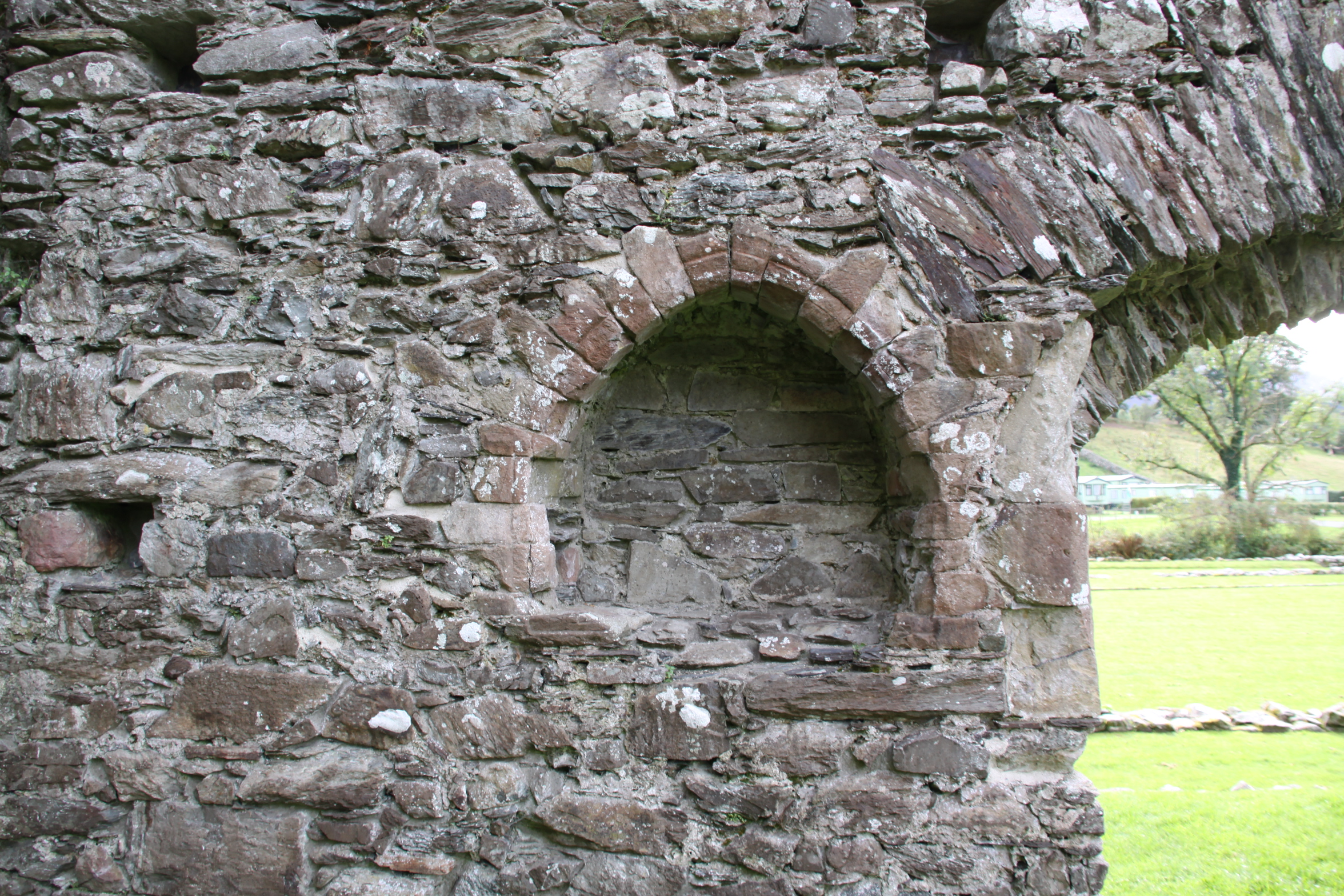
At the east end of the abbey, in the south aisle, an arched recess is provided with touches of decorative red sandstone.  These touches give an idea of how the abbey achieved some degree of ornamentation without the opulence of cathedrals and Cluniac abbeys.

Apparently someone, possibly the abbot, attempted to save some of the abbey’s dignity (or secure himself a nice pension) by hiding Cymer’s ecclesiastical plate, consisting of a 13th Century silver gilt chalice and paten, under a stone at Cwm-y-Mynach.  Whatever the motive, whether to return it to the abbey’s headquarters at Citeaux, or to melt it down for personal benefit, it was never retrieved.  Like most of the portable heritage of North Wales, it found its way to the National Museum of Wales in Cardiff.  I have been unable to find out if it is still there, or to find an image of it.

Following dissolution, the property was leased to John Powes, “royal servant,”  but not until May 1558.  It was probably robbed for building stone for surrounding farm buildings and dry-stone walling, and once the roof either fell into disrepair or was robbed for tiles or lead, exposure would have led to rapid deterioration.

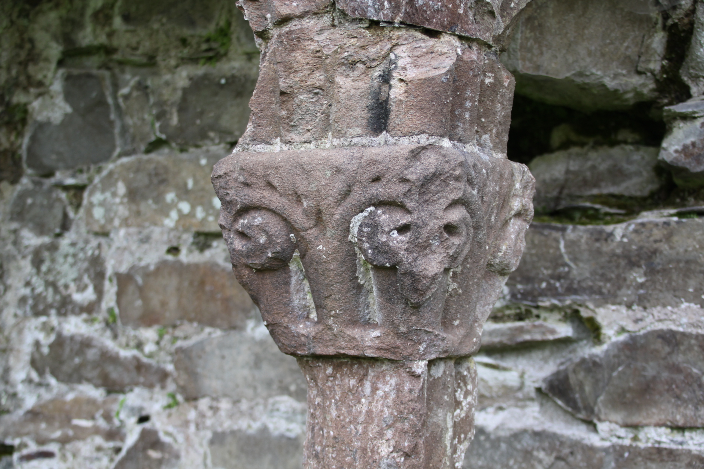
Detail of one of the capitals, in red sandstone (detail of the above photograph).

East end of the truncated church

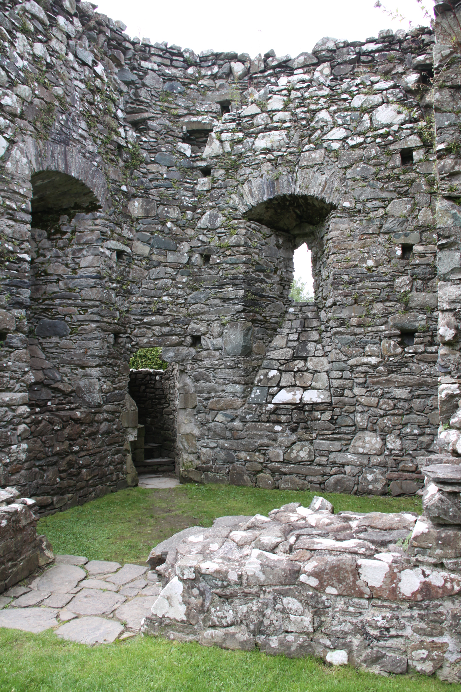
Spiral staircase in the 14th Century tower leading to – where? There was presumably an upper floor in the tower.

Remains of the spiral staircase in the 14th Century tower

East end of the church

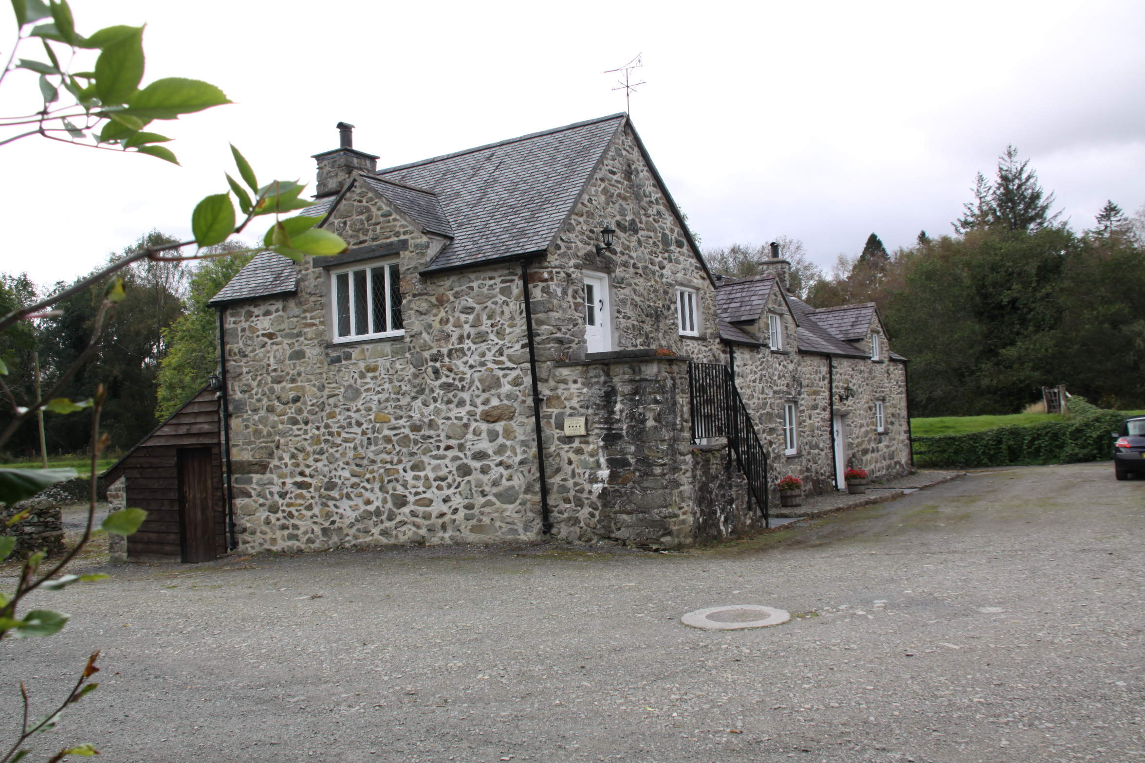
Farmhouse that lies over the site of the site of what is thought to be the abbot’s quarters


Visiting

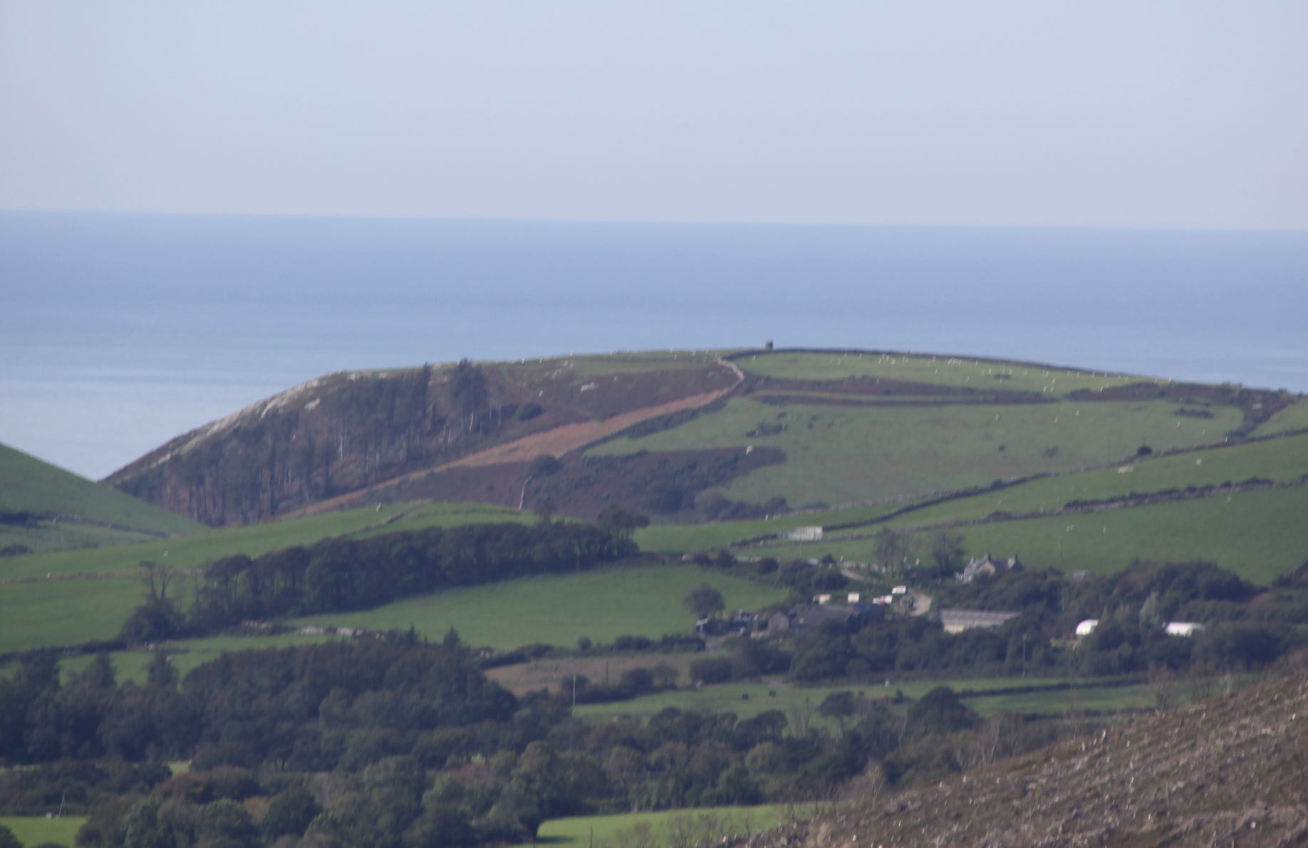
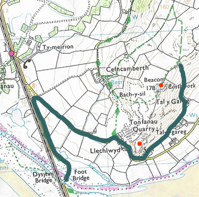
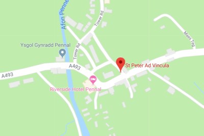
Cymer Abbey is easy to reach.  It lies just off the A487 north of Dolgellau and is well sign-posted.  After driving through a small caravan park, there are two very attractive farm buildings, and a small parking area.  Both parking and access to the abbey ruins are free of charge.  There is an information board showing the main features of the abbey.

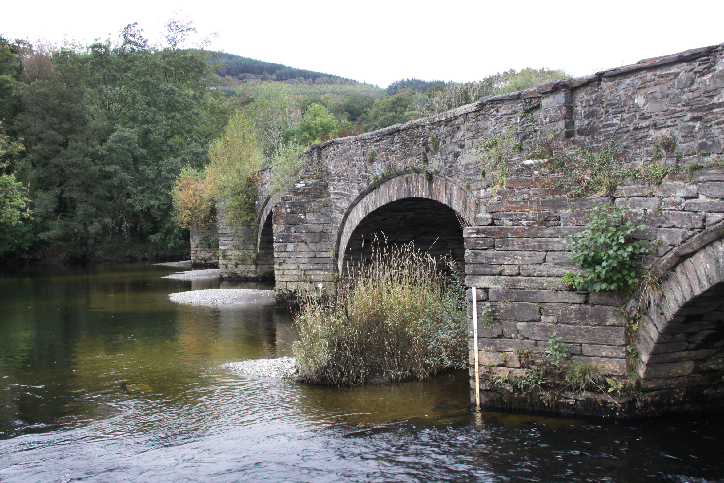
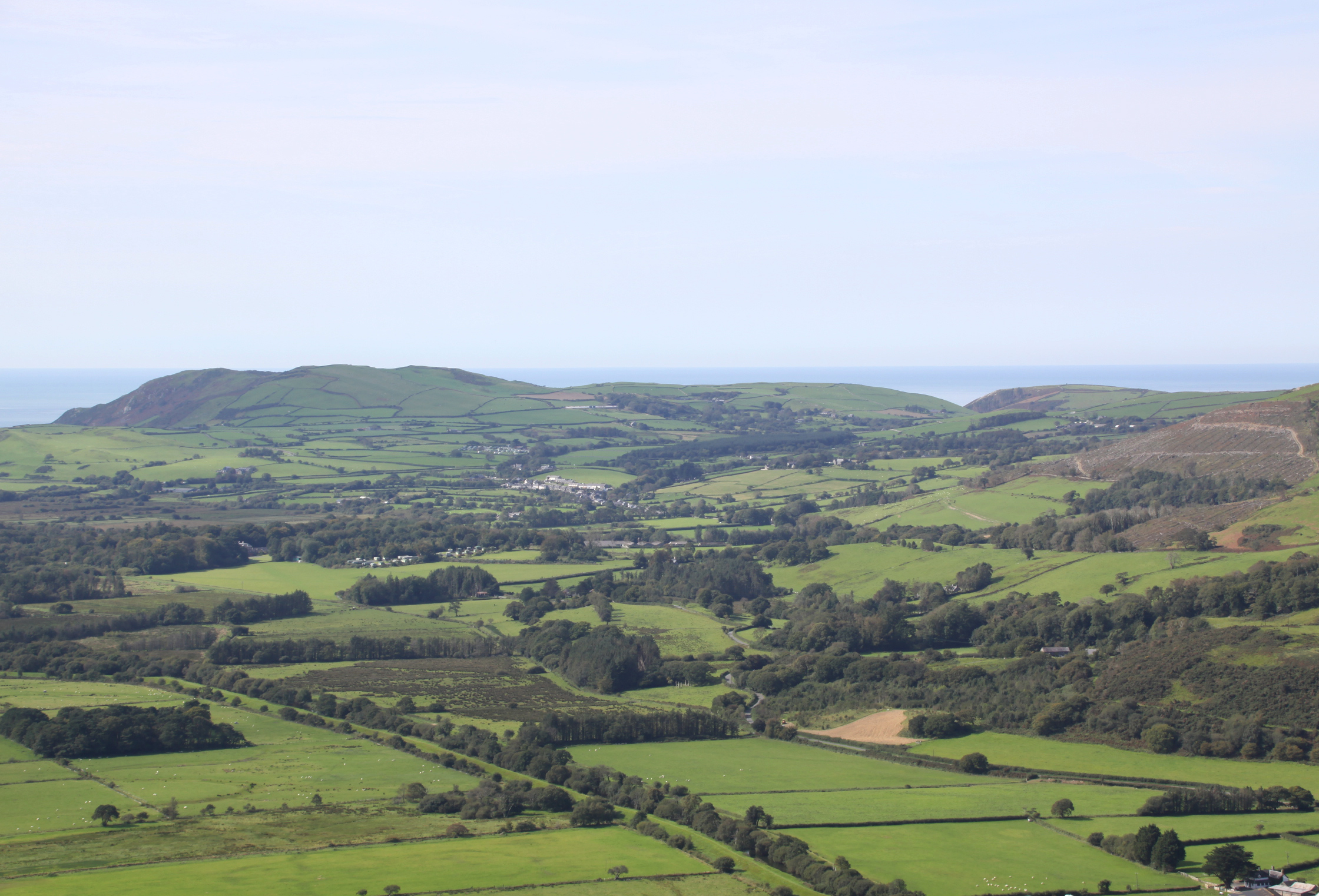
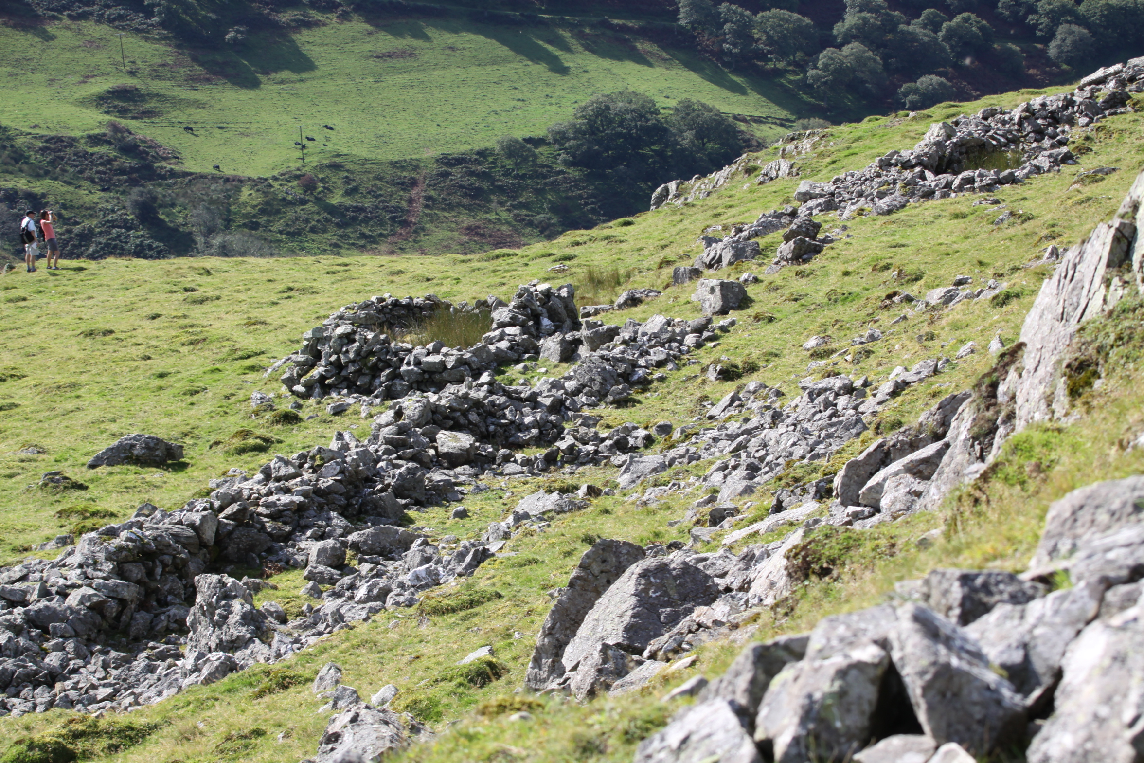
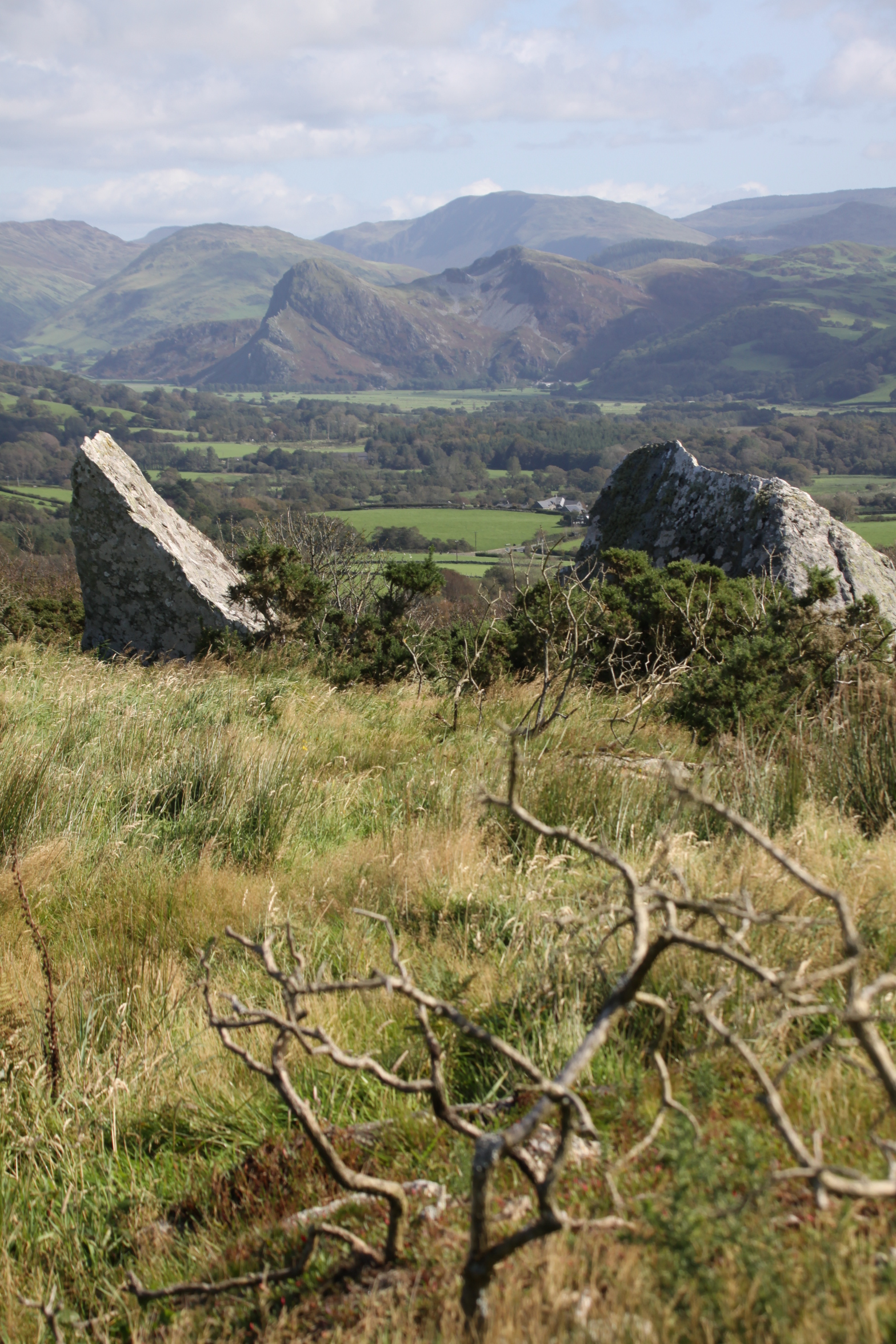
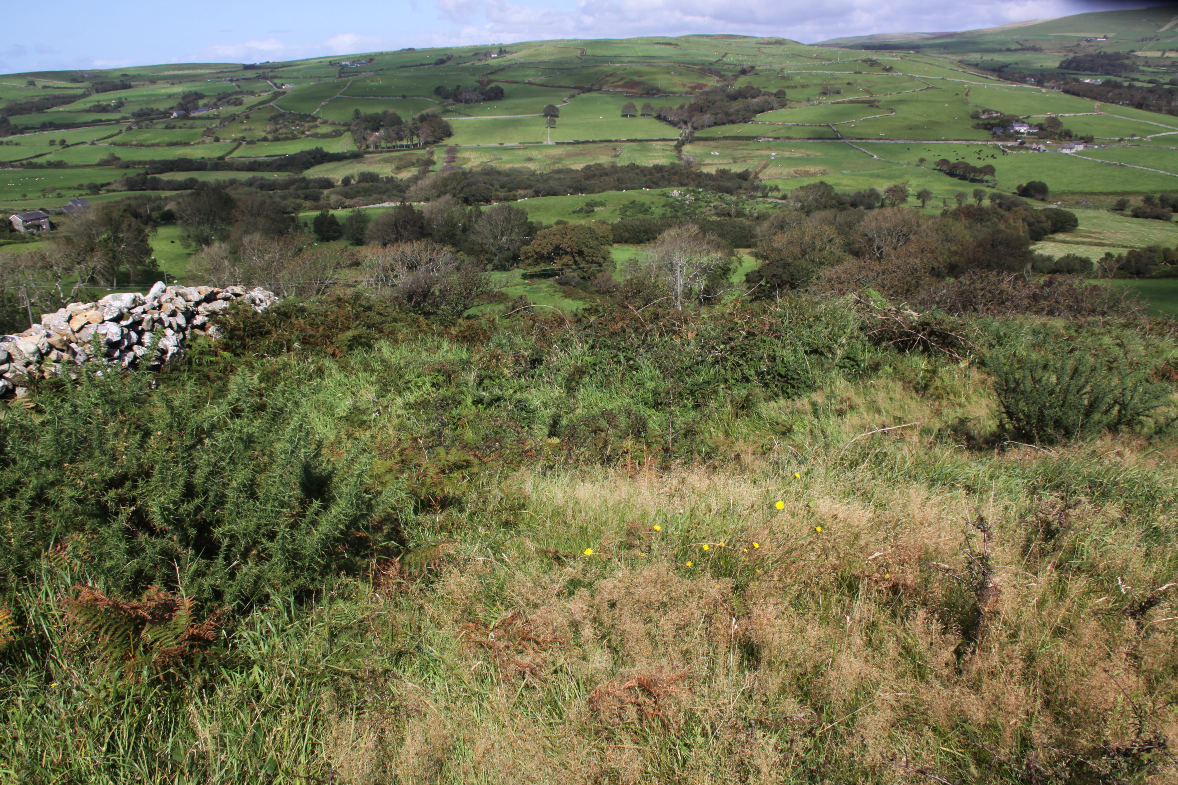
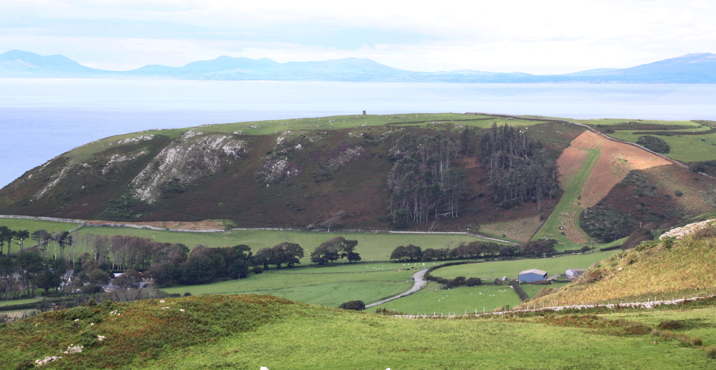
The river Mawddach, which was a ford during Medieval times, had a lovely road bridge built over it in the 18th Century, which is now a foot bridge.  A car park on the Cymer side of Llanelltyd bridge is provided for those walking to the New Precipice Walk above the village of Llanelltyd on the other side of the bridge.  The views from the bridge, both over the river and over the surrounding countryside, are well worth adding to the abbey visit.  The bridge could do with a bit of maintenance, as the roots from the shrubs embedded into its brickwork will start to pull the mortar out and undermine the structure of the bridge.


Sources:

Books and papers

Burton, J. 1994.  Monastic and Religious Orders in Britain 1000-1300. Cambridge Medieval Textbooks. Cambridge University Press.

Burton, J. and Kerr, J. 2011.  The Cistercians in the Middle Ages.  Boydell Press

Davis, S.J.  2018.  Monasticism.  A Very Short Introduction.  Oxford University Press

Evans D.H. 2008, Valle Crucis Abbey, Cadw 2008

Gascoigne, B.  2003 (2nd edition).  A Brief History of Christianity. Robinson

Gies, F. and Gies, J.  1990. Life in a Medieval Village.  Harper

Gilingham, J, and Griffiths, R.A. 1984, 2000.  Medieval Britain. A Very Short Introduction.  Oxford University Press

Krüger, K. (ed.) 2012.  Monasteries and Monastic Orders. 2000 years of Christian Art and Culture.  H.F. Ullmann.

Livingstone, E.A. 2006 (Revised 2nd edition).  Concise Dictionary of the  Christian Church.  Oxford University Press

Robinson, D.M. 1995 (2nd edition). Cymer Abbey. Cadw

Robinson, D.M and Harrison, S. 2006.  Cistercian Cloisters in England and Wales Part I: Essay. Journal of the British Archaeological Association, 159:1, p.131-207


Websites

Coflein
Cymer Abbey
https://coflein.gov.uk/en/site/95420?term=cymer%20abbey

Ancient and Medieval Architecture – by Janusz Michalew
Llanelltyd – Cymer Abbey
https://medievalheritage.eu/en/main-page/heritage/wales/llanelltyd-cymer-abbey/ 

English Heritage
The Dissolution
https://www.english-heritage.org.uk/learn/histories/dissolution/

Monastic Wales
Cymer Abbey
https://www.monasticwales.org/browsedb.php?func=showsite&siteID=27

Open Yale Courses (Yale University, Connecticut)
The Early Middle Ages, 284–1000 (course given by Professor Paul H. Freedman)
https://oyc.yale.edu/history/hist-210

A visit to Castell y Gaer hillfort

Aerial view of Castell y Gaer. Source:  People’s Collection Wales via the RCAHMW

This can hardly be termed a walk, because the B-road runs around 15ft from the ramparts on an unenclosed section of open hillside overlooking the sea.  I certainly had a good walk on and around it, but it was not a walk in its own right, and I went elsewhere to stretch my legs properly afterwards.  For those of you hoping that the endless posts about hillforts will eventually come to an end – five down, four to go, plus a summary post 🙂   If you are wondering about the sunshine, this was actually on the 17th September, but I have a bit of a backlog at the moment.

Of all the hillforts in the series so far, this was by far the easiest to access and observe on the ground.

The approach is from the A493 coast road.  As you close on Llywgril from the south, there is a cemetery on the right, just before you reach the village itself, and a tiny, sharp right-hand turn in front of the cemetery.  The hillfort is about 3 minutes up the single-track road (driving slowly).  It is on private land, and there’s no public footpath, there are barriers to entry and the Heneb website states that the owner currently allows access, which is a generous courtesy.  I parked on the verge opposite.  The banks are liberally covered in gorse, but there are plenty of ways into the fort, including the original entrance at the far right as you look at it form the road.  Sheep tracks show that it is regularly visited by the local livestock, and they break through the gorse at a number of locations around the perimeter.

Castell y Gaer site plan. Source: Bowen and Gresham 1967

Castell-y-Gaer is quite different from most of the hillforts described so far.  Well preserved, it overlooks the sea but is not on the peak of the hill.  Although it seems high from below, which it is at just above the 120m OD contour line, it only has that drop on its western side.  It is on a slight knoll, very slightly tipped towards the sea to the northwest, a slope dropping fairly steeply away beneath it, running into pasture below.  The land around it on three sides, however, is fairly level and it is overlooked by higher ground on the same hill.  If it was not for the defenses, would present no difficulty to anyone attempting to enter it.

It measures c.60m by 30-44m and gives a sense of good amount of internal space.  The overall shape is sub-rectangular, and although the internal space tips to the northwest, the interior is far more level than any of the previous hillforts visited in the area, and it would not be surprising to find the foundations of structures within it.  Although not obvious at first glance, it does incorporate natural scarps above steep natural slopes on the west and north, but it is particularly notable for its artificial defenses, particularly its stone-faced banks, reaching 6m wide, and deep ditches, with counterscarping (second bank and ditch) to the southeast.  The stone appears to have been quarried from the ditches, and possibly from the hillfort interior.  Even though it is not at the summit of the hill, it is very exposed, and on an averagely breezy day was very windy.

Ditch on the eastern side

Stone-faced rampart

Stone-faced rampart to the north

Hillfort interior

Wider view of the hillfort interior

Ramparts along the eastern side

Ramparts looking northeast

The defenses have something in common with Craig yr Aderyn, which has similar wide, sloping rock-faced banks, but the entrance is more complex, the interior more open, and the siting completely different.

Plan of Castell y Gaer. Source: Heneb

The entrance is at the northeast corner, facing east.  On the eastern side of the hillfort the northern end of the outer bank overlaps with the southern end of the scarp, forcing the visitor the visitor to walk in facing north, but they are immediately confronted with more earthworks that force them round in a loop to the south, and this gives access to the entrance.  This dog-leg turn would have impeded access if control over entry was required.

The Coflein website says that the interior of the enclosure shows signs of cultivation and that a rectangular enclosure/platform, c.20m square, to the northeast may be connected.  It also records that there are extensive traces of relict fields occur to the west, although it does not comment on dating, although the close association between the fields and the hillfort makes a direct association possible.  The fields are visible on the photograph below,

Aerial view of Castell y Gaer. Source: Coflein (catalogue C821284)

 
The Afon Gwril runs down the narrow, shallow valley to the north, but is not a major water course, and it is unknowable if it was a reliable source of water in the Iron Age.  The OS map marks a well/spring immediately to the north.  Again, it is impossible to know if this was present in the Iron Age.

The views are all about the coastline.  As well as the sea immediately to the west, the coastline is clearly visible all the way to Barmouth and the mouth of the Mawddach estuary to the north.  Immediately to the north, the inland view is over a nearby hillside, now a pattern of drystone walls.  The Lleyn Peninsula was visible in the far north as a blue silhouette.  Behind the fort, rising to the east and southeast, is lightly sloping hillside.  This drops fairly steeply to the southwest of the fort in a line with the hillside beneath the fort itself.   The slope flattens gradually towards the sea, and both the hill and the fields below are grazed today by sheep at all levels and cattle on the lower levels.  To the south, pastures look out to the sea.

View to the west

Looking west from outside the southern bank of the hillfort.

Looking south across the gently sloping pastures to the sea

Looking north across the hillslope pastures towards Barmouth and the hills beyond

View from the hillfort to the east

View of the hillfort from the east

To the north, the hills behind the Mawddach are visible, at least on a sunny day.  To the west there is just sea.

View towards Barmouth, the Mawddach estuary and Dinas Oleu (approximate location marked with a red arrow)

There are no hillforts in sight to the south or east, just the immediate hillside.  The nearest hillfort to the south, also on a hill overlooking the coast but out of line of sight from Castell y Gaer, is Bwlch on Foel Llynfandigaid, which is around 4km away as the crow flies but a range of higher ground stands between them. A perusal of the Ordnance Survey map produced the site of Dinas Oleu, which sits immediately above Barmouth at SH61711578 and turns out to be the remains of an Iron Age hillfort (approachable via a footpath and there are a few details about it on the Coflein website).  The two sites are around 7km apart as the crow flies, and it would require a very clear day or night for any signals to be visible, not always a foregone conclusion in a coastal/estuary location.  The arrow in the above photograph is a guess, based on trying to match up the photograph with the OS map, and should be treated as extremely approximate.  The lack of a line of sight to the sites to the south does not rule out that Castell y Gaer had an important role linking north and south along the coast.

Although I included this as a possible outlier of the Dysynni and Dyfi hillfort group, I suspect that it is probably part of the Mawddach group, although at the moment, not having seen or read about any of the Mawddach hillforts, that’s just a guess.  This does not mean that it would not have been in communication with hillforts to the south, or that it did not have a potentially pivotal role in communication between north and south along the coast, but its main physical orientation to the north, its views to the north and its distinctive architectural features, suggest that it may be part of a slightly different tradition.

Sources:

Bowen, E.G. and Gresham, C.A. 1967.  History of Merioneth, volume 1.  From the earliest times to the Age of the Native Princes.  The Merioneth Historical and Record Society.

Websites:

Coflein
https://coflein.gov.uk/en/site/302716/details/castell-y-gaer

Heneb
http://www.heneb.co.uk/merionethforts/13castellygaer.html


A walk up Craig yr Aderyn (Bird Rock) #2 – the Iron Age hillfort

Looking up at Craig yr Aderyn from the medieval castle Castell y Bere in the Dysynni valley to the west

This walk has been divided into two, partly because I went crazy with the camera and took too many photographs, but also because I had quite a lot to say about the hillfort.  The second post, this one, is about the hillfort and what can be seen from it.  The first one was about the walk itself, how to get to it, where the two different forks take you to, and what views can be seen from parts of the route.

I am currently walking as many of the nine Iron Age hillforts in the local area as I can before winter sets in.  Or at least, I am when it’s not sloshing with rain and there’s no haze or mist to obscure views.  Fortunately there has been some glorious weather recently, after a rather soggy summer.  One of the wonderful things about hillforts is that the views are often terrific, and Craig yr Aderyn is simply the best.  It dominates the Dysynni valley from miles around, catching the light in dramatic ways, but I had never seen it up close.  Approaching it along the lovely road from Llanegryn for the first time, I was somewhat staggered when I rounded a corner and suddenly found it looming over me.  Drifting happily down the road, I had no idea that I had arrived so near to it.

Craig yr Aderyn is a highly visible local landmark in the Dysynni valley (SH643068), and is approached by small B-roads from Bryncrug or Abergynolwyn.  For full details of reaching Craig yr Aderyn and the route up, see my other post, about the walk rather than the hillfort.

A distinctly soggy part of the Dysynni floodplain.

Craig yr Aderyn, which translates as Rock of Birds, or more usually Bird Rock, is a major local landmark, abutting the of the Foel Wyllt hill ridge overlooking the Dysynni valley from the south. The course and character of the river Dysynni have changed over time.  Before the 18th century the estuary reached almost to the foot of Craig yr Aderyn, but the river silted up and is no longer navigable.  The land has been drained since the 1700s to create better quality land for farming, although standing looking down from the summit, it is quite clear that the land to the west still has some very boggy patches marked by beds of spiny rush (Juncus acutus), which is found in all freshwater flats, bogs and marshes herabouts.  It is not known what it looked like in prehistory, but the presence of a glacial valley with Cadair Idris at its back indicates that a melt-water river certainly passed Craig yr Aderyn on its way to the sea, and this will have established a valley route into which later hill drainage descended.  It would be useful to know what it was like during the Iron Age.

According to a Snowdonia Active publication (2018) the crag is made of rhyolitic tuff, rock formed from volcanic ash laid down after a major eruption through the Bala fault line c.800 million years ago.  It is separated from the hillside behind it by a saddle or col 100ft below the peak.  Its distinctive shape is immediately recognizable from miles around, almost always visible in the Dysynni area.  Its gaze always seems to follow you around.  Its summit is at 230m OD (700ft).  The hillfort is lower, at about 180 OD, 10m higher than the 170m OD Tal y Garreg, the next highest hillfort in the area.  Although the north face of the crag is very steep, the home of nesting birds and a route for rock climbers, there is a much more gradual approach to the rear.

Craig yr Aderyn is one of a small number of hillforts that were built near the Dysynni valley.  I’ve already posted about the two small hillforts at the mouth of the Dysynni, Tal y Garreg and Llechlwyd on Mynydd Garreg above Tonfanau, some 8km away to the west of Craig yr Aderyn.  Nearer to Craig yr Aderyn is Castell Mawr, c.5.5km to the west as the crow flies, about which I have also posted.  See the map at the end of the post.

At Craig yr Aderyn all of the hillfort construction work took place on a natural shelf beneath the rocky peak, which the hillfort incorporates.  Its man-made defenses consist of two phases of earthen and stone banks.  Today the fort’s ramparts are covered in grass, but most of them are still clearly visible, although it took me some time to trace them against the site plan on the ground.  Thankfully they are covered mainly with short turf rather than bracken or long grass, which makes the job much easier than at places like Castell Mawr.  The ramparts are impressive, and served to cut off the only realistic line of human access to the hillfort, as the other side is a sheer drop into the valley beyond from the summit of Craig yr Aderyn, some 270m below.  The combination of natural and stone-faced sloping man-made defenses makes this one of the most ostentations structures of this type in the area.  The site is thought to have been built in two phases.

This site plan shows how the ramparts are built into the rocks of the crag behind a natural shelf, using the existing topography as part of the design of the hillfort. The earlier phase is on the left, divided by a bank and ditch with a slightly inturned entrance. The second phase is on the right with a much deeper inturned entrance that forms a short passageway.  Source:  Bowen and Gresham 1967

The most obvious features of the first phase are the two sets of ditches and eroded banks, which once formed ramparts that were stone-faced.  This is sometimes called the upper fort.  There was an in-turned entrance at the southeast side through a gap in the rampart.  The enclosed area encloses approximately 0.8 hectares (just under 2 acres), and measures roughly 100 by 55m (c.330 x 180ft).  the shape formed against the line of the natural topography is a triangle.

Detail of the second phase entrance, with the inturned entrance forming something of a corridor into the second phase enclosure. Source: Bowen and Gresham 1967

In the second phase an additional line of banks and ditches were built on the eastern side to enclose a larger area of approximately 1.6 hectares, measuring 119 by 170m (390 x 560ft) on the east side, which was most vulnerable to attack. This included a substantial stone wall, much more impressive than the first phase.  Unfortunately, this has now collapsed, but its original line is still clearly visible.  Secondary improvements were a wall on the south side and two new banks to the east.  These were accompanied by another in-turned entrance, this a lot more prominent and well built than in phase 1.  Unlike the first entrance it could only be approached via a steep slope.  This is the entrance that the public footpath uses today, but even if you approach the hillfort at a tangent and follow a sheep track into the interior, the entrance is unmistakable from the interior.

The early excavations at Craig yr Aderyn, such as they were, produced very little in the way of dateable artefacts, and although a pottery sherd was identified at the time as Romano British, I have not seen any modern opinion on the subject of its date, and have no idea where the sherd itself is located today.  Even if this tenuous evidence was validated, it is not enough to tie in in with the other hillforts in the area, as none of those have been excavated and the architecture itself is only suggests very approximate dating.

View to the northwest from the summit

The location of the site is commanding.  It is c.9 km inland and therefore although the sea is visible, it has no view over the comings and goings of anything that was travelling along the coast.  If it was in league with any or all of the Tal y Garreg, Llechlwyd or Castell Mawr hillforts, that may not have been important.  What it did have, and still does, is  remarkable views over the Dysynni valley to the west and east from the summit, and good views towards the hill slopes to the north and south.   It is lower than many of the surrounding hills to north and south, but difficult to reach except via the saddle connecting it to the main hillside to its north.

View to the west

View to the east

Stone-fronted ramparts

The function of this hillfort remains unknown.  Even at 180m OD (590ft), Craig yr Aderyn cannot be completely ruled out as a settlement, but it it was very small, and would certainly be extremely inconvenient for permanent living, just like the other hillforts so far visited.  Although there are level surfaces that might have been suitable for settlement huts and storage, the only signs of settlement that have been found to date are an indeterminate feature found in 1874, and two possible and unconfirmed platforms in the south-east corner found in the 1921.   Whilst it might have been used as a seasonal settlement for taking sheep herds into the hills, it seems far too elaborate for this sort of role, particularly given the human resources required to build the impressive stone facing of the ramparts.

The entrance to the phase 2 extension to the hillfort

The stone-faced ramparts and entrance are themselves interesting, unique in the Dysynni area, and suggest that the site was particularly important to its builders.  In his overview of the Iron Age, Timothy Darvill in his overview of mentions that after c.400BC a number of sites were provided with sloping stone-faced ramparts, which he suggests were as much for ostentation as defense.  In a more recent discussion, focused on the Ceredigion hillforts, Toby Driver points to these as a recurring theme in that area, and he too suggests that they may have been intended to give the appearance of strength, a deterrent rather than being strictly defensive.  Although they would have required substantial investment in effort to build them, they would have been relatively easy to maintain, as their survival today demonstrates.

Upper (phase 1) and lower (phase 2) ramparts, both stone-faced

If there was insufficient stone for the facing from digging out the ditches, there was plenty of loose stone available for the ramparts.  Nearby rockfalls from the hill behind Craig yr Aderyn would have done the trick, and it is quite likely that those prominent today were the result of glacial activity.  The rocks in the immediate area were much bigger than any of those used for the stone facing, so they were probably broken up.  Interestingly, much of that rock is quartzite, some of it quite massive, but none of that was used in the rampart facing.  This suggests that the builders had a very specific vision, and it didn’t include quartzite.

The hillfort coming into view along the col (or saddle).

One slight oddity if the hillfort was to impress, is that it is not visible from a distance.  It is only when one is almost upon it that the impressive stonework comes into view.  Its appearance is defensive, because the ramparts are large and stone-faced, and the entrance well built, but the approach is not particularly challenging.  I paused twice for a breather on my way up, but I’m in my mid 50s and not at optimal fitness.  For a fit person it would present no difficulties at all, and for a hypothetical raiding party accustomed to such tasks it would have been all in a day’s work.  The approach is out of direct line of sight of the hillfort itself, and partly obscured even from the summit.  If its role was primarily defensive, lookouts would have to be stationed in the area to ensure that any threat was detected early.  its potential as a defensible retreat was tried and tested during the 10th Century AD when, according to a publication by Snowdownia Active, Tywyn was attacked and burned by Norsemen.  When they approached from the sea a warning beacon was lit on the coast, and Tywyn residents retreated to Craig yr Aderyn.  There are related theories for use.  One  are that the site might have been used as a refuge for local farming families or the most important of the local elite if there was conflict over land, or it could have been used as a secure communal store for important raw materials, food and craft products, including livestock.  There is really nothing to help narrow down a precise role.

Map showing the known hillforts in the area (my annotations in yellow). Source of map: Archwilio

From Craig yr Aderyn there is a 360 degree view of the surrounding landscape.  From the hillfort it is a very short walk to the summit where there is an excellent, uninterrupted line of sight west to Mynydd Garreg and the sea in the distance, along the Dysynni valley.  Although I couldn’t make out the trig point or ramparts on Tal y Garreg hillfort through my telephoto lens, the ramparts are certainly in the line of sight.  The promontory on which Llechlwyd sits was easy to make out and I could see where Castell Mawr was located.  Bwlch too, which I haven’t yet visited, was easily visible, with its unmistakable trig point.  These lines of sight would have been no use at all for seeing what people were up to, because the other hillforts were simply too far away, but would be invaluable if the occupants were signalling to one other about any threats from outside the area, including from the sea.  There are no known hillforts nearer to Craig yr Aderyn.

The ridge at the left of the photograph, at the end of the Dysynni valley is Mynydd Garreg. Llechlwyd and Tal y Garreg hillforts are at the coastal end, and Castell Mawr at the opposite end of the ridge. Bwlch is also visible at far right. Views from Craig yr Aderyn

Bwlch hillfort from Craig yr Aderyn

Phase 2 ramparts, incorporating an enclosure that may be later in date

The second phase of the hillfort argues a renewed interest in securing the space, extending it over a larger area and adding further stone-faced ramparts.   Two distinct phases of hillfort construction have been identified at many sites elsewhere in Britain.  Although it is unknown whether the two phases at Craig yr Aderyn conform to this pattern, it seems worth giving a brief outline of the general framework.  The first British phase of hillfort building occurs, at the transition between the Late Bronze Age and the early Iron Age at c.800BC, gaining momentum after c.600BC.   These were generally single rampart-and-ditch (univallate) structures.  The addition of more defenses and additional banks and ditches then came substantially later, at a time when some other hillforts were abandoned at around 400BC.

Craig yr Aderyn from the hillfort Castell Mawr

Some hillforts in the south of England continued to be used into the Roman period.  It would not be surprising if those in  west Wales, became overtly defensive during and after the Roman invasion of Wales in AD74.  If the identification of Romano-British pottery was accurate, this might have coincided with a new anxiety about protecting the community from the threat of Roman incursion, or the threat of raiders coming to secure products to accumulate resources that would help negotiations with Roman traders or native traders securing goods to sell to the Romans.  According to Roman sources Britain was a good source of slaves, and rural areas were likely targets.

If it emerges that the local hillforts were contemporary at the time of their original construction,  I am leaning towards a completely speculative model of fortified sites being used to enable people to stay in touch and share early warnings about potential threats from further afield.  More about the role and function of local hillforts will be discussed on a future post, once I have finished visiting all nine hillforts (four down, five to go).

Sources:

Bowen, E.G. and Gresham, C.A. 1967.  History of Merioneth, volume 1.  From the earliest times to the Age of the Native Princes.  The Merioneth Historical and Record Society.

Cunliffe, B. 1995.  Iron Age Britain.  Batsford

Driver, T. 2013.  Architecture, Regional Identity and Power in the Iron Age Landscapes of Mid Wales.  The Hillforts of North Ceredigion.  BAR British Series 583.

Gwynedd Archaeological Trust 2009.  A visitor guide to the main Iron Age hill forts of Meirionnydd.  Project No. G1770. Report No. 839

RCMHCW 1921.  Royal Commission on the Historical Monuments and Constructions in Wales and Monmouthshire.  An Inventory of the Ancient Monuments in Wales and Monmouthshire.  Volume IV: The County of Merioneth.

Sjöberg, K.S. 2014.  Hidden possibilities.  Possible uses of hillforts in southern Gwynedd, north-west Wales. Unpublished Masters thesis, Uppsala University, Department of archaeology and ancient history. http://www.diva-portal.org/smash/record.jsf?pid=diva2%3A799381&dswid=8151

Snowdonia Active 2018. Craig yr Aderyn. Site Guides for Recreation.  Protected Landscapes of Wales.

Websites:

Archaeology Data Service
https://archaeologydataservice.ac.uk

Coflein
https://coflein.gov.uk/en/archive/6512930/details/504
https://coflein.gov.uk/en/archive/6512928/details/504
https://coflein.gov.uk/en/archive/6512929/details/504

Gwynedd Archaeological Trust (no date).  Historic Landscape Characterisation: The Dysynni
http://www.heneb.co.uk/hlc/dysynni/dysynni2.html

Gwynedd Archaeological Trust (no date).  Hillforts in Dwyfor and Merioneth http://www.heneb.co.uk/merionethforts/9craigyraderyn.html


A walk to Castell Mawr hillfort, Mynydd Garreg, near Llanegryn

This is the third Iron Age hillfort in my series about hillforts south of the Mawddach estuary and north of the Dyfi estuary.  Out of a total of nine, which includes an outlier in Machynlleth, I am visiting all those in the immediate area that are accessible via public footpaths, and Castell Mawr is one of those.

Castell Mawr (translating roughly as big castle) lies on the far northeastern end of a ridge along the top of Mynydd Garreg.  The nearest village is Llanegryn.  At the opposite end of the ridge are two hillforts about which I have posted previously, Tal y Garreg and its lower neighbour the promontory fort Llechlwyd, both of which are a mere 1.5km away from Castell Mawr.  None of the three hillforts have been excavated but structurally and topographically, each is very different in character.

Castell Mawr is quite unlike either Tal y Garreg or Llechlwyd in a number of ways, although like them, it is surrounded by pasture and has views over Craig yr Aderyd (Bird Rock) where another hillfort was located.  Whilst Tal y Garreg and Llechlwyd are on fairly high points on the ridge, (170ft OD and 70 OD respectively), and are on the edge of very steep drops on at least one side, Castell Mawr appears to be much lower than either.  The site is at 120 OD, but the surrounding pastures are also quite high, sloping gently away towards lower contours, and the hills that form the main views to the north and east are much higher, giving a sense that it is quite low down.  The ridge is only 10ft or so above the surrounding fields, with the west side ditch raising this to 18ft.   Unlike the hillforts overlooking Tonfanau, this feels very much integrated into the immediate landscape, not above and apart from it.  On the other hand, it does have remarkable views to west, north, northeast and east.

The overgrown interior of Castell Mawr hillfort, with views to the north. The modern drystone wall has been built along the western edge of the hillfort

It is a scrubby hillfort.  Some hillforts are scrubbier and more indistinct than others, but this one outdoes itself.  I was even in doubt that I was in the right place at first, in spite of the OS map clutched in my hand that argued forcefully that the site couldn’t be anywhere else and neither could I.  I eventually found sufficient features to confirm that the map was right, and I was indeed at Castell Mawr.  This is nothing like the great hillforts of the Welsh Marches or the Clwydian Range.  It is small, overgrown and incredibly difficult to make any sense of at all on the ground.  It is, however, interesting, and the views are simply stunning.  If you walk to the other end of the ridge to Tonfanau (about 1.5km away as the crow flies, but about 2km when you follow the footpath) you will be seriously happy that you went because the views are terrific.

If you are interested in visiting Castell Mawr (Grid Reference SH5804504795) or walking the ridge, here are some basic details.  The nearest village, about 2km away as the crow flies (about 3km to walk), is Llanegryn.  The hillfort is located just beyond the Castell Mawr Farm house and out-buildings, and is helpfully skirted on its southwestern side by a footpath that continues across the ridge to the two hillforts above Tonfanau, making it easy to walk the three hillforts in one day.

The location of Castell Mawr on the Ordnance Survey map, OL23. Click to enlarge to see the footpath around the hillfort clearly.

There are two ways of approaching Castell Mawr.  The first way is a less straight forward walk, parking at the Tonfanau bridge and walking up to the ridge of the hill and then along it, about 5km there and back with diversions to find gates through the drystone wall, but including a short but steep route up Mynydd Garreg.  See the Tal y Garreg post for my preferred way up on to the ridge.  Instead of turning left to Tal y Garreg, turn right along the centre of the ridge, which is a footpath leading to Castell Mawr.  The footpath is not at all clearly marked, so if you take that route, I recommend that you take a map and compass.  Alternatively it’s a matter of parking up at the Castell Mawr end and taking a short walk to the hillfort along a short stretch of footpath and then proceeding along the ridge towards Tal y Garreg.  The footpath is accessed just off a narrow B-road that runs just to the north of the hillfort, which is itself accessed from the A493.  There is no formal parking area, but you can either leave your car on the wide verge outside Castell Mawr Farm, or alternatively park in Llanegryn and walk footpaths from the A493, which is  a distance of no more than 3km.  The footpath alongside Castell Mawr is not marked with a public footpath sign.  You simply walk up into the farm, past the house on the right and follow the track to the left behind a stone barn and then to the right, continuing along the track.  On your left are a modern farm building and some fields and on the right a steep bank, which is the hillfort.  Carry on up the track.  On the right is a gate that takes you into the hillfort.  Immediately ahead of you is another gate that takes you up on to the ridge to continue the walk.

Castell Mawr hillfort is aligned northeast (top of the photograph) to southwest.

The site is a roughly oval enclosure on a rocky protuberance at the end of the Mynydd Garreg ridge, measuring roughly 262.5ft/80m north-east to south-west by 118ft/36m.  It depends for most of its defensive potential on natural slopes.  A man-made rampart is clearly visible on the west, consisting of a rock-cut ditch below a steep slope.  It is around 18ft/5.5m from bottom of the ditch to the top of the bank. Another line of defense can just about be seen at the south side of the fort, but does not extend around the east side, which is something of a puzzle, as the natural slope is steep but not terribly high –  at a guess I would say about 10ft/3m from the level of the surrounding fields.  At the north there is a slight inner bank, possibly with a shallow ditch behind it, which I found by falling into it.  This seems to be an extension of the outer earthwork visible above on the outside of the drystone wall.  Other details are remarkably difficult to make out, although by dint of fighting my way through brambles and leaning over the drystone wall I did find the outer bank on the west side that is shown on the aerial photograph.  The Coflein website suggests that there may be an east-facing entrance, and I have no idea how anyone could have made that judgement.  I can’t see it either on the ground or from the aerial photographs and Bowen and Gresham says that the position of the entrance is uncertain.  The The Royal Commission (1921) covers the site in four lines on page 128, but the brief entry does include the information that in a 1914 visit a freshwater spring was observed within the hillfort.  Today a spring is marked on the OS map immediately to the north, just to the west of the farm.  Bowen and Gresham suggest that the site is incomplete.  Unfortunately, and perhaps sensibly, they have not attempted to provide a plan of the hillfort.

The interior of the hillfort, looking to the west

The outer ditch on the west side, with the short but steep slope to the top of the bank, where a drystone wall has since been constructed

Another view of the slope and the ditch at its base

Another view of the ditch and bank.

In the hillfort looking south

The wide outer bank shown clearly on the aerial photograph, on the west

The interior of the hillfort looking east

Minor modern quarrying along the eastern edge of the hillfort, showing the top of the hillfort above, giving an indication of the short height above the levels of the fields

The west bank from outside the hillfort, from the south

An annex is mentioned by Bowen and Gresham, of which I could seen nothing due to the heavy scrub and bracken, but it apparently extends a further 78ft/24m to the north of the inner bank.  Perhaps part of it includes the outer bank shown on the west of the aerial photograph.

Castell Mawr does not seem a promising site for locating internal structures of any sort.  The interior is a mixture of considerably uneven ground, with big dips and holes disguised by bracken and very thick grass, together with big horizontal chunks of bedrock around which the site is built.  There are three massive glacial eratics within the site, which are not mentioned anywhere else, but are truly impressive.  Two of them must be about 6ft/1.8m tall.

View to the north

Some more questions arise with an assessment of the views from Castell Mawr.  My initial response (other than “wow”) was that from the point of view of keeping an eye on the movements of people across the landscape the potential for observation of any activities in the valley below, coming from east or west, was excellent.  The land drops slowly away from Castell Mawr into the valley, and there are superb, wide views across to the north and northeast, across the pass through which the A493 travels towards the hills beyond, with some views towards the west.

View from the Castell Mawr to the west

View from Castell Mawr to the east

View from Castell Mawr to the northeast

View from Castell Mawr to the east

View from the hillfort to the northeast

Looking uphill to the south

On the other hand, looking back along the ridge to the south, you find yourself looking up to higher ground.  From the hillfort it doesn’t look like much of a rise, but as you approach it, it turns out to be a fairly steep slope that has views for miles around.  Once up there, you find yourself looking down into the hillfort’s south end, and it is difficult to imagine that the single line of defensive bank and ditch, even with sturdy palisades, would have been much of a deterrent to anyone approaching from this direction.  This is the same story at the promontory hillfort Llechlwyd, at the opposite end of the ridge, where a much better positioned site sits on very high, steep slopes and is only vulnerable from the rear, where high ground looks down on it.

Looking towards the hillfort from the south.  The rise on the other side of the wall is one of the defensive banks.

A view to the north looking down into the hillfort from the higher ground to the south. As you follow the two converging lines of drystone downhill, the hillfort is on the other side of the section of drystone wall that connects them.  The line of stone in the foreground, at the bottom of the photo, seems to be artificial and extends some way to the west, but there is no indication of its date.

As to other hillforts, this is also interesting.  Craig yr Aderyn (Bird Rock) is unambiguously visible to the northeast, overlooking the Dysynni valley, but none of the other known hillforts are visible.  Craig yr Aderyn is too far away to be able to see any significant activity unless there were signals set up between the sites.

The distinctively shaped Craig yr Aderyn from the interior of Castell Mawr

Tal y Garreg from the ridge above Castell Mawr.

If you want to see either Bwlch or Tal y Garreg, you need to walk a maximum of 10 minutes to the top of the ridge, from which Bwlch, Tal y Garreg and Craig yr Aderyn are all clearly visible.  Llechlwyd is not visible from the ridge, because like Castell Mawr, it too is at the bottom of a steep slope at the end of the ridge, but at the opposite end. Bwlch, like Craig yr Aderyn, is too far away to be able to see any significant activity at the site unless there were intentional signals set up between the sites for communication. From the point of view of line of sight to other hillforts, this part of the ridge above Castell Mawr would have been a much better, if much more exposed location (it was very windier than on the Castell Mawr outcrop).  On the other hand, the view into the pass below Castell Mawr (perhaps a former river valley) was completely invisible from the ridge, so perhaps the route along valley bottom and its approaches from east and west were the most important factors in the decision to locate the hillfort on that relatively low, rocky outcrop.

Bwlch, the brown hill in the distance, at right of the photograph, with a trig point just visible on top.

In my previous two posts about Tal y Garreg and Llechlwyd I have mentioned that no excavations have taken place on any of the Mynydd Garreg hillforts, so it is impossible to establish whether they were or were not contemporary, and therefore whether they had any form of relationship with each other.  It is immensely frustrating that speculation is all that’s available right now, but here are a couple of educated guesses.  Tal y Garreg and Llechlwyd are at the opposite end of the Mynydd Garreg ridge from Castell Mawr.  Tal y Garreg and Llechlwyd overlook the Dysynni broadwater and are so close to one another that if they were contemporary they must have been used together and if they were not contemporary it seems probable that one replaced the other.  In either case it is possible that one or both had a relationship with Castell Mawr.  They occupied the same ridge but faced in opposite directions overlooking different valleys and landscapes, which would have been invaluable for a joint defensive role as well as for communication and the moving of livestock to markets.  The ridge could have been used both for for livestock herding, as it is today, as well as driving eastwards, and the annex at Castell Mawr might have been used for rounding up sheep, cattle and/or horses.

It is also possible that they were in conflict with each other.  The most substantial defences of Castell Mawr are to the south, which could have been against an incursion from the Tal y Garreg end of the ridge, and Tal y Garreg similarly made impressive use of a rocky outcrop to raise itself above the level of the ridge in the direction of Castell Mawr.

Oh for a bit of subsurface clarification and a few radiocarbon dates!

More views from Castell Mawr:


Sources:

Bowen, E.G. and Gresham, C.A. 1967.  History of Merioneth, volume 1.  From the earliest times to the Age of the Native Princes.  The Merioneth Historical and Record Society.

Gwynedd Archaeological Trust 2009.  A visitor guide to the main Iron Age hill forts of Meirionnydd.  Project No. G1770. Report No. 839

The Royal Commission 1921. An Inventory of the Ancient Monuments in Wales and
Monmouthshire: VI. – County of Merioneth.  His Majesty´s Stationery Office
https://tinyurl.com/y3a8yhtc

Sjöberg, K.S. 2014.  Hidden possibilities.  Possible uses of hillforts in southern Gwynedd, north-west Wales. Unpublished Masters thesis, Uppsala University, Department of archaeology and ancient history. http://www.diva-portal.org/smash/record.jsf?pid=diva2%3A799381&dswid=8151

Websites:

Archaeology Data Service
https://archaeologydataservice.ac.uk

Archwilio
https://www.archwilio.org.uk/arch/

Coflein
https://www.coflein.gov.uk/

Gwynedd Archaeological Trust (no date).  Historic Landscape Characterisation: The Dysynni
http://www.heneb.co.uk/hlc/dysynni/dysynni2.html


A walk to Llechlwyd Iron Age hillfort, Tonfanau

The location of the two hillforts above Tonfanau, with Llechlwyd on the promontory, right.

Llechlwyd (sometimes referred to as Llechrwyd) hillfort is located on a long, narrow promontory that extends out from the hill above Tonfanau, Mynydd Garreg (Garreg hill), a short distance from Tywyn.  Llechlwyd means “grey (lwyd) stone (llech).”  At a height of 70m OD it is considerably lower than nearby Tal y Garreg hillfort (170m OD).  If you have not read my post about Tal y Garreg hillfort I suggest you read that first, because this post makes frequent reference to it.  Like Tal y Garreg, Llechlwyd has not been excavated, but it conforms to the basic design of an Iron Age hillfort, and is generally accepted to be of that period.  Llechlwyd is only a short walk from Tal y Garreg, but is a rather more difficult hillfort to reach.  The relative positions of the two hillfort are shown in the aerial photograph on the above left. The dark shadows to the left of both hillforts highlight parts of the Tonfanau stone quarry, which has cut away bits of both.

My route up and down Mynydd Garreg, above Tonfanau.  The shading in purple shows Tal y Garreg at the top and Llechlwyd below.  Source: Archwilio, with my route drawn in.

The routes up and down the hill that I took can by seen at the end of the post.  Apologies for the legend “style” instead of “stile” in the photographs above and left, but I only realized after I had posted this piece.  I parked by the Tonfanau bridge, on the Tywyn side, and walked to the bridle path, up the hill, over the stile, and back along the ridge towards the easily visible hillfort of Tal y Garreg, which makes excellent use of a natural rise in the topography.  Then, instead of going through the fence to Tal y Garreg, I turned left and walked along the fence, passing Tal y Garreg on my right.  This fence leads directly into Llechlwyd. On the aeriel photograph above it looks like a straightforward walk along the ridge, but in fact there’s a rather steep drop from the ridge to the promontory below, with a 100ft difference between the heights of the two hillorts. This can be seen clearly in the picture at the top of the post.  The route down is along very indistinct sheep tracks through coarse gorse – very rough on the lower legs if you are wearing shorts!  There’s no way through the fence, which is topped with barbed wire, and it splits the hillfort in two, so you have to retrace your footsteps towards Tal y Garreg when you want to return to the valley.  I returned via the quarry track that leads down into the old quarry yard, which itself is part of a footpath that skirts the northern base of the hill.

The date range for Llechlwyd is unknown because the site has not been excavated.  It has features typical of an Iron Age hillfort, but as the the Iron Age spans the period c.800/600BC – AD43, overlapping with the Roman occupation (AD43-c.410) that doesn’t narrow it down a great deal.  Unfortunately the structural remains alone are not sufficient to establish a narrower time frame.

Aerial view of Llechlwyd, annotated. Source of photograph: Coflein

Llechlwyd is something of a curiosity.  Although it has excellent views over the Dysynni valley and the coast to the north and south, it is in a very low position relative to the line of the hill above and behind it, with absolutely no visibility of anyone approaching along the ridge.  Although there are two banks and ditches across the promontory, it would be incredibly difficult to defend if the promontory was approached from the rear.  This would argue that either it was used in conjunction with Tal y Garreg hillfort, or that its purpose was not defensive.  Tal y Garreg today is often hidden within low cloud, not an ideal feature for a site presumably located at least partially for its views over the surrounding landscape.  In the Iron Age the temperature fluctuated, but was generally far more wet and cloudy than in the preceding Bronze Age.  This might be a good reason for establishing a secondary, lower fort to maintain clear visibility even in bad weather.  Unfortunately, it is not known whether Llechlwyd and Tal y Garreg were actually contemporary.

Another view of Llechlwyd. Source: Apple Maps

The quarry has removed part of the site, but the remaining banks and ditches are still visible and the aerial photographs above and left show where the large banks and entrance are located along the promontory. The big inner rampart, 3.6m high, consists primarily of stone.  The outer rampart is 3.2m high and the ditch 1.9m deep. The entrance, at the west end, is in-turned and sits on a steep slope of the hill. The steep sides provided enough protection on three sides, and the banks and ditches were used to secure the access to the ridge.  No excavation or geophysical survey have taken place, and the aerial photographs reveal nothing about what may lie beneath the surface of the hillfort, so we remain ignorant of any possible hut circles or storage structures.

The hillfort has lines of sight to Bwlch hillfort on Foel Llanfendigaid, c.2km to the north, and Craig yr Aderyn (Bird Rock), c.8km to the east.   Its main views are over the Dysynni valley immediately at its foot, as far as Craig yr Aderyn, and along the coast to the north and south.  The modern quarry makes the lines of sight between Llechlwyd and Tal y Garreg difficult to assess.  It is possible that the occupants of Llechlwyd would have been able to see a stretch of the ramparts of Tal y Garreg, and by the same token the occupants may have been able to see into Llechlwyd, but it is also possible that the topography blocked the line of sight completely.  It is a marvellous spot for a look-out over the lowlands, but, as mentioned above, to its rear it is overlooked by a steep slope that links the promontory with the rest of Mynydd Garreg.

Looking down over Llechlwyd promontory hillfort, with the Dysynni and the sea beyond

View over the Dysynni Broadwater. The valley will have had a different look to it during the Iron Age, but will have had a similar value for subsistence strategies

View across the broadwater towards Tywyn and over Cardigan Bay

View to the east

A very murky view of Craig yr Aderyn (Bird Rock), upon which another hillfort was built, to the east of Llechlwyd and Tal y Garret

A view to Bwlch hillfort to the north, with the Llyn Peninsula visible on the horizon.

There are no signs of Iron Age domestic structures hereabouts, but they will have been somewhere in the valley, visible from the hillfort, distributed at a similar frequency to modern farmsteads.  Livestock herding was probably the most practical subsistence activity, just as it is today.

At the other end of Mynydd Garreg, about 1.5km away, shown on the map above, is the hillfort Castell Mawr.  It is not visible from Tal y Garreg or Llechlwyd,  Castell Mawr has a secondary enclosure attached to it, which may have been used for corralling livestock.  If the area’s hillforts were related and friendly, it may be that Castell Mawr was used as a local livestock trading point, or as the gathering point for moving livestock further afield.  Without excavation such musings are pure speculation, particularly in view of the fact that it is not known if they were contemporary, but these are the sort of question that excavation might help to answer.  Excavation could provide insight into construction methods and artefacts, both of which could give an idea of the date of construction and the usage of the site, and would help to establish the chronological relationship between neighbouring hillforts and between these and the hillforts of other areas.

Sources:

Bowen, E.G. and Gresham, C.A. 1967.  History of Merioneth, volume 1.  From the earliest times to the Age of the Native Princes.  The Merioneth Historical and Record Society.

Gwynedd Archaeological Trust 2009.  A visitor guide to the main Iron Age hill forts of Meirionnydd.  Project No. G1770. Report No. 839

Sjöberg, K.S. 2014.  Hidden possibilities.  Possible uses of hillforts in southern Gwynedd, north-west Wales. Unpublished Masters thesis, Uppsala University, Department of archaeology and ancient history. http://www.diva-portal.org/smash/record.jsf?pid=diva2%3A799381&dswid=8151

Websites:

Archwilio
https://www.archwilio.org.uk/her/chi1/arch.html?county=Gwynedd&lang=eng

Coflein
https://www.coflein.gov.uk/

A walk to the top of Tonfanau to explore the Tal y Garreg Iron Age hillfort

Tonfanau from the southwest. Tal y Garreg is immediately above the quarry

Ordnance Survey map showing the route taken up the hill, and the location of the two hillforts, marked by red dots. These two sites are also marked on an aerial photograph below.

I have wanted to see the Tal y Garreg Iron Age hillfort at the top of Tonfanau quarry, on Mynydd Garreg (rock hill), for some time, so on Sunday (9th August) I packed my rucksack and went along the route I had scoped out on Saturday, which had been made so enjoyable by the verges filled with wild flowers.  I parked the car on the road leading up to the Tonfanau footbridge, as before and followed exactly the same route, but this time instead of stopping at the gate into the field at the end of the bridlepath, I followed the faint track of the footpath up the hill.  The route is marked in dark green on the map to the left.  There are two hillforts on Tonfanau, both of which are marked with red dots, Tal y Garreg at the summit overlooking the quarry, and Llechlwyd on a lower promontory to the east of the quarry.   On this post I will talk about Tal y Garreg, but I covered Llechlwyd on another post, and the map above and an aerial shot below show the geographical relationship between the two.  The walk up the side of the hill is very beautiful, and the views from all around the top of the hill are breathtaking.  I should, however, make a couple of health and safety notes about this walk before I recommend it as a great one to do

First, the track starts to climb fairly easily, as in the photo on the right, but as you near the top, where the bracken gives way to open ground, it becomes steep.  When you turn around to admire the view, the ground seems to drop sharply away beneath you, and falling would result in an unimpeded roll downhill.  I am very sure-footed, but instead of tacking to reduce the effort, I went straight up, leaning forward, to reduce the risk of tripping.  The views are stunning, just be careful. There are other public footpath approaches marked on the map, which might be easier.  Second, the hillfort of Tal y Gareg sits above the quarry.  Indeed, the quarry has removed a big part of the hillfort.  When you climb to the brick monument on the summit of the hillfort you are getting near to the edge of the quarry, and at the edge there is almost nothing to prevent you falling the steep drop into the quarry should you lose your footing – just fence poles with a single run of wire to mark the edge.   Perfectly okay if you’re aware of it, but do not let children loose up there.

Access over two sets of steps to the ridge at the top of the hill

The top of the hill is a ridge that extends 1.5km to the northeast, with terrific views either side.  The ridge is enclosed today by a long, winding drystone wall that extends as far as the eye can see.  A short wooden ladder on either side of the wall allows you to cross the wall easily, but take care – two of the steps on the ridge side are rotten, one completely broken.  The inside of this drystone perimeter is divided up into separate enclosures by more drystone walling, but all of them have gates or are open so you can wander freely across the top.  To the southwest is the river Dysynni, at the eastern end are views over the hills flanking the valley, including Craig yr Aderyn (Bird Rock).

I was up there partly for the views, but mainly because I am on a hillfort mission at the moment and wanted to check out what was left of one of two small Iron Age hillforts.  In the area between the Mawddach estury and the Dyfi estuary are fifteen known hillforts.  These fall into two distinct geographical groupings, a northern and southern group.  Eight of the fifteen are in the southern group and I am hoping to walk all of those that are accessible by public footpath.

When the first hillforts were excavated during the late 19th Century, it was assumed that all hillforts were defensive, and some southern hillforts certainly were, but it is by no means clear if all hillforts were built as a response to conflict.  Because so few hillforts have been excavated in northwest and mid Wales, it is impossible to establish exactly what they were designed to do, and most of them probably had multiple functions.  I’ll be talking more about the roles of hillforts in this area on a future post.

It is almost impossible to photograph a hillfort sensibly at ground level, although some banks and ditches can usually be captured.  Aerial photographs and excavation plans are the best ways of of visualizing individual hillforts.


Another view of the quarry. Source: Gwynedd Archaeological Trust

In fact, Tal y Garreg hillfort was very easy to spot from the ground, as the builders made use of a rise in the local topography and natural escarpments that face north.  Tal y Garreg means “end of the rock/cliff” and probably refers to the rocky ridge on which it is built. It lies at the southwest end of a 1.5km ridge at c.170m OD.   The natural lift in the land, shown on the above photograph at far right makes the hillfort highly visible from the ridge behind it.  The composite image above (click to enlarge if required) shows Tal y Garreg hillfort from the air with the 1967 site plan (upside down in terms of the photograph – Bowen and Gresham 1967) and a view of it from the middle of the ridge.  Another plan to the left offers a different view.  Today, massive piles of rock from the quarrying activity are left lying around, so it is not immediately easy to see the structural features and it helps to have the plan to hand to locate them.  There are two sets of banks and ditches, referred to as bivallate on the northeastern and southwestern sides.  The banks, or ramparts, were probably pallisaded to make it even more impressive from a distance, and to make it easier to protect if needed.  These ramparts contain an area around 45m long by 22m wide, small in hillfort terms.  Still, it was clear that although the space it contained wasn’t large, it had been built on an impressive scale.  The entrance was simple, inturned, and cut through the scarp to the north, facing the ridge.  It’s worth walking along the the edge of the drystone wall that runs behind the fort so that you can get a feel for the banks and ditches shown on the far left in the aerial photo, but be careful how near you get to the quarry edge.  One of the banks and ditches, cut into bedrock, is shown below, with the sea in the background.  Tal y Garreg overlooks the Dysynni valley rather than establishing a good line of sight with hills to the east or the coast to the north, although a short walk along the ridge on an averagely clear day provides those views.  The views have been radically changed by quarrying, but there were clearly good lines of sight across the sea, down into the Dysynni valley and back along the ridge.

Ditch at Tal y Garreg, excavated through the bedrock. Ramparts on the bank at this point would have given views over the Dysynni valley and Cardigan Bay.

The site has never been excavated, so any thoughts on its date or the number of phases involved in its construction are purely speculative.  On both plans a 10m diameter “tower” is marked, and this was a circular structure, in front of which is a rock-cut ditch now full of stone, which may be the remains of the tower, suggesting that it was quite a substantial feature.  One proposal is that the small primary bivallate hillfort may have been overlain by a smaller and later fort that made use of the earlier features, and that the tower may have been part of this later re-use, dating to a Roman or post-Roman/Early Medieval re-occupation.  In fact, there is so little evidence of Roman presence in the area that it seems rather unlikely that a Roman fort was located here, so it is more likely that any second phase was post-Roman.

The Tal y Garreg hillfort is so small that I am not sure that it really qualifies for the title “hillfort,” when compared with more massive and impressive examples, that contained a number of other structures within their ramparts.  It does, however, feature typical hillfort characteristics. It took advantage of strong strategic position that could be partially barricaded with banks and ditches on vulnerable sides, using steep sides to provide natural barriers to attack.  Like most hillforts, although not all, it is on high ground overlooking good farming land or pasture.  Although there are no known settlements in the area, farmsteads were almost certainly dotted around the landscape much as they are today, and the hillforts probably overlooked some of these in the valley.  The ridge itself may have been used for grazing livestock, just as it is today. In the photograph below, the sheep were on top of the ridge and the horses were just outside the drystone wall at the top of the approach to the ridge.

The hillfort had no water supply other than rainfall.  This small defended enclosure could not have sheltered large numbers of people against hostilities, and could not have been reached in a hurry from the valley below, so it was either designed to shelter a privileged few;  to store important resources in a relatively inaccessible location;  to segregate certain centralized activities in a single location;  to be a visible symbol of territorial tenure – or a mixture of various roles.

Located both on the edge of the Dysynni valley and on the coastal plain, lines of communication could have extended both on a north-south axis and along the Dysynni valley, past Craig yr Aderyn (Bird Rock) hillfort, and into the Tal y Llyn valley heading northwest towards the hillforts near Corwen and Ruthin.  The ridge itself would have provided a high-level route alongside the Dysynni valley for c.1.5km.  At the other end of the ridge is another hillfort, Castell Mawr, which appears to have had a large annex that could have been used as a livestock corral.

Tal y Garreg is only a short walk from Llechlwyd hillfort, which also sits on the side of Tonfanau quarry, and I will be posting about in the future.  Both are poorly understood, and it is not known if they were related to each other or were chronologically separate.  They could have been contemporary but they may have been separated by anything from years or decades to one or more centuries. Until they are excavated this relationship will not be clarified.

I wanted to see if there was a clear line of sight from Tal y Garreg to the hillforts of Llechlwyd, also at the southwestern end of the ridge at the top of Tonfanau, Craig yr Aderyn (Bird Rock) c.8km to the east and Bwlch hillfort on the next hilltop, 2km to the north, Foel Llanfendigaid.  As none of these sites have been excavated it is not known whether they were contemporary, but in the event that they were, having a clear line of sight might have had many benefits, irrespective of whether the occupants of the hillforts were friends or enemies. The nearest hillfort, Llechlwyd, is visible from Tal y Garreg, which has a view down into the much lower promontory fort.   Craig yr Aderyn is visible from Tal y Garreg, although in the distance.  If required, it would have been easy enough to set up a signal on a clear day.  Bwlch is very easily visible, and looks like the perfect location for a hillfort.  Between the two, a near-flat piece of coastal plain is divided today into fields and used for pasture.

Craig yr Aderyn (Bird Rock) c.8km from Tal y Garreg

View from Tal y Garreg to Foel Llanfendigaid, on top of which is the hillfort Bwlch

It was useful to see what could be viewed when outside the hillfort, but still along the ridge, and it was impressive how many broad views were available from the ridge beyond the hillfort, some of which are below, all overlooking good quality pasture, currently being grazed by sheep and cattle, and far into the distance in all directions including the sea.  It was a hazy day so the views weren’t quite as spectacular as they might have been, but they showed enough to indicate that Tal y Garreg was a good site for watching movements for many miles around.

View from one side of the ridge to the other, taken from the stile.

Dysynni valley, looking east

A final though on the views available from the hillfort and visibility from below is that a couple of days later I went to walk along the Dysynni from Tonfanau bridge to Ynysymaengwyn, skirting the broadwater, and found that the entire of the top of Tonfanau was under a cloud, just where Tal y Garreg was built.  It was impossible to see its location, and it would be impossible to see anything at all from the hillfort down into the valley.  This could have been a distinct disadvantage in its location!  The second hillfort, Llechlwyd, which is on the lower promontory at 70m OD, was not shrouded in cloud, so although it had no visibility of the ridge behind it, it did have the advantage of being less prone to cloud cover.

There’s a modern structure on top of the hill at this point, which is an Ordnance Survey trig pillar.  There are also the foundations of an old shipping signal.  Ordnance Survey trig pillars (or points) are part of the history of mapping in the UK.  Trig is shorthand for triangulation, and in 1936 the first of c.6500 trig pillars were built as part of the project to retriangulate Britain.  Most of them made of concrete but the Tal y Garreg trig pillar was made  of local stone, and is shown on the right.  The OS is still responsible for maintaining the pillars, of which around 6000 remain at similar locations. The project was designed to improve the accuracy of mapping, and although it has been surpassed by modern techniques and technologies, it revolutionized map-making in Britain.  Here’s an excerpt from the Ordnance Survey page on the subject of the trig pillars:

Triangulation works by determining the location of a point by measuring angles to it from known points at either end of a fixed baseline and in this case, those known points were the 6,500 + trig pillars erected across the country. In practice, a theodolite would have been secured to the top mounting plate and made level. It would then be directly over the brass bolt underneath the pillar. Angles were then measured from the pillar to other surrounding points. For the highest accuracy primary points in the retriangulation, many rounds of angles would have been measured with the observations taking several hours.

I was expecting to have the hill to myself, but there was a group of around 10 people up there enjoying the view.  We exchanged cheerful greetings, and when they left I noticed that they took the  wide quarry track that runs on a shallow incline alongside the quarry scar.  Out of curiosity I took the same route down, and it runs into the quarry yard, which is the same as the access point to the Wales Coast Path.  A farm gate opens out onto the B-road.  The quarry track is not a public footpath, but it is not barred in any way, is safe, and as the quarry is out of use it seems okay to use it.  It’s a much easier, much shallower incline than the steep path that I took up.  Although not as attractive, it gives remarkable and safe views over the quarry itself.

The quarry track

When you reach the quarry yard, you’ll find that it is a piece of industrial archaeology in its own right, with an abandoned control panel in a small building, and various bits of abandoned heavy-duty hardware lying around, plus various shallow concrete water holders, presumably for filtration purposes.  One of them had a healthy population of bullrushes growing out of it.  Gwynedd Archaeological Trust reports that the quarry was first used for extracting granite, which is unusual in this area:

The ridge has been quarried since at least the nineteenth century. A narrow-gauge link to the Cambrian Railways was put in c. 1898, superseded by a standard-gauge siding in 1906, around the time it was taken over directly by John Corbett of Ynysymaengwyn, working as Tonfanau Granite Quarries. In 1965 this became a subsidiary of Penmaenmawr and Welsh Granite Co., and operated as Kingston Minerals from 1965 to 1981. It was thereafter worked by Mr G.C. Evans of Aberllefenni.

The report goes on to say that latterly the quarry was used to exploit a sill of coarse dolerite and gabbro that is suitable for use as road surfacing material.  Here are a few snaps of the quarry as I was on my way out, but I will be going back to explore in more depth.

Sources:

Bowen, E.G. and Gresham, C.A. 1967.  History of Merioneth, volume 1.  From the earliest times to the Age of the Native Princes.  The Merioneth Historical and Record Society.

Gwynedd Archaeological Trust 2009.  A visitor guide to the main Iron Age hill forts of Meirionnydd.  Project No. G1770. Report No. 839

Sjöberg, K.S. 2014.  Hidden possibilities.  Possible uses of hillforts in southern Gwynedd, north-west Wales. Unpublished Masters thesis, Uppsala University, Department of archaeology and ancient history. http://www.diva-portal.org/smash/record.jsf?pid=diva2%3A799381&dswid=8151

Websites:

Coflein
https://www.coflein.gov.uk/

Gwynedd Archaeological Trust (no date).  Historic Landscape Characterisation: The Dysynni
http://www.heneb.co.uk/hlc/dysynni/dysynni2.html

Cefn Caer, Roman auxiliary fort, Pennal

Simplified reconstruction of Pennal Fort by Gwynedd Archaeological Trust: Source: Gwynedd Archaeological Trust

The nearest Roman site to Aberdovey is the fort at Pennal, called Cefn-Caer (which translates roughly as ridge/hillside of the fort), 10.5km (6.7miles) away from Aberdovey.  Although there is a rock-cut track that stretches from Penhelig to Picnic Island along the estuary that is known locally as the Roman Road, this actually dates to 1827.  Cefn Caer at Pennal, however, is the real thing:  a Roman fort 600 yards from Pennal down a small B-road.  It formed part of a network of forts and roads that were key to the Roman plans to subjugate Wales.  When I first started looking into Cefn Caer for this post, it was simply because the site is part of this area’s history and I wanted to include it as a small representatives of Roman activity in Wales.  The word “small” is worth noting here, because I was expecting Cefn Caer to be no more than a very ephemeral way station for travellers (mansio) or a tiny watch-post.  In fact, it is a fairly substantial affair, as demonstrated by the above simplified reconstruction by Gwynedd Archaeological Trust (GAT).  The GAT work at the site reveals an auxiliary fort with all the features associated with a permanent installation, which had an important strategic role.

Pre-Roman Wales. Source: Wikipedia

The Roman Empire first made its presence felt on British shores first under no less a personage than the Emperor Julius Caesar, albeit only briefly in 55BC and 54BC.  Under the Emperor Claudius matters were taken far more seriously in AD 43 and there was to be no retreat, and after the invasion most of Britain was incorporated in the Roman Empire for for the best part of 400 years. The period of the Roman occupation of Britain is known as the Romano-British period (AD 43 to 410).

Iron Age Britain immediately prior to the invasion was divided into six main tribal areas, recorded in Roman documents, which were organized in social hierarchies that were based on lineage, status and military aptitude “cemented by the distribution of favours and hospitality; consequently equipment for eating looms large in the archaeological record” (Davies and Lynch 2000).  Parade gear, with a particular focus on horses and chariots, is also dominant in the archaeological record.  Subsistence practices depended very much upon geography, but combined herding of domesticated animals (cattle, sheep, goat and pigs) with the cultivation, where possible, of emmer wheat and barley.  Hillforts are generally thought of as synonymous with the Iron Age, as places where political power was centred, but in mid-west Wales, where there are very few hillforts, suggesting that political power was more fragmented, and consisted of scattered farmsteads.  Although the Tal y Llyn hoard (covered on an earlier post) found at Cader Idris is very rich, it is entirely possible that it was hidden by someone travelling through the area, rather than a local resident.  Although in some areas life went on without disruption for some time, in the areas where the invaders first settled, they introduced substantial change very quickly.

The Emperor Claudius, Naples Archaeological Museum.

When Aulus Plautius, the chosen commander of the Emperor Claudius, led an invasion force to Britain and  landed in the southeast, he found the prosperous and sophisticated Catuvellauni tribe dominant, their territory extending from Essex to Surrey under the leadership of Caratacus and his brother Togodummus.  Caratacus and Togodummus were defeated when confronted with the 40,000 men in four legions and supporting auxiliary forces.  Caratacus abandoned his family and fled to the Silures tribe in southeast Wales to rethink his strategy.  Caratacus realized that the partially low-lying territory of the Silures was vulnerable and created an alliance with the Ordovices, which had highland areas in its territory, to organize resistanc,.  The Ordovices were the main tribe occupying most of Gwynedd and Ceredigion, and “by creating a multi-tribe resistance he [Caratacus] offered the most effective bulwark against the Roman invasion to date” (de la Bédoyère 2003).

Cefn Caer, showing farm buildings with traces of the Roman fort in the field to its right. Source: RCAHMW (on the Coflein website) Catalogue Number C872327, File Reference : AP_2009_1671. By Toby Driver

It was not until AD 47 that the Romans felt the need to turn their attention to the tribal areas of what is now known as Wales.  Wales had many benefits from a Roman point of view, including rich mineral resources, fertile valleys and a long coastline.  It would also have been a good source of manpower via voluntary enlistment or conscription.  Perhaps most important, strategically, without peace in rebellious Wales, all Roman-controlled land to its east was potentially under threat.  The first period of military hostilities between Rome and Wales lasted between AD 47 and AD 60, with multiple campaigns against the Marches and Welsh communities, starting in the southeast.  A significant event was the Battle of Caer Caradoc in AD 50, where Caratacus led armies composed of the Ordovices and Silures against the Roman military.  In spite of the strategic advantage of Caratacus and his armies, holding the high ground, the Roman forces under the governor Publius Ostorius Scapula had weaponry, body armour and military experience that outclassed Silurian and Ordovician resources.  Caratacus was defeated and ultimately taken into custody and carried to Rome where the Roman senate were sufficiently impressed by his speech that he earned a pardon from Claudius and lived out his life in Rome.  In his book “Defying Rome,” de la Bédoyère comments that Caratacus “failed to appreciate that he was on the whole a dinosaur.  While he maintained his resistance he found the only place he could do so was amongst people who had no idea what Rome amounted to.”   The Romans did not have it all their own way, but although the Silures went on to defeat a Roman legion in AD 52, it was only a matter of time before Wales was brought under Roman control.  There was a brief respite when the Boudiccan rebellion in East Anglia in AD 60 required the redeployment of troops.  Full-scale invasion was temporarily abandoned and a strategy of containment was practised in Wales, with all of the only permanently occupied military bases lying along the border.

Wroxeter (Viroconium Cornoviorum). Source: Wikpedia. Photograph by Alastair Rae

In AD 73 under the Emperor Vespasian, Sextus Julius Frontinus was appointed Governor of Britain (AD 73-77) , and it is during his tenure that Wales was fully conquered.  Three legionary fortresses were established as campaign bases, at Caerleon (Isca Silurum), Wroxeter (Viroconium Cornoviorum) and Chester (Deva Victrix), and temporary camps were set up within Wales itself, setting the scene for “a network of garrison posts, incorporating fortlets and watchtowers, eventually linked by an all-weather road system” (Arnold and Davies) which were used to maintain control over the rural and often highland zones.

Information about Iron Age and Romano-British exploitation of the western areas of west of mid Wales is particularly sparse, but it would be surprising if such rich natural resources as the Dyfi and particularly Dysynni valleys were not employed for cattle herding and some cultivation, with the surrounding highlands excellent for sheep herding.  It is by no means clear if the Ordovices occupied the whole area, as the boundaries of tribal areas are not known, and it is thought that other smaller and less dominant communities also occupied parts of Wales, but it seems clear that whatever happened to the Ordovices would have had an impact on other small communities in the area.  After their defeat under the leadership of Caratacus in AD 50, the Ordovician tribe again rebelled in AD 77-78 and was put down uncompromisingly by the British governor, Gnaeus Julius Agricola.  Agricola went on to establish forts at Caernarfon, Caersws, Pen Llystyn (Bryncir),  Tomen y Mur (Trawsfynydd), Caer Gai (Penllyn) and Cefn Caer (Pennal), most of them in river valleys or estuaries.  Other sites in the mid Wales area established in this period were the fortlets at Erglodd in Ceredigion and Brithdir in Merionnydd.

Military installations c.AD 70-80. Source: Arnold and Davies 2000, p.16

The Roman architectural infrastructure in Wales took the same form as it did elsewhere, a hierarchy of military installations.  The most important in strategic, organizational and to an extent administrative terms were the legionary fortresses at Chester (Deva), Wroxeter (Viroconium Cornoviorum) and Caerleon (Isca Silurum).  These were, however, in a minority, and the main control over Wales was exercised by a large number of auxiliary forts dotted at strategic positions throughout Wales, often on rivers and estuaries, supplemented at intervals by small fortlets and watch towers.  Legionary and auxiliary forts each refer to the type of garrison stationed there.  Legions were the elite army of the Roman Empire, composed of c.5000 men, divided into ten cohorts.  They served for twenty-five years and were rewarded on retirement with a choice of land or a payment.  Auxiliaries were composed of non-Roman citizens, men who entered the army from throughout the Roman empire sometimes sometimes as volunteers but  sometimes extracted from their homes by force.  They were granted Roman citizenship once they retired.  They were far more numerous than the legionary forces and were essential to the Roman occupation of Britain.  Mid Wales in the Romano-British period  remains poorly understood, which means that wherever a Roman site or a contemporary Iron Age is identified in the area, it is potentially of considerable importance for understanding what was happening in mid Wales at this time.  The Cefn Caer fort was an auxiliary fort, the westernmost of Roman structures in Meirionnydd, established in the AD 70s.

Cefn Caer geophysical survey results. Source: Hopewell 2001

There are few visible features of Cefn Caer on the ground.  The ramparts to the southwest and northwest can be made out, but elsewhere they are low banks that cannot always be seen.  Before it was torn down and rebuilt in 1769  the church in the village of Pennal was reported to include a large number of Roman brick in its walls, and remaining obstructions to cultivation were probably moved in the distant past, and the land continues to be used by the local farm for cultivation.   The farm buildings, including a sub-Medieval farmhouse (which can be visited), sit within the west corner of the fort and the northern corner of the fort is crossed by a small B-road  Although the 1967 History of Merioneth provided dimensions derived from previous surveys of the fort, detailed knowledge of the scale and structure of the fort comes from more recent analysis of aerial photographs, the use of geophysical survey and field excavations, the latter only sampling certain parts of the site. The history of the archaeological work can be summarized as follows.  The site was first noted by Robert Vaughan in his Survey of Merioneth in the mid 17th Century, and in a late 17th Century letter by the rector of Dolgellau, Maurice Jones.  Amongst the 17th Century finds were a silver coin inscribed with the name of the Emperor Domition.  Subsequent visits to the site reported ditches, coins, bricks, a hard paved road, pottery and a tile relating to II Augustian Legion.   The main sources of information are the initial detailed report by Professor R. C. Bosanquet in 1921, which was further studied and commented upon in 1957 by H.C. Irvine in BBCS Volume XVII part 2, and these were the best sources of information on the subject prior to the work by Gwynedd Archaeological Trust (GAT).  GAT used conventional survey, geophysical survey,  and excavated some sample trenches to investigate further (Hopewell 2001, 2003).

Cefn Caer was a small auxiliary fort (castellum) with traces of a ditch still visible at the northwest, outside the rectangular bank that encloses the fort.  It was built in AD 70s. It is more than 1.68ha (5 acres) in area, measuring 140m x 120m (c.550ft x 425ft) northeast to southwest with rounded corners.  An earlier site of c.2.4ha appears to have predated it, which may have been the temporary fort established before the construction of the permanent site.  The fort was located at the west end of a ridge or spur that rises 15m (50ft) above the floodplain north of the river Dyfi, c.10km (c. 6 miles) from the mouth of the estuary.  This offered it the dual benefits of having something of a view over the surrounding area, and in particular the river crossing.  It was only 100m (328ft) northeast of the marshy Dyfi floodplain and 1.6km (half a mile) from the river itself, where “tongues of the land extend opposite each other to both banks of the river” (History of Merioneth) providing an ideal place for fording the river, and where coastal vessels could unload.   Roman forts were built to a fairly standardized template, meaning that they could be built rapidly without resorting to labour beyond the personnel they had to hand, and Cefn Caer does not deviate from this basic form.  For comprehensive details see Hopewell 2003 (available to download – link also at the end of this post) but here are some of the key features that Hopewell describes, with numbers in the text referring to the site plan, copied here.

Resuilts of the GAT geophsyical survey at Cefn Caer. Source: Hopewell 2003, Gwynedd Archaeological Trust

Cefn Caer was arranged around two main axes that crossed the fort at right-angles to each other, one on a northeast to southwest axis, the other crossing it on a northwest to southeast axis, and the whole fort was surrounded by defensive ditches. At its centre, on a natural rise, were the fort’s stone-founded headquarters, the principia (principal buildings – no.5 on the above plan) measuring 25m x 28m.  Several other buildings also appear to have had stone foundations.  The entrance to the principia is on the south-west side, and “leads into a courtyard with a portico on four sides bounded by a cross hall at the rear. At the rear of the building stand a set of five rooms comprising a central shrine room (sacellum) with offices to either side” (Hopewell 2003).  There are two buildings either side of the via principia. GAT interprets the building to the north-west (10) as the praetorium (commander’s house).  In the retentura (rear part of the fort) one block of centuriae (military barracks) (12 on the above plan) can clearly be seen.  The officer’s quarters stand towards the corner of the fort. Part of the space in the praetentura (the front part of the fort) appears to be taken up by two ranges of centuriae.  Part of the big building complex (14) may be a stable block with the stalls.  Within the fort are a number of roads, which are standard for an auxiliary fort, as follows:

  • The via principalis (6 on the above plan), running from north-west to the south-east across the centre of the fort.
  • A short length of the via praetoria (7) runs at right angles to the via principalis under the farmyard
  • The via decumana (8) runs from the rear of the principia to the north-eastern gate
  • The via sagularis (9) runs around the inside of the ramparts

Beyond the main limits of the fort a vicus developed to the northeast and northwest.  A vicus is a small settlement associated with an auxiliary fort, a community of traders and their families, who supplied good to the garrisons within, but its inhabitants were rarely local, and were just as much outsiders as those within the fort.  Marriage was forbidden to Roman soldiers, but there is little doubt that less formal arrangements existed, and that families of soldiers also resided within the vicus.   The presence of a vicus next to the fort is indicative of its permanence and relative longevity.  Below the southwestern annex there was a small circular building that was probably a small temple, shrine or tomb.  A large rectangular building (33 on the above plan) measuring 34 x 22m may be a mansio (travellers’ way station).  A mid 19th Century visit by the Cambrian Archaeological Association mentions the remains of a hypocaust (sub-floor heating, sometimes associated with bath complexes), and this appears to have been located in an annex to the northwest of the fort (22) where there is plenty of Roman tile on the surface.

Cefn Caer site plan. Source: History of Merioneth, page 239, figure 102.

The fort has four entrances, one in the centre of each side, and there have been some efforts to determine where the roads that terminated here linked to locally.  A small B-road cuts across the north corner of the site, shown in the plan from History of Merioneth to the left, and the History of Merioneth suggests that the sudden kink in the road indicates that for a short span it follows the Roman road that emerged from the site.  Evidence of the same Roman road a little further on appears to run along a nearby ridge.  There was also an earlier indication that portions of a road led from the southwest gate led down to the river.  The History of Merioneth suggests that this may have led to a quay at Llyn y Bwtri.  The southeast gate would have faced the river crossing. Cefn Caer appears to be linked to a number of national routes as follows.

  • Via the fortlet at Brithdir towards Tomen y mur (to the northeast of Llyn Trawsfynydd. Tomen y Mur is considered to have been the most important Gwynedd fort due to its strategic position, its size and its complex layout, with an amphitheatre, bath house, vicus, mansio and related structures, including a possible aqueduct.  Although the roads connecting it are not completely mapped, it is clear that it was an important link between mid (and south) Wales with the important sites of Caernarfon and Canovium (Caerbun) to the north, which were in turn connected to the regional capital at Chester.
  • Via the fortlet at Brithdir northeast towards the important fort of Chester), via smaller forts at Caer Gai and Llanfor.
  • Cefn Caer probably linked to another route, this time west to another ciwitas captial at Wroxeter via the fortlet at Pen y Crogbren and the forts at Caersws and Forden Gaer.
  • It was also clearly connected with sites to the south of the river Dyfi, in the first instance the fortlet at Erglodd and, in turn, the forts at Pen Llwyn and Cae Gaer.  These were on routes to the important southern Welsh fort Caerleon.

These are all shown on the map of Roman Wales above and although the road network cannot currently be completed, the map indicates how Pennal was linked to other sites in the area, providing an important intersection at the river Dyfi between north and south parts of west Wales.

Brithdir fortlet from the air. Source: RCAHMW colour oblique photograph of Brithdir Roman fortlet. Taken by Toby Driver on 11/12/2007. Published on the Coflein website.

Another Meirionnydd fort at Brithdir, 3 miles east of Dolgellau, was found in the early 1960s and is clearly connected by a contemporary road to Cefn Caer at Pennal.  It measured c.184x184ft (54m sq), so was much smaller than the Cefn Caer fort.  It has not been excavated and there are no extant remains, but it shows up very clearly in aerial photographs like the one at left, and in the early 1990s geophysical survey was carried out at the fortlet.  When a new housing estate was under construction nearby in the 1970s the opportunity was taken to excavate, and the results of these combined sources show a complex history at and around the site.  At least two and possibly three, ditches surrounded the fort, and there are indications that a bathhouse and workshops were present.  Brithdir was considered to have been built to guard an important intersection of a number of routes.

The fortlet at Erglodd in Ceredigion.  Source: Gwynedd Archaeological Trust

Looking to the south of Cefn Caer, the nearest site on the other side of the river was the fortlet at Erglodd, to which it was presumably connected by a road to the Dyfi ford.  You can read more about the results of the geophysical survey in the Gwynedd Archaeological Report on the subject (Hopewell 2007).

Unlike the other parts of England and Wales, there is no evidence for towns developing or villas being built in Mid Wales.  Arnold and Davies say that this “may be a silent commentary not just upon native resistance but upon the inability of the agrarian base to produce the necessary surplus.  Together with geographical constraints, this inhibited political co-operation and fostered continuation of highly segmented societies.”

In the period AD 78-83, again in AD 98-119 and then again in AD 125-6 troops were required in the north of Britain (eventually resulting in Hadrian’s Wall and Antonine Wall) and overseas, when some troops were again withdrawn from Wales.  Some forts were abandoned whilst others, like Tomen-y-Mur at Trawsfynydd, were resized and operated with less manpower.  By AD 140 very few auxiliary forts were occupied in Wales and it is probable that Cefn Caer was abandoned either at this stage, or during the 3rd Century, when most of Wales was abandoned.

A lot of unanswered questions may be tackled in the future.  Gwynedd Archaeological Trust’s Roman Fort Environs Project funded by Cadw is researching the environs of a number of forts using fluxgate gradiometer survey, which should help to develop an understanding not only of the forts but of their ancillary structures, roads and supporting settlements.  Gwynedd Archaeological Trust has so far carried out surveys at Canovium (Caerhun), Caer Gai (Llanuwchllyn), Caer Llugwy (Capel Curig), Cefn Caer (Pennal) and Pen Llystyn (Bryncir).  These findings will be published in the future.  At the same time, a number of GAT and independent projects are looking for the remains of Roman roads in areas where the linkages are known only from small sections, in order to fill the gaps in knowledge about the roads between forts and the routes they followed.  Research by Hugh Toller, for example, is thought to have uncovered a number of previously unknown sections of the RRX96 road between Pennal and Brithdir.

Main sources:
Arnold, C.J. and Davies, J.L. 2002.  Roman and Early Medieval Wales.  Sutton Publishing
de la Bedoyere, G. 2003.  Defying Rome. The Rebels of Roman Britain. Tempus
Bosanquet, R.C. 1921. Cefn Caer – Roman fort in An Inventory of the Ancient Monuments in Wales and Monmouthshire VI. County of Merioneth RCAHM
Bowen, E.G. and Gresham, C.A. 1967.  History of Merioneth.  Volume 1: From the earliest times to the Age of the Native Princes.  The Merioneth Historical and Record Society
Davies, J. 2007 (third edition). A History of Wales.  Penguin
Davies, J. and Lynch, F. 2000. The Late Bronze and Iron Age.  In (eds.) Lynch, F., Aldhouse-Green, S. and Davies, J.L.  Prehistoric Wales.  Sutton Publishing
Gwyn, D and Davidson, A. 2007. Ports and Harbours of Gwynedd: Aberdyfi.  A Threat Related Assessment. GAT Project No. 1824. Report No. 671.1. April,2007. Gwynedd Archaeological Trust
Hopewell, D. 2001. Roman Fort Environs G1632, Report 416. Gwynedd Archaeological Trust 2001.  http://www.walesher1974.org/her/groups/GAT/media/GAT_Reports/GATreport_416_compressed.pdf
Hopewell, D. 2003.  Roman Fort Environs 2002/2003, G1632, Report number 479. Gwynedd Archaeological Reports.  http://www.walesher1974.org/her/groups/GAT/media/GAT_Reports/GATreport_479_compressed.pdf 
Hopewll, D. 2007.  Roman Fort Environs. Geophysical Survey at Trawscoed Roman Fort and Erglodd Fortlet. G1827(2). Report number: 667.  Gwynedd Archaeological Trust.  http://www.dyfedarchaeology.org.uk/projects/07romanergloddgeophys.pdf
Irvine, H.C. 195
7. Bulletin of the Board of Celtic Studies Volume XVII part 2, (p.124-131)

Coflein entry on Cefn Caer:
https://coflein.gov.uk/en/site/300159/details/cefn-caer-roman-fortpennal-roman-fort
Coflein entry on Brithdir fortlet:
https://coflein.gov.uk/en/site/95480/details/brithdir-roman-site

A visit to St Peter Ad Vincula Church, Pennal

There are six churches in the Bro Ystumanner Ministry Area, which covers the Dyfi Estuary and Dysynni Valley.  I intend to write about all six of the churches, which include St Peter’s in Aberdovey and St Cadfan’s in Tywyn, but am starting with St Peter ad Vincula in Pennal.  The story of St Peter ad Vincula comes in three parts:  1) as a piece of architectural and ecclesiastical heritage in its own right, 2) as the site at which Owain Glyndŵr’s Llythyr Pennal (Pennal Letter) was signed, and 3) as a modern, fully functioning community church.  I was lucky enough to be given a full tour of the church by church warden Hugh Ramsbotham, to whom my sincere thanks.

The unusual name of the church refers to a story in the Acts of the Apostles XII.  St Peter ad Vincula translates as St Peter in Chains and refers to an event when St Peter was jailed in Jerusalem by Herod.  The night before his trial he was asleep, flanked by two soldiers and chained in irons, awaiting trial for preaching about Jesus.  An angel is said to have woken him on the night before his trial, releasing him from his chains with a touch, guiding him out of the prison past unseeing guards.  Today, the chain is kept in a reliquary under the main altar of the Basilica di San Pietro in Vincoli (Rome), which was built in the 5th Century to house the chains.

Aerial view of Pennal, with the church of St Peter ad Vincula surrounded by an oval wall. Source: Coflein website

The village of Pennal lies on the River Pennel, which runs into the River Dyfi, and it is probable that this was the main Dyfi river crossing throughout the Roman and Mediaeval periods.  The village was occupied from at least the Roman period, if not earlier, with a small fort, Cefn Gaer, established near to the river.  The site of the church itself had probably been occupied by a pre-Christian structure, suggested by the oval perimeter wall of the churchyard.  Oval and circular churchyard walls are often associated with a number of early structures including Roman era churches that survived the departure of the Romans, early burial grounds, pre-Christian shrines and Anglo-Saxon defended sites.  Such circular and oval churchyards are common in Wales.

The first church was established in around the 6th Century by Saint Tanwg and Saint Eithrias, missionaries from Armorica (modern Brittany).  There are no signs of either that wooden structure or any that followed it.  Pennal was the site of one of 21 llysoedd, or royal court compounds, and the motte that stands some 300m to the south-west of the church may have been part of the contemporary complex.  The church was re-dedicated at the end of the 11th Century by the Normans and it is possible that it was first rebuilt in stone during the 1130s when Gruffydd ap Cynan initiated a programme to rebuild ancient churches of Gwynedd.  Throughout the Mediaeval period it was located within the cantref (similar to a county) of Meirionnydd and the smaller administrative unit of the cwmwd (commote) of Ystumanner.  Throughout the Middle Ages the church  was one of three Chapels of Ease (subsidiary churches) under St Cadfan at Twywyn, along with Llanfinhangel-y-Pennant and Llanfair (Tal-y-Llyn).   The church is recorded as having served several of the Welsh tywysogion (princes) and is mentioned in the Norwich Taxatio (records of assessments of English and Welsh ecclesiastical wealth) of 1253.  It is probable that it was designated a Chapel Royal of the Princes of Gwynedd under Owain Glyndŵr. In the 1284 in the Statute of Rhuddlan the cantref of Merionnydd was combined with other cantrefs to form Merionethshire.

The Pennal Letter. Source: British Library. Archives nationales de France, J//516/A/29 J//516/B/40. Copyright © Archives nationales de France

The presence of a llys here partially accounts for the presence of Owain Glyndŵr in the early 15th Century.  The connection with Owain Glyndŵr concerns an important moment in Welsh history, which could have turned the tide in favour of Welsh independence from England. In 1404 Glyndŵr held a Parliament at Machynlleth where he was, according to tradition, crowned Prince of Wales, having organized the previously very fragmented opposition to Henry IV.  At the time he had backing from Scotland and Northumbria, but by the end of 1405 this support had been eroded by Henry’s armies.  In 1406 Glyndŵr assembled a formal meeting of his nobles and clergy at Pennal, including the Archdeacon of Meirionnydd Gruffydd Young, to discuss the options for making a strategic alliance with Charles VI of France.  During this period there were two papacies, the traditional papacy base in Rome and a new breakaway papacy in Avignon, France.  Charles VI was loyal to the Avignon papacy, whilst the English king Henry VI was loyal to Rome.  Glyndŵr hoped to take advantage of the breach within the Roman Catholic Church as a bargaining chip to gain the support of Charles VI.  As a result, a letter was written by Glyndŵr in Latin to Charles VI offering allegiance to Pope Benedict XIII in return for military support.  It was signed by Glyndŵr and provided with his great seal, which was probably done at the church.  Although the hoped-for support never arrived, the letter remains a vital historical document recording Glyndŵr’s intentions, a strategy for the future of Wales, which included the development of a Welsh church with its own Archbishopric at st David’s, an independent Welsh government and the establishment of two universities.  The letter is preserved today in France at the Archives Nationales de France in Paris, and a copy is on display in the church at Pennal.  A translation of the letter is available in English on the Canolfan Owain Glyndŵr website.  The letter was carried to France by Hywel Eddoyer and Maurice Kelly.  A 1996 painting by Ceredigion artist Aneurin Jones (1930 – 25 September 2017) that reconstructs the assembly hangs in the church, showing members of the parish at the time it was painted.

The Aneurin Jones reconstruction of Glyndŵr’s assembly at Pennal

The earliest of the clearly dated parts of the building belong to the 16th Century, with Roman red sandstone brickwork from the fort incorporated into the walls of the church and churchyard walls, which were otherwise built of locally sourced stone.  The church was a chapel of ease in the Tywyn parish in the Middle Ages, but became a parish church in 1683 under its first rector, Maurice Jones.  The 19th Century renovations were radical, but incorporated aspects of the 16th and later century features into the structure.  16th Century survivors include roof timbers that were incorporated into the new roof, oak pews, the oak altar and possibly the carved pulpit.

The church was rebuilt in 1700 and 1761.  In the 18th Century Pennal acquired particular importance when an east-west turnpike was built following the Merioneth turnpike act of 1775, which ran from near Pennal through Cwm Maethlon (Happy Valley) to Tywyn, completely bypassing Aberdovey.  By the mid 19th Century the wharf at Pennal became important for transporting slate downriver to Aberdovey for loading onto coastal vessels and in 1865 the Cwm Ebol slate slab quarry, about a mile to the northwest of Pennal, built a tramway to the village after several years of using horses to transport the slates.

During the 19th Century the church was again rebuilt in 1810 and 1872-3.  It is to the 19th Century that most of the current form and character of the church belongs.  St Peter ad Vicula is Grade II listed (listing number 23314, listed on 25th May 2000).  The interior layout of the church is a single unit incorporating both chancel and nave with a slate roof. There is also a south porch added in 1880 and made of stone from Llugwy Quarry, a north vestry added in 1890 and short square bell tower with two bells at the east end, with a fully functioning clock is set into the exterior just below the tower.  The original gallery was removed in 1873 (and was replaced with a modern version in 2010).  The internal floor area was lowered by two feet and six inches c.1901.  Wonderful 19th Century quarry tiles cover the floor of the chancel and the step leading up to it, as well as the floor of the vestry.  The modern slate floor at the west end replaced more quarry tiles, of which only one tiny patch survives.  The roof is a very nice open tie-beam arrangement, with re-used older timbers as well as contemporary Victorian ones.

The church has five lovely stained glass windows, all dating to the late 19th and early 20th Centuries.  The earliest belongs to 1872 (by Holland and Holt of Warwick) and the latest, which replaced 1872 windows in the nave, date to the early 1920s and commemorate members of the community.  The themes are The Ascension (1872 by Holland and Holt); the IHS monogram, the abbreviation of the Greek spelling of Jesus, “ΙΗΣΟΥΣ” (1872, by Holland and Holt); Christ Blessing Children Brought by the Mothers (1893, Ward and Hughes); The New Jerusalem (c.1923, by Powell and Sons, designed by Ernest Penwarden), and Charity (1928).  The Ascension, which dominates the church at its eastern end, is a particularly colourful and lively piece, with a depiction of the the Green Man presiding over fruit and vegetable at its base, the only known representation of the Green Man on stained glass known in Wales.  The Green Man is usually a sculpture, either surrounded by or made of leaves, probably pagan in origins but frequently depicted in church sculptures, perhaps connected with ideas of earth-bound seasonal renewal and the harvest.  Most of the windows are commemorative, some with inscriptions below the them, or within the glass itself.  The Ascension window, for example, was dedicated to the memory of William Hodson Lloyd, who died in 1871.

The provenance of the three striking Flemish oak plaques showing the martyrs St Jude, St Andrew and St Paul on the north wall is unknown.  There used to be four of them, all dating to around 1700, but one was stolen.  A brass plaque, a rare example dating to the mid 19th Century, commemorates three Thruston sisters, one of whom held the first school in Pennal in the church’s gallery.  The date of the fretwork pulpit is uncertain.  The lovely little organ was built by John Smith of Bristol, c.1840 and still plays perfectly.  Underneath the altar, church documents record that Lleucy Llwyd (Lucy Lloyd) was interred following her tragic death.

The story of Lleucy Llywd belongs to the mid-14th Century, but is more legend than history.   Lleucy lived on Dolgelynnen Farm near the Dyfi river and fell in love with a young court poet called Llywelyn Goch.  Lleucu’s father refused to let them marry, and kept the two apart.  When Llywelyn Goch had to go away for a period of time, promising to return, Lleucy’s father told her that Llywelyn had married another woman. Lleucu died of a broken heart and Llywelyn returned to her on the day of her funeral. The story has been immortalized in Llywelyn Goch’s famous Welsh elegy Marwnad Lleucu LLwyd.  Copies are available online in Welsh (e.g. on Wikisource), but I have been unable to find an English translation – please get in touch if you know of one!

In 1991 a road widening scheme removed part of the churchyard, to the south. It was done sympathetically, so that the sense of the space being a clearly defined oval is retained.  The graves were moved to a new site outside the village, and ninety one tomb stones were recorded and moved to lean against the walls within the churchyard.  Unsurprisingly, some Roman tiles were found at the same time.  The churchyard was converted into a Heritage Garden in 2004 to commemorate the 600th anniversary of Owain Glyndŵr’s Parliament and this incorporated many of the headstones into its design.  It was designed by Peter Styles and was constructed by a Pennal, William Rees, with funding from Cyngor Gwynedd,with funds from the EU and the Welsh National Assembly, the Snowdonia National Park fund for sustainable development (CAE) and numerous local supporters.  Its aim was to provide a place of peace and tranquillity, incorporating native species of tree, shrub and flower, including some lovely pieces of topiary, emulating monastic gardens.  The dominant theme is of repeated curvilinear motifs, reminiscent of Welsh stone circles and Celtic themes.  Key features are memorial plaques, a statue of Owain Glyndŵr by sculptor David Haynes and circular oak benches that act as a textural bridge between the grey stone that makes up most of the garden and the delightful shrubbery that sits within it.  The sculpture, about 4ft tall, shows a man ready for action, a cloak held in place with a dragon clasp, and a suit of armour showing the faces of men who lost their lives, their bereft mothers and widows, and themes that bring Wales to mind, like buzzard, hare, oak tree, raven and harp.

Memorial to Charles Thomas Thruston of Pennal Tower

It is easy to think of churches merely in terms of their physical architecture and history, but of course churches were built by people for their communities.  Perhaps more than any other church I can remember visiting in the last couple of years, St Peter ad Vincula gives the sense of how it has been tied up with village life and the key families who helped to support and maintain it.  The monumental inscriptions on the walls, the earliest of which dates to 1717, all commemorated key contributors to the church, and captured some of the sense of pride and involvement that these people had invested in the community and in their country.  The number of memorials to those who died in wars alone is remarkable.  All these families, the Anwyls, Thrustons, Edwards, Talgarths and Rucks have died out now in the Pennal area, but there is a sense of continuity between them and the church’s current guardians.  Each of these family histories deserve research in their own right.

Today the church is one of six in the Bro Ystumanner Ministry Area in the Archdeaconry of Meirionnydd and the Diocese of Bangor.  The other churches in the Ministry Area are St Cadfan in Tywyn, St Peter in Aberdovey, St David in Abergynlowyn, St Michael in Llanfihangel-y-Pennant and St.s Mary and Egryn in Llanegryn.  The Reverend Ruth Hansford presides over the Ministry Area, supported by both clerics and lay personnel.  The village is tiny and being sandwiched between Tywyn and Aberdovey in the west and Machynlleth in the east does not have a vast catchment area, and of course congregations fluctuate throughout the year as locally-based holiday visitors come and go, but the church still manages to hold a congregation at 9.30 every Sunday and holds commemorative services, concerts and festivals, with song a running theme through all their activities.  The gallery upstairs is a space for meetings, social gatherings, small events and quiet contemplation, whatever your denomination.  Involvement with the local school, with its 18 pupils, is important, and evinced in the Remembrance Day exhibit at the west end of the church, and in an earlier project to interpret the Green Man, upstairs in the gallery.  The church is full of charm and interest, and above all warmth, with dozens of community stories embedded in every feature.

Location of St Peter ad Vincula in Pennal. Courtesy Google Maps.

The church is literally on the A493 that links Aberdovey in the west to Machynlleth in the east.  It is a small village, and parking may be difficult during the summer but is easy out of season.  Through the main door and to the left you will see a small metal box on the wall above a table with leaflets about the church’s history.  Feed a pound coin into it and it turns on all the lights for 20 minutes, transforming the interior.  Such a great idea.

Address:
Church of St Peter ad Vincula
Pennal
Machynlleth
SY20 9DW
Contact details are on the Church of St Peter ad Vincula website at: http://pennalchurch.org.uk

My many thanks again to Hugh Ramsbotham for the excellent guided tour, as well as to David Inman for introducing us.

References

British Listed buildings. Church of St Peter ad Vincula.
https://britishlistedbuildings.co.uk/300023314-church-of-st-peter-ad-vincula-pennal#.VwbTR3arSM8
Canolfan Owain Glyndŵr.  Pennal Letter.
http://www.canolfanglyndwr.org/pennal-letter.php
Gwynedd Archaeological Trust 2007. Ports and Harbours of Gwynedd: Aberdyfi. A Threat Related Assessment. GAT Project No.1824, Report No.671.1, April 2007
http://www.walesher1974.org/her/groups/GAT/media/GAT_Reports/GATreport_671.1_compressed.pdf
Gwynedd Archaeological Trust 2011.  Conservation Area Appraisal: Aberdyfi, Gwynedd. GAT Project  No.2155, Report No.956, June 2007.
http://www.walesher1974.org/her/groups/GAT/media/GAT_Reports/GATreport_956_compressed.pdf 
Leighton, D. 2015. Cym Ebol slate/slab works. RCAHMW, 26 January 2015
http://www.coflein.gov.uk/en/site/286681/details/cwm-ebol-slate-quarrycwm-ebol-slab-works
St Peter ad Vincula Church Leaflet: A Guide to the Church.
St Peter ad Vincula Church Leaflet: The Heritage Garden at Pennal.
Stained Glass in Wales. Church of St Peter ad Vincula, Pennal, Gwynedd. http://stainedglass.llgc.org.uk/site/284 
Visit Mid Wales.  Local Legend – Lleucu Llwyd at Dyfi Valley and Coast.
http://www.visitmidwales.co.uk/Machynlleth-Local-Legend-Lleucu-Llwyd/details/?dms=3&feature=1002&venue=1124365 
Vousden, N. 2012. St Peter ad Vincula.  RCAHMW, April 2012
http://www.coflein.gov.uk/en/site/415/details/st-petersst-peter-ad-vinculas-church

Castell-y-Bere (1221-1295) in the Dysynni Valley

Ordnance Survey map showing Abergynolwyn, shaded red at bottom right and Castell y Bere in the red square (OS Explorer OL23 Cadair Idris and Llyn Tegid)

Castell-y-Bere is at Grid Reference SH6676908547, overlooking the Dysynni valley near the village of Llanfihangel-y-Pennant.  It is maintained by Cadw (Cadw number ME023 ).  It is a splendid place to visit.  Its remains are substantial, accessed via a short and easy walk, offering spectacularly scenic views over the Dysynni valley that it protected, and is far enough off the beaten track to be wonderfully peaceful.  There are various routes to Castell-y-Bere, but if you are not fond of single track roads, the easiest, and almost certainly the quickest, is to go along the B4405 from Bryncrug to Abergynolwyn, turn left in the middle of the village and follow the brown signs to Castell-y-Bere for about 15 minutes.  For those that don’t know the roads, they are very good quality with plenty of passing places, and the hedges are kept cut right back, but you do have to resign yourself to the fact that you are almost certainly have to do some backing to passing places before you get to your destination, particularly during the summer when the castle has a lot of visitors.  It is very well worth it, however. 

There’s a parking area, and an information sign before you pass through a kissing gate and head along the path.   The walk takes you through trees.  The stone-cut path is well defined but quite uneven.  Although it qualifies as an easy walk and there are no particularly steep bits, there are some fairly sharp drops to the side of the path, so you do have to be sure of your footing. This is even more the case with the castle itself.  There are a number of flights of stairs within the castle, some of which terminate at the edge of a steep drop with no barriers.  If you walk around using a bit of common sense (particularly if you have children in tow) it is perfect, and so much better than the usual ugly tubular metal barriers that disfigure most heritage sites today. 

Castell y Bere aerial photograph with my annotations showing key components of the castle (Source of photograph: Coflein website)

Approaching its original entrance, the castle offers a gloomy and imposing welcome to the building that requires a climb up wooden steps, emulating the original sense of entering into an intimidating stony eyrie,dominated by walls and gate towers, with pits beneath the wooden drawbridges so that when the two drawbridges were raised and each portcullis was dropped there were formidable barriers to entry.  The castle itself provides uninterrupted views over the entire landscape surrounding it, which was strategically invaluable in the 13th century when it was built.  I was expecting a far more dilapidated structure, but what survives is sufficient to make the reconstruction shown on one of the signs traceable on the ground with very little effort, although it helps to have the aerial photograph to refer to.  I have added labels to my photograph of the reconstruction and the Coflein aerial photograph of the castle as it is today, so that my photographs can be related to the original layout of the castle. 

The castle was built in 1221 by Llywelyn ab Iorwerth (also known as Llywelyn Fawr, or the Great, c.1173-1240). Llywelyn, prince of Gwynedd, was a remarkable character, a landmark personality in Welsh history whose reign is characterized by military action to extend his power and attempts at diplomacy to retain it.  It was one of several that he built, including the important castles at Dolwyddelan in southwest Conwy and Dolbadarn at the foot of Snowdon’s Llanberis Pass.

Cattle grazing at the foot of Castell-y-Bere in the Dysynni valley.

The land that Llywelyn chose for his castle was owned by Llywelyn’s illegitimate eldest son Gruffud ab Llywelyn and was taken from him by Llywelyn for the construction of the castle.  The glacial Dysynni valley is wide and flat-based, providing unusually wide tracts of fertile pasture.  Cattle was one of the principal sources of wealth for the Welsh princes in Gwynedd in the 13th Century, and by controlling the pastures surrounding Castell-y-Bere, Llywelyn was able to protect his herds and provide year-round pasture.  Cattle are still herded in the valley, and there were plenty of Welsh black cattle in the fields below the castle when I visited. 

The river Dysynni at the foot of Castell-y-Bere

The castle had political as well as economic value.  From Llywelyn’s point of view, establishing a realm over the entire area of Merionnydd was part of a much more ambitious plan to extend his control over substantial of Wales that were not yet dominated by invaders from England.  Castle building was a relatively new tradition for the Welsh who established undefended courts called llysoedd, which would not have stood up to much in the way of determined attack.  At Dolwyddelan Castle, for example, the remains of the earlier llys survive.  The Norman advances into Wales from the 11th Century put a different complexion on Welsh strategic thinking.  The Norman lords who established their territory in the southeast of Wales, along what is now known as the Welsh Marches, demonstrated how vulnerable the Welsh were to potential hostilities from the east. Timber and earthwork motte and bailey castles were the first defensive structures, but stone castles soon followed.

A photograph of the Cadw sign showing a reconstruction of Castell-y-Bere by Chris Smith. I have added annotations to identify key features of the castle.

View from the middle tower towards the north tower

Llywelyn’s castle was built on a rock outcrop and incorporates much of the bedrock into its construction.  As clearly shown in the aerial photograph from the Coflein website above, it was a contour fort, following the line of the rock.  The castle’s current substantial form reflects various additions to Llywelyn’s original structure.  Its original walls were not as substantial as Edward I’s later additions, and the surviving walls of the original structure demonstrate that this was a much less durable structure than those built by the English.  English castles consisted mainly of straight walls connected by either square or round towers.  In Wales contour forts were common, and apisidal D-shaped towers were characteristic.  Castell-y-Bere has two D-shaped towers, one at each end of the castle, together with a round tower the middle rectangular tower.  K. Steele of the RCAHMW describes how the southernmost of these D-shaped towers differs from typical design “being isolated from the main castle structure, overlooked by the rectangular keep, and accessible from the ground floor, thus rendering it defensively weak.”  The castle was constructed of the ubiquitous local stone.   When the castle was excavated in 1851 some high quality carved stonework was discovered, suggesting that Castell-y-Bere was one of the elaborately decorated of Llywelyn ab Iowerth’s castles. 

The following section looks at the history of Gwynedd up until Castell-y-Bere was abandoned in 1295, for which the following family tree might be of assistance:

Llywelyn ab Iowerth family tree for the period during which Castell-y-Bere was occupied


Llywelyn the Great on his deathbed, with his sons Gruffydd and Dafydd in attendance. By Matthew Paris, in or before 1259.  Source: Wikipedia

Castell-y-Bere remained in Llywelyn’s possession during his lifetime.  Between 1218 and 1240, when Llywelyn ab Iowerth died, peaceful relations were maintained between Llywelyn and Henry III, but the situation deteriorated after his death.  Llywelyn ab Iowerth died in April 1240 of natural causes, leaving two sons, his illegitimate eldest son Gruffud and his legitimate younger son Dafydd by his wife Joan.  Llywelyn had disinherited Gruffud in 1220 to ensure that Dafydd ab Llywelyn would succeed him, an arrangement that was rubber-stamped by the Pope, thanks to the intercedence of Henry III.  When Dafydd ab Llywelyn inherited his father’s seat, Henry re-organized.  Dafydd’s disinherited half brother Gruffud was handed over to Henry for imprisonment in the Tower of London to prevent any attempt to oust Dafydd and destabilize Gwynedd, and Dafydd’s own rights were undermined. Gruffud died at the Tower in an escape attempt in 1244.  Dafydd died of natural causes without an heir in 1246.

Stairs leading up to the rectangular middle tower

The power vacuum allowed Henry III to enter Gwynedd and establish Crown control over the most powerful of the strongholds in Wales, now under the leadership of Owain and Llywelyn ab Gruffudd, two of Gruffud’s sons.  A third brother, Dafydd, was also a beneficiary.  They inherited a Gwynedd under siege, and peace was purchased with the provision of knights and foot soldiers.  Wales remained subjugated until the three brothers came into conflict with each other, Llywelyn ab Gruffudd emerging triumphant and proceeding to take over large tracts of Wales.  From 1258 until 1262, whilst Henry was busy with a rebellion of the barons under Simon de Montfort, he consolidated his new territory, securing its borders.   However, in 1262 he was on the march again, claiming new territories in the far south.  He formed an allegiance with Simon de Montfort in 1265, formalized in the Treaty of Pipton, and although Simon de Montfort was defeated and killed in battle only weeks later, Henry III chose to honour the Pipton agreement in the Treaty of Montgomeryshire in 1267.  The principality of Wales was formed, with Llywelyn ab Gruffudd officially recognized as Prince of Wales, with the right to homage of all the Welsh lords, for which privilege he paid 25,000 marks and became a vasal of the king.

Entrance into the building providing access to the north tower.

Llywelyn ab Gruffudd had made a lot of enemies, particularly in the Marches.  In 1271 he attacked Caerphilly castle and extended his realm even further.  Davies says that his authority “extended from Anglesey to Machen, from the outskirts of Chester to the outskirts of Kidwelly.  He was lord of about three quarters of the surface area of Wales and of as somewhat lower proportion of its inhabitants.  He had perhaps two hundred thousand subjects.” However, the powerful Marcher houses of Clare, Bohun and Mortimer came into direct conflict with Llywelyn, and in 1274 both his brother Dafydd and his chief vassal abandoned him, going to England.  Henry III had died in 1272, but his heir Edward I was away on the Crusade and did not return to claim the crown until August 1274.

One of the rectangular structures in the courtyard

The relationship between Llywelyn and Edward I was strained from the very beginning, caused partly by Llywelyn’s marriage to Elinor, the daughter of Simon de Montfort and by Llywelyn’s refusal to travel to the English court to pay homage to the king.   Edward retaliated by abducting Elinor and in 1276 Llywelyn was labelled a rebel.  Permission was given to the Marcher Lords to reclaim territories that they had lost and the king himself prepared for war against the prince and took an army of 800 knights and 15,000 foot soldiers into Gwynedd.  Llywelyn, cut off from food supplies in Anglesey, submitted in  November 1277.  The Treaty of Aberconwy in 1277 swept away Llywelyn principality in all but name.  Much of eastern Wales was lost to Norman control and castles were established to maintain control in key areas of  Gwynedd, giving Edward nearly complete control by 1280.

Oak bucket bound with hazel, with hazel pegs, found in the well. Source: National Museum of Wales. 53.123/4.

More uprisings followed, in particular the war of 1282-3 that spread after an attack by Llywelyn’s brother Dafydd ab Gruffudd on Hawarden and Rhuddlan Castles.  Llywelyn ab Gruffud had little choice but to participate but all these attempts were ultimately futile.  Llywelyn ab Gruffud was killed in battle on 11th December in 1282 and Dafydd assumed the title Prince of Wales but by early 1283, Edward I’s vast English army had the Welsh heartland hemmed in.  Dafydd based himself at Dolwyddelan Castle in southwest Conwy whilst the English took Bangor, Caer-yn-Arfon and Harlech, building vast castles as they went.  Castell-y-Bere was the last of the Welsh strongholds to withstand Edward’s armies, falling in April 1283.  Dafydd was captured in June 1283.  He was tortured and put to a grizzly death in Shrewsbury in October 1283, whilst Edward’s programme of castle building continued uninterrupted.

The rubble interior of the walls, in a section probably reinforced by Edward I.

Castell y Bere survived the 1283 battle and under Edward I a number of improvements were made.  It received additional fortifications, in particular thick walls linking the south and middle towers.  The large rectangular keep overlies a rock-cut ditch suggesting that it had the adjoining D-shaped tower are additions to the original castle may be from this time.  Edward wanted to establish an English borough and a charter was granted, extending from Abermaw to the Dyfi, but the site never prospered.  In 1284 the Statute of Wales, or the Statute of Rhuddlan, was initiated.  The three counties of Anglesey, Caernarfon and Merioneth were created and placed under the management of English sheriffs, effectively splitting Gwynedd into manageable administrative chunks and ending the dreams of Llywelyn ab Iorwerth.  A last ditch Welsh uprising during 1294-5 ended Castell-y-Bere.  Madog ab Llywelyn attempted to take the castle from the English.  He failed, but the castle was very badly damaged in the process and was abandoned.  The 1850 excavations found extensive charcoal, suggesting that it may have been burned.

View along the castle towards the pastures in the Dysynni valley

The 1850 clearance of the site produced some other interesting discoveries.  One of the excavators W.W.E Wynne describes opening the excavations in an article in Archaeologia Cambrensis “in the year 1850, we commenced our excavations, not with the expectation of discovering any object of superior interest, but for the purpose of tracing as accurately as possible the circuit of the walls and making a plan of the building.”  It was during these excavations that the ornamental stonework and other masonry fragments were found. Other items discovered were pieces of chain-mail, corroded arrowheads, part of a crossbow, several knives, one retaining a wooden handle, part of a bone comb and large amounts of pottery, mainly glazed in green or olive.  Animal bones bearing signs of butchery included roe deer and boar. 

Plate from Wynne’s 1861 report of the 1850 excavations.

Views from Castell-y-Bere over the pastures that are used today for grazing cattle and sheep


References:

Stonework from Castell-y-Bere, held at Criccieth Castle Museum. Source: Hchc2009 under CC-BY-SA-3.0 licence

Avent, R. 2010. Dolwyddelan Castle, Dolbadarn Castle, Castell y Bere. Cadw

Davies, J. 2007.  A History of Wales. Penguin

Glamorgan-Gwent Archaeological Trust http://www.gatehouse-gazetteer.info/Welshsites/510.html

Jenkins, G.H. 2007. A Concise History of Wales. Cambridge University Press

Steele, K. 2008.  Castell-y-Bere. RCAHMW, 4 November 2008 http://www.coflein.gov.uk/en/site/93719/details/castell-y-bere.

Wynne, W.W.E., 1861. Castell y Bere, Merionethshire.  Archaeologia Cambrensis Vol. 16 p. 105-10 https://archive.org/stream/archaeologiacam07moorgoog#page/n121/mode/1up


Walk: Autumn scenery around Tal y LLyn and Castell-y-Bere on a perfect sunny day

My visit to Castell-y-Bere on Monday, via a very short detour to Tal-y-Llyn, was a perfect cocktail of lovely sun-kissed scenery, well maintained heritage and a clump of fascinating education all in one visit.  What’s not to love?  If you wake up to a glorious autumnal day like this one, why not consider sorting out all your bits and pieces in the morning and then hop into the car and go to Castell-y-Bere for an hour or two.  It’s the perfect excuse for a tiny holiday-like experience.

I have written up the castle itself and its history on another post, here, but here are some photographs of the surrounding scenery. With the sun reflecting off fast-moving streams, filtering through the reds, oranges and yellows of autumn leaves and lighting up the stunningly bright greens of the grass, and the rust-coloured foliage on the hillsides it was just about the most idyllic day I have had at Aberdovey so far.  I spent most of last week in London.  It was super to visit my former home, but the contrast was unbelievable.  The feeling today of being let loose on life was exceptional.

Desert boots turn out to be surprisingly well suited to Welsh footpaths. My other hiking boots have not yet emerged from the packing boxes, but these did fine.