Category Archives: Postcard

Day Trip: The Grade II listed Pont Abermaw (Barmouth Bridge)

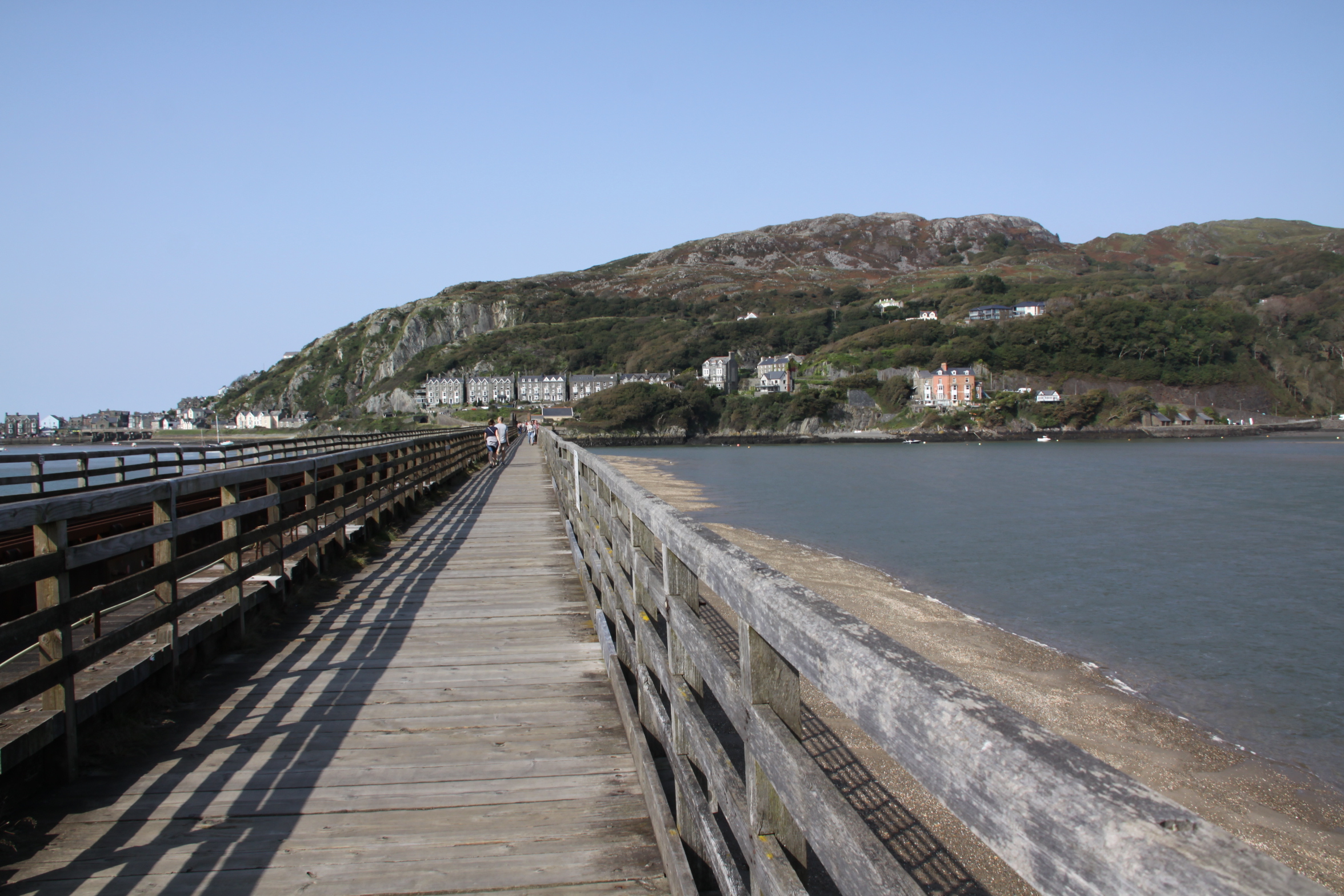
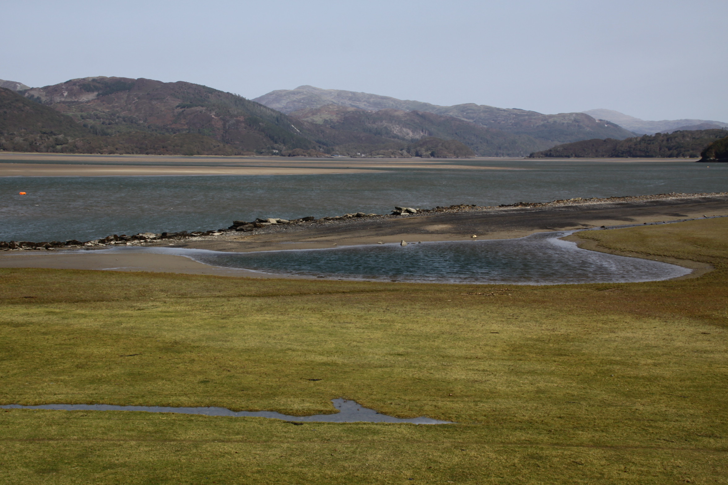
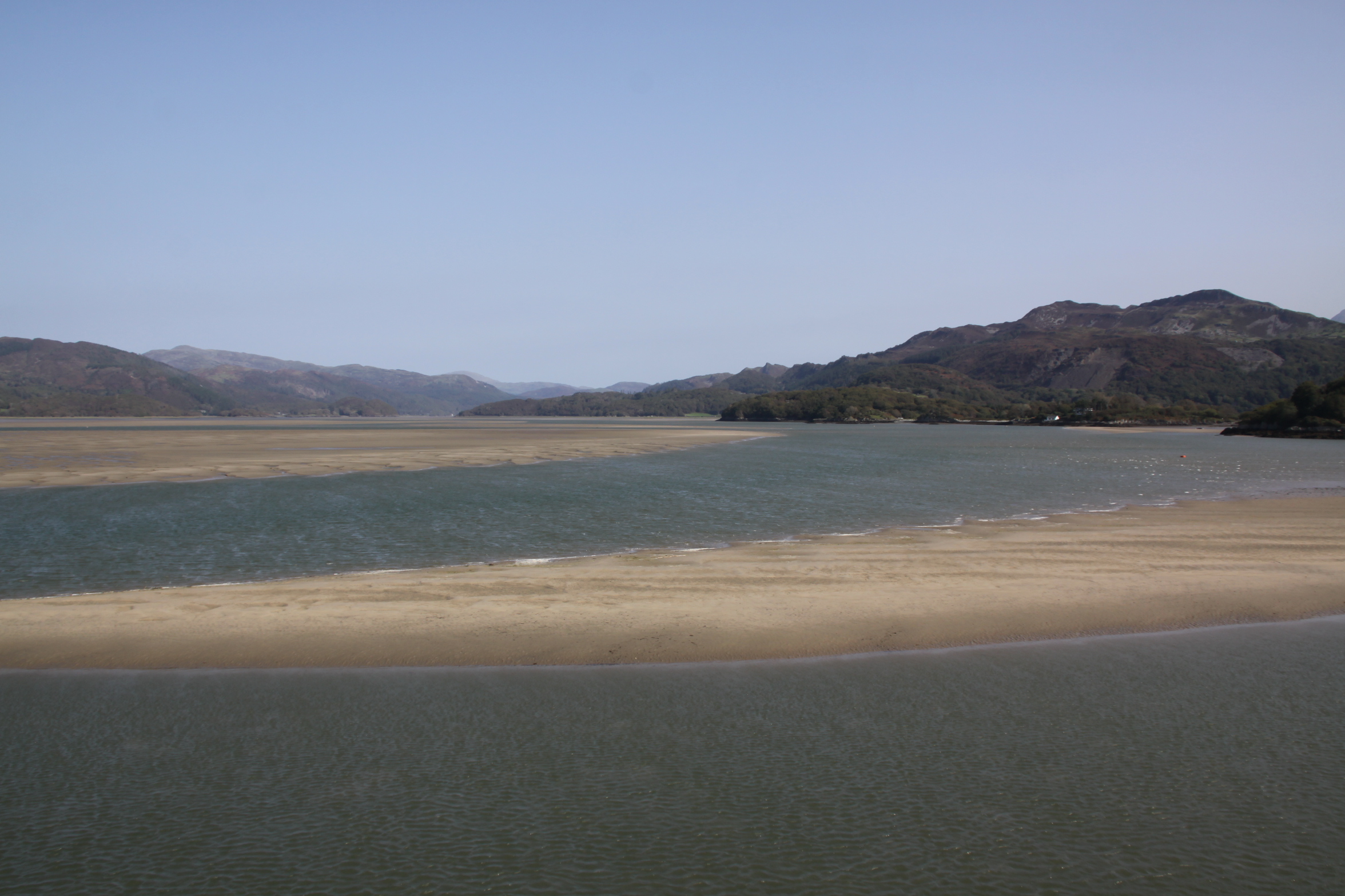
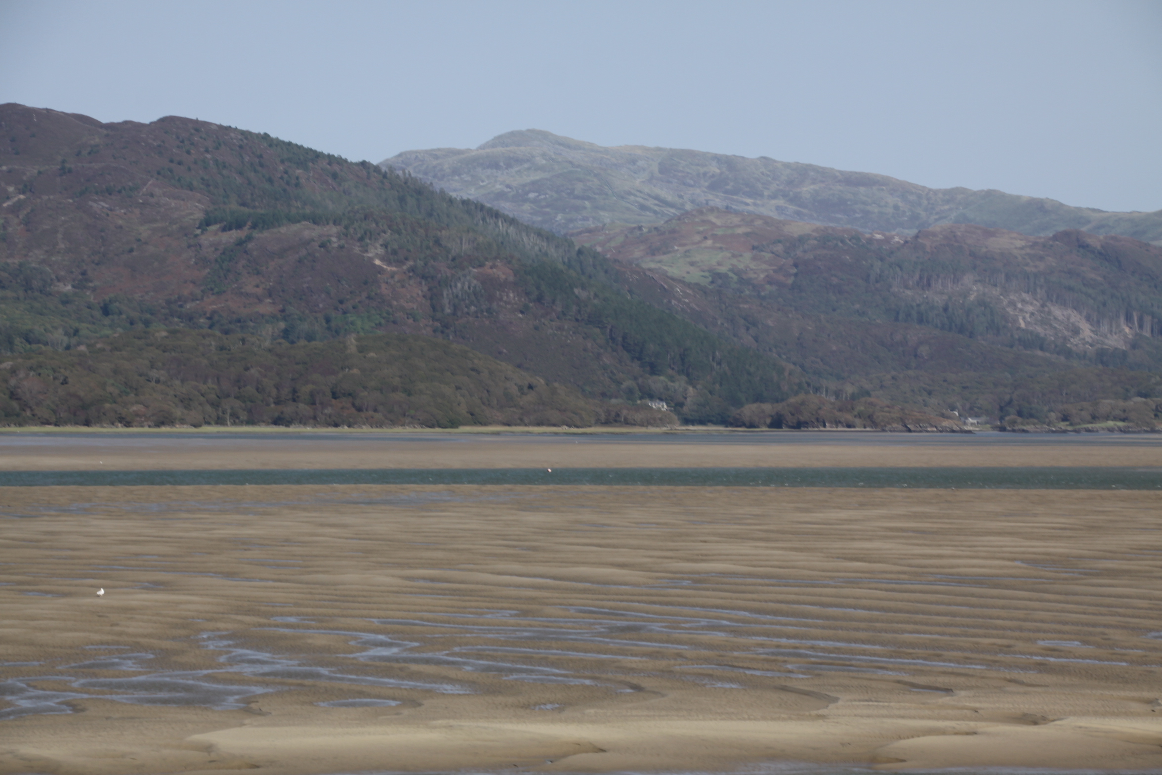
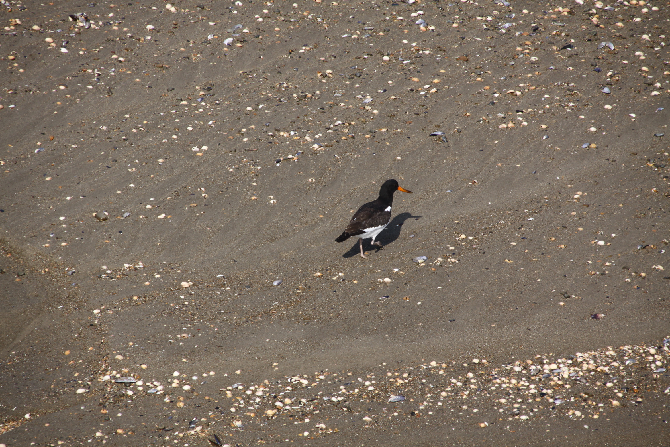
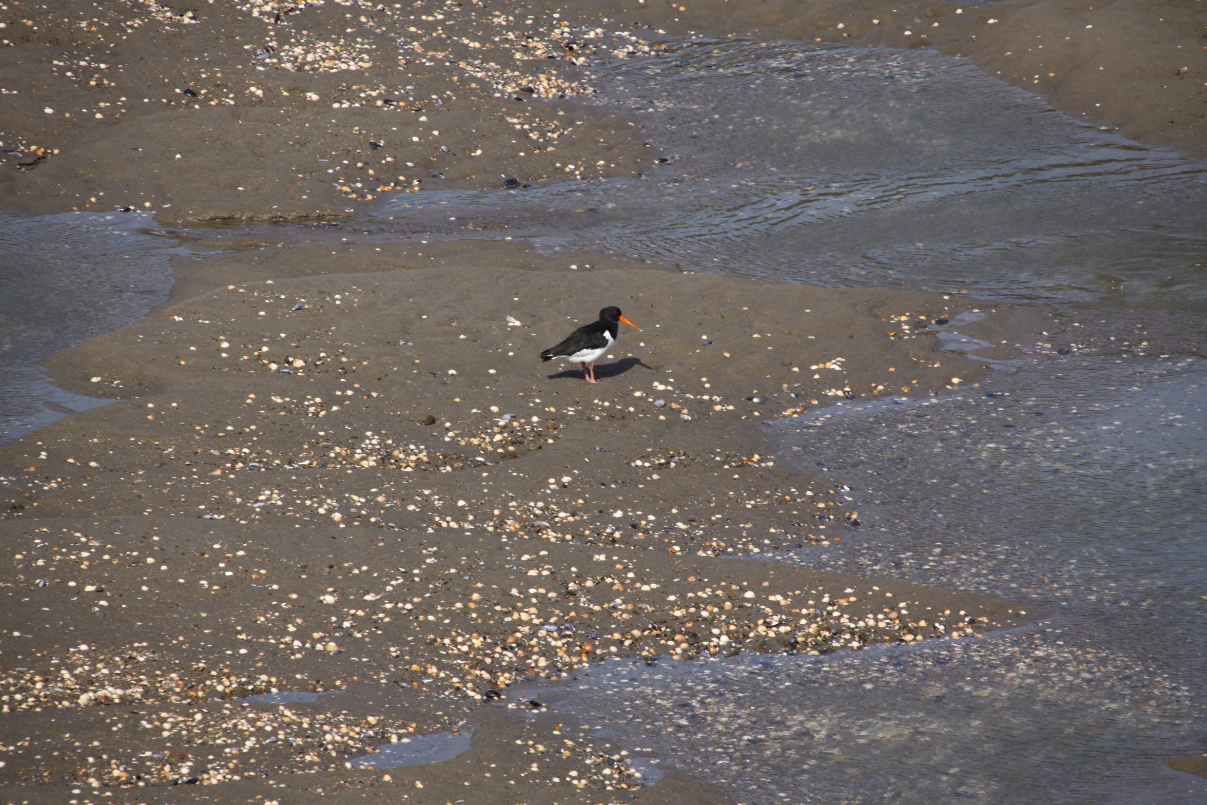
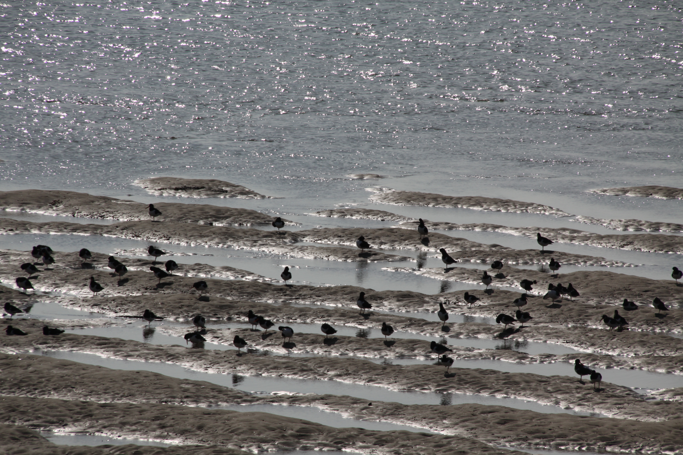
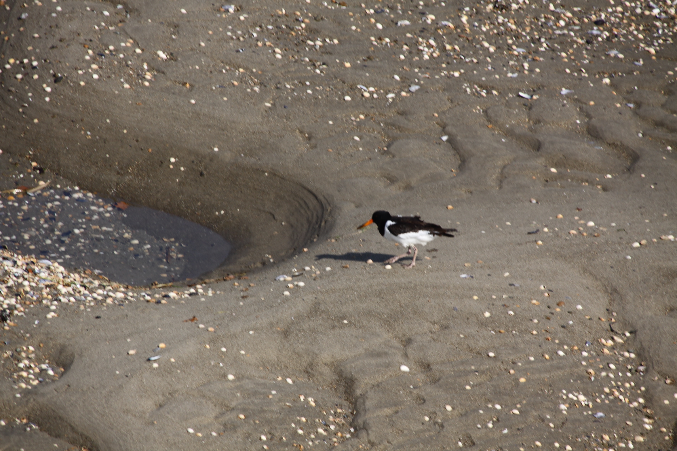
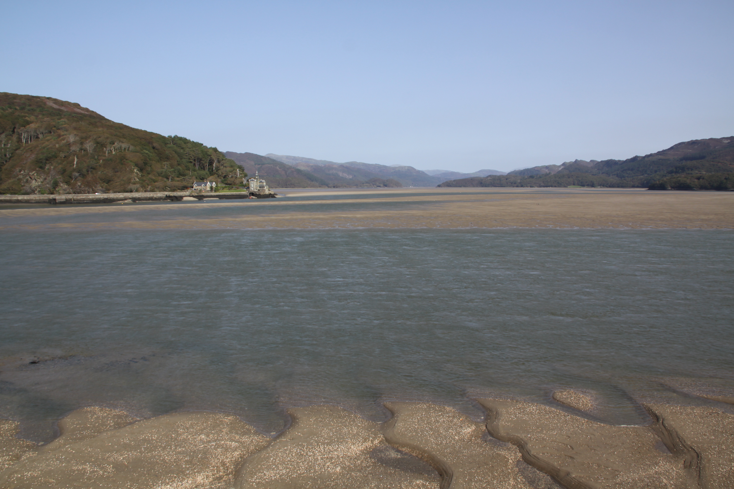
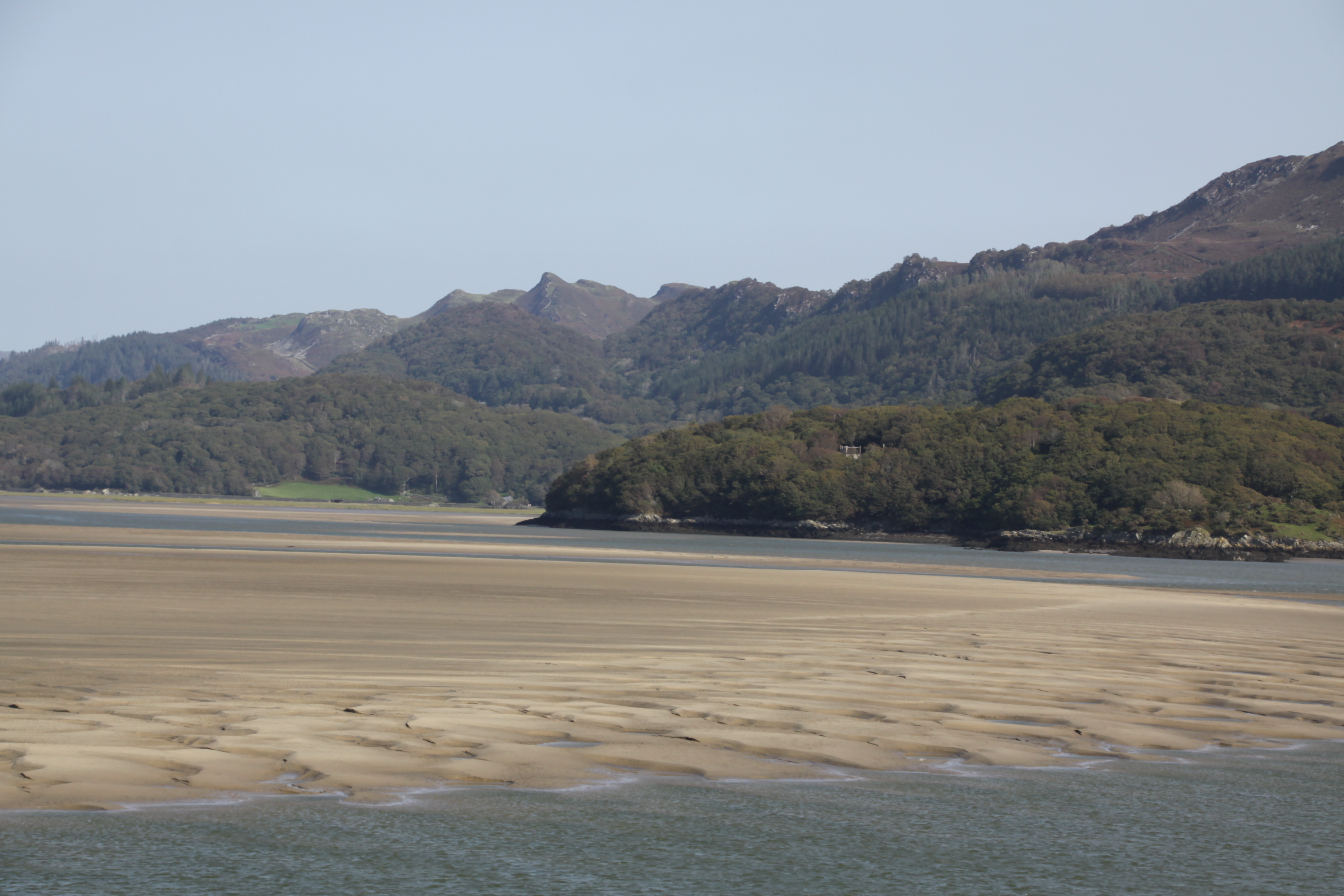
After walking up to Castell y Gaer hillfort in mid September, I drove to Morfa Mawddach railway station, a short drive away, and parked up.  This is a favourite route for cyclists of all sorts.  Some go there to do some serious peddling around the Mawddach on a marked out on the Mawddach Trail (following the route of the disused “Dolgelley Branch” of the Aberystwyth and Welsh Coast Railway line, which opened in 1869), others had hired bikes in Barmouth.  It’s the same with walkers – some are there to do the trail, others are just walking the bridge.  Fortunately, it was a very quiet day, at least on the bridge itself.  The views on a sunny day are great, and when the wind drops, the high-pitched sound of the oystercatchers is lovely.

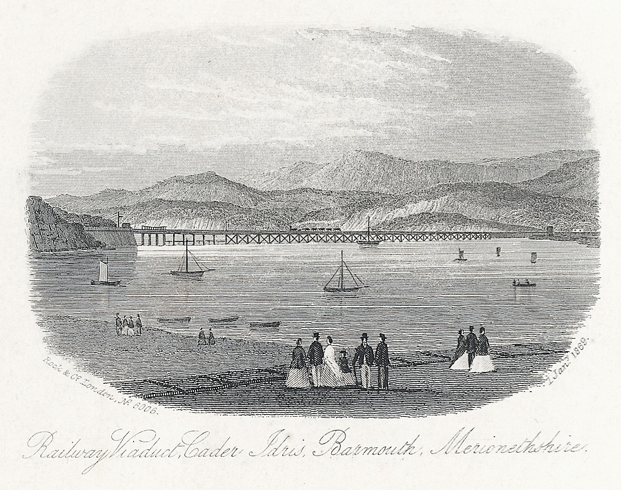
The railway viaduct in c. 1869.  Source: Wikipedia

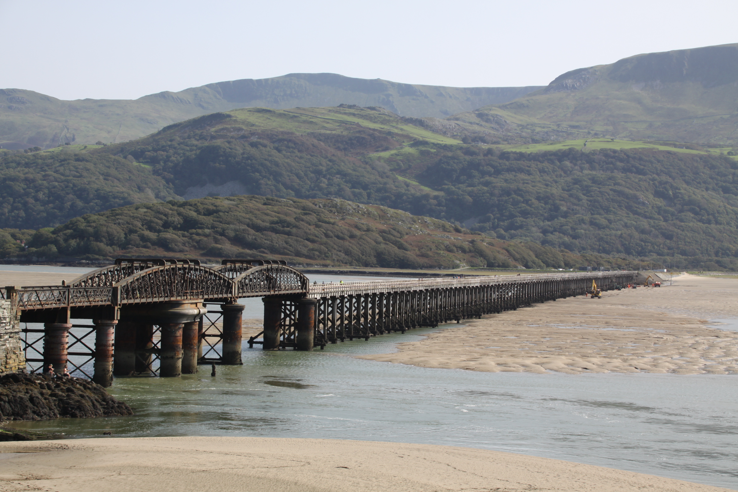
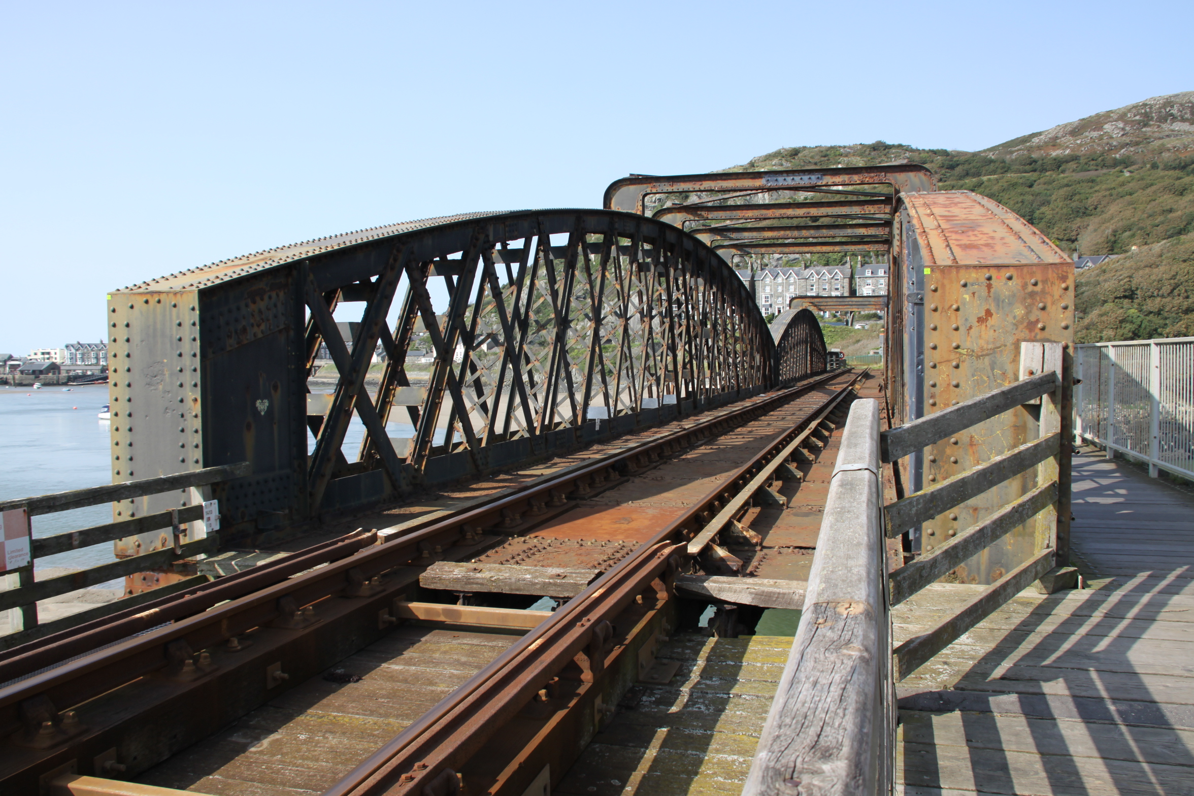
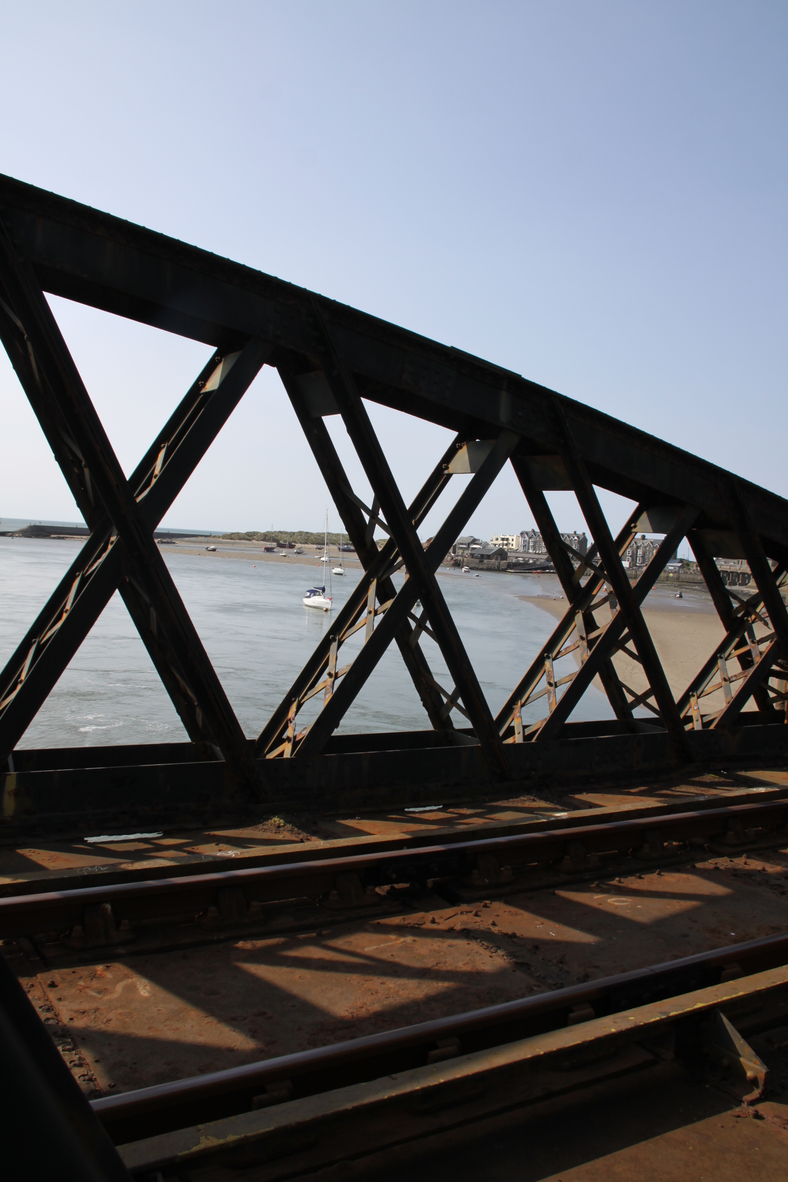
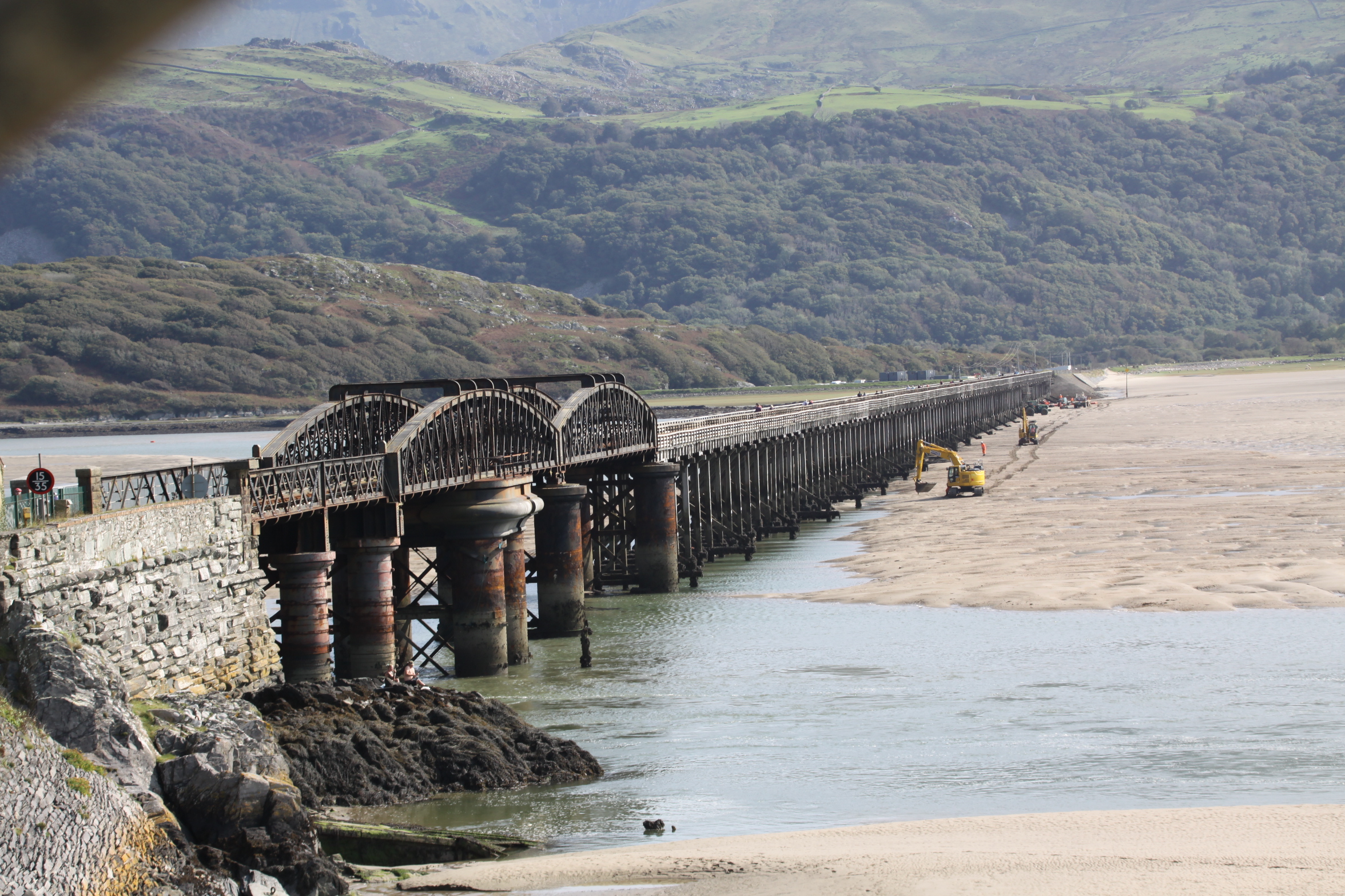
Barmouth Bridge, or viaduct, was built between 1864 and 1867 in  to carry the Aberystwyth and  Welsh Coast Railway, now the Cambrian Railway, across the Mawddach estuary, which it still does.  It cuts off an 18 mile trip around the estuary that would otherwise have had to be taken by the railway between Morfa Mawddach and Barmouth.  Designed by Welsh civil engineer Benjamin Piercy, and English civil engineer and architect Henry Conybearet, it has a span of c.800m, the longest wooden-framed viaduct in Britain.  It was grade II listed in 1988.

Although most have been replaced long ago, timber pile viaducts of the Barmouth bridge type were once common on the Welsh coastal railways.  Conybeare’s decision to choose timber as the main construction material was probably driven by much the same concern to save costs, rather than employing iron,.  Baltic timber could be brought to the site very cheaply by sea, and was a fraction of the cost that an iron viaduct would have been.  Although it was well known that Teredo navalis, a boring worm, could do considerable damage to vessels and sub-surface wooden structures, it was thought not to inhabit the Mawddach estuary, and may not have done when the viaduct was built.

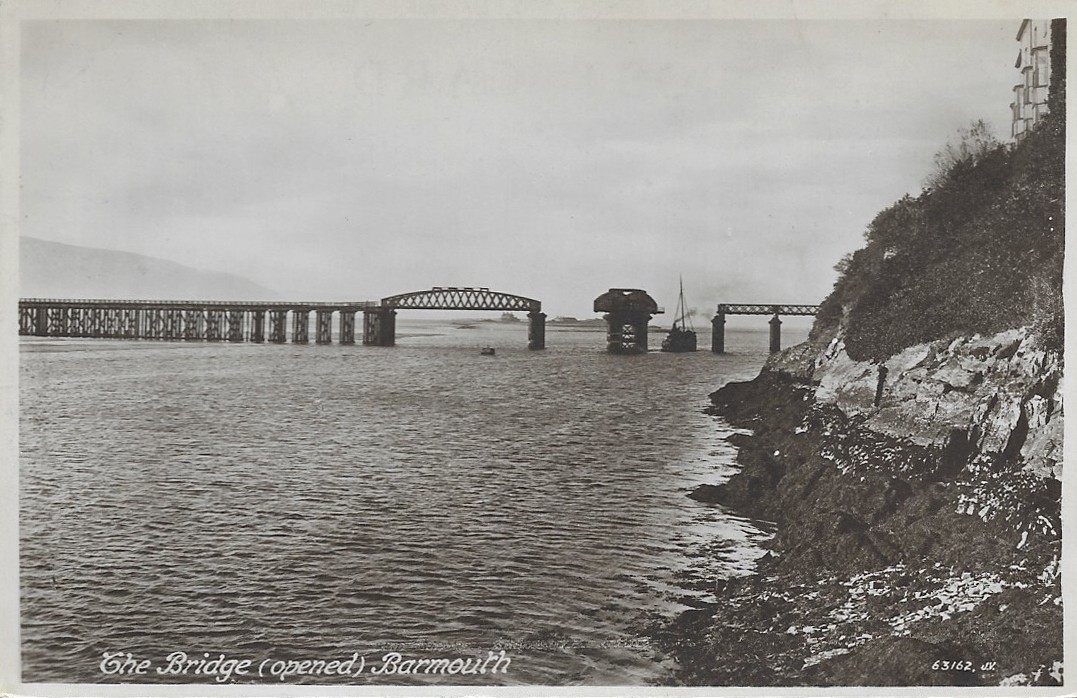
The original design included a rolling drawbridge section that pulled back across the track and  enabled vessels to use the navigation channel into the estuary.  This was replaced by the twin-hogback steel lattice swing bridge in 1899, which, with a span of 41.5m, could swing open to let vessels pass, shown on a vintage postcard to the right.  The swing span was operated in March 1984 and April 1987, but permanent rails indicate that it is unlikely to be opened in the future.

After a number of repairs and renovations, the wooden elements supporting the span are composed of 113 timber pile trestles 5.5 metres apart, which are now encased in concrete sleeves reinforced by glass-fibre.

The viaduct has had quite an exciting life, with a number of challenges to its longevity.  It caught fire in 1892, and it was only thanks to a local boy, who raised the alert, that the fire was swiftly extinguished.  It had a lucky escape in 1946 when a live mine came in on the tide and touched one of the wooden pillars, but fortunately failed to detonate. In 1980, considerable dismay was caused by the discovery that Teredo navalis had eaten into 69 of the supporting pillars.  The bridge had to be closed, and restoration work was carried out over a six month period, during which a rail replacement service was run by the Cambrian Line between Barmouth and Tywyn.  In August 2015, there were real fears that the footbridge would be closed as part of a cost-saving exercise announced by Gwynedd Council.  The bridge had been a toll bridge, with a couple hired to collect small sums from users of the walkway, but with 90,000 visitors a year, these sums added up very nicely and contributed towards £38,000 that Gwynedd Council paid to Network Rail to keep the walkway open.   An online petition was immediately organized by a local resident, collecting over 20,600 names in support of keeping the bridge open.  A £1.00 honesty box system was implemented, but even on my one walk to Barmouth and back, it was amazing how many people didn’t contribute anything.  In October 2016 a fire broke out and the bridge had to be closed again, but only for a fortnight, with a rail replacement service also running between Barmouth and Tywyn.

On its 150th anniversary a celebration was held, and a special train was run from Shrewsbury to Pwllheli, pulling Riviera Trains Mark 1 carriages.  In March 2020 it was announced that the bridge was to receive a £25 million revamp from Network Rail to replace a large number of the timber and metal elements and install a new track along the entire span.

Sources

Barmouth Railway Viaduct. Coflein.  https://coflein.gov.uk/en/site/34918/details/barmouth-railway-viaductbarmouth-bridge-cambrian-coast-line

Barmouth Viaduct. Engineering Timelines
https://web.archive.org/web/20141015015046/http://www.engineering-timelines.com/scripts/engineeringItem.asp?id=1340

Closing Barmouth Bridge will have ‘big effect’ on economy warns charity.  North Wales Live.  20th August 2015
https://www.dailypost.co.uk/news/north-wales-news/closing-barmouth-bridge-big-effect-9841952

20,000-name petition to keep Barmouth Bridge open to all. 21st August 2015.  BBC.
https://www.bbc.co.uk/news/uk-wales-north-west-wales-34010645

Fire shuts Barmouth Bridge until next week.  North Wales Live. 4th October 2016
https://www.dailypost.co.uk/news/north-wales-news/fire-shuts-barmouth-bridge-until-11978355

150th Anniversary of Barmouth Bridge Celebrated with Special Train Service.  Forwarder Magazine. 10th October 2017
https://forwardermagazine.com/150th-anniversary-of-barmouth-bridge-celebrated-with-special-train-service/

Barmouth Bridge £20m plan on its 150th anniversary.  BBC News. 10 October 2017
https://www.bbc.co.uk/news/uk-wales-north-west-wales-41568248

Barmouth Viaduct to get £25m revamp. BBC News.  26 May 2020
https://www.bbc.co.uk/news/uk-wales-52807338

The changing appearance of the Trefeddian Hotel in postcards

The Trefeddian as it was built on the left, and my photograph of it today (28th July 2020) taken from roughly the same angle but from a lower level

You can click on any of the images to enlarge them to get a better look at the details of the building.

The Trefeddian Hotel is one of the major local landmarks, a palatial white immensity overlooking the golf course, sand dunes and beach, recipient of the AA Hotel of the Year Award for Wales 2018/19.  I don’t know anything about the history of the Trefeddian Hotel, but images of the hotel in postcards provide a fascinating record of architectural changes to the building’s exterior features.  It would be great to know the background to these changes and to find out if the interior evolved at a similar rate to the exterior.  All of the images can be clicked on to get a better view of the details.

I have to admit to being slightly in love with the original vision, above, left and below, with its wonderful square chateau-like towers and its mock-Tudor half-timbered exterior.  Or was it inspired by the Alsace as the decorative tiling on the roof may imply?  Whatever the inspiration, it is a bizarre mish-mash of ideas.  Although it breaks all the rules and is anything but elegant, I think that it is delightful, a truly riotous expression of enthusiasm for a very personal conceptualization.  Whoever designed it, it looks as though they were having a great time.  I do wish I could have seen it.  The only piece of history that I’ve picked up is that the hotel has been in the hands of the same family for a century, so it dates at least to the 1920s if not before.  Note the single-storey building to its right/the south, which remains today.

The postcards below show the extension that was added to the north (left, in these postcards).  The second of the two has a postmark of 1934, which indicates that the extension predated that year.  There was no attempt to integrate it stylistically with the original, and it looks very peculiar.  A single storey building to the north, on the far left of this postcard is retained today.

In the first of the two cards, the railway crossing on to the golf course is accompanied by a small building that looks rather like a toll house.  This was the crossing-keeper’s house, and was still standing at least in July 1965 when it was photographed by C.C. Green for his book The Coast Lines of the Cambrian Railways vol.2.  Today the crossing remains, but the house has vanished.  I’m surprised that the crossing ever needed a keeper, because the traffic crossing the railway must have been minimal, and mainly on foot.

In the two postcards below, the half-timbered effect seems to have been removed, and may have been in the image above as well.  It would make sense that it was taken away at the time that the new wing was added to lessen the contrast between the two.

The following photograph gives a good view of the elaborate porch into the old wing and shows the complex of single and two-storey buildings to the north of the new wing, at the left side of the postcard. The enclosed garden at the rear of the building appears to have a small greenhouse as well as other structures, and looks as though it is laid down, at least partly, to rows of vegetables.

The next architectural reinvention of the building retains the new wing and removes all the original external features including the towers, the original gable and any remaining half-timbering.  Was it a complete rebuild on more or less the same footprint, or just a change to the external features?  I am guessing from the angled corner at the south end where the south tower once stood, visible in the second of the two photographs, that it was a re-invention rather than a complete rebuild.  The aerial view in the second postcard shows the outbuildings and an intriguing view of the garden, all providing a good idea of the scale of the operation.  The first of the enclosed gardens at the rear of the hotel looks as though it was turned over to vegetables. I can’t work out what the other two enclosed gardens contained.

The postcards have postmarks dated 1972 and 1979 respectively, so the conversion was probably done in the 1960s and looks like it.  The northern extension to the left has been retained, but the towers and the mock half-timber have gone and the replacement facade has about as much personality as a cereal box.  The colour change from yellow to white by the end of the 70s was a good move.  The single storey building at the right that I menitoned at the start of the post is visible in the second photograph, now connected to the main building by a corridor with windows.

Today the Trefeddian has retained its gabled north wing, but its box-like southern section has again been reinvented, with a new gable, decorative metalwork and balconies.  Two extensions to north and south have been added, flanking the two main wings, and there are dormer windows in the roof.  The building is still asymmetrical, but it has a much more aesthetically appealing appearance than its previous incarnation.  All the ancillary annexes to north and south of the main hotel building have been retained.

Detail of the top of the southern extension

Compare with the third and fourth photographs from top, where the same railway crossing is shown with a small building, the crossing keeper’s house, to the right of the gates.  As mentioned above, it was still standing in 1965 and looked as though it was in fairly good condition.  It’s a shame that it vanished at some point after that date.


Vintage postcard of fishing-net racks on the beach, postmarked 1917

This postcard was purchased with the job lot that started the vintage postcard series, but for some reason it did not get published with the rest, and I found it whilst putting the entire collection away for safe keeping.  It is interesting, capturing echoes of the small-scale fishing industry.  The postmark has a date of 1917, which means that the photograph was taken before that time.  It shows the lovely four-terrace white building Cliffside that still stands, beautifully maintained.  This side of it, nearest to where the photographer stood, is a low building with a tall chimney at the back.  Does anyone know what the building with the chimney was for?  I’ve been through Hugh M. Lewis books, but I cannot find a mention of anything that would explain the chimney in that location.

All of the buildings adjoining Cliffside are still in situ, but the chimney has gone.   The dominating feature of the photograph is the rickety looking arrangement of poles that run along the beach, for the drying of fishing nets.   There is also a really rather nice little open-top carriage on the road, minus horse.

Above is the same sort of angle today.  The fishing net frames were built where the concrete platform now stands.  The concrete monster puzzled the life out of me for years, but I was told recently that Aberdovey used to have extensive mussel beds, and this platform was used for processing them.  Indeed, it lies next to the foundations of an earlier platform.  It fell out of use when the mussel beds shifted elsewhere.  I do wish that someone would knock it down, as it’s a real eyesore!

In the image below I have superimposed the photograph over the postcard and reduced the opacity of the photograph so that if you look very hard (and it does make your eyes go a bit funny), you can see both the fishing net frames and the mussel sorting platform.   The bus stop has changed the line of the wall, but the slipway is still in situ and the houses have changed only very little.

Not many postcards include a sender address, but this one does, and there’s a neat little cross written on the left of the postcard to show where it is located:  C/O Mrs Richards, Aberdovey Cottage, Bath Place, Aberdovey, Wales.  I think that this is probably now 3-4 Bath Place, known as Dovey Cottage (just east of the Literary Institute).

The postcard was sent without a stamp, and there is a pencil-written note saying “Unpaid.”  Presumably the Ashton Under Lyne recipient, Miss Bishop, had to pay an excess fee.

The card, number 42883, was in the Sepiatone series, produced by Photocrom Co.Ltd.  of London and Tunbridge Wells.

Aberdovey Beach with elegant fashions and tall masts, c.1900

A vintage postcard in the Valentine series.  I go and have a look at eBay and Etsy every couple of months to see if there are any new and interesting vintage postcards available.  This was the only one that has appealed to me since I finished the vintage postcard series in mid March.  The reverse of the postcard was entirely unmarked, so I have no official dating information but the smart women’s outfits of long skirts and well-fitted blouses, suggest the the turn of the 20th Century.  The postcard speaks for itself.  You can click on it to see a bigger version.


Some final comments on vintage postcards (#30)

Sent in 1977, produced by Dennis Productions, which only closed in 2000. I absolutely love the cars parked along Sea View Terrace, all looking as though they belong in a museum of the 70s. I think that my Mum had the blue Austin 1100 before we left the UK in 1972.  The card was posted from Llandysul in Ceredigion, where the family of four who were on holiday in Aberdovey went on Sundays to Cross Inn for Sunday worship at the Holy Trinity church where, the letter says, there were visitors to the church from Stowbridge, Birmingham, Broadway, Leicester and Tonypandy.  It was sent to an address in Bicester

If you are coming to the postcard series late and want to go back and see what other postcards have been featured, I’ve provided an index of the entire series on the Heritage page, in chronological order (by approximate date of the postcard itself).  Alternatively you can click on the “Postcard” category in the right hand margin to see all the postcards in the series, in the order in which they were published, excluding all other posts: https://aberdoveylondoner.com/category/postcard/.

I knew absolutely nothing about vintage postcards when I bought a job lot on eBay.  The pictures are completely compelling in their own right, but turn the postcard over and, when they have been used, there is a wealth of information about when the postcard was manufactured and sent, and what sort of people were sending them. A note to self has been that it is by far more useful to buy used postcards rather than pristine unsent ones, because the stamps, postmarks, addresses and even the messages contain useful information.  The histories of the postcard companies are also fascinating.  I had no idea that the postcard was such an important source of commercial income, and was clueless how such companies worked.   Postcards are only a partial record of architectural, economic and social history, but they contribute a surprising amount.  Multiple personal, social and economic histories are tied up in these microscopic snapshots of life.  Of course, as insights into the past of Aberdovey and the surrounding area they are quite simply terrific.

Reading the Hugh M. Lewis books and booklets it is clear that the character of the village has shifted dramatically over the centuries from a rural fishing village with a single water pump to a shipbuilding hub, which became a local outpost of the industrial revolution.  Religious institutions appeared like mushrooms.  An 18th Century turnpike was followed in the 19th Century by a railway connecting north Wales, mid Wales and England.  A tourist industry was established in the 19th Century that continues to thrive today. Gas lighting was installed and then replaced with electric lighting.  Land, foot and horse were first supplemented by bicycle.  The first cars began to appear in the early 20th Century, and were clearly a real novelty.  Although the building of sailing vessels ceased after the 1880s in Aberdovey and sailing ships were the most common sight at the Aberdovey jetty well into the 20th Century, steam ships visited the port regularly, becoming part of the local economic routine.  During the war Aberdovey’s industrial importance decayed, and the tourist industry became increasingly important to the local economy.  The wharf and jetty were rebuilt to reflect this change in the 1960s, a new car park was built in 1970, new houses and community structures have modified the landscape of the village, particularly on the hill above Copper Hill Street, and continue to do so.

In spite of all these changes, what amazes me is how little the core of Aberdovey has changed in its essential architectural character over the last century.  As Aberdovey resident Helen Williams pointed out, there’s not much in the way of expansion that can happen along the seafront, due to its position between the sea and the cliff, which prevents any serious expansion even in the width of the roads.  Gaps between buildings have been filled, but the original buildings are so solidly crafted that replacements have been rarely necessary, and apart from dormer windows that extend the usability of buildings upwards, there’s not much expansion along the seafront.  Instead, newer buildings worked their way uphill, heading up and beyond Copper Hill Street, Gwelfor Road and Balkan Hill, as well as along the hillside overlooking the golf course.  It is remarkable how much of the 19th Century village has been retained intact.

There are some lovely modern photo postcards for sale in the village, by Robin Goodland, Jeremy Moore, Glyn Davies and others. The one here is a bit different, sold during the summer at the Information Centre on the wharf, painted by Dave Thompson (www.davethompsonillustration.com) and produced by Star Editions (www.stareditions.com). It is a rather rather different take on Aberdovey than the photograph postcards, with a 1950s retro travel poster feel to it. In the foreground is the ‘Dai’s Shed’ fishing bat.

Perhaps the most conspicuous difference between past and present in Aberdovey, not visible in the postcards, is cultural.  The Welsh language is still heard in shops, restaurants, pubs and at the Neuadd Dyfi, but since the 1950s there has been an ongoing influx of English people who have holiday homes or settle here permanently.  Beyond sunbathing and watersports, and in so far as any village can be, it is a really rather cosmopolitan place.  As well as an excellent butcher, a post office, a pharmacy, two convenience stores, a dry cleaner, three pubs, numerous cafes, restaurants, ice cream parlours, hotels, holiday lets and b&bs and a number of places of worship, there are more unexpected places to visit.  These include two art galleries, a community hall with a theatre, fashion shops, two hair-dressers, a yacht club, a bowling club, tennis courts, the Outward Bound centre, a Snowdonia National Park information centre and of course the Pen Y Bryn shelter.   There’s a lot going on in such a small place!

Printed picture postcards were first established in the 1870s but became very popular in the 1890s across Europe and America.  In 1902 the current format was ratified by the Post Office, with a picture on one side, and the reverse divided into two, half for the message and half for the address and the stamp.

Using postcards as chronological markers is by no means straight forward.  Photography had become increasingly popular, and photographers had been building up sizeable filing systems that were used in successive decades for postcards, meaning that an image and its incorporation into a postcard might be many years apart from one another.  Postcards might be sold for a decade or more after they were first printed, so this too can add ambiguity to the date of the image.  A postal mark might have a solid date, which tells us when the postcard was sent, but the image itself might be years or even decades old.  One postcard in this series, showing the school on the slopes of Pen-Y-Bryn, had a 1909 postmark, but the company that produced the card had gone out of business in 1904.  In this particular case, the main building in the photograph was built in 1894, which gives a time range for when the photograph was taken, but in other examples where there are few diagnostic features, such as landscape photographs and modern photographs of the village, there may be little to help narrow down a date range.  For example, in the set of five at the top of this post, the penultimate photograph also shows the school at Pen-Y-Bryn, but seen in isolation from its more diagnostic companions, it would be difficult to judge when, between the common use of colour photographs for postcards in the 1950s and the 1977 postmark, that photograph was taken.  The postal mark just provides a terminus ante quem, an indication of a date before which the card must have been manufactured.  That can be a useful starting place.

I thought that fashion would be a helpful pointer, but that theory was partially scuppered by two factors.  First is that people are absent from a lot of postcards, and second is that Dai Williams tells me that to make old postcards look more current, people wearing contemporary fashions were dark-room pasted into older photographs.  He showed me one extraordinary example where two almost identical postcards had a group of people walking down the road, but in one the adults were holding the hands of two children and in the second the children had been removed.  Although I have confidence that postcard producer Gwilym Williams, who appears to have been a local photographer, was capturing life just as it was, photographs by the big national postcard producers may have been seriously tampered with.  Vintage cars might have been more useful for dating images, if I knew anything about them.

Glyn and Claire Davies

Another different take on the standard photo postcard is the collection produced by Glyn and Claire Davies based on their original paintings and sold in their shop, The Gallery, in Aberdovey (http://www.galleryaberdyfi.co.uk/cms/). Delicately executed watercolours provide evocative views of Aberdovey, some showing day to day bustle, some showing a more peaceful scenes in and around the village.  Above are two scenes on postcards, on the left by Glyn Davies and on the right by Claire Davies.  I have sent more of the postcards in this series than any others.

This card from “Dai’s Shed,” selling superb locally caught seafood from Easter until Autumn, is both a souvenir postcard and an advert (www.daisshed.co.uk). Dai’s fishing boat is shown in the photo at low tide against a backdrop of the hills over the estuary.

If the postmark is not legible, the stamp can give a time range, and there are a couple of websites that specialize in this.  I had assumed that the collecting of postcards, deltiology, would have a massive online presence, but resources turn out to be very fragmented and incomplete.  There are a number of websites that specialize in providing information about different manufacturers to help collectors find out the essentials about general background and specific postcards or postcard series, most importantly dates.  Unfortunately, some postcards are not included in those databases and several manufacturers are barely mentioned online.  The two best resources that I found are the MetroPostcards website, which is a mine of information about postcard manufacturers and printing techniques, and the enormous and searchable Frith’s database, which is as invaluable collection of as many postcards in the Frith’s catalogue as they have been able to pull together.

My brief flirtation with the picture postcard is over, unless I see anything particularly unusual, but I have very much enjoyed finding out about aspects of Aberdovey that I didn’t know before, and experiencing a real sense of continuity between past and present.

My sincer thanks to Dai and Helen Williams for introducing me to vintage postcards, for talking to me about Aberdovey’s history and for allowing me leaf through their collection.  Also for that fabulous pre-Christmas chocolate biscuit from Fortnum’s!

Many, many thanks too to Sierd Jan Tuinstra for taking the time to have an independent look at the postcards and other posts, using his expertise from  investigations into the Aberdovey section of the Cambrian Railway to clarify some points, expand details, refine dates and provide new information and insights, not just about rail but about all aspects of Aberdovey’s economic infrastructure.  My post on the flour mill will be rewritten shortly with new information, entirely thanks to Sierd Jan.


Vintage Postcards #29 – Church Street

An unusual photograph from Valentine’s and Sons Ltd, in their Sepiatype series.  Three girls look down the road towards the photographer, but otherwise the scene is very peaceful.  The postcard is unused.  It took me a while to work out the viewpoint from which the photograph was taken, because the road has changed quite significantly, but the wall on the right, which is the rear wall of the churchyard, is the give-away.  For those unfamiliar with the geography of Aberdovey, this is the road which, as you enter Chapel Square and face up Copper Hill Street, shoots off to the right, behind the big Wesleyan Methodist chapel.


Vintage Postcards #28: Happy Valentine’s Day!

This lusciously coloured postcard, which I have bought right at the end of my Vintage Postcard phase, is an unexpected treasure.  When eBay presented it to me as a possibility following previous Aberdovey-themed postcard purchases, I thought it was such fun, but I hadn’t realized that it contained a secret surprise –  a fold-out section consisting of twelve miniature black and white photographs on a paper strip, hidden underneath the flap at the base of the rose.

The card was posted in July 1956.  Apparently the stamp fixed to the card was not sufficient, and a “postage due” stamp and mark have been added.  The message is remarkably prosaic, given the romantic theme of the card.

It was produced by James Valentine and Sons, in their “Mail Novelty” range.


Vintage Postcards #27: Aberdovey from the Air

These postcard images speak for themselves.  Both were unsent.  Lovely Sierd Jan Tuinstra, who is an absolute fount of knowledge about Aberdovey, has provided the following information, with my sincere thanks:

As to their date, they were both taken on the same day during the same flight. Probably sometime in the 1920’s . They pop up on eBay every now and then, and I have a slightly different copy of the top card a few years back, which was posted in 1928.  There is a third view from the same flight.

Commercial air photography didn’t exist prior to 1919. But after the war, ex RAF reconnaissance officers started the air photographing business using their hard won knowledge and experience.

I instantly noticed the railway wagons in the three postcards. Two of them can be readily recognized as Great Western wagons, thereby dating the view to after 1923. In every one of the postcards their position and that of the other wagons is exactly the same, meaning that all three views must have been taken on the same day.

Vintage Postcards #26 Cadair Idris

Cadair Idris, the Chair of Idris, the local giant, is a dominant feature of the area.  I’ve walked to the summit a number of times on the Minffordd Path, but that was many years ago and I’ve no idea where those photographs are now.  When spring arrives it will certainly be time to do it again.  The first photograph (Valentine’s AG105), which is unused, superbly captures the solid mass of Cadair Idris, its massive presence.  The sharp outcrop in the foreground is both a great piece of photographic composition and a reminder of the enormous geological forces that lifted up the Welsh hill ranges.  Below it, a well-used track carves a route well into the distance.

Painting of Pen y Gader, the summit of Cadair Idris,  by Thomas Compton 1812-1818 (lithographer Daniel Havell). Source: Wikipedia, via the National Library of Wales

Cadair Idris was a popular destination from at least the late 1700s, when tourists were first attracted to Llyn Cau, the glacial cwym lake.  Llyn Cau has attracted tourists ever since, and it became a popular destination throughout the 19th Century.  Richard Wilson painted Llyn Cau in the late 1700s, and early 19th Century artists continued to produce various interpretations of Cadair Idris, including Edward Pugh (1816), John Skinner Prout (1830), Samuel Jackson (1833) and Sidney Richard Percy (1874).  A painting by Compton is shown here on the left, and some other examples can be seen on the Campaign for National Parks website.  A few brave souls reached the summit, like Thomas Compton who painted it in the early 19th Century.  At 2927 feet the summit and highest point of of Cadair Idris is called Pen Y Caer.

What is remarkable about the summit postcard to the right is that the women reached the summit in those long skirts!  What a nightmare, even if they took one of the easier routes.   All were sensibly armed with sticks, but their footwear is hidden from sight.  They look as though they are heading out for a shoot.  That photograph (Valentine’s 32025), was postmarked1918.  The message on the back, sent to Derby, says that the writer hopes to climb it one night!  The mind boggles, quite frankly.

Vintage Postcards #24: The 1894 school on Pen Y Bryn

The school on Pen Y Bryn prior to the posting date of 1909

The former school in around 1977, minus many original features

I was puzzled when I saw this building in other photographs of the village, because it looked to me like a Nonconformist chapel, but I had no recollection of seeing it.  Local residents Dai and Helen Williams told me that it was once a school and has now been converted to apartments.  I vaguely recalled that in my general reading about chapels, there had been a small chapel on the side of Pen Y Bryn, the small hill with the folly on top, and that this was converted to or replaced by a school.

Aberdovey in the late 1880s/early 1890s, from the book Round The Coast

Sure enough, Hugh M. Lewis (who attended the school) says that the school replaced a small Congregational Chapel called Capel Bach (Low Chapel) that had been built on the site in 1845. In the photograph to the right it is shown overlooking the sea at the very far right of the scene.  The photograph, from the book Round the Coast, is described on an earlier post.  The chapel was abandoned when the Congregationalists built a bigger chapel on the seafront, on Glandyfi Terrace, opposite today’s Information Centre, where it still stands (you can read about the Congregationalist buildings in Aberdovey on an earlier post).

Lewis says that the old chapel was knocked down in order to erect a purpose-built school that cost £600.00 and opened in January 1894 with 102 pupils.  The building is rendered today, but was presumably built of local stone, and has brick features around the windows.  The bell at the front of the school was used to call children to attend, in the same way that church bells call congregations to worship.  Playgrounds were segregated, one for girls and one for boys.  This was not the first school in the village, and I’ll talk about education, which was influenced by religious interests, on a future post.  I love the washing hanging on the line in the foreground – not a usual feature of picture postcards these day, unless you happen to be in Venice.

Other buildings of note are also shown in the photograph, all covered on earlier posts.  At the far left is the Wesleyan Methodist Chapel, and in the middle of the photograph, now Dovey Marine, the roof of Calvinistic Methodist Chapel in the middle of Chapel Square is just visible.  In the background, the tower of St Peter’s Church is clearly visible, and just beyond and set above it, the Calvinist Tabernacl dominates.

I realized that it had to be somewhere near the footpath from Chapel Square up to Pen-Y-Bryn, and when I walked up there, it turns out that one side sits along the footpath.  The photographs above were taken from the footpath and from Pen-Y-Bryn.

The card is by Sir Evelyn Wrench’s early postcard company (about whom more on an earlier post).  Wrench had been out of business for five years when this postcard was posted in 1909 from Aberdovey to an address in the village of Bawdeswell near East Dereham, Norfolk.  This says a lot about the dangers of using postmarks to date photographs on postcards!

Main Source:

Hugh M. Lewis.  Aberdyfi Portrait of a Village.