Category Archives: Archaeology

New book: Richard Mayou, “The Dyfi Estuary – An Illustrated History”

I am very excited to have taken receipt today of Richard Mayou’s new book “The Dyfi Estuary – An Illustrated History”, just published by The Machynlleth Tabernacle Trust.  I will report more when I have done more than devour the feast of lovely photographs, but for anyone wanting to secure a copy, it is available from the Machynlleth MOMA (Museum of Modern Art) at https://moma.cymru/en/product-category/books/.  There are two versions of the same book, one in English and one in Welsh.  Here’s the preview from the back cover:

The Dyfi estuary looks peaceful and unchanging, but the book tells
a different and dramatic story.  There have been armies, great estates, a centre
of seaborne trade, a great woollen industry, cattle droving and fishing of
salmon and herring and internationally renowned mines and quarries.
Now its post-industrial landscape is a place of
sheep-farming, conservation and tourism.

I’m chuffed to bits that this blog is listed in the further reading section.


A first-time walk from Happy Valley towards the Dysynni

I hadn’t seen my friend Caroline for ages, so it was great to do one of our social distancing walks, and one that was new to me, taking in a tiny prehistoric stone circle.  The track is marked on the OS map as a “byway open to all traffic” and follows the line of the Nany Braich-y-rhiw stream, at a higher level.  The views were as spectacular as they always are when you get on to the higher ground in these parts, into the Dyfi valley at the start of the walk, into Happy Valley, and eventually, ahead into the Dysynni valley.  The track is very deep and carved out of the bedrock in places, just like the Aberdovey estuary’s “Roman Road,” which is actually thought to date to the 1820s.  We drove to the point of departure in separate cars, parking on verges, as it is a long hike to reach the start from Aberdovey, and then a long hike in its own right.  On this occasion it was a there-and-back walk rather than a circular one, but just as good because the views are different in each direction.  It was 19th September and the weather was in our favour.

On the map below I’ve marked the starting point in red, and have put blue dot where another path descends into the valley, more or less opposite the Bearded Lake.  Although we carried on along the main track, you can make a lengthy circular walk if you take the path into Happy Valley, and it would probably be easiest to park in the official Happy Valley car park if you are going to do that (which also serves as the car park for those wanting to walk up to the Bearded Lake).

It’s an easy walk if you have good footwear, with a good track and no very steep gradients.  It should also be avoided in wet weather, or at least go in heavy duty footwear.  It had been very dry for the previous week, but we still ended up having to walk off the path in certain places as it was swamped with mud, and was often marshy either side of the path.  There were several points at which we had to ford fairly wide streams, two of which are marked on the map as fords. It was very windy even on a sunny day, so head gear would be a sensible precaution.  The only cloud on the horizon was that at weekends it is used by trial bikers, travelling at speed, with precious little care for any walkers who might be round the next corner.  Thanks to the noisy engines, you can hear them coming and get out of the way, but I recommend that you avoid walking there at weekends.

The stone circle is a little way along the path, up to the right, just a few seconds to reach it from the footpath.


The walk offers beautiful views over Happy Valley and the hills beyond.

Watch out for the Bearded Lake on the other side of the valley to the left, on this occasion glistening in the sun like a silver mirror.  I’ve written about the legends associated with the lake on an earlier post.

We walked past the footpath down into Happy Valley, which would have formed a circular walk, and headed instead for the views ahead, which offer an unexpected sight of the Dysynni valley.

As it descends towards the Dysynni, the track meets the stream, Nant Braich-y-rhiw.

At this point, descending towards the Dysynni valley, we turned back towards the cars, but if you carry on you reach a single-track B-road that crosses the Talyllyn railway at Rhyd-yr-onen and finishes in Bryncrug.  It was an equally beautiful walk on the return leg.  I suppose it was about an hour and half in each direction, pausing to enjoy the views with a picnic.


A visit to Castell y Gaer hillfort

Aerial view of Castell y Gaer. Source:  People’s Collection Wales via the RCAHMW

This can hardly be termed a walk, because the B-road runs around 15ft from the ramparts on an unenclosed section of open hillside overlooking the sea.  I certainly had a good walk on and around it, but it was not a walk in its own right, and I went elsewhere to stretch my legs properly afterwards.  For those of you hoping that the endless posts about hillforts will eventually come to an end – five down, four to go, plus a summary post 🙂   If you are wondering about the sunshine, this was actually on the 17th September, but I have a bit of a backlog at the moment.

Of all the hillforts in the series so far, this was by far the easiest to access and observe on the ground.

The approach is from the A493 coast road.  As you close on Llywgril from the south, there is a cemetery on the right, just before you reach the village itself, and a tiny, sharp right-hand turn in front of the cemetery.  The hillfort is about 3 minutes up the single-track road (driving slowly).  It is on private land, and there’s no public footpath, there are barriers to entry and the Heneb website states that the owner currently allows access, which is a generous courtesy.  I parked on the verge opposite.  The banks are liberally covered in gorse, but there are plenty of ways into the fort, including the original entrance at the far right as you look at it form the road.  Sheep tracks show that it is regularly visited by the local livestock, and they break through the gorse at a number of locations around the perimeter.

Castell y Gaer site plan. Source: Bowen and Gresham 1967

Castell-y-Gaer is quite different from most of the hillforts described so far.  Well preserved, it overlooks the sea but is not on the peak of the hill.  Although it seems high from below, which it is at just above the 120m OD contour line, it only has that drop on its western side.  It is on a slight knoll, very slightly tipped towards the sea to the northwest, a slope dropping fairly steeply away beneath it, running into pasture below.  The land around it on three sides, however, is fairly level and it is overlooked by higher ground on the same hill.  If it was not for the defenses, would present no difficulty to anyone attempting to enter it.

It measures c.60m by 30-44m and gives a sense of good amount of internal space.  The overall shape is sub-rectangular, and although the internal space tips to the northwest, the interior is far more level than any of the previous hillforts visited in the area, and it would not be surprising to find the foundations of structures within it.  Although not obvious at first glance, it does incorporate natural scarps above steep natural slopes on the west and north, but it is particularly notable for its artificial defenses, particularly its stone-faced banks, reaching 6m wide, and deep ditches, with counterscarping (second bank and ditch) to the southeast.  The stone appears to have been quarried from the ditches, and possibly from the hillfort interior.  Even though it is not at the summit of the hill, it is very exposed, and on an averagely breezy day was very windy.

Ditch on the eastern side

Stone-faced rampart

Stone-faced rampart to the north

Hillfort interior

Wider view of the hillfort interior

Ramparts along the eastern side

Ramparts looking northeast

The defenses have something in common with Craig yr Aderyn, which has similar wide, sloping rock-faced banks, but the entrance is more complex, the interior more open, and the siting completely different.

Plan of Castell y Gaer. Source: Heneb

The entrance is at the northeast corner, facing east.  On the eastern side of the hillfort the northern end of the outer bank overlaps with the southern end of the scarp, forcing the visitor the visitor to walk in facing north, but they are immediately confronted with more earthworks that force them round in a loop to the south, and this gives access to the entrance.  This dog-leg turn would have impeded access if control over entry was required.

The Coflein website says that the interior of the enclosure shows signs of cultivation and that a rectangular enclosure/platform, c.20m square, to the northeast may be connected.  It also records that there are extensive traces of relict fields occur to the west, although it does not comment on dating, although the close association between the fields and the hillfort makes a direct association possible.  The fields are visible on the photograph below,

Aerial view of Castell y Gaer. Source: Coflein (catalogue C821284)

 
The Afon Gwril runs down the narrow, shallow valley to the north, but is not a major water course, and it is unknowable if it was a reliable source of water in the Iron Age.  The OS map marks a well/spring immediately to the north.  Again, it is impossible to know if this was present in the Iron Age.

The views are all about the coastline.  As well as the sea immediately to the west, the coastline is clearly visible all the way to Barmouth and the mouth of the Mawddach estuary to the north.  Immediately to the north, the inland view is over a nearby hillside, now a pattern of drystone walls.  The Lleyn Peninsula was visible in the far north as a blue silhouette.  Behind the fort, rising to the east and southeast, is lightly sloping hillside.  This drops fairly steeply to the southwest of the fort in a line with the hillside beneath the fort itself.   The slope flattens gradually towards the sea, and both the hill and the fields below are grazed today by sheep at all levels and cattle on the lower levels.  To the south, pastures look out to the sea.

View to the west

Looking west from outside the southern bank of the hillfort.

Looking south across the gently sloping pastures to the sea

Looking north across the hillslope pastures towards Barmouth and the hills beyond

View from the hillfort to the east

View of the hillfort from the east

To the north, the hills behind the Mawddach are visible, at least on a sunny day.  To the west there is just sea.

View towards Barmouth, the Mawddach estuary and Dinas Oleu (approximate location marked with a red arrow)

There are no hillforts in sight to the south or east, just the immediate hillside.  The nearest hillfort to the south, also on a hill overlooking the coast but out of line of sight from Castell y Gaer, is Bwlch on Foel Llynfandigaid, which is around 4km away as the crow flies but a range of higher ground stands between them. A perusal of the Ordnance Survey map produced the site of Dinas Oleu, which sits immediately above Barmouth at SH61711578 and turns out to be the remains of an Iron Age hillfort (approachable via a footpath and there are a few details about it on the Coflein website).  The two sites are around 7km apart as the crow flies, and it would require a very clear day or night for any signals to be visible, not always a foregone conclusion in a coastal/estuary location.  The arrow in the above photograph is a guess, based on trying to match up the photograph with the OS map, and should be treated as extremely approximate.  The lack of a line of sight to the sites to the south does not rule out that Castell y Gaer had an important role linking north and south along the coast.

Although I included this as a possible outlier of the Dysynni and Dyfi hillfort group, I suspect that it is probably part of the Mawddach group, although at the moment, not having seen or read about any of the Mawddach hillforts, that’s just a guess.  This does not mean that it would not have been in communication with hillforts to the south, or that it did not have a potentially pivotal role in communication between north and south along the coast, but its main physical orientation to the north, its views to the north and its distinctive architectural features, suggest that it may be part of a slightly different tradition.

Sources:

Bowen, E.G. and Gresham, C.A. 1967.  History of Merioneth, volume 1.  From the earliest times to the Age of the Native Princes.  The Merioneth Historical and Record Society.

Websites:

Coflein
https://coflein.gov.uk/en/site/302716/details/castell-y-gaer

Heneb
http://www.heneb.co.uk/merionethforts/13castellygaer.html


A walk up Craig yr Aderyn (Bird Rock) #2 – the Iron Age hillfort

Looking up at Craig yr Aderyn from the medieval castle Castell y Bere in the Dysynni valley to the west

This walk has been divided into two, partly because I went crazy with the camera and took too many photographs, but also because I had quite a lot to say about the hillfort.  The second post, this one, is about the hillfort and what can be seen from it.  The first one was about the walk itself, how to get to it, where the two different forks take you to, and what views can be seen from parts of the route.

I am currently walking as many of the nine Iron Age hillforts in the local area as I can before winter sets in.  Or at least, I am when it’s not sloshing with rain and there’s no haze or mist to obscure views.  Fortunately there has been some glorious weather recently, after a rather soggy summer.  One of the wonderful things about hillforts is that the views are often terrific, and Craig yr Aderyn is simply the best.  It dominates the Dysynni valley from miles around, catching the light in dramatic ways, but I had never seen it up close.  Approaching it along the lovely road from Llanegryn for the first time, I was somewhat staggered when I rounded a corner and suddenly found it looming over me.  Drifting happily down the road, I had no idea that I had arrived so near to it.

Craig yr Aderyn is a highly visible local landmark in the Dysynni valley (SH643068), and is approached by small B-roads from Bryncrug or Abergynolwyn.  For full details of reaching Craig yr Aderyn and the route up, see my other post, about the walk rather than the hillfort.

A distinctly soggy part of the Dysynni floodplain.

Craig yr Aderyn, which translates as Rock of Birds, or more usually Bird Rock, is a major local landmark, abutting the of the Foel Wyllt hill ridge overlooking the Dysynni valley from the south. The course and character of the river Dysynni have changed over time.  Before the 18th century the estuary reached almost to the foot of Craig yr Aderyn, but the river silted up and is no longer navigable.  The land has been drained since the 1700s to create better quality land for farming, although standing looking down from the summit, it is quite clear that the land to the west still has some very boggy patches marked by beds of spiny rush (Juncus acutus), which is found in all freshwater flats, bogs and marshes herabouts.  It is not known what it looked like in prehistory, but the presence of a glacial valley with Cadair Idris at its back indicates that a melt-water river certainly passed Craig yr Aderyn on its way to the sea, and this will have established a valley route into which later hill drainage descended.  It would be useful to know what it was like during the Iron Age.

According to a Snowdonia Active publication (2018) the crag is made of rhyolitic tuff, rock formed from volcanic ash laid down after a major eruption through the Bala fault line c.800 million years ago.  It is separated from the hillside behind it by a saddle or col 100ft below the peak.  Its distinctive shape is immediately recognizable from miles around, almost always visible in the Dysynni area.  Its gaze always seems to follow you around.  Its summit is at 230m OD (700ft).  The hillfort is lower, at about 180 OD, 10m higher than the 170m OD Tal y Garreg, the next highest hillfort in the area.  Although the north face of the crag is very steep, the home of nesting birds and a route for rock climbers, there is a much more gradual approach to the rear.

Craig yr Aderyn is one of a small number of hillforts that were built near the Dysynni valley.  I’ve already posted about the two small hillforts at the mouth of the Dysynni, Tal y Garreg and Llechlwyd on Mynydd Garreg above Tonfanau, some 8km away to the west of Craig yr Aderyn.  Nearer to Craig yr Aderyn is Castell Mawr, c.5.5km to the west as the crow flies, about which I have also posted.  See the map at the end of the post.

At Craig yr Aderyn all of the hillfort construction work took place on a natural shelf beneath the rocky peak, which the hillfort incorporates.  Its man-made defenses consist of two phases of earthen and stone banks.  Today the fort’s ramparts are covered in grass, but most of them are still clearly visible, although it took me some time to trace them against the site plan on the ground.  Thankfully they are covered mainly with short turf rather than bracken or long grass, which makes the job much easier than at places like Castell Mawr.  The ramparts are impressive, and served to cut off the only realistic line of human access to the hillfort, as the other side is a sheer drop into the valley beyond from the summit of Craig yr Aderyn, some 270m below.  The combination of natural and stone-faced sloping man-made defenses makes this one of the most ostentations structures of this type in the area.  The site is thought to have been built in two phases.

This site plan shows how the ramparts are built into the rocks of the crag behind a natural shelf, using the existing topography as part of the design of the hillfort. The earlier phase is on the left, divided by a bank and ditch with a slightly inturned entrance. The second phase is on the right with a much deeper inturned entrance that forms a short passageway.  Source:  Bowen and Gresham 1967

The most obvious features of the first phase are the two sets of ditches and eroded banks, which once formed ramparts that were stone-faced.  This is sometimes called the upper fort.  There was an in-turned entrance at the southeast side through a gap in the rampart.  The enclosed area encloses approximately 0.8 hectares (just under 2 acres), and measures roughly 100 by 55m (c.330 x 180ft).  the shape formed against the line of the natural topography is a triangle.

Detail of the second phase entrance, with the inturned entrance forming something of a corridor into the second phase enclosure. Source: Bowen and Gresham 1967

In the second phase an additional line of banks and ditches were built on the eastern side to enclose a larger area of approximately 1.6 hectares, measuring 119 by 170m (390 x 560ft) on the east side, which was most vulnerable to attack. This included a substantial stone wall, much more impressive than the first phase.  Unfortunately, this has now collapsed, but its original line is still clearly visible.  Secondary improvements were a wall on the south side and two new banks to the east.  These were accompanied by another in-turned entrance, this a lot more prominent and well built than in phase 1.  Unlike the first entrance it could only be approached via a steep slope.  This is the entrance that the public footpath uses today, but even if you approach the hillfort at a tangent and follow a sheep track into the interior, the entrance is unmistakable from the interior.

The early excavations at Craig yr Aderyn, such as they were, produced very little in the way of dateable artefacts, and although a pottery sherd was identified at the time as Romano British, I have not seen any modern opinion on the subject of its date, and have no idea where the sherd itself is located today.  Even if this tenuous evidence was validated, it is not enough to tie in in with the other hillforts in the area, as none of those have been excavated and the architecture itself is only suggests very approximate dating.

View to the northwest from the summit

The location of the site is commanding.  It is c.9 km inland and therefore although the sea is visible, it has no view over the comings and goings of anything that was travelling along the coast.  If it was in league with any or all of the Tal y Garreg, Llechlwyd or Castell Mawr hillforts, that may not have been important.  What it did have, and still does, is  remarkable views over the Dysynni valley to the west and east from the summit, and good views towards the hill slopes to the north and south.   It is lower than many of the surrounding hills to north and south, but difficult to reach except via the saddle connecting it to the main hillside to its north.

View to the west

View to the east

Stone-fronted ramparts

The function of this hillfort remains unknown.  Even at 180m OD (590ft), Craig yr Aderyn cannot be completely ruled out as a settlement, but it it was very small, and would certainly be extremely inconvenient for permanent living, just like the other hillforts so far visited.  Although there are level surfaces that might have been suitable for settlement huts and storage, the only signs of settlement that have been found to date are an indeterminate feature found in 1874, and two possible and unconfirmed platforms in the south-east corner found in the 1921.   Whilst it might have been used as a seasonal settlement for taking sheep herds into the hills, it seems far too elaborate for this sort of role, particularly given the human resources required to build the impressive stone facing of the ramparts.

The entrance to the phase 2 extension to the hillfort

The stone-faced ramparts and entrance are themselves interesting, unique in the Dysynni area, and suggest that the site was particularly important to its builders.  In his overview of the Iron Age, Timothy Darvill in his overview of mentions that after c.400BC a number of sites were provided with sloping stone-faced ramparts, which he suggests were as much for ostentation as defense.  In a more recent discussion, focused on the Ceredigion hillforts, Toby Driver points to these as a recurring theme in that area, and he too suggests that they may have been intended to give the appearance of strength, a deterrent rather than being strictly defensive.  Although they would have required substantial investment in effort to build them, they would have been relatively easy to maintain, as their survival today demonstrates.

Upper (phase 1) and lower (phase 2) ramparts, both stone-faced

If there was insufficient stone for the facing from digging out the ditches, there was plenty of loose stone available for the ramparts.  Nearby rockfalls from the hill behind Craig yr Aderyn would have done the trick, and it is quite likely that those prominent today were the result of glacial activity.  The rocks in the immediate area were much bigger than any of those used for the stone facing, so they were probably broken up.  Interestingly, much of that rock is quartzite, some of it quite massive, but none of that was used in the rampart facing.  This suggests that the builders had a very specific vision, and it didn’t include quartzite.

The hillfort coming into view along the col (or saddle).

One slight oddity if the hillfort was to impress, is that it is not visible from a distance.  It is only when one is almost upon it that the impressive stonework comes into view.  Its appearance is defensive, because the ramparts are large and stone-faced, and the entrance well built, but the approach is not particularly challenging.  I paused twice for a breather on my way up, but I’m in my mid 50s and not at optimal fitness.  For a fit person it would present no difficulties at all, and for a hypothetical raiding party accustomed to such tasks it would have been all in a day’s work.  The approach is out of direct line of sight of the hillfort itself, and partly obscured even from the summit.  If its role was primarily defensive, lookouts would have to be stationed in the area to ensure that any threat was detected early.  its potential as a defensible retreat was tried and tested during the 10th Century AD when, according to a publication by Snowdownia Active, Tywyn was attacked and burned by Norsemen.  When they approached from the sea a warning beacon was lit on the coast, and Tywyn residents retreated to Craig yr Aderyn.  There are related theories for use.  One  are that the site might have been used as a refuge for local farming families or the most important of the local elite if there was conflict over land, or it could have been used as a secure communal store for important raw materials, food and craft products, including livestock.  There is really nothing to help narrow down a precise role.

Map showing the known hillforts in the area (my annotations in yellow). Source of map: Archwilio

From Craig yr Aderyn there is a 360 degree view of the surrounding landscape.  From the hillfort it is a very short walk to the summit where there is an excellent, uninterrupted line of sight west to Mynydd Garreg and the sea in the distance, along the Dysynni valley.  Although I couldn’t make out the trig point or ramparts on Tal y Garreg hillfort through my telephoto lens, the ramparts are certainly in the line of sight.  The promontory on which Llechlwyd sits was easy to make out and I could see where Castell Mawr was located.  Bwlch too, which I haven’t yet visited, was easily visible, with its unmistakable trig point.  These lines of sight would have been no use at all for seeing what people were up to, because the other hillforts were simply too far away, but would be invaluable if the occupants were signalling to one other about any threats from outside the area, including from the sea.  There are no known hillforts nearer to Craig yr Aderyn.

The ridge at the left of the photograph, at the end of the Dysynni valley is Mynydd Garreg. Llechlwyd and Tal y Garreg hillforts are at the coastal end, and Castell Mawr at the opposite end of the ridge. Bwlch is also visible at far right. Views from Craig yr Aderyn

Bwlch hillfort from Craig yr Aderyn

Phase 2 ramparts, incorporating an enclosure that may be later in date

The second phase of the hillfort argues a renewed interest in securing the space, extending it over a larger area and adding further stone-faced ramparts.   Two distinct phases of hillfort construction have been identified at many sites elsewhere in Britain.  Although it is unknown whether the two phases at Craig yr Aderyn conform to this pattern, it seems worth giving a brief outline of the general framework.  The first British phase of hillfort building occurs, at the transition between the Late Bronze Age and the early Iron Age at c.800BC, gaining momentum after c.600BC.   These were generally single rampart-and-ditch (univallate) structures.  The addition of more defenses and additional banks and ditches then came substantially later, at a time when some other hillforts were abandoned at around 400BC.

Craig yr Aderyn from the hillfort Castell Mawr

Some hillforts in the south of England continued to be used into the Roman period.  It would not be surprising if those in  west Wales, became overtly defensive during and after the Roman invasion of Wales in AD74.  If the identification of Romano-British pottery was accurate, this might have coincided with a new anxiety about protecting the community from the threat of Roman incursion, or the threat of raiders coming to secure products to accumulate resources that would help negotiations with Roman traders or native traders securing goods to sell to the Romans.  According to Roman sources Britain was a good source of slaves, and rural areas were likely targets.

If it emerges that the local hillforts were contemporary at the time of their original construction,  I am leaning towards a completely speculative model of fortified sites being used to enable people to stay in touch and share early warnings about potential threats from further afield.  More about the role and function of local hillforts will be discussed on a future post, once I have finished visiting all nine hillforts (four down, five to go).

Sources:

Bowen, E.G. and Gresham, C.A. 1967.  History of Merioneth, volume 1.  From the earliest times to the Age of the Native Princes.  The Merioneth Historical and Record Society.

Cunliffe, B. 1995.  Iron Age Britain.  Batsford

Driver, T. 2013.  Architecture, Regional Identity and Power in the Iron Age Landscapes of Mid Wales.  The Hillforts of North Ceredigion.  BAR British Series 583.

Gwynedd Archaeological Trust 2009.  A visitor guide to the main Iron Age hill forts of Meirionnydd.  Project No. G1770. Report No. 839

RCMHCW 1921.  Royal Commission on the Historical Monuments and Constructions in Wales and Monmouthshire.  An Inventory of the Ancient Monuments in Wales and Monmouthshire.  Volume IV: The County of Merioneth.

Sjöberg, K.S. 2014.  Hidden possibilities.  Possible uses of hillforts in southern Gwynedd, north-west Wales. Unpublished Masters thesis, Uppsala University, Department of archaeology and ancient history. http://www.diva-portal.org/smash/record.jsf?pid=diva2%3A799381&dswid=8151

Snowdonia Active 2018. Craig yr Aderyn. Site Guides for Recreation.  Protected Landscapes of Wales.

Websites:

Archaeology Data Service
https://archaeologydataservice.ac.uk

Coflein
https://coflein.gov.uk/en/archive/6512930/details/504
https://coflein.gov.uk/en/archive/6512928/details/504
https://coflein.gov.uk/en/archive/6512929/details/504

Gwynedd Archaeological Trust (no date).  Historic Landscape Characterisation: The Dysynni
http://www.heneb.co.uk/hlc/dysynni/dysynni2.html

Gwynedd Archaeological Trust (no date).  Hillforts in Dwyfor and Merioneth http://www.heneb.co.uk/merionethforts/9craigyraderyn.html


A walk to Castell Mawr hillfort, Mynydd Garreg, near Llanegryn

This is the third Iron Age hillfort in my series about hillforts south of the Mawddach estuary and north of the Dyfi estuary.  Out of a total of nine, which includes an outlier in Machynlleth, I am visiting all those in the immediate area that are accessible via public footpaths, and Castell Mawr is one of those.

Castell Mawr (translating roughly as big castle) lies on the far northeastern end of a ridge along the top of Mynydd Garreg.  The nearest village is Llanegryn.  At the opposite end of the ridge are two hillforts about which I have posted previously, Tal y Garreg and its lower neighbour the promontory fort Llechlwyd, both of which are a mere 1.5km away from Castell Mawr.  None of the three hillforts have been excavated but structurally and topographically, each is very different in character.

Castell Mawr is quite unlike either Tal y Garreg or Llechlwyd in a number of ways, although like them, it is surrounded by pasture and has views over Craig yr Aderyd (Bird Rock) where another hillfort was located.  Whilst Tal y Garreg and Llechlwyd are on fairly high points on the ridge, (170ft OD and 70 OD respectively), and are on the edge of very steep drops on at least one side, Castell Mawr appears to be much lower than either.  The site is at 120 OD, but the surrounding pastures are also quite high, sloping gently away towards lower contours, and the hills that form the main views to the north and east are much higher, giving a sense that it is quite low down.  The ridge is only 10ft or so above the surrounding fields, with the west side ditch raising this to 18ft.   Unlike the hillforts overlooking Tonfanau, this feels very much integrated into the immediate landscape, not above and apart from it.  On the other hand, it does have remarkable views to west, north, northeast and east.

The overgrown interior of Castell Mawr hillfort, with views to the north. The modern drystone wall has been built along the western edge of the hillfort

It is a scrubby hillfort.  Some hillforts are scrubbier and more indistinct than others, but this one outdoes itself.  I was even in doubt that I was in the right place at first, in spite of the OS map clutched in my hand that argued forcefully that the site couldn’t be anywhere else and neither could I.  I eventually found sufficient features to confirm that the map was right, and I was indeed at Castell Mawr.  This is nothing like the great hillforts of the Welsh Marches or the Clwydian Range.  It is small, overgrown and incredibly difficult to make any sense of at all on the ground.  It is, however, interesting, and the views are simply stunning.  If you walk to the other end of the ridge to Tonfanau (about 1.5km away as the crow flies, but about 2km when you follow the footpath) you will be seriously happy that you went because the views are terrific.

If you are interested in visiting Castell Mawr (Grid Reference SH5804504795) or walking the ridge, here are some basic details.  The nearest village, about 2km away as the crow flies (about 3km to walk), is Llanegryn.  The hillfort is located just beyond the Castell Mawr Farm house and out-buildings, and is helpfully skirted on its southwestern side by a footpath that continues across the ridge to the two hillforts above Tonfanau, making it easy to walk the three hillforts in one day.

The location of Castell Mawr on the Ordnance Survey map, OL23. Click to enlarge to see the footpath around the hillfort clearly.

There are two ways of approaching Castell Mawr.  The first way is a less straight forward walk, parking at the Tonfanau bridge and walking up to the ridge of the hill and then along it, about 5km there and back with diversions to find gates through the drystone wall, but including a short but steep route up Mynydd Garreg.  See the Tal y Garreg post for my preferred way up on to the ridge.  Instead of turning left to Tal y Garreg, turn right along the centre of the ridge, which is a footpath leading to Castell Mawr.  The footpath is not at all clearly marked, so if you take that route, I recommend that you take a map and compass.  Alternatively it’s a matter of parking up at the Castell Mawr end and taking a short walk to the hillfort along a short stretch of footpath and then proceeding along the ridge towards Tal y Garreg.  The footpath is accessed just off a narrow B-road that runs just to the north of the hillfort, which is itself accessed from the A493.  There is no formal parking area, but you can either leave your car on the wide verge outside Castell Mawr Farm, or alternatively park in Llanegryn and walk footpaths from the A493, which is  a distance of no more than 3km.  The footpath alongside Castell Mawr is not marked with a public footpath sign.  You simply walk up into the farm, past the house on the right and follow the track to the left behind a stone barn and then to the right, continuing along the track.  On your left are a modern farm building and some fields and on the right a steep bank, which is the hillfort.  Carry on up the track.  On the right is a gate that takes you into the hillfort.  Immediately ahead of you is another gate that takes you up on to the ridge to continue the walk.

Castell Mawr hillfort is aligned northeast (top of the photograph) to southwest.

The site is a roughly oval enclosure on a rocky protuberance at the end of the Mynydd Garreg ridge, measuring roughly 262.5ft/80m north-east to south-west by 118ft/36m.  It depends for most of its defensive potential on natural slopes.  A man-made rampart is clearly visible on the west, consisting of a rock-cut ditch below a steep slope.  It is around 18ft/5.5m from bottom of the ditch to the top of the bank. Another line of defense can just about be seen at the south side of the fort, but does not extend around the east side, which is something of a puzzle, as the natural slope is steep but not terribly high –  at a guess I would say about 10ft/3m from the level of the surrounding fields.  At the north there is a slight inner bank, possibly with a shallow ditch behind it, which I found by falling into it.  This seems to be an extension of the outer earthwork visible above on the outside of the drystone wall.  Other details are remarkably difficult to make out, although by dint of fighting my way through brambles and leaning over the drystone wall I did find the outer bank on the west side that is shown on the aerial photograph.  The Coflein website suggests that there may be an east-facing entrance, and I have no idea how anyone could have made that judgement.  I can’t see it either on the ground or from the aerial photographs and Bowen and Gresham says that the position of the entrance is uncertain.  The The Royal Commission (1921) covers the site in four lines on page 128, but the brief entry does include the information that in a 1914 visit a freshwater spring was observed within the hillfort.  Today a spring is marked on the OS map immediately to the north, just to the west of the farm.  Bowen and Gresham suggest that the site is incomplete.  Unfortunately, and perhaps sensibly, they have not attempted to provide a plan of the hillfort.

The interior of the hillfort, looking to the west

The outer ditch on the west side, with the short but steep slope to the top of the bank, where a drystone wall has since been constructed

Another view of the slope and the ditch at its base

Another view of the ditch and bank.

In the hillfort looking south

The wide outer bank shown clearly on the aerial photograph, on the west

The interior of the hillfort looking east

Minor modern quarrying along the eastern edge of the hillfort, showing the top of the hillfort above, giving an indication of the short height above the levels of the fields

The west bank from outside the hillfort, from the south

An annex is mentioned by Bowen and Gresham, of which I could seen nothing due to the heavy scrub and bracken, but it apparently extends a further 78ft/24m to the north of the inner bank.  Perhaps part of it includes the outer bank shown on the west of the aerial photograph.

Castell Mawr does not seem a promising site for locating internal structures of any sort.  The interior is a mixture of considerably uneven ground, with big dips and holes disguised by bracken and very thick grass, together with big horizontal chunks of bedrock around which the site is built.  There are three massive glacial eratics within the site, which are not mentioned anywhere else, but are truly impressive.  Two of them must be about 6ft/1.8m tall.

View to the north

Some more questions arise with an assessment of the views from Castell Mawr.  My initial response (other than “wow”) was that from the point of view of keeping an eye on the movements of people across the landscape the potential for observation of any activities in the valley below, coming from east or west, was excellent.  The land drops slowly away from Castell Mawr into the valley, and there are superb, wide views across to the north and northeast, across the pass through which the A493 travels towards the hills beyond, with some views towards the west.

View from the Castell Mawr to the west

View from Castell Mawr to the east

View from Castell Mawr to the northeast

View from Castell Mawr to the east

View from the hillfort to the northeast

Looking uphill to the south

On the other hand, looking back along the ridge to the south, you find yourself looking up to higher ground.  From the hillfort it doesn’t look like much of a rise, but as you approach it, it turns out to be a fairly steep slope that has views for miles around.  Once up there, you find yourself looking down into the hillfort’s south end, and it is difficult to imagine that the single line of defensive bank and ditch, even with sturdy palisades, would have been much of a deterrent to anyone approaching from this direction.  This is the same story at the promontory hillfort Llechlwyd, at the opposite end of the ridge, where a much better positioned site sits on very high, steep slopes and is only vulnerable from the rear, where high ground looks down on it.

Looking towards the hillfort from the south.  The rise on the other side of the wall is one of the defensive banks.

A view to the north looking down into the hillfort from the higher ground to the south. As you follow the two converging lines of drystone downhill, the hillfort is on the other side of the section of drystone wall that connects them.  The line of stone in the foreground, at the bottom of the photo, seems to be artificial and extends some way to the west, but there is no indication of its date.

As to other hillforts, this is also interesting.  Craig yr Aderyn (Bird Rock) is unambiguously visible to the northeast, overlooking the Dysynni valley, but none of the other known hillforts are visible.  Craig yr Aderyn is too far away to be able to see any significant activity unless there were signals set up between the sites.

The distinctively shaped Craig yr Aderyn from the interior of Castell Mawr

Tal y Garreg from the ridge above Castell Mawr.

If you want to see either Bwlch or Tal y Garreg, you need to walk a maximum of 10 minutes to the top of the ridge, from which Bwlch, Tal y Garreg and Craig yr Aderyn are all clearly visible.  Llechlwyd is not visible from the ridge, because like Castell Mawr, it too is at the bottom of a steep slope at the end of the ridge, but at the opposite end. Bwlch, like Craig yr Aderyn, is too far away to be able to see any significant activity at the site unless there were intentional signals set up between the sites for communication. From the point of view of line of sight to other hillforts, this part of the ridge above Castell Mawr would have been a much better, if much more exposed location (it was very windier than on the Castell Mawr outcrop).  On the other hand, the view into the pass below Castell Mawr (perhaps a former river valley) was completely invisible from the ridge, so perhaps the route along valley bottom and its approaches from east and west were the most important factors in the decision to locate the hillfort on that relatively low, rocky outcrop.

Bwlch, the brown hill in the distance, at right of the photograph, with a trig point just visible on top.

In my previous two posts about Tal y Garreg and Llechlwyd I have mentioned that no excavations have taken place on any of the Mynydd Garreg hillforts, so it is impossible to establish whether they were or were not contemporary, and therefore whether they had any form of relationship with each other.  It is immensely frustrating that speculation is all that’s available right now, but here are a couple of educated guesses.  Tal y Garreg and Llechlwyd are at the opposite end of the Mynydd Garreg ridge from Castell Mawr.  Tal y Garreg and Llechlwyd overlook the Dysynni broadwater and are so close to one another that if they were contemporary they must have been used together and if they were not contemporary it seems probable that one replaced the other.  In either case it is possible that one or both had a relationship with Castell Mawr.  They occupied the same ridge but faced in opposite directions overlooking different valleys and landscapes, which would have been invaluable for a joint defensive role as well as for communication and the moving of livestock to markets.  The ridge could have been used both for for livestock herding, as it is today, as well as driving eastwards, and the annex at Castell Mawr might have been used for rounding up sheep, cattle and/or horses.

It is also possible that they were in conflict with each other.  The most substantial defences of Castell Mawr are to the south, which could have been against an incursion from the Tal y Garreg end of the ridge, and Tal y Garreg similarly made impressive use of a rocky outcrop to raise itself above the level of the ridge in the direction of Castell Mawr.

Oh for a bit of subsurface clarification and a few radiocarbon dates!

More views from Castell Mawr:


Sources:

Bowen, E.G. and Gresham, C.A. 1967.  History of Merioneth, volume 1.  From the earliest times to the Age of the Native Princes.  The Merioneth Historical and Record Society.

Gwynedd Archaeological Trust 2009.  A visitor guide to the main Iron Age hill forts of Meirionnydd.  Project No. G1770. Report No. 839

The Royal Commission 1921. An Inventory of the Ancient Monuments in Wales and
Monmouthshire: VI. – County of Merioneth.  His Majesty´s Stationery Office
https://tinyurl.com/y3a8yhtc

Sjöberg, K.S. 2014.  Hidden possibilities.  Possible uses of hillforts in southern Gwynedd, north-west Wales. Unpublished Masters thesis, Uppsala University, Department of archaeology and ancient history. http://www.diva-portal.org/smash/record.jsf?pid=diva2%3A799381&dswid=8151

Websites:

Archaeology Data Service
https://archaeologydataservice.ac.uk

Archwilio
https://www.archwilio.org.uk/arch/

Coflein
https://www.coflein.gov.uk/

Gwynedd Archaeological Trust (no date).  Historic Landscape Characterisation: The Dysynni
http://www.heneb.co.uk/hlc/dysynni/dysynni2.html


A walk to Llechlwyd Iron Age hillfort, Tonfanau

The location of the two hillforts above Tonfanau, with Llechlwyd on the promontory, right.

Llechlwyd (sometimes referred to as Llechrwyd) hillfort is located on a long, narrow promontory that extends out from the hill above Tonfanau, Mynydd Garreg (Garreg hill), a short distance from Tywyn.  Llechlwyd means “grey (lwyd) stone (llech).”  At a height of 70m OD it is considerably lower than nearby Tal y Garreg hillfort (170m OD).  If you have not read my post about Tal y Garreg hillfort I suggest you read that first, because this post makes frequent reference to it.  Like Tal y Garreg, Llechlwyd has not been excavated, but it conforms to the basic design of an Iron Age hillfort, and is generally accepted to be of that period.  Llechlwyd is only a short walk from Tal y Garreg, but is a rather more difficult hillfort to reach.  The relative positions of the two hillfort are shown in the aerial photograph on the above left. The dark shadows to the left of both hillforts highlight parts of the Tonfanau stone quarry, which has cut away bits of both.

My route up and down Mynydd Garreg, above Tonfanau.  The shading in purple shows Tal y Garreg at the top and Llechlwyd below.  Source: Archwilio, with my route drawn in.

The routes up and down the hill that I took can by seen at the end of the post.  Apologies for the legend “style” instead of “stile” in the photographs above and left, but I only realized after I had posted this piece.  I parked by the Tonfanau bridge, on the Tywyn side, and walked to the bridle path, up the hill, over the stile, and back along the ridge towards the easily visible hillfort of Tal y Garreg, which makes excellent use of a natural rise in the topography.  Then, instead of going through the fence to Tal y Garreg, I turned left and walked along the fence, passing Tal y Garreg on my right.  This fence leads directly into Llechlwyd. On the aeriel photograph above it looks like a straightforward walk along the ridge, but in fact there’s a rather steep drop from the ridge to the promontory below, with a 100ft difference between the heights of the two hillorts. This can be seen clearly in the picture at the top of the post.  The route down is along very indistinct sheep tracks through coarse gorse – very rough on the lower legs if you are wearing shorts!  There’s no way through the fence, which is topped with barbed wire, and it splits the hillfort in two, so you have to retrace your footsteps towards Tal y Garreg when you want to return to the valley.  I returned via the quarry track that leads down into the old quarry yard, which itself is part of a footpath that skirts the northern base of the hill.

The date range for Llechlwyd is unknown because the site has not been excavated.  It has features typical of an Iron Age hillfort, but as the the Iron Age spans the period c.800/600BC – AD43, overlapping with the Roman occupation (AD43-c.410) that doesn’t narrow it down a great deal.  Unfortunately the structural remains alone are not sufficient to establish a narrower time frame.

Aerial view of Llechlwyd, annotated. Source of photograph: Coflein

Llechlwyd is something of a curiosity.  Although it has excellent views over the Dysynni valley and the coast to the north and south, it is in a very low position relative to the line of the hill above and behind it, with absolutely no visibility of anyone approaching along the ridge.  Although there are two banks and ditches across the promontory, it would be incredibly difficult to defend if the promontory was approached from the rear.  This would argue that either it was used in conjunction with Tal y Garreg hillfort, or that its purpose was not defensive.  Tal y Garreg today is often hidden within low cloud, not an ideal feature for a site presumably located at least partially for its views over the surrounding landscape.  In the Iron Age the temperature fluctuated, but was generally far more wet and cloudy than in the preceding Bronze Age.  This might be a good reason for establishing a secondary, lower fort to maintain clear visibility even in bad weather.  Unfortunately, it is not known whether Llechlwyd and Tal y Garreg were actually contemporary.

Another view of Llechlwyd. Source: Apple Maps

The quarry has removed part of the site, but the remaining banks and ditches are still visible and the aerial photographs above and left show where the large banks and entrance are located along the promontory. The big inner rampart, 3.6m high, consists primarily of stone.  The outer rampart is 3.2m high and the ditch 1.9m deep. The entrance, at the west end, is in-turned and sits on a steep slope of the hill. The steep sides provided enough protection on three sides, and the banks and ditches were used to secure the access to the ridge.  No excavation or geophysical survey have taken place, and the aerial photographs reveal nothing about what may lie beneath the surface of the hillfort, so we remain ignorant of any possible hut circles or storage structures.

The hillfort has lines of sight to Bwlch hillfort on Foel Llanfendigaid, c.2km to the north, and Craig yr Aderyn (Bird Rock), c.8km to the east.   Its main views are over the Dysynni valley immediately at its foot, as far as Craig yr Aderyn, and along the coast to the north and south.  The modern quarry makes the lines of sight between Llechlwyd and Tal y Garreg difficult to assess.  It is possible that the occupants of Llechlwyd would have been able to see a stretch of the ramparts of Tal y Garreg, and by the same token the occupants may have been able to see into Llechlwyd, but it is also possible that the topography blocked the line of sight completely.  It is a marvellous spot for a look-out over the lowlands, but, as mentioned above, to its rear it is overlooked by a steep slope that links the promontory with the rest of Mynydd Garreg.

Looking down over Llechlwyd promontory hillfort, with the Dysynni and the sea beyond

View over the Dysynni Broadwater. The valley will have had a different look to it during the Iron Age, but will have had a similar value for subsistence strategies

View across the broadwater towards Tywyn and over Cardigan Bay

View to the east

A very murky view of Craig yr Aderyn (Bird Rock), upon which another hillfort was built, to the east of Llechlwyd and Tal y Garret

A view to Bwlch hillfort to the north, with the Llyn Peninsula visible on the horizon.

There are no signs of Iron Age domestic structures hereabouts, but they will have been somewhere in the valley, visible from the hillfort, distributed at a similar frequency to modern farmsteads.  Livestock herding was probably the most practical subsistence activity, just as it is today.

At the other end of Mynydd Garreg, about 1.5km away, shown on the map above, is the hillfort Castell Mawr.  It is not visible from Tal y Garreg or Llechlwyd,  Castell Mawr has a secondary enclosure attached to it, which may have been used for corralling livestock.  If the area’s hillforts were related and friendly, it may be that Castell Mawr was used as a local livestock trading point, or as the gathering point for moving livestock further afield.  Without excavation such musings are pure speculation, particularly in view of the fact that it is not known if they were contemporary, but these are the sort of question that excavation might help to answer.  Excavation could provide insight into construction methods and artefacts, both of which could give an idea of the date of construction and the usage of the site, and would help to establish the chronological relationship between neighbouring hillforts and between these and the hillforts of other areas.

Sources:

Bowen, E.G. and Gresham, C.A. 1967.  History of Merioneth, volume 1.  From the earliest times to the Age of the Native Princes.  The Merioneth Historical and Record Society.

Gwynedd Archaeological Trust 2009.  A visitor guide to the main Iron Age hill forts of Meirionnydd.  Project No. G1770. Report No. 839

Sjöberg, K.S. 2014.  Hidden possibilities.  Possible uses of hillforts in southern Gwynedd, north-west Wales. Unpublished Masters thesis, Uppsala University, Department of archaeology and ancient history. http://www.diva-portal.org/smash/record.jsf?pid=diva2%3A799381&dswid=8151

Websites:

Archwilio
https://www.archwilio.org.uk/her/chi1/arch.html?county=Gwynedd&lang=eng

Coflein
https://www.coflein.gov.uk/

A walk to the top of Tonfanau to explore the Tal y Garreg Iron Age hillfort

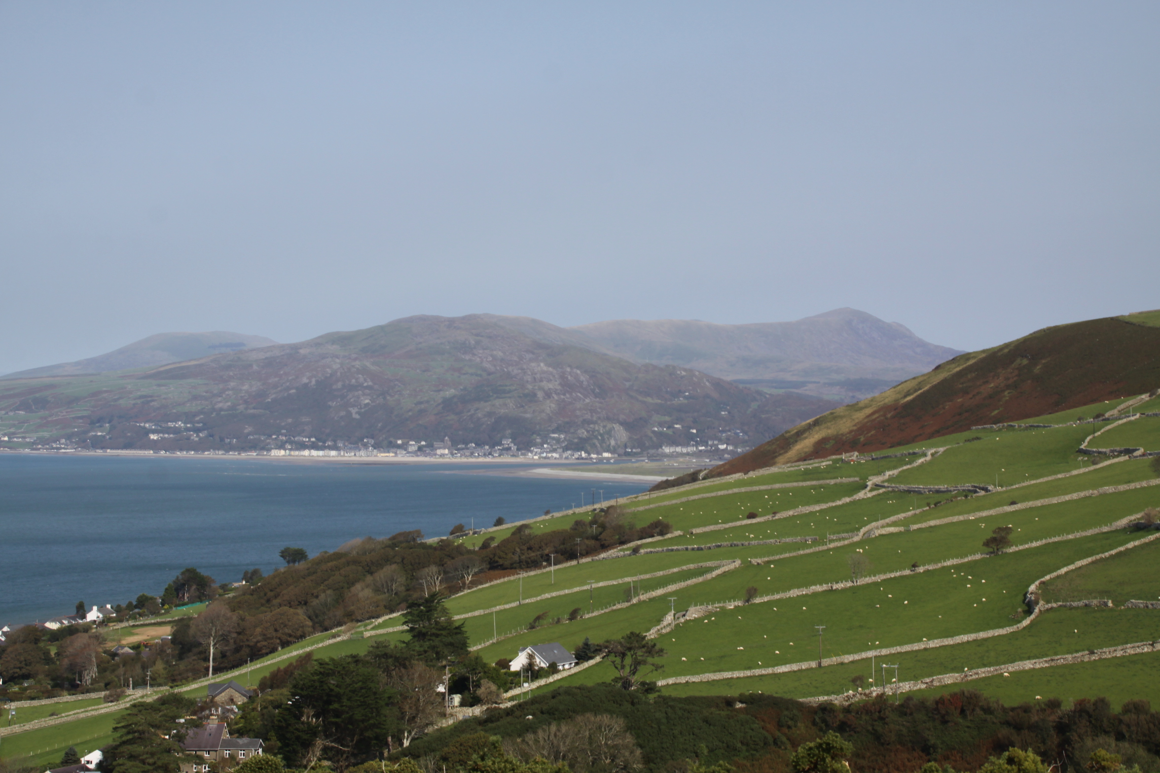
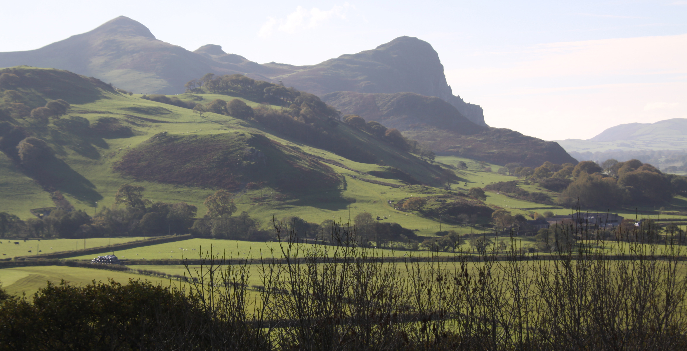
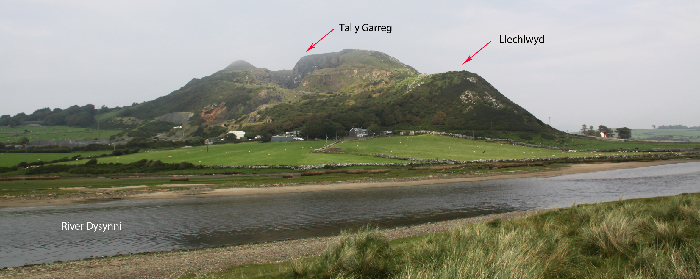
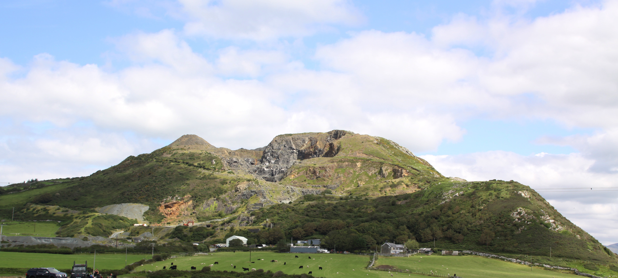
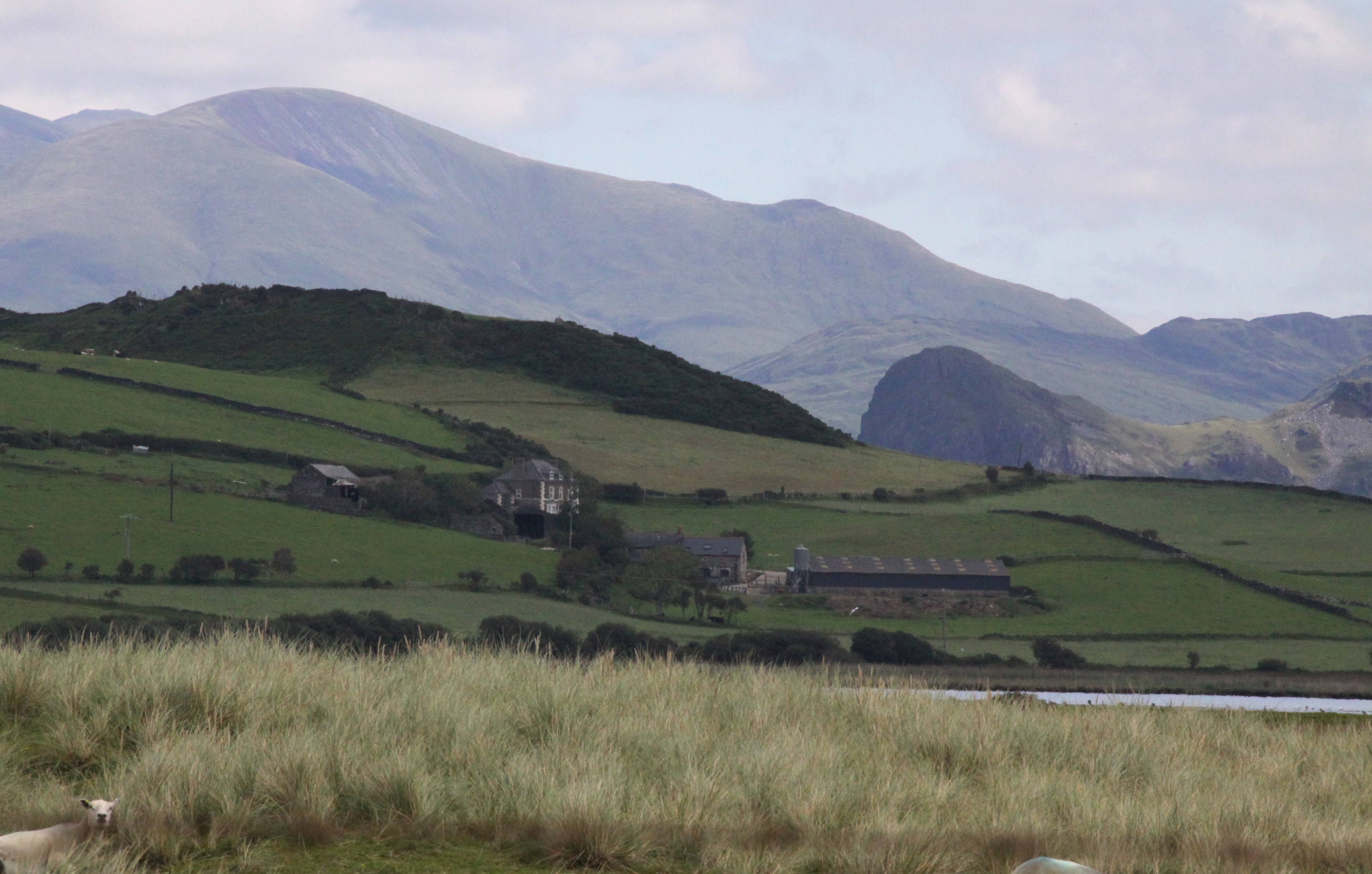
Tonfanau from the southwest. Tal y Garreg is immediately above the quarry

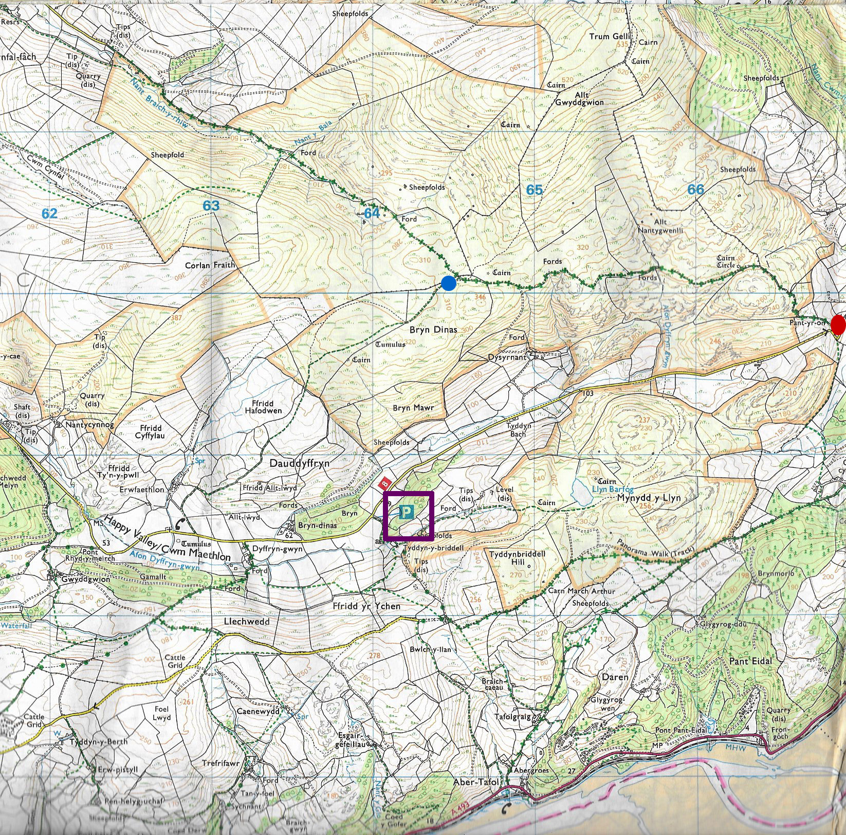
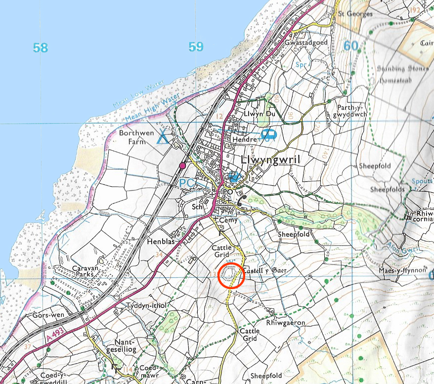
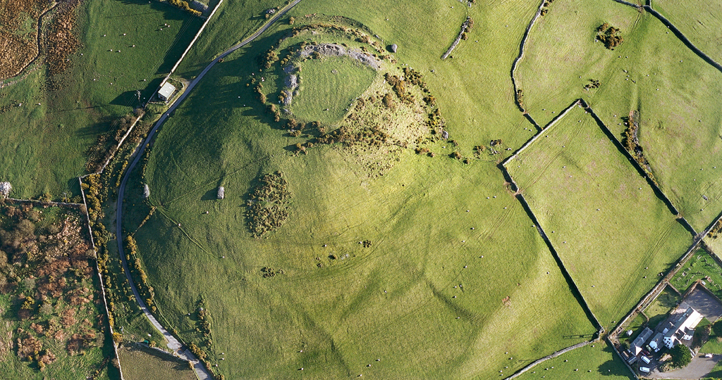
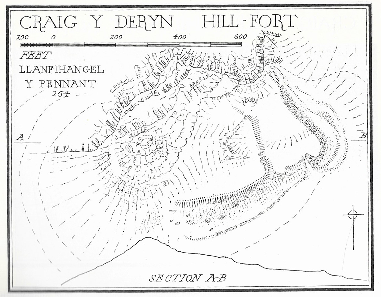
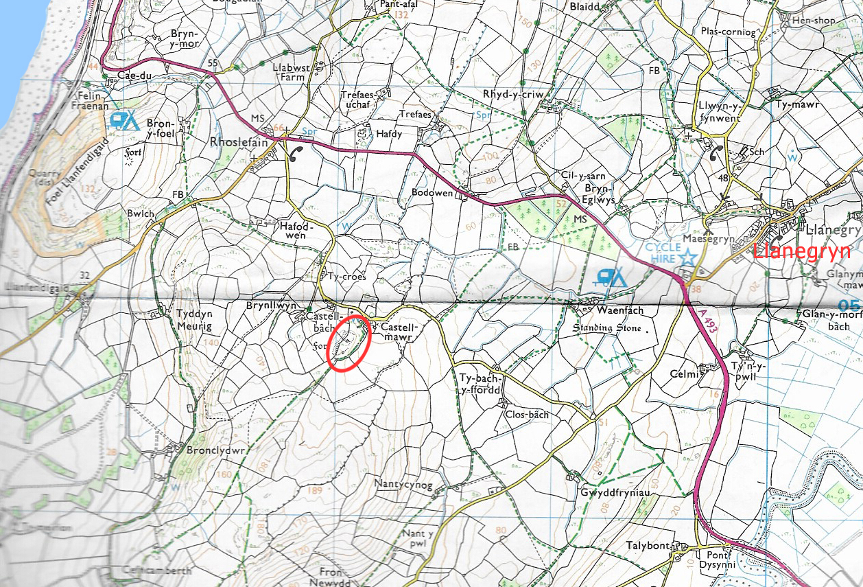
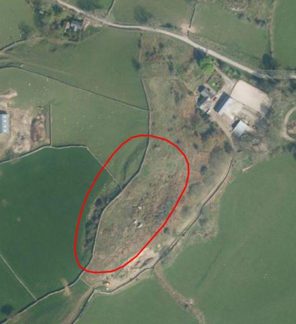
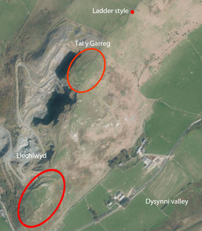
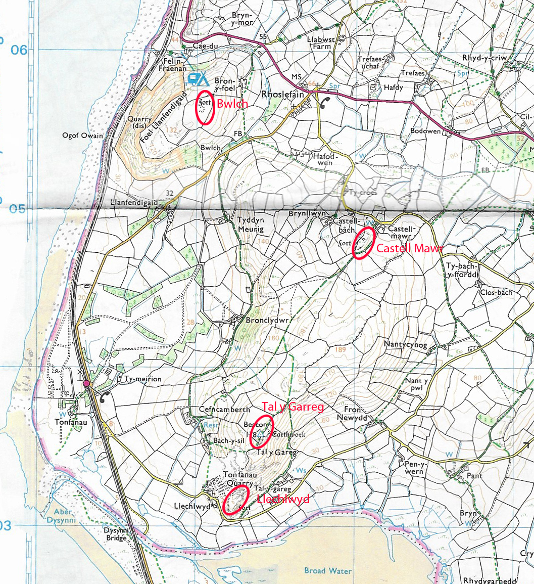
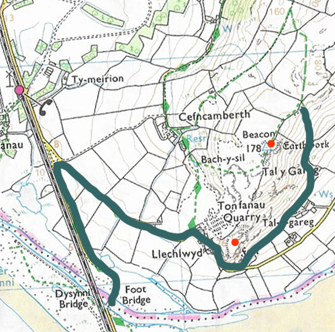
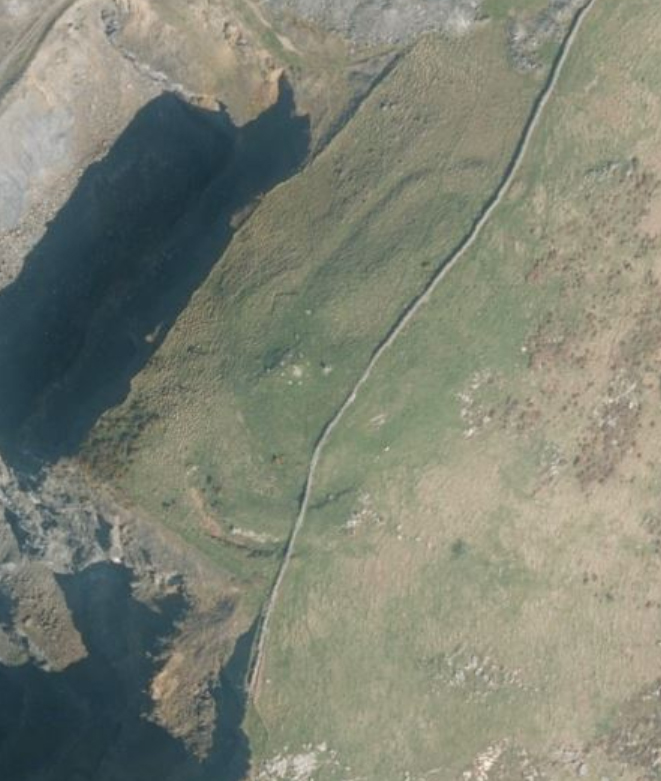
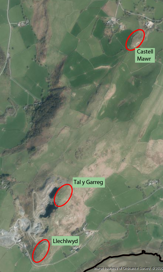
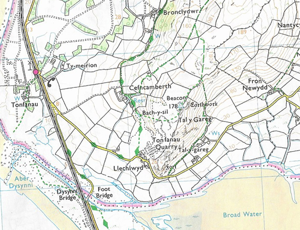
Ordnance Survey map showing the route taken up the hill, and the location of the two hillforts, marked by red dots. These two sites are also marked on an aerial photograph below.

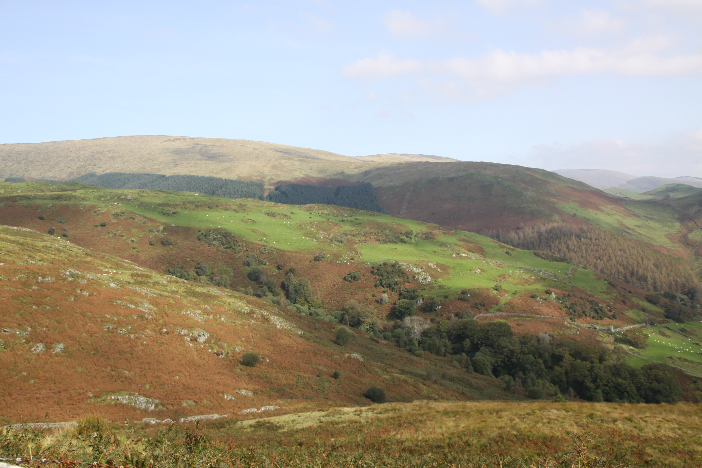
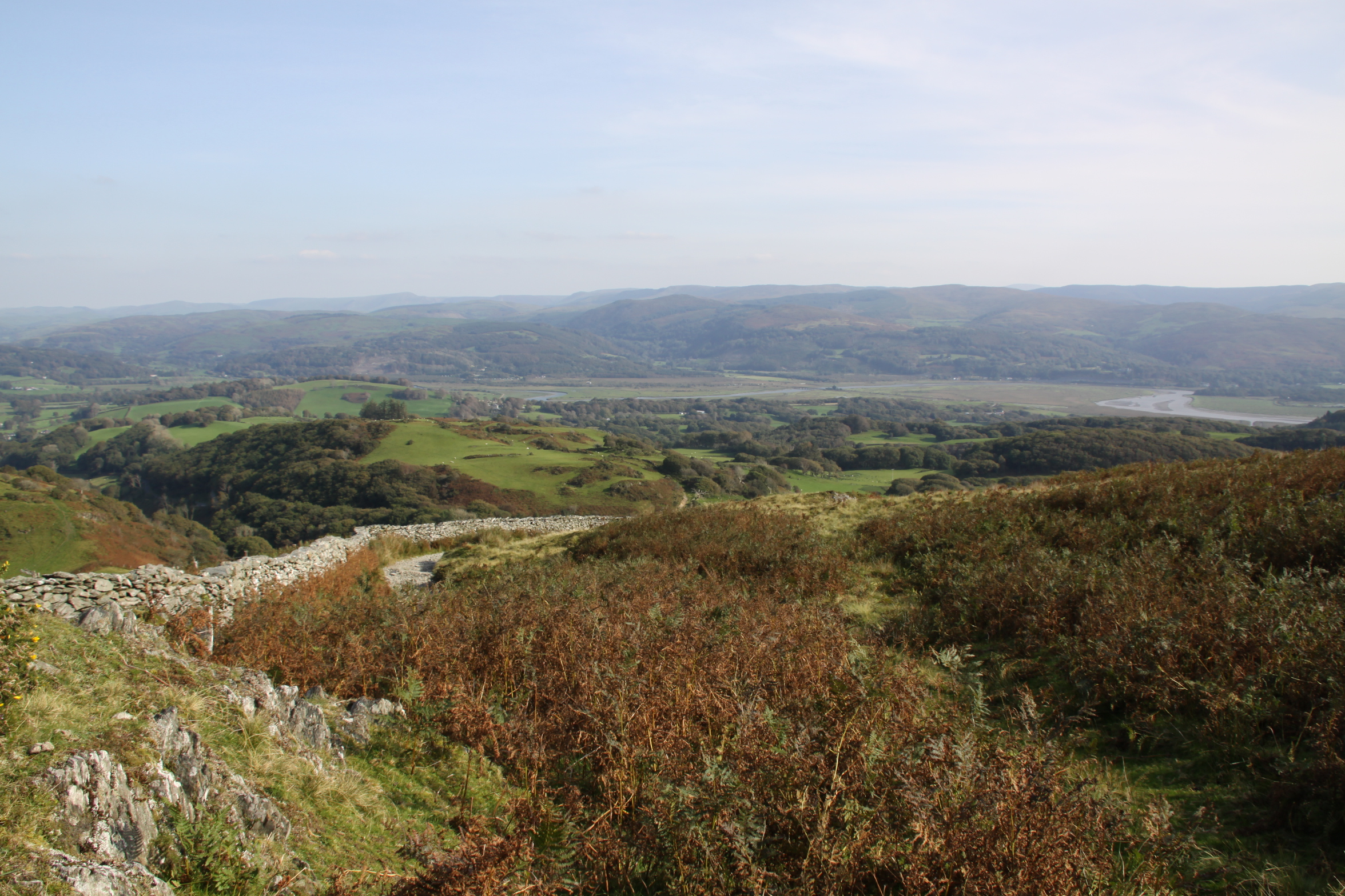
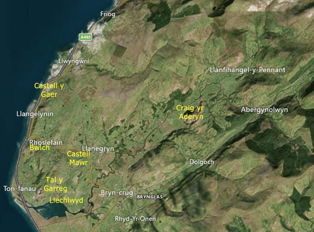
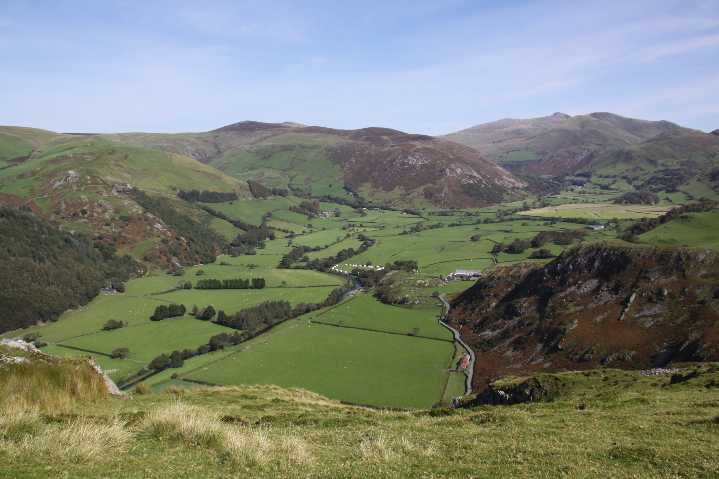
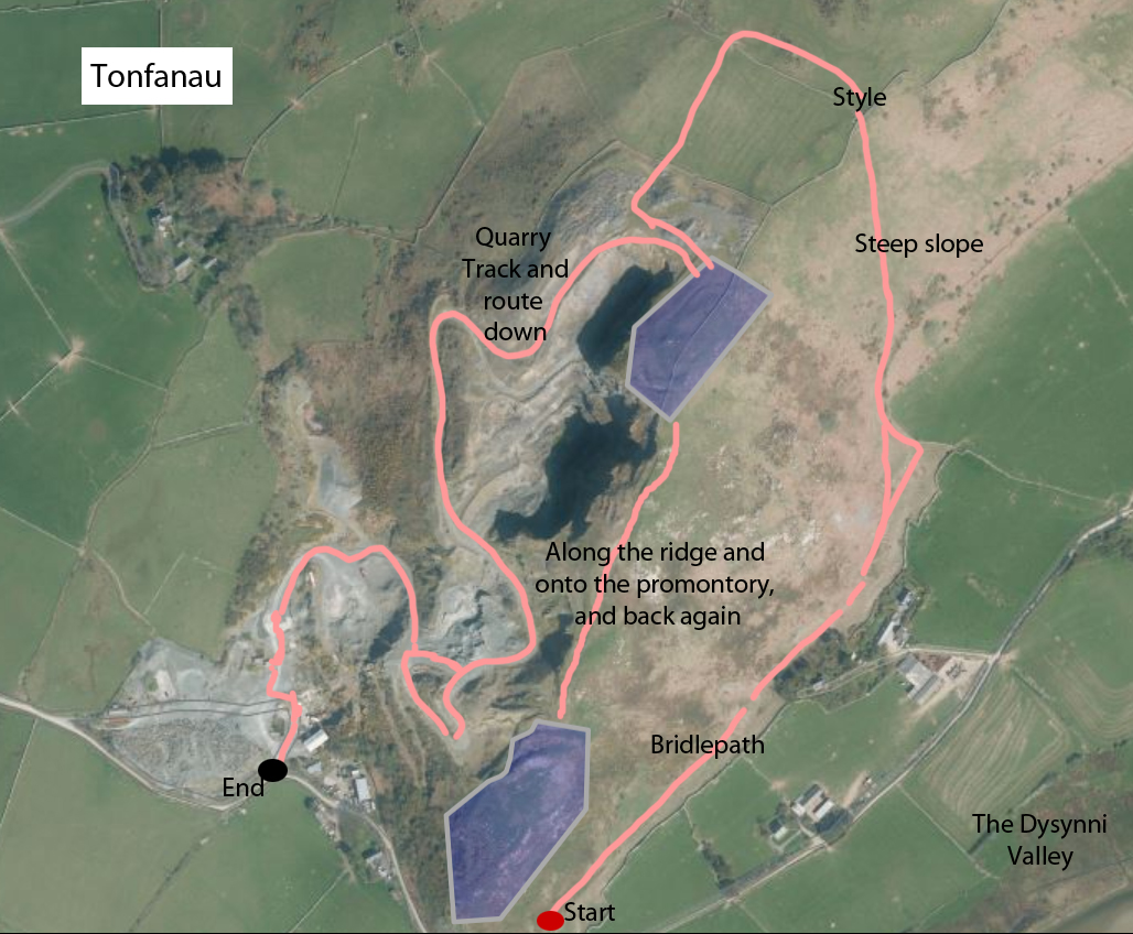
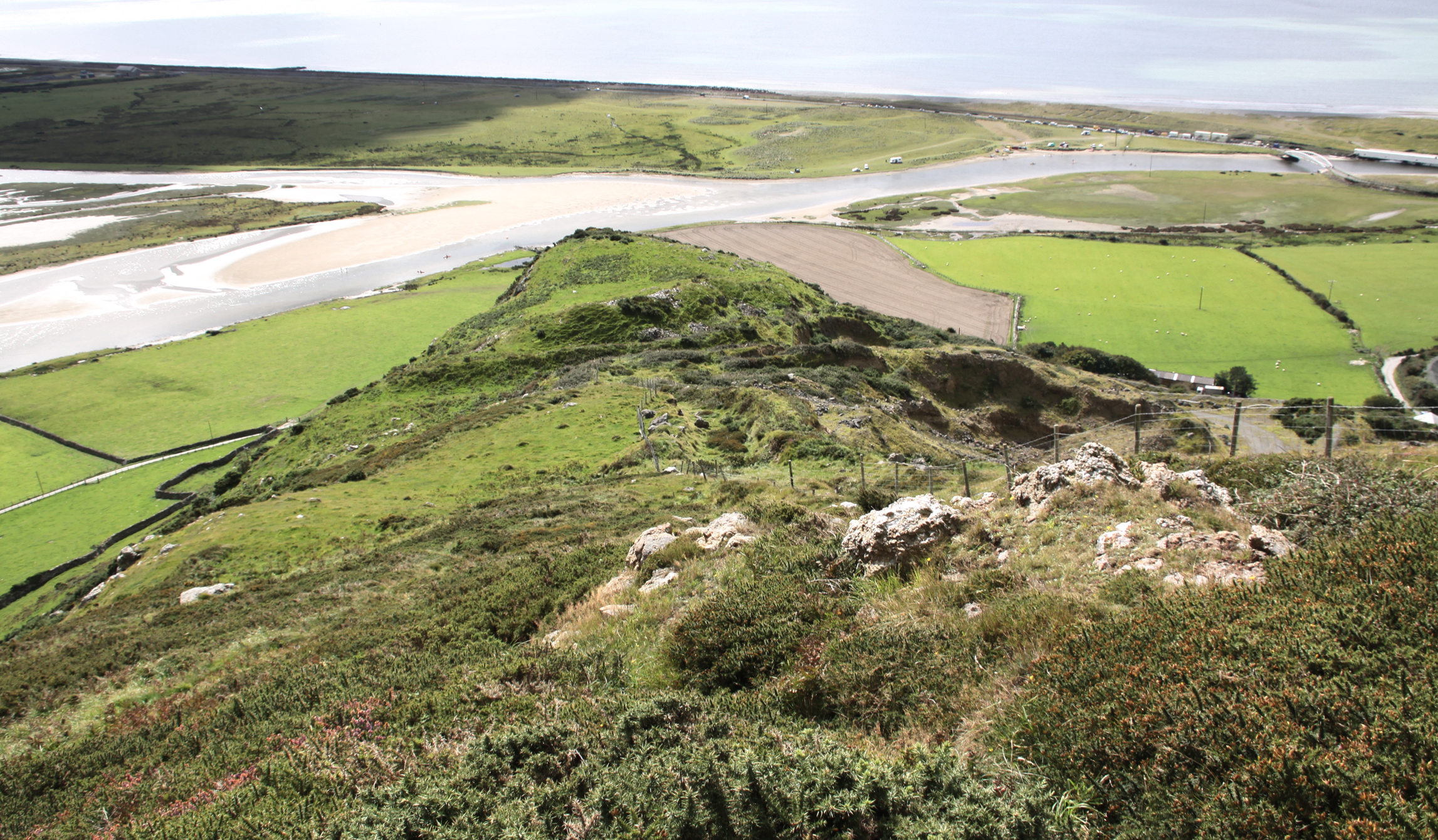
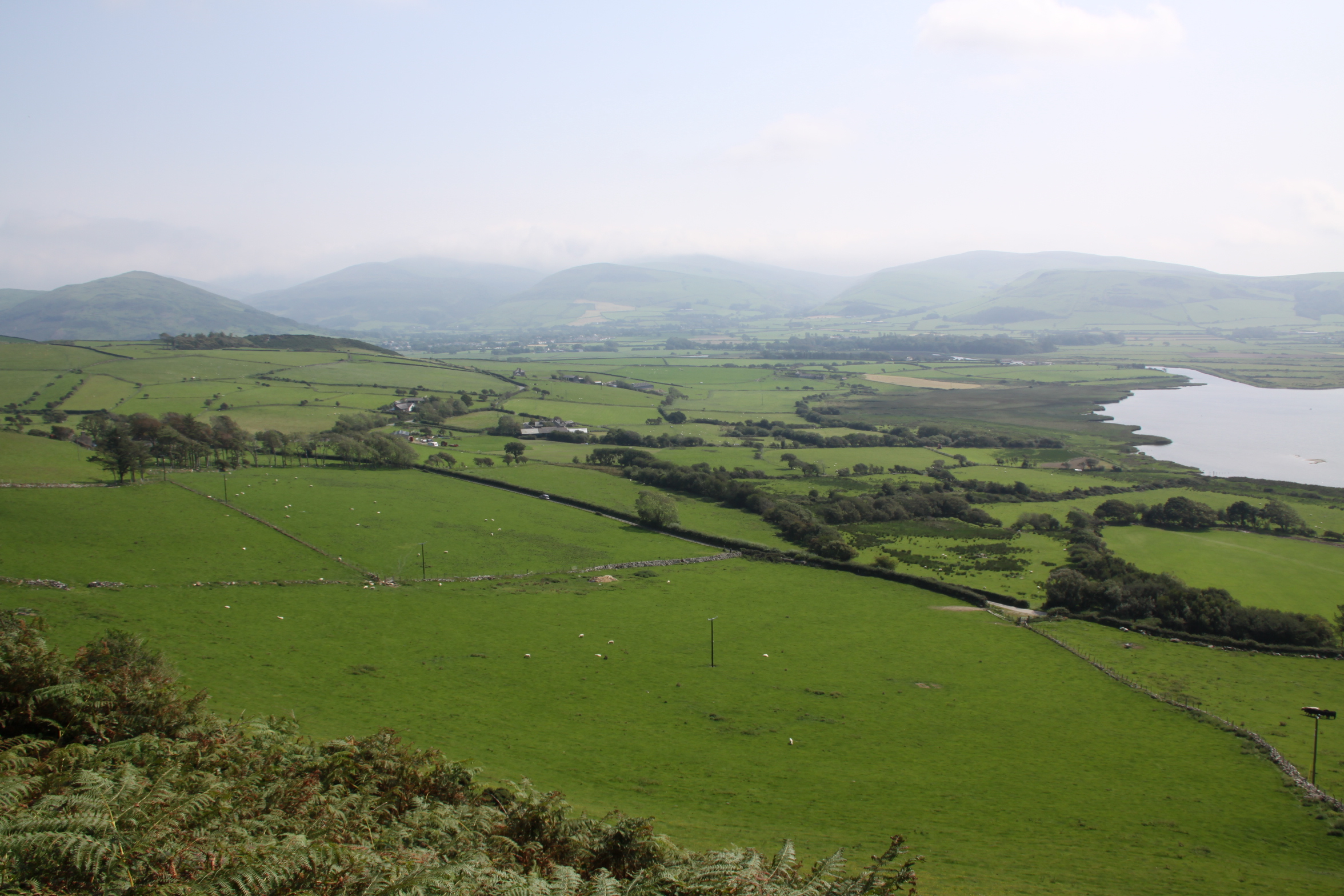
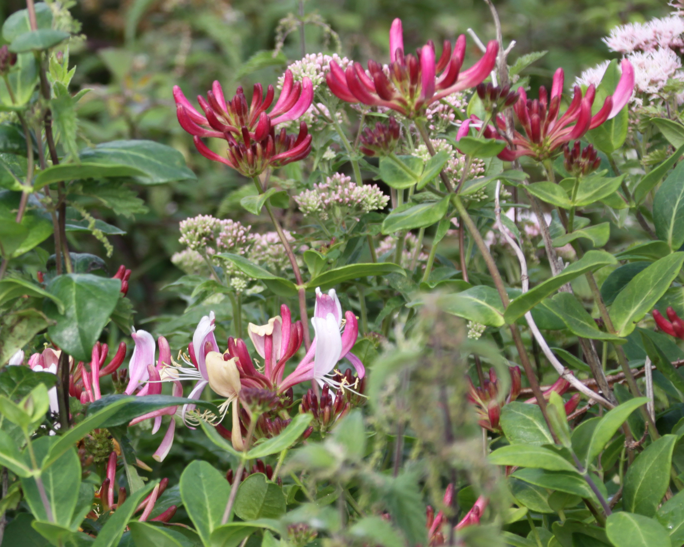
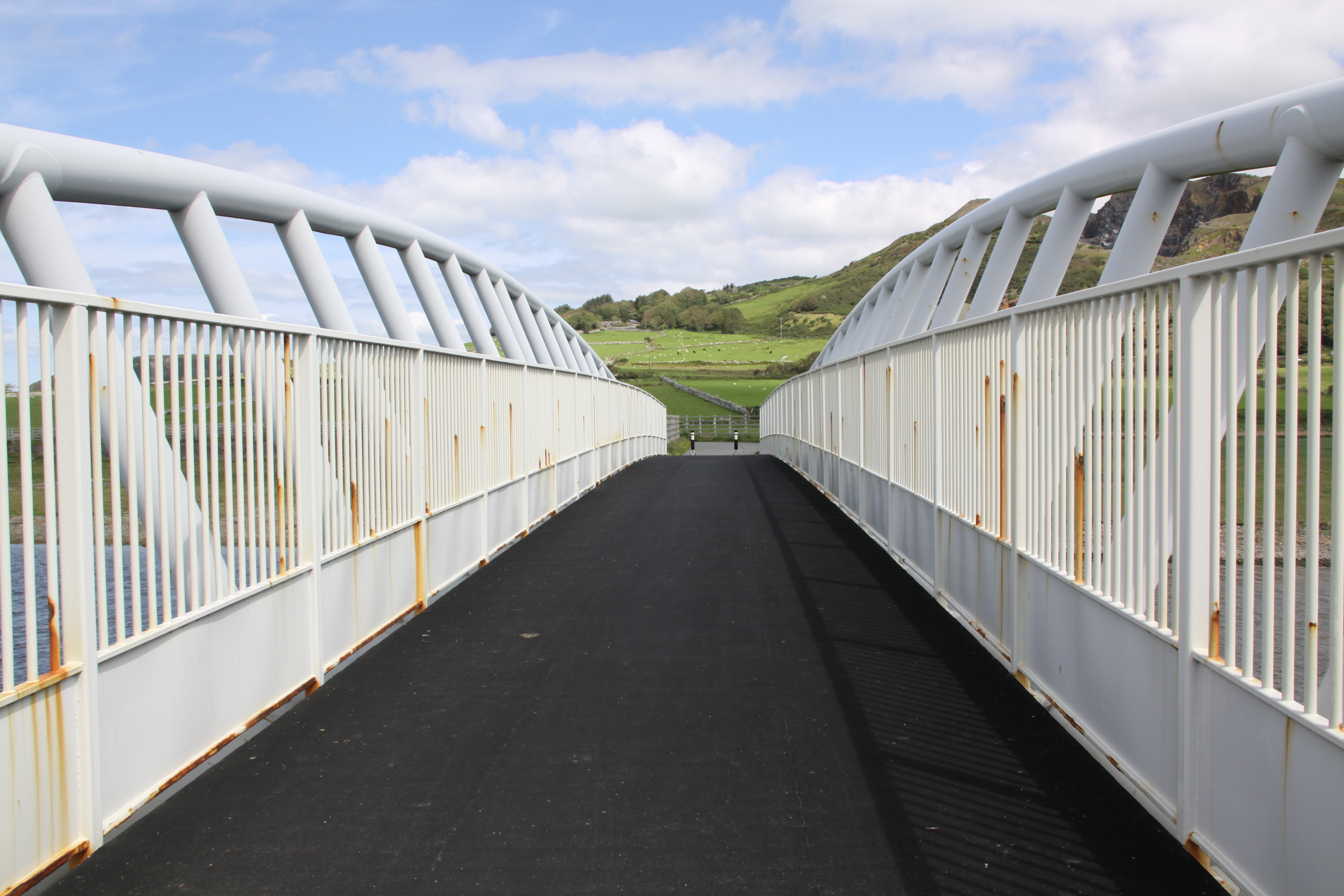
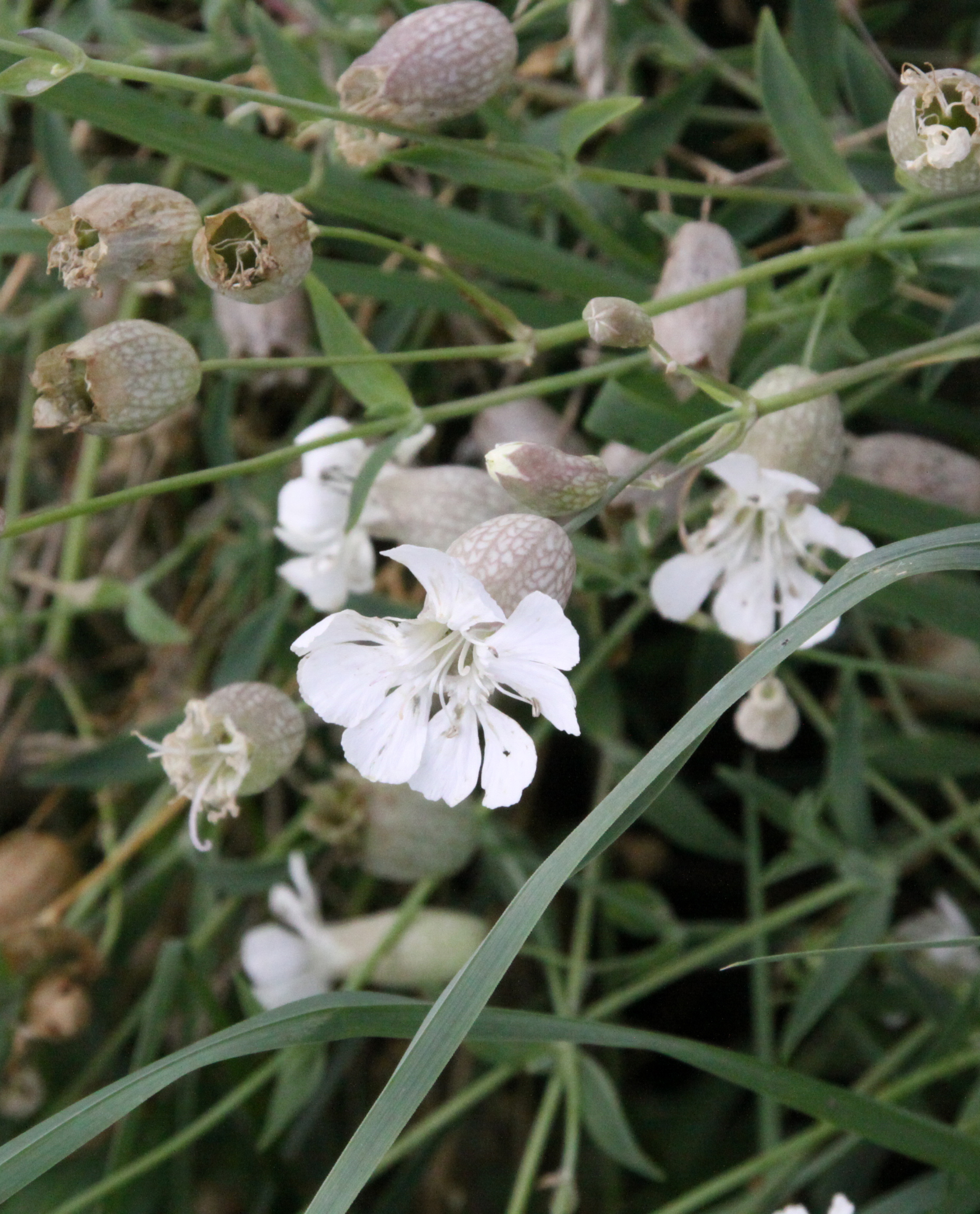
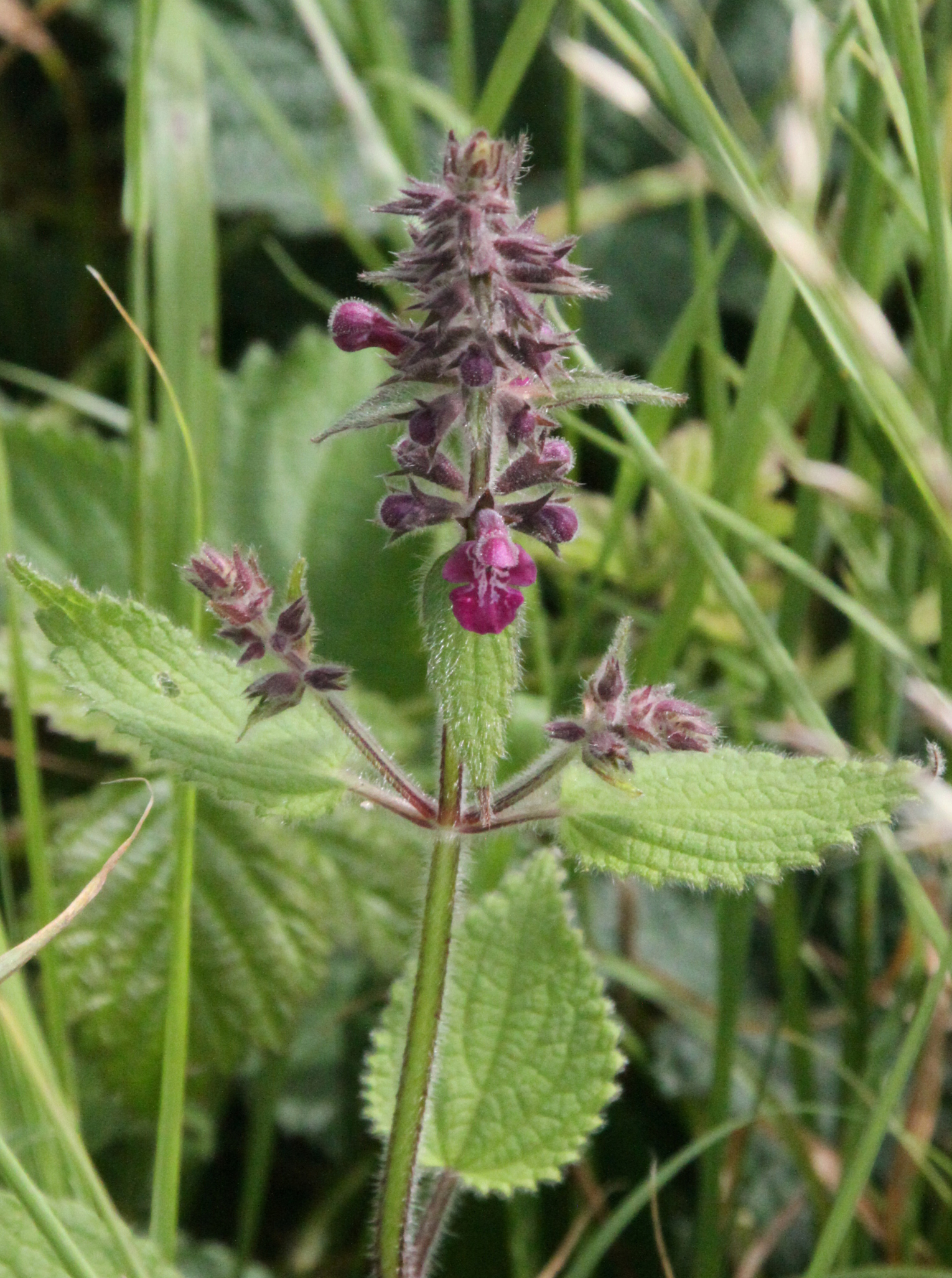
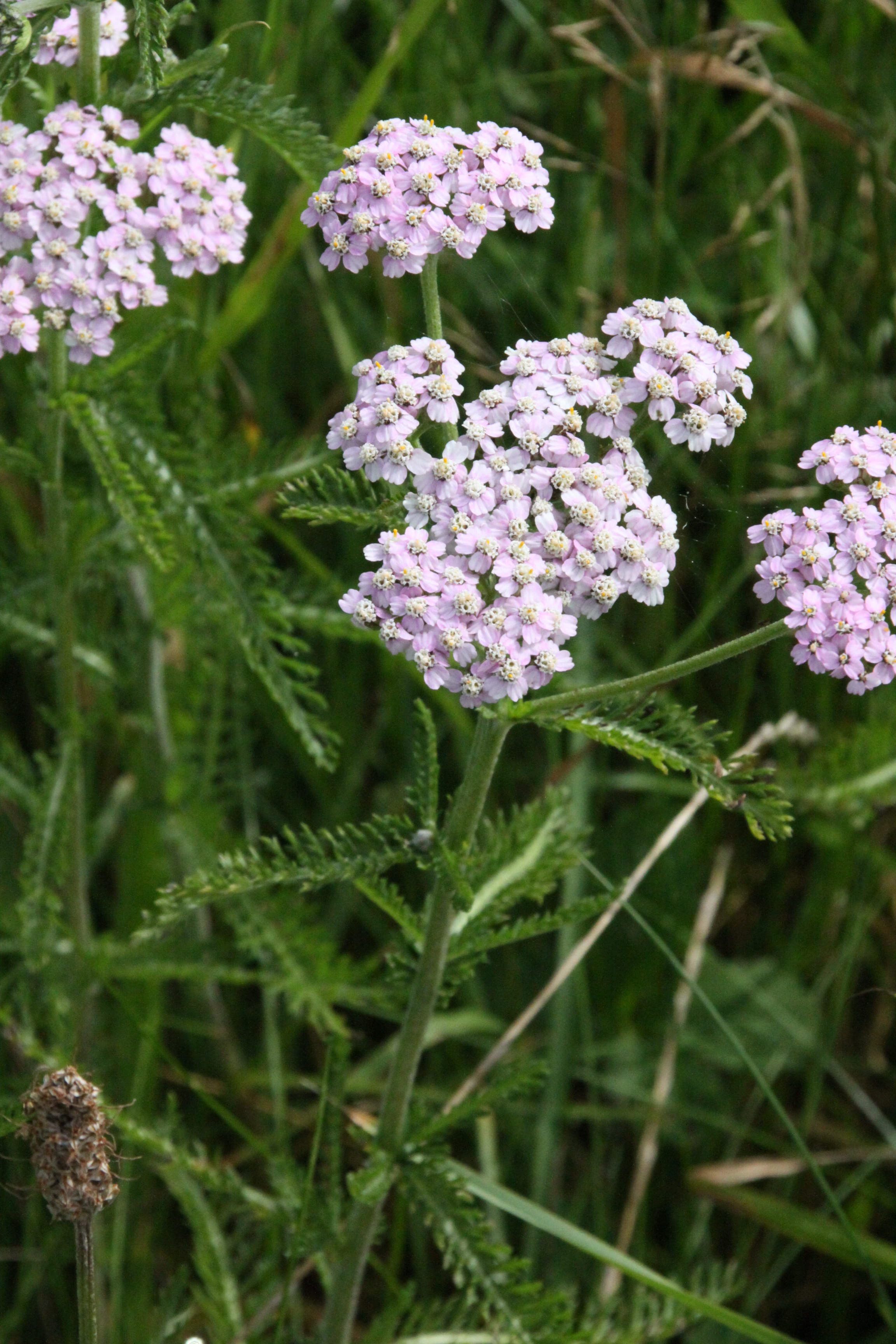
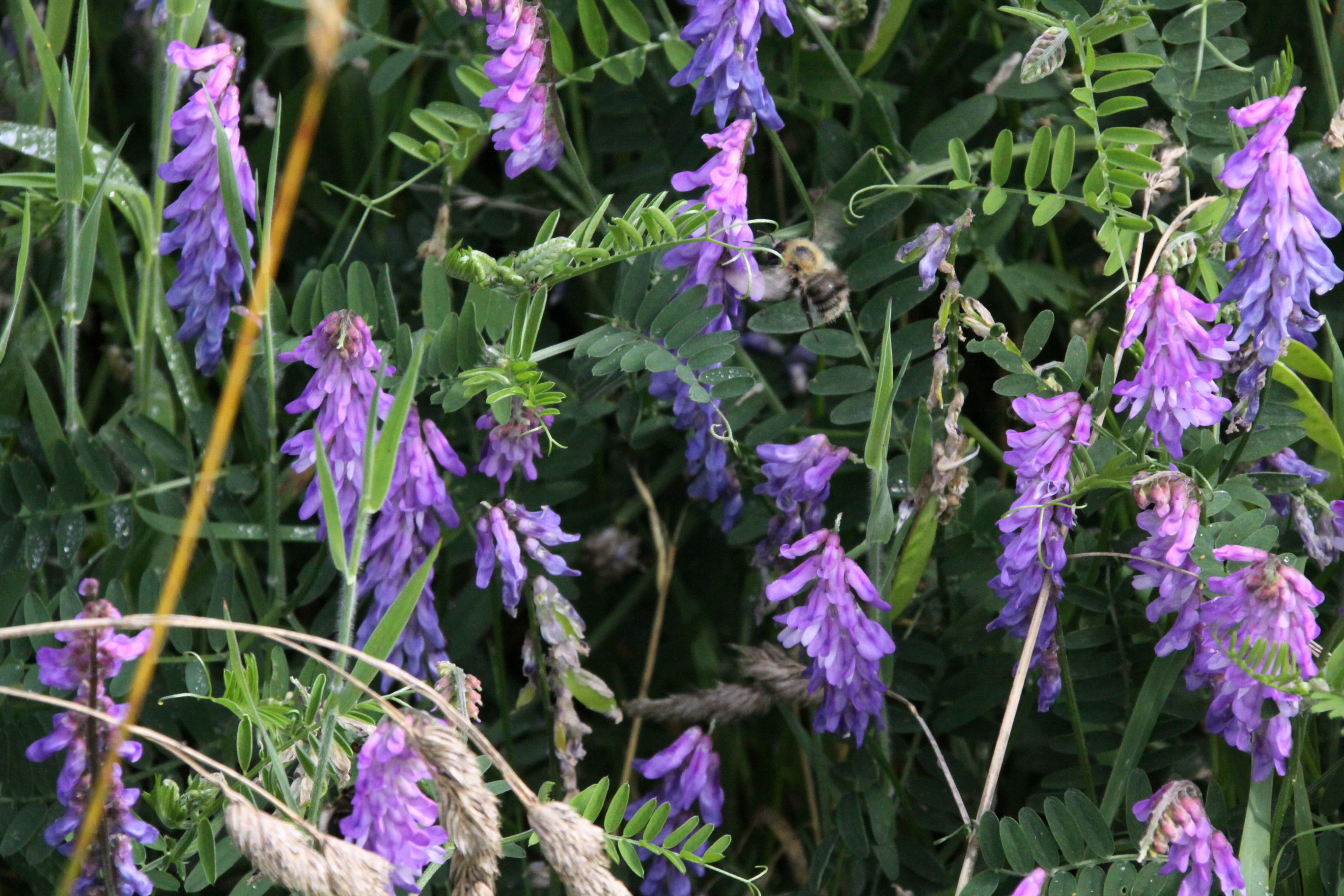
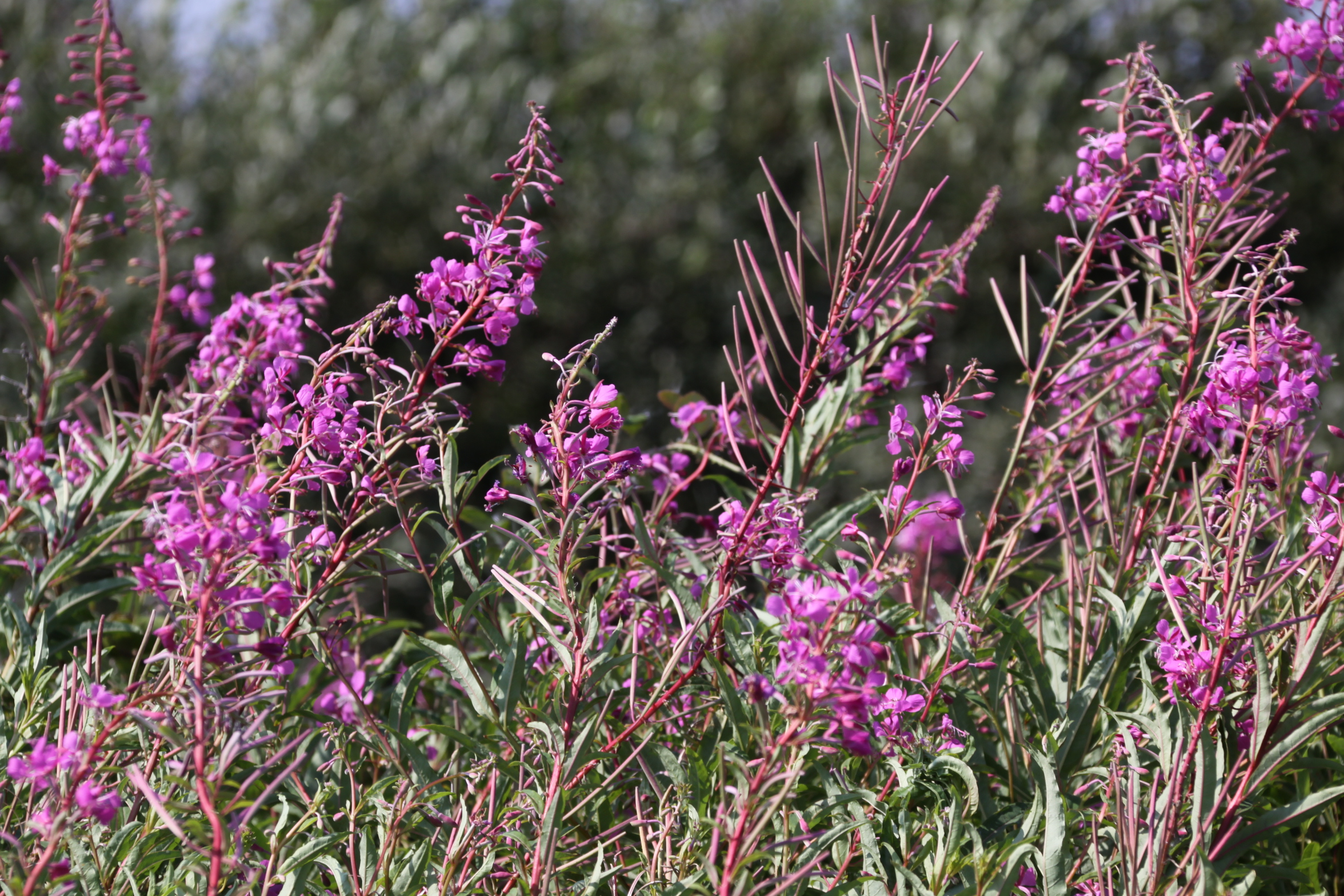
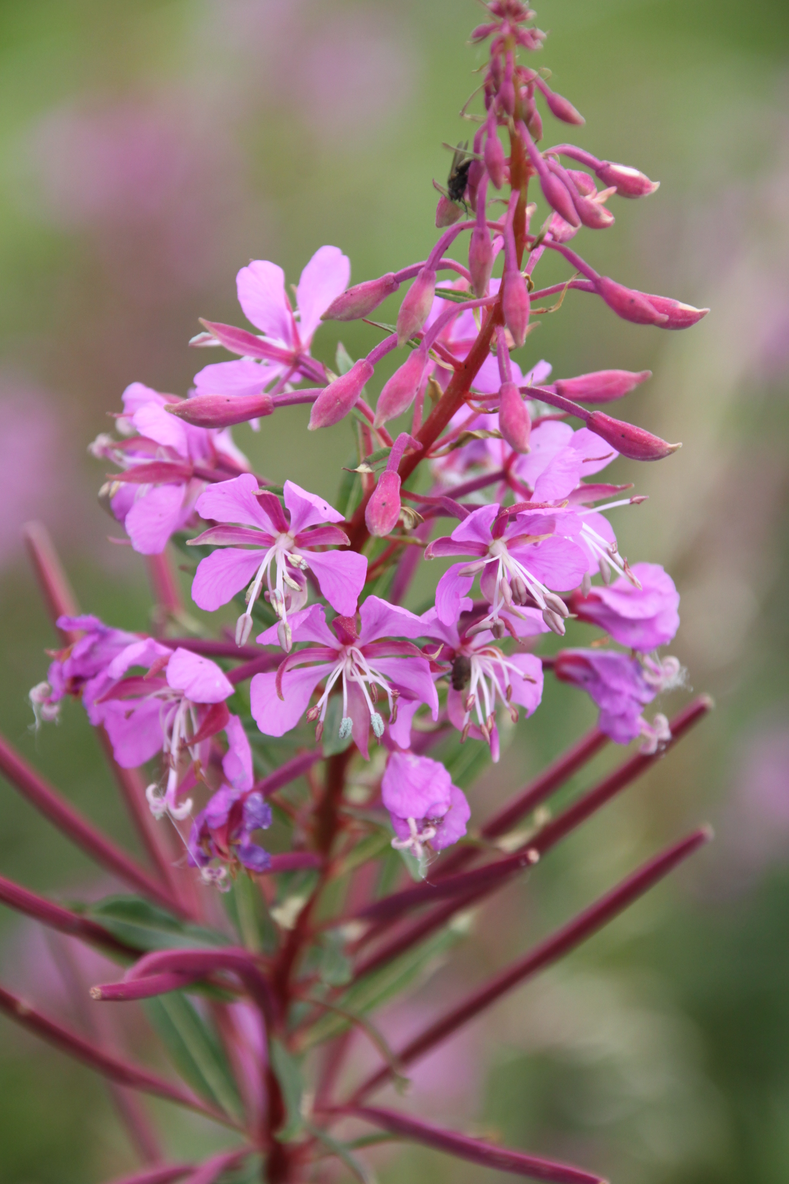
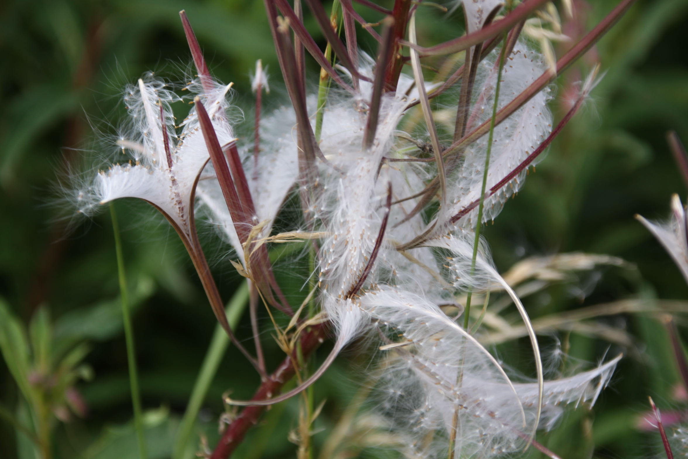
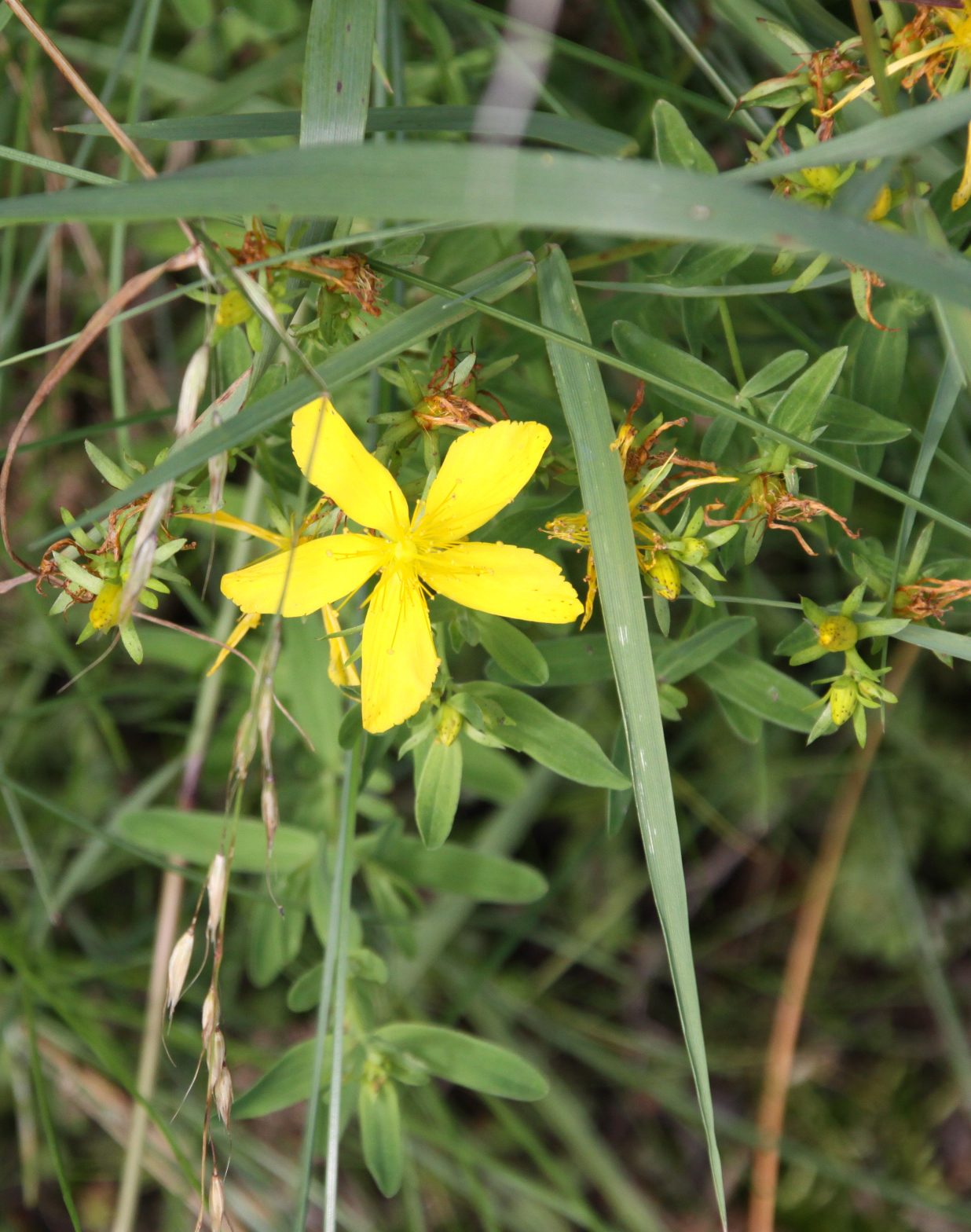
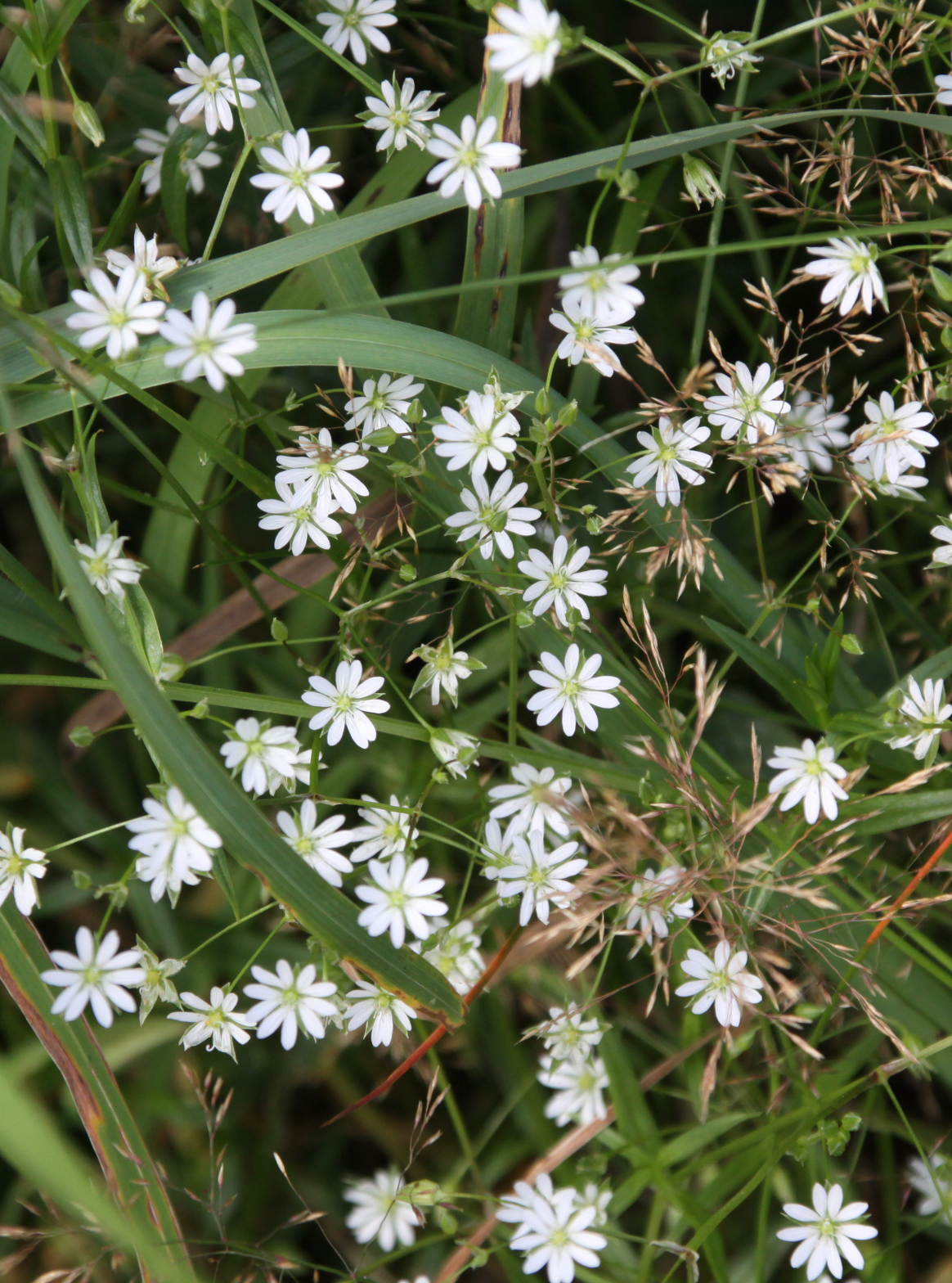
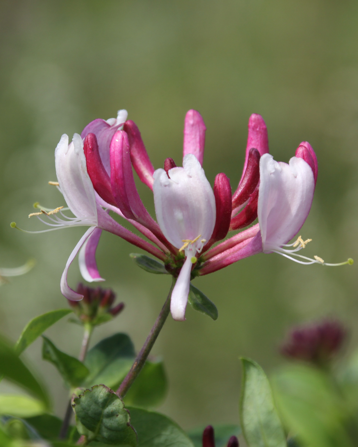
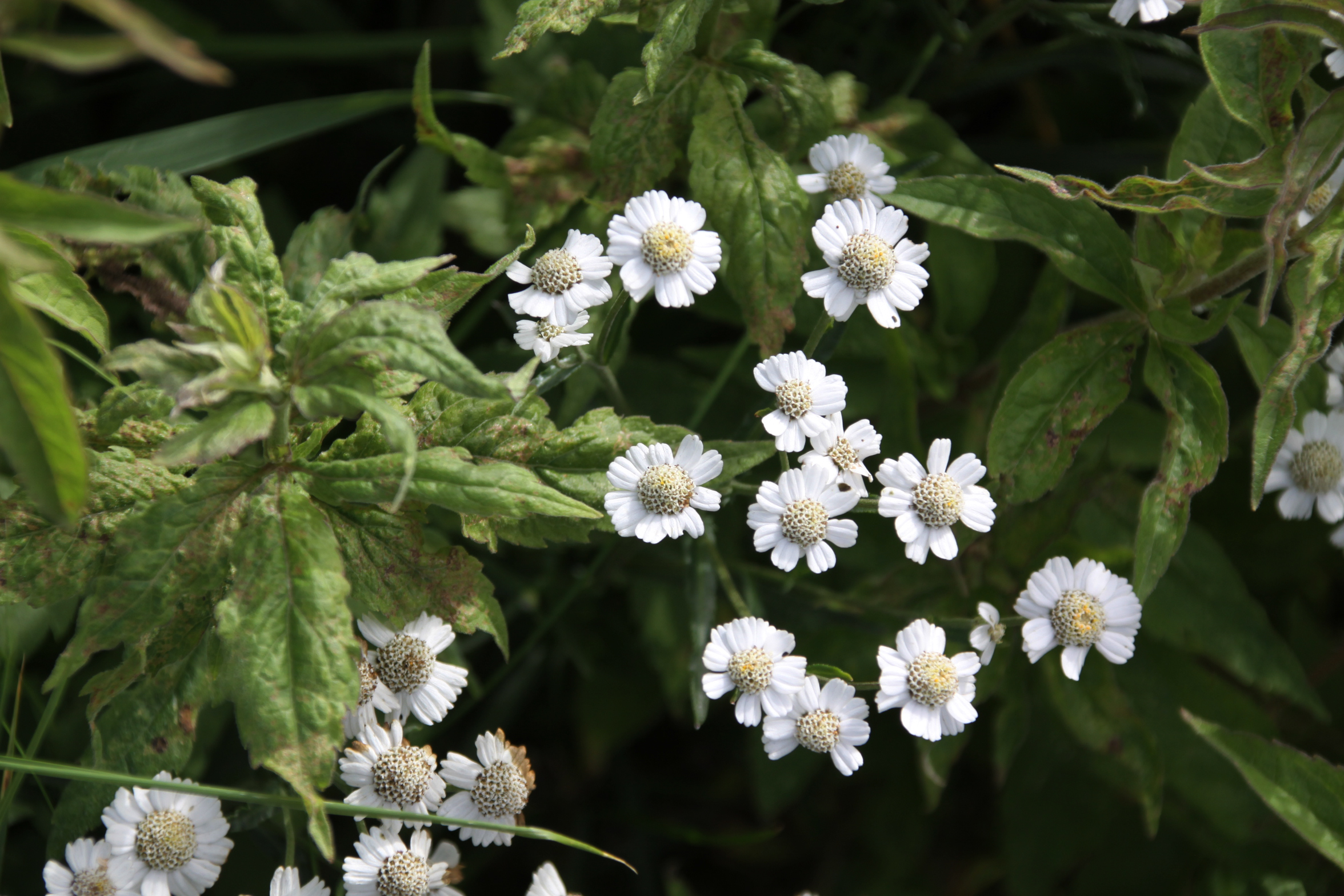
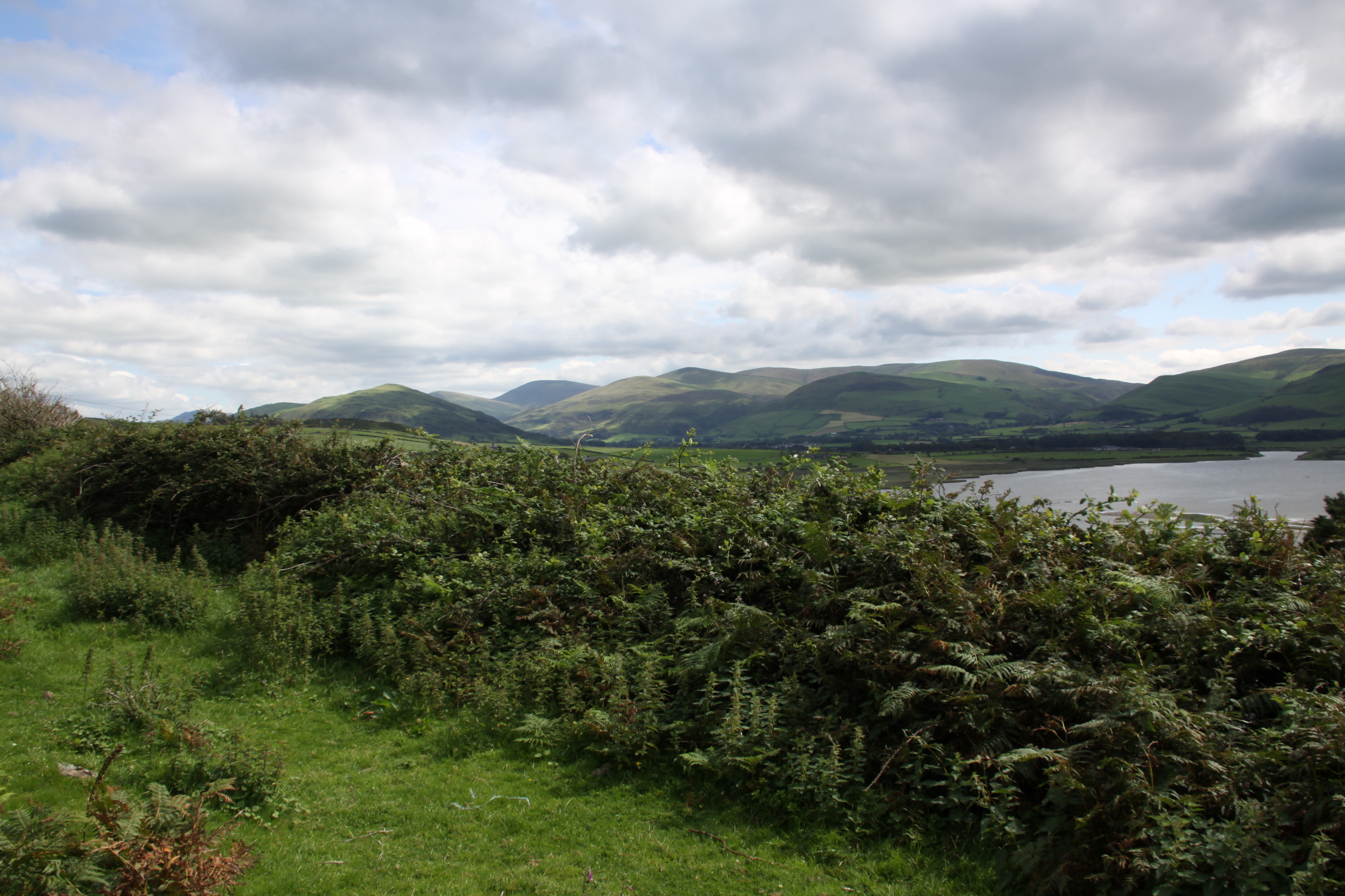
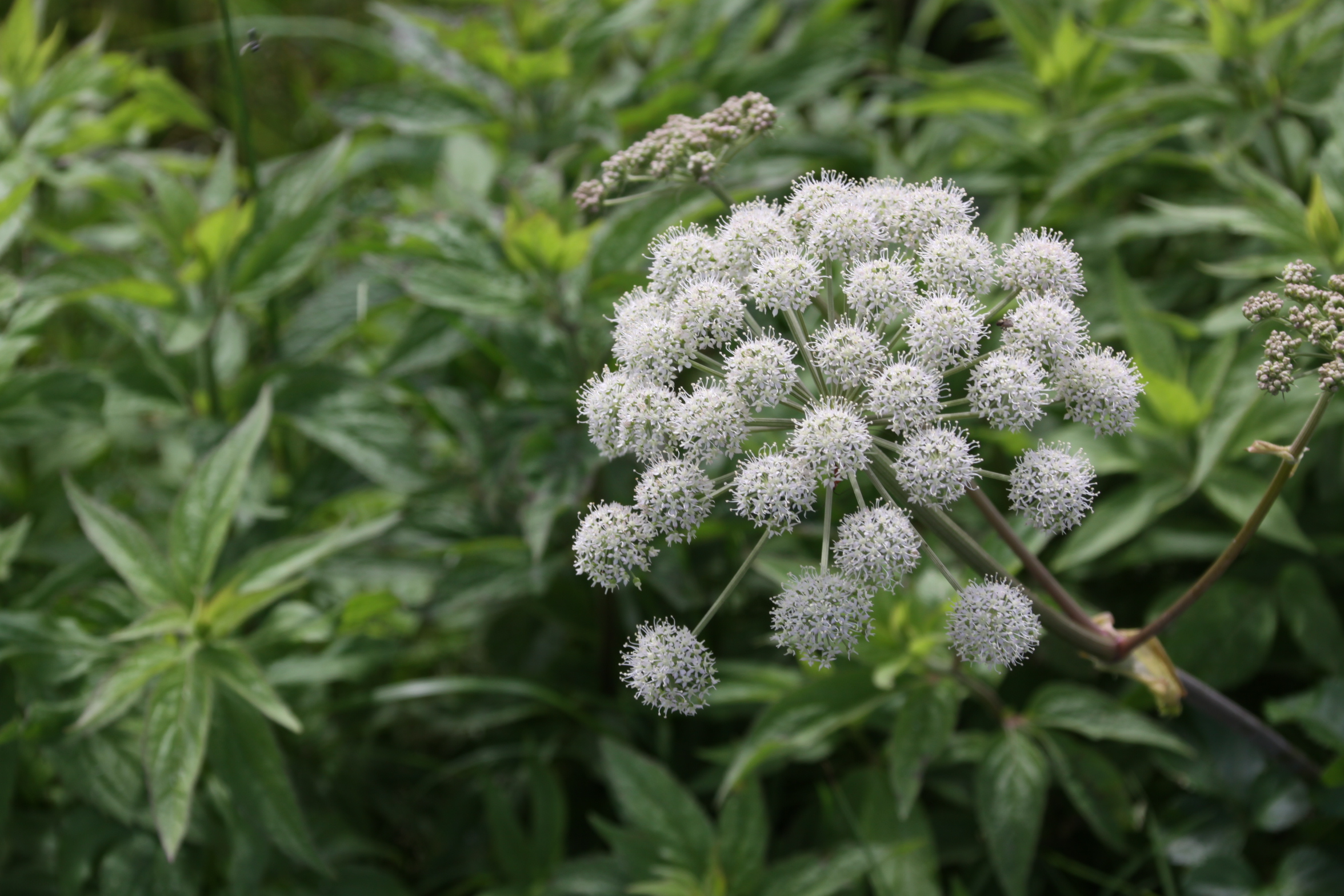
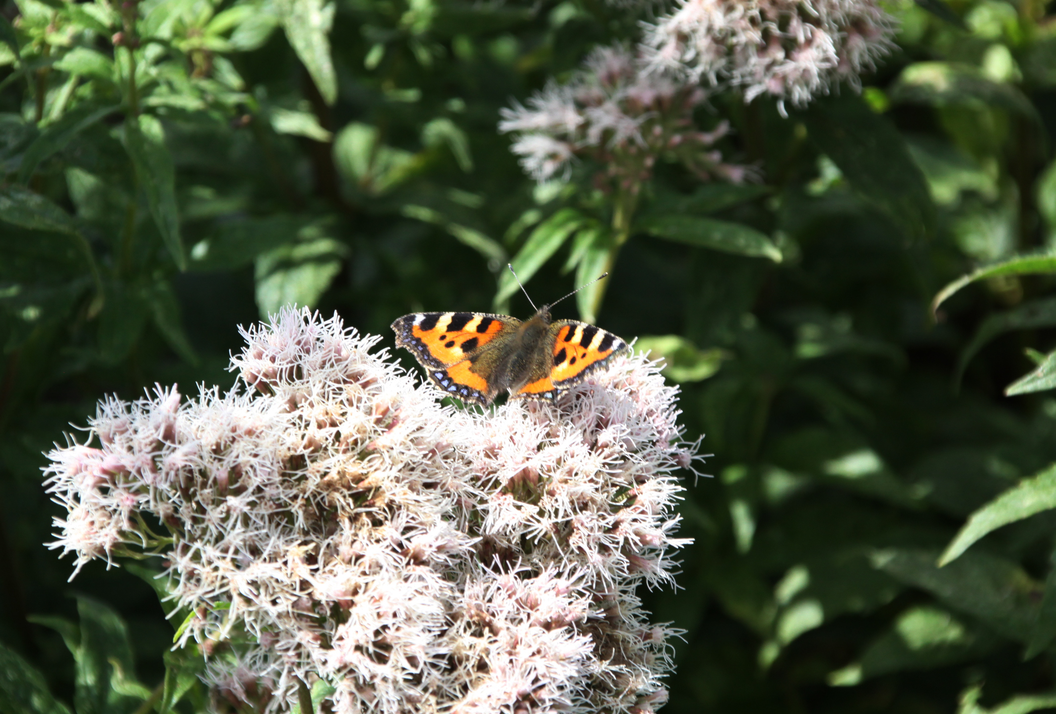
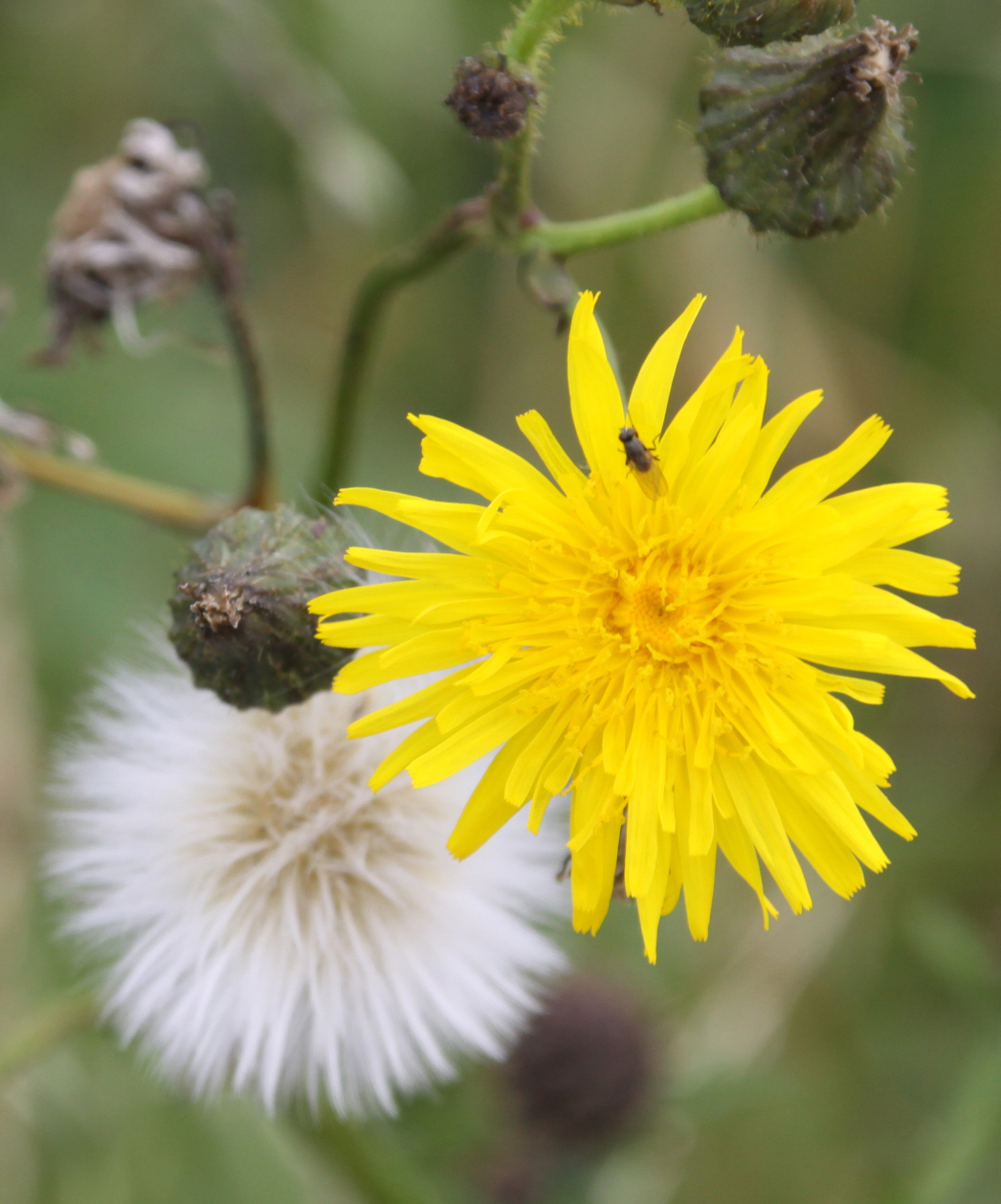
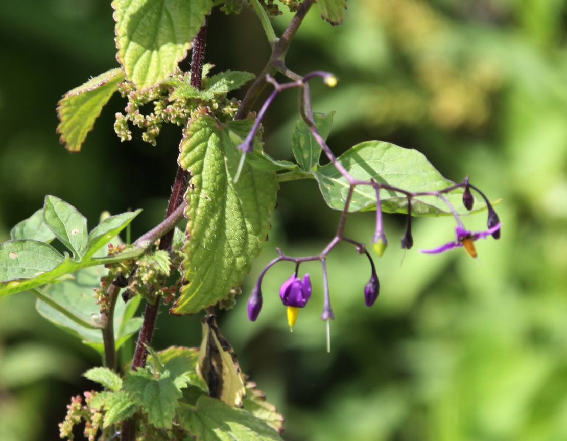
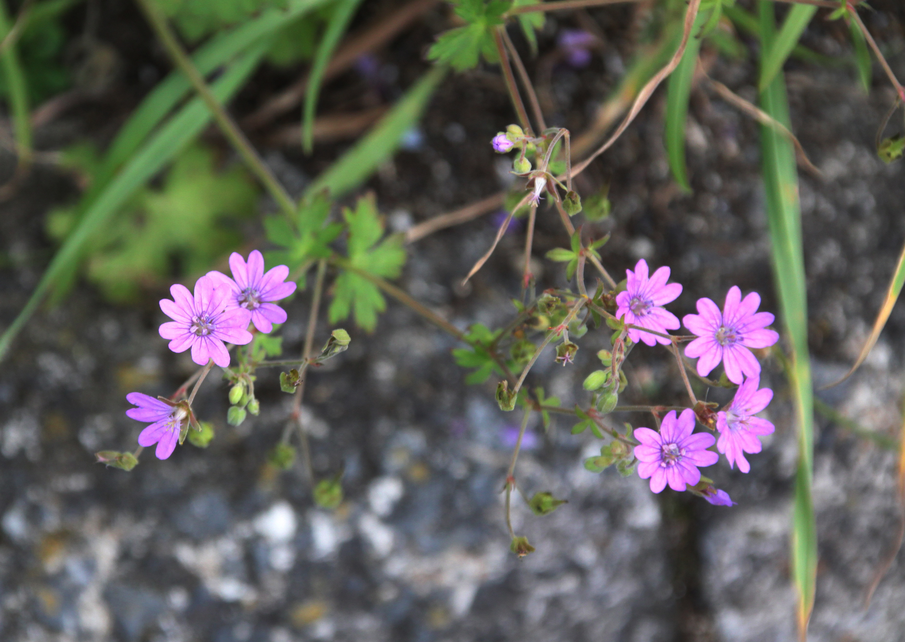
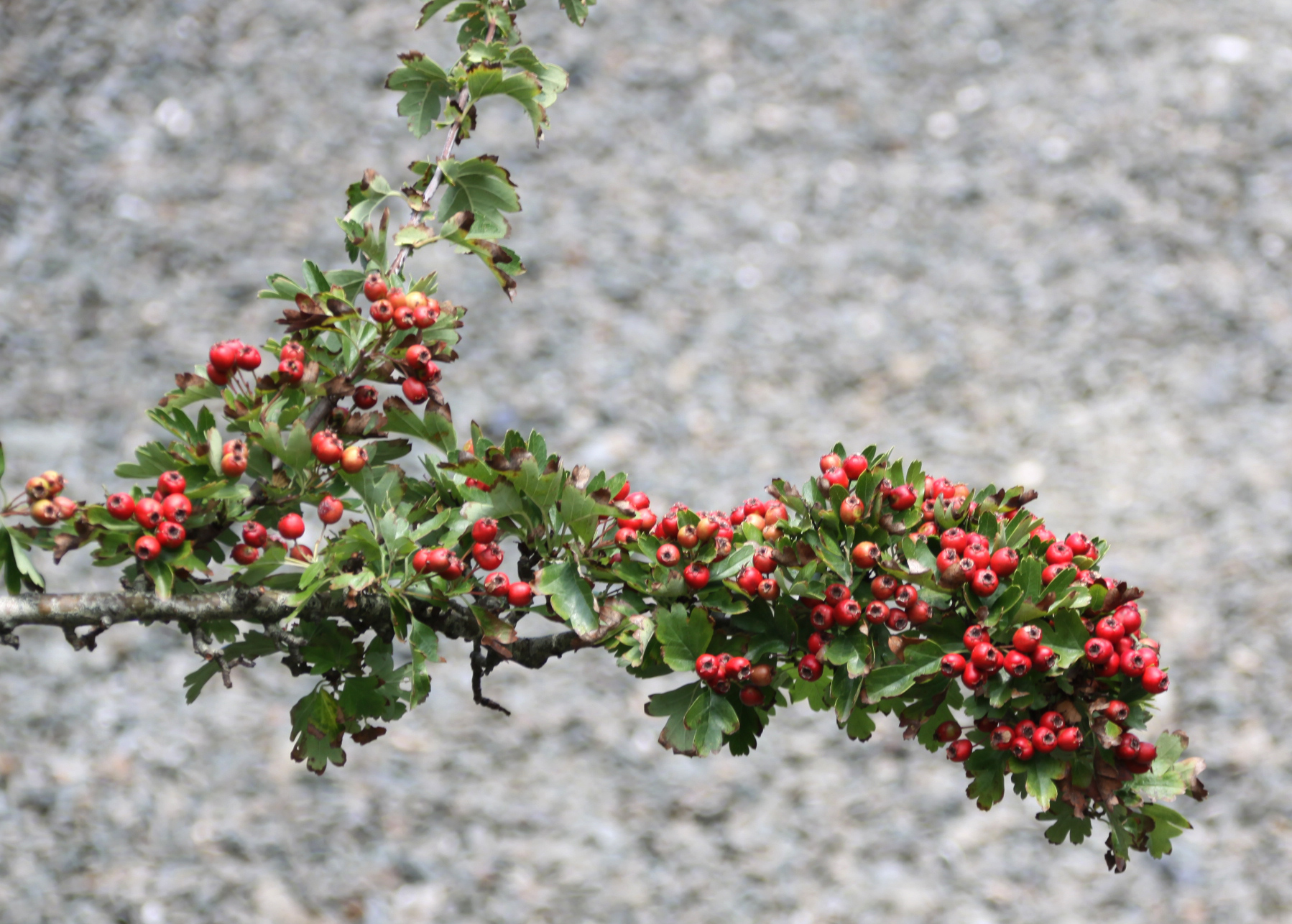
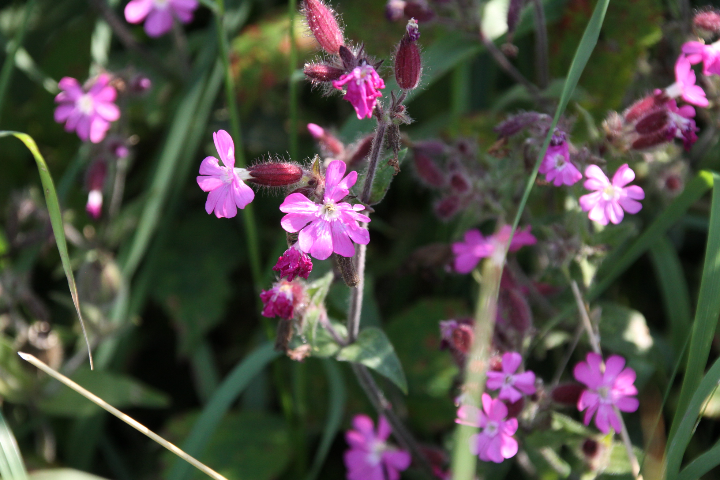
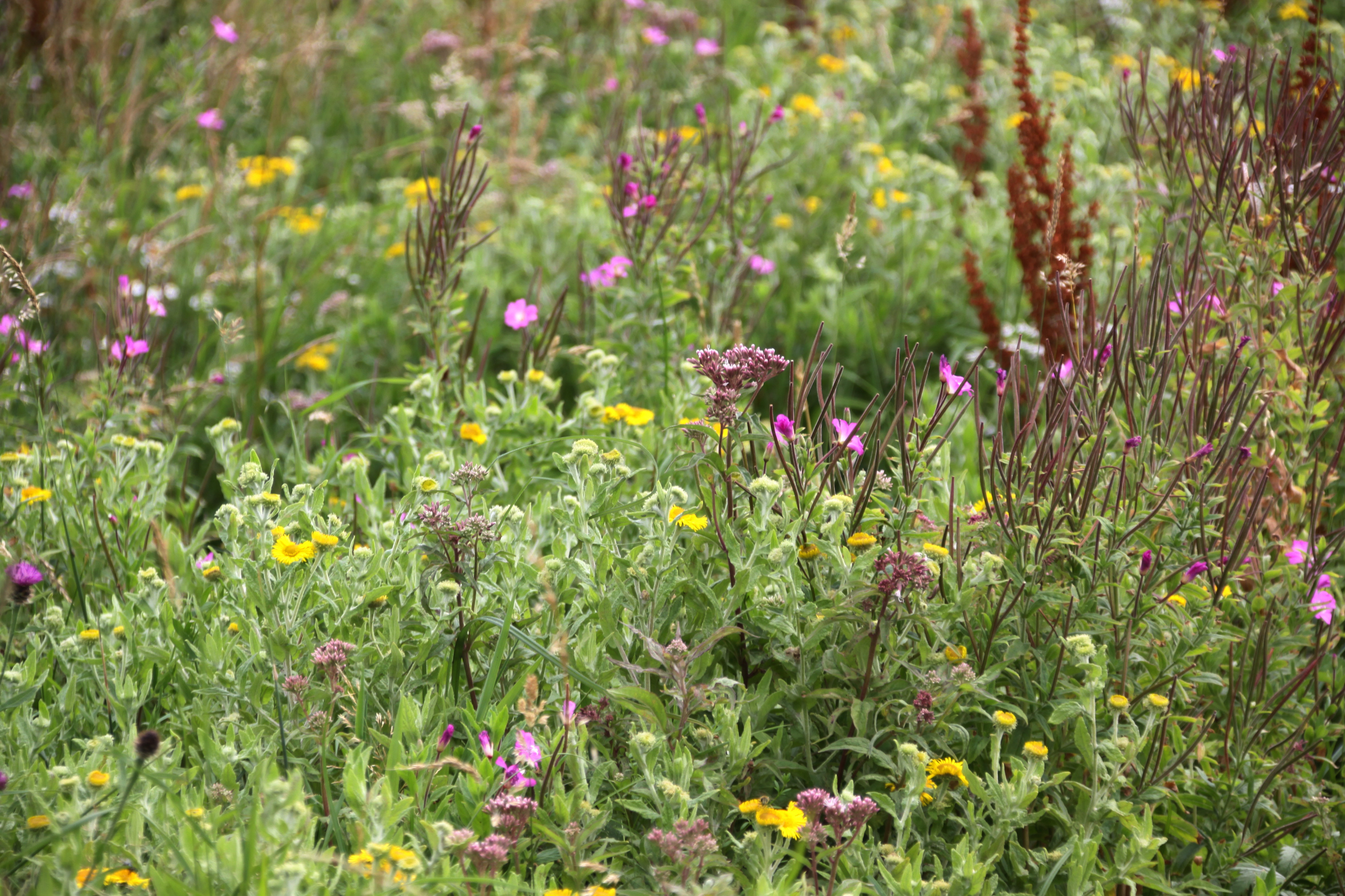
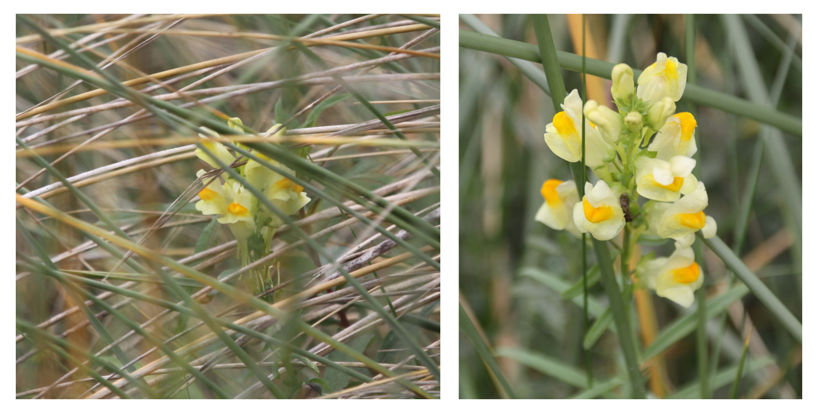
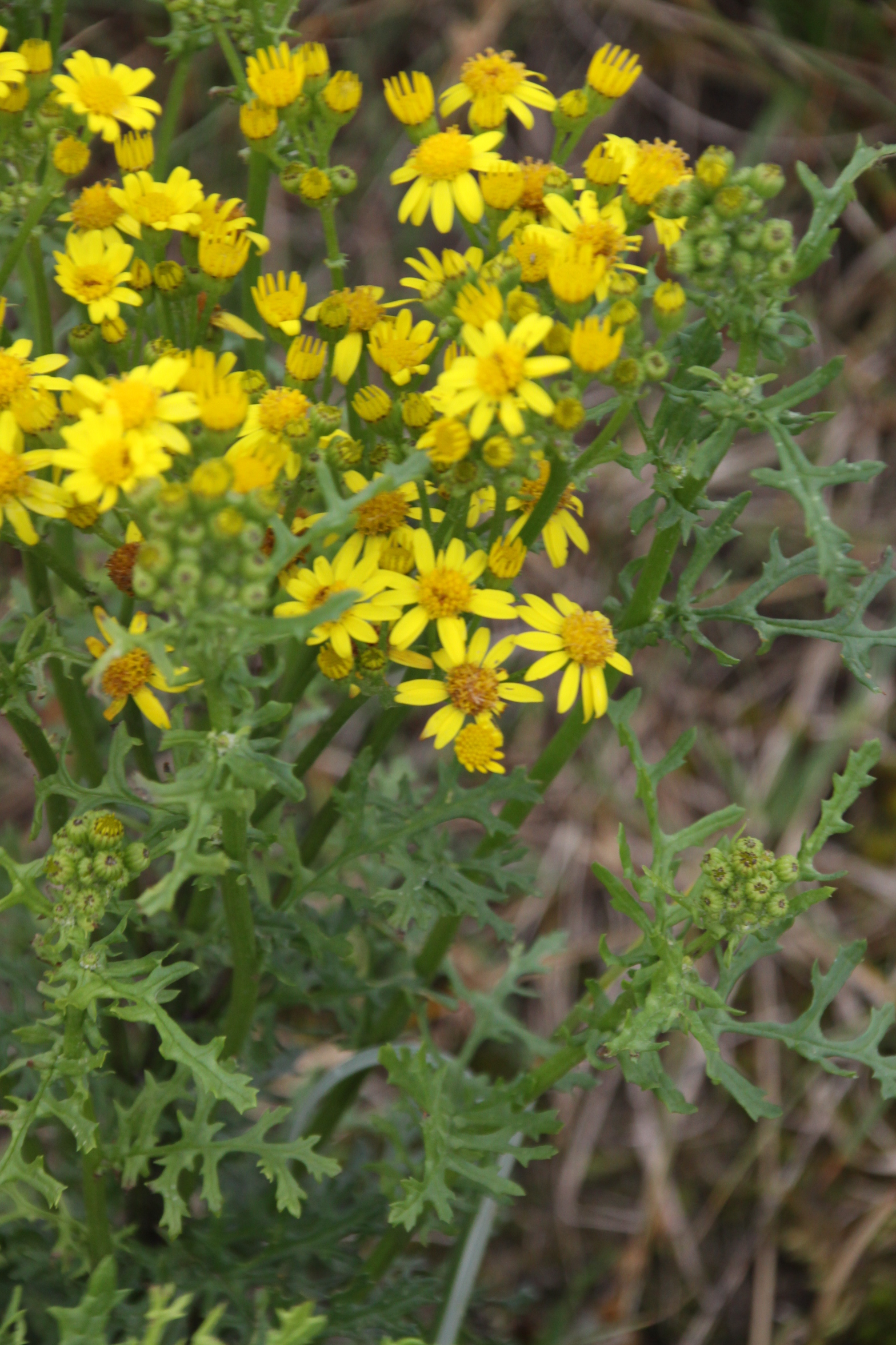
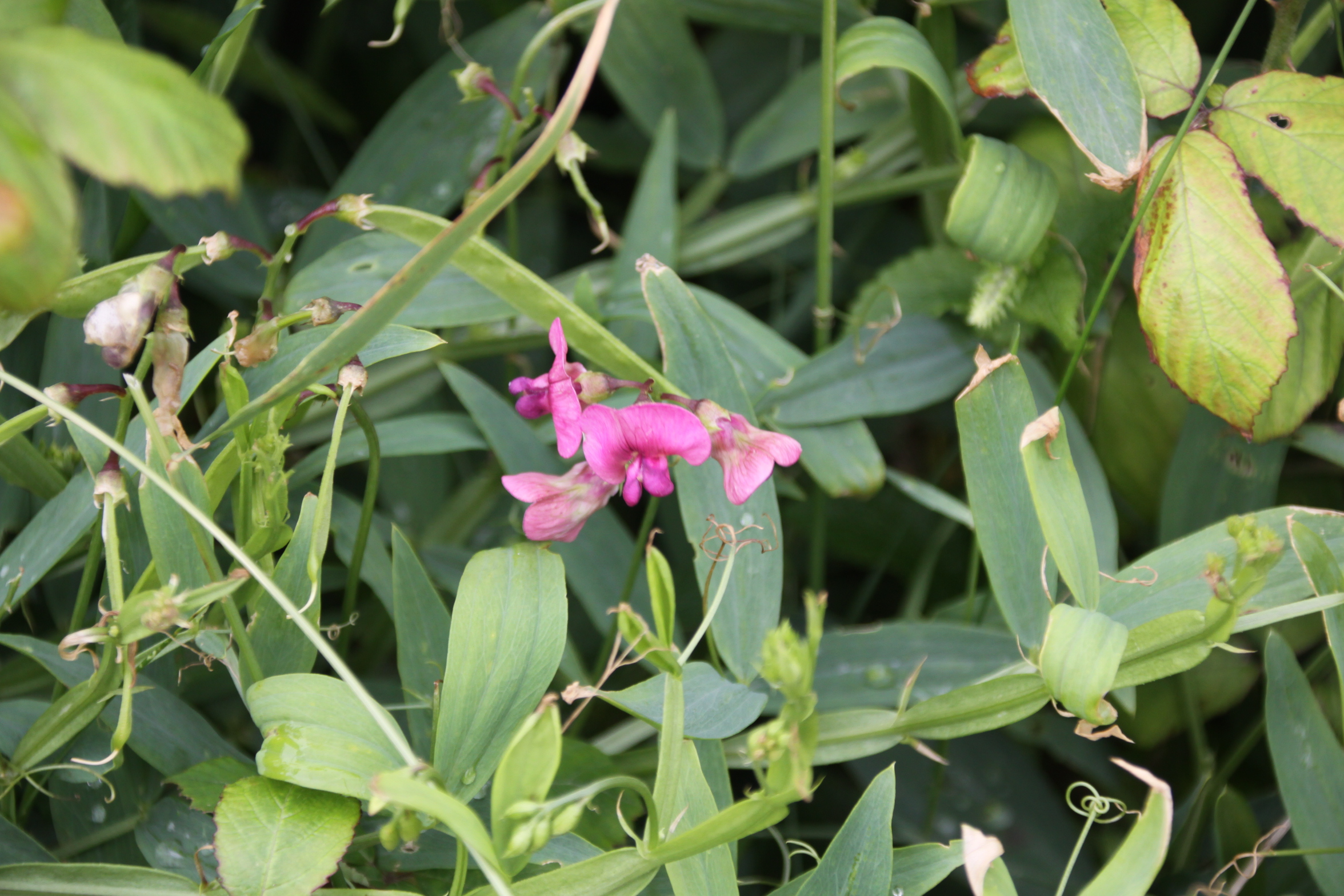
I have wanted to see the Tal y Garreg Iron Age hillfort at the top of Tonfanau quarry, on Mynydd Garreg (rock hill), for some time, so on Sunday (9th August) I packed my rucksack and went along the route I had scoped out on Saturday, which had been made so enjoyable by the verges filled with wild flowers.  I parked the car on the road leading up to the Tonfanau footbridge, as before and followed exactly the same route, but this time instead of stopping at the gate into the field at the end of the bridlepath, I followed the faint track of the footpath up the hill.  The route is marked in dark green on the map to the left.  There are two hillforts on Tonfanau, both of which are marked with red dots, Tal y Garreg at the summit overlooking the quarry, and Llechlwyd on a lower promontory to the east of the quarry.   On this post I will talk about Tal y Garreg, but I covered Llechlwyd on another post, and the map above and an aerial shot below show the geographical relationship between the two.  The walk up the side of the hill is very beautiful, and the views from all around the top of the hill are breathtaking.  I should, however, make a couple of health and safety notes about this walk before I recommend it as a great one to do

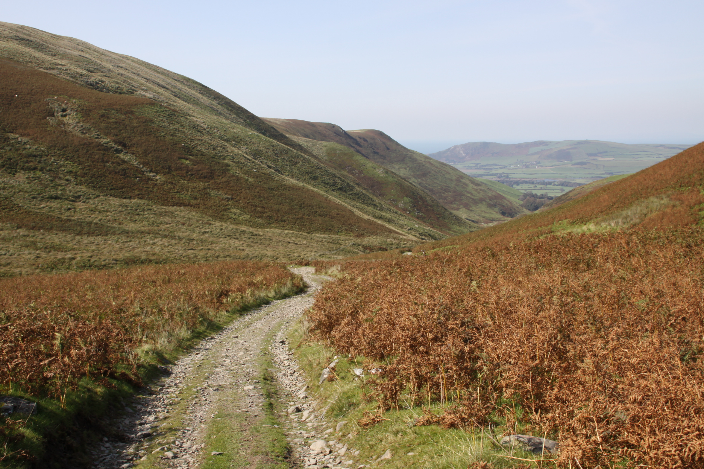
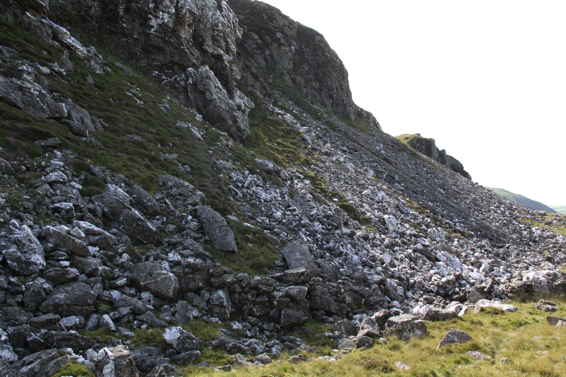
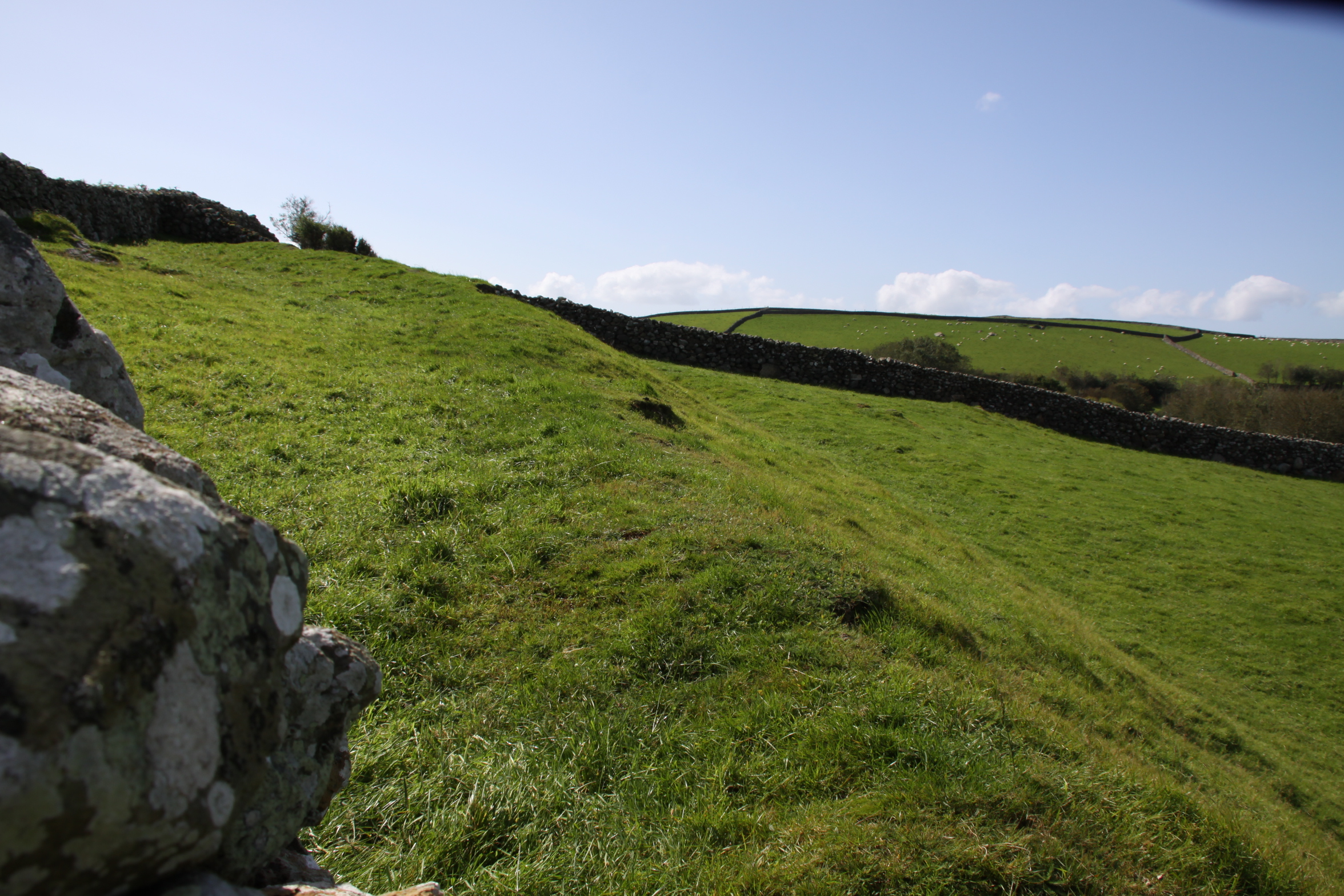
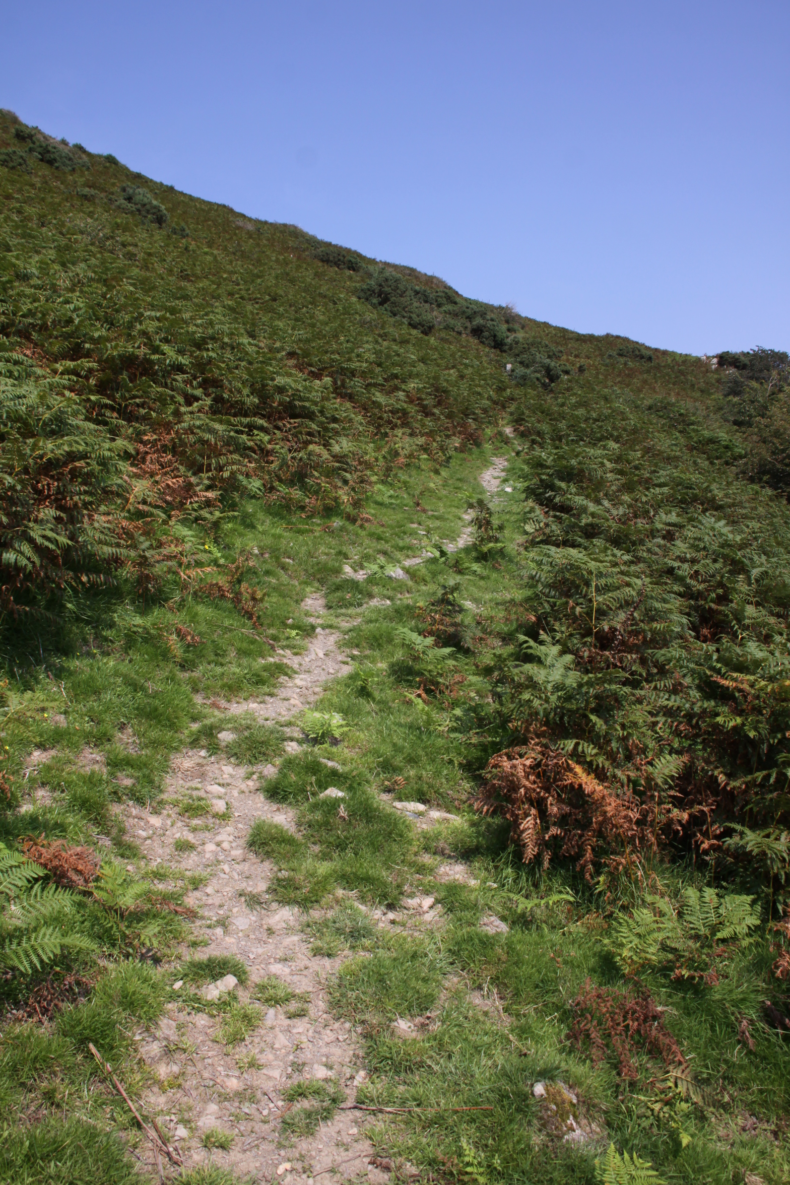
First, the track starts to climb fairly easily, as in the photo on the right, but as you near the top, where the bracken gives way to open ground, it becomes steep.  When you turn around to admire the view, the ground seems to drop sharply away beneath you, and falling would result in an unimpeded roll downhill.  I am very sure-footed, but instead of tacking to reduce the effort, I went straight up, leaning forward, to reduce the risk of tripping.  The views are stunning, just be careful. There are other public footpath approaches marked on the map, which might be easier.  Second, the hillfort of Tal y Gareg sits above the quarry.  Indeed, the quarry has removed a big part of the hillfort.  When you climb to the brick monument on the summit of the hillfort you are getting near to the edge of the quarry, and at the edge there is almost nothing to prevent you falling the steep drop into the quarry should you lose your footing – just fence poles with a single run of wire to mark the edge.   Perfectly okay if you’re aware of it, but do not let children loose up there.

Access over two sets of steps to the ridge at the top of the hill

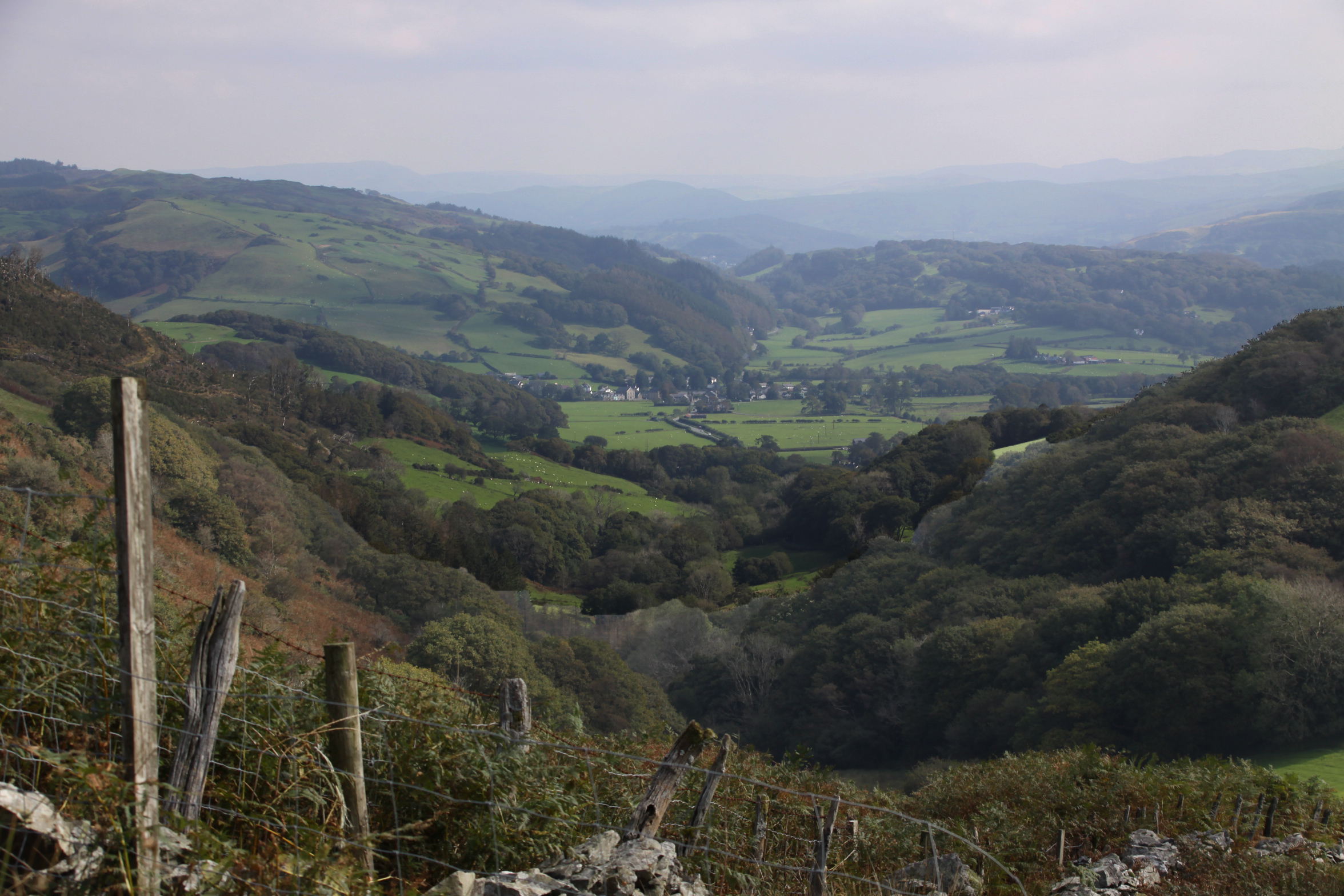
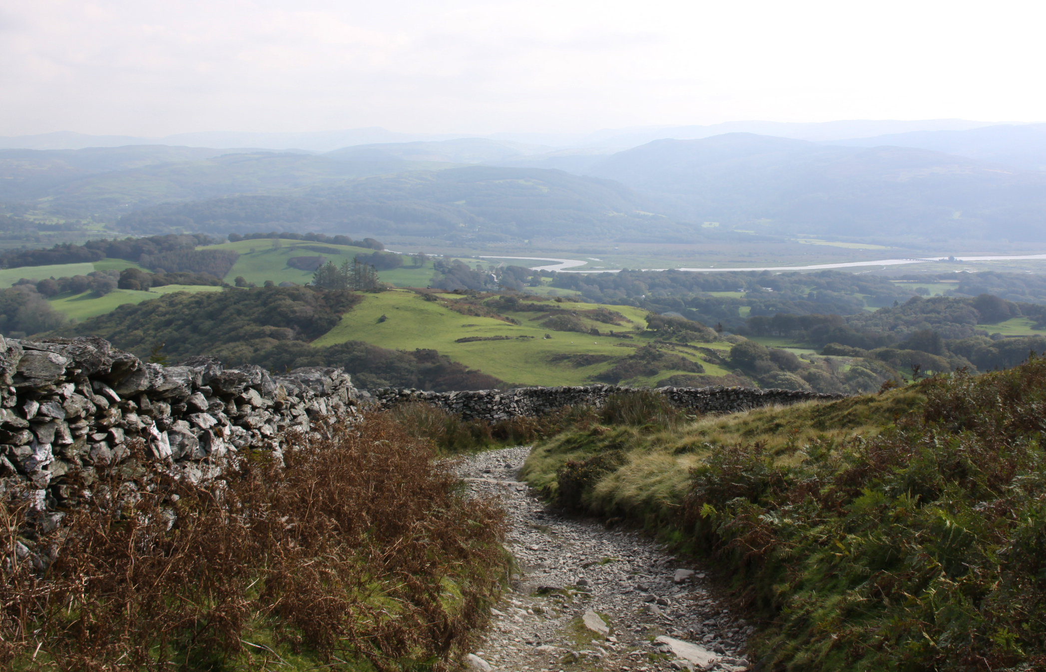
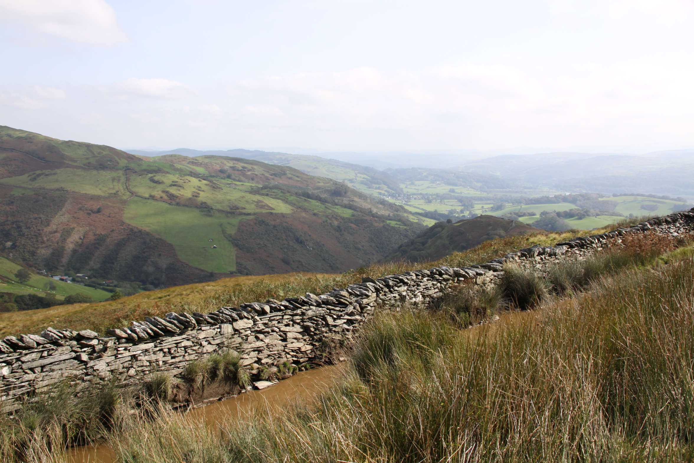
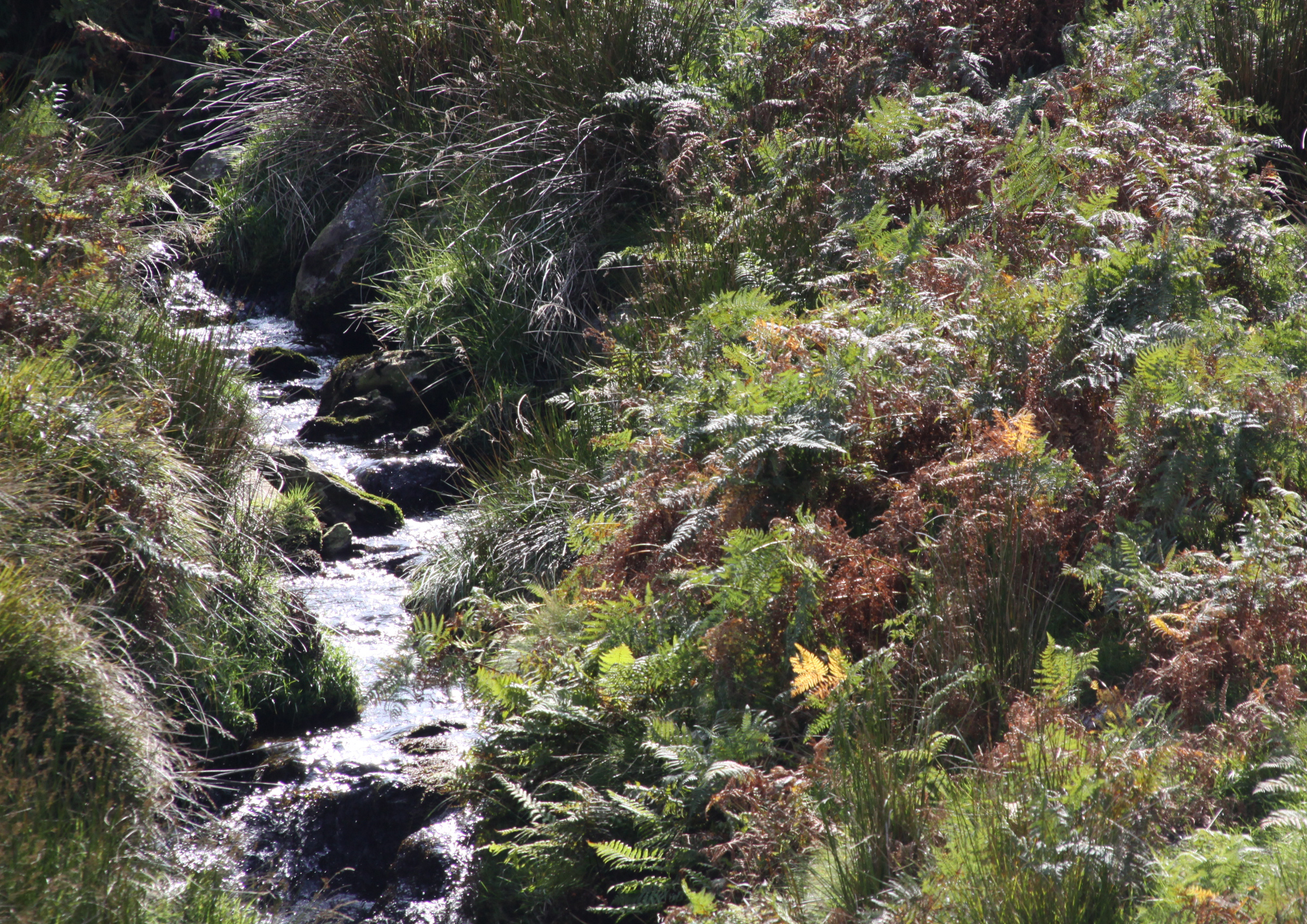
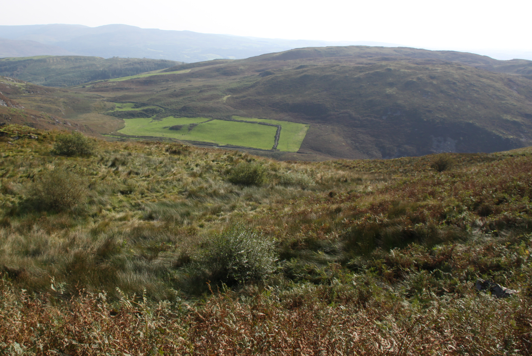
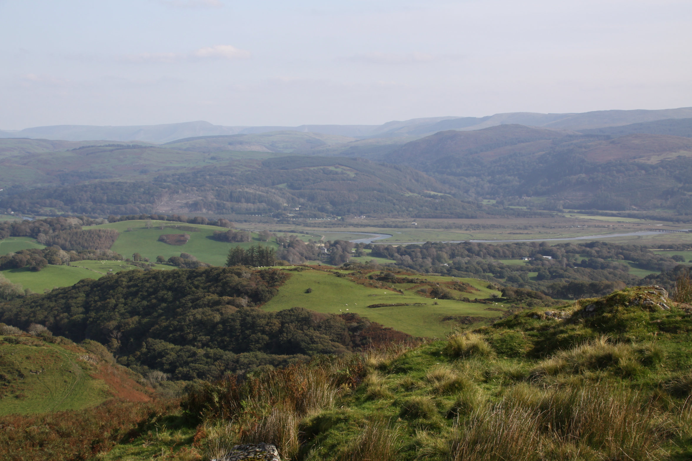
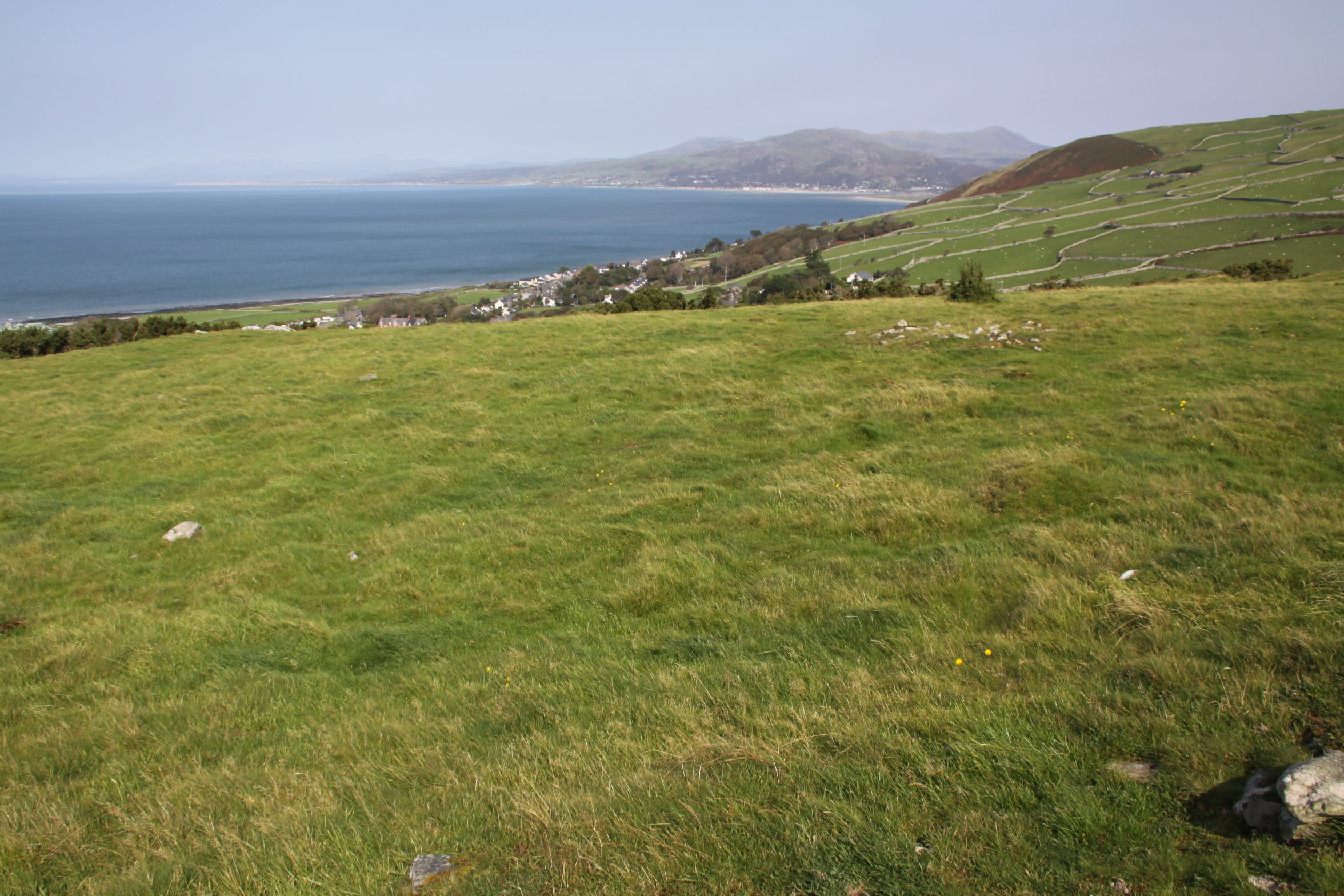
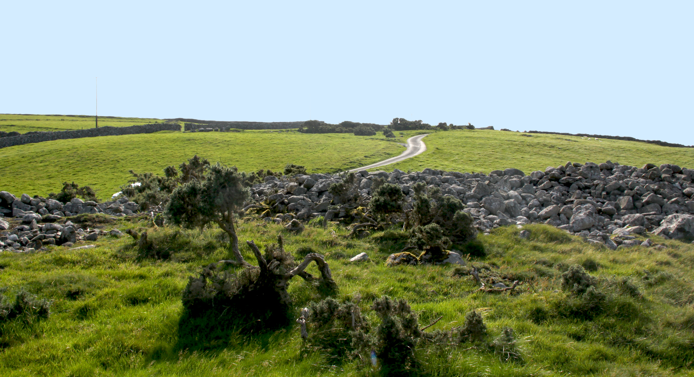
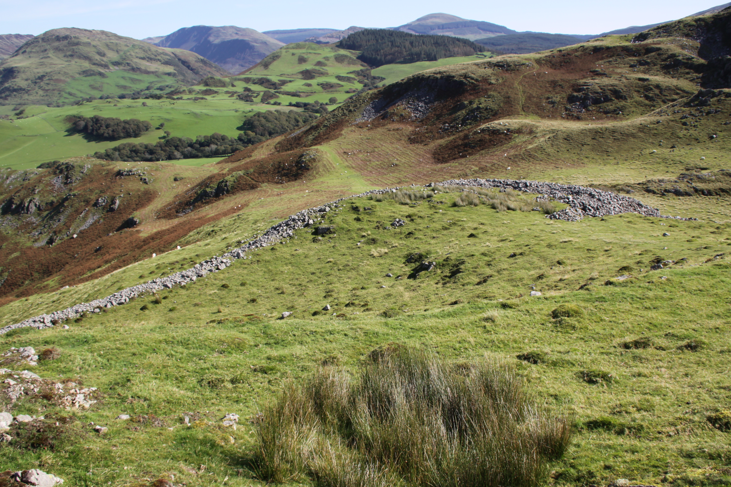
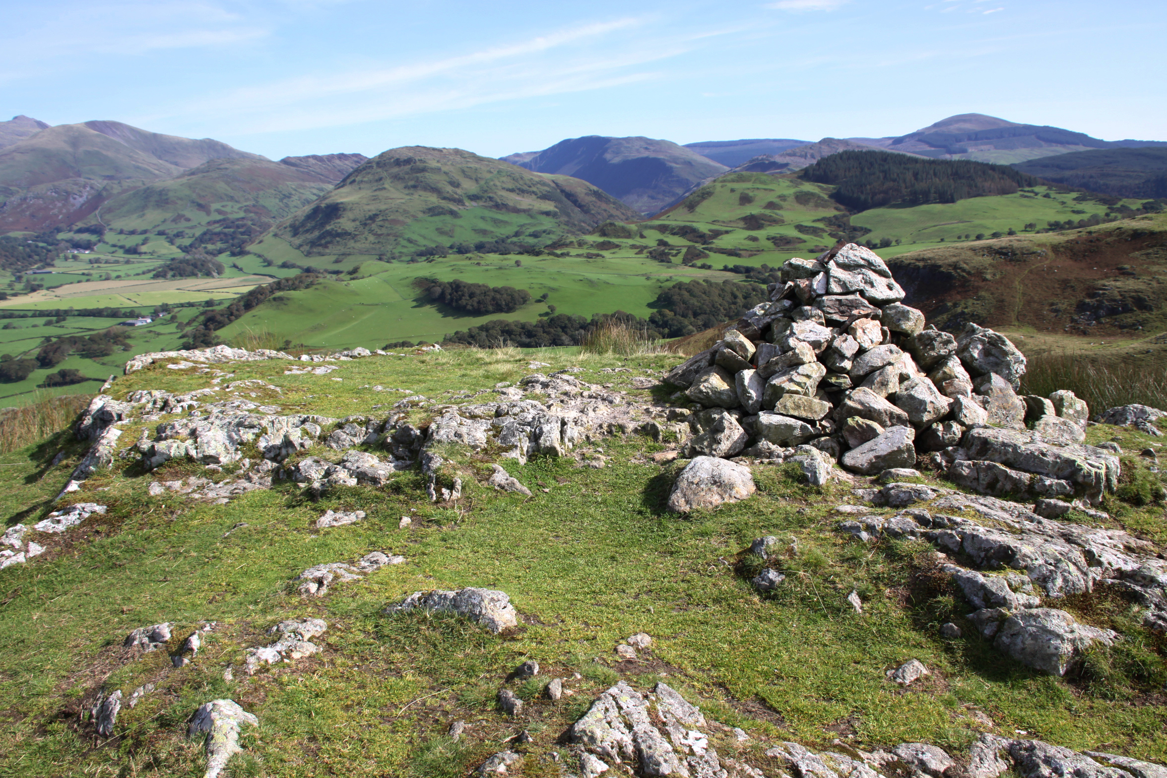
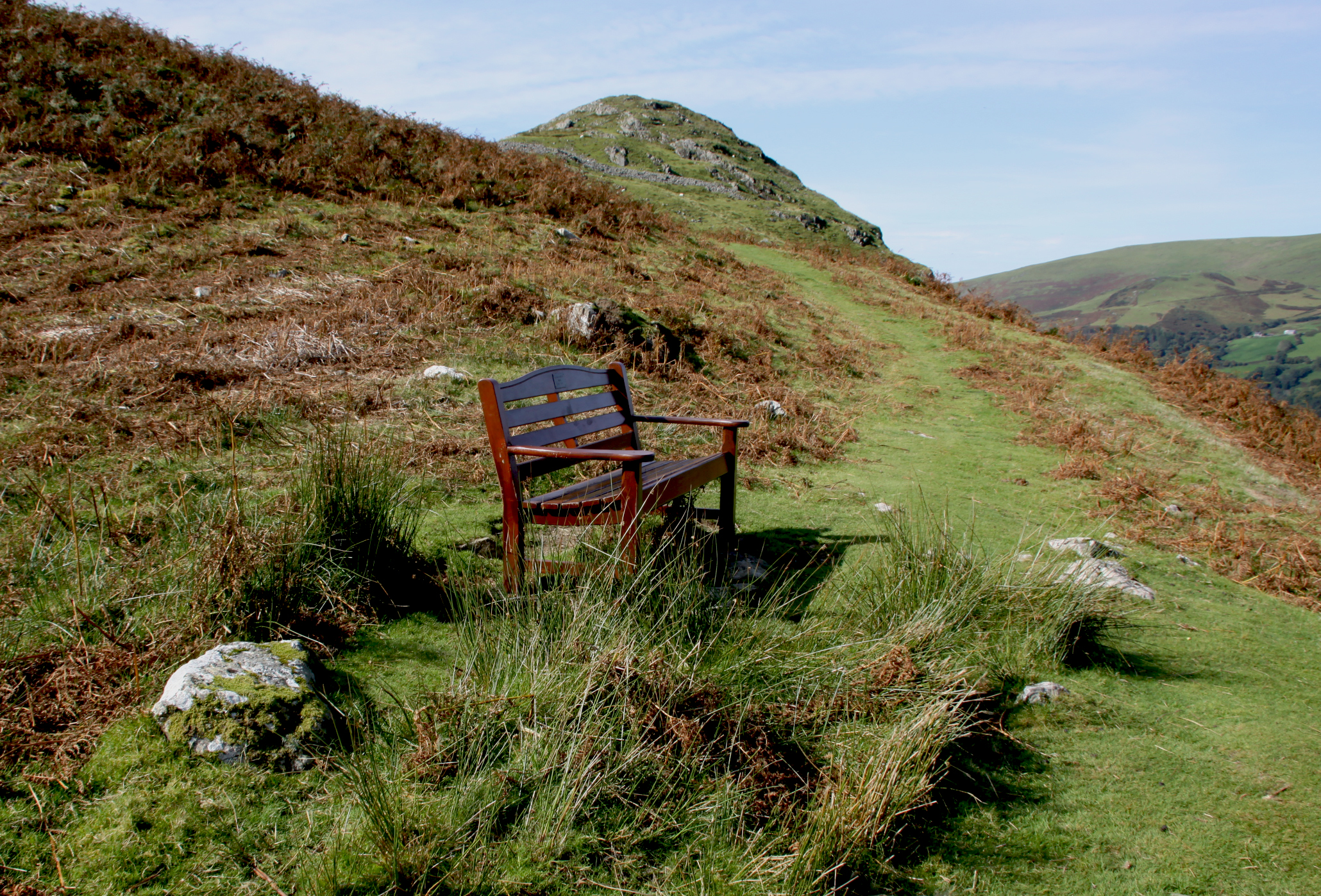
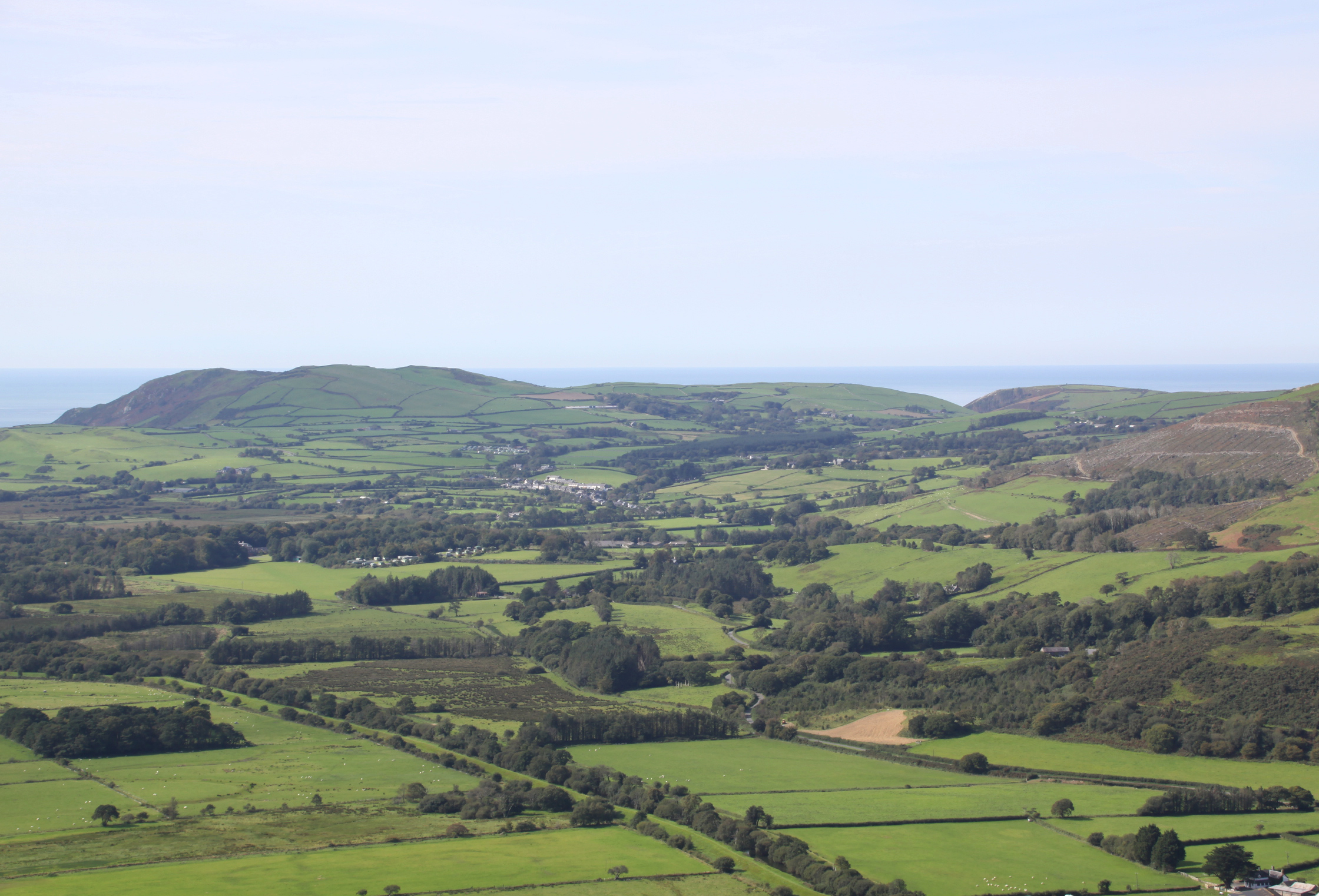
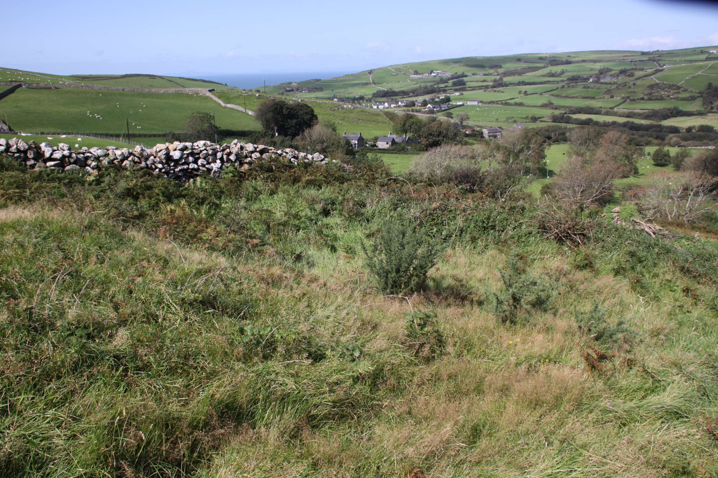
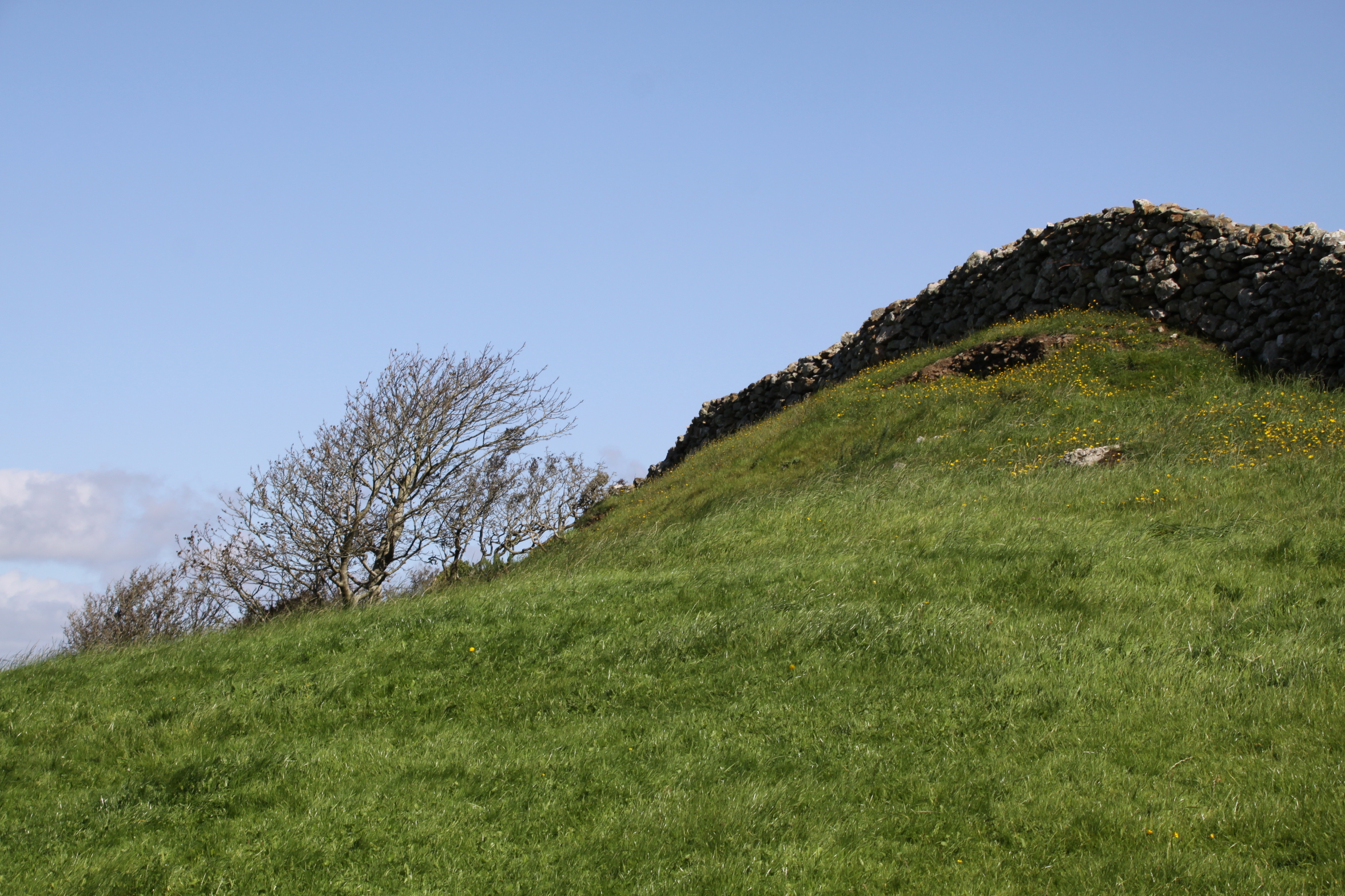
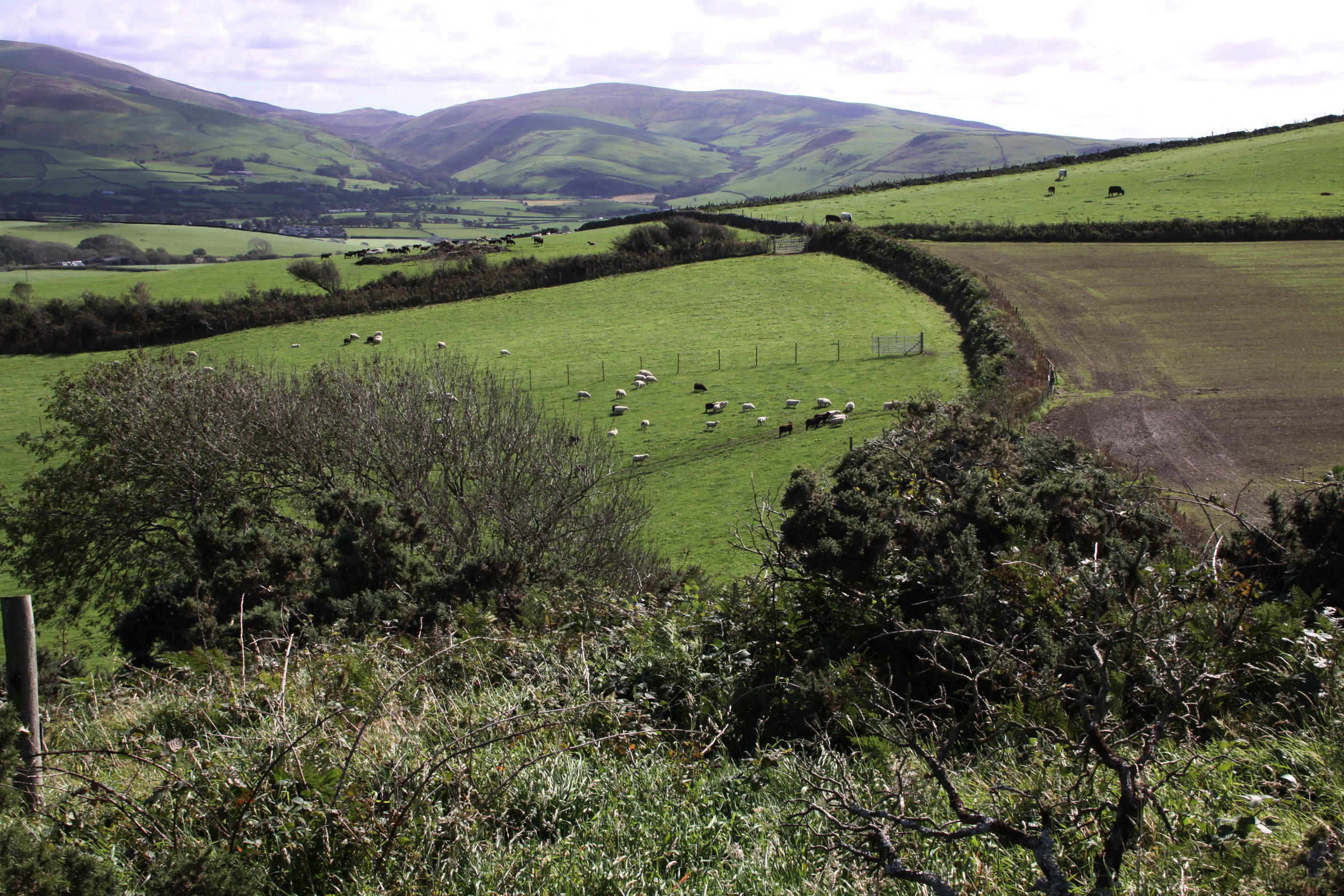
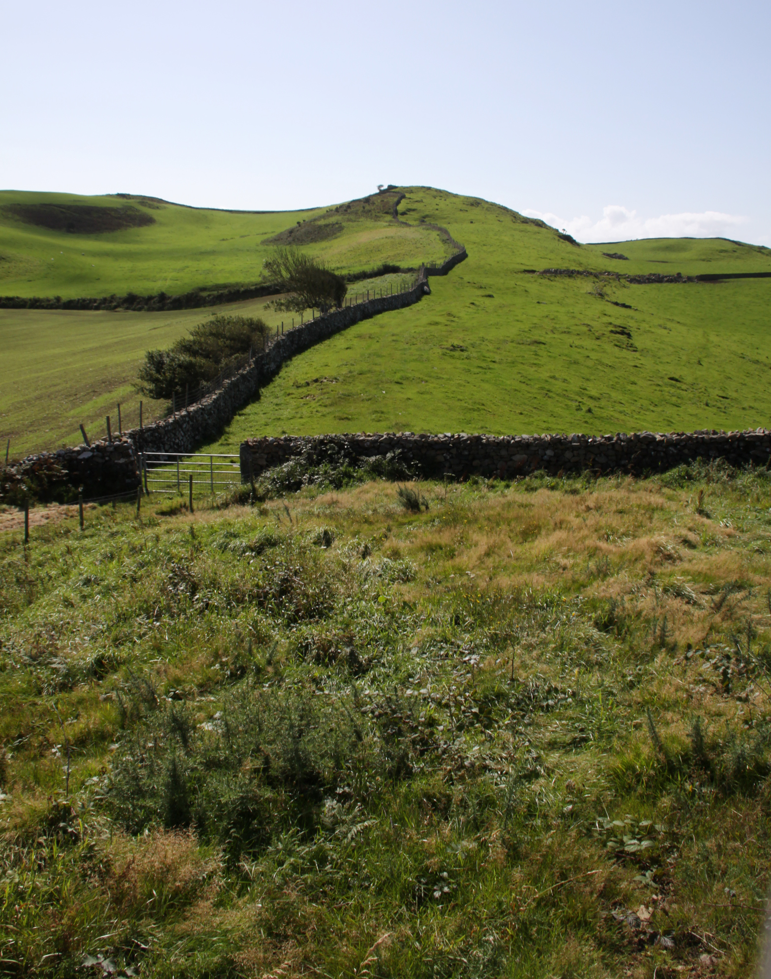
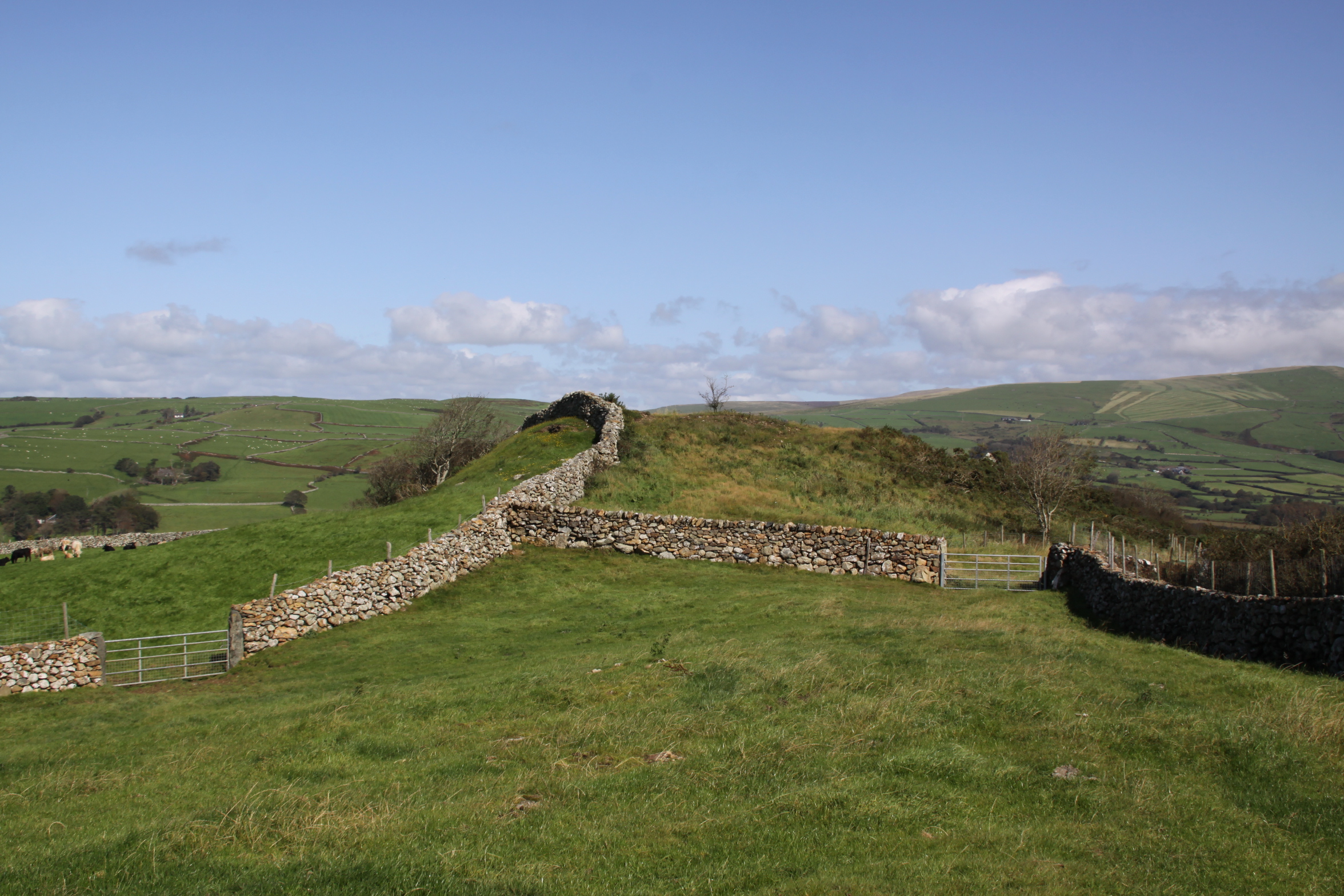
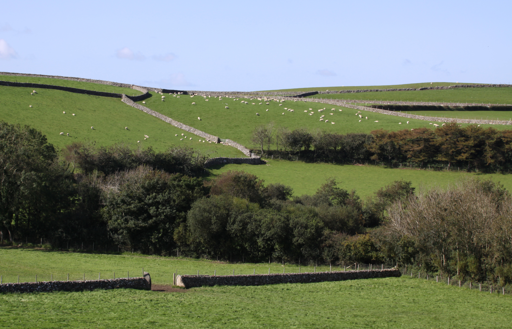
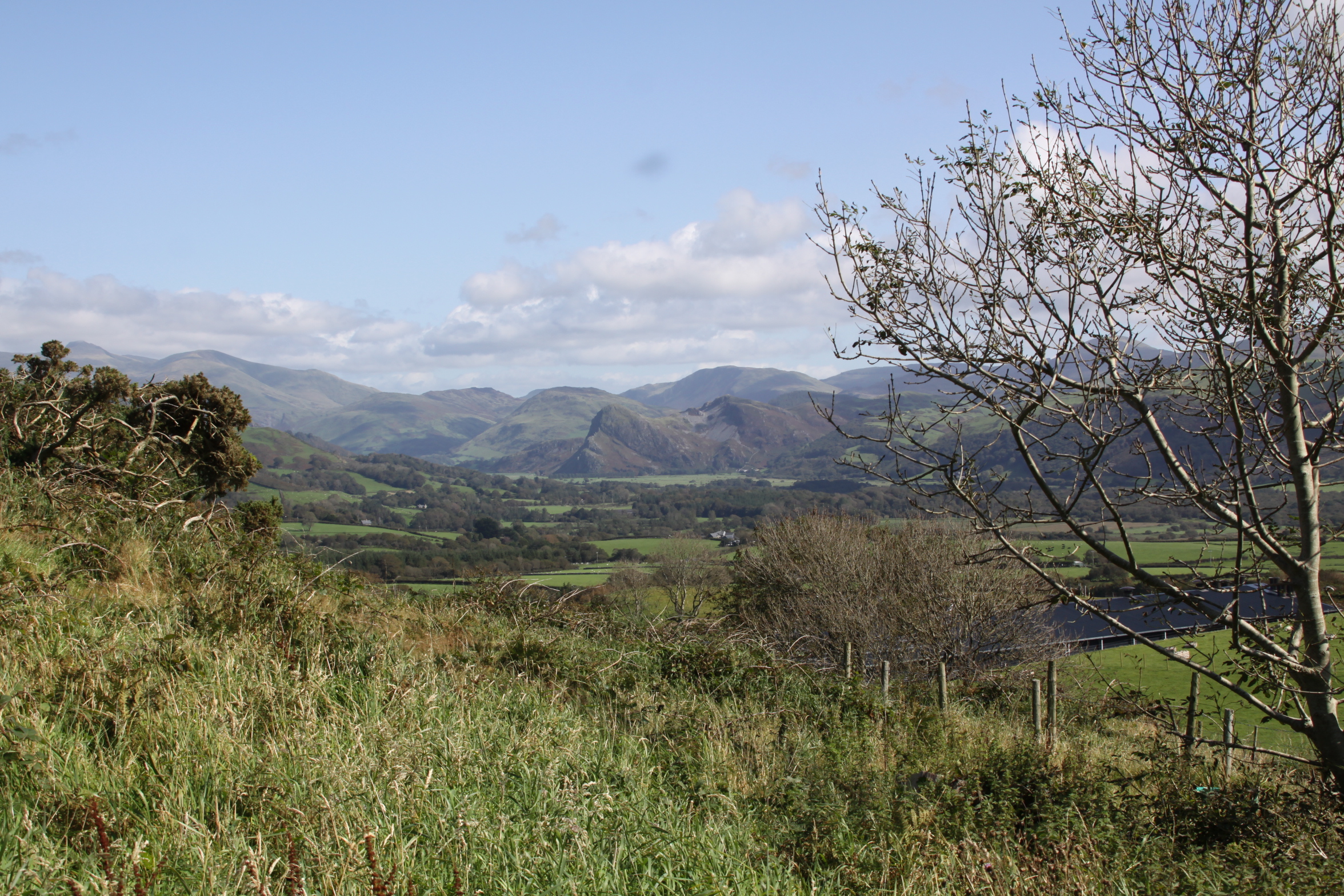
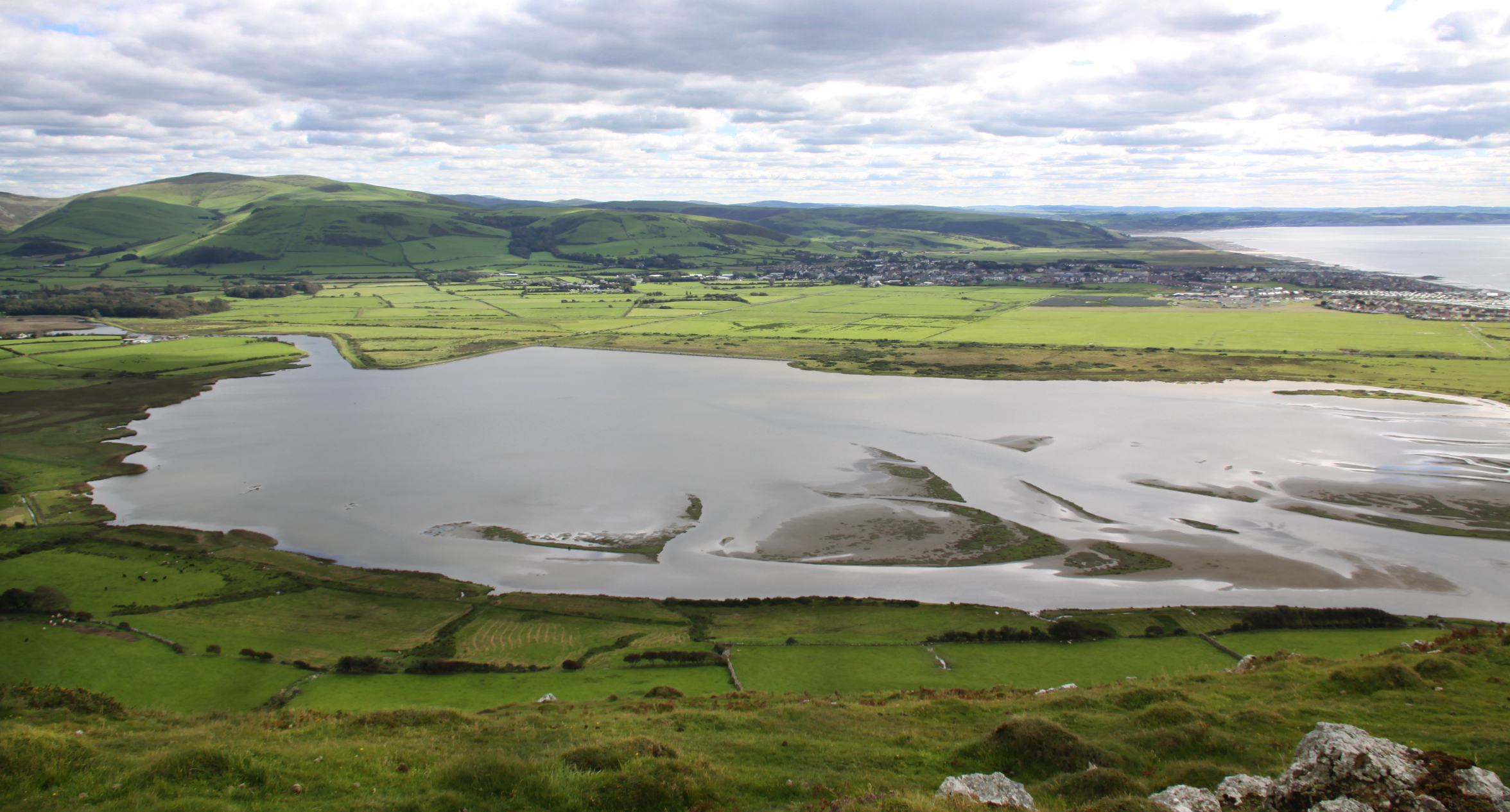
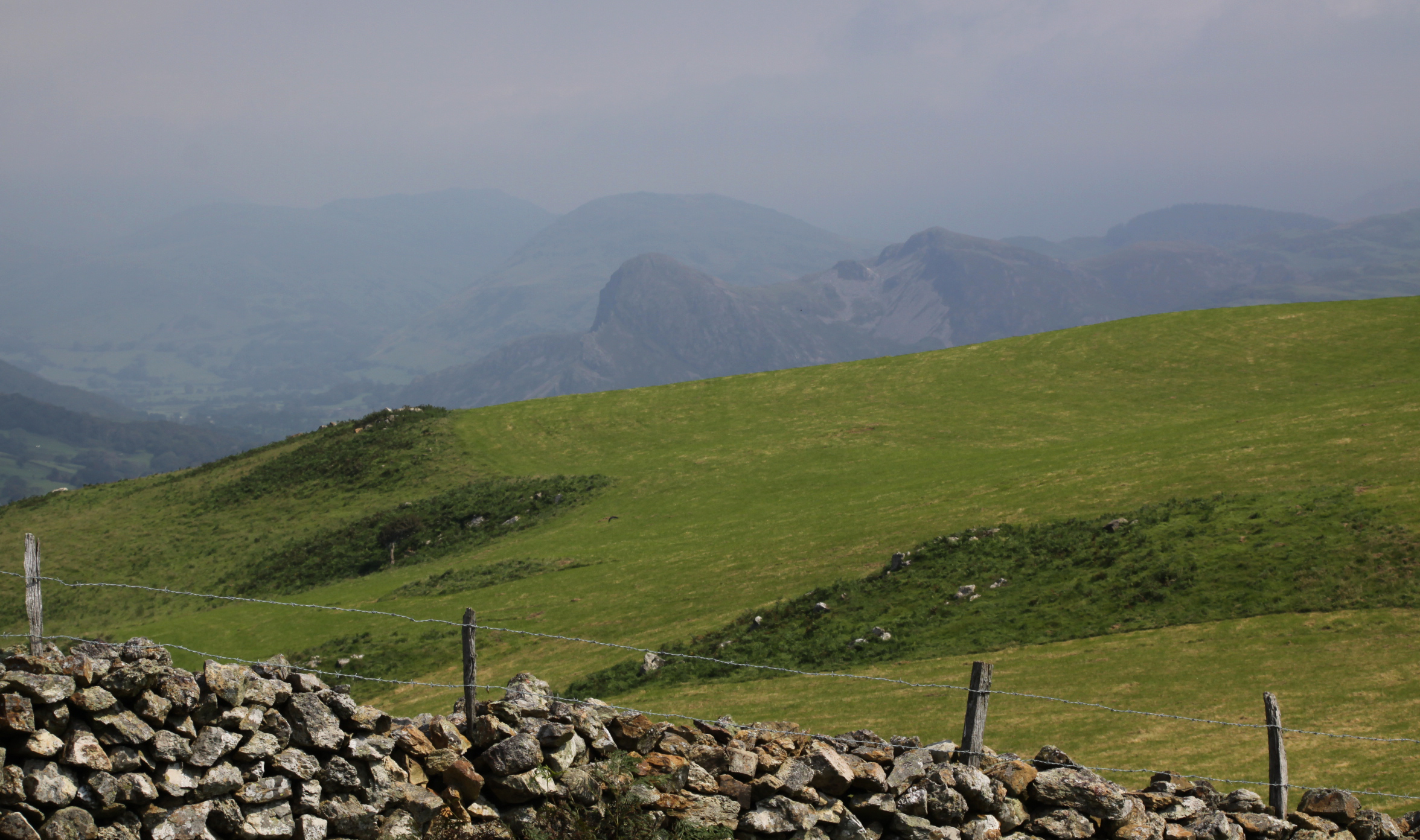
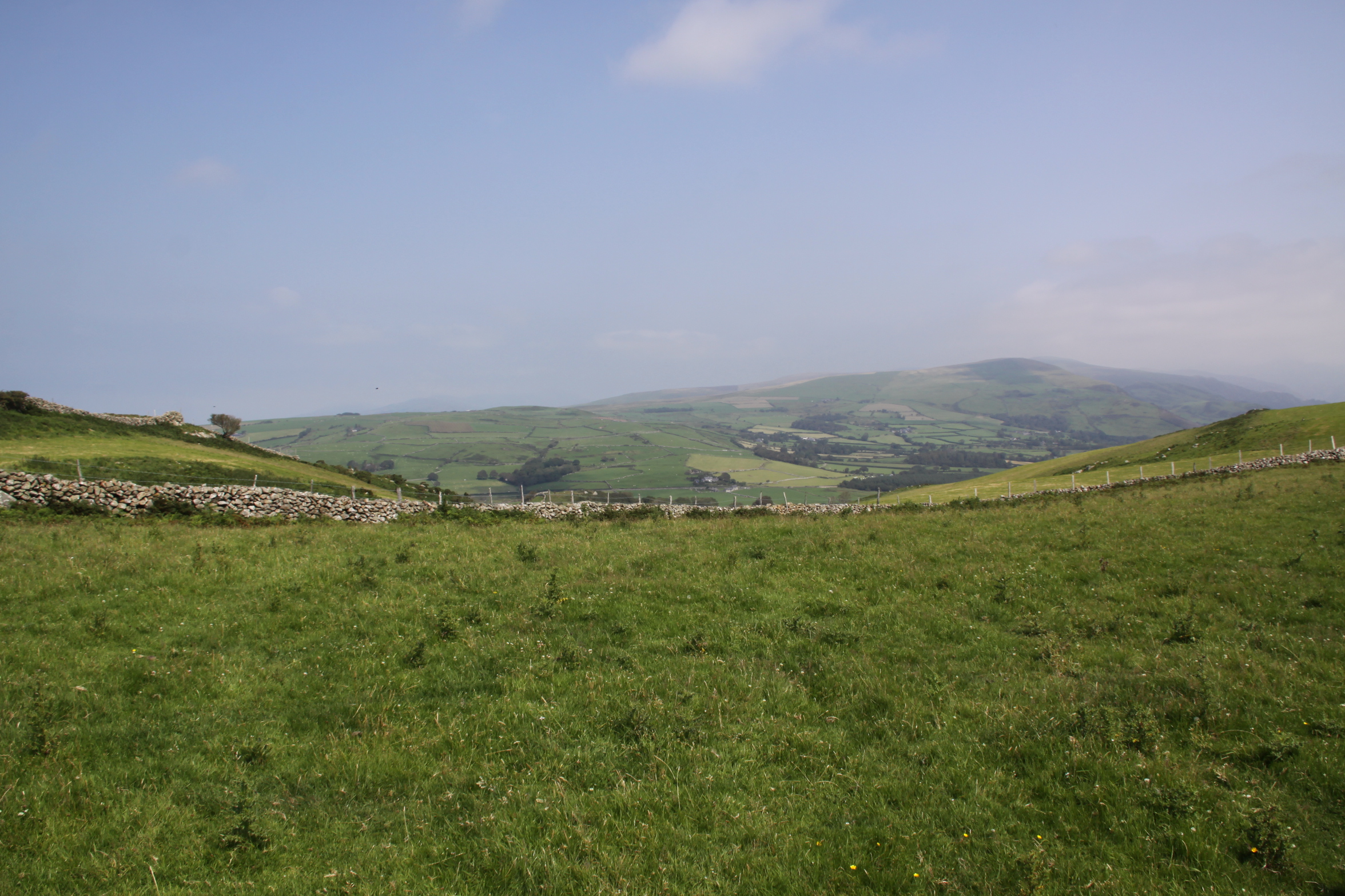
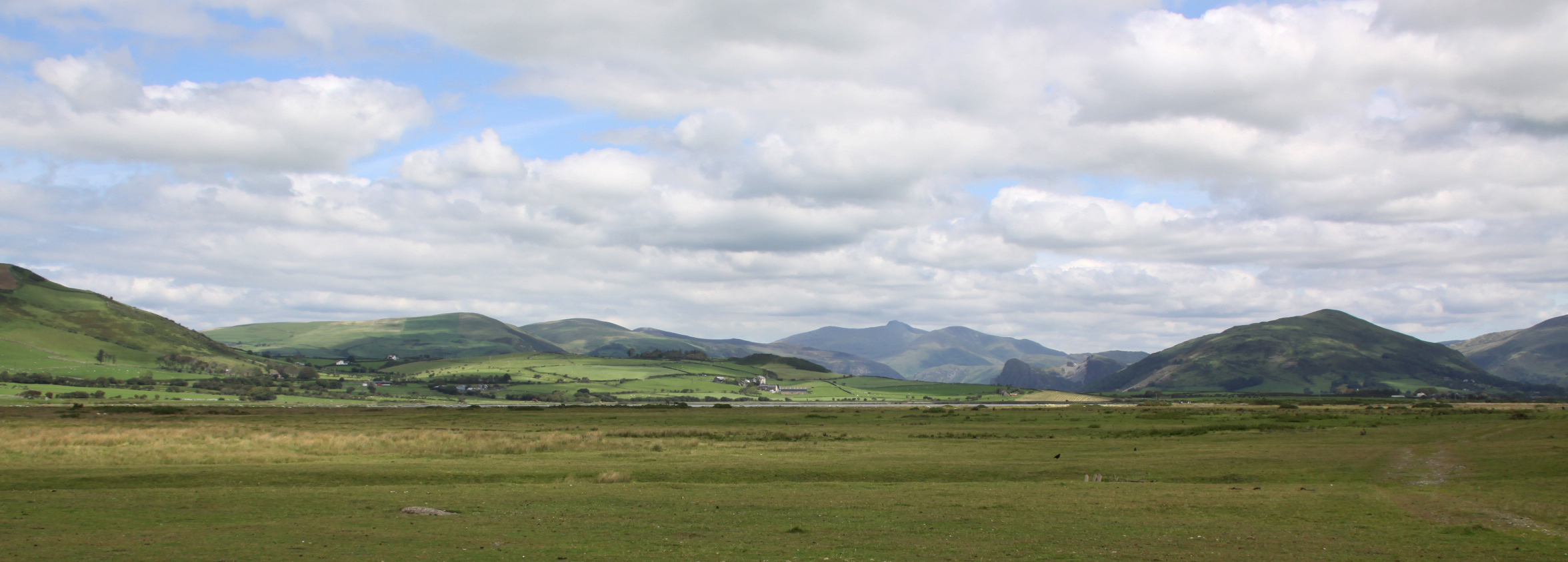
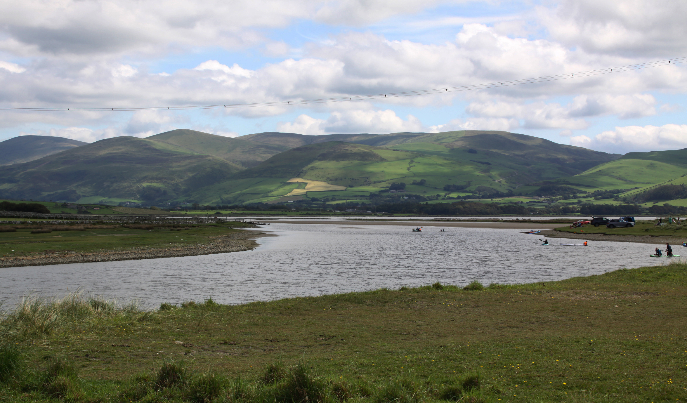
The top of the hill is a ridge that extends 1.5km to the northeast, with terrific views either side.  The ridge is enclosed today by a long, winding drystone wall that extends as far as the eye can see.  A short wooden ladder on either side of the wall allows you to cross the wall easily, but take care – two of the steps on the ridge side are rotten, one completely broken.  The inside of this drystone perimeter is divided up into separate enclosures by more drystone walling, but all of them have gates or are open so you can wander freely across the top.  To the southwest is the river Dysynni, at the eastern end are views over the hills flanking the valley, including Craig yr Aderyn (Bird Rock).

I was up there partly for the views, but mainly because I am on a hillfort mission at the moment and wanted to check out what was left of one of two small Iron Age hillforts.  In the area between the Mawddach estury and the Dyfi estuary are fifteen known hillforts.  These fall into two distinct geographical groupings, a northern and southern group.  Eight of the fifteen are in the southern group and I am hoping to walk all of those that are accessible by public footpath.

When the first hillforts were excavated during the late 19th Century, it was assumed that all hillforts were defensive, and some southern hillforts certainly were, but it is by no means clear if all hillforts were built as a response to conflict.  Because so few hillforts have been excavated in northwest and mid Wales, it is impossible to establish exactly what they were designed to do, and most of them probably had multiple functions.  I’ll be talking more about the roles of hillforts in this area on a future post.

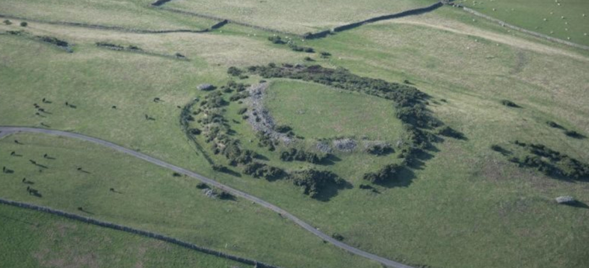
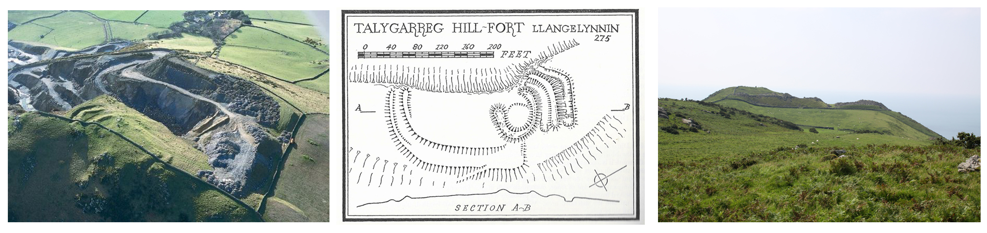
It is almost impossible to photograph a hillfort sensibly at ground level, although some banks and ditches can usually be captured.  Aerial photographs and excavation plans are the best ways of of visualizing individual hillforts.


Another view of the quarry. Source: Gwynedd Archaeological Trust

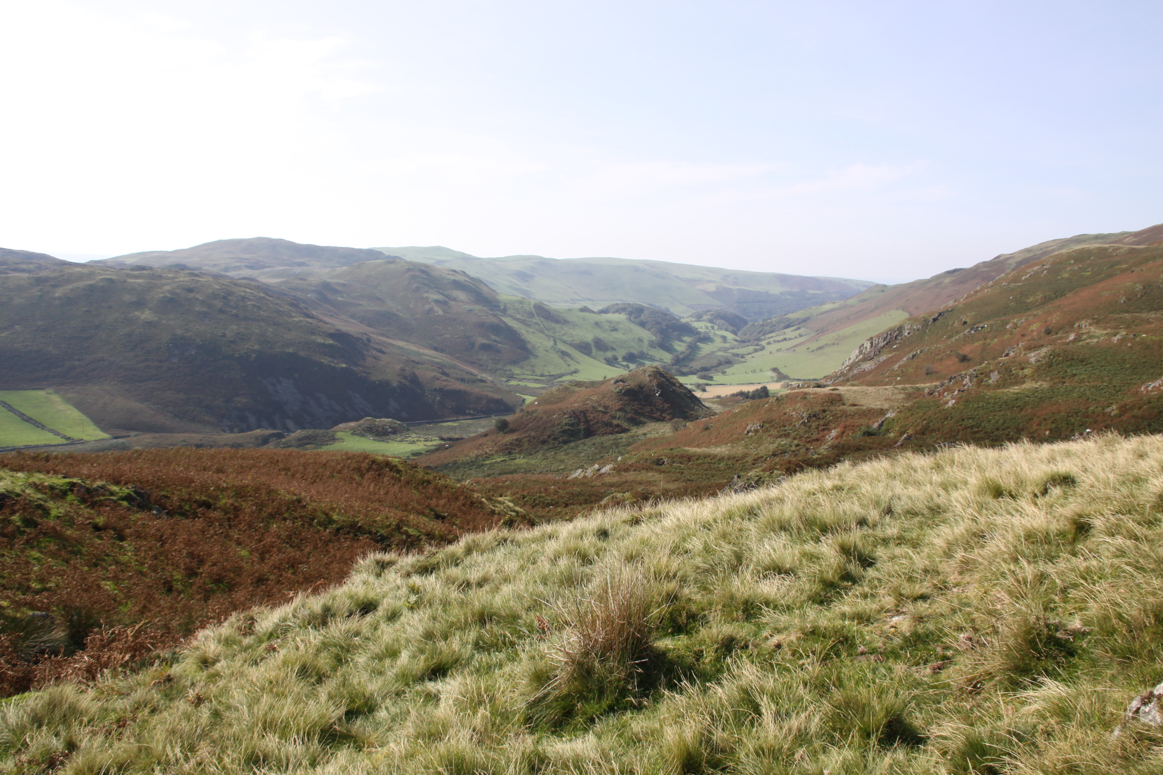
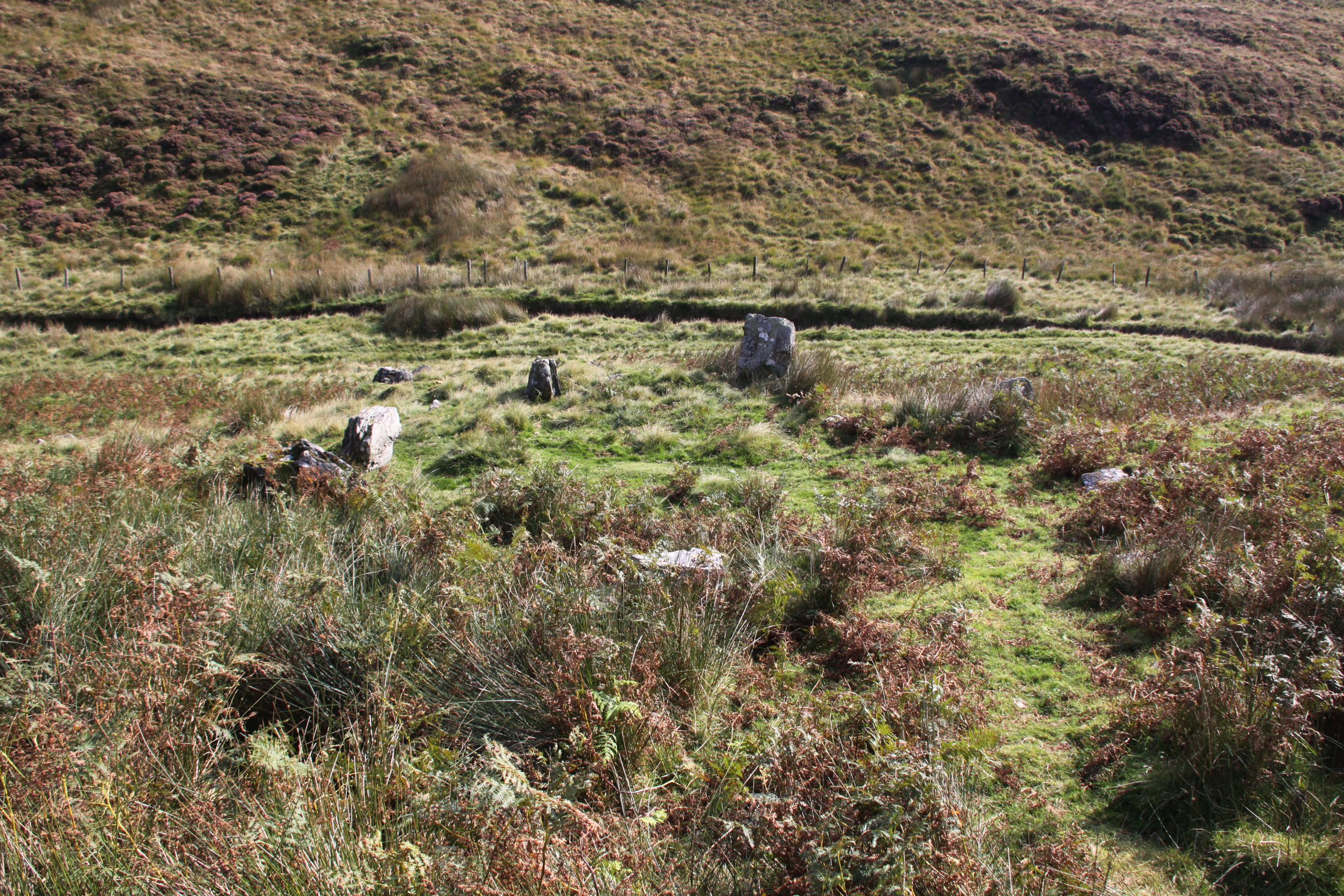
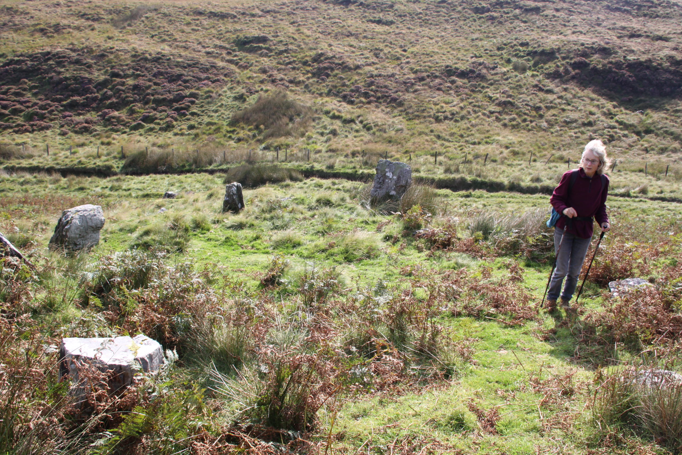
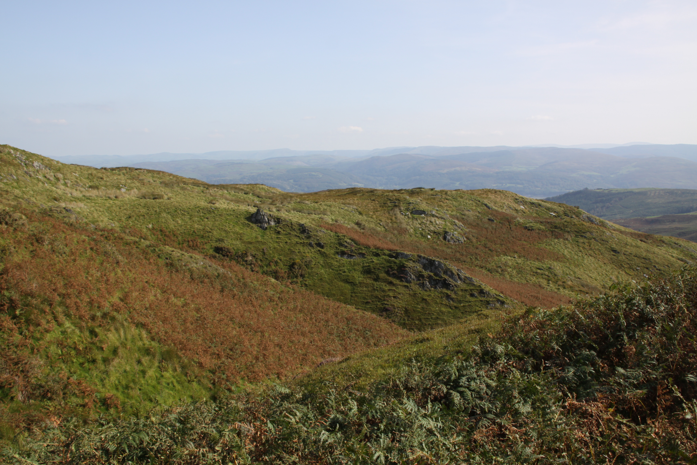
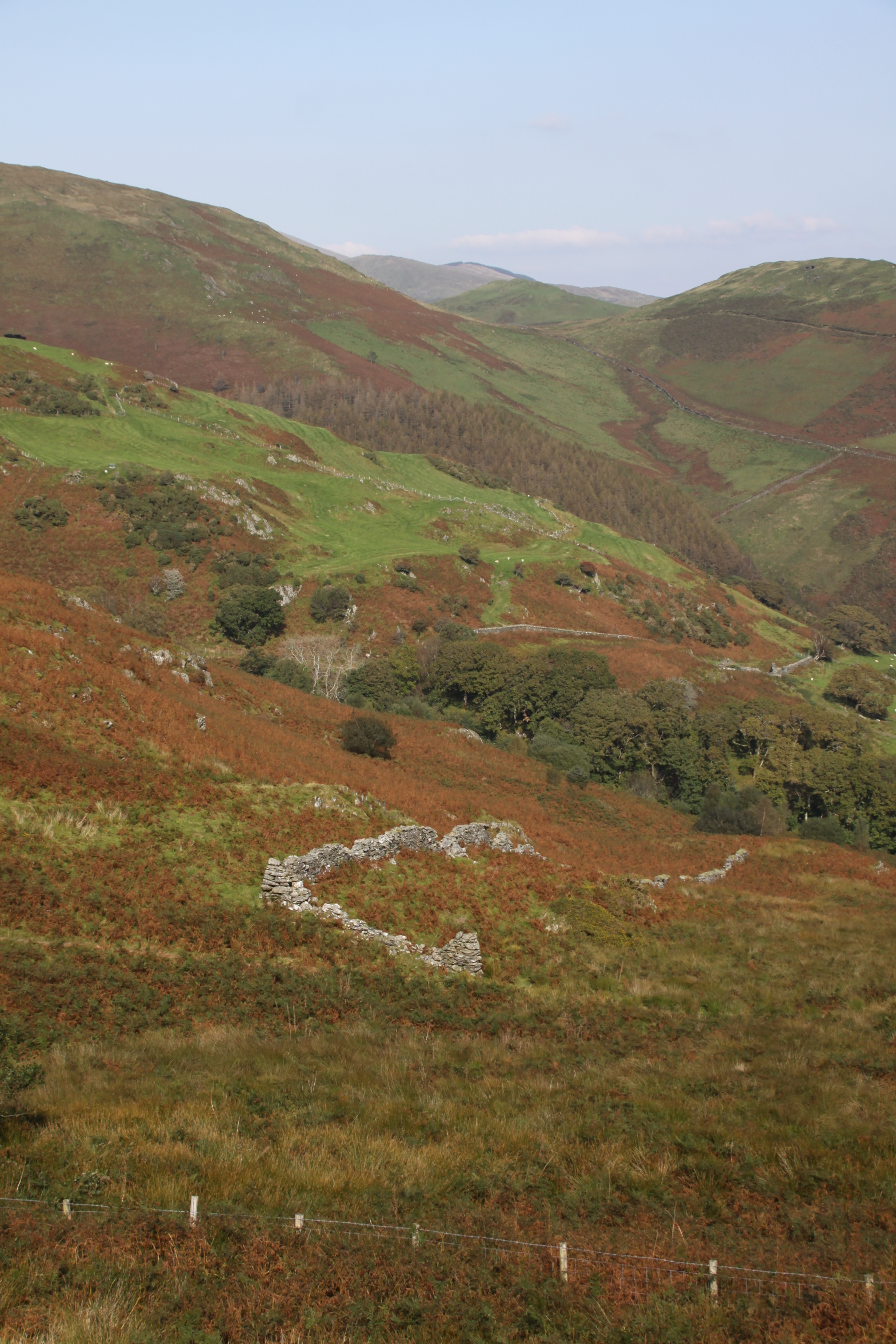
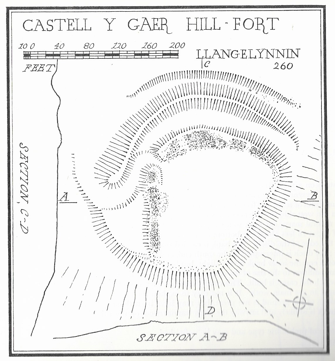
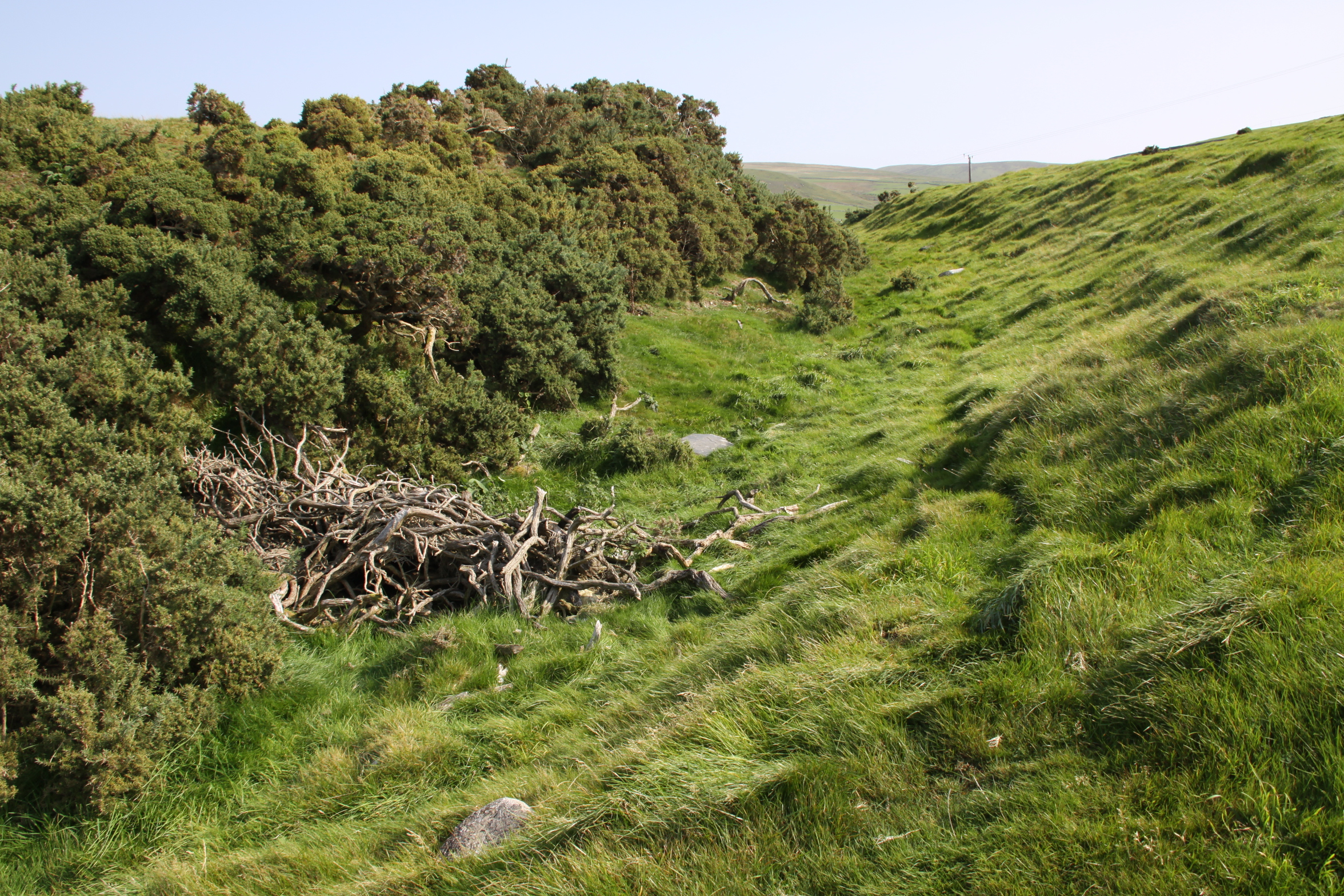
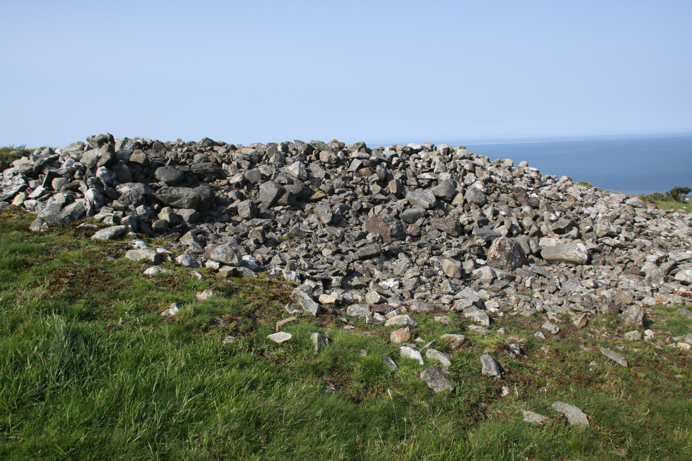
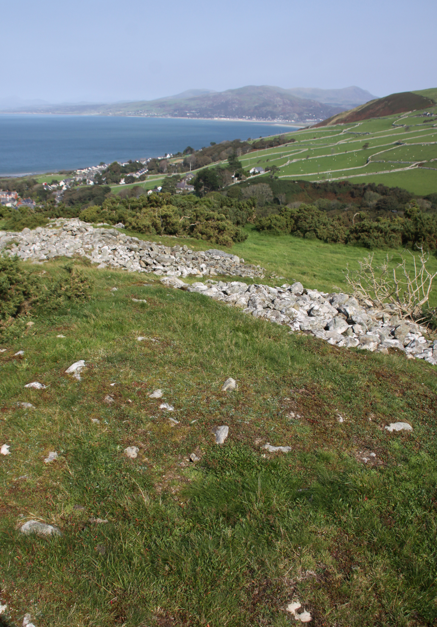
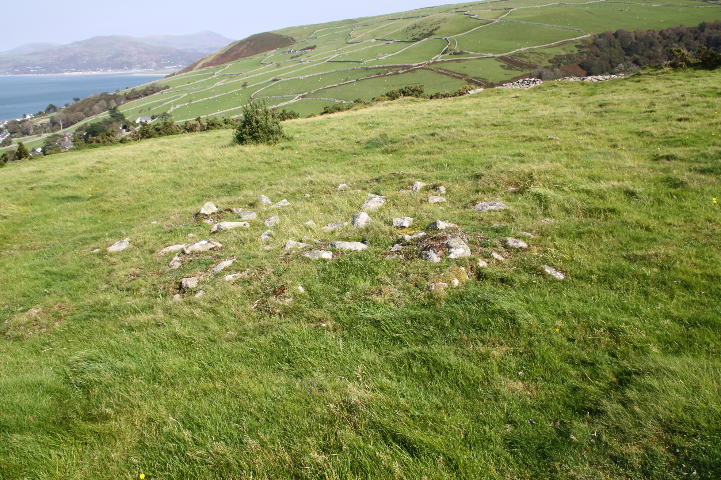
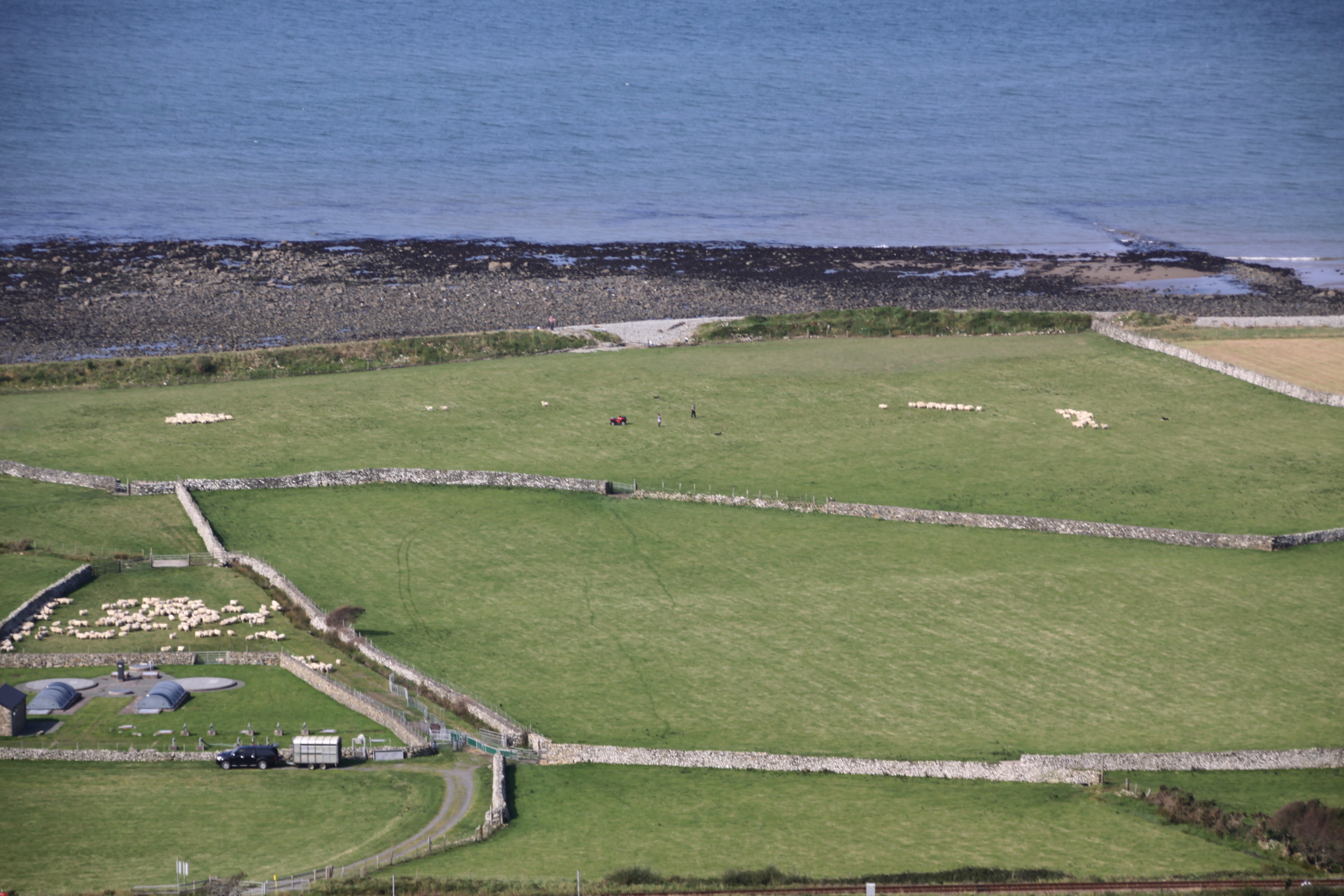
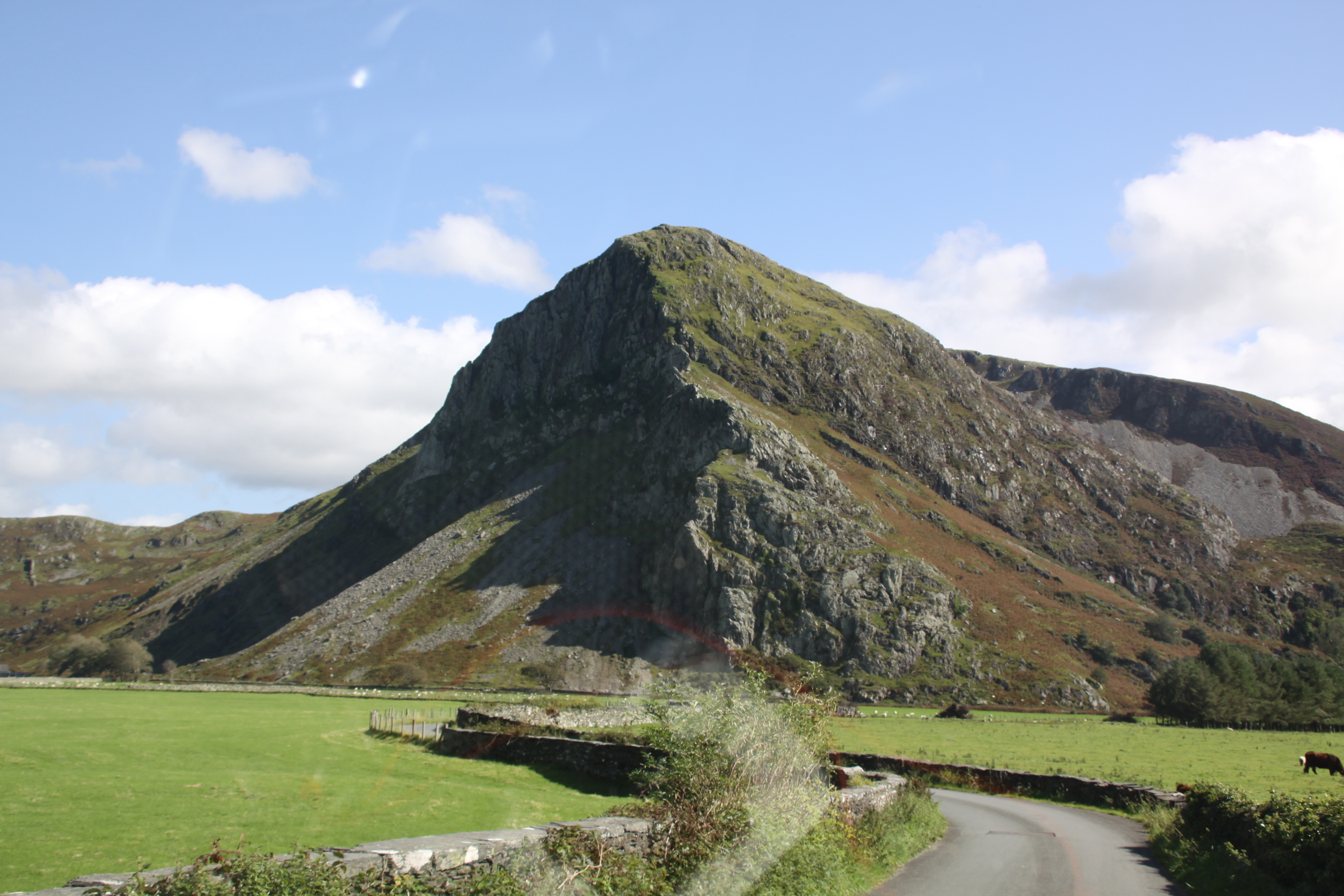
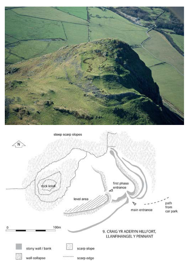
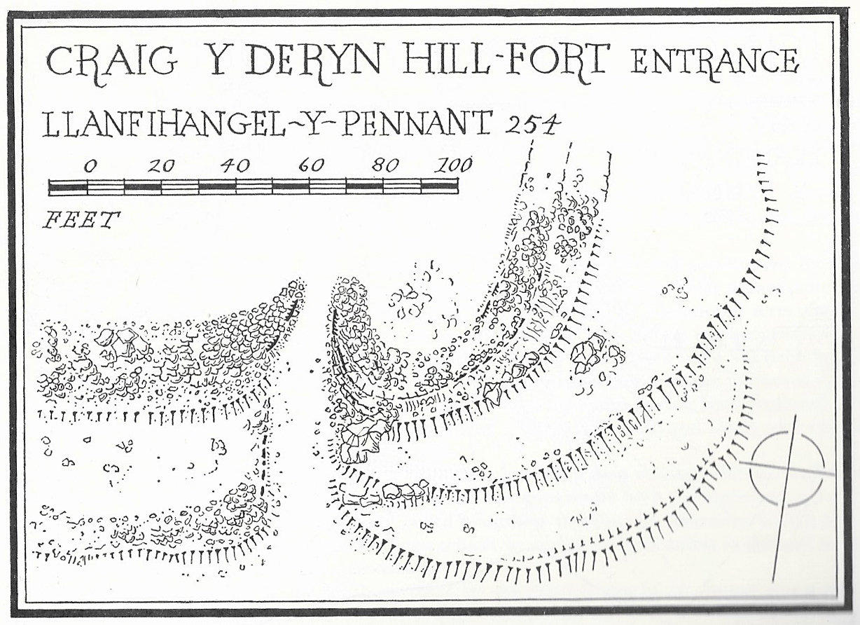
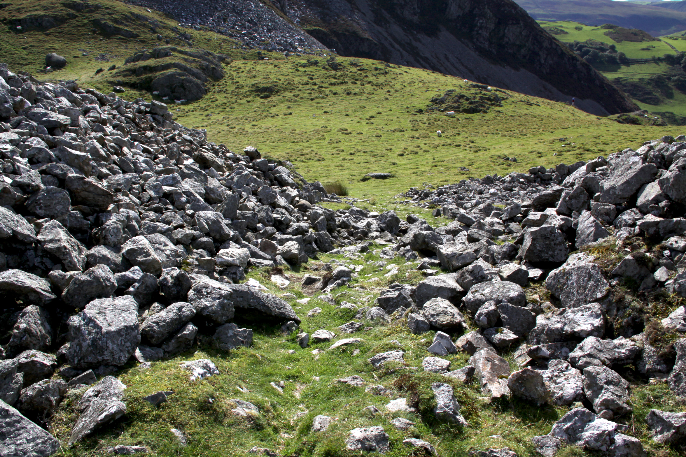
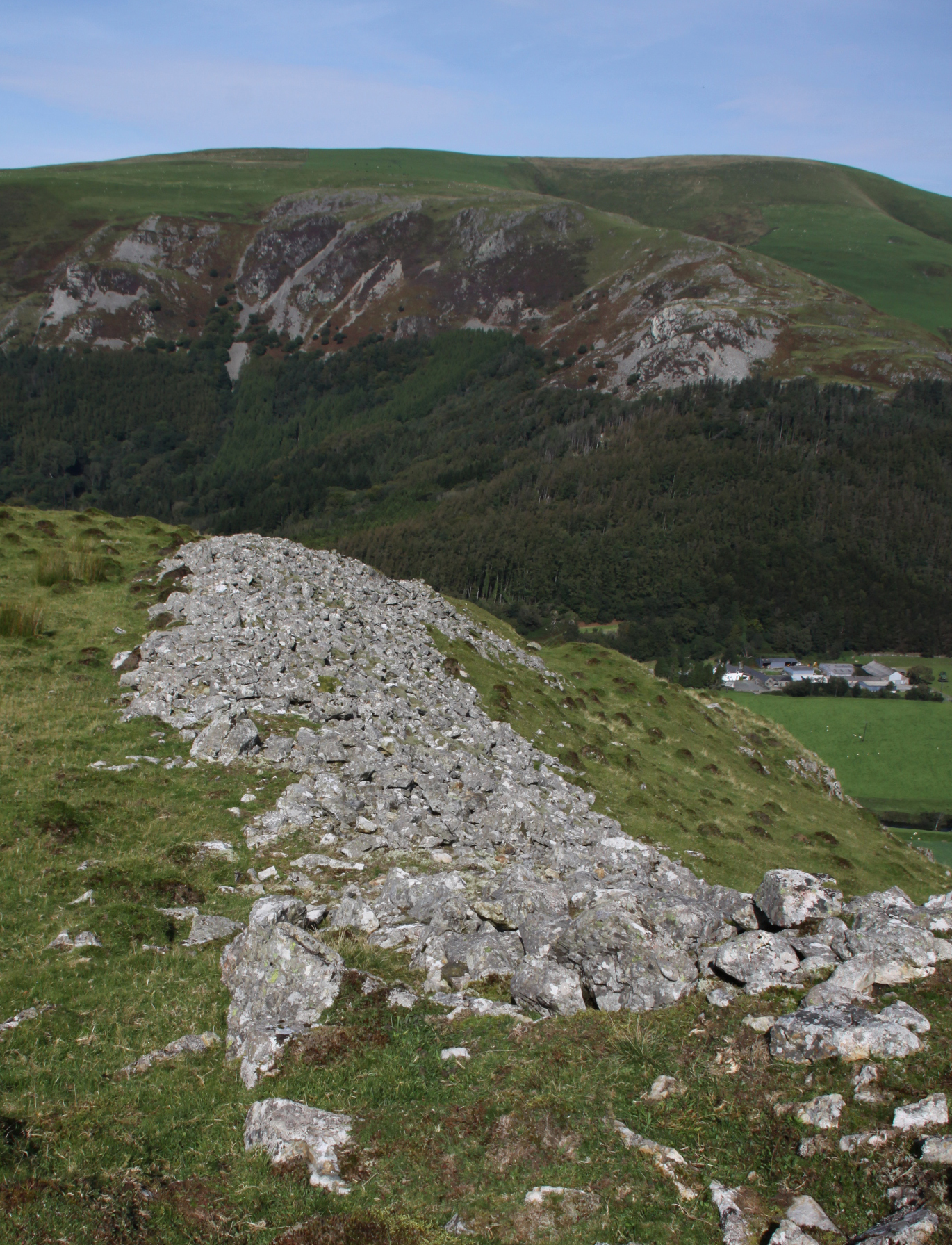
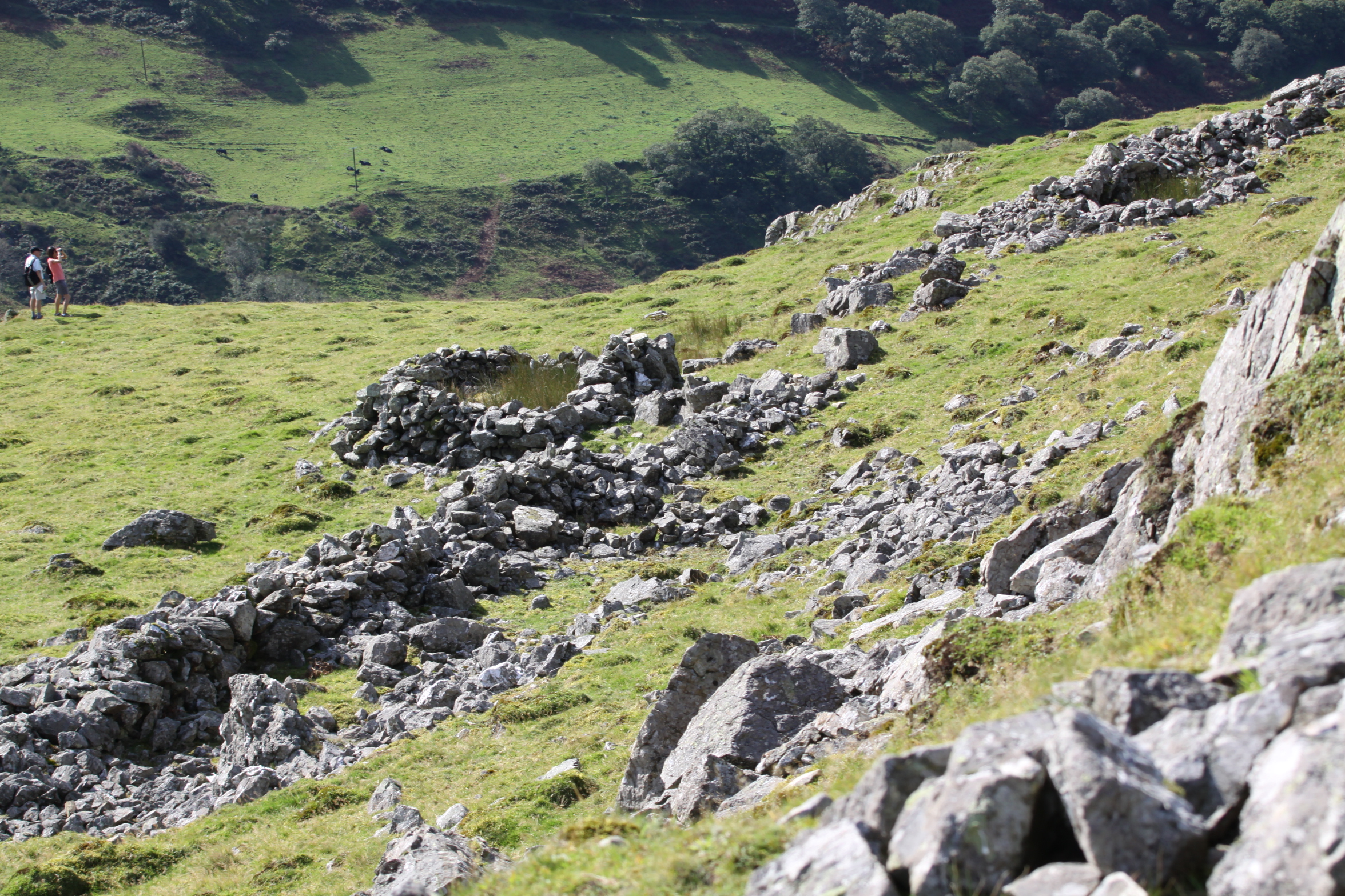
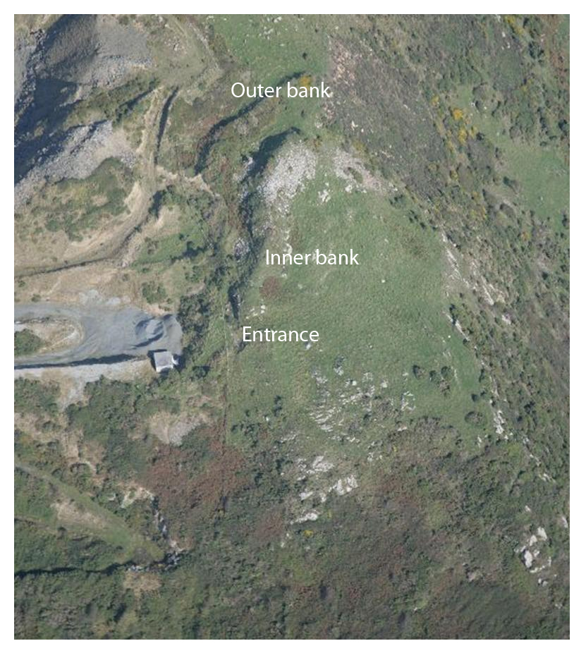
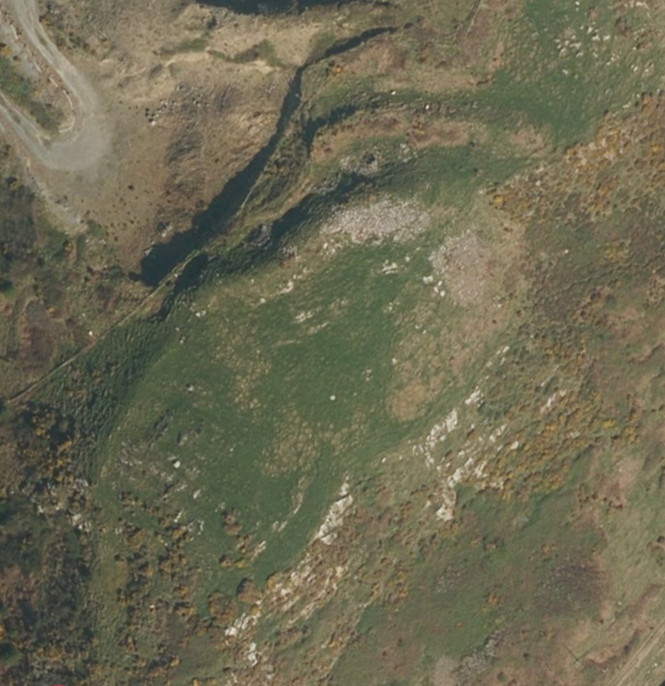
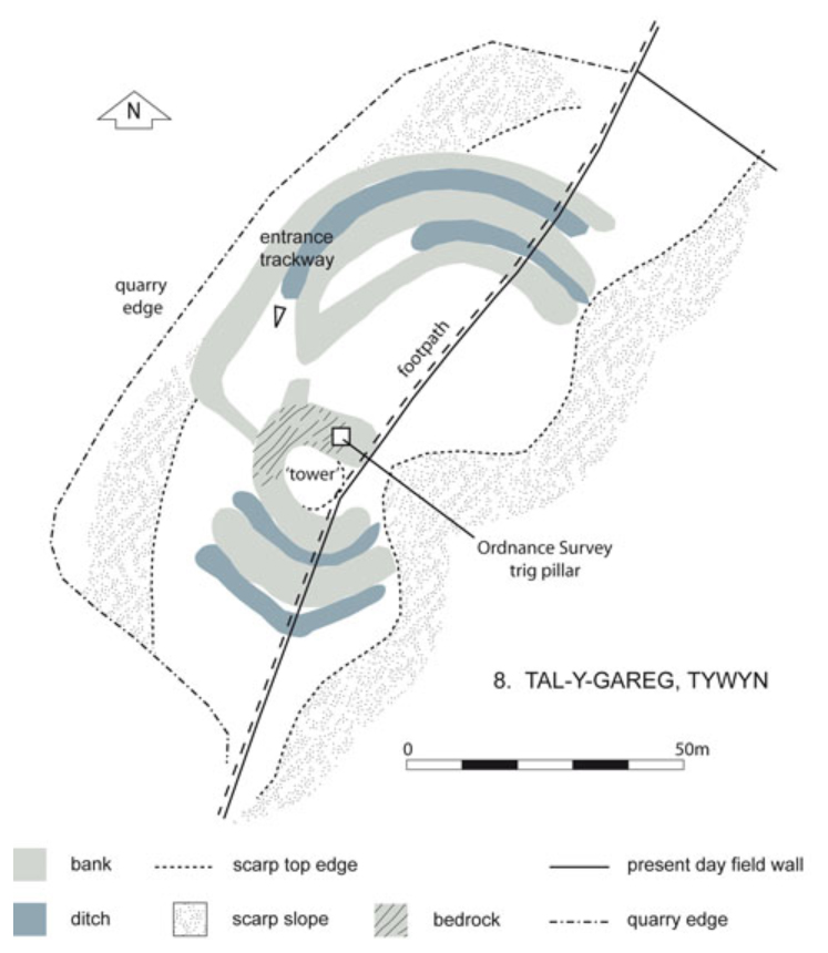
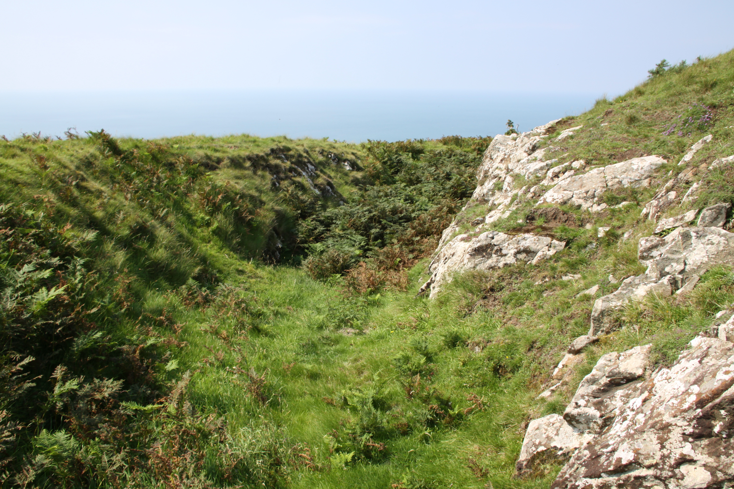
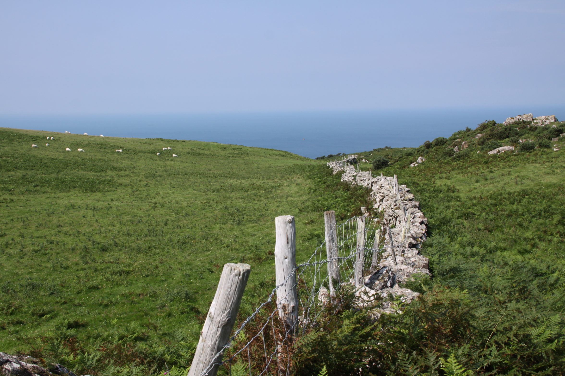
In fact, Tal y Garreg hillfort was very easy to spot from the ground, as the builders made use of a rise in the local topography and natural escarpments that face north.  Tal y Garreg means “end of the rock/cliff” and probably refers to the rocky ridge on which it is built. It lies at the southwest end of a 1.5km ridge at c.170m OD.   The natural lift in the land, shown on the above photograph at far right makes the hillfort highly visible from the ridge behind it.  The composite image above (click to enlarge if required) shows Tal y Garreg hillfort from the air with the 1967 site plan (upside down in terms of the photograph – Bowen and Gresham 1967) and a view of it from the middle of the ridge.  Another plan to the left offers a different view.  Today, massive piles of rock from the quarrying activity are left lying around, so it is not immediately easy to see the structural features and it helps to have the plan to hand to locate them.  There are two sets of banks and ditches, referred to as bivallate on the northeastern and southwestern sides.  The banks, or ramparts, were probably pallisaded to make it even more impressive from a distance, and to make it easier to protect if needed.  These ramparts contain an area around 45m long by 22m wide, small in hillfort terms.  Still, it was clear that although the space it contained wasn’t large, it had been built on an impressive scale.  The entrance was simple, inturned, and cut through the scarp to the north, facing the ridge.  It’s worth walking along the the edge of the drystone wall that runs behind the fort so that you can get a feel for the banks and ditches shown on the far left in the aerial photo, but be careful how near you get to the quarry edge.  One of the banks and ditches, cut into bedrock, is shown below, with the sea in the background.  Tal y Garreg overlooks the Dysynni valley rather than establishing a good line of sight with hills to the east or the coast to the north, although a short walk along the ridge on an averagely clear day provides those views.  The views have been radically changed by quarrying, but there were clearly good lines of sight across the sea, down into the Dysynni valley and back along the ridge.

Ditch at Tal y Garreg, excavated through the bedrock. Ramparts on the bank at this point would have given views over the Dysynni valley and Cardigan Bay.

The site has never been excavated, so any thoughts on its date or the number of phases involved in its construction are purely speculative.  On both plans a 10m diameter “tower” is marked, and this was a circular structure, in front of which is a rock-cut ditch now full of stone, which may be the remains of the tower, suggesting that it was quite a substantial feature.  One proposal is that the small primary bivallate hillfort may have been overlain by a smaller and later fort that made use of the earlier features, and that the tower may have been part of this later re-use, dating to a Roman or post-Roman/Early Medieval re-occupation.  In fact, there is so little evidence of Roman presence in the area that it seems rather unlikely that a Roman fort was located here, so it is more likely that any second phase was post-Roman.

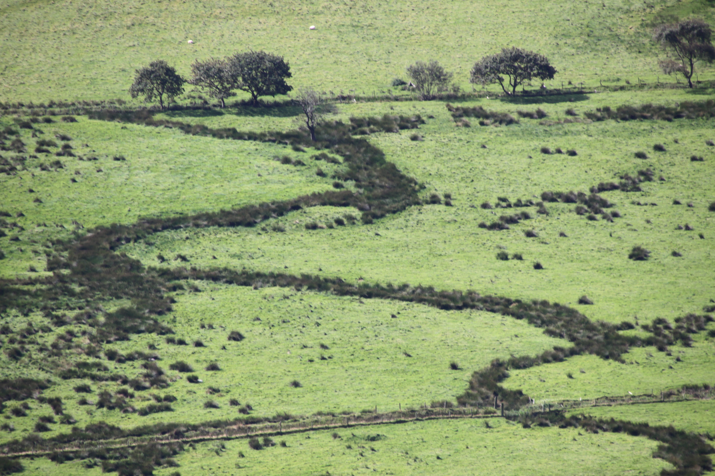
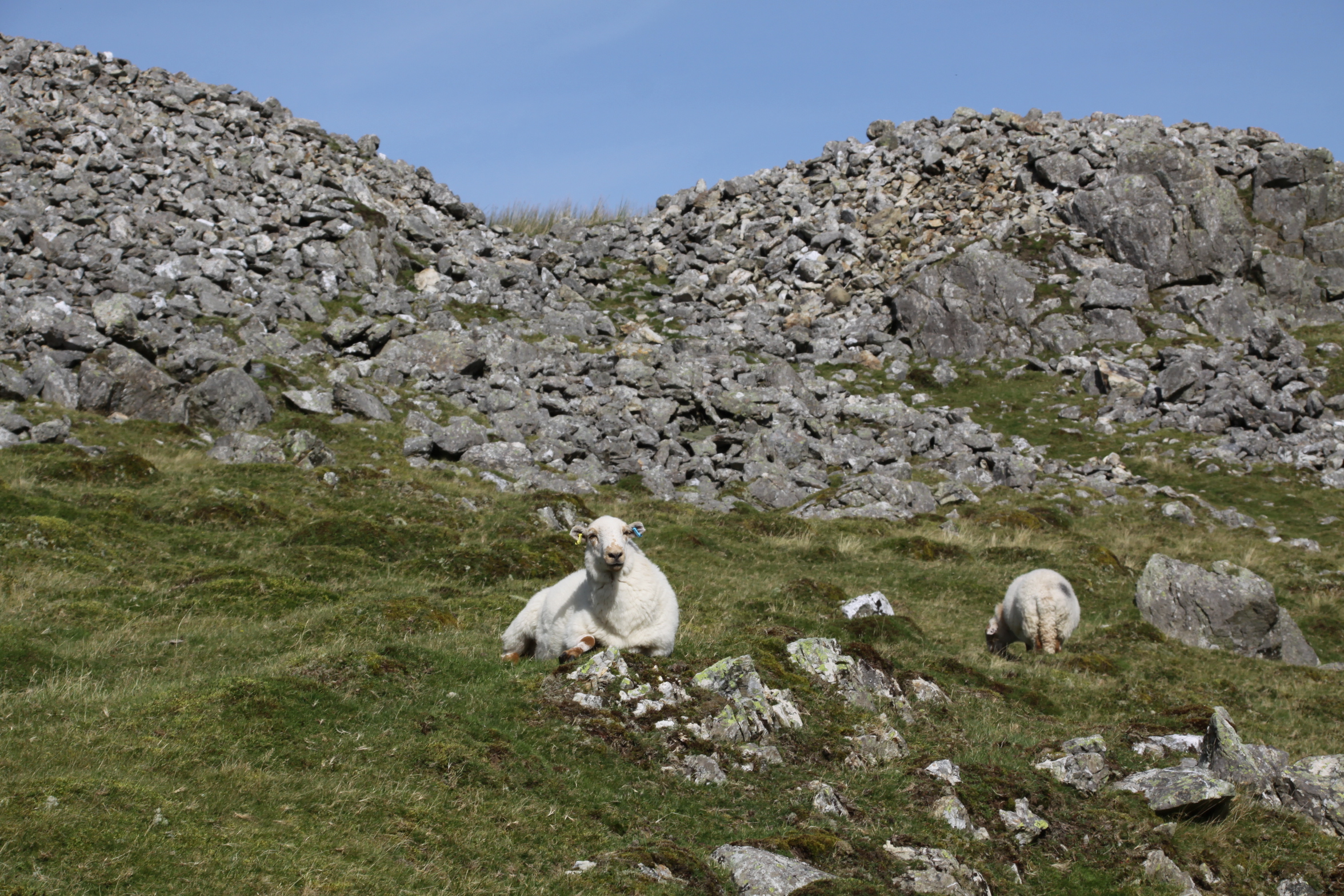
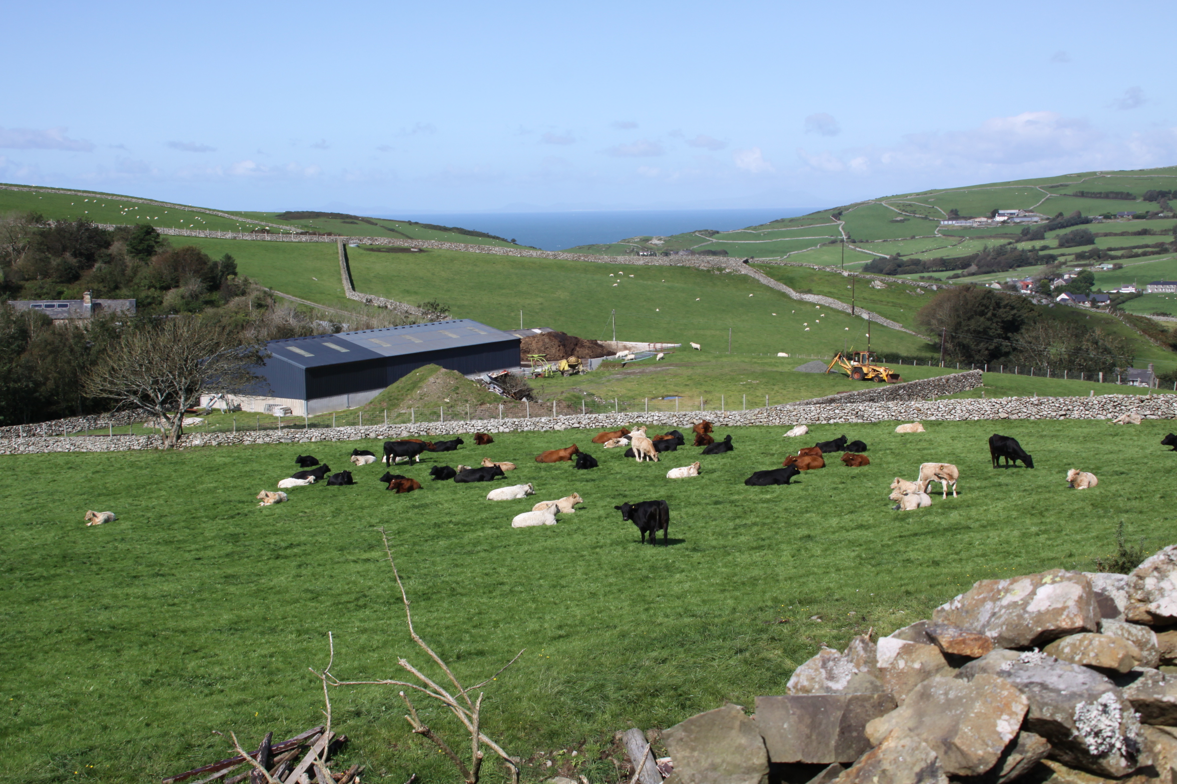
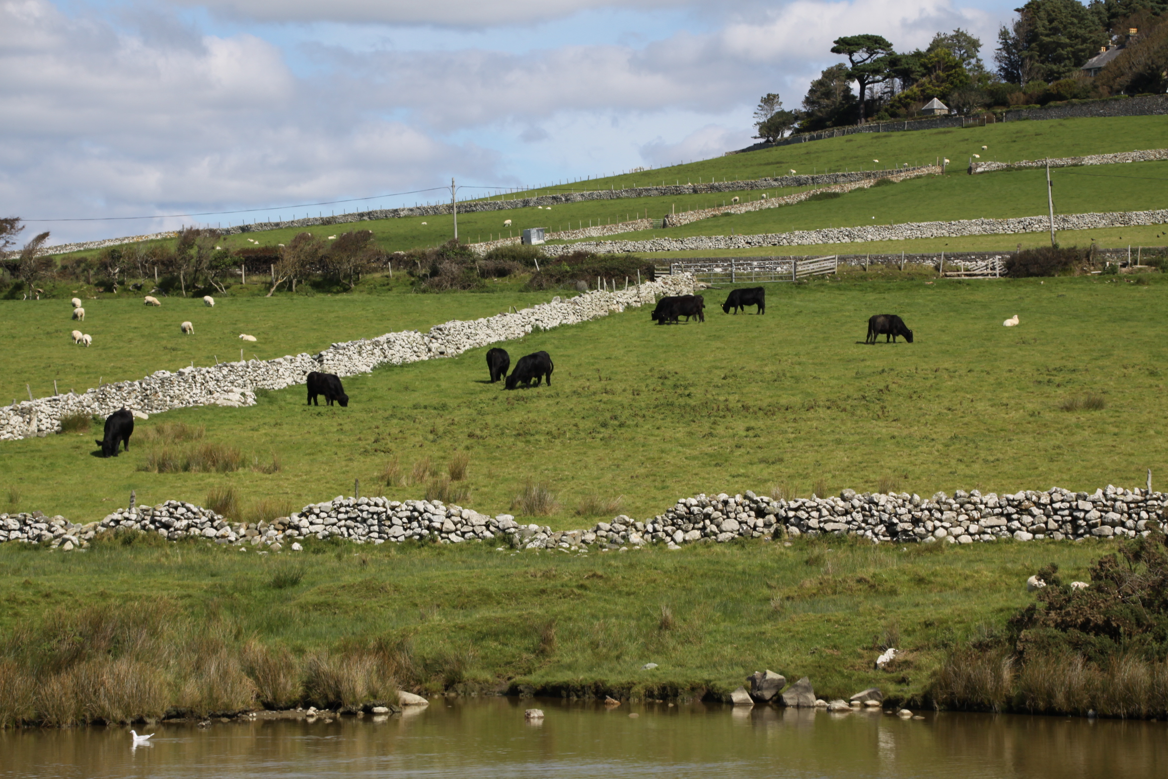
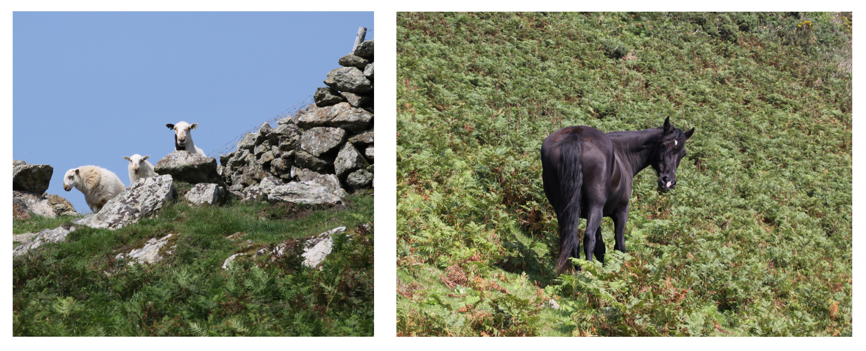
The Tal y Garreg hillfort is so small that I am not sure that it really qualifies for the title “hillfort,” when compared with more massive and impressive examples, that contained a number of other structures within their ramparts.  It does, however, feature typical hillfort characteristics. It took advantage of strong strategic position that could be partially barricaded with banks and ditches on vulnerable sides, using steep sides to provide natural barriers to attack.  Like most hillforts, although not all, it is on high ground overlooking good farming land or pasture.  Although there are no known settlements in the area, farmsteads were almost certainly dotted around the landscape much as they are today, and the hillforts probably overlooked some of these in the valley.  The ridge itself may have been used for grazing livestock, just as it is today. In the photograph below, the sheep were on top of the ridge and the horses were just outside the drystone wall at the top of the approach to the ridge.

The hillfort had no water supply other than rainfall.  This small defended enclosure could not have sheltered large numbers of people against hostilities, and could not have been reached in a hurry from the valley below, so it was either designed to shelter a privileged few;  to store important resources in a relatively inaccessible location;  to segregate certain centralized activities in a single location;  to be a visible symbol of territorial tenure – or a mixture of various roles.

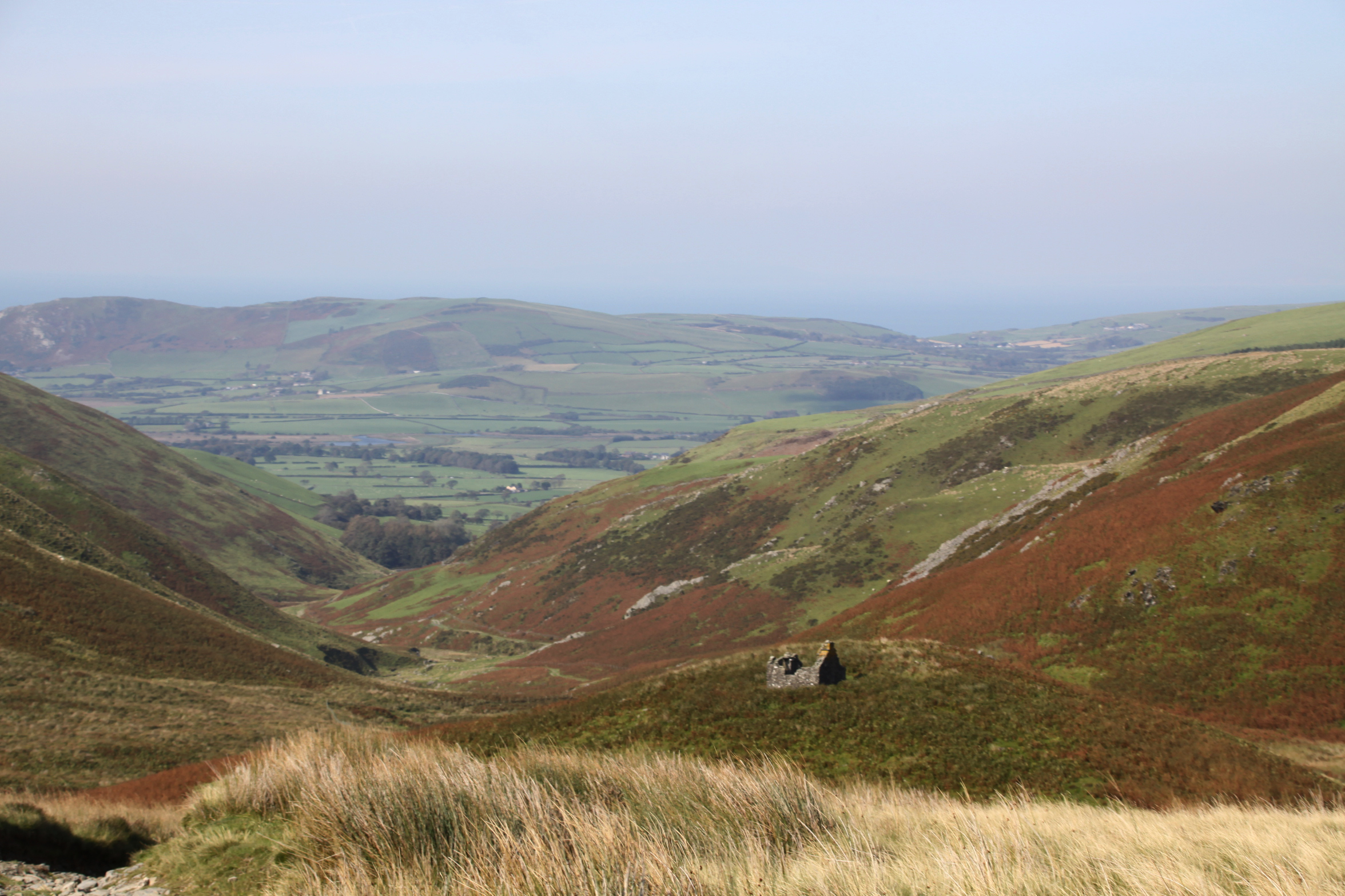
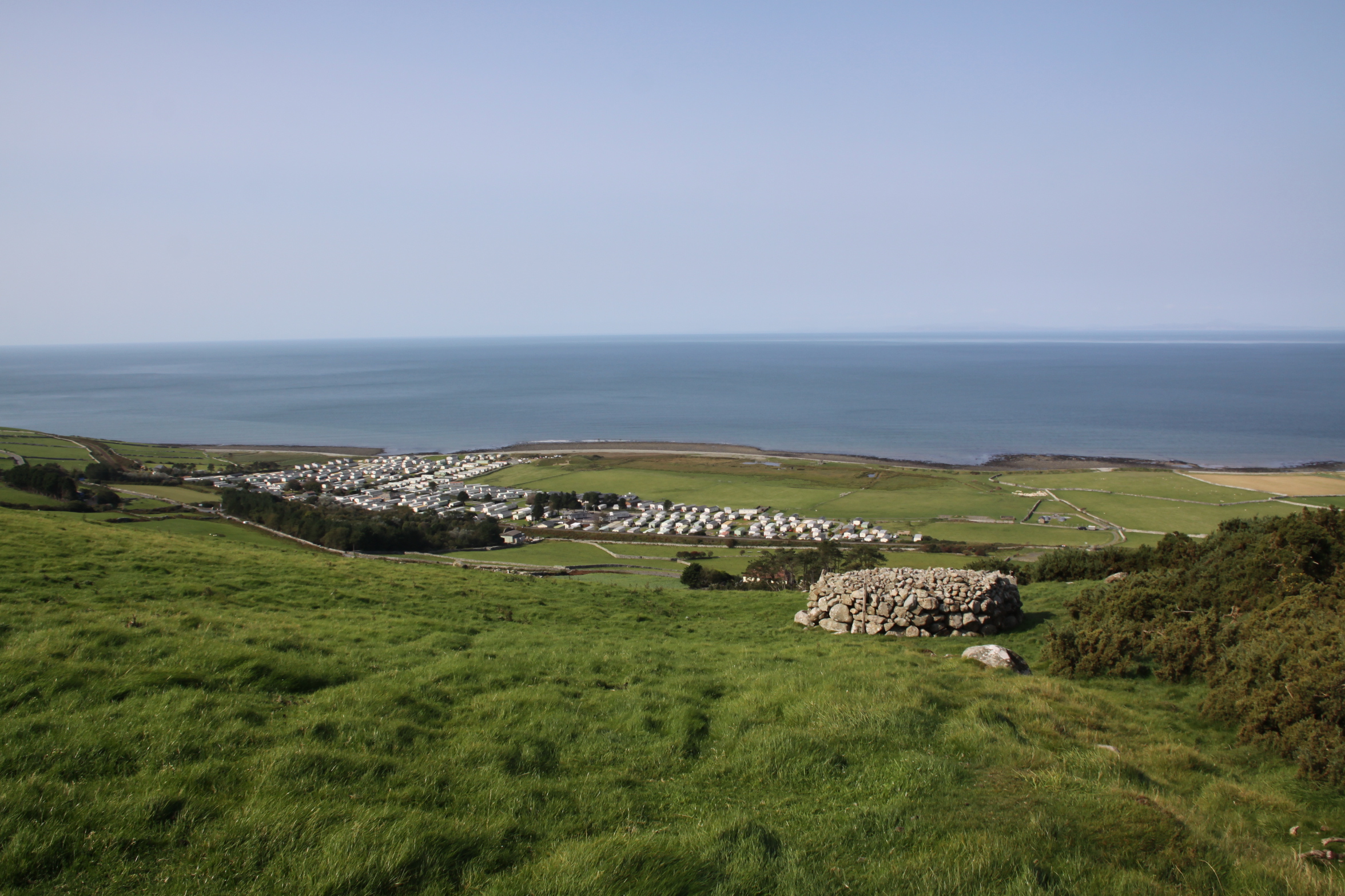
Located both on the edge of the Dysynni valley and on the coastal plain, lines of communication could have extended both on a north-south axis and along the Dysynni valley, past Craig yr Aderyn (Bird Rock) hillfort, and into the Tal y Llyn valley heading northwest towards the hillforts near Corwen and Ruthin.  The ridge itself would have provided a high-level route alongside the Dysynni valley for c.1.5km.  At the other end of the ridge is another hillfort, Castell Mawr, which appears to have had a large annex that could have been used as a livestock corral.

Tal y Garreg is only a short walk from Llechlwyd hillfort, which also sits on the side of Tonfanau quarry, and I will be posting about in the future.  Both are poorly understood, and it is not known if they were related to each other or were chronologically separate.  They could have been contemporary but they may have been separated by anything from years or decades to one or more centuries. Until they are excavated this relationship will not be clarified.

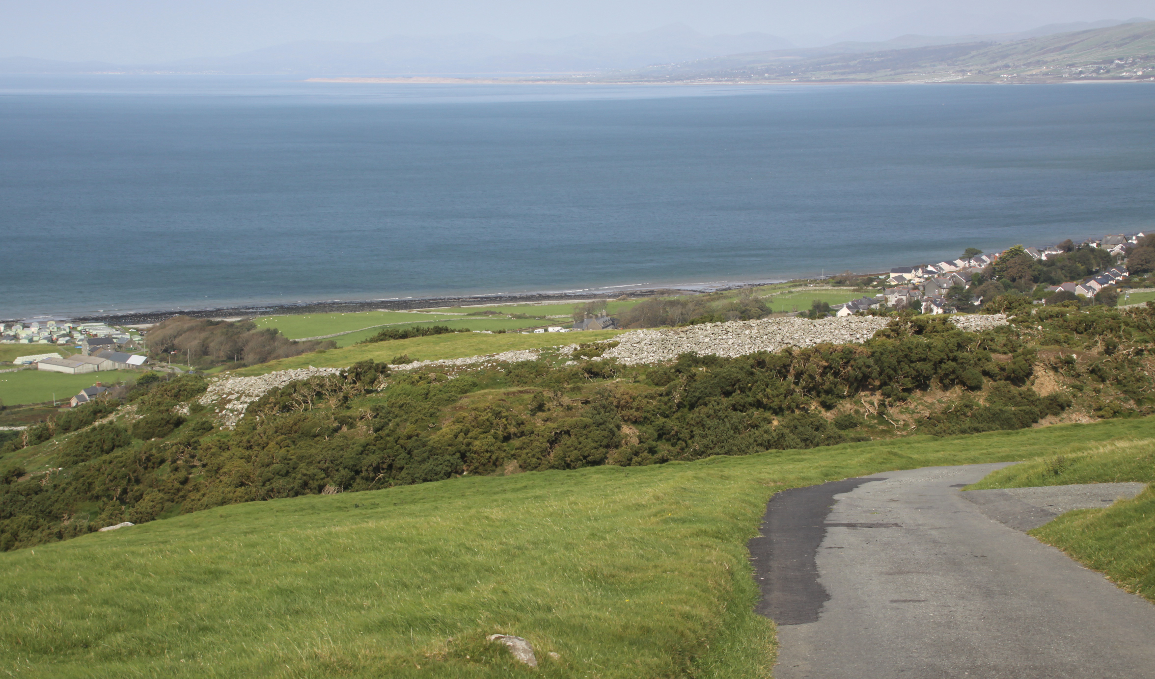
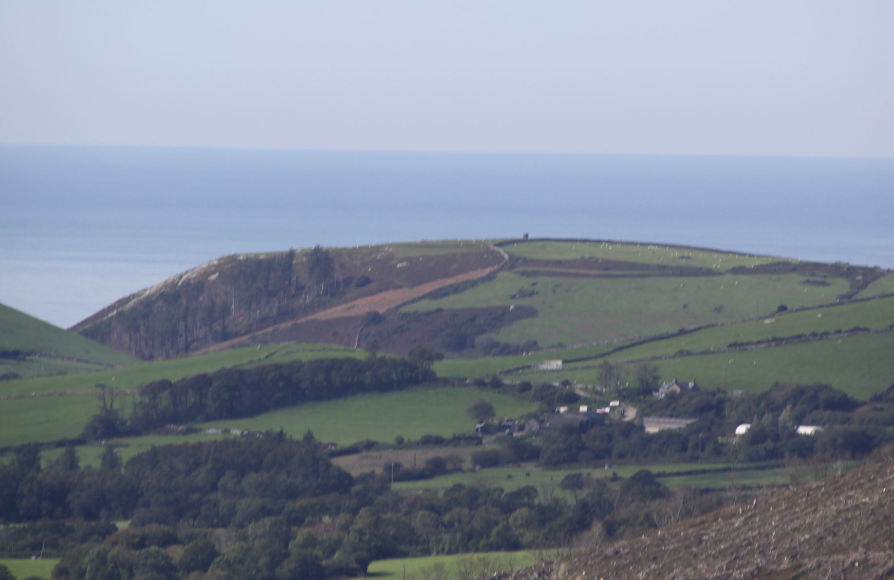
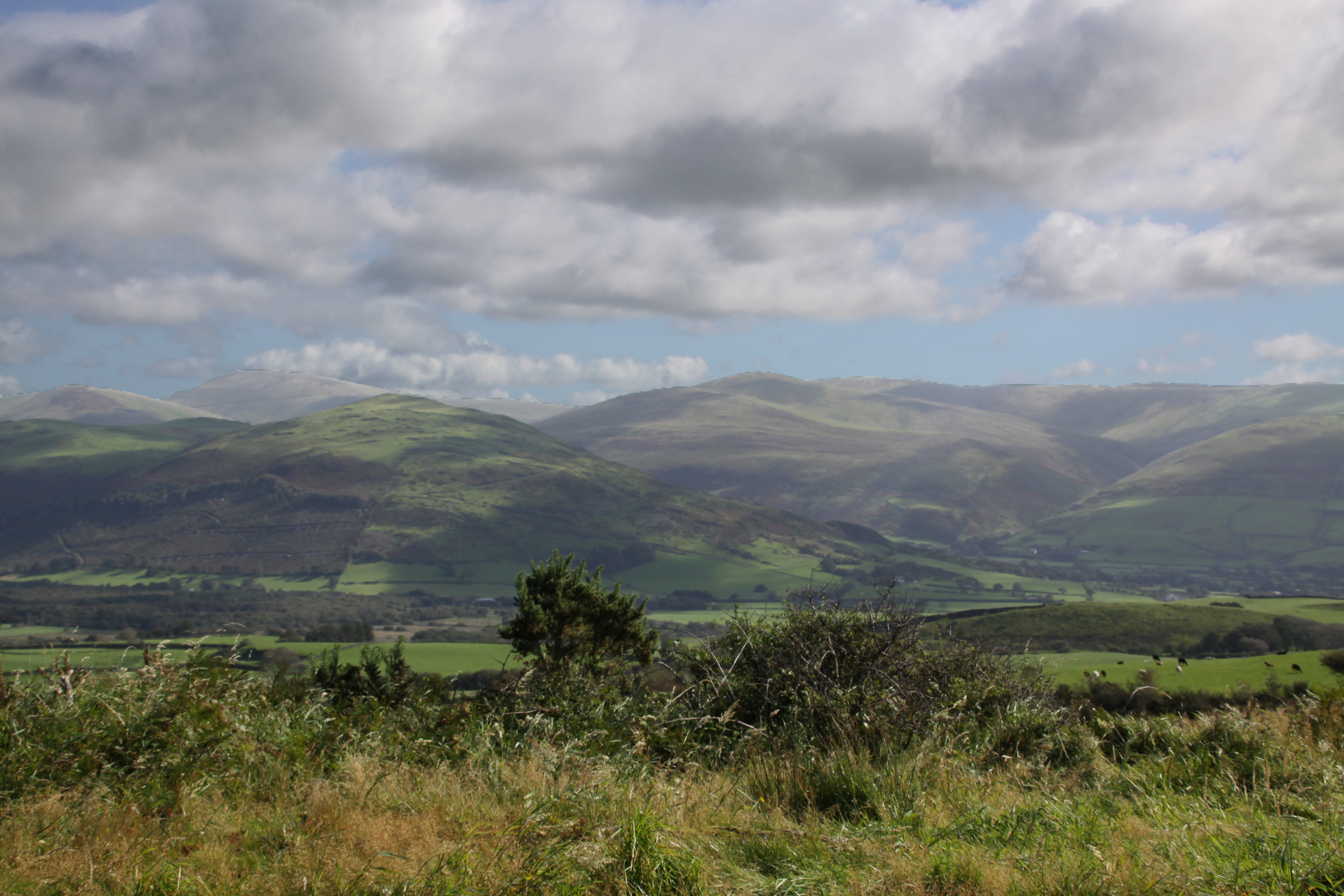
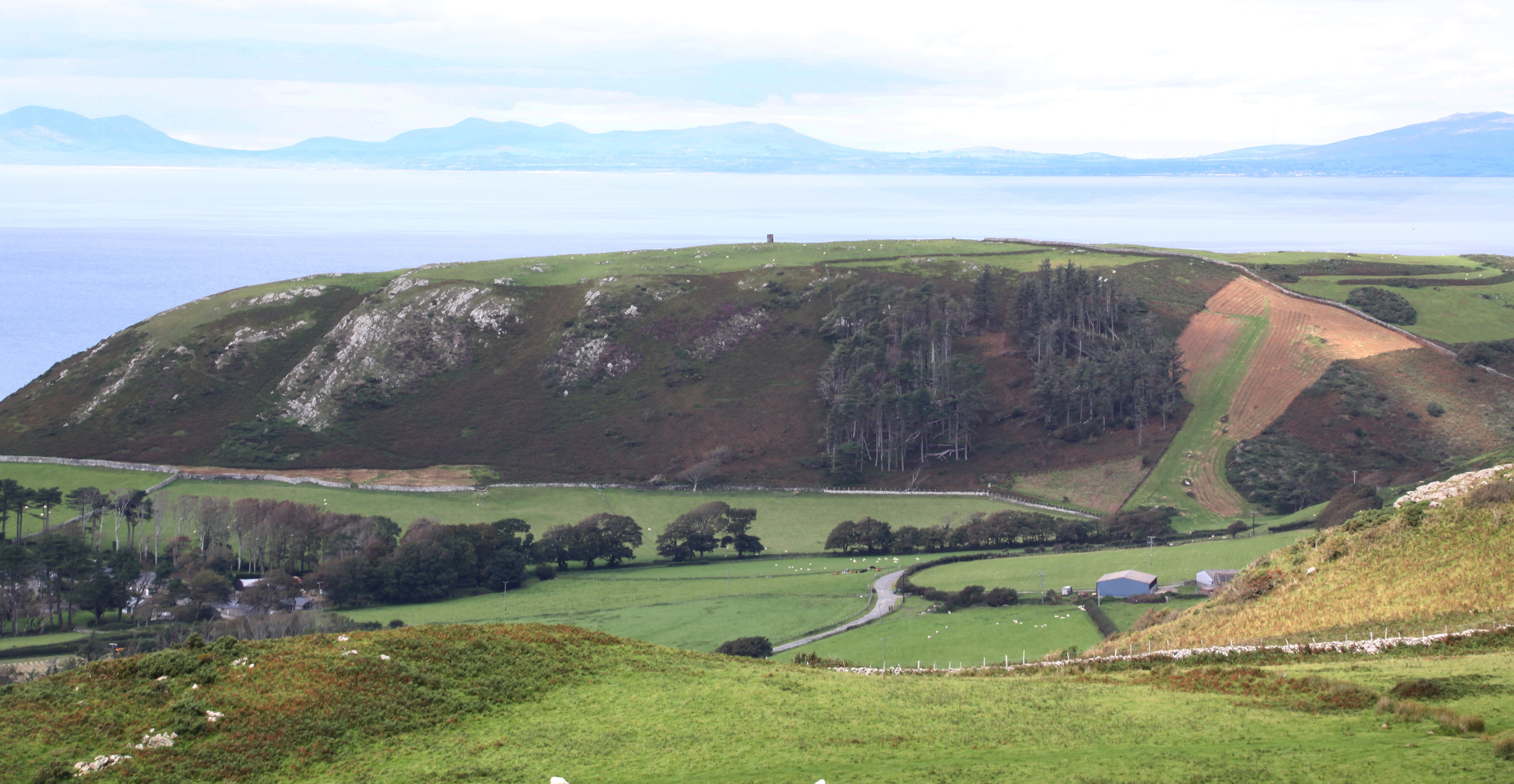
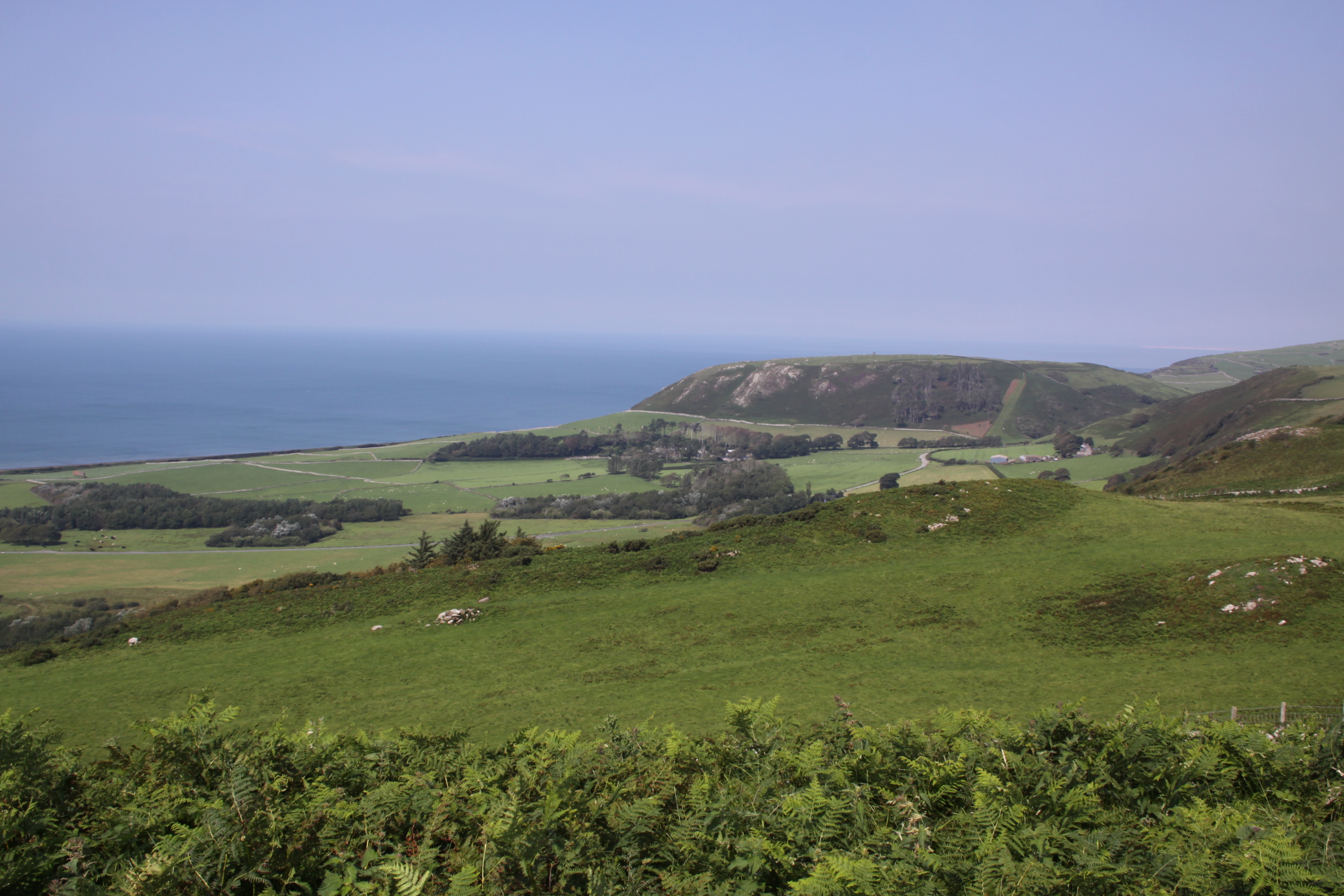
I wanted to see if there was a clear line of sight from Tal y Garreg to the hillforts of Llechlwyd, also at the southwestern end of the ridge at the top of Tonfanau, Craig yr Aderyn (Bird Rock) c.8km to the east and Bwlch hillfort on the next hilltop, 2km to the north, Foel Llanfendigaid.  As none of these sites have been excavated it is not known whether they were contemporary, but in the event that they were, having a clear line of sight might have had many benefits, irrespective of whether the occupants of the hillforts were friends or enemies. The nearest hillfort, Llechlwyd, is visible from Tal y Garreg, which has a view down into the much lower promontory fort.   Craig yr Aderyn is visible from Tal y Garreg, although in the distance.  If required, it would have been easy enough to set up a signal on a clear day.  Bwlch is very easily visible, and looks like the perfect location for a hillfort.  Between the two, a near-flat piece of coastal plain is divided today into fields and used for pasture.

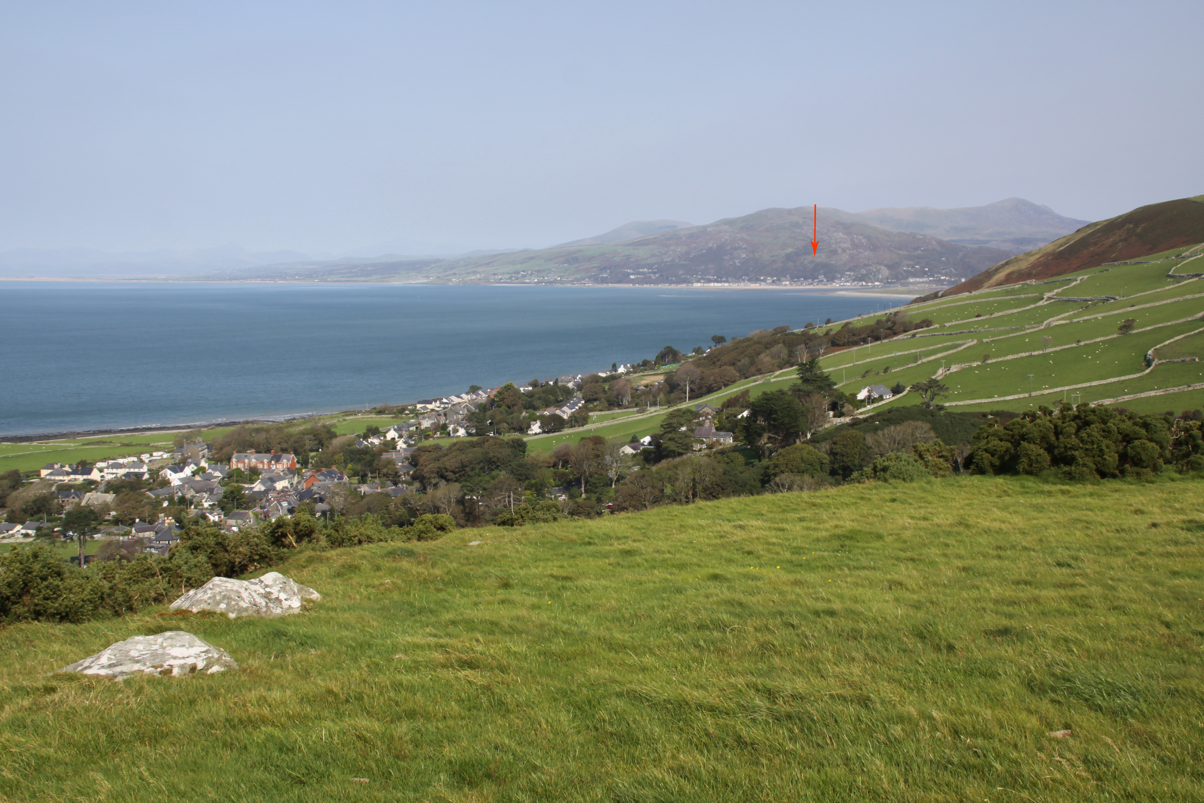
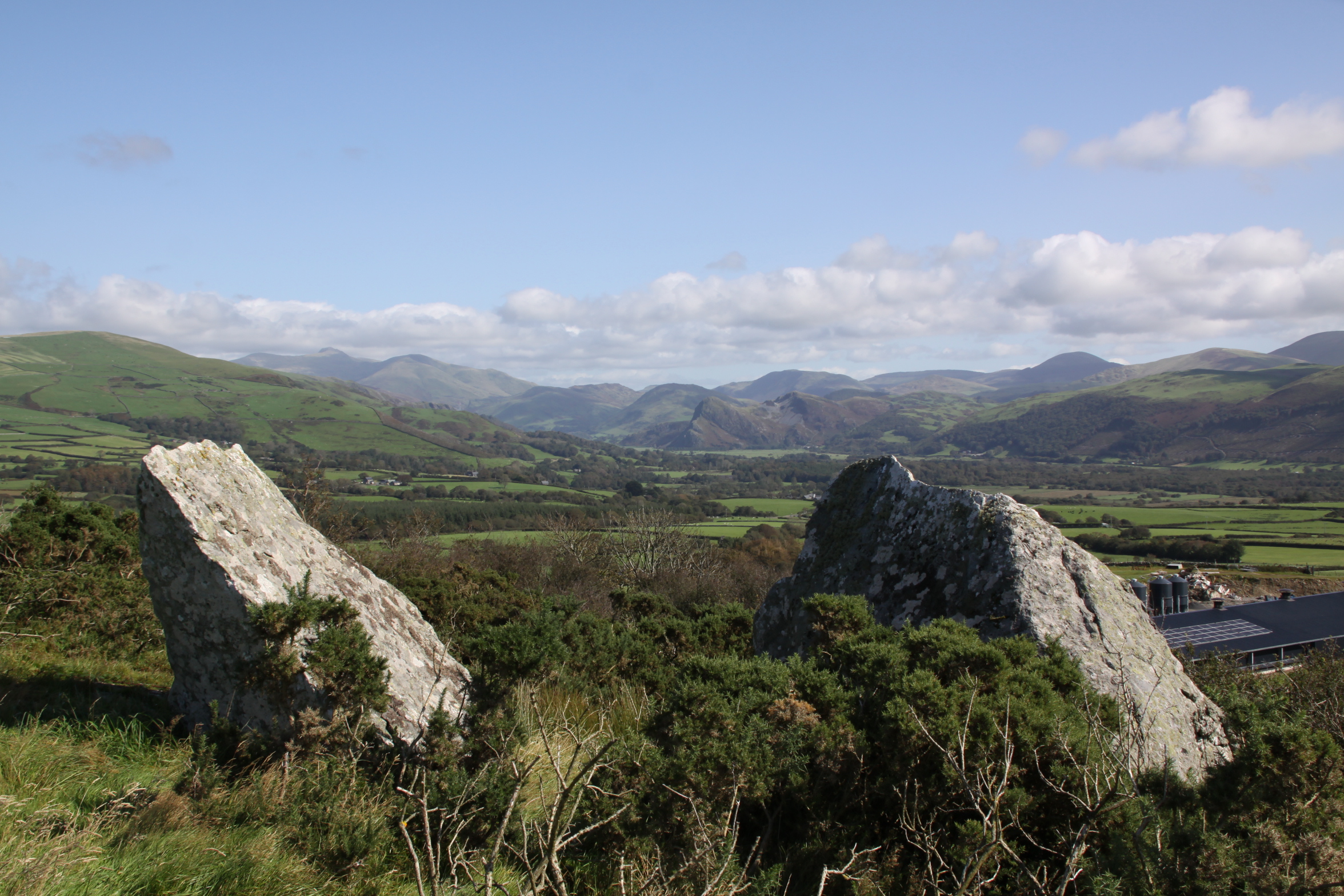
Craig yr Aderyn (Bird Rock) c.8km from Tal y Garreg

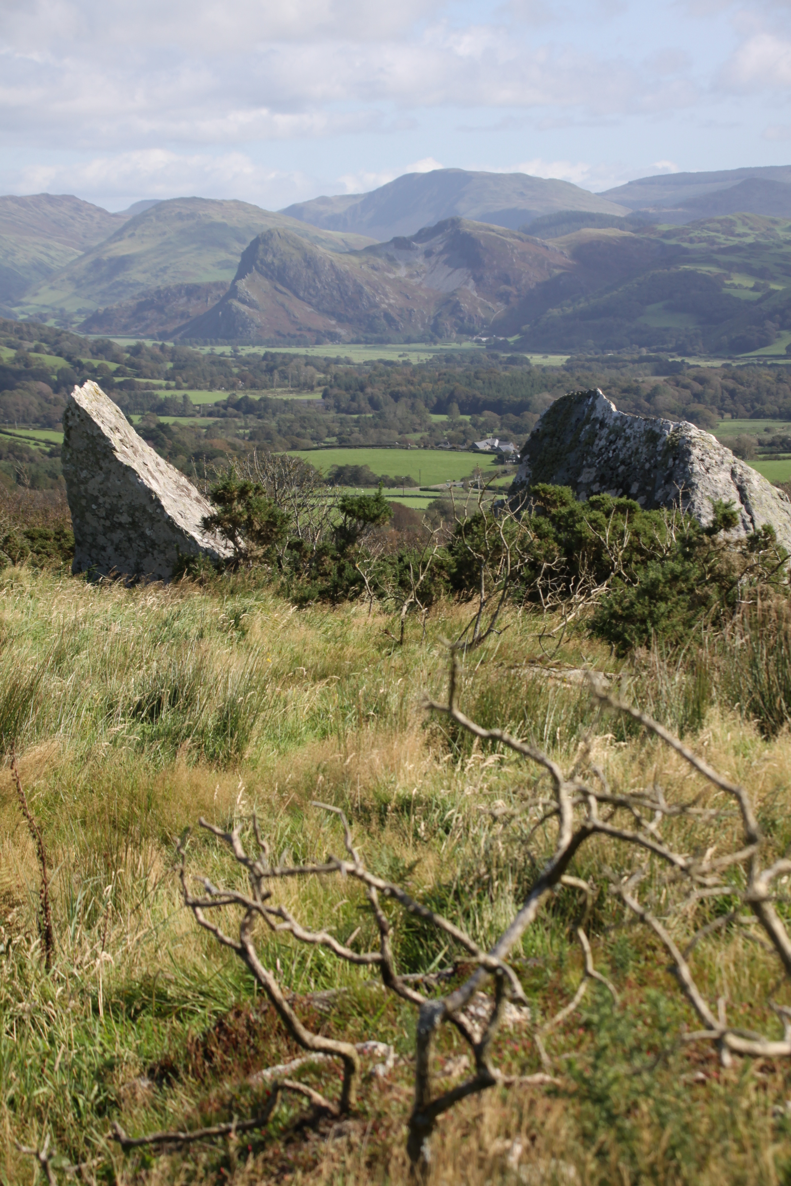
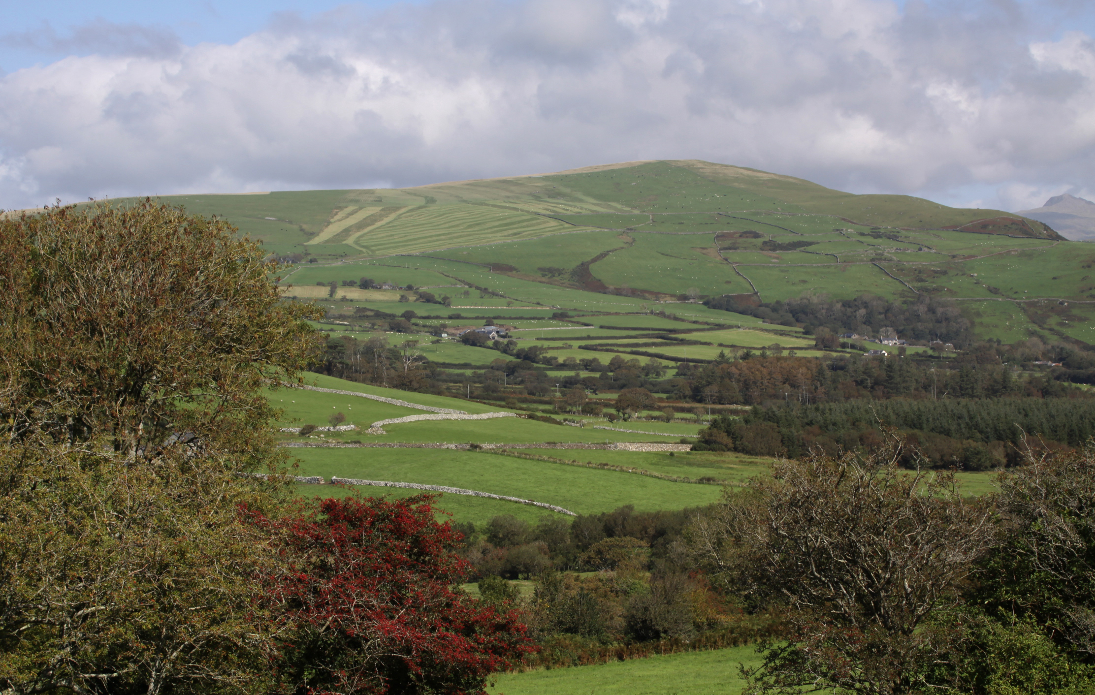
View from Tal y Garreg to Foel Llanfendigaid, on top of which is the hillfort Bwlch

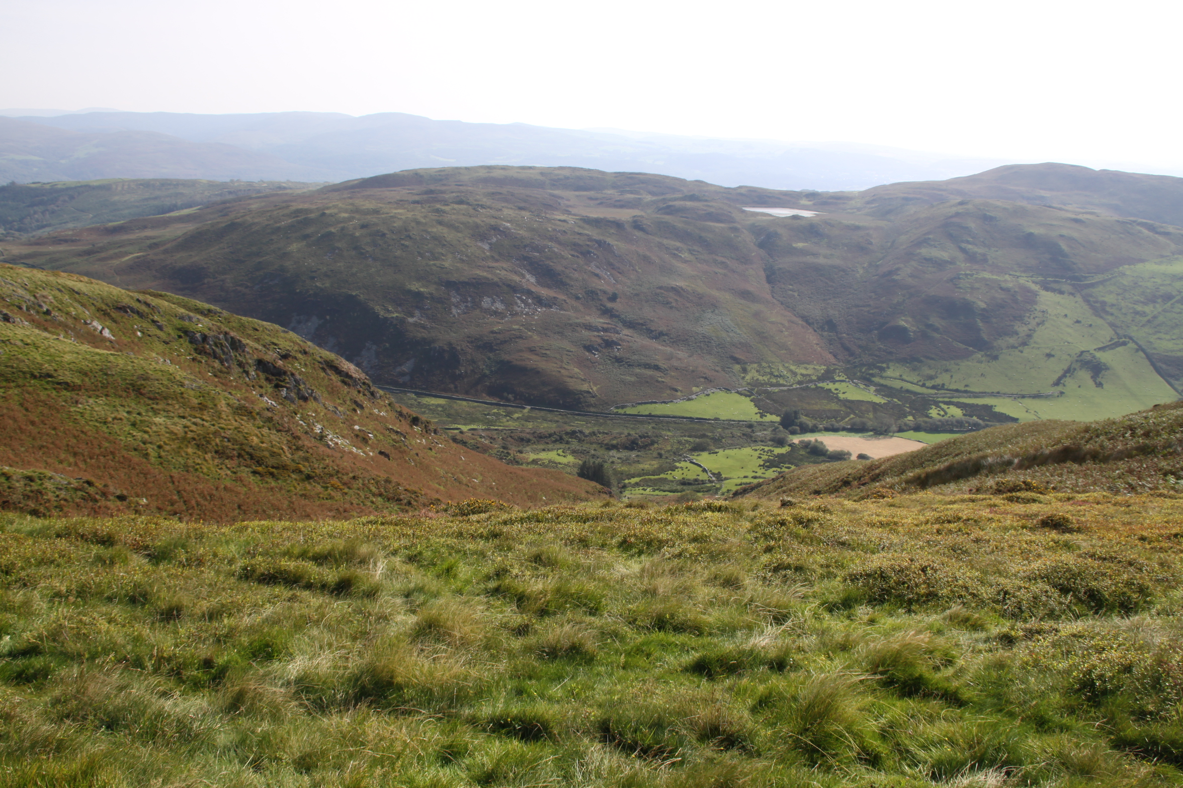
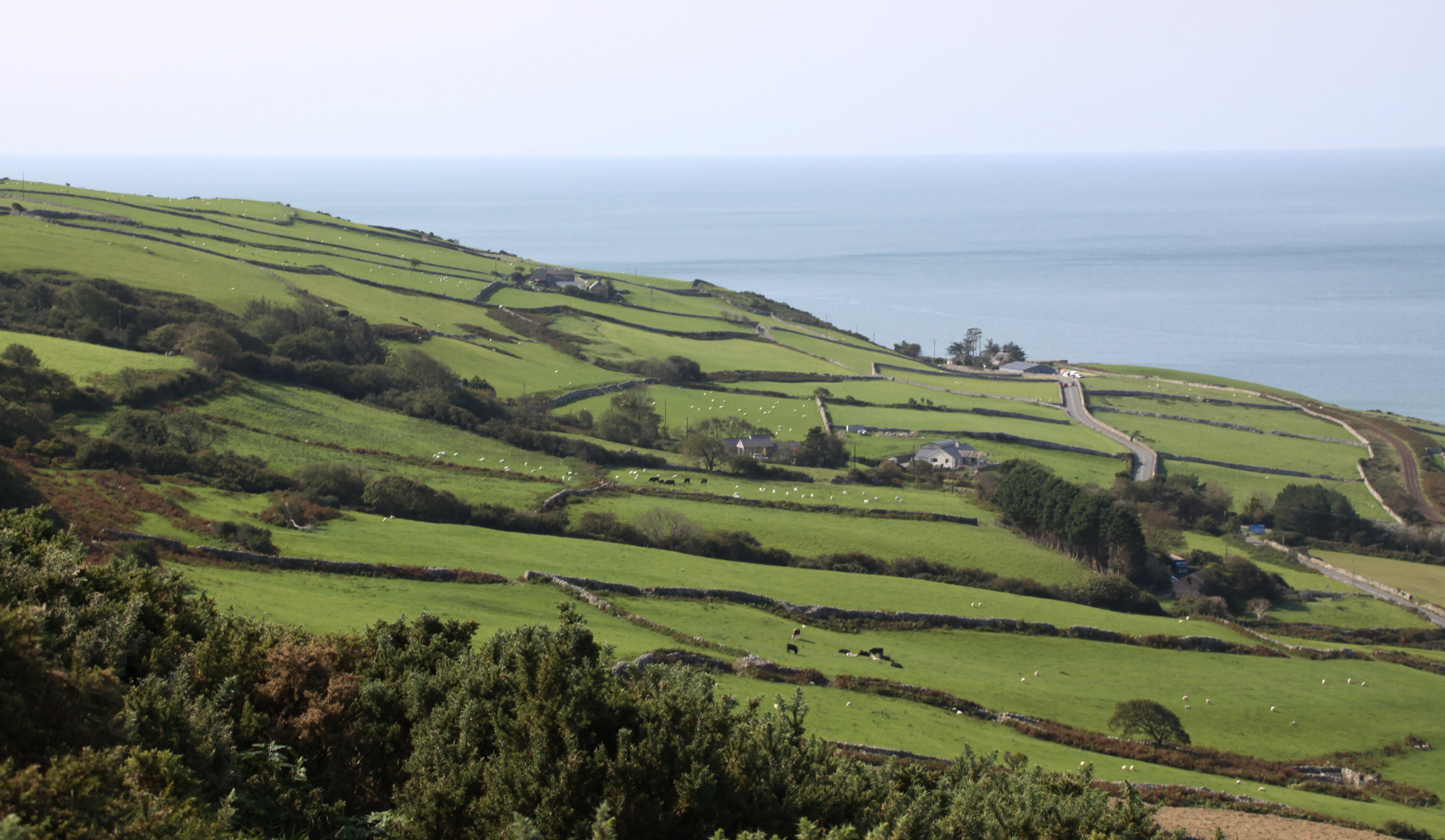
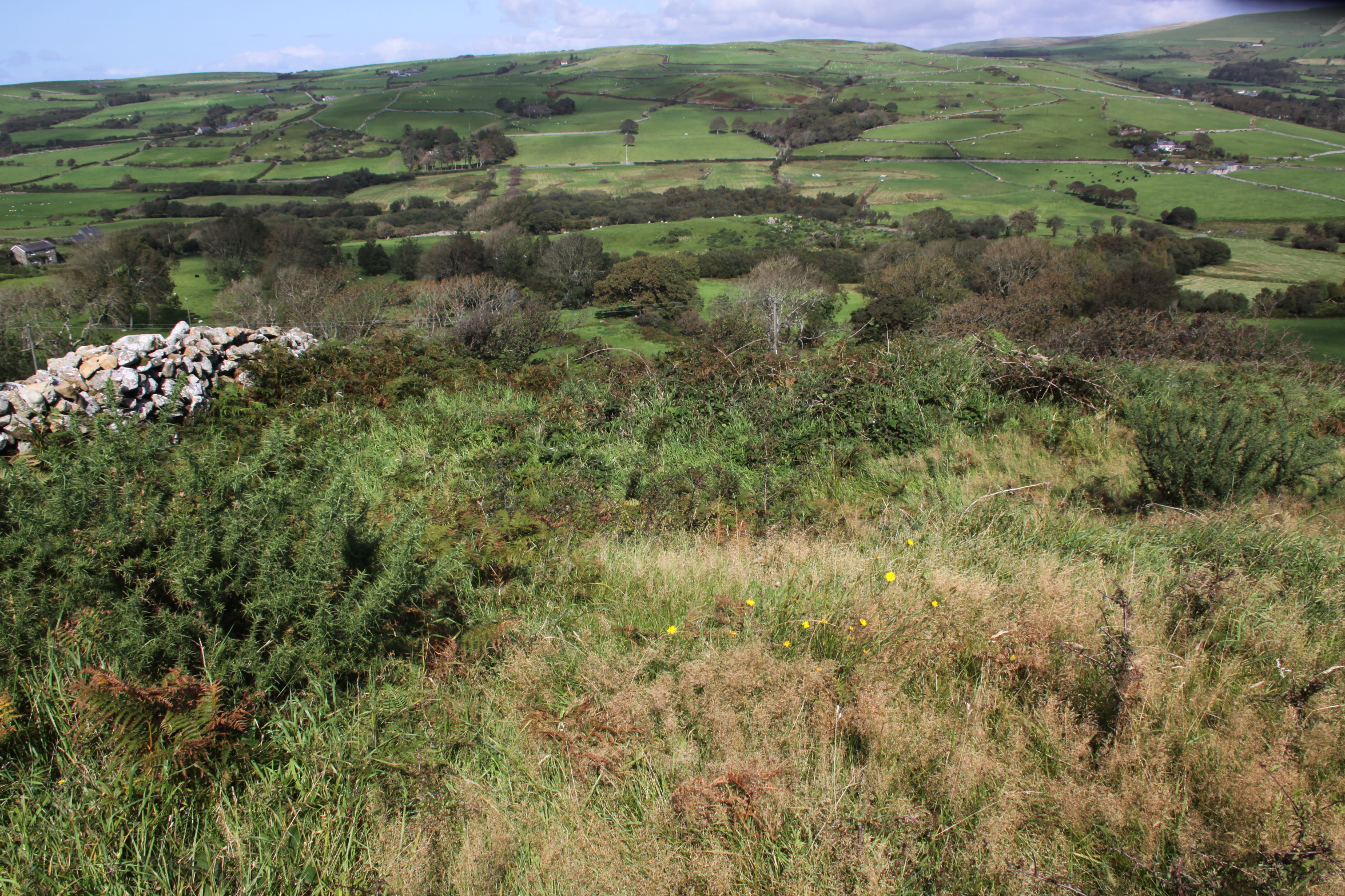
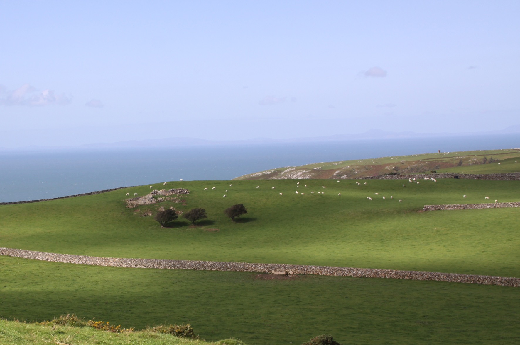
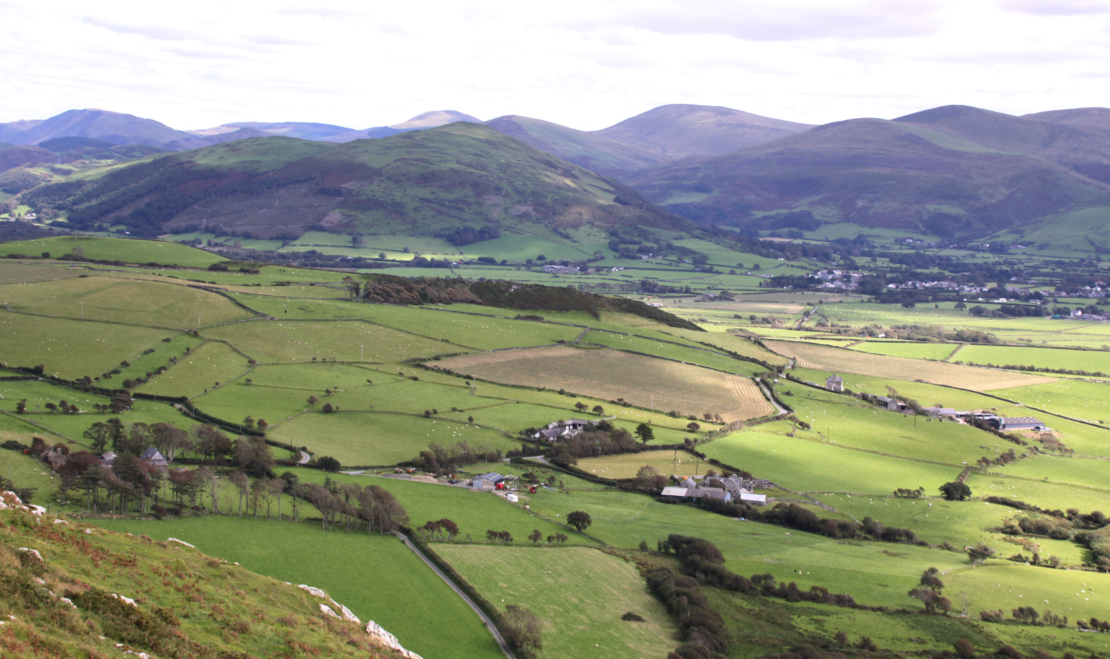
It was useful to see what could be viewed when outside the hillfort, but still along the ridge, and it was impressive how many broad views were available from the ridge beyond the hillfort, some of which are below, all overlooking good quality pasture, currently being grazed by sheep and cattle, and far into the distance in all directions including the sea.  It was a hazy day so the views weren’t quite as spectacular as they might have been, but they showed enough to indicate that Tal y Garreg was a good site for watching movements for many miles around.

View from one side of the ridge to the other, taken from the stile.

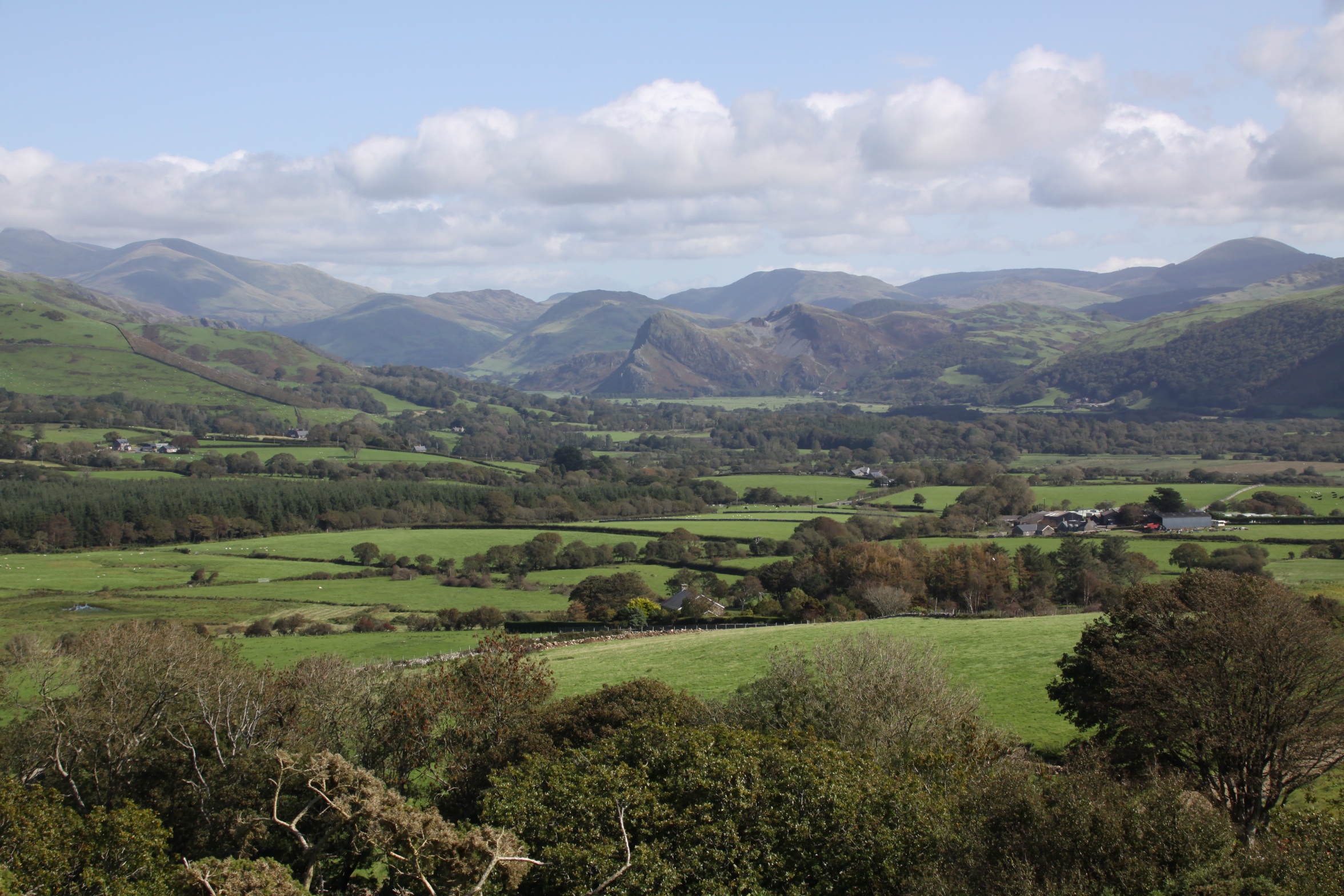
Dysynni valley, looking east

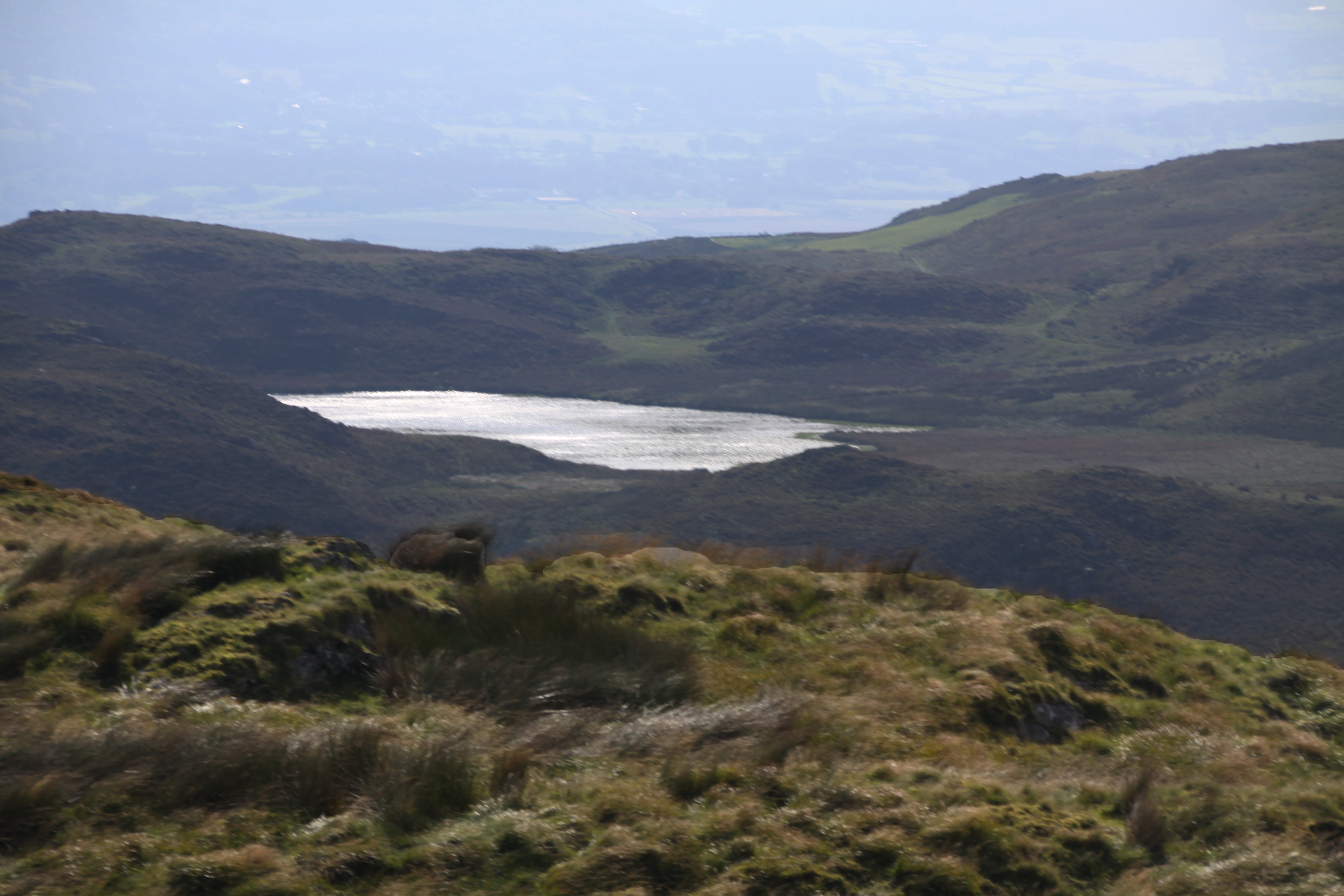
A final though on the views available from the hillfort and visibility from below is that a couple of days later I went to walk along the Dysynni from Tonfanau bridge to Ynysymaengwyn, skirting the broadwater, and found that the entire of the top of Tonfanau was under a cloud, just where Tal y Garreg was built.  It was impossible to see its location, and it would be impossible to see anything at all from the hillfort down into the valley.  This could have been a distinct disadvantage in its location!  The second hillfort, Llechlwyd, which is on the lower promontory at 70m OD, was not shrouded in cloud, so although it had no visibility of the ridge behind it, it did have the advantage of being less prone to cloud cover.

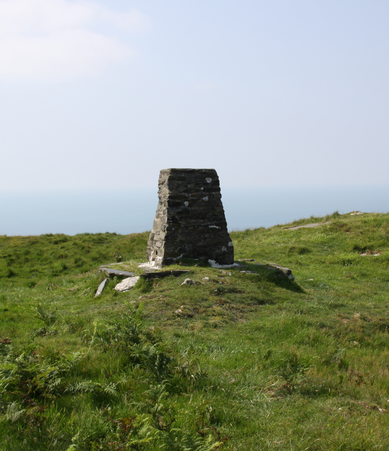
There’s a modern structure on top of the hill at this point, which is an Ordnance Survey trig pillar.  There are also the foundations of an old shipping signal.  Ordnance Survey trig pillars (or points) are part of the history of mapping in the UK.  Trig is shorthand for triangulation, and in 1936 the first of c.6500 trig pillars were built as part of the project to retriangulate Britain.  Most of them made of concrete but the Tal y Garreg trig pillar was made  of local stone, and is shown on the right.  The OS is still responsible for maintaining the pillars, of which around 6000 remain at similar locations. The project was designed to improve the accuracy of mapping, and although it has been surpassed by modern techniques and technologies, it revolutionized map-making in Britain.  Here’s an excerpt from the Ordnance Survey page on the subject of the trig pillars:

Triangulation works by determining the location of a point by measuring angles to it from known points at either end of a fixed baseline and in this case, those known points were the 6,500 + trig pillars erected across the country. In practice, a theodolite would have been secured to the top mounting plate and made level. It would then be directly over the brass bolt underneath the pillar. Angles were then measured from the pillar to other surrounding points. For the highest accuracy primary points in the retriangulation, many rounds of angles would have been measured with the observations taking several hours.

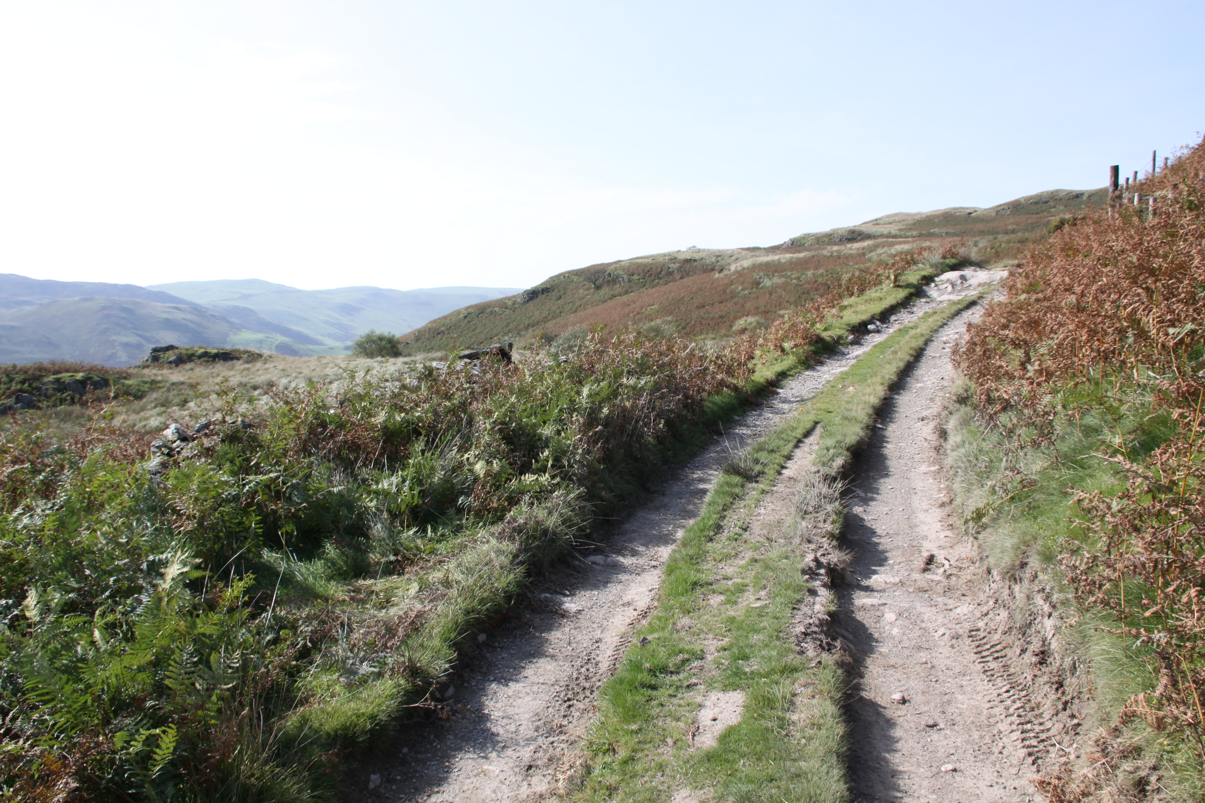
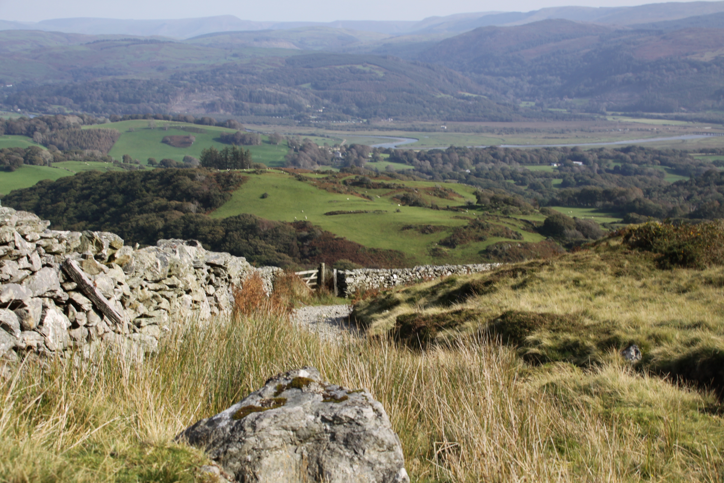
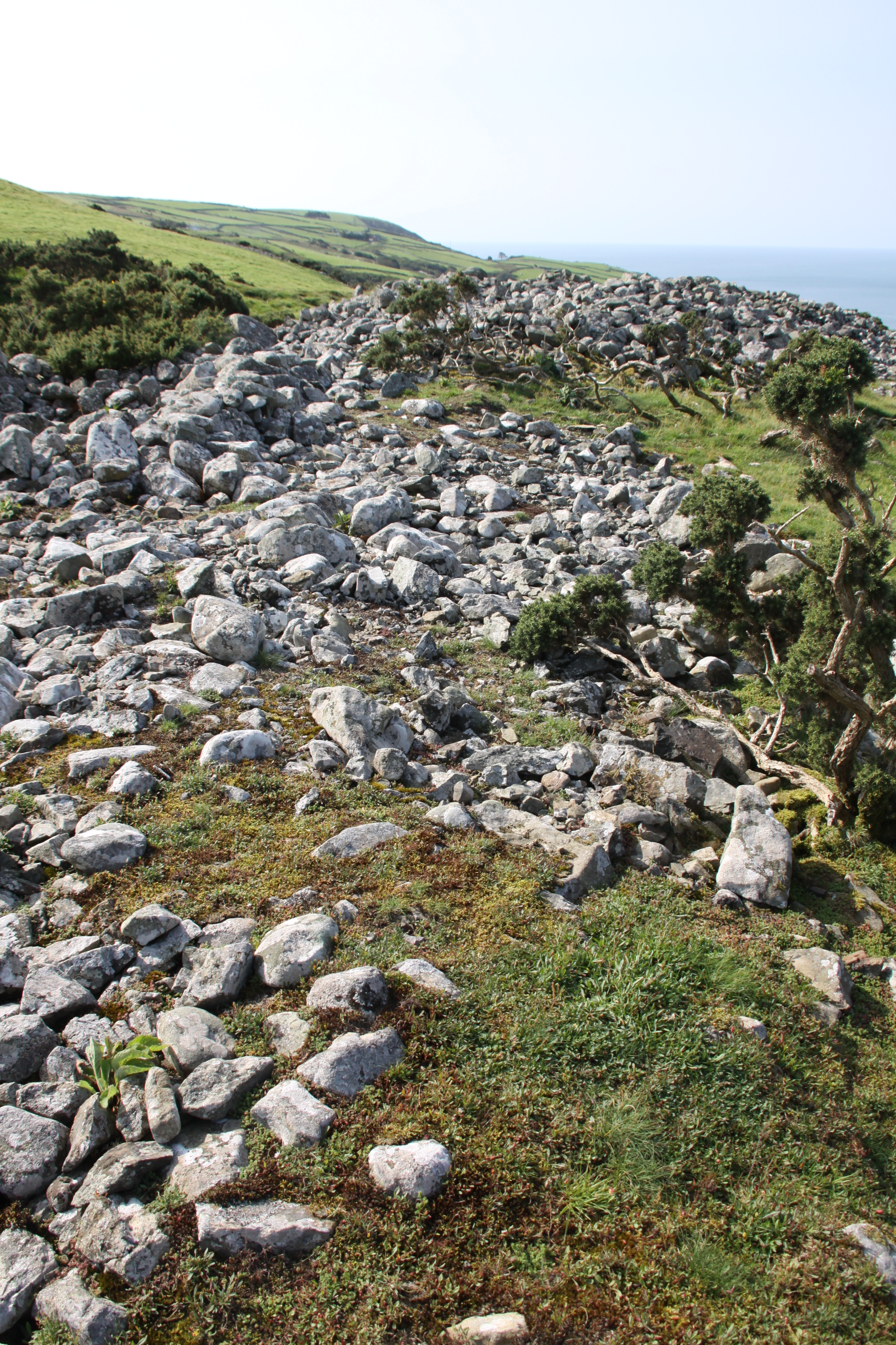
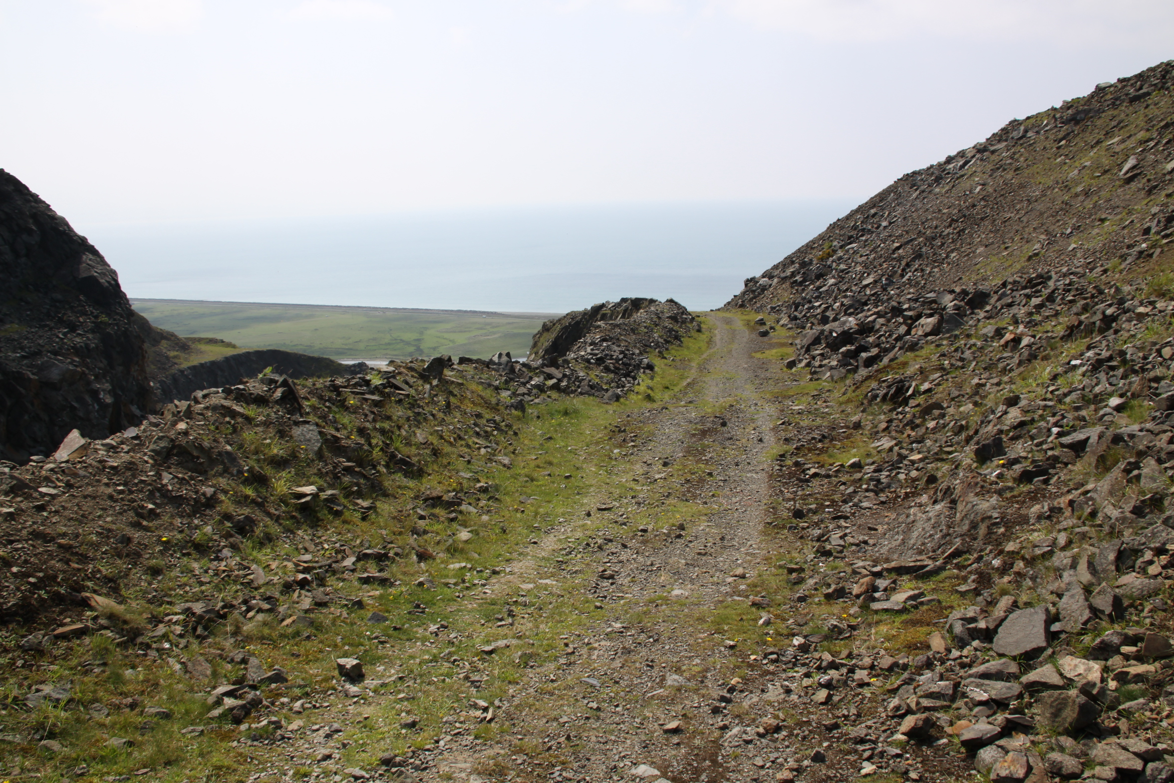
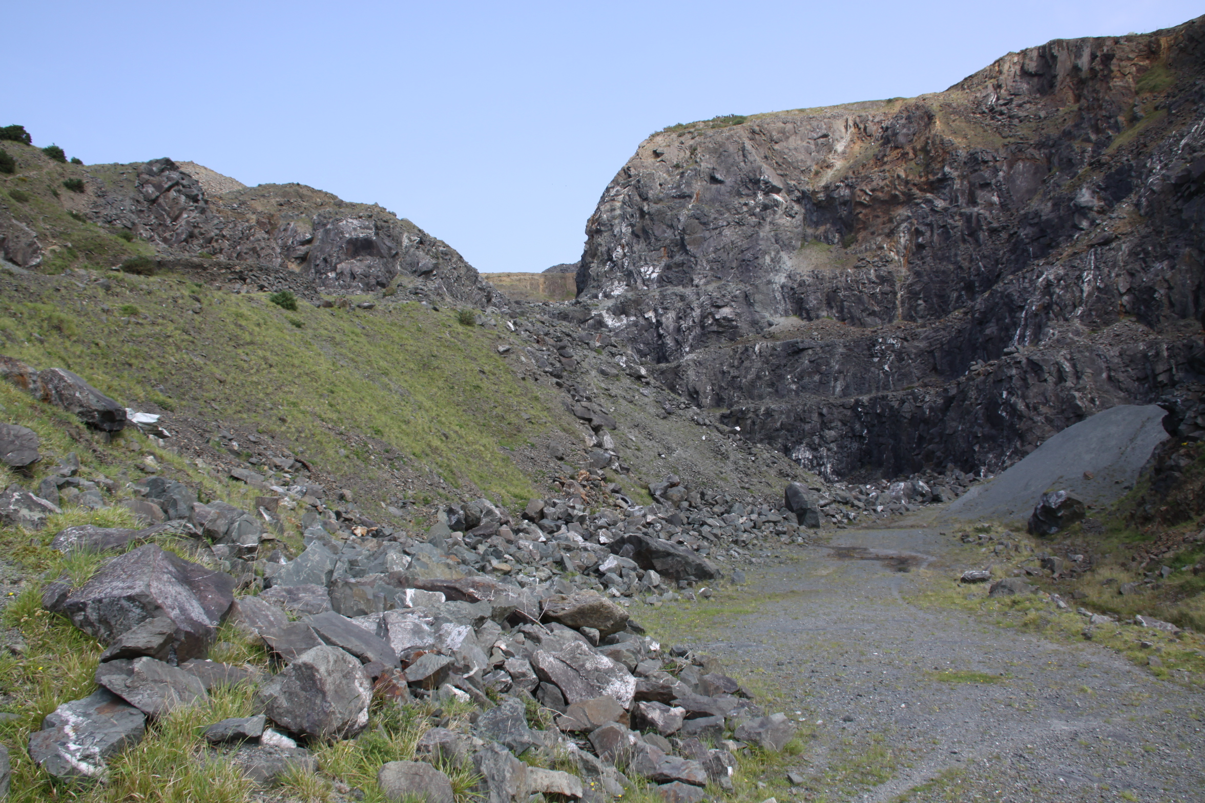
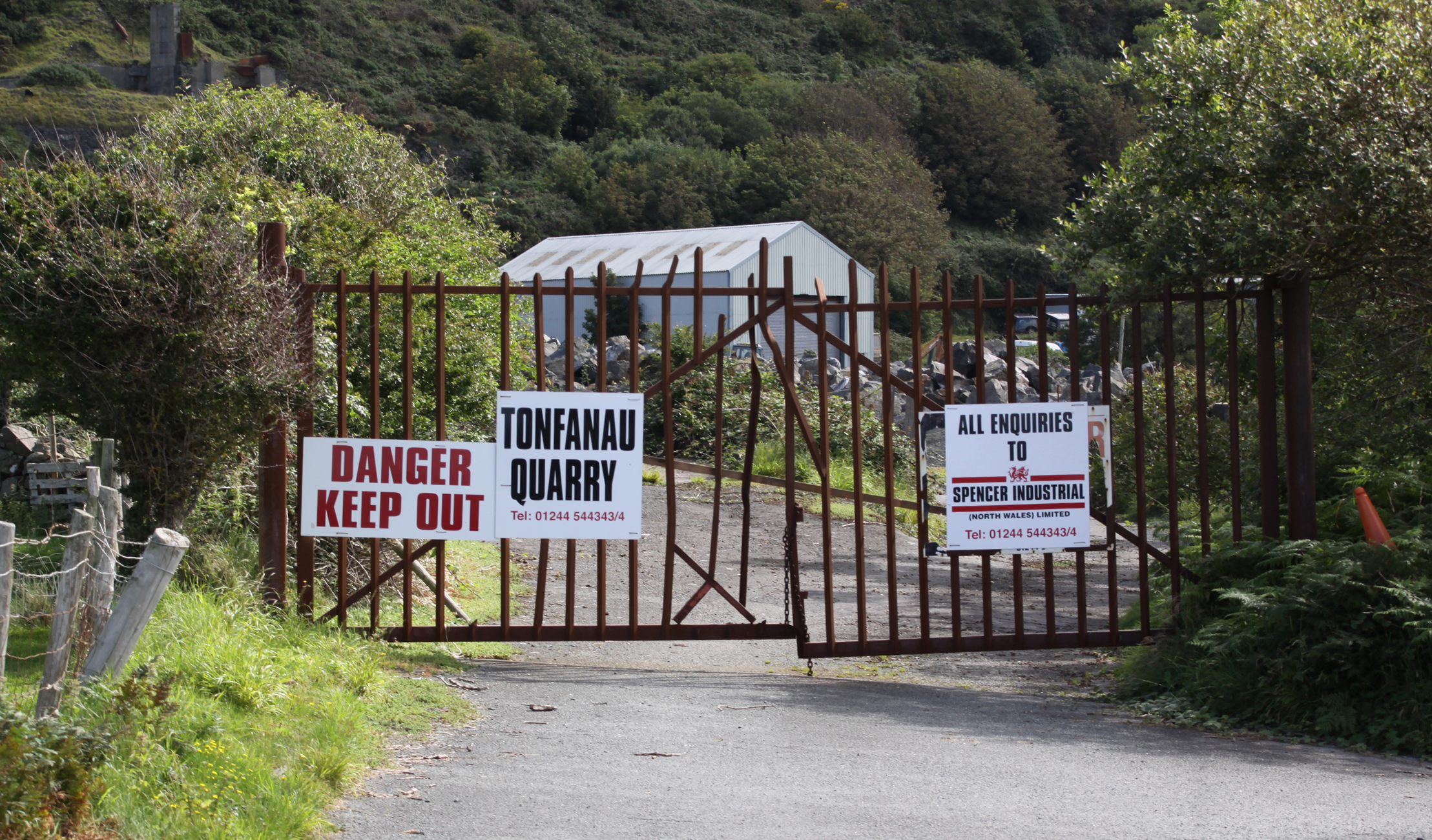
I was expecting to have the hill to myself, but there was a group of around 10 people up there enjoying the view.  We exchanged cheerful greetings, and when they left I noticed that they took the  wide quarry track that runs on a shallow incline alongside the quarry scar.  Out of curiosity I took the same route down, and it runs into the quarry yard, which is the same as the access point to the Wales Coast Path.  A farm gate opens out onto the B-road.  The quarry track is not a public footpath, but it is not barred in any way, is safe, and as the quarry is out of use it seems okay to use it.  It’s a much easier, much shallower incline than the steep path that I took up.  Although not as attractive, it gives remarkable and safe views over the quarry itself.

The quarry track

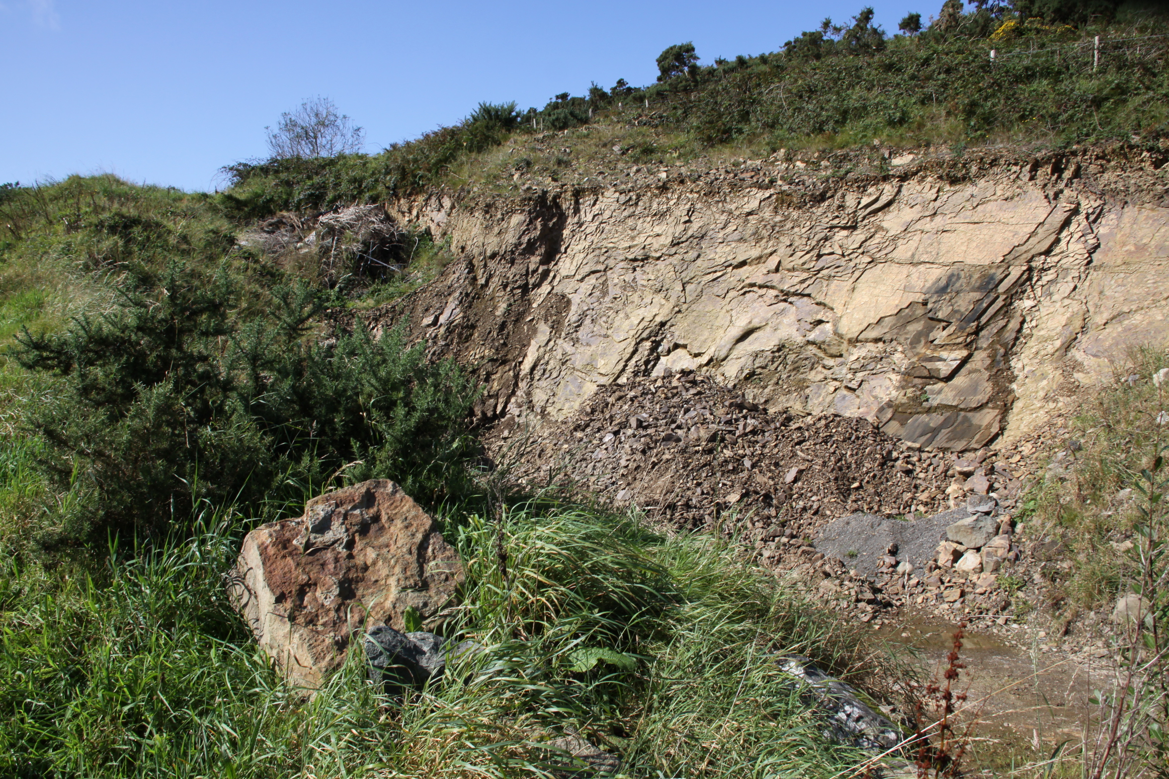
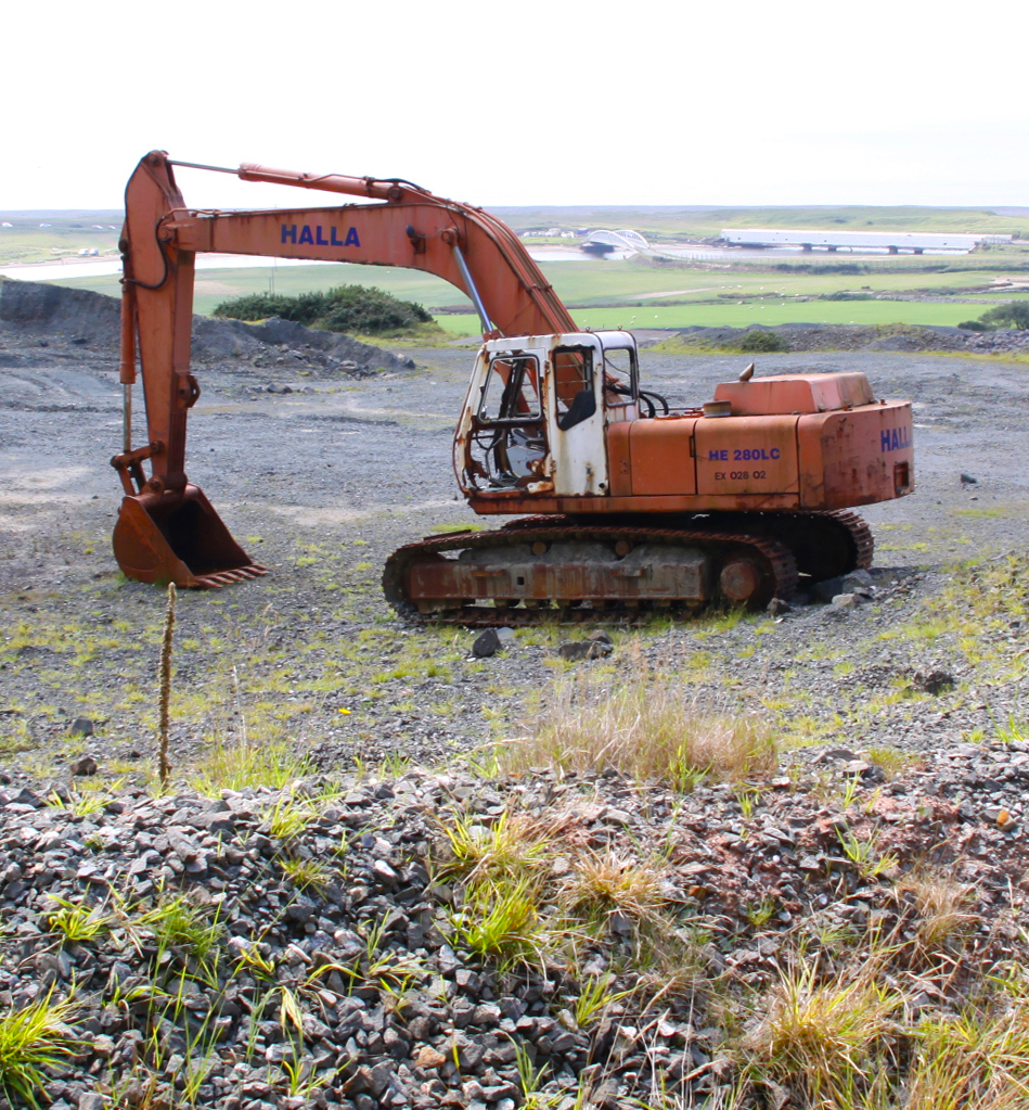
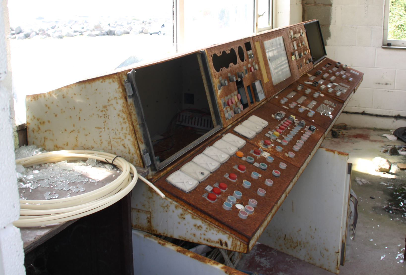
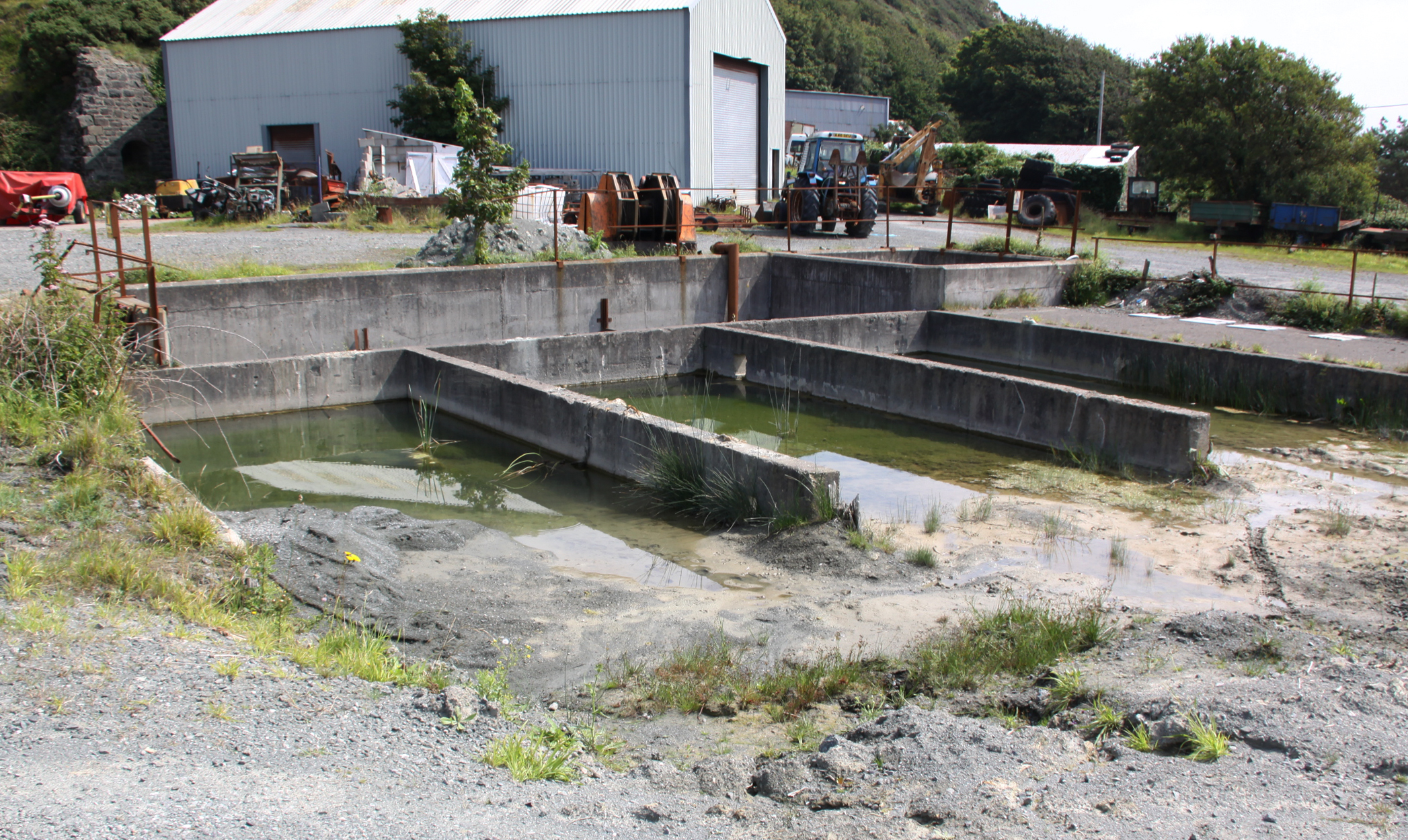
When you reach the quarry yard, you’ll find that it is a piece of industrial archaeology in its own right, with an abandoned control panel in a small building, and various bits of abandoned heavy-duty hardware lying around, plus various shallow concrete water holders, presumably for filtration purposes.  One of them had a healthy population of bullrushes growing out of it.  Gwynedd Archaeological Trust reports that the quarry was first used for extracting granite, which is unusual in this area:

The ridge has been quarried since at least the nineteenth century. A narrow-gauge link to the Cambrian Railways was put in c. 1898, superseded by a standard-gauge siding in 1906, around the time it was taken over directly by John Corbett of Ynysymaengwyn, working as Tonfanau Granite Quarries. In 1965 this became a subsidiary of Penmaenmawr and Welsh Granite Co., and operated as Kingston Minerals from 1965 to 1981. It was thereafter worked by Mr G.C. Evans of Aberllefenni.

The report goes on to say that latterly the quarry was used to exploit a sill of coarse dolerite and gabbro that is suitable for use as road surfacing material.  Here are a few snaps of the quarry as I was on my way out, but I will be going back to explore in more depth.

Sources:

Bowen, E.G. and Gresham, C.A. 1967.  History of Merioneth, volume 1.  From the earliest times to the Age of the Native Princes.  The Merioneth Historical and Record Society.

Gwynedd Archaeological Trust 2009.  A visitor guide to the main Iron Age hill forts of Meirionnydd.  Project No. G1770. Report No. 839

Sjöberg, K.S. 2014.  Hidden possibilities.  Possible uses of hillforts in southern Gwynedd, north-west Wales. Unpublished Masters thesis, Uppsala University, Department of archaeology and ancient history. http://www.diva-portal.org/smash/record.jsf?pid=diva2%3A799381&dswid=8151

Websites:

Coflein
https://www.coflein.gov.uk/

Gwynedd Archaeological Trust (no date).  Historic Landscape Characterisation: The Dysynni
http://www.heneb.co.uk/hlc/dysynni/dysynni2.html

A short wildflower walk from the Dysynni (Tonfanau) bridge

Bottom left of this map is the Dysynni rail bridge with the more recent Tonfanau foot bridge immediately alongside.  The bridge was built in 2013, just north of Tywyn (see more about the bridge on an earlier post here).  On Saturday, having escaped the truly appalling traffic carnage and the suicidal pedestrians in Aberdovey, I parked up just short of the bridge, hauled on some walking shoes and crossed over the bridge, pausing to admire the Dysynni river. The railway bridge that runs alongside, a nice bit of local heritage, is currently encased in white plastic.  Heaven knows what is being done, but good to see that it is being cared for.  The footpath beneath the railway bridge, by the way, is closed as a result.  I had only very limited time, but yesterday I simply wanted to scope out the best way of getting to the top of the Tonfanau hill that dominates the Dysynni at this point, so was looking for the footpaths that would take me up on another day.

The walk along the Wales Coast Path extends towards Tonfanau station from the bridge, but turns back along a hairpin turn along the road until just past the main quarry gates, when it turns left through a farm gate into the quarry yard to proceed along the western edge of the hill, as shown on the above map.  I ignored that turning and walked past the quarry until I reached a bridlepath sign on the left at Lechlwyd, also shown on the above map, which takes a route along the eastern edge of the hill.  Along the bridlepath, the hill soars steeply above the track.  It is beautiful, vibrantly green, and in places covered in dense swathes of glorious gorse and heather.  At the point where a gate opened into a big field I turned back, but the footpath eventually leads up to the top of the hill and the Iron Age hillforts.  I did that walk on Sunday, and I’ll post about that walk in a couple of days.

Although part of my walk was B-road, only two cars passed me, and there were plenty of verges onto which to retreat to let the occasional vehicle go past.

The walk offers some fine views over the Dysynni and the hills beyond, but perhaps the most remarkable aspect of it was the amazing density of wild flowers bursting up and out of the verges and reaching through the hedges.  If you are looking for a short and very easy walk that requires no preparation or planning, and is easy on the legs, this one, at this time of the year, is a very good option.


Tonfanau footbridge

Tonfanau, with the scarring from the quarry

I’m not sure what this flock of birds consists of.  My initial thought was that they are starlings, but although the shape and beak are right, they seem far too light, unless it’s a trick of the sun.

Field or common bindweed (Convolvulus arvensis).  Visually similar to sea bindweed (Calystegia soldanella), which I have posted about from dune walks, but common bindweed has smaller flowers and different leaves, much longer and thinner.  One of my books (Spencer-Jones and Cuttle 2005) says that once they begin to coil anti-clockwise around a support they grow so fast that a stem can complete one coil in less than two hours.  As a result they spread fiendishly fast, colonizing whole hedges and shrubs.

Mugwort (Artemisia vulgaris) is liberally distribute throughout all the verges near the Dysynni.
It is very common on wastelands, and reaches 150cm, forming clumps.  At the moment the bright white flowers on purple-red stems are particularly attractive.

Gatekeeper (Pyronia tithonus)

Bladder campion (Silene vulgaris) apparently smells similar to cloves at night.  The leaves are edible when boiled and smell like fresh peas.

Hedge woundwort (Stachys sylvatica) grows on the wasteland and the edge of cultivated land and footpaths, with a preference for semi shade.  The toothed leaves look rather like nettles.  They grow up to 1m tall.   It was renowned from the 16th Century for its healing properties, and it has proved to be mildly antiseptic.  White markings on the lower lip of the two-lip flower guides bees to nectar.

A pink version of yarrow, which is usually white (Achillea millefolium).  The name, meaning thousand leaf, refers to the feathery leaves.  They thrive in coastal areas.  I’ve posted about it before, but I love the story behind the name.  spreads by underground stems, and is patch-forming. It is disease resistant, which can benefit neighbouring plants, and its small leaves prevent excessive moisture loss. It was named for Achilles, who used it to heal the wounds of his soldiers, and it retains its reputation as a good cure for cuts and bruises. It has a long history as a remedy for colds and fevers (as a tea) and for toothache (when the leaves are chewed). Its leaves and flowers are used in salads in small quantities, it can be boiled as a vegetable and served with butter, and it can be thrown into soups and stews. It has a slightly bitter taste. Flowers July to October.

Tufted vetch (Vicia cracca). A climber that uses long tendrils to scramble through hedges and shrubs.

Agrimony (Agrimonia eupatoria) – there were loads of these, which I had never seen before, and they were very pretty.  When they have finished flowering a fruit forms, the calyx of which has hooked spines that attach themselves easily to animal fur for dispersal.  A standard tool in the physician’s herbal remedy kit in the past, and still used as a component in solutions for catarrh and digestive problems.

The blackberries (Rubus fruticocus) are ripening!  Not long now :-).  Apparently there are nearly 2000 micro-species, so telling one from another is more of a challenge than I feel the need to get to grips with.

Common knapweed (Centaurea nigra), looking very like a thistle, but with long pointed leaves and no spines.  The brightly coloured bee is a male red-tailed bumble bee (Bombus lapidarius)

Betony (Stachys officinalis)

Hemp agrimony (Eupatorium cannabinum).  It produces white hairs to disperse its seeds, giving it a rather fluffy appearance.  The name Eupatorium comes from Eupator Mithradates the Great of Pontus (which under Mithradates incorporated Turkey and various territories around the Black Sea).  Mithradates allegedly used it for making antidotes to poisons.


The perennial Rosebay willowherb (Chamerion augustfolium) is everywhere hereabouts at this time of year.  Because it has rhizomes, it forms in large patches that are actually a single plant.  Each spear has a marvellous grouping of bright pink flowers with long white stamen, as below.  When the seedpods open, seeds spreads by means of attached plumes, forming pretty fibrous masses, as shown below.  The plant used to be known as fireweed due to its prevalence on WW2 bomb sites, and it is frequently found in wasteland and poor soils.

Rosebay willowherb seed pods and plumes

Perforate St John’s-wort (Hypericum perforatum)

Greater stitchwort (Stellaria holostea)

Common/yellow toadflax (Linaria vulgaris) looks so exotic, like an orchid, but is relatively commonplace.  It is a perennial that flowers between July and October.  Narrow leaves grow spirally up the stems.  The flower is two-lipped and only large long-tongued bees can push the two closed lips apart to reach the nectar.  Colloquial names include squeeze-jaw and bunny-mouth.  It likes open fields and sandy soils.

Beautifully scented honeysuckle (Lonicera periclymenum) was in all the hedges

Sneezewort (Achillea ptarmica).

Update on a very wet Monday (10th August):  I couldn’t find out what these are, but in reply to my request for help, Jean suggests that they may be bullace, wild plums.  I’ll go back and pick one when it stops raining.

Sheep’s-bit (Jasione montana)
Sometimes called Sheep’s-bit scabious, this is actually a perennial member of the campanula family, even though it has no obvious resemblance to the usual bell-flowered character of campanulaceae and at first glace looks much more like a true scabious.  Unlike scabious, it has small, alternate hairy leaves. and tiny narrow petals.  According to the Wildlife Trusts website, pollinating insects, which see a different light spectrum to humans, find it highly visible under ultraviolet (UV) light, and use the patterns and colours on the petals to guide them to the nectar and pollen.  It usually starts flowering in July, but thanks to the remarkably warm spring, a lot of species are flowering early.  It likes a wide variety of environments, including dry grassland, and is often found in coastal areas.  It is an excellent pollinator.

Heather and broom on the southern slopes of Tonfanau.

View from the bridlepath across the Dysynni to the hills beyond

Holly blue (Celastrina argiolus)

Lord and Ladies (Arum maculatum) fruit, what we used to call cuckoopint when I was a child.

Meadow vetchling (Lathyrus pratensis)

Red admiral (Vanessa atalanta)

Common fleabane (Pulicaria dysenterica).  Pulix in Latin means flea, and the plant was used was used as a flea deterrent.

Small tortoiseshell (Aglais urticae) on Hemp agrimony.

Bittersweet, or woody nightshade (Solanum dulcamara).  All parts of the plant are poisonous but in humans usually cause only upset stomachs. The latin species name “dulcamara” means sweet-bitter, which describes the bitter taste, followed by a sweet after-taste. In Germany physicians used it as a cure for rheumatism and it was hung around the necks of cattle to ward off evil. It flowers from June to September and is happy in hedgerows and woods. After flowering it produces egg-shaped berries that start off green, as above, and slowly become a bright, shiny red.

Hawthorn berries (Crataegus monogyna)

Red campion (Silene dioica). Campions are one of the flowers I remember very fondly from childhood.

A verge full of splendid colour.


An imposing farmhouse and fields int he foreground, with
Craig yr Aderyn (bird rock) and soaring hills beyond

The drive back into Aberdovey from Tywyn defies description.  The road was lined with parked cars, often in places where I’ve never seen cars parked before (and in several places where cars simply shouldn’t be parked).   It seems as though a lot of people who would normally be holidaying on the Mediterranean have decided to come to Aberdovey instead.  I am sincerely happy for the Aberdovey businesses, but social distancing is non-existant, masks are few and far between, and the whole thing looks like a seething petrie dish for the transmission of nasties.  After one experimental foray, I’m staying well out of it.


Early July dune flowers, more foraging

July already.  How on earth did that happen?  A sunny day today, and a welcome change from the recent wet weather.  The day before yesterday it wasn’t actually raining in the afternoon, although it had all morning, and the feeling of going stir-crazy after all the rain was immense, so it was a relief to go and see what else had come into flower in the sand dunes, which seem to be changing all the time.


The sea holly is just coming in to flower, one of my favourites (Eryngium marititinum).  There seems to be less of it in the dunes than in previous years, but that may just be an impression.  The leaves are a lovely silvery-blue colour and the flowers are a stunning powdery cornflower blue, forming little domes.  It loves full sun and dry coastal and rocky habitats.  Surprisingly, given its appearance, it is  a member of the carrot family.

Common/yellow toadflax (Linaria vulgaris) looks so exotic, like an orchid, but is relatively commonplace.  It is a perennial that flowers between July and October.  Narrow leaves grow spirally up the stems.  The flower is two-lipped and only large long-tongued bees can push the two closed lips apart to reach the nectar.  Colloquial names include squeeze-jaw and bunny-mouth.  It likes open fields and sandy soils.


Hound’s-tongue (Cynoglossum officinale) is new to me.  It has many small dark crimson flowers, each with five petals, on hairy stems.  After flowering, the fruit is a spiked nutlet that starts green and goes through deep purple to brown.  They hook on to the fur of a passing animal.  The ones in the dunes were courteous enough to have both flowers and nutlets on show.

Hedge woundwort (Stachys sylvatica) grows on the wasteland and the edge of cultivated land and footpaths, with a preference for semi shade.  The toothed leaves look rather like nettles.  They grow up to 1m tall.   It was renowned from the 16th Century for its healing properties, and it has proved to be mildly antiseptic.  White markings on the lower lip of the two-lip flower guides bees to nectar.

Rosebay willowherb (Chamerion angustifolium) is a spreading perennial up to 1.5m tall.  It colonized bomb sites during the Second World War and became known as “fireweed.”  It spreads both by rhizomes and by seed, so where it is found, it is usually widespread, and the the rhizomes mean that a whole patch may actually be a single plant.  Delicate Four-petalled pink flowers with white stamens that climb the stem go over first at the bast and continue to be in bud at the top, meaning that they may stay in flower from June to September.  Its leaves used to be used as in infusion to substitute for tea.

Before flowering, old man’s beard, or traveller’s joy (Clematis vitalba) looks just like clematis and is probably the next most widespread plant in the dunes after marram grass, hugging the lower lying areas.  It spreads over everything, and provides a natural protective home for the wild pyramidal orchid (Anacamptis pyramidalis) that grows in the dunes.  The name old man’s beard refers to the hairy, air-born seed heads that appear in autumn and extend into winter.  The flower begins as a tiny, spherical white bud and bursts into lovely, starry white flowers with four white sepals and a burst of stamens.

Common ragwort (Senecio jacobaea) is common in the area,  in the hills, fields, wasteland, and in the dunes.  It is poisonous to birds, horses and cattle, particularly when dry, but for some reason sheep seem to be immune.  It may be either biennial or perennial.  Although it can be mistaken for goldenrod (Solidago virgaurea) from the flower alone, the leaves are very different.  Where goldenrod has long, thin leaves, common ragwort’s leaves are untidy, dissected and multiple-lobed.  Senecio is almost the only specie that can be used for food by the day-flying red and black cinnabar moth’s (Tyria jacobaea) caterpillar, striped bright orange and black, absorbing the plant’s poison as a defense against birds.  In spite of the fact that they can be seen between May and August, there were none on view that day.

Broad-leaved everlasting pea (Lathyrus latifolius) is a French perennial that has colonized many other countries.  A vigorous scrambling plant that uses tendrils to colonize hedges and shurbs.  It was brought from France to Britain as a garden plant and has gone native.  The flowers are larger than most of the other pea family of flowers, up to 3cm across, with shades of dark pink and purple.

Marsh pennywort (Hydrocotyle vulgaris) is very similar to the more widespread wall pennywort (Umbilicus rupestris), but grows in marshy areas, whilst wall pennywort grows, as the names suggests, out of walls (and is widespread in Aberdovey).  This particular marsh pennywort was growing out of the side of one of the drainage streams on the golf course.  It is less waxy and succulent than wall pennywort, as it doesn’t need to store as much water.  Both are edible as leaves in salads and as garnishes with much the same flavour.  The flavour can be variable, so although it tastes a bit like cucumber, it can be bitter, and a leaf should be tasted before picking more.

White stonecrop (Sedum album) has now spread over huge areas of the lower parts of the sand dunes, particularly near the road where the sand is mixed with soil, its succulent leaves forming mats, and its white star-like flowers clustering at the top of the short, slender stems.  Drought tolerant, thanks to the succulent leaves that store water.  Like Sea rocket (Cakile maritima) it has apparently benefited from the lack of people around, colonizing areas that would otherwise be used for reaching the caravan park, the golf course and the beach.

The perennial sea beet (Beta vulgaris subsp. maritima) and the orache are side by side at the edge of the dunes, both huge clumps, both common at the edges of sand dunes. Sea beet has a tall, spiky clumps of flowers straggling across the top of the plant.  Sea beet is both drought and saline tolerant.  It is the wild version of a version that was cultivated in the Middle East for its roots and leaves.  Sea beet is easily confused with fat hen (Chenopodium album) and both are members of the Chenopodiaceae, but the leaves have very different edges.  Sea beet leaves have a smooth, untoothed margin, whereas fat hen leaves look more like orache, with a toothed margin.  Sea beet is a popular foraging ingredient, with smaller, younger leaves used in salads and bigger leaves spinach in a tiny amount of water for a few minutes, like spinach.  Squeeze out the water, return to the pan with some butter, and you have a much tangier version of spinach.  On my to-do list.


Artemisia absinthium or wormwood seems to come in a variety of forms, many with a lot more foliage than this, but there are a lot of photographs of it online looking just like this.  Small fdsfsfas of tiny yellow flowers tit on a network of silvery stems with silvery leaves.  I haven’t put it to the test, because I didn’t know what it was when I took the photograph, but it is the primary flavouring of absinthe, much beloved of Toulouse-Lautrec and his contemporaries.

The last triumph of the day was the discovery of some field mushrooms and some baby puffballs.  I had the puffballs tossed in butter and added at the last minute to a slow cooker stew with French smoked sausages, onion, garlic, dried ceps, savoy cabbage and peeled baby new potatoes.  The puffballs were mushroomy but delicate, a real treat.

Vintage Postcards #4: The Roman Road

The Roman Road as it is today from a similar viewpoint to the first postcard, with Trefri in the background

The Roman Road is a nice local myth.  It forms part of a popular low-tide walk along the estuary to Picnic Island (which I have written about here) and is a truly remarkable sight, cut out of the black Aberystwyth series shales, which in places are so smooth that the rock looks polished and glistens in the sun.

Although there is a Roman fortlet at Pennal 11km away, there are very few indications that the Romans did anything more than pass through Aberdovey, if they even did that.  Trying to find out what it was built for I first looked to Hugh M. Lewis, who wrote several histories of the village, but he was unable to shed any light on the subject.  My original guess was that it was built in the 1860s, part of the works for the building of the railway, but that failed to address the question of the purpose of such a track.  In his description of a 6-mile walk that incorporates the road, the author David Roberts, an Aberdovey resident, states that the track was built in 1808 for horse and carriage, but he doesn’t expand on this observation.  I then found a publication by the Gwynedd Archaeological Trust (GAT Ports and Harbours of Gwynedd, 2007) that contains the following statement, and which appears to confrim what David Roberts says and provides sources for identifying this as a road designed to connect to a stretch of road that already linked Pennal to Machynlleth:

Fenton remarks in 1808 that a new road was under construction from Aberdyfi to Machynlleth but implies that the section from Pennal to Machynlleth was already in being, that an extension west and north to Tywyn ‘by way of the sands’ was contemplated if not actually under construction. This road, known as ‘hen ffordd Corbet’ was not a success, being built so low that it was frequently covered by the tides. Its course is marked on the plans for the replacement road dated 1823 and prepared by Thomas Penson (DRO: Z/CD/168).  This is probably Thomas Penson junior (1790-1859), county surveyor of Montgomeryshire, a versatile and able architect-engineer, rather than his father. Lewis states that this road was completed in 1827

I am still unsure if this is the correct answer, as the track barely seems wide enough for horse-drawn vehicles, and in places would have been lethal underfoot for horses.  One would need to see Penson’s plans for the replacement road mentioned by the Gwynedd Archaeological Trust’s report.  Whatever its original purpose, it is invaluable today as a ready-made footpath for walkers.  The note about the road being unpopular due to being submerged by tides holds true today.  The walk is impossible without wading through water at high tide.  I note that the second of the two postcards does not commit itself on the subject and states merely that the scene shows “The Rocks.”

The first postcard was unused, so there are no helpful postmark or stamp details to give an indication of date.  It was manufactured by Lilywhite Ltd of Triangle, Halifax.  Lilywhite was set up by Arthur Frederick Sergeant (1882-1952) in around 1910 and produced postcards at least until 1931 when their factory burned down, destroying both prints and negatives.  They took over Arrow Series Postcards in the 1920s and as well as retaining the Arrow name for some of their postcards, re-released some earlier Arrow postcards under the Lilywhite name.  I’ll keep an eye open for a used version of this postcard to see if I can find a date or at least a date range.

The second postcard has a Edward VII stamp and an Aberdovey postmark dated August 7th 1904.  Edward VII reigned from 1902-1910, and this particular shade of blue-green was issued between 1902 and 1904.

I loved the brevity of the message, which also contained the brilliant information that the sender had been staying at Glandwyr in Aberdovey. 115 years later it is owned by a very nice local holiday company, Dyfi Cottages, that lets out properties in the village and also runs the Visit Aberdovey Facebook page.  There’s a lovely sense of continuity in those details.  I suppose that postcards were, and still are, a form of social media, a way of maintaining communication with people far away.  The postcard was sent to the beautiful village of Luccombe, which now lies in Exmoor National Park in Somerset.  The house to which it was sent, Wychanger, was a manor house now Grade 2 listed and converted to semi-detached homes.  It is fun to have the full breadcrumb trail.

Photograph showing the location of Glandwr, used with permission, copyright Dyfi Cottages and Aberdyfi Holidays

Evelyn Wrench, from an article in
‘The Pictorial Magazine’, January 2nd 1904. Ref: Wr D 48/65.  Source: The University of Nottingham’s Manuscripts and Special Collections blog

The 1902 Post Office regulations are provided as simple instructions on each half of the back of the card, leaving no room for any confusion!  The title Gwladgarwr at the front of the card is a puzzle, appearing on a lot of Wrench’s Welsh postcards.  It means “patriot” and was the title of a Welsh language newspaper (Yr Gwladgarwr), but the newspaper appears to have no connection with the postcard manufacturer.  The card is in the Wrench Series, no.8006, and was printed in Berlin.

Sir John Evelyn Leslie Wrench (1882-1966) was a British author and journalist.  While in Germany after leaving school, Wrench was impressed with the popularity and high quality of German postcards and decided to shelve his plans to become a dimplomat and instead set up a British business producing high quality postcards in sepia, black and white, and colour.  He had his resort postcards printed in Dresden (Saxony) and Berlin from where they were shipped in bulk to London.  Although it remained in business for only a few years, the postcard company was a initially a phenomenal success and Wrench himself became something of a media darling.  Based in Haymarket in London Wrench’s postcard company had over 100 employees and sold in the region of 50 million cards, all before he had reached 21 years of age.  Wrench went out of business in 1904, having sunk too much capital into the company, leaving him unable to repay loans but he went on to have a very successful career.  He was founder of the Royal Over-Seas League, became editor of The Spectator and was knighted by George V in 1932.