 There are six churches in the Bro Ystumanner Ministry Area, which covers the Dyfi Estuary and Dysynni Valley. I intend to write about all six of the churches, which include St Peter’s in Aberdovey and St Cadfan’s in Tywyn, but am starting with St Peter ad Vincula in Pennal. The story of St Peter ad Vincula comes in three parts: 1) as a piece of architectural and ecclesiastical heritage in its own right, 2) as the site at which Owain Glyndŵr’s Llythyr Pennal (Pennal Letter) was signed, and 3) as a modern, fully functioning community church. I was lucky enough to be given a full tour of the church by church warden Hugh Ramsbotham, to whom my sincere thanks.
The unusual name of the church refers to a story in the Acts of the Apostles XII. St Peter ad Vincula translates as St Peter in Chains and refers to an event when St Peter was jailed in Jerusalem by Herod. The night before his trial he was asleep, flanked by two soldiers and chained in irons, awaiting trial for preaching about Jesus. An angel is said to have woken him on the night before his trial, releasing him from his chains with a touch, guiding him out of the prison past unseeing guards. Today, the chain is kept in a reliquary under the main altar of the Basilica di San Pietro in Vincoli (Rome), which was built in the 5th Century to house the chains.
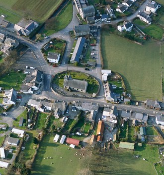
Aerial view of Pennal, with the church of St Peter ad Vincula surrounded by an oval wall. Source: Coflein website
The village of Pennal lies on the River Pennel, which runs into the River Dyfi, and it is probable that this was the main Dyfi river crossing throughout the Roman and Mediaeval periods. The village was occupied from at least the Roman period, if not earlier, with a small fort, Cefn Gaer, established near to the river. The site of the church itself had probably been occupied by a pre-Christian structure, suggested by the oval perimeter wall of the churchyard. Oval and circular churchyard walls are often associated with a number of early structures including Roman era churches that survived the departure of the Romans, early burial grounds, pre-Christian shrines and Anglo-Saxon defended sites. Such circular and oval churchyards are common in Wales.
The first church was established in around the 6th Century by Saint Tanwg and Saint Eithrias, missionaries from Armorica (modern Brittany). There are no signs of either that wooden structure or any that followed it. Pennal was the site of one of 21 llysoedd, or royal court compounds, and the motte that stands some 300m to the south-west of the church may have been part of the contemporary complex. The church was re-dedicated at the end of the 11th Century by the Normans and it is possible that it was first rebuilt in stone during the 1130s when Gruffydd ap Cynan initiated a programme to rebuild ancient churches of Gwynedd. Throughout the Mediaeval period it was located within the cantref (similar to a county) of Meirionnydd and the smaller administrative unit of the cwmwd (commote) of Ystumanner. Throughout the Middle Ages the church was one of three Chapels of Ease (subsidiary churches) under St Cadfan at Twywyn, along with Llanfinhangel-y-Pennant and Llanfair (Tal-y-Llyn). The church is recorded as having served several of the Welsh tywysogion (princes) and is mentioned in the Norwich Taxatio (records of assessments of English and Welsh ecclesiastical wealth) of 1253. It is probable that it was designated a Chapel Royal of the Princes of Gwynedd under Owain Glyndŵr. In the 1284 in the Statute of Rhuddlan the cantref of Merionnydd was combined with other cantrefs to form Merionethshire.
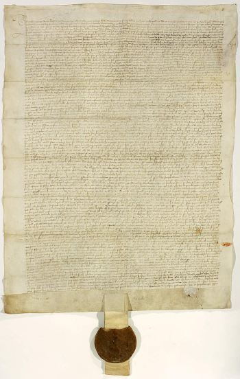
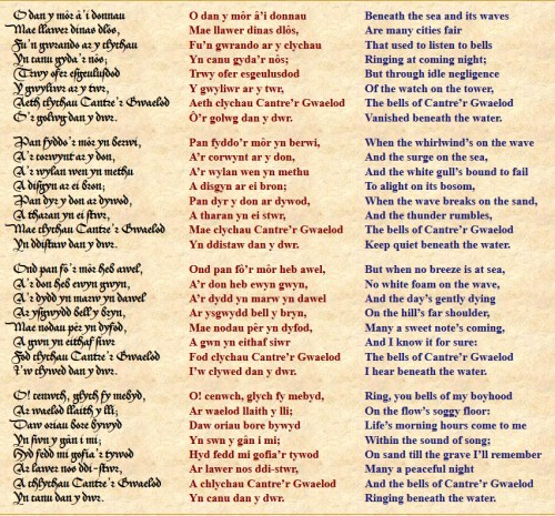
The Pennal Letter. Source: British Library. Archives nationales de France, J//516/A/29 J//516/B/40. Copyright © Archives nationales de France
The presence of a llys here partially accounts for the presence of Owain Glyndŵr in the early 15th Century. The connection with Owain Glyndŵr concerns an important moment in Welsh history, which could have turned the tide in favour of Welsh independence from England. In 1404 Glyndŵr held a Parliament at Machynlleth where he was, according to tradition, crowned Prince of Wales, having organized the previously very fragmented opposition to Henry IV. At the time he had backing from Scotland and Northumbria, but by the end of 1405 this support had been eroded by Henry’s armies. In 1406 Glyndŵr assembled a formal meeting of his nobles and clergy at Pennal, including the Archdeacon of Meirionnydd Gruffydd Young, to discuss the options for making a strategic alliance with Charles VI of France. During this period there were two papacies, the traditional papacy base in Rome and a new breakaway papacy in Avignon, France. Charles VI was loyal to the Avignon papacy, whilst the English king Henry VI was loyal to Rome. Glyndŵr hoped to take advantage of the breach within the Roman Catholic Church as a bargaining chip to gain the support of Charles VI. As a result, a letter was written by Glyndŵr in Latin to Charles VI offering allegiance to Pope Benedict XIII in return for military support. It was signed by Glyndŵr and provided with his great seal, which was probably done at the church. Although the hoped-for support never arrived, the letter remains a vital historical document recording Glyndŵr’s intentions, a strategy for the future of Wales, which included the development of a Welsh church with its own Archbishopric at st David’s, an independent Welsh government and the establishment of two universities. The letter is preserved today in France at the Archives Nationales de France in Paris, and a copy is on display in the church at Pennal. A translation of the letter is available in English on the Canolfan Owain Glyndŵr website. The letter was carried to France by Hywel Eddoyer and Maurice Kelly. A 1996 painting by Ceredigion artist Aneurin Jones (1930 – 25 September 2017) that reconstructs the assembly hangs in the church, showing members of the parish at the time it was painted.
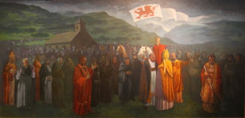
The Aneurin Jones reconstruction of Glyndŵr’s assembly at Pennal
 The earliest of the clearly dated parts of the building belong to the 16th Century, with Roman red sandstone brickwork from the fort incorporated into the walls of the church and churchyard walls, which were otherwise built of locally sourced stone. The church was a chapel of ease in the Tywyn parish in the Middle Ages, but became a parish church in 1683 under its first rector, Maurice Jones. The 19th Century renovations were radical, but incorporated aspects of the 16th and later century features into the structure. 16th Century survivors include roof timbers that were incorporated into the new roof, oak pews, the oak altar and possibly the carved pulpit.
The church was rebuilt in 1700 and 1761. In the 18th Century Pennal acquired particular importance when an east-west turnpike was built following the Merioneth turnpike act of 1775, which ran from near Pennal through Cwm Maethlon (Happy Valley) to Tywyn, completely bypassing Aberdovey. By the mid 19th Century the wharf at Pennal became important for transporting slate downriver to Aberdovey for loading onto coastal vessels and in 1865 the Cwm Ebol slate slab quarry, about a mile to the northwest of Pennal, built a tramway to the village after several years of using horses to transport the slates.
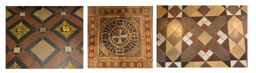
 During the 19th Century the church was again rebuilt in 1810 and 1872-3. It is to the 19th Century that most of the current form and character of the church belongs. St Peter ad Vicula is Grade II listed (listing number 23314, listed on 25th May 2000). The interior layout of the church is a single unit incorporating both chancel and nave with a slate roof. There is also a south porch added in 1880 and made of stone from Llugwy Quarry, a north vestry added in 1890 and short square bell tower with two bells at the east end, with a fully functioning clock is set into the exterior just below the tower. The original gallery was removed in 1873 (and was replaced with a modern version in 2010). The internal floor area was lowered by two feet and six inches c.1901. Wonderful 19th Century quarry tiles cover the floor of the chancel and the step leading up to it, as well as the floor of the vestry. The modern slate floor at the west end replaced more quarry tiles, of which only one tiny patch survives. The roof is a very nice open tie-beam arrangement, with re-used older timbers as well as contemporary Victorian ones.
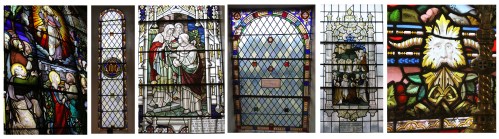
 The church has five lovely stained glass windows, all dating to the late 19th and early 20th Centuries. The earliest belongs to 1872 (by Holland and Holt of Warwick) and the latest, which replaced 1872 windows in the nave, date to the early 1920s and commemorate members of the community. The themes are The Ascension (1872 by Holland and Holt); the IHS monogram, the abbreviation of the Greek spelling of Jesus, “ΙΗΣΟΥΣ” (1872, by Holland and Holt); Christ Blessing Children Brought by the Mothers (1893, Ward and Hughes); The New Jerusalem (c.1923, by Powell and Sons, designed by Ernest Penwarden), and Charity (1928). The Ascension, which dominates the church at its eastern end, is a particularly colourful and lively piece, with a depiction of the the Green Man presiding over fruit and vegetable at its base, the only known representation of the Green Man on stained glass known in Wales. The Green Man is usually a sculpture, either surrounded by or made of leaves, probably pagan in origins but frequently depicted in church sculptures, perhaps connected with ideas of earth-bound seasonal renewal and the harvest. Most of the windows are commemorative, some with inscriptions below the them, or within the glass itself. The Ascension window, for example, was dedicated to the memory of William Hodson Lloyd, who died in 1871.
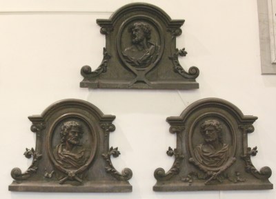
 The provenance of the three striking Flemish oak plaques showing the martyrs St Jude, St Andrew and St Paul on the north wall is unknown. There used to be four of them, all dating to around 1700, but one was stolen. A brass plaque, a rare example dating to the mid 19th Century, commemorates three Thruston sisters, one of whom held the first school in Pennal in the church’s gallery. The date of the fretwork pulpit is uncertain. The lovely little organ was built by John Smith of Bristol, c.1840 and still plays perfectly. Underneath the altar, church documents record that Lleucy Llwyd (Lucy Lloyd) was interred following her tragic death.
The story of Lleucy Llywd belongs to the mid-14th Century, but is more legend than history. Lleucy lived on Dolgelynnen Farm near the Dyfi river and fell in love with a young court poet called Llywelyn Goch. Lleucu’s father refused to let them marry, and kept the two apart. When Llywelyn Goch had to go away for a period of time, promising to return, Lleucy’s father told her that Llywelyn had married another woman. Lleucu died of a broken heart and Llywelyn returned to her on the day of her funeral. The story has been immortalized in Llywelyn Goch’s famous Welsh elegy Marwnad Lleucu LLwyd. Copies are available online in Welsh (e.g. on Wikisource), but I have been unable to find an English translation – please get in touch if you know of one!
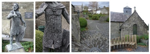
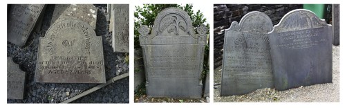
 In 1991 a road widening scheme removed part of the churchyard, to the south. It was done sympathetically, so that the sense of the space being a clearly defined oval is retained. The graves were moved to a new site outside the village, and ninety one tomb stones were recorded and moved to lean against the walls within the churchyard. Unsurprisingly, some Roman tiles were found at the same time. The churchyard was converted into a Heritage Garden in 2004 to commemorate the 600th anniversary of Owain Glyndŵr’s Parliament and this incorporated many of the headstones into its design. It was designed by Peter Styles and was constructed by a Pennal, William Rees, with funding from Cyngor Gwynedd,with funds from the EU and the Welsh National Assembly, the Snowdonia National Park fund for sustainable development (CAE) and numerous local supporters. Its aim was to provide a place of peace and tranquillity, incorporating native species of tree, shrub and flower, including some lovely pieces of topiary, emulating monastic gardens. The dominant theme is of repeated curvilinear motifs, reminiscent of Welsh stone circles and Celtic themes. Key features are memorial plaques, a statue of Owain Glyndŵr by sculptor David Haynes and circular oak benches that act as a textural bridge between the grey stone that makes up most of the garden and the delightful shrubbery that sits within it. The sculpture, about 4ft tall, shows a man ready for action, a cloak held in place with a dragon clasp, and a suit of armour showing the faces of men who lost their lives, their bereft mothers and widows, and themes that bring Wales to mind, like buzzard, hare, oak tree, raven and harp.
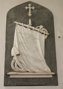
Memorial to Charles Thomas Thruston of Pennal Tower
It is easy to think of churches merely in terms of their physical architecture and history, but of course churches were built by people for their communities. Perhaps more than any other church I can remember visiting in the last couple of years, St Peter ad Vincula gives the sense of how it has been tied up with village life and the key families who helped to support and maintain it. The monumental inscriptions on the walls, the earliest of which dates to 1717, all commemorated key contributors to the church, and captured some of the sense of pride and involvement that these people had invested in the community and in their country. The number of memorials to those who died in wars alone is remarkable. All these families, the Anwyls, Thrustons, Edwards, Talgarths and Rucks have died out now in the Pennal area, but there is a sense of continuity between them and the church’s current guardians. Each of these family histories merit research in their own right as mirrors of local heritage.
 Today the church is one of six in the Bro Ystumanner Ministry Area in the Archdeaconry of Meirionnydd and the Diocese of Bangor. The other churches in the Ministry Area are St Cadfan in Tywyn, St Peter in Aberdovey, St David in Abergynlowyn, St Michael in Llanfihangel-y-Pennant and St.s Mary and Egryn in Llanegryn. The Reverend Ruth Hansford presides over the Ministry Area, supported by both clerics and lay personnel. The village is tiny and being sandwiched between Tywyn and Aberdovey in the west and Machynlleth in the east does not have a vast catchment area, and of course congregations fluctuate throughout the year as locally-based holiday visitors come and go, but the church still manages to hold a congregation at 9.30 every Sunday and holds commemorative services, concerts and festivals, with song a running theme through all their activities. The gallery upstairs is a space for meetings, social gatherings, small events and quiet contemplation, whatever your denomination. Involvement with the local school, with its 18 pupils, is important, and evinced in the Remembrance Day exhibit at the west end of the church, and in an earlier project to interpret the Green Man, upstairs in the gallery. The church is full of charm and interest, and above all warmth, with dozens of community stories embedded in every feature.
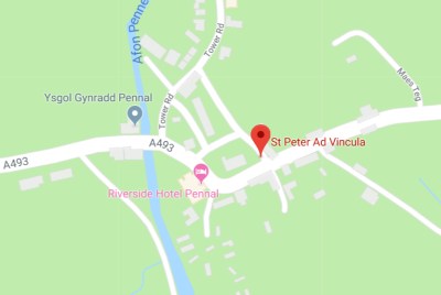
Location of St Peter ad Vincula in Pennal. Courtesy Google Maps.
The church is literally on the A493 that links Aberdovey in the west to Machynlleth in the east. It is a small village, and parking may be difficult during the summer but is easy out of season. Through the main door and to the left you will see a small metal box on the wall above a table with leaflets about the church’s history. Feed a pound coin into it and it turns on all the lights for 20 minutes, transforming the interior. Such a great idea.
Address:
Church of St Peter ad Vincula
Pennal
Machynlleth
SY20 9DW
Contact details are on the Church of St Peter ad Vincula website at: http://pennalchurch.org.uk
My many thanks again to Hugh Ramsbotham for the excellent guided tour, as well as to David Inman for introducing us.
References
 British Listed buildings. Church of St Peter ad Vincula.
https://britishlistedbuildings.co.uk/300023314-church-of-st-peter-ad-vincula-pennal#.VwbTR3arSM8
Canolfan Owain Glyndŵr. Pennal Letter.
http://www.canolfanglyndwr.org/pennal-letter.php
Gwynedd Archaeological Trust 2007. Ports and Harbours of Gwynedd: Aberdyfi. A Threat Related Assessment. GAT Project No.1824, Report No.671.1, April 2007
http://www.walesher1974.org/her/groups/GAT/media/GAT_Reports/GATreport_671.1_compressed.pdf
Gwynedd Archaeological Trust 2011. Conservation Area Appraisal: Aberdyfi, Gwynedd. GAT Project No.2155, Report No.956, June 2007.
http://www.walesher1974.org/her/groups/GAT/media/GAT_Reports/GATreport_956_compressed.pdf
Leighton, D. 2015. Cym Ebol slate/slab works. RCAHMW, 26 January 2015
http://www.coflein.gov.uk/en/site/286681/details/cwm-ebol-slate-quarrycwm-ebol-slab-works
St Peter ad Vincula Church Leaflet: A Guide to the Church.
St Peter ad Vincula Church Leaflet: The Heritage Garden at Pennal.
Stained Glass in Wales. Church of St Peter ad Vincula, Pennal, Gwynedd. http://stainedglass.llgc.org.uk/site/284
Visit Mid Wales. Local Legend – Lleucu Llwyd at Dyfi Valley and Coast.
http://www.visitmidwales.co.uk/Machynlleth-Local-Legend-Lleucu-Llwyd/details/?dms=3&feature=1002&venue=1124365
Vousden, N. 2012. St Peter ad Vincula. RCAHMW, April 2012
http://www.coflein.gov.uk/en/site/415/details/st-petersst-peter-ad-vinculas-church

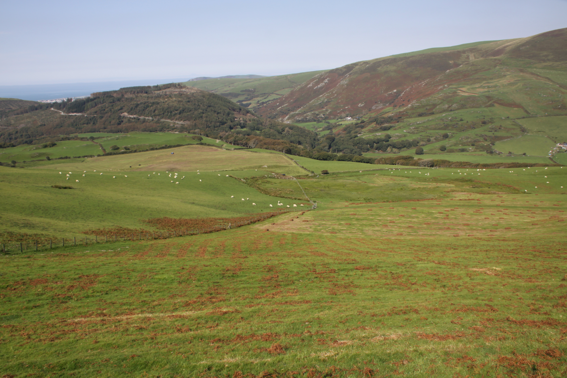
 It was supposed to be a hillfort visit, but I was fed up of driving to where I wanted to walk, so two weeks ago I did a route that I could do by leaving the house on foot, taking the Panorama walk to the lake and back again, which takes a route across the ridge. I had planned to take the longer route via Happy Valley, but was tired after an iffy night, so took the shorter route, which also allowed me to get a look at the rear end of Foel Caethle, a hillfort the lies between Tywyn and Aberdovey, from a slightly higher viewpoint than the peak of Caethle itself.
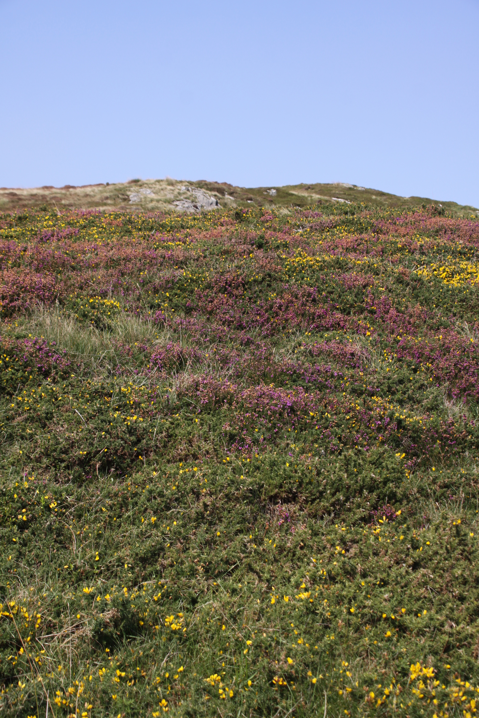
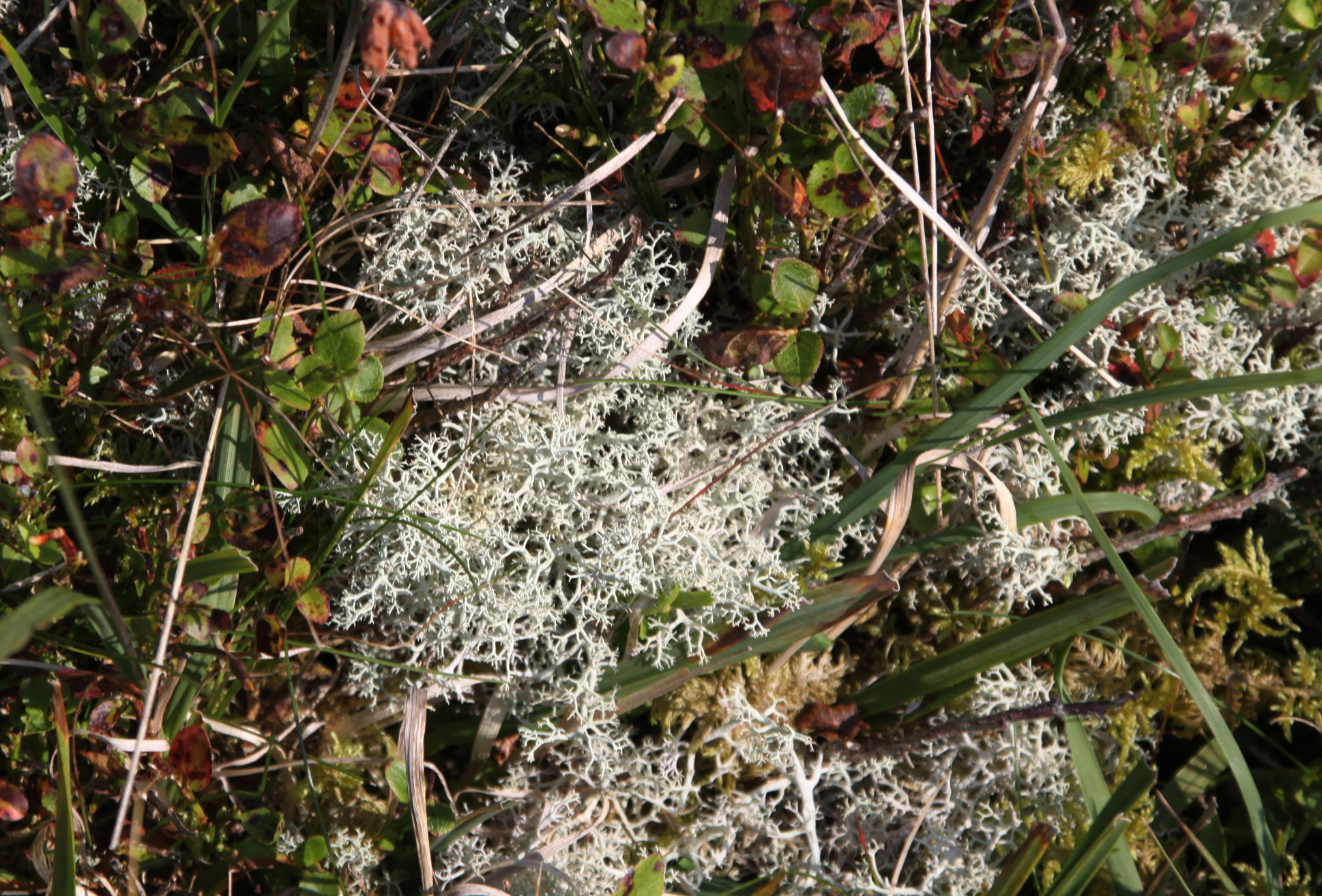
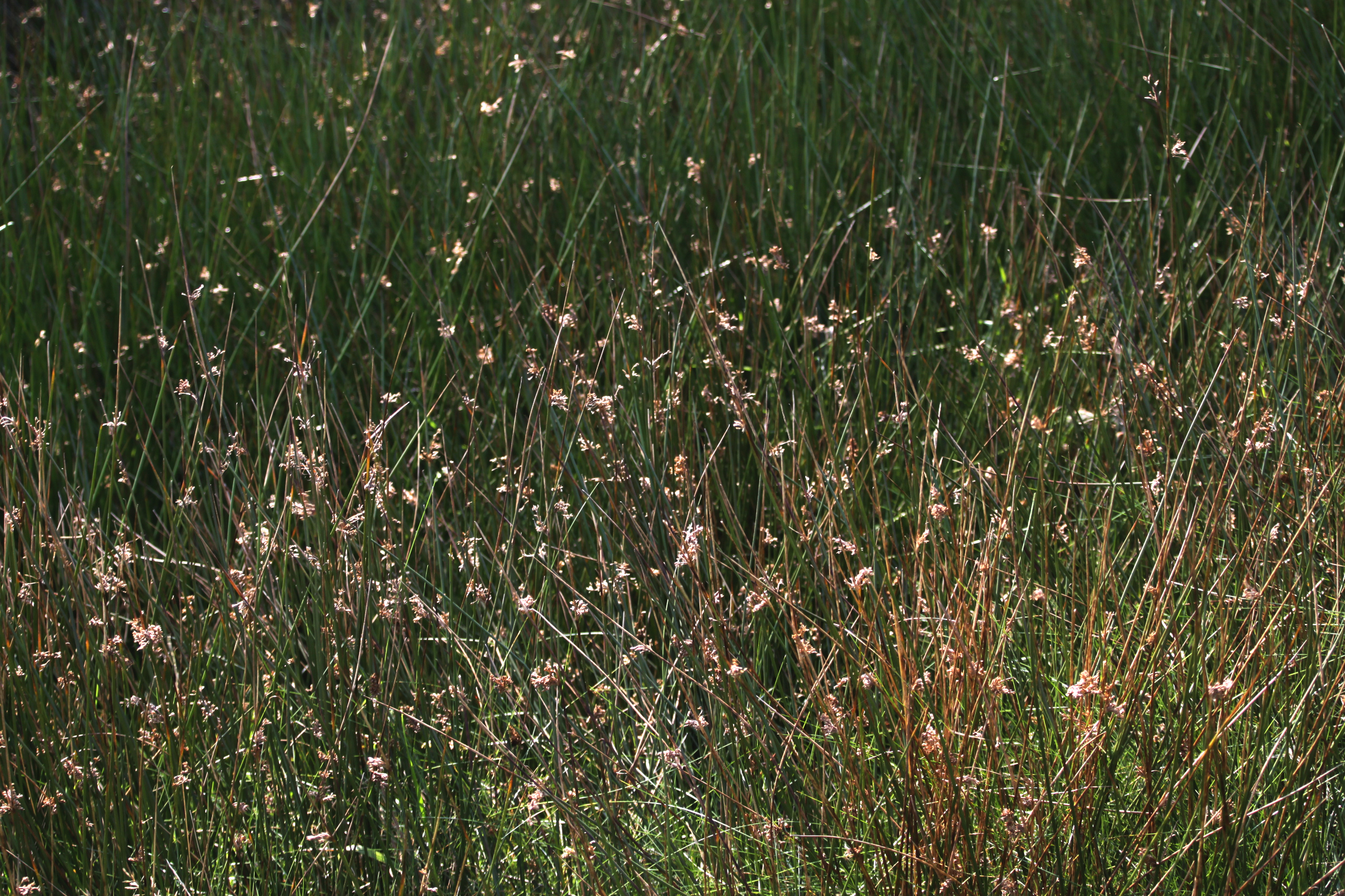
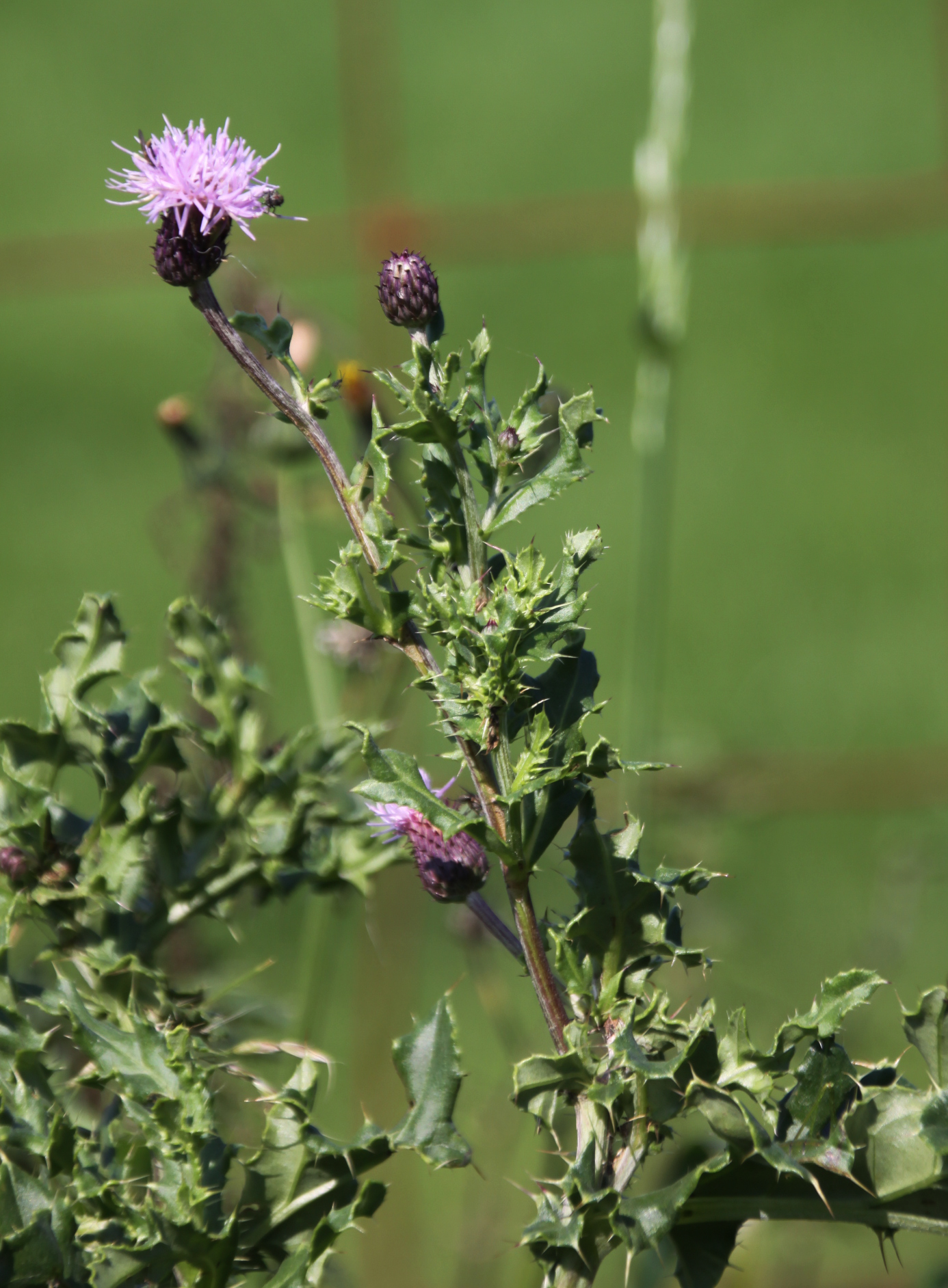
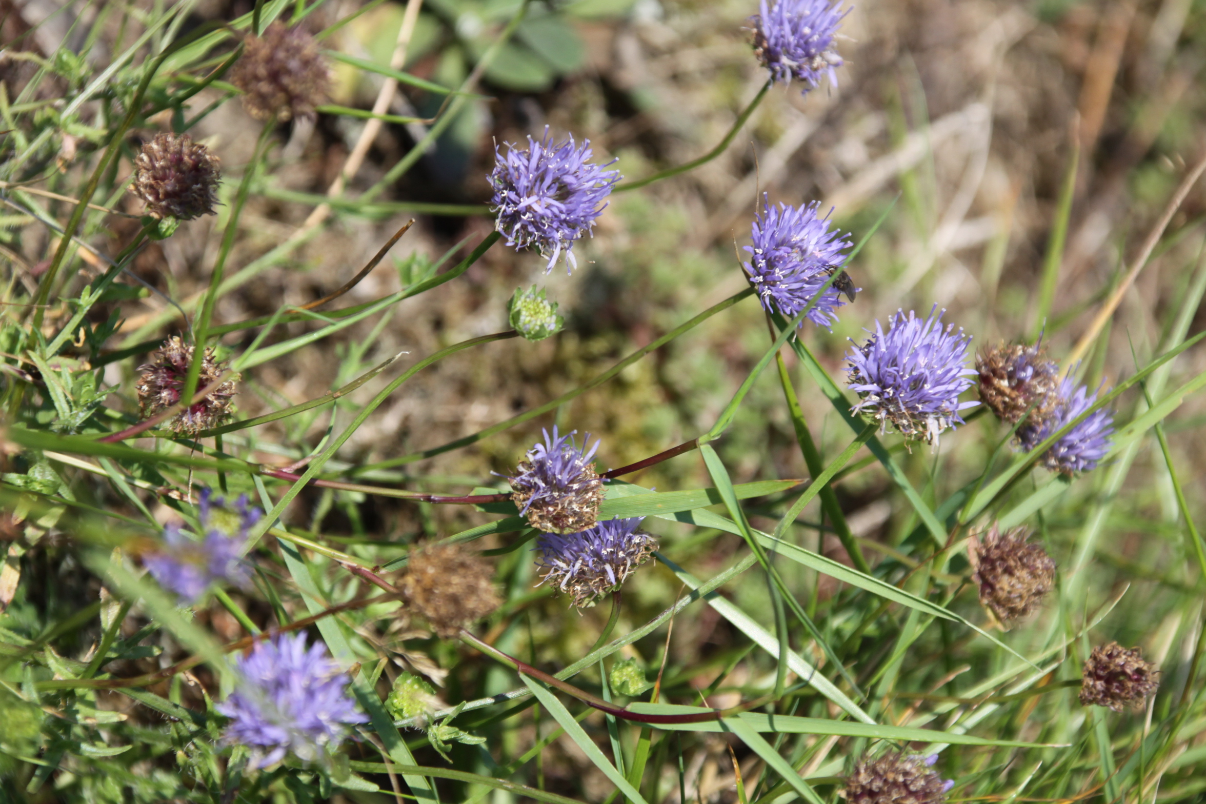 If you haven’t done it before, it’s super-easy to follow the Panorama on the Ordnance Survey map. You pass through a number of gates (five in total, I think, but more if you choose not to balance your way across cattle grids) so you will need to take hand gel and/or gloves. Just walk up Copper Hill Street from Chapel Square, and after about five minutes take the right turn into Mynydd Isaf, which is a development of 1960s bungalows. Follow this all the way to the top and at the crossroads go left. Keep an eye out in the verges too, for wild flowers and small butterflies. The harebells are particularly worth seeing – more prolific in August but with many still left in September. The tormentil is prolific at this time of year, and the last of the little cornflower-blue Sheep’s-bit are still around. There were lots of red admiral butterflies around, although none of them were obliging enough to settle to have their portraits taken.
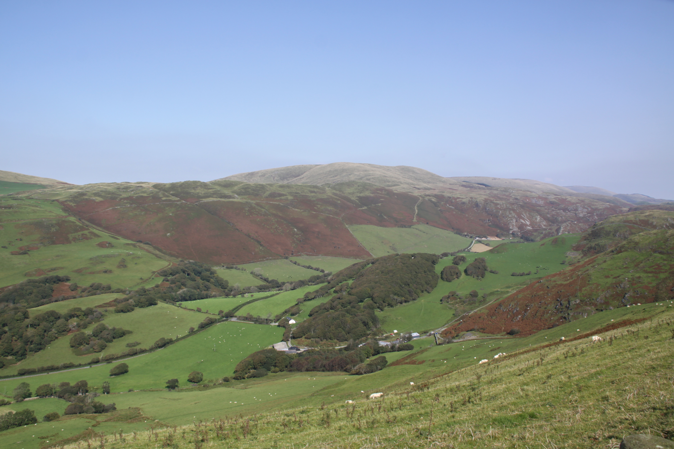
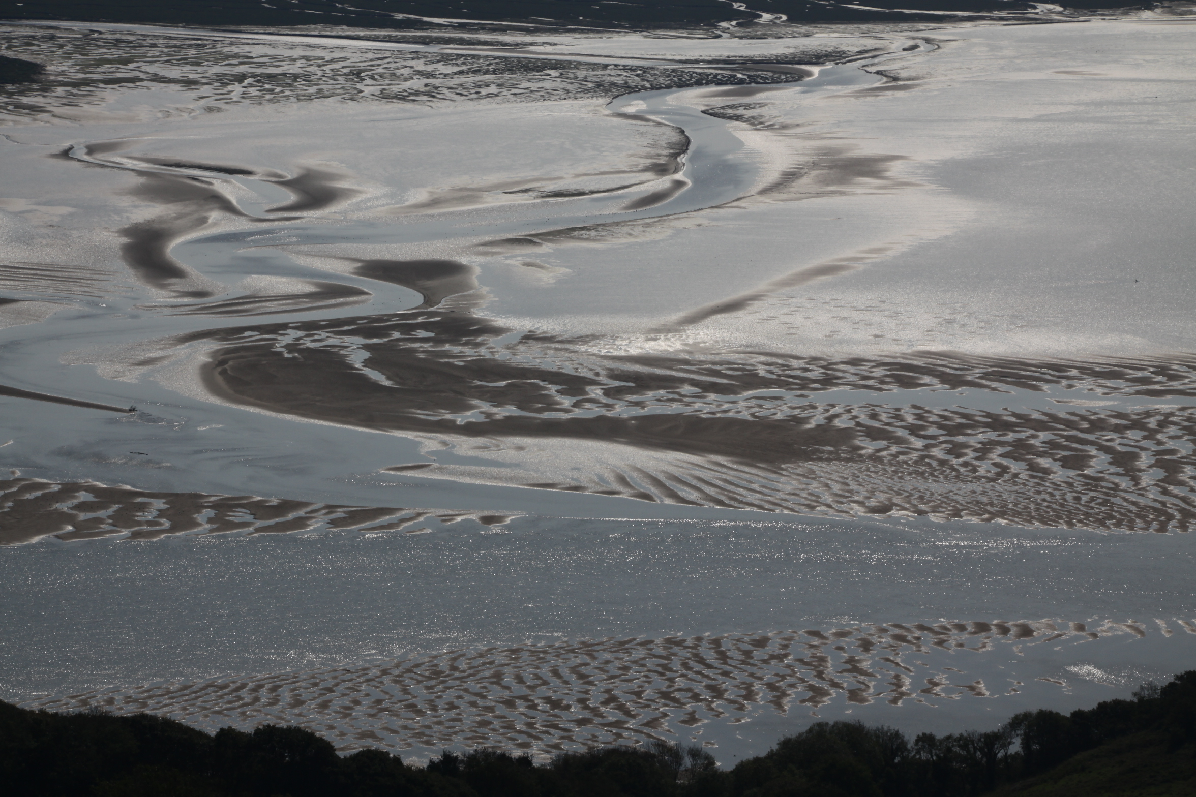
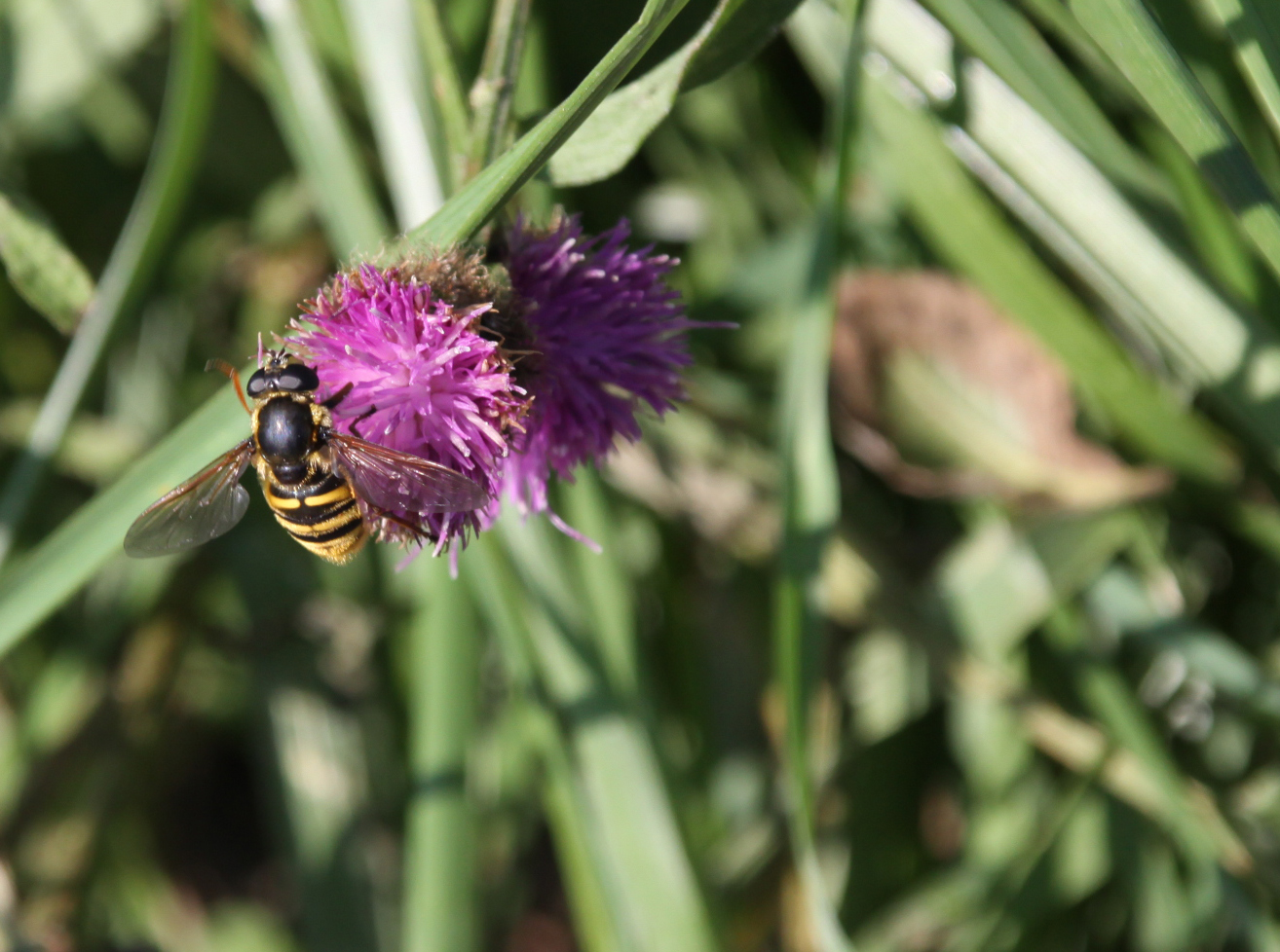 This takes you uphill, and you are instantly in the countryside, passing a farm on your right, with views over Aberdovey to your left. Just keep walking, not forgetting to turn round and see the gorgeous views over the estuary as you go higher, until you reach a right turn, with the chalet park ahead of you. It’s about an hour and 15 minutes from here to the fork for Llyn Barfog (and the same on the return leg), with gorgeous views over Happy Valley and the hills to the left, and some views over the glistening estuary to the right, which looks completely different depending on whether the tide is in or out.
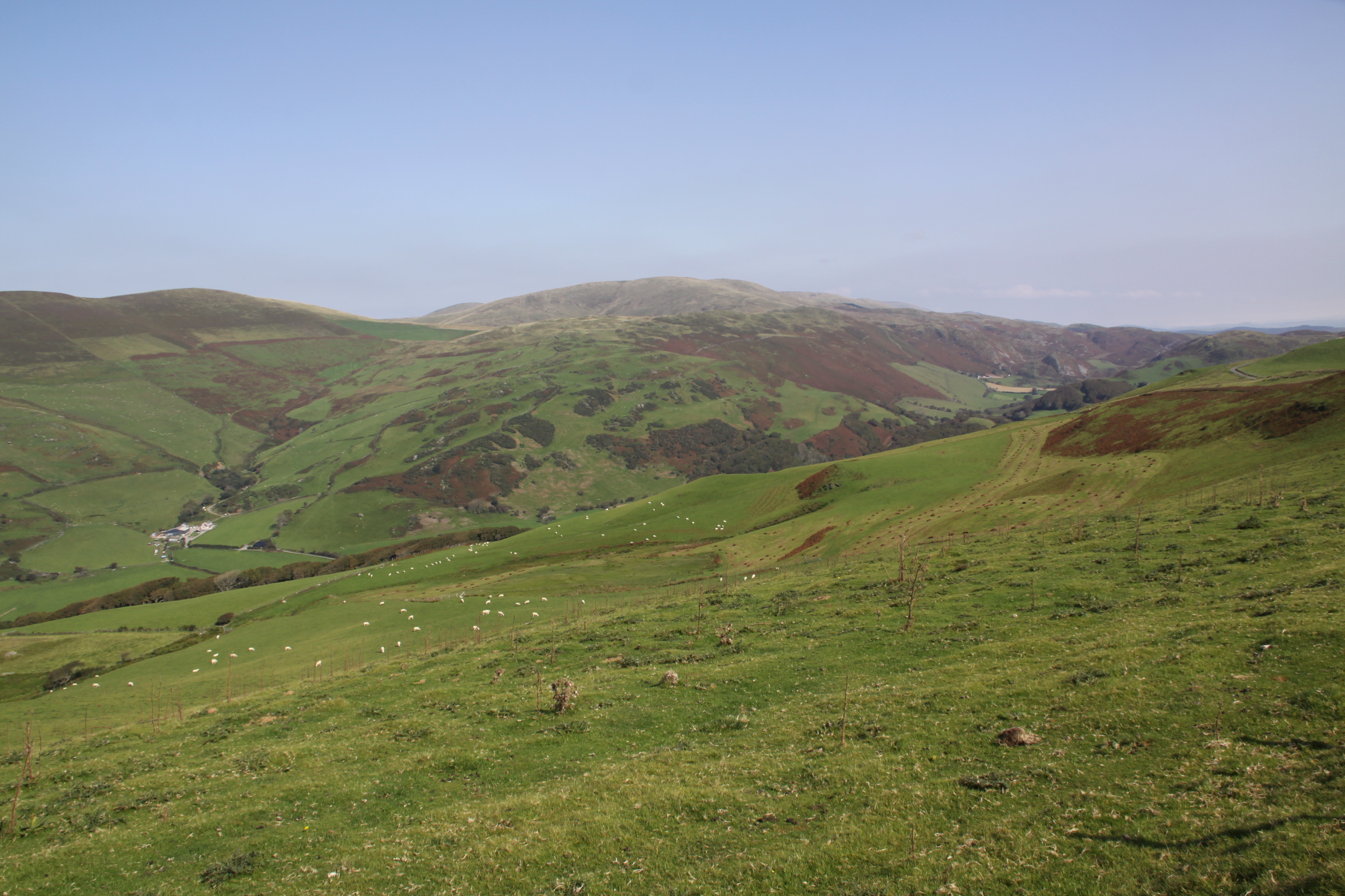
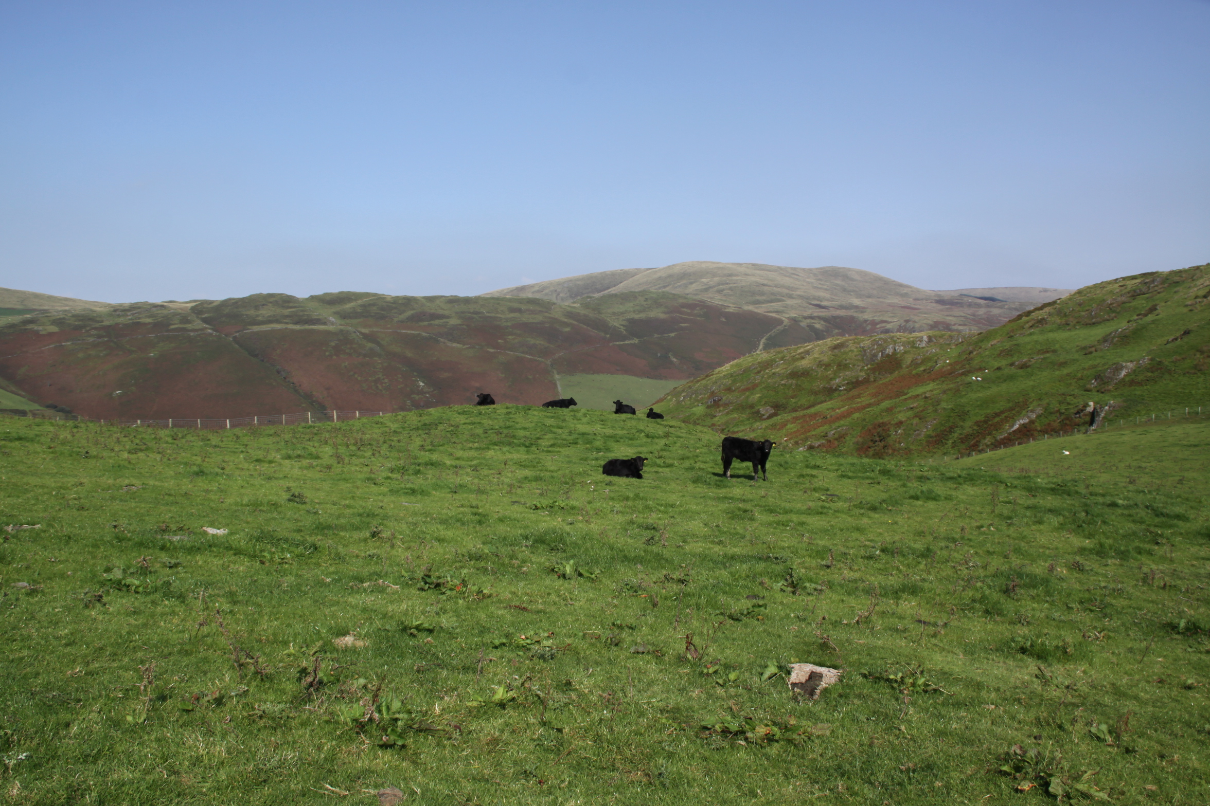
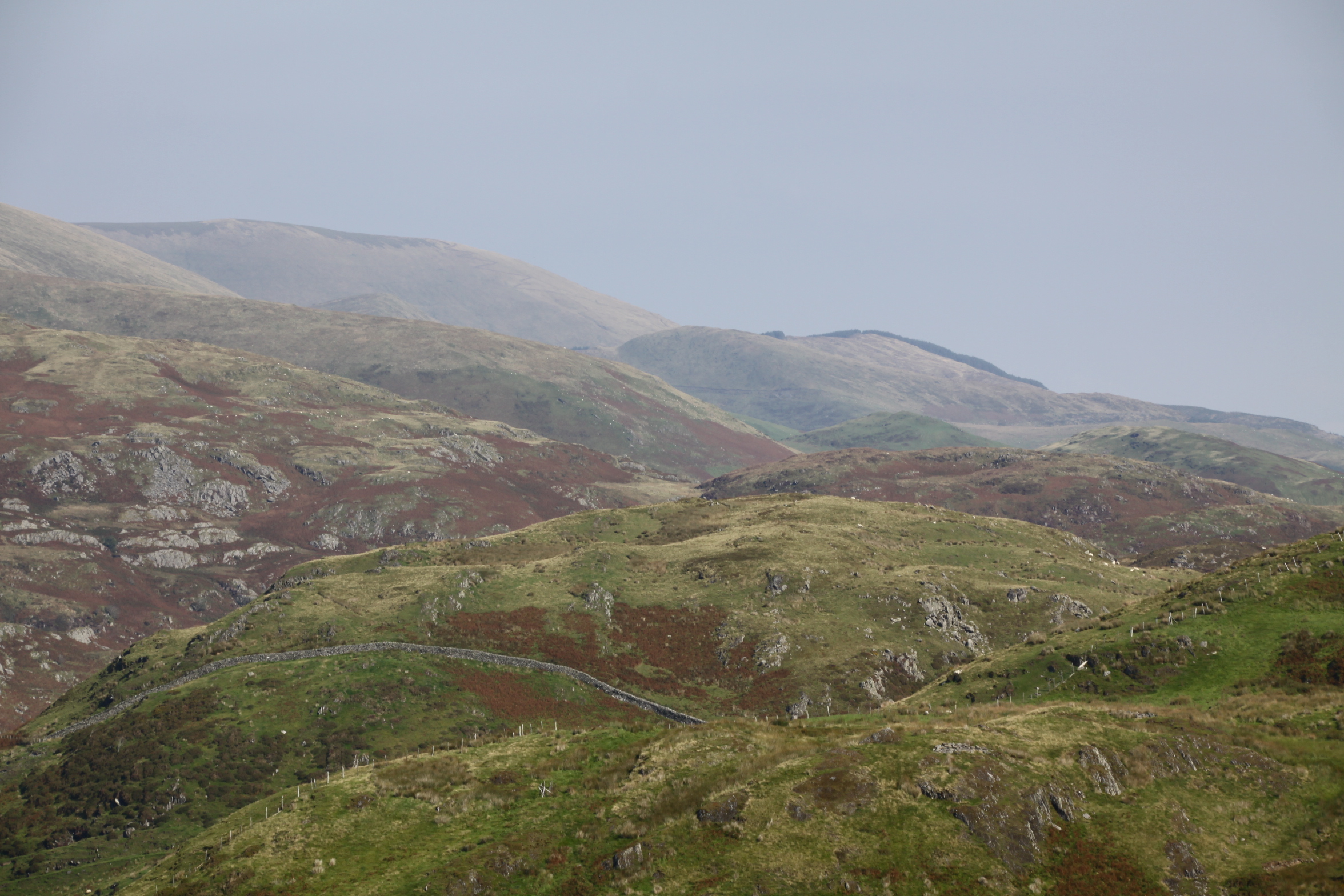
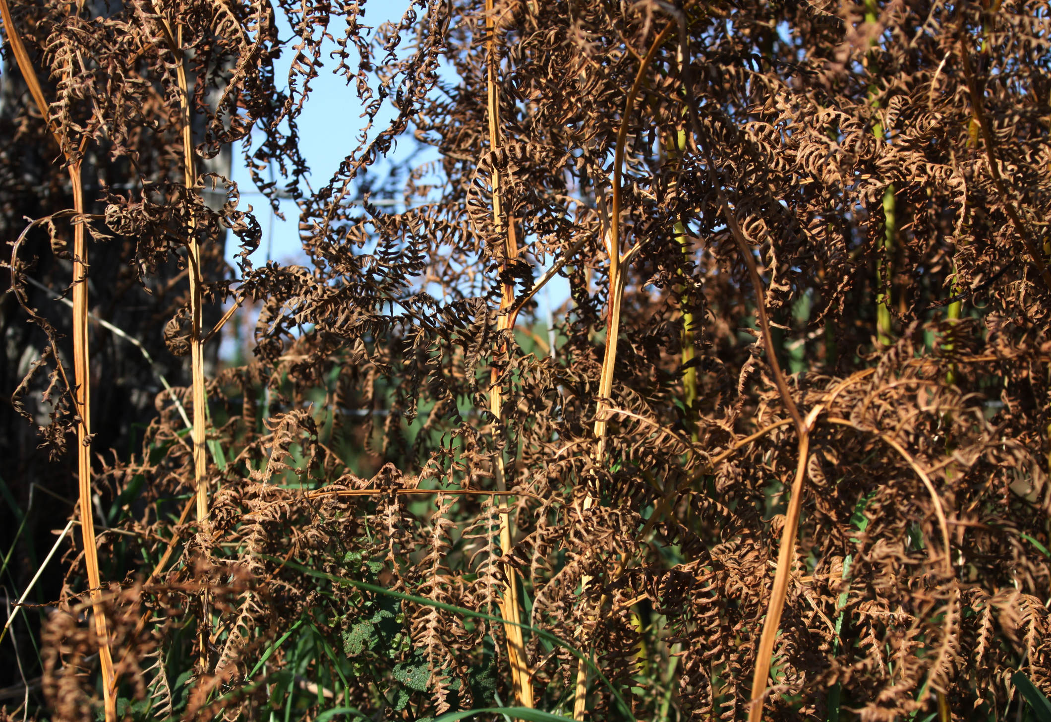
 The tarmac eventually runs out at the farm, at which point you pass through two gates and onto a deeply incised farm track with a drystone wall on your right and views now mainly over the estuary, with a slope of gorse and heather rising to your left.
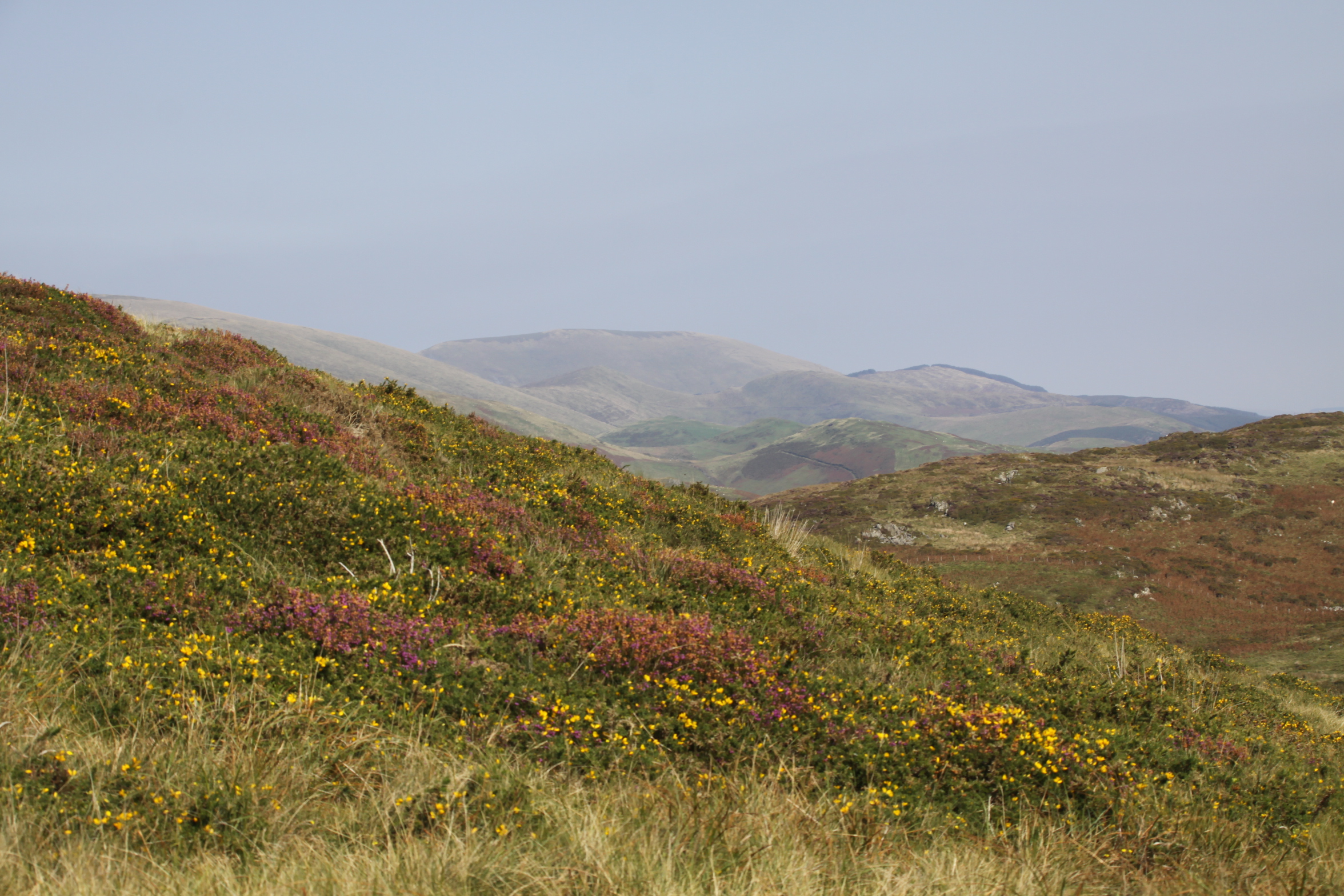
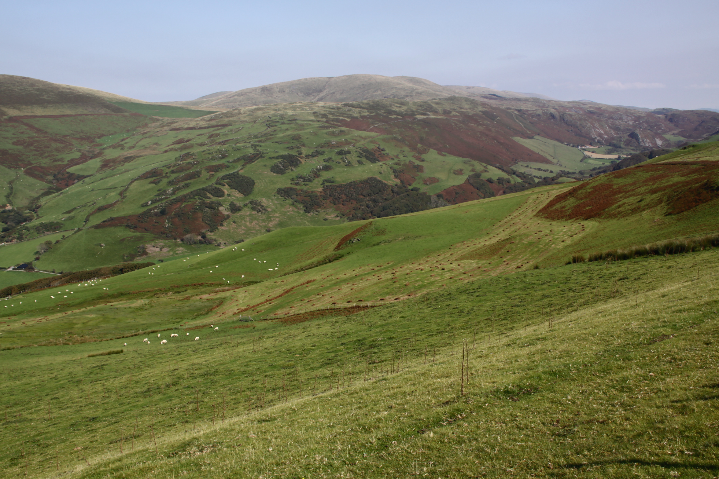
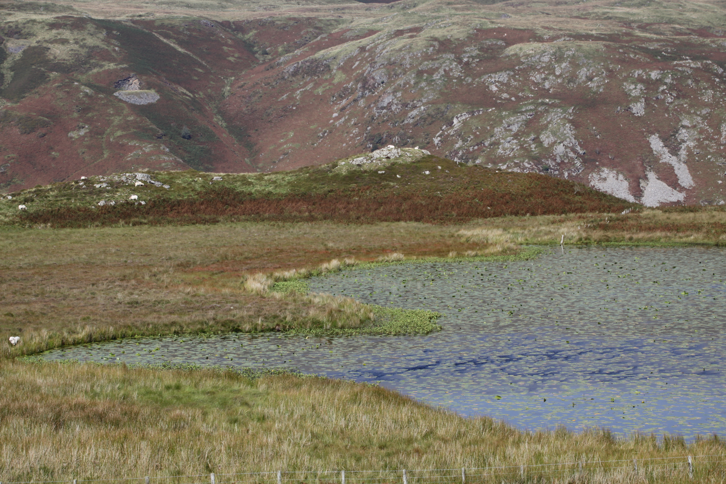
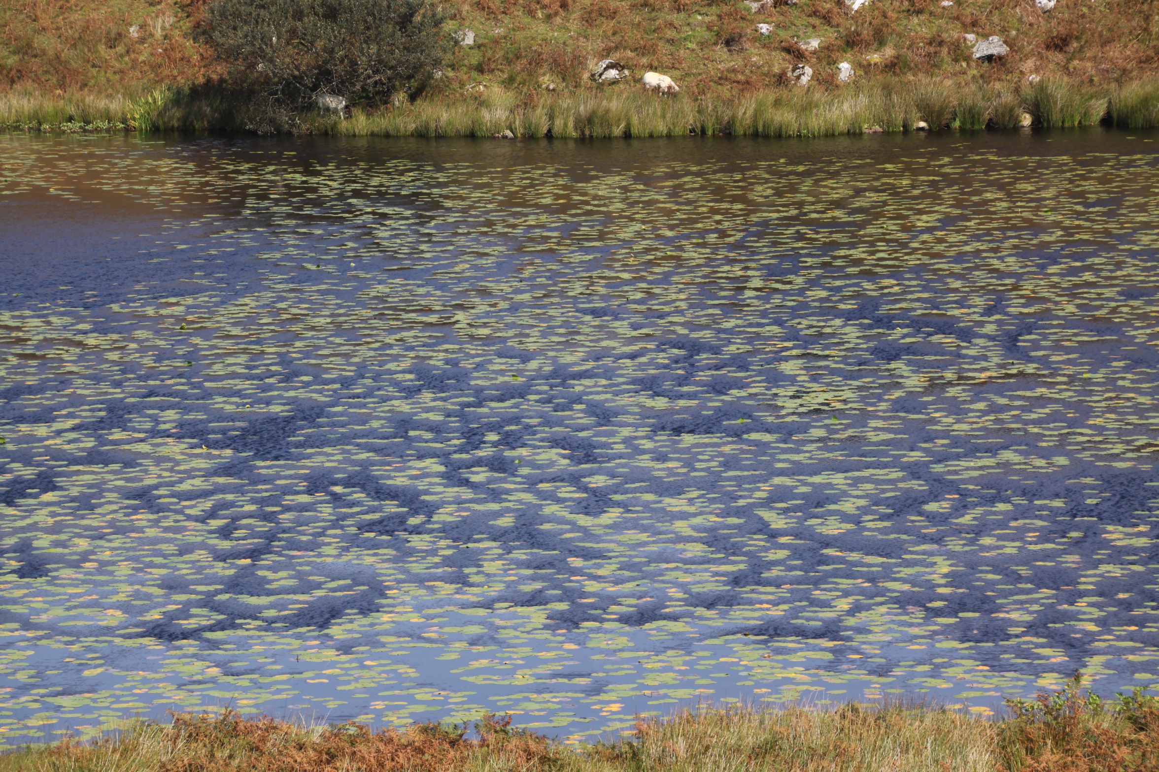
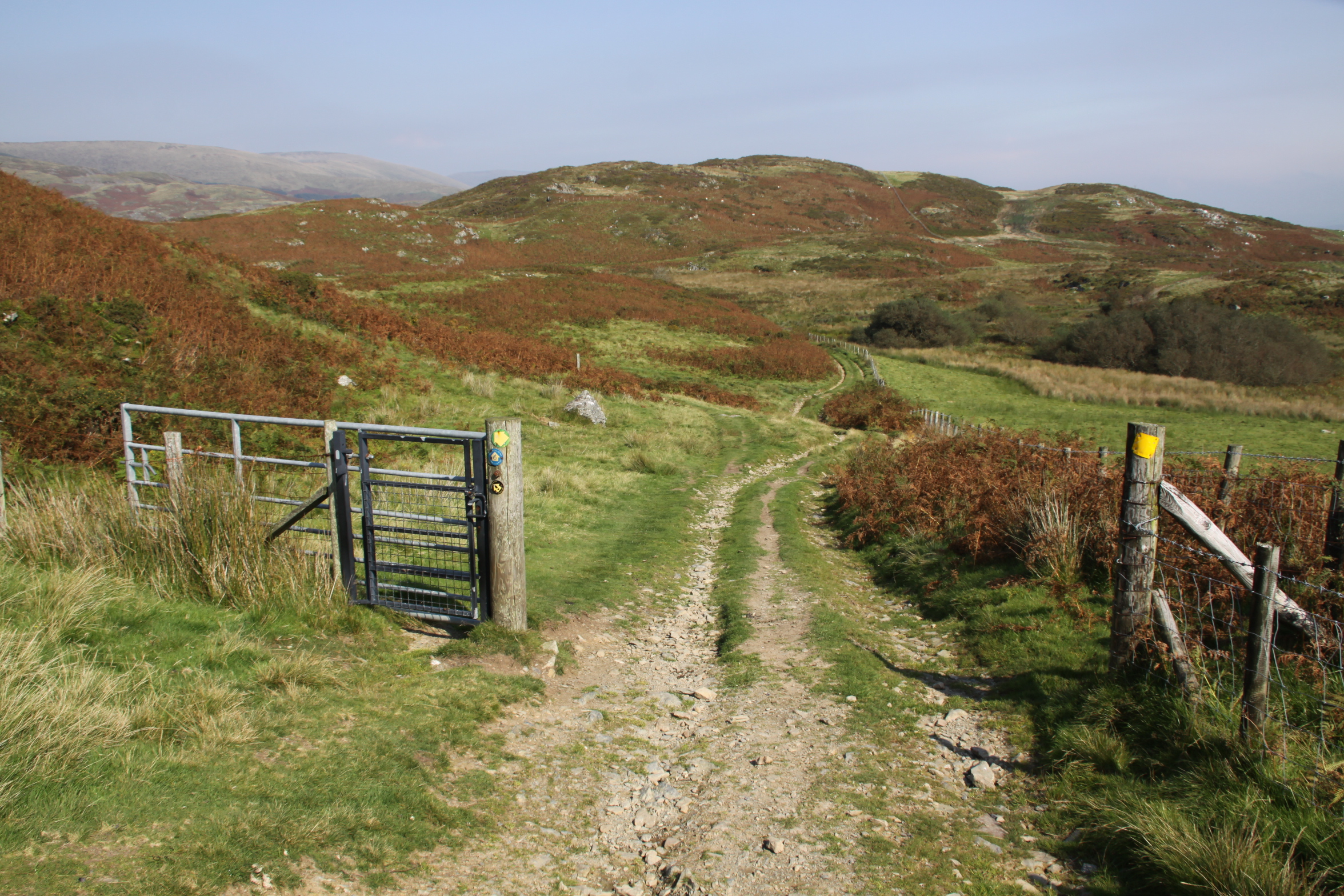 Carrying on a short way downhill, with views over the hills ahead, an array of colours as they fade into the distance, you go through an open gate (shown right) and the footpath for Llyn Barfog is just on the left. It is easily missed – there is a wooden stake marking it (shown immediately below), but no signpost. It is, however, quite well worn so if you keep an eye open you should be okay. This takes you round the foot of a small hill rise and leads you directly to the lake, about a 10 minute walk. I sometimes follow the sheep tracks to the top of the rise instead and then make my own way down, because the view down onto the lake is great, but the going isn’t easy – the sheep tracks are very narrow and the surface all around consists of big, dense clumps of heather that are not easy to walk between.
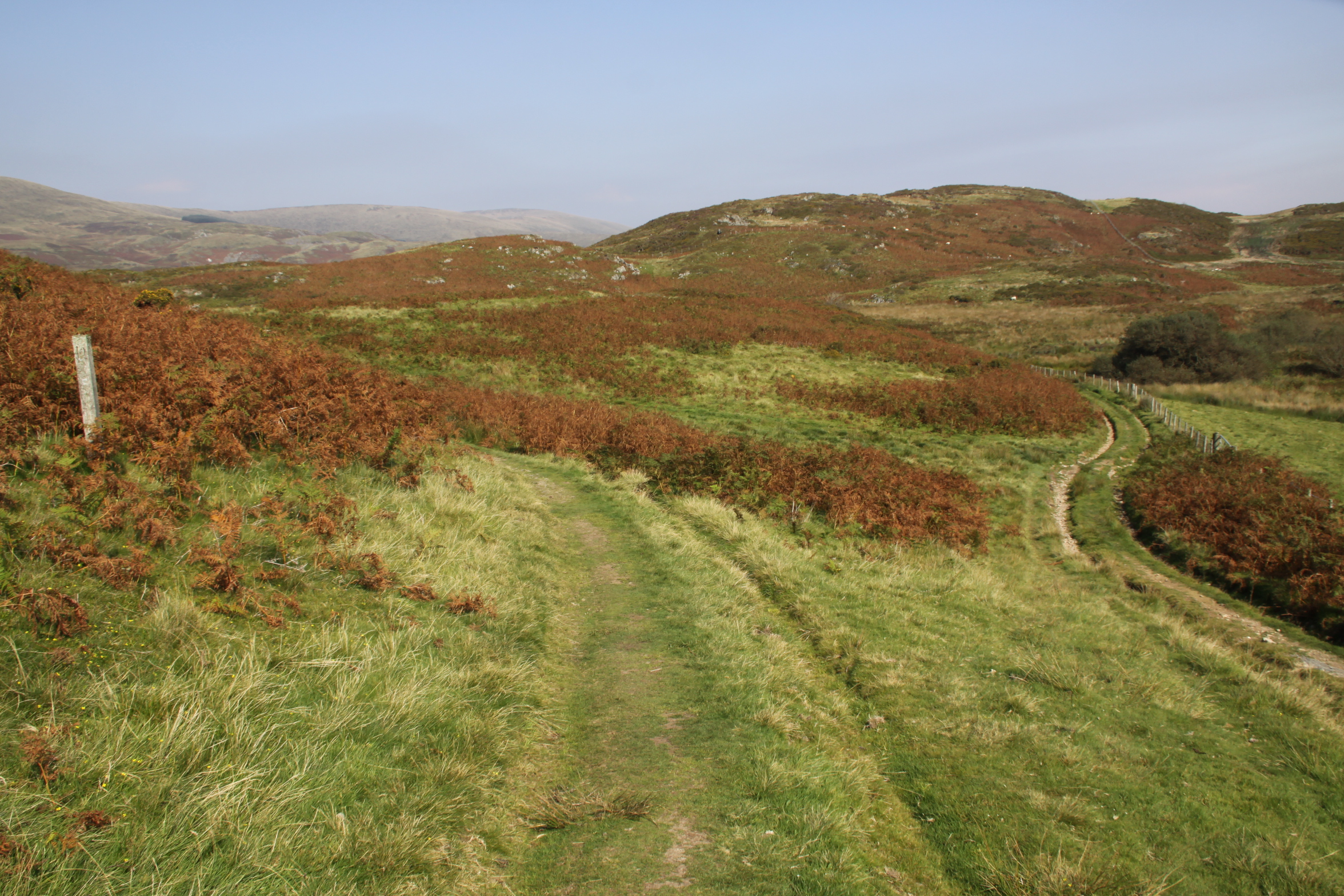
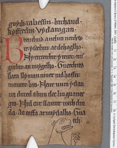
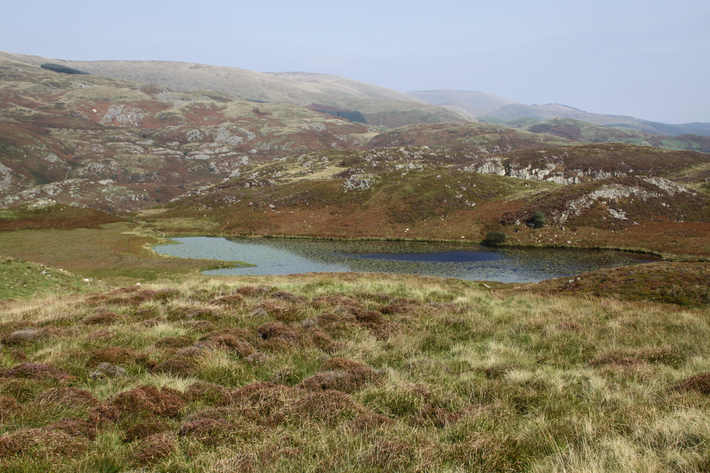 The name “bearded” is thought to relate to the vegetation around its edges. Unlike Arthur’s horse’s stone, one really could imagine this being a source of myth and legend, and indeed, there are at least two. One concerns the water monster known as the afanc, which is associated with other lakes too, a legend that eventually had an Arthurian spin on it. Here’s the main thrust of it. The afanc was the cause of flooding and other damage to good land. In some versions he lives in a cave and slays three princes a day who come to kill him, but they are resurrected, and the cycle repeats. In the case of Llyn Barfog, the afanc must be lured from the water by a heroic figure who will finish him off, and this hero eventually becomes Arthur. Arthur and his horse pull the monster from the lake, finishing it off, and one of the horse’s hooves leaves its imprint in the Carn March Arthur. See more on the Coflein website, where you can read a Llyn Barfog legend of green-clad fairies, two cows in love and a greedy farmer.
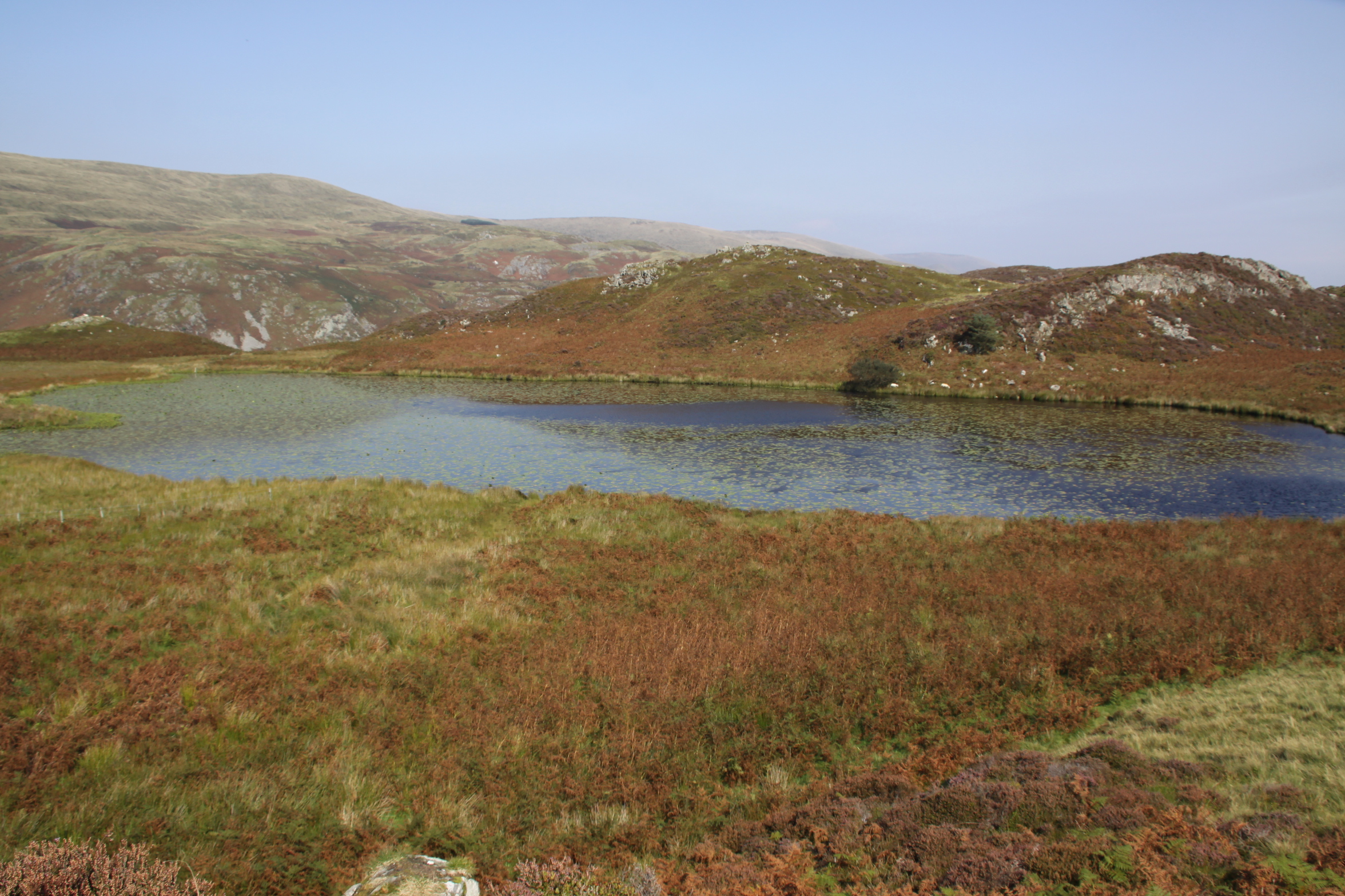


