Category Archives: Economic history

The peaceful ruins of the 1198 Cymer Cistercian Abbey, Dolgellau

Cymer Abbey. Source: Coflein

The quiet remains of Cymer Abbey lie in a scenic valley on the edge of a shallow, bubbling stretch of the river Mawddach, which itself evokes tranquillity and peace.   In spite of being approached via a caravan park, it is a truly idyllic spot.  Cymer Abbey, Kymer deu dyfyr, meaning “meeting of the waters” and dedicated to the Virgin Mary was founded in 1198 and was one of the northernmost Cistercian abbeys in Wales.

An abbey consists of a  church and monastery headed by an abbot and populated by monks.  Because the monks were resident, usually for life, an abbey contains not merely the architectural components required for worship and contemplation, but the structures required for everyday living and self-improvement, including premises for cooking, eating, sleeping, meeting, learning and punishing.  An abbey was designed to be self-sufficient, and therefore had an important economic component to support its religious and cultural endeavours.

The Cistercians

A 12th Century interpretation of St Benedict delivering his monastic rule in the 6th Century AD.  Source:  Wikipedia, via Monastery of St. Gilles, Nimes France (1129)

The Cistercian order of monks spread through Wales during the 12th Century AD.   The European tradition of monastic living had a long heritage, based on the teachings of St Benedict of Monte Cassino in Italy in the 6th Century AD, who set down rules for monastic life, the standards to which subsequent Benedictine monastic orders adhered.  As the monastic life spread through Europe, new orders were brought into being, most of them adaptations of the Benedictine rules, but modified to reflect their own ideologies and beliefs about how best to serve God.  During the early Middle Ages, the Cistercians believed in devotion combined with hard work, an ethic at odds with the more opulent and self-indulgent Benedictine Cluniac order that was becoming dominant in France, and believed, unlike St Benedict himself, that hard work deterred from the celebration of God, and instead invested in ostentatious architecture decorated with stained glass windows, art works and precious metals, carrying out extensive and elaborate liturgical rituals, using music and song, as ways of glorifying god.

Johann Petr Molitor, Cistercian monks, murals in the Capitular Hall, Cistercian Abbey Osek, North Bohemia, before 1756. Source: Wikipedia, from the Cistercian Abbey of Osek, North Bohemia

The prosperous and comfortable Cluniac repelled many for whom the initial Benedictine vision was nearer to Christ.  The Carthusians and Cistercians were both breakaway orders that sought to return to a more honest monastic life in which humility, obedience and hard work were combined with prayer and learning.  Initially, the Cistercians embraced a much simpler way of life than contemporary orders, inspired directly by St Benedict and by the simple and sacrificial life described by Christ himself.  They established their abbeys in very remote areas, isolated themselves from urban life, and from the associated temptations.  Their undyed white tunics and cowls were an instant visual differentiator from the black tunics of other Benedictine orders, and lead to them being referred to as the White Monks.  Different roles were assigned to different monks, such as the cellarer who controlled all food and drink for the entire abbey, the novice master, and the sacrist who was responsible for the upkeep of the church.  All were were considered to be equal in status.   The abbot was in overall charge of the monastery, and his orders were law, but he slept in the same dormitory as the other monks.

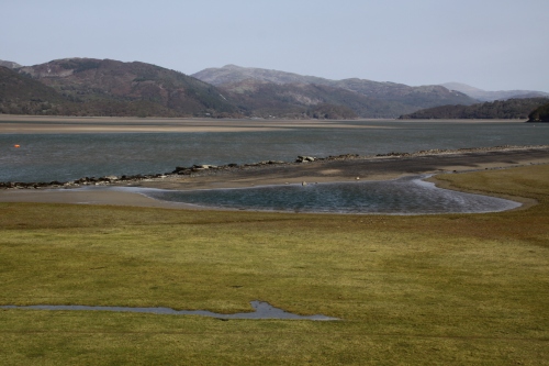
The river Mawddach at Cymer Abbey

The monks worked the fields, engaged in building projects, and processed the harvest.  They were assisted by lay brothers, uneducated and lower order members of the monastic community who ate, slept and worshipped in different places from the monks, and were not given access to certain parts of the abbey.  Food was simple and plain.  Meat was not consumed, and most of the protein consumed by monks came from beans, fish, eggs and cheese.  Meat was banned by the Benedictines due to the dangers of its encouraging carnal passions, because monks were required to be celibate.  The importance of fish in the diet, as well as the requirement for fresh drinking water, meant that many abbeys, like Cymer, were built near to rivers.

By the later Middle Ages, most of the stricter Cistercian rules were relaxed, and the abbot slept in his own quarters, sometimes a separate building altogether, the monks rarely worked the land themselves, and meat was consumed along with a much more elaborate selection of foodstuffs.  The plagues of the 14th Century wiped out what remained of the lay brotherhood, and their work was carried out by servants.

The Welsh Cistercians

12th Century links between Cistercian monasteries. Source: Evans, D.H. Valle Crucis Abbey (Cadw).  Although Citeaux, the node for all Cistercian abbeys, established early new bases in France, it was Clairvaux under the lead of St Bernard that was responsible for the earliest new abbeys in Wales.  Of these Whitland was the most important for the northward spread of monasticism.  The green lines emanating from Savigny reflect the Savignac order, which merged with the Cistercians after only 20 years, in 1147. So although Basingwerk in the north and Neath in the south were founded as Savignac orders, after 1147 they were brought under the rule of  the Cistercians at Citeaux.

In southwest Wales, Whitland Abbey, which had been established from France in 1140, provided monks for new abbeys for the southwest of Wales, mid Wales, north Wales and southwest Ireland.  A new abbey required an endowment by a donor, someone with enough land and wealth to give some of it away in return for the prayers offered by the monks for the souls of the donor and his family.   Monks were considered to have a hotline to God.  Having dedicated their lives to Him, and living sin-free lives, they built up a surplus of virtue and influence that could be employed on behalf of the living in order to provide for them in the afterlife, an intercession to minimize the impact of sins committed in life.  Many early abbeys in England were sponsored by English royalty, but two distinct strands of monastic tradition were established in Wales after the Norman conquest.

Alternating courses of thin and big stone in the north wall

In Wales, earlier versions of monasticism predated the Benedictines, but were much more modest in scope.  The Benedictine version of monastic life, based on the model of the abbey, came to Wales in two movements.  In southeast Wales, new abbeys were established in the wake of the Norman conquest and had a distinctly Anglo-Norman flavour.   A second strand of monastic spread in Wales began at the Cistercian Whitland (Abaty Hendy-gwyn ar Daf) founded in 1140 by monks from St Bernard’s abbey at Clairvaux, second only to the Cistercians’ founding abbey at Citeaux.  Whitland spawned a series of abbeys that were funded by the native Welsh princes and were populated almost exclusively by Welsh monks, a pura Wallia (Welsh Wales) version of Cistercian monasticism.  By establishing new daughter abbeys under its authority, Whitland spread the Cistercian order into the poorer and more remote areas of Wales, where monks could practise their devotions in isolation but were still near enough to manors and villages to enable them to trade their produce, mainly agricultural, in exchange for the basics required for sustaining the abbey.  Cymer, for example, traded its wool and horses to the court of Llewyllyn ap Gruffud.

Cymer Abbey

Arches defining the north aisle of the church

Although the foundation charter has been lost, it is known that Cymer was founded with an endowment by Maredudd ap Cynan, Lord of Merioneth, and possibly his brother Gruffudd ap Cynan.  A charter of 1209, issued by Llewellyn ap Iorwerth, confirmed the grants and privileges of the abbey and validating its claims of ownership.

In the usual pattern, the first monks for the new abbey came from an existing abbey, in this case Cwmhir Abbey in mid Wales, itself founded from the mother house at Whitland in 1176.  Other monks could then join from the local area, paying a single fee for their clothing, food and to begin their training as novices.  The fee was not insubstantial, and although the monks took a vow of poverty, they were not themselves poor people before joining the abbey.   As it happens, Cymer was one of the less economically viable of the Welsh abbeys and was therefore unable to support a large number of monks, and these monks would have lead a relatively impoverished lifestyle compared with those in wealthier Welsh abbeys like Strata Florida or Abbey Crucis.

Abbeys followed a standardized plan, with a cruciform church making up one side of a four-sided complex that surrounded a square section of grass or garden (the garth).  Around the garth was a walkway, usually covered, called the cloister.  This connected all the buildings, and also served as a processional way. Cymer differs from the standard layout in a number of ways.

Cadw site plan showing the surviving stonework in grey and brown, and the possible abbots lodging, as well as the missing section of the abbey

First, the abbey had both church and cloister, as well as the required buildings around the cloister, but the church as it survives today was not the standard cross-shaped arrangement.  This is significant.  Only the nave and the choir section, the piece that made up the long part of the cross has been found, even after 19th Century and more recent excavations.  The nave was where the lay brethren prayed.  Beyond a division across the nave to separate the public area from the private (the pulpitum), were usually the opposing transepts, two wings that made up the arms of the cross, with a tower built over the central section.  Then, beyond this section, were the all-important choir and high altar where the most important rituals were enacted.  These parts were exclusive to the monks, and provided access to the cloister and the upstairs dormitory.  At Cymer the nave served the multiple role of nave, choir and chancel/sanctuary.  The missing, exclusive section of the church (transepts, tower, choir and high altar) means either that this was destroyed in the past, or that it was never built.  Most analysts favour the latter explanation, which suggests that the abbey was not endowed with a sufficient initial investment, and that its estates were not sufficiently profitable to enable the abbey to be built.

Truncated abbey church, seen from the refectory.

Normally, the church was the first building to be constructed in stone, with other accommodation built of wood until the church was complete, but at Cymer the ancillary buildings were built in stone even though the church was apparently incomplete, so it is all something of a puzzle.  However, the small rectangle that made up the 13th Century church seems to have done the job of a larger entity, with the nave (reserved for the laity and visitors) at the west end, the monk’s choir in the middle, and the presbytery / chancel / sanctuary (the area around the high altar) at the end.  The church was also divided into three sections length-ways by two aisles flanking the main central portion of the church (known as a basilica layout), achieved by adding columns and arches.  At the business end of the church, where the monks worshipped eight times during the day and night, were some small decorative features, such as ornamental capitals at the top of columns.  The main arch into the cloister was also slightly ornamental, and a tiny rose window topped the east end, but in keeping with Cistercian principles, there were few other ornamental flourishes, and although the abbey had a few pieces of fine silver ware, there would have been no stained glass, art works or tapestries.

The 14th Century tower

At a later date, in the fourteenth century, it was quite clearly thought that a tower was a basic requirement and that its absence was a detriment, so a small tower was added (shown on the above plan in brown).  Bizarrely, however, it was added at the wrong end.  The church was usually orientated west to east, the entrance at the west and the choir and high altar at the east.  The tower sat between east and west ends, at the point where the arms of the cross intersected with the main run of the church.  The new tower, however, was put at the west end where the  main entrance from the outside world would have been positioned.  It was small and understated in terms of its overall dimensions, but its walls were immensely thick.  It was provided with corner buttresses and was clearly built to last.

The cloister appears to have followed the standard Cistercian format.  The most important room was the Chapter House, which was on the east side of the cloister.  Here, every day for around 15-30 minutes, the monks sat on benches along the walls to hear the abbot, who sat on a raised platform, read a chapter from the rules of the order, and to discuss the upcoming business of the day.  Confessions were made and punishments decided upon.  Next to the Chapter House was often a book cupboard, where important religious texts and treatises were kept, and in some abbeys copied for wider distribution.  Between the Chapter House and the church was usually a sacristy, which held the vestments and other essentials for the daily liturgies that took place in the church.  At the other end of the Chapter House was the day room, a heated room where monks could seek respite in the cold winter months.

Cadw sign at Cymer Abbey showing an artist’s impression of the 14th Century abbey

Above this east range of rooms was usually the monks’ dormitory and latrines.  Although the abbot would have slept with the monks in the early years, by the 15th Century at Cymer he had his own house, over the site of which a farmhouse now stands.  Against the cloister wall shared with the church were often desks to enable reading and copying.    At the far end of the cloister, opposite the church, was the refectory.  At some abbeys this is perpendicular to the line of the cloister, sticking out, but at Cymer it lies along the cloister.  A stone lavatorium (washing trough or bowl) would have been close by, often in the garth, and monks ritually purified their hands with water before eating.   It is not clear what made up the west range, but it could have included, for example, the kitchen, the cellarer’s office and the lay brothers’ day room and refectory

Water channel running down the middle of the refectory

Cistercian abbeys were known for their skills diverting and using water.  At Cymer a v-shaped channel drew water off the river and diverted it through the refectory.  It still flows today.

The monastery was never one of the Cistercians’ more successful establishments.  In fact, it was probably one of the most understated and impoverished of the abbeys.  Most of the successful abbeys supported themselves by farming, selling wool from herds of sheep, horse breeding, tithes (a special tax on householders that supported church establishments), by taking income from estates that they owned, and by personal donations.  Its contemporary, Valle Crucis near Llangollen, founded in 1201, benefitted from all of these sources of income, but Cymer was always a very modest outpost of the Cistercian world.  Cymer lacked the big grange estates that supported Valle Crucis, had little agricultural land and few fishing rights, although it did sell its wool and horses to the prince Llewellyn ap Iorwerth (died 1240).  Most of its properties were in mountainous areas, including Llanelltyd, Llanfachreth, Llanegryn and Neigwl on the Lleyn peinsula.  Dairying seems to have been a primary activity, and Llewellyn’s charter mentions metallurgy and mining, which is surprising for such a small establishment.   Cistercian abbeys all owned loyalty to the founding abbey in France, Citeaux.   Cash was clearly short.  Every year abbots were required to visit Citeaux to participate in the General Chapter, a vast gathering of abbots and other monastic leaders that served to ensure obedience to the order and to reinforce its rules.  In 1274, the abbot of Cymer had to borrow a sum of £12.00 (today about 8,757, the equivalent of 15 horses or 34 cows) from Llewellyn ap Gruffud (died c.1282) to enable him to undertake the expense of the journey.

There were multiple difficulties establishing an abbot who could be trusted to run the abbey, and these resulted in disputes that would not have helped the fortunes of the abbey:

In 1443, John ap Rhys left office at Cymer and appeared as an abbot in Strata Florida Abbey. In his place a John Cobbe was chosen, but Rhys did not think to give up Cymer and banished his successor. This led to the taking of the convent and his new abbot Richard Kirby under royal custody. Once again, the monarch’s supervision was necessary in 1453. During this period, the abbey’s income was valued at a very small amount of £ 15 of annual income. Despite the royal interventions, disputes over the appointment of the abbot’s office continued at the end of the 15th century. In 1487, there was even excommunication by the general chapter of one of the monks, William, because of his self-proclaimed election. Despite this, in 1491 he was again mentioned in the documents as abbot of Cymer. Lewis ap Thomas was the last superior of the monastery since 1517. [from Janusz Michalew’s Ancient and Medieval Architecture]

The entrance from the south aisle of the church into the cloister. Only monks were permitted to use this.

It is also clear that Cymer suffered during military conflicts, which cannot have helped its fortunes.  Some of its buildings were burned during one of Henry III’s campaigns.  Llewellyn ap Gruffud made the monastery his military headquarters in  both 1275 and 1279, and  only a few years later Edward I occupied the abbey in 1284.  There are records that Edward paid £80.00 compensation to Cymer for damages inflicted during the occupation.  Today this is equivalent to £55,525 (around 94 horses or 177 heads of cattle).  By 1379 only an abbot and four monks were resident at the abbey.   In Henry VIII’s 1536 evaluation of the value of abbeys, the abbey was valued at only £51 13s and 4d (around £6,913 today, enough to purchase 3 horses or 12 cows). [Currency conversions from the National Archives Currency Convertor].  

Double archway from the main body of the church into the north aisle.

In the early 16th Century Henry VIII had fallen out with the Pope over his wished-for divorce from Catherine of Aragon.  As the head of the church in England and Wales, Pope
Clement VII was the only person who could rubber stamp the divorce.  Henry was fortunate that the Protestant movement started by Luther was taking shape in Europe, and in order to remove himself from the power of the Pope, he aligned himself with the new movement and declared himself the head of the Church of England.  No longer owing any loyalty to Catholic institutions, he set out to value them as economic units, a survey called the Valor Ecclesiasticus, and in 1536 announced that any abbeys with an income less than £200.00 should be “suppressed” under the Act of Suppression.  This effectively meant that they were closed as monastic establishments, their valuables sold or melted down.  Some villages took over the church, whilst some were given or leased to new owners.  The grandeur of some of the abbeys proved to be very attractive to some new owners.  If abandoned, the lead used in roofs and drainage stripped, leaving them vulnerable to the weather.  As a small abbey, Cymer was a victim of this first round of suppressions, and was closed in 1536/37.  Other, much larger and prestigious abbeys were disbanded over the following years.

Facing stones on one of the arches dividing the main nave from the north aisle

Although Christianity and spiritual concerns were still important in both urban and village life, there does not appear to have been much public resistance to the closure of abbeys.  The  central role of monasteries in caring for the souls of the rich had gone into decline, but the abbeys were still important parts of economic and social life, engaging in trade, dispensing charity, caring for the sick and welcoming pilgrims.  It was still considered to be good to have all that spirituality on one’s doorstep.  Still, the rumblings generated by Martin Luther, whose views on all the liturgies, prayers and rituals that took place in abbeys were soon well known (he referred to them as “dumb ceremonies”), and his comments on the Catholic fixation on saints and relics as “mere superstition,” were finding attentive audiences throughout Europe.  In fact, the world was becoming rather less superstitious as time went on and knowledge began to supplement if not replace faith.   The world in which the monasteries operated was changing, and Henry VIII gave the world a far from subtle push in a completely new direction.

The left-side lancet window at the east end of the church

Although some abbots and priors stood up for their institutions against the Act of Suppression, that was always, in practical if not spiritual terms, a mistake – they were usually killed and their establishments destroyed.  In the north of England a 30,000-strong protest descended on York demanding that their monasteries remained open.  Henry VIII promised that the grievances of the protestors would be heard if they would return to their homes, but 200 people regarded as central to the protest were rounded up and killed.

Other religious leaders and their followers, either due to fear or pragmatism, counted their blessings and accepted the radical change if not happily, at least without active resistance.  Some abbots and priors jumped on Henry’s bandwagon and went to work elsewhere in the new church structure, whilst the remainder of the individuals in the monastic community, male and female, were pensioned off.  The immense wealth that Henry amassed with the sudden acquisition of the abbeys, their lands and their treasures was eventually spent on wars.

At the east end of the abbey, in the south aisle, an arched recess is provided with touches of decorative red sandstone.  These touches give an idea of how the abbey achieved some degree of ornamentation without the opulence of cathedrals and Cluniac abbeys.

Apparently someone, possibly the abbot, attempted to save some of the abbey’s dignity (or secure himself a nice pension) by hiding Cymer’s ecclesiastical plate, consisting of a 13th Century silver gilt chalice and paten, under a stone at Cwm-y-Mynach.  Whatever the motive, whether to return it to the abbey’s headquarters at Citeaux, or to melt it down for personal benefit, it was never retrieved.  Like most of the portable heritage of North Wales, it found its way to the National Museum of Wales in Cardiff.  I have been unable to find out if it is still there, or to find an image of it.

Following dissolution, the property was leased to John Powes, “royal servant,”  but not until May 1558.  It was probably robbed for building stone for surrounding farm buildings and dry-stone walling, and once the roof either fell into disrepair or was robbed for tiles or lead, exposure would have led to rapid deterioration.

Detail of one of the capitals, in red sandstone (detail of the above photograph).

East end of the truncated church

Spiral staircase in the 14th Century tower leading to – where? There was presumably an upper floor in the tower.

Remains of the spiral staircase in the 14th Century tower

East end of the church

Farmhouse that lies over the site of the site of what is thought to be the abbot’s quarters


Visiting

Cymer Abbey is easy to reach.  It lies just off the A487 north of Dolgellau and is well sign-posted.  After driving through a small caravan park, there are two very attractive farm buildings, and a small parking area.  Both parking and access to the abbey ruins are free of charge.  There is an information board showing the main features of the abbey.

The river Mawddach, which was a ford during Medieval times, had a lovely road bridge built over it in the 18th Century, which is now a foot bridge.  A car park on the Cymer side of Llanelltyd bridge is provided for those walking to the New Precipice Walk above the village of Llanelltyd on the other side of the bridge.  The views from the bridge, both over the river and over the surrounding countryside, are well worth adding to the abbey visit.  The bridge could do with a bit of maintenance, as the roots from the shrubs embedded into its brickwork will start to pull the mortar out and undermine the structure of the bridge.


Sources:

Books and papers

Burton, J. 1994.  Monastic and Religious Orders in Britain 1000-1300. Cambridge Medieval Textbooks. Cambridge University Press.

Burton, J. and Kerr, J. 2011.  The Cistercians in the Middle Ages.  Boydell Press

Davis, S.J.  2018.  Monasticism.  A Very Short Introduction.  Oxford University Press

Evans D.H. 2008, Valle Crucis Abbey, Cadw 2008

Gascoigne, B.  2003 (2nd edition).  A Brief History of Christianity. Robinson

Gies, F. and Gies, J.  1990. Life in a Medieval Village.  Harper

Gilingham, J, and Griffiths, R.A. 1984, 2000.  Medieval Britain. A Very Short Introduction.  Oxford University Press

Krüger, K. (ed.) 2012.  Monasteries and Monastic Orders. 2000 years of Christian Art and Culture.  H.F. Ullmann.

Livingstone, E.A. 2006 (Revised 2nd edition).  Concise Dictionary of the  Christian Church.  Oxford University Press

Robinson, D.M. 1995 (2nd edition). Cymer Abbey. Cadw

Robinson, D.M and Harrison, S. 2006.  Cistercian Cloisters in England and Wales Part I: Essay. Journal of the British Archaeological Association, 159:1, p.131-207


Websites

Coflein
Cymer Abbey
https://coflein.gov.uk/en/site/95420?term=cymer%20abbey

Ancient and Medieval Architecture – by Janusz Michalew
Llanelltyd – Cymer Abbey
https://medievalheritage.eu/en/main-page/heritage/wales/llanelltyd-cymer-abbey/ 

English Heritage
The Dissolution
https://www.english-heritage.org.uk/learn/histories/dissolution/

Monastic Wales
Cymer Abbey
https://www.monasticwales.org/browsedb.php?func=showsite&siteID=27

Open Yale Courses (Yale University, Connecticut)
The Early Middle Ages, 284–1000 (course given by Professor Paul H. Freedman)
https://oyc.yale.edu/history/hist-210

Day Trip: The Grade II listed Pont Abermaw (Barmouth Bridge)

After walking up to Castell y Gaer hillfort in mid September, I drove to Morfa Mawddach railway station, a short drive away, and parked up.  This is a favourite route for cyclists of all sorts.  Some go there to do some serious peddling around the Mawddach on a marked out on the Mawddach Trail (following the route of the disused “Dolgelley Branch” of the Aberystwyth and Welsh Coast Railway line, which opened in 1869), others had hired bikes in Barmouth.  It’s the same with walkers – some are there to do the trail, others are just walking the bridge.  Fortunately, it was a very quiet day, at least on the bridge itself.  The views on a sunny day are great, and when the wind drops, the high-pitched sound of the oystercatchers is lovely.

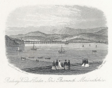
The railway viaduct in c. 1869.  Source: Wikipedia

Barmouth Bridge, or viaduct, was built between 1864 and 1867 in  to carry the Aberystwyth and  Welsh Coast Railway, now the Cambrian Railway, across the Mawddach estuary, which it still does.  It cuts off an 18 mile trip around the estuary that would otherwise have had to be taken by the railway between Morfa Mawddach and Barmouth.  Designed by Welsh civil engineer Benjamin Piercy, and English civil engineer and architect Henry Conybearet, it has a span of c.800m, the longest wooden-framed viaduct in Britain.  It was grade II listed in 1988.

Although most have been replaced long ago, timber pile viaducts of the Barmouth bridge type were once common on the Welsh coastal railways.  Conybeare’s decision to choose timber as the main construction material was probably driven by much the same concern to save costs, rather than employing iron,.  Baltic timber could be brought to the site very cheaply by sea, and was a fraction of the cost that an iron viaduct would have been.  Although it was well known that Teredo navalis, a boring worm, could do considerable damage to vessels and sub-surface wooden structures, it was thought not to inhabit the Mawddach estuary, and may not have done when the viaduct was built.

The original design included a rolling drawbridge section that pulled back across the track and  enabled vessels to use the navigation channel into the estuary.  This was replaced by the twin-hogback steel lattice swing bridge in 1899, which, with a span of 41.5m, could swing open to let vessels pass, shown on a vintage postcard to the right.  The swing span was operated in March 1984 and April 1987, but permanent rails indicate that it is unlikely to be opened in the future.

After a number of repairs and renovations, the wooden elements supporting the span are composed of 113 timber pile trestles 5.5 metres apart, which are now encased in concrete sleeves reinforced by glass-fibre.

The viaduct has had quite an exciting life, with a number of challenges to its longevity.  It caught fire in 1892, and it was only thanks to a local boy, who raised the alert, that the fire was swiftly extinguished.  It had a lucky escape in 1946 when a live mine came in on the tide and touched one of the wooden pillars, but fortunately failed to detonate. In 1980, considerable dismay was caused by the discovery that Teredo navalis had eaten into 69 of the supporting pillars.  The bridge had to be closed, and restoration work was carried out over a six month period, during which a rail replacement service was run by the Cambrian Line between Barmouth and Tywyn.  In August 2015, there were real fears that the footbridge would be closed as part of a cost-saving exercise announced by Gwynedd Council.  The bridge had been a toll bridge, with a couple hired to collect small sums from users of the walkway, but with 90,000 visitors a year, these sums added up very nicely and contributed towards £38,000 that Gwynedd Council paid to Network Rail to keep the walkway open.   An online petition was immediately organized by a local resident, collecting over 20,600 names in support of keeping the bridge open.  A £1.00 honesty box system was implemented, but even on my one walk to Barmouth and back, it was amazing how many people didn’t contribute anything.  In October 2016 a fire broke out and the bridge had to be closed again, but only for a fortnight, with a rail replacement service also running between Barmouth and Tywyn.

On its 150th anniversary a celebration was held, and a special train was run from Shrewsbury to Pwllheli, pulling Riviera Trains Mark 1 carriages.  In March 2020 it was announced that the bridge was to receive a £25 million revamp from Network Rail to replace a large number of the timber and metal elements and install a new track along the entire span.

Sources

Barmouth Railway Viaduct. Coflein.  https://coflein.gov.uk/en/site/34918/details/barmouth-railway-viaductbarmouth-bridge-cambrian-coast-line

Barmouth Viaduct. Engineering Timelines
https://web.archive.org/web/20141015015046/http://www.engineering-timelines.com/scripts/engineeringItem.asp?id=1340

Closing Barmouth Bridge will have ‘big effect’ on economy warns charity.  North Wales Live.  20th August 2015
https://www.dailypost.co.uk/news/north-wales-news/closing-barmouth-bridge-big-effect-9841952

20,000-name petition to keep Barmouth Bridge open to all. 21st August 2015.  BBC.
https://www.bbc.co.uk/news/uk-wales-north-west-wales-34010645

Fire shuts Barmouth Bridge until next week.  North Wales Live. 4th October 2016
https://www.dailypost.co.uk/news/north-wales-news/fire-shuts-barmouth-bridge-until-11978355

150th Anniversary of Barmouth Bridge Celebrated with Special Train Service.  Forwarder Magazine. 10th October 2017
https://forwardermagazine.com/150th-anniversary-of-barmouth-bridge-celebrated-with-special-train-service/

Barmouth Bridge £20m plan on its 150th anniversary.  BBC News. 10 October 2017
https://www.bbc.co.uk/news/uk-wales-north-west-wales-41568248

Barmouth Viaduct to get £25m revamp. BBC News.  26 May 2020
https://www.bbc.co.uk/news/uk-wales-52807338

A brief history of RAF Tywyn (or RAF Morfa Tywyn), later known as the Morfa Camp

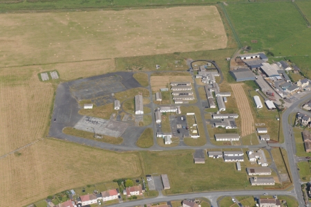
RAF Tywyn as it is today, near the beach off Sandilands Road. The concrete hard-standings are where two hangars once stood Source: Coflein, catalogue no. C679084

In Tywyn, if you head past Idris Villas and carry on down Sandilands Road towards the level crossing, you will pass what remains of RAF Tywyn, which comprised a camp, hangars, airfield, control tower and transmitter.  It was built on a large piece of flat grassland belonging to Morfa Farm and later known as the Morfa Camp.  Morfa means marsh/bog, and Roy Sloan reports that it flooded frequently, to the extent that damage was sometimes inflicted on planes as they attempted to take off and land, and the station’s aircraft occasionally had to be moved to RAF Llanbedr.   The majority of the wartime buildings have been demolished.  Most of the information in this post comes from Roy Sloan’s 1991 book Wings of War Over Gwynedd, full details of which are listed below under Sources, with my thanks to the author.

RAF Tywyn. Aerial Photograph 540/373/UK/3611/0181 from 1st July 1950 showing airfield and tented barracks. Source: Dyfed Archaeological Trust, Report 2015/32. Copyright National Monuments Record of Wales

The purpose of the camp was mainly to engage in anti-aircraft co-operation duties, which primarily involved supplying target practice for anti-aircraft training in Tonfanau Camp, which had been established on the coast a few kilometers to the north of Tywyn in 1938 (described on an earlier post). 

The camp and airfield was built during the summer of 1940 and opened on 8 September 1940 as an air-cooperation base for the Royal Artillery Anti-Aircraft Practice Camp at Tonfanau. It was under the control of No.70 Group, Army Co-Operation Command, which was created in December 1940 to facilitate joint British Army and the RAF activities where air support to the Army was likely to be vital.  Its Commanding Officer was Squadron Leader Irens, recently promoted from the position of Flight Lieutenant, and the personnel numbered 12 officers and 226 airmen.  Two flights were assigned to RAF Tywyn.  “Flights” were units that consisted of a small number of planes (usually no more than six), their aircrews and ground support.  The two assigned to RAF Tywyn were from No.1 Ant-Aircraft Unit (AACU), called U-Flight and C-Flight. 

Winston Churchill, David Margesson and others waiting to watch the launch of a DH.82 Queen Bee target drone, 6 June 1941. By  War Office official photographer, Horton (Capt) – Source: Imperial War Museums photograph H 10307

U-Flight specialized in de Havilland Queen Bee pilotless drones, the radio-controlled version of the Tiger Moth, and had relocated to Tywyn from RAF St Athan (Vale of Glamorgan, south Wales).  C-Flight was equipped with Hawker Henleys, and had come from RAF Penrhos (Llyn peninsula, north Wales), arriving at RAF Tywyn in June 1941.  In June 1942 these were joined by two Lysanders on detatchment from No.6 AACU.  In November of the same year three Miles M.25 Martinet target tugs arrived when C-Flight became No.1605 Flight (all lettered Flights were to become numbered instead during the war).  The unit lost one of this Henley’s, together with its pilot, in a crash in low cloud over hills at Penygroes at about the same time.

Miles Martinet TT Mark I in flight in c.1942. Source: Wikipedia

Maycrete hut, RAF Tywyn Morfa

The camp was built of pre-fabricated huts and hangars, plus a control tower. The Nissen huts were composed of corrugated iron sheets that form half-cylinders to create lightweight buildings.   They looked like gigantic pig-styes, a half-tube of corrugated iron blocked at either end, one end containing a door for access. Maycrete huts are long single-storey rectangular buildings consisting of reinforced concrete posts supporting a pitched roof frame that supports corrugated asbestos roof panels.  The hangars were all similarly made of prefabricated parts according to specific design standards and consisted of two Bellman hangars (walls and roof easily assembled from rolled steel sections),two Blister hangars (another pig-styie style arched structure made of corrugated metal on a wooden or metal frame, which does not need a solid base to be laid, and can be anchored with pegs), and two Bessoneau hangars (portable timber and canvas structures with a central ridge anchoring a slightly arched roof on vertical stanchions).  Parts of the concrete aprons on which two of the hangars stood remain.  The control tower was built to an RAF specification.  A transmitter for control of the Queen Bee was installed in November 1940 but due to technical difficulties it was not operational until the end of February 1941. 

A Hawker Henley deploying a drogue target. Source: Ref: RAE-O 784a from the collections of the Imperial War Museums

When the station opened, the Queen Bee and the Henley were both used as targets for training.  The Queen Bee was used as a direct target and the Henleys towed targets behind them.  Offset aiming was supposed to protect the Queen Bee from destruction in these sessions, but when shot down, its controller would attempt to retrieve it.  Unlike the Tiger Moth on which it was based, it had a light wooden fuselage that was a lot more buoyant that the Tiger Moth’s metal construction.   Sloan says that the Queen Bee was quite sophisticated for its time, but was subject to fairly heavy losses when being used for target practice, as near-misses caused damage to its control system.  The Henleys were manned by a pilot and drogue/towing operator.  The drogue was a a canvas cylinder approximately 12 feet long and 4 feet in diameter.  The Henley was not designed for use in target practice, and the drag of drogue towing often caused heavy engine strain.  There were several accidents when engines malfunctioned or failed, and some deaths.  Unlike the Henleys, the Martinets that arrived in 1942 were designed for towing, with a lot of attention having been invested into the cooling system to counteract the strain of towing heavy loads.  In March 1944 two Hurricanes joined the station, and some of the Henleys were replaced by Martinets.  Sloan says that by the end of December there were 21 aircraft at RAF Tywyn, 8 Hawker Henleys, 9 Miles Martinets, 2 Hurricanes, and an Oxford.  The Queen Bees were no longer in use.

RAF Tywyn Christmas menu 1942. Source: Coflein, cataloge no.C554685

The Army Co-Operation Command was disbanded in 1943, as part of a general re-organization, and became part of the prestigious Fighter Command, which became responsible for the airfield in June of that year.  In the December 1605 Flight, formerly C-Flight, was combined with 1628 Flight to become 631 Squadron, but it continued to be saddled with Henleys when most other towing squadrons were now using Martinets. Sloan says that by February 1944 the station’s complement was 16 officers, 25 non-commissioned officers (NCOs) and 185 airmen.  In February 1944 one of the Henleys caught fire in the air and was ditched in the sea, very near the shore, with no loss of life.  The plane was retrieved the next day by the Royal Army Service Corps (RASC) No.1 Amphibious Training Wing based nearby.

Sloan quotes pilot Bert Pudney as a source for what it was like to be a towing pilot.  He had joined the RAF in 1937 at the age of 16.  By 1944 he had the rank of Sergeant and was transferred to Tywyn in the May of that year to fly Henleys.  The account covers two pages in Roy Sloan’s book, but here’s a short excerpt:

The were several types of target, the largest being red flag 40 feet long and 6 feet wide, which was towed at various heights at a distance of 2,000 feet from the beech at Tonfanau, where Royal Artillery units had their guns – 4.5s and 3.7s.  We towed at 140 m.p.h. because anything faster would send engine temperatures up.  Some of the shelling was erratic, sometimes the target was hit and it dropped into the sea, sometimes the wire was cut and we lost the flog, but quite often the RA gunners seemed to be aiming at me and not the flat.  I remember my Target Towing Operator (TTO) once saying after a few shots surrounded us, ‘This is getting bloody dangerous, Skipper!’

We also used a variety of drogues, carrying about a dozen or so then streaming them with about 400 feet of tow for various bodies to shoot at, e.g. RAF Regiment, Commandos etc.  Their bullets were dipped in various coloured paints and after a few passes the drogue was dropped to check which groups had hit the target.  This was indicated, of course, by coloured hols in the white nylon.

A B-17 at an airshow in 2014. Source: Wikipedia

Some excitement occurred in July 1944 when a USAAF (United States Army Airforces) B-17 Flying Fortress bomber returning from North Africa with the 390th Bomb Group became lost in bad weather and, short of fuel, the pilot identified the Welsh coastline and flew along it, deciding to attempt a landing at the Tywyn airfield.  The bomber was huge, far bigger than anything that the airfield was designed to cope with, and the bomber not only overshot the airfield but crossed the railway line and ran into an air raid shelter.  A fire in the wing was put out by the station’s fire tender and the local fire brigade.  The occupants of the bomber were fine, but the aircraft itself was a write-off.  The railway line was again a victim in February 1945 when one of two Hurricane crashes again crossed the line, again resulting in a write-off of the plane.

RAF Tywyn. The legend reads “In memory of the men and women of the RAF and the airforces of the commonwealth who served at RAF Morfa Towyn on this site, 1939-1945 and the members of al forces who traced for service here 1946-1999. Erected by Towyn and Aberdovey Branch of the Royal Air Forces Association

After the end of war 631 squadron were deployed to Llanbedr in May 1945 and were replaced by No.22 Group, Technical Training Command.  On 25th July it was closed, but its life was not yet over.  It was transferred to the War Office and became an army camp and Outward Bound school and then a Joint Service Mountain Training Centre, an Armed Forces training facility .  The latter closed in 1999.  The old airfield was turned into a sports field and following a number of feasibility studies in 2015, is now a solar farm.  Morfa camp is now privately owned, and some of the buildings are apparently let out as storage units.  There is a commemorative plaque mounted on a slate monument at the entrance to the former camp.


Sources:

Sloan, Roy 1991.  Chapter 8, A Forgotten Airfield. RAF Tywyn. In Wings of War over Gwynedd. Aviation in Gwynedd during World War II. Gwasg Carreg Gwalch

I failed to get hold of the following book, but for anyone interested in finding out more, it might be worth tracking it down:  Jones, Rees Ivor 2000. The Military in Tywyn 1795–1999: The Warlike Side of a Small Welsh Seaside Town.

Websites:

Airfields of Britain
https://www.abct.org.uk/airfields/airfield-finder/towyn

Coflein
https://www.coflein.gov.uk/en/site/309967/details/towyn-airfieldmorfa-town-airfieldmorfa-raf-base-tywyn

De Haviland Aircraft Museum – Queen Bee
https://www.dehavillandmuseum.co.uk/aircraft/de-havilland-dh82b-queen-bee/

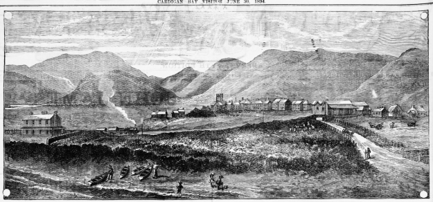
Newspaper illustration of Tywyn and the railway in June 1894

On the same page in The Cardigan Bay Visitor as the Aberdovey advertising feature that I posted about the other day, was this super illustration of Tywyn showing the steam train, 30 years after the railway opened, and boats pulled up on the beach. To get a better look, click the image to enlarge it, because the details cannot be seen clearly on the small image above.

Thanks to John Pughe for letting me know that the road in the picture is Pier Road.

It is sometimes easy to lose sight of the great surrounding views when in Tywyn itself, but as the illustration shows, Tywyn is nested at the base of some very fine hills, and it really is in a super location.  A road now follows the railway on its far side, leading to the railway and foot bridges across the river Dysynni with great views over the hillsides.  Much of the  area just beyond the railway was eventually taken to build the RAF camp and airfield (that later became known as the Morfa camp), much of which still stands, although part of it was replaced with a solar energy farm.

The Cardigan Bay Visitor, 30th July 1894, courtesy of Welsh Newspapers online: https://newspapers.library.wales/view/3824070/3824072/7/

Tonfanau Army Camp from 1938 to the present day

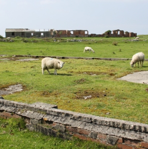
Some of the few surviving remains of Tonfanau Army Camp today, behind Tonfanau station, complete with grazing sheep, the sea just out of sight in the background


Tonfanau in the past and recent present. Source of upper image: AAJLR.org, ref tonp_067. Source of lower image: Coflein.

The first time I heard the name Tonfanau was when I was researching the Ynysmaengwyn Estate.  In the late 1870s John Corbett, who had purchased the estate, also invested in Tonfanau granite quarry to aid with his construction projects in Tywyn.  Recently I have also been doing research into the hillforts on the hill behind Tonfanau.  In both cases my searches came up with very little about either subject, but an awful lot of information about an army camp that I had known existed but knew nothing about. I became interested in the story of the camp.

The Tonfanau camp (pronounced ton-van-ow – the ow to rhyme with cow)  was established in the 1930s as an anti-aircraft artillery training centre, but it underwent many changes in role over time, before being nearly entirely demolished in the late 1980s or 1990s. One of the most arresting aspects of the subject is the remarkable number of accounts and photographs available online by those who were stationed at Tonfanau.  The camp is not merely a few ruins of the past, it is something that lives on in people’s memories, giving lie to the very few abandoned and desolate fragments that remain.

The impressive extent of Tonfanau camp shown on an Ordnance Survey map, circa 1960s. Source: AAJLR website, ref tonp_068

This is a short summary of why the camp was established, what it was used for at different times, how far it extended over the surrounding area, what it consisted of, and what remains today.

I have made considerable use of the resources that I have found on the web, all of which are credited below in “Sources” with my sincere thanks.  Particular thanks must go to the Tonfanau page on the AAJLR website and its many contributing volunteers for assembling such a magnificent collection of photos, many of which are reproduced here.

In terms of visiting, if you are aiming to incorporate the remains of the camp into a walk, the easiest and most attractive way is to drive down Sandilands Road, turning right just before the level crossing.  Follow the road to the Tonfanau footbridge, and it is about a 15 minute walk from there.  In summer it is a particularly nice walk as the verges from the Dysynni footbridge to the station are filled with a profusion of wildflowers.  Otherwise it is a matter of driving to Tonfanau station down bendy single track lanes and parking up there.  You can cross the railway to go down to the emplacements on the beach, or walk up the road opposite the station to see some of the other remaining structures.  Otherwise it’s a matter of wandering around the publicly accessible parts of fields to see more.

Tonfanau camp.  Source: AAJLR.org

The remains of Tonfanau camp are interesting, but be warned that they are really very ugly, a thorough blot on the landscape.  This sort of swiftly-built camp, of which there were several dotted around the country, must have been just as alien in their own ways as Roman camps imposed on an Iron Age landcsape, just as uncompromising and just as much as an imposition, but eventually becoming a fact of life.  Unlike the Roman armies of occupation, these invaders of the landscape were British, and the camps were there to serve the nation, giving their sudden arrival, even if unwanted and unwelcome, a positive reason for being.

Anti-Aircraft Training 1938s – 1957

Heavy ackack anti-aircraft gun at Tonfanau, ref tonp_274. Source: John Mills, AAJLR.org

Throughout its existence the camp consisted of a series of fairly basic buildings, including brick-built huts, wooden huts, hangars and so-called Nissen huts.  Nissen huts, like bailey bridges (of which more below) were assembled from pre-fabricated parts to enable very rapid construction.  Corrugate iron sheets were used to form half-cylinders that created lightweight buildings, useful in a variety of situations.  They looked like gigantic pigsties, half-tubes of corrugated iron blocked at either end, one end containing a door for access.

The camp was built beyond the immediate reach of the nearby villages, on a wide coastal plain beneath Tonfanau hill, spanning both sides of the railway line.  The Tonfanau railway station was added on the existing Cambrian Railway line, which itself linked into the national rail network, to serve the camp .  By train, the camp was a few minutes from Tywyn.  By road, it was a matter of negotiating some bendy B-roads and passing through Bryncrug before reaching Tywyn, some 30 minutes or so later.  The decision to put the site beyond the immediate vicinity of residential areas was probably connected directly to the noise that the camp would produce as an anti-aircraft gun range.  Either that, or this was the biggest flat-ish area available in the vicinity for the construction of this sort of camp.  Either way, the camp was neither a part of the village, nor completely isolated from it.  At some point a bailey bridge was established at the crossing over the River Dysynni where the railway also crosses, substantially reducing the time taken to get into Tywyn.  When an RAF camp was built at Sandilands in Tywyn in September 1940, partly to build on an existing relationship that the RAF already had with the Tonfanau camp, communication and visits between the two camps probably became quite frequent.

Anti-aircraft emplacements at Tonfanau camp from the air. Ref. tonp_067. Source: AAJLR.org

As an artillery training camp, Tonfanau had various sites to enable training on different types of weapon.  The big anti-aircraft (AA) guns were mounted on permanent emplacements just behind the beach, as shown on the above photograph.  The foundations of these can still be seen above the line of the beach, some of which are shown on the photographs at the end of this post.  These pointed out to sea for target practice.  The targets were initially supplied by RAF Tywyn’s, which had a camp in the Sandilands part of town and later became known as Morfa Camp, which is how it is usually known today.  Disposable gliders were towed using Hawker Henley planes near to the position of the anti-aircraft emplacements, and these gliders were used as targets.  All I can say is hats off to the pilots who took on that unenviable task!  Eventually these were replaced with an unmanned remote-controlled version of the Tiger Moth known as the Queen Bee, which must have been a lot safer all round.

Anti-aircraft guns in action, ref tonp_028. Source: AAJLR.org

A  first hand account of the Anti-Aircraft training is provided by Stanley Briggs, who found himself at Tonfanau in 1949 after initial training at Oswestry before shipping out to Egypt:

“After our initial training we were taken by train to Tonfanau on the West coast of Wales between Aberystwyth and Barmouth. This is the Cardigan Bay coastline area, the nearest town is Towyn. Only the beach, a railway line and a road separated us from the sea. We had the sea on one side and the Cader Idris mountain, inland, behind us.

That bay is massive and ideal for target practice for our 3.7 guns, but I have to say that I didn’t fancy the RAF pilots jobs of towing a sleeve behind their plane while National Servicemen were firing at them for practice with live rounds.

The Cader Idris was ideal for physical fitness too, which our physical fitness training instructor (PTI) put to good use, we were all eighteen years old and I have to say that personally I really enjoyed every minute of that part of it.

QF 3.7 inch anti-aircraft gun.  Source: Wikipedia

The same discipline training continued at Tonfanau. It was here that we were confronted with the 3.7 gun, the Sergent in charge gave us all a good knowledge of how to maintain, dismantle and fire it. We all had to learn each others position on the gun in case one of the members of the team was killed in action (that was a sobering thought!)

The gun had a large barrel and was transported on a trailer consisting of four legs and wheels, towed by an AEC Matador lorry. Each leg had to be raised for the travelling position and lowered for the firing position. Other positions for the team of gunners were Traverse Operator, Elevation Operator, Tannoy Operator, and Ammunition Operator who had to lift a round up and put it in the breach and finally, the Sergeant who had the responsibility of firing. The first time I lifted a round of ammunition, my knees buckled as they were very heavy for a nine stone weakling, which I was at the time.”

There seems to have been a second level of artillery training at the site during this period, which took place after the heavy anti-aircraft guns had left, as described by Frank Yates who, at the age of 21, served with the Royal Artillery, Light Anti-Aircraft Battery and was attending the Officer Cadet course.

Aerial view of the remains of a small-bore firing range. Source: Coflein

“The camp was large, with brick and concrete hutments and purpose built dining halls, garages and the like, with the Garrison Theatre dominating the landscape. The camp had been Heavy AA before we moved in, but there were now two separate factions, the bulk of the Heavies had returned to their base Artillery depot at Oswestry, leaving a nucleus to run the firing camp. On the firing apron, between the sea and the railway, was an ex Naval 3” Gun, a weapon which fulfilled a dual role in the Navy. It had the reputation of producing the loudest ‘bang’ of any British gun and they once fired it for our benefit. It certainly lived up to its reputation! Before leaving the “Heavies” may I mention that they did not fire at a towed drogue, the tow plane would not have survived. There was talk of them using a radio controlled, unmanned target, a project easily arranged nowadays, but too unreliable in those days. . . .

After various demonstrations, witnessed from a head down position in the trench, the sticky bomb was shown. This was an anti tank weapon, although it would need a very brave or a very lucky man to get near enough to use it! It was a glass ball, like a small goldfish bowl, full of TNT and covered in stockinette which was impregnated with very powerful glue. The thing was provided with a handle, containing the fuse and firing mechanism. The bomb was smashed down onto the tank, deforming into a dome shape, a ‘shaped charge.’ The handle is released, the bomber runs away and the charge explodes in 4 seconds.”

Frank Yates goes on to describe what the camp was like to live in whilst he was there, and what sort of other training took place at the camp.  It’s a very engaging read, so do have a look at his entry on the BBC WW2 website.

Bailey bridge over the Dysynni. Photograph by Edwin Lines 1990, ref. tonp_278. Source: AAJLR.org

I am assuming that the bailey bridge that used to cross the Dysynni dates to this period.  It was still in situ in 1990 when former camp resident Edwin Lines took this photo.  Bailey bridges were portable, pre-fabricated, truss bridges. The concept was developed between 1940 and 1941 by Sir Donald Bailey, a civil servant in the British War Office, for the military.  It was a portable, pre-fabricated, truss bridge that was was made up of prefabricated panels and easily assembled parts.  These could be carried by trucks and assembled by men without special equipment, using simple devices, such as ropes and pulleys, in a matter of hours.  Once a bridge has done its job it can be disassembled, moved and rebuilt elsewhere.  Bailey bridges proved their worth in the Second World War.  The Tonfanau bridge ran parallel to the railway bridge, where today the railway bridge and the 2013 Tonfanau footbridge cross the Dysynni.   As they were originally designed to be sufficiently robust to carry tanks, I assume that this one could carry light vehicles as well as pedestrians, which would have substantially improved access to the bright lights of Tywyn!

All Arms Junior Leaders’ Regiment 1959 – 1966

Entrance sign to the All Arms Junior Leader Regiment camp at Tonfanau.  Source: 28 Days

The All Arms Junior Leaders’ Regiment (AAJLR) was established at Tonfanau in May 1959 and was disbanded in August 1966.  Its purpose was to train boys aged between 15 and 17½ as future senior non-commissioned officers.  Boys were sourced from various points within the British army.

My thanks to Ken Hart’s excellent AAJLR.org website as the source of the information on this page, which talks about the activities that they boys were engaged in on a term by term basis:

Entrance to Tonfanau Camp in about 1964, complete with postbox. By Brenda Keens, ref tonp_265. Source: AAJLR.org

“The year was split into 3 terms with a fresh intake of boys each term. The first term of each boys service was completely dedicated to turning these 15 and 16 year olds into disciplined soldiers.  From the second term the prime emphasis was on education as all senior NCO’s were required to obtain the Army Certificate of Education [Class 1].  Alternate days were spent on Military Training which included Drill, Weapons Training, Driver Training, Map Reading and casually strolling over the gently rolling Brecon Beacons in wonderful Welsh weather fully equipped in thin denims, a poncho and carrying a webbing back pack.  The boys final term included specialist training according to the arm or corps he intended to serve in as a senior soldier.  Mixed in with all this there was sport, adventure training, outward bound courses and inter company competitions including the Rhyl cup.

Every boy also took part in the ‘Duke of Edinburgh’s Award scheme’ and to this end most evenings were spent doing a large number of hobbies. The rest of the time was spent cleaning the barracks or doing your personal kit whilst huddled round a coal burning pot-bellied stove in a futile attempt to keep warm.”

There’s a whole page on the AAJLR website dedicated memories of Lance Corporal Fagg who, in charge of the Guardhouse, was the terror of most of the boys at the site.  These short accounts bring daily existence at the camp to vivid life.  One contributor to the site, John Sabini, wrote the following, which is a nice introduction to an awe-inspiring individual.  Other accounts are often a lot more earthy!

The idea of over-wintering in one of those flimsy huts makes my All Arms Junior Leaders Regiment plaque (Photograph by Peter Woolridge, ref. cphoto_153.) Source: AAJLR.org

L/Cpl Fagg re-joined 3 RGJ sometime around 1967 in Iserlon Germany. Due to a quirk of fate I was allocated to a room with him (thankfully for only a couple of nights) when I moved from a Rifle Company to the Battalion Signals Platoon.
Did you know his first name was Hermes (a bit like being a boy named Sue) which could explain his bad attitude to his fellow human beings! He was a cookhouse NCO orderly in charge of tea urns and spud bashing. His nickname in the battalion was ‘Dog-End’. He disappeared mid way through our tour in Germany and I am not sure where he went; this was my last sighting of L/Cpl Hermes (Dog-End) Fagg, 3rd Green Jackets, The Rifle Brigade.
As he is probably now in the great guard room in the sky, I am sure he would appreciate that he is immortalised (!) on the AAJLR website and that he made such a lasting impression on all those who had the misfortune to cross his path.

The idea of over-wintering in one of those flimsy huts makes my blood run cold!

PYTHON site 1968

In 1968 the camp was one of the designated sites for the PYTHON project, a plan for continuity of government in Wales in the event of nuclear war.  There’s not much information on the web on the subject of PYTHON, and what is here comes from a Wikipedia article, the main source of which was the book The Secret State: Preparing For The Worst 1945 – 2010 by Peter Hennessy (Penguin 2014).  The idea was to disperse government officials to various locations instead of centralizing them in one place.   Sites were chosen on the basis of existing accommodation, independence from the national power and water grids, nuclear fallout protection and distance from likely targets.  Tonfanau Army Camp was temporarily designated as the PYTHON location for Wales.  Each PYTHON group would be supported by dispersed sections of the United Kingdom Supply Agency and the National Air Transport Agency.  Aberystwyth University replaced Tonfanau as the preferred location soon afterwards, which is probably just as well as I don’t see government ministers surviving a mid-Wales winter in those huts, never mind a nuclear war!

Uganda-Asia refugee camp 1972 – 1973

Photograph of Ugandan Asian family at Tonfanau by Jim Arnould, Nova (April 1973). Source: Oxford University Press blog

The camp was re-opened very briefly to house Uganda-Asian refugees.  Uganda had been a British colony, and while India was still also a British colony, the British government had encouraged Indian professionals to travel to Uganda to seek prosperity by helping with railway construction and the overall improvement of the economy.   The offer was taken up with enthusiasm, with thousands of Indian families settling in Uganda and making good livings.  Their successes were at first welcomed and then regarded with suspicion by Ugandan communities.  In 1962, Uganda was granted independence and in 1971, military leader Idi Amin staged a coup and came into power.  Only a year later, on August 5th 1972, Amin inaugurated a policy of economic reform, an “economic war” in his own words, that included the expropriation of properties owned by Asians and Europeans.  He gave Ugandan Asians 90 days noticed to leave the country, calling them “economic bloodsuckers,” claiming that they were draining the wealth of the nation at the expense of native Ugandans.  Their departure was hastened at gunpoint, giving them little doubt about their fate should they stay.

Of 80,000 Ugandan-Asian exiles, nearly 29,000 with UK passports came to Britain.  The official Ugandan Resettlement Board (URB) had the thankless task of providing them with temporary accommodation until permanent resettlement could be arranged, and took the decision to place them in refugee camps.  Tonfanau was one of sixteen refugee camps chosen for the task.

The entrance to the Cafe at the Tonfanau refugee camp, when the camp was in ruins. The bright, lively scene is very much at odds with the drab surroundings, and gives a sense of how hard it must have been to relocate to such a bleak place. Source: 28 Days website.

Tonfanau camp had been closed for nearly four years when it was suddenly dragged back into service to house over 3000 of these refugees for a period of six months, and must have been in somewhat poor condition. It was, in fact, only chosen as a last resort when other locations had been rejected.   Captain Freddy Fuller was put in charge of the camp, probably very well qualified as he had spent 25 years running an Outward Bound school.  Volunteers from the surrounding community formed a welcome group to provide the newcomers with essentials, including clothes and toys for the children, and each volunteer was instructed to assign themselves to individual families to assist them.  However, there was very little furniture and most of the exiles had to sit on the floor. It must have been a freezing, bleak and worrying winter in those bare huts, and Jordanna Bailkin’s book Unsettled repeats James Hamilton-Paterson’s poignant report on the camp, seeing “miserable people in their gorgeous saris” huddling in Tywyn’s two fish and chip shops for warmth.  Bailkin describes how donations of clothes resulted in some peculiar and probably difficult encounters:  “Adding to the bizarre atmosphere, most of the clothes donated to Tonfanau through the WRVS [Women’s Royal Voluntary Service] were from the 1960s.  Chandrika Joshi, whose family stayed at Tonfanau for five or six months when she was 14 years old, found herself dressed in a brown rubber minidress: “Such outfits went largely unnoticed in camp, where everyone was similarly attired, but more ‘out of place’ when she went to a school a few weeks later” (again quoted from Jordanna Bailkin’s book Unsettled – see Sources at end).

Fortunately, by the spring of 1973, all had been re-homed, hopefully in much better conditions, elsewhere in the UK.

Demolition of the site

I have been unable to find when the site was finally demolished, or why some buildings were left in tact.  It was probably done between the late 1980s and early 90s.  Apart from a bare handful of surviving buildings that survived the demolition, it was a pretty thorough job.  What does survive gives a very good idea of both how ephemeral these buildings were intended to be, but also how enduring they proved to be before they were intentionally removed.

Part of the site is used, at the time of writing, by Tonfanau Road Racing for motorcycle racing on a 1-mile track during the summer, run by Crewe and South Cheshire Motor Club.  A 2010 proposal to use the land for a new prison never came to fruition.  Most of the land has been returned to farm use and sheep now roam freely over most of it.

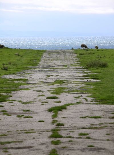
Below are a couple more of my photographs of what’s left of the site today.  For many more from all periods, see the substantial collection contributed by many volunteers on the All Arms Junior Leaders Regiment website.

Sources:

Jordanna Bailkin 2018.  Unsettled: Refugee Camps and the Making of Multicultural Britain. Oxford University Press

Becky Taylor 2018.  Good Citizens? Ugandan Asians, Volunteers and ‘Race’ Relations in 1970s Britain. History Workshop Journal, Volume 85, Spring 2018, p.120–141
https://academic.oup.com/hwj/article/doi/10.1093/hwj/dbx055/4818096

Roy Sloan 1991.  Wings of War over Gywnedd.  Aviation in Gwynedd during the World War II. Gwasg Carreg Gwalch


Websites

28 Days Later Urban Exploration
https://www.28dayslater.co.uk/threads/tonfanau-military-camp-tonfanau-nr-tywyn-february-2015.94390/

40th Anniversary for Ugandan Asian Refugees in Wales
https://www.itv.com/news/wales/2012-07-31/40th-anniversary-for-ugandan-asian-refugees-in-wales/

Ken Hart’s All Arms Junior Leaders Regiment (AAJLR) website
About: http://www.aajlr.org/about/about_main.html
Tonfanau camp: http://www.aajlr.org/tonfanau/tonfanau_main.html

Memories of Frank Yates, Royal Artillery, Light Anti Aircraft Battery. Chapter 17, BBC World War 2 People’s War. Article ID A7375845
https://www.bbc.co.uk/history/ww2peopleswar/stories/45/a7375845.shtml

Stanley Briggs: Then and Now
http://www.stanleybriggs.com/art_nat_service1.html

Tonfanau Road Racing
https://www.tonfanauroadracing.co.uk/

Wikipedia article about PYTHON
https://en.wikipedia.org/wiki/PYTHON#Locations


Newspaper advertisement feature for Aberdovey, 30th June 1894

I was looking, as usual, for something else entirely when I stumbled across this advert on the Welsh Newsapers online website, in The Cardigan Bay Visitor.  It dates to June 30th 1894. It picks up on an 1892 story in another publication and repeats it with what feels like a distinctly self-satisfied air.  There’s nothing much to add to it, I just thought that people might like to see it.  You can click on the text to enlarge it to a readable size, but the text is also copied out in full below the image.


“ABERDOVEY AS A WINTER RESORT. We have just heard of Aberdovey as being a splendid winter resort, and it is considered by eminent medical authorities to be a friendly rival to Torquay. Aber- dovey faces full south, and the high hills behind completely shelter it from the cold and boisterous North-east, North, and North-west winds. Now we have all heated of the “Bells of Aberdovey,” and almost every school girl who has “spanked on the grand pianner” has learnt to play Brinley Richards’—or was it some other musicians ?—composition on the much-tortured instrument which is supposed to simulate the harmonious tinkling of those famous Welsh Bells. But have we all heard Happy Valley, about two miles from Aberdovey ? Have we taken those walks to the legendary Bearded Lake and Arthur’s Hoof? Then the long, long miles of the sands of Aberdovey, so rich in shells and pebbles, what a splendid promenade they make.  Now all you non-fashionable people whose purses are not sufficiently long for Bath, Bournemouth, and Torquay, hie you to Aberdovey for the winter, if you shrink from the idea of the Continent on account of the recent cholera out- breaks. You will find plenty to interest you; and the golf ground is said to be one of the best in the United Kingdom. Hotels are not extravagant in their prices, and apartments may be obtained at very moderate terms.  SELF AND PARTNER, in Sala’s Journal, November 19th, 1892.”

You can check out the original page at
https://newspapers.library.wales/view/3824070/3824072/7/

North and mid-Wales railway e-Books

For the last few years I’ve been purchasing e-books from the British Transport Treasures website, which is dedicated to supplying good quality digitized copies of out-of-print British transport titles, some dating back to the turn of the 20th Century and many of them really difficult to get hold of.  Prices are generally very low, and support the hosting of the website.  I came across the site when chatting with the site’s owner, who’s an expert on the local history of the area where I used to live in London.  I think that the site is a brilliant way of keeping some of these old titles alive and accessible.  The following railway e-books may be of interest to local railway enthusiasts:

The Story of the Cambrian, by C. P. Gasquoine,Woodall, Minshall, Thomas & Co. Ltd., 1922 [ebook]
£4.05
Hard back book, 10”x 6.5 “, pp. 158, 34 B&W half tone images, appendices of old timetables. Map of Cambrian Railways.
http://www.britishtransporttreasures.com/product/the-story-of-the-cambrian-by-c-p-gasquoinewoodall-minshall-thomas-co-ltd-1922-ebook/

Cambrian Railways A Souvenir – 1895 [ebook]
£2.15
Bbooklet, 9.5”x 6.5”, 40pp superb black and white photographs, adverts Cambrian services, coloured map of railway on back cover.
http://www.britishtransporttreasures.com/product/cambrian-railways-a-souvenir-1895/

Locomotives of the Cambrian, Barry and Rhymney Railways. By M. C. V. Allchin, self published 1943 [ebook]
£2.95
http://www.britishtransporttreasures.com/product/locomotives-of-the-cambrian-barry-and-rhymney-railways-by-m-c-v-allchin-self-published-1943-ebook/

Welsh Mountain Railways 1924 [ebook]
£2.15
Booklet 7.25”x 4.25 50pp. inc. covers, two maps, 16 black and white photographs tipped in, not paginated.
http://www.britishtransporttreasures.com/product/welsh-mountain-railways-1924

Snowdon and the mountain railway, by anon. (“E. W.”) Woodall, Minshall & Co. nd. But c1900. [ebook]
£3.95
Paper covers, silk cord binding, 11X 8”, P. 18 inc. covers and adverts. 12 B&W photogravure photographs of trains, the railway Snowdon and surroundings.
http://www.britishtransporttreasures.com/product/snowdon-and-the-mountain-railway-by-anon-e-w-woodall-minshall-co-nd-but-c1900-ebook/

The Wonderland of Wales, GWR, Ffestiniog, Snowdon and Welsh Highland Railways, Timetables, etc., summer 1923 [Booklet]
£2.00 Booklet, 7.25”x 4.75”, pp. 16, inc. paper covers.
http://www.britishtransporttreasures.com/product/the-wonderland-of-wales-gwr-festiniog-snowdon-and-welsh-highland-railways-timetables-etc-summer-1923-booklet/


The changing appearance of the Trefeddian Hotel in postcards

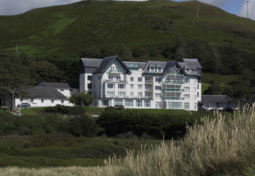
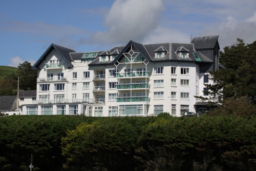
The Trefeddian as it was built on the left, and my photograph of it today (28th July 2020) taken from roughly the same angle but from a lower level

You can click on any of the images to enlarge them to get a better look at the details of the building.

The Trefeddian Hotel is one of the major local landmarks, a palatial white immensity overlooking the golf course, sand dunes and beach, recipient of the AA Hotel of the Year Award for Wales 2018/19.  I don’t know anything about the history of the Trefeddian Hotel, but images of the hotel in postcards provide a fascinating record of architectural changes to the building’s exterior features.  It would be great to know the background to these changes and to find out if the interior evolved at a similar rate to the exterior.  All of the images can be clicked on to get a better view of the details.

I have to admit to being slightly in love with the original vision, above, left and below, with its wonderful square chateau-like towers and its mock-Tudor half-timbered exterior.  Or was it inspired by the Alsace as the decorative tiling on the roof may imply?  Whatever the inspiration, it is a bizarre mish-mash of ideas.  Although it breaks all the rules and is anything but elegant, I think that it is delightful, a truly riotous expression of enthusiasm for a very personal conceptualization.  Whoever designed it, it looks as though they were having a great time.  I do wish I could have seen it.  The only piece of history that I’ve picked up is that the hotel has been in the hands of the same family for a century, so it dates at least to the 1920s if not before.  Note the single-storey building to its right/the south, which remains today.

The postcards below show the extension that was added to the north (left, in these postcards).  The second of the two has a postmark of 1934, which indicates that the extension predated that year.  There was no attempt to integrate it stylistically with the original, and it looks very peculiar.  A single storey building to the north, on the far left of this postcard is retained today.

In the first of the two cards, the railway crossing on to the golf course is accompanied by a small building that looks rather like a toll house.  This was the crossing-keeper’s house, and was still standing at least in July 1965 when it was photographed by C.C. Green for his book The Coast Lines of the Cambrian Railways vol.2.  Today the crossing remains, but the house has vanished.  I’m surprised that the crossing ever needed a keeper, because the traffic crossing the railway must have been minimal, and mainly on foot.

In the two postcards below, the half-timbered effect seems to have been removed, and may have been in the image above as well.  It would make sense that it was taken away at the time that the new wing was added to lessen the contrast between the two.

The following photograph gives a good view of the elaborate porch into the old wing and shows the complex of single and two-storey buildings to the north of the new wing, at the left side of the postcard. The enclosed garden at the rear of the building appears to have a small greenhouse as well as other structures, and looks as though it is laid down, at least partly, to rows of vegetables.

The next architectural reinvention of the building retains the new wing and removes all the original external features including the towers, the original gable and any remaining half-timbering.  Was it a complete rebuild on more or less the same footprint, or just a change to the external features?  I am guessing from the angled corner at the south end where the south tower once stood, visible in the second of the two photographs, that it was a re-invention rather than a complete rebuild.  The aerial view in the second postcard shows the outbuildings and an intriguing view of the garden, all providing a good idea of the scale of the operation.  The first of the enclosed gardens at the rear of the hotel looks as though it was turned over to vegetables. I can’t work out what the other two enclosed gardens contained.

The postcards have postmarks dated 1972 and 1979 respectively, so the conversion was probably done in the 1960s and looks like it.  The northern extension to the left has been retained, but the towers and the mock half-timber have gone and the replacement facade has about as much personality as a cereal box.  The colour change from yellow to white by the end of the 70s was a good move.  The single storey building at the right that I menitoned at the start of the post is visible in the second photograph, now connected to the main building by a corridor with windows.

Today the Trefeddian has retained its gabled north wing, but its box-like southern section has again been reinvented, with a new gable, decorative metalwork and balconies.  Two extensions to north and south have been added, flanking the two main wings, and there are dormer windows in the roof.  The building is still asymmetrical, but it has a much more aesthetically appealing appearance than its previous incarnation.  All the ancillary annexes to north and south of the main hotel building have been retained.

Detail of the top of the southern extension

Compare with the third and fourth photographs from top, where the same railway crossing is shown with a small building, the crossing keeper’s house, to the right of the gates.  As mentioned above, it was still standing in 1965 and looked as though it was in fairly good condition.  It’s a shame that it vanished at some point after that date.


The Tomlins flour mill, Aberdovey: Melin Ardudwy (revised and updated)

From the moment I saw a photograph of Melin Ardudwy in Hugh M. Lewis’s book Aberdyfi, Portrait of a Village, I wanted to know all about it.  This is my second attempt to supply information about it.

Melin Ardudwy.  Source:  Hugh M. Lewis’s book Aberdyfi, Portrait of a Village.  It is also shown in C.C. Green’s The Coast Lines of the Cambrian Railways volume 2, p.80

When I first started to look around for information about the mill, to my immense frustration, there was remarkably little to be found in any of the resources I had to hand.  Melin Ardudwy is only mentioned in passing in local history accounts, almost forgotten by most histories of the village.  It is not even mentioned on the Coflein website, which is usually a reliable starting place, often providing a few helpful references to chase. A bit of pottering around in my books and files turned up only a little information.  The photograph in Hugh M. Lewis’s book is shown above right.  In the process of my searches online, I was excited to find, on the People’s Collection website, a superb sepia picture of the mill (below left) showing it behind a train pulled by the locomotive Seaham, ready to depart.  Next, I found that the mill was listed in Gwynedd Archaeological Trust’s document Ports and Harbours of Gwynedd: Aberdyfi under their “Buried Sites With Poor Archaeological Potential” category, which contributed a short paragraph on the subject.  However, the best source of information was one I didn’t have and to which my attention was drawn by Sierd Jan Tuinstra, who is an amazing source of information about anything railway-related in Aberdovey.  He pointed me to a book that I hadn’t come across:  The Coast Lines of the Cambrian Railways, Volume Two, by C.C. Green (Wild Swan Publications 1996), and found some news articles about the mill that also help to fill out the story of the mill.  I also found a number of useful short articles on The National Library of Wales website that added to the story.  With thanks to Sierd Jan, Green’s book and the newspaper articles, I have now revised the original post with the new information.  For the first time I now knew the name of the mill’s owner: Mr James Tomlins.

In the Cambrian News and Merionethshire Standard on 27th August 1880, tenders were requested for the proposed new flour mill at Aberdovey.  The advert was placed by Robert and Evans of Aberystwyth, solicitors to the trustees.  The tender was evidently granted to James Tomlins, and Green (p.64) gives more details:

Mr Tomlin of Warwick wished to erect a four mill, and Mr Humphreys-Owen [of the Cambrian and West Coast Railway] and the solicitor were instructed to look in to the company’s right to use the land.  That report was favourable, and Mr Tomlin proceeded with his building work.

Green’s book has the photograph at the top of this post, showing the very first delivery into the flour mill, by a 2-4-0 Sharp Stewart engine with timber-sided cab. Bankruptcy proceedings in 1897 give details of the set-up costs invested by Mr Tomlins and his investors:  “He built a mill at a cost of about £10,000 and £2,000 had been expended in alterations.  He was allowed an overdraft of £2,000 and to that was added £4,0000 he borrowed and £3,000 he was allowed by a flour firm.

Later, Green makes the following information about the expansion of railway facilities at the mill mill (p.65)

In 1883, there was much debate about providing a ‘Cover for Mr Tomlin’s trucks.’  at the end, it was suggested that the company would pay half the cost of £125 so long as Mr Tomlin provided the labour for the erection of the structure, and undertook to send all his traffic along those routes most favourable to the company.

In 1884, Mr Tomlin asked for a siding to be laid down out of the company’s empty wagon storage siding to a new warehouse he proposed to erect at the end of his mill.  He laid it in with his own labour to the engineer’s satisfaction, and paid 20 shillings per annum for the use of the company’s land, and a proportion of the cost of the interlocking apparatus in the signal box.

Splendid view of Melin Ardudwy, c.1896.  Source: People’s Collection.

Gwynedd Archaeological Trust publication, Ports and Harbours of Gwynedd: Aberdyfi says that Melin Ardydwy (GAT25065) was a steam roller mill, and the mill was known both as the Ardudwy Flour Mill and, more formally, as the Cambrian Roller Flour Mill.   By the 1870s roller milling was becoming widespread, and conventional wind-powered flour mills were being abandoned.  Roller mills enabled the mass-production of much greater volumes of flour, which could be consistently graded and were used to make newly fashionable white bread. Apparently this area beyond the village was known as Ardudwy, hence the mill’s name.

The mill used to stand where a little housing development stands just outside the village to the left on the way to Tywyn, near the golf course.  The mill was four storeys high, stone-built, with five bays on the main frontage, three on the side, and had a protruding extension one bay in width.  The brick-built chimney sits in the corner where the two parts of the building meet.  It is a substantial edifice.  A large shed-like structure stands at its side.

It is not clear quite where the water came from.  Steam mills required a reliable supply of water such as a river or canal. Failing this a reservoir was usually necessary with sufficient capacity to supply the mill with at least one day’s supply of the required water.  James Tomlins’s name occurs time and time again in debates in Tywyn concerning the supply of water to Aberdovey for sewerage, drainage and the supply of businesses dependent upon it, but it is completely opaque how the mill was supplied with water until he managed to secure agreement for an improved water supply.  That agreement was finally made on 13th February 1894, with the Montgomery County Times and Shropshire and Mid-Wales Advertiser reporting that

Mr. Tomlins has for years been agitating respecting the insufficient water supply and constructed drainage of the place, but he failed to make any tangible impression on the Board representatives until last summer’s drought proved his hypothesis. Penyroror Hill is the site fixed upon for the new reservoir. The result of the enquiry will soon be made public.

As an amusing aside, the author of the report finishes with a rather embittered rhetorical question:  “By the way, can anybody enlighten us why an enquiry closely pertaining to Aberdovey should be held Towyn?”

The traditional approach to flour production was to crush wheat grain between two circular millstones, an upper runner stone that rotated and a lower bed stone that was fixed into a stationary position.  The runner stone was powered either by wind or water.  In the 1850s the repeal of the Corn Laws meant that imported grain was affordable and Britain’s dependence on imported grain grew from 2% in the 1830s to  45% (and 65% for wheat alone) during the 1880s.  The arrival of the railway in Aberdovey seventeen years previously had resulted in an expansion of the deep water sea trade with imported cargoes from Ireland, South Wales, Newfoundland, the Baltic, South America and elsewhere, which in turn led to the expansion of the coastal and rail transport from the port.  Cargoes were trans-shipped, via rail or coastal vessels, to other parts of Wales and England.  Hugh M. Lewis says that wheat and barley were imported from the Mediterranean, Australia and Canada.  At a time when white bread was increasingly in demand, mill technology was changing and rollers began to replace millstones all over Britain  Rollers were cheaper to make than the skilled but arduous and time-consuming dressing of millstones.  The website From Quern to Computer has a useful overview of the reasons that steam-powered mills became so popular, and why they were often located, like Melin Ardudwy, at ports:

Henry Simon was one of the main manufacturers of roller machines for flour milling. Source: From Quern to Computer (full reference at end of post)

In 1878 The National Association of British and Irish Millers (nabim) was formed for ‘mutual advancement and protection’ in the light of the ‘great changes which are now in progress in the manufacture of flour, and in the machinery used for that purpose’.  These ‘great changes’ . . . were driven by two related factors:  the growing demand for white bread and the increased importation of hard wheats from North America, Russia and also Australia and India, to meet demand.  These hard wheats gave good quality flours, naturally higher in gluten than native soft wheats, which enabled the production of well-risen white bread.  The gradual reduction method employed by the new roller mills was not only better suited to milling hard wheats than traditional millstones, but also to extracting a greater proportion of fine white flour.  In addition, changes were taking place in the location of the milling industry, as large new mills were built at ports and on navigable rivers and canals, well-placed to receive deliveries of imported wheat.  Such changes were also facilitated by the use of steam power.

Melin Ardudwy was an outcome of this industrialization of flour production.  I can find no mention anywhere of exactly what internal machinery was installed or how many rollers it drove.  However, the basic operation can be cobbled together from general accounts of steam-driven roller mills.

Roller milling, as the name implies, replaced circular stones with rollers, c12 inches in diameter, not unlike a big mangle, through which the grain was gradually broken down through successive pairs of rollers.  These were set at a specific distance from each other, fixed by a technician, spinning towards each other at different speeds in incremental stages until the grain was sufficiently reduced.  Grain was fed in to the rollers and extracted via pneumatic pipes.  Flour was extracted at all stages of the process.

Green provides a fascinating plan of the railway showing the mill in the context of other structures serving or served by the railway c.1923.  It is marked on the plan as Tomlins Steam Mill, and has an accompanying warehouse.  I have scanned it, a pretty poor job that makes a complete pig’s breakfast of the part where the plan spans the page join.  You can click on it to get a better view of it.  It shows how Tomlins Steam Mill was integrated with the rest of Aberdovey’s railway infrastructure. I have highlighted the mill in red and the station in green.

Plan of the railway at Aberdovey, c.1923, showing the Tomlins Mill at Ardudwy. Source: C.C. Green 1996, The Coast Lines of the Cambrian Railways, Volume 2. Wild Swan Publications, p.74-5

The plan seems to show that the tracks in the photograph at the top of this post ran into Tomlins Mill, shown in red.  There is another siding shown running to the south of that track, terminating next to the mill, and others to the north. The two sidings to the north appear to relate to other activities, with one serving cattle pens and another relating to a proposed goods yard.  a total of four tracks seem to have served the mill itself, a fairly impressive operation.  All of the sidings eventually connect to the main line near the golf club’s club house.  This linkage to the main line meant that flour could be taken further afield by rail, or taken down to the port for loading on to vessels for transhipment along the coast to south Wales.

1884 was a good, profitable year for Mr Tomlins, although he was still in debt.  He had the best possible machinery and established a trade monopoly, but by 1893 he was in difficulties due to increasing competition and ongoing debt.  On 3rd November 1894, the Montgomery County Times and Shrophshire and Mid-Wales Advertiser reported that a wheat conditioning plant was installed at the mill, “giving every possible satisfaction,” but this was obviously not sufficient to rescue the business, which was obviously in trouble.  In 1897 a long report appeared in the Cambrian News and Merionethshire Standard, dated 10th December 1897, announcing that the mill had declared bankruptcy, with liabilities of £2,124, 8s 5d.  The public examination heard that “the cause of failure was stated to be the heavy outlay in building a flour mill at Aberdovey, the erection of expensive machinery, insufficient capital to work that business at a profit, heavy insurance and interest, bad debts, competition, and working at no profit for four years prior to 1895.”  A fairly comprehensive list of woes. The mill was sold at auction on 29th April 1897 to a Mr Powell of the Midlands for £1600, but it is unclear what happened to it between then and when the main building was pulled down.

A postcard that shows it in the distance (below) shows women in fashions that date to the 1910s, with the mill and its chimney still in tact.  The picture of the mill on the right, is a detail of the postcard on the left, visible in the distance.

The Cambrian News and Merionethshire Standard on 4th December 1908 describes the dismantling of the mill itself, leaving the chimney behind:  “The old flour mill adjoining the railway is being rapidly dismantled, at the instance of the Cambrian Railway Company, its condition having of late become unsafe.  Mr J.P. Lewis undertook the contract, which up to the present has proceeded without incident.”  The chimney remained in place until 1920.

The demolition of the chimney was reported in The Cambrian News on 4th June 1920, as follows:

On Wednesday week, an exodus of men, women and children, 100s in no.s, was made for Ardudwy and the sea.  For on that night the giant chimney of the old mill, erected at about 1884, was to be rased to the ground.  Since that date, the old chimney had served as an excellent landmark for the Aberdovey fishermen, and they took this opportunity – the heat of its destruction – to organize a collection from the spectators for the Sailors Orphanage Fund, which was some solatium for the loss of their silent friend . . . . At exactly 10 minutes to eight, Mrs Richards, Ardudwy, applied the torch to the well-petrolled timber and in less time than it takes to write, the base was a mass of flames. . . . A neater job was never done.”

I don’t know when the rest of the mill was taken down, and it may have survived until the land was cleared for the modern housing estate that now sits on the land.

It would be rather nice to know more about James Tomlin other than his name.  He was a member of various boards in Tywyn and Aberdovey and, as mentioned above, was involved in a number of heated debates about improvements to Aberdovey’s water supply for drainage, sewerage and business operations, how it should be implemented.  A report of the marriage of his son Herbert in Chaddesley-Corbett in 1903 indicates that he was married with at least one child.  The bankruptcy proceedings recorded that he was very poor at keeping his books in order and he was, according to a report dating to 21st October 1887, a teetotaler!  I could probably find some more odds and ends by trawling through the newspapers online, but whatever I find, it’s not going to make up much of a biography.  If anyone knows of any more about him please get in touch.

Main sources for this post:

The National Library of Wales website (a fabulous resource):
https://newspapers.library.wales

The Coast Lines of the Cambrian Railways, volume 2, 1996 by C.C. Green.  Wild Swan Publications

Structural Engineering in the Lancashire Cotton Spinning Mills 1850-1914: the example of Stott & Sons by Roger N. Holden, 1993. Industrial Archaeology Review, Volume 15, 1993 – Issue 2

Technology and Transformation: The Diffusion of the Roller Mill in the British Flour Milling Industry, 1870-1907.  Jennifer Tann and R. Glyn Jones. Technology and Culture
Vol. 37, No. 1 (Jan., 1996), p. 36-69 (Available to read on JSTOR)

Gwynedd Archaeological Trust 2007.  Ports and Harbours of Gwynedd: Aberdyfi. A Threat Related Assessment.  GAT Project  No.1824, Report No.671.1, April 2007

Gwynedd Archaeological Trust 2011. Conservation Area Appraisal: Aberdyfi, Gwynedd.  GAT Project No. 2155. Report No. 956, June, 2011

Aberdyfi, Portrait of a Village by Hugh M. Lewis.

Aberdyfi, A Chronicle Through the Centuries by Hugh M. Lewis

From Quern to Computer: the history of flour milling. Roller Milling: A Gradual Takeover. September 06th 2016 by Martin and Sue Watts
https://millsarchive.org/explore/features-and-articles/entry/171161/from-quern-to-computer-the-history-of-flour-milling/11669

England 1870–1914. The Oxford history of England by R.C.K. Ensor.  (1936). Clarendon Press


The arrival of gas, running water and electricity in Aberdovey 1865-1945

The following information has been assembled from books and booklets by Hugh M. Lewis M.B.E.  Aberdovey inhabitants and visitors are very lucky to have his recollections, and his investigations into village history, captured in a number of small publications.  Having been born in 1910 he grew up in the village and became a repository of information about the village both during his own lifetime and before it.   Without his work, it would be very difficult to get a clear view of how Aberdovey developed during the late 19th and the 20th Centuries.

The arrival of such things as running water, gas and electricity were important to a village that had ambitions to develop its tourist industry.  The gasworks, finally up and running in 1868-9, followed fast on the heals of the arrival of the railway, and villagers must have felt that modern living really had arrived.

The promenade with a gas light on the corner, sometime after 1900. Source: Aberdyfi: A Glimpse of the Past by Hugh M. Lewis.

In 1864 the Tywyn Board of Health approved an application to build a gasworks near Trefeddian Terrace, to consist of a large gas holder, a tall chimney and a manager’s house.  Work began on the gasworks, but the work was not completed and in 1865 attempts were made to sell them.  It was not until 1868 that the Aberdyfi Gasworks were acquired by the Tywyn Gas Company, and gas was fed from the Tywyn Gasworks in underground pipes, which allowed for the provision of gas lighting and the connection of some houses.  The gas holder in Aberdovey was used for storage and the tall chimney that accompanied it was knocked down.  The lamps were lit manually by a lamplighter, who used a long pole to reach them.  Hugh M. Lewis says that that the street lamps were quite far apart “leaving pockets of darkness in between haloes of light, the weak glare of cottage candles, the beam of an occasional torch, glow of a hurricane lantern or yellow light of a carbide bicycle lamp.”  The lamplighter was first replaced by a pilot light and a timer, and eventually gaslights were replaced by electric street lights.

The Aberdovey village pump, with the bakery and Wesleyan chapel behind. Source: Aberdyfi – The Past Recalled, by Hugh M. Lewis.

It is interesting that gas arrived in Aberdovey thirty years before most houses had permanent running water, with many households remaining dependent on the village pump.   New houses were going up quickly as mining, shipbuilding and trading activities expanded, and the village pump became increasingly impractical.  In 1898 a rectangular reservoir with a capacity of 3 million gallons was built in the hills beyond the village near Crychnant Farm, and water mains were laid in the village, to which homes were then connected.  By 1901 there were 310 houses and the population stood at 1358  people, so the reservoir had a lot of residents to supply.  Hugh M. Lewis (1910-2003) says that even during his own childhood, the water supply often ran out during the summer.  He says that local children could earn “the odd halfpenny” by carrying buckets of water to houses at some distance from the pump.

A photograph showing a formally arranged gathering next to the village pump. I suspect that the above painting was actually derived from this photograph.  Source: Aberdyfi – Portrait of a Village by Hugh M. Lewis

The reservoir above the village, with a capacity of 3 million gallons. Source: Aberdyfi – A Chronicle Through Time by Hugh M. Lewis

The old gas lamp and the modern electric street light, side by side at the bottom of Gwelfor Road. Source: Aberdyfi – The Past Recalled, by Hugh M. Lewis

Electricity is one of those household facilities that one takes very much for granted, but Aberdovey remained without an electricity supply until 1945.   A company was formed, with shares offered at a pound each to raise capital of £13,000.  A combination of water and oil power were used to generate electricity.  Originally it was thought that water-powered turbines would be sufficient, and water was sourced from Caethle steam near the disused lead mines in Happy Valley.  The demand, however, outstripped the supply and water power was supplemented by oil.

After the Second World War, Aberdovey settled into a very different pattern of social and economic activity from its more industrial past.  The copper, iron and lead industries had come to an end, shipbuilding had ended with the arrival of the railways, and Aberdovey retained only a minor role as a port.  Instead, the tourist trade, which had taken off in the 1860s, became the mainstay of the village economy, and for this, the provision of running water, gas and electricity had become essential.

Sources:

The information and images used in this post were sourced from two books by Hugh M. Lewis:

  • Aberdyfi, Portrait of a Village
  • Aberdyfi:  A Portrait Through the Centuries.
  • Aberdyfi:  The Past Recalled
  • Aberdyfi:  A Glimpse of the Past