I enjoyed the beach so much during our short stay in Tywyn, that I took a serious number of photographs. Here are another bunch, slightly different from the previous one.
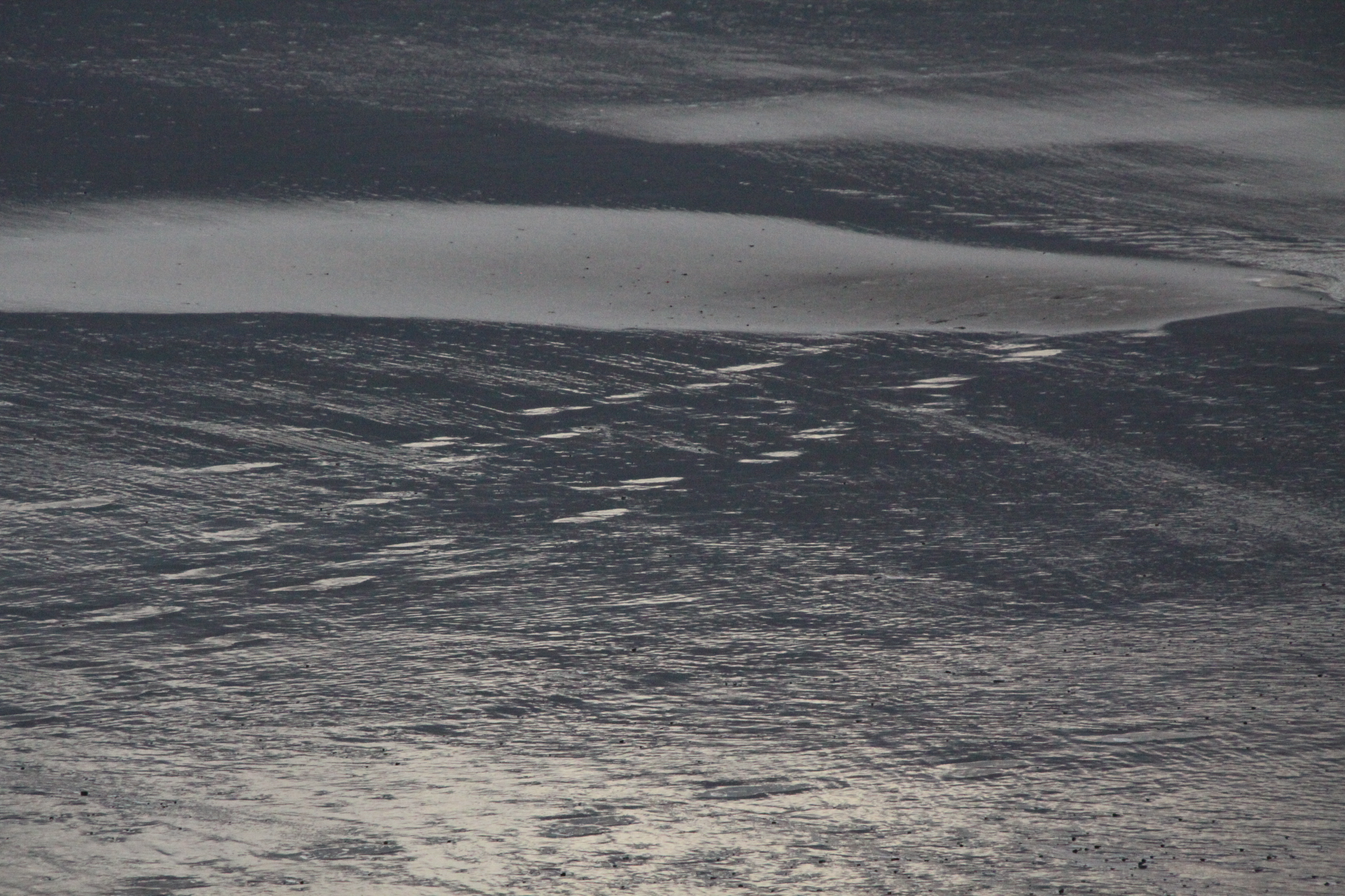

I enjoyed the beach so much during our short stay in Tywyn, that I took a serious number of photographs. Here are another bunch, slightly different from the previous one.
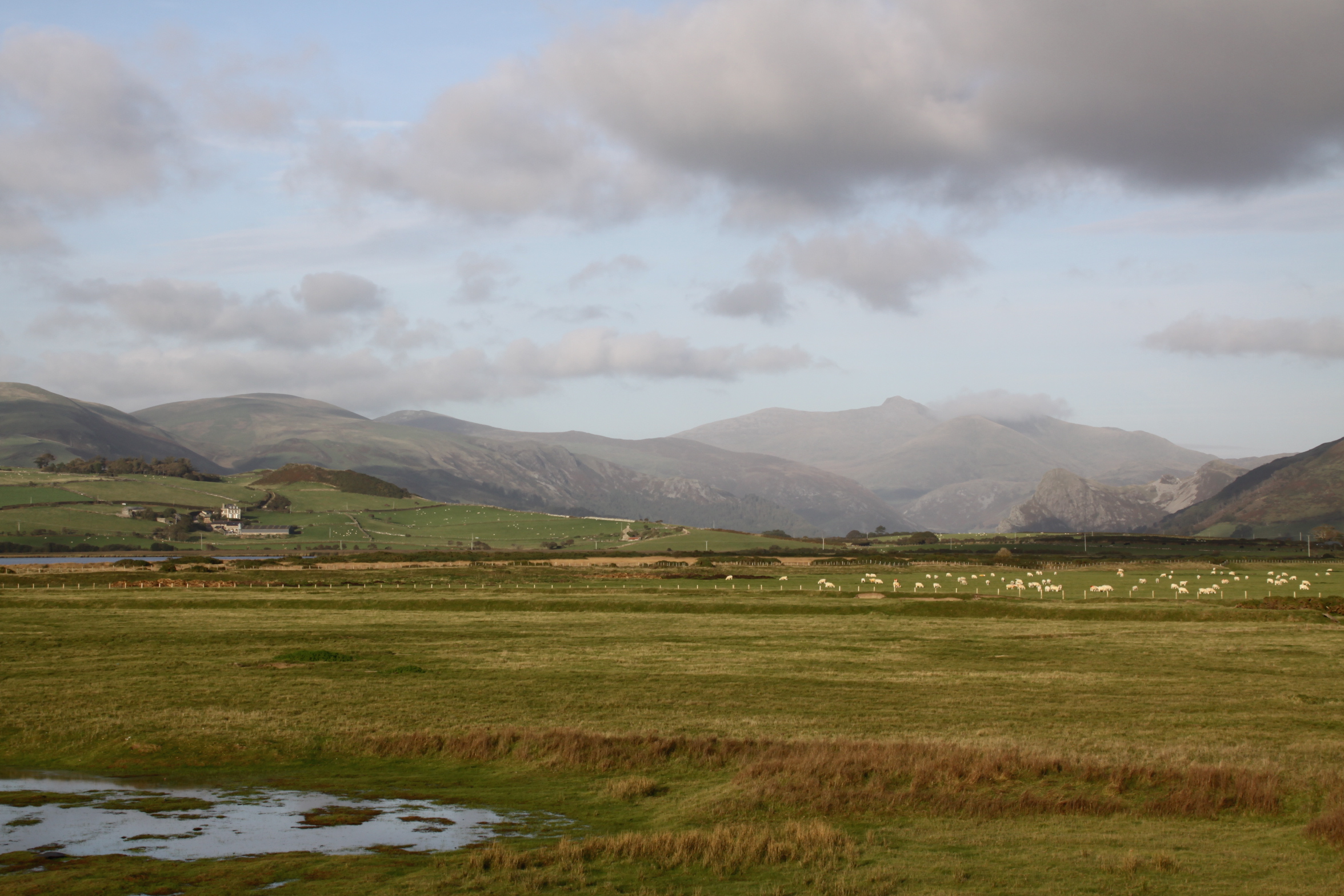
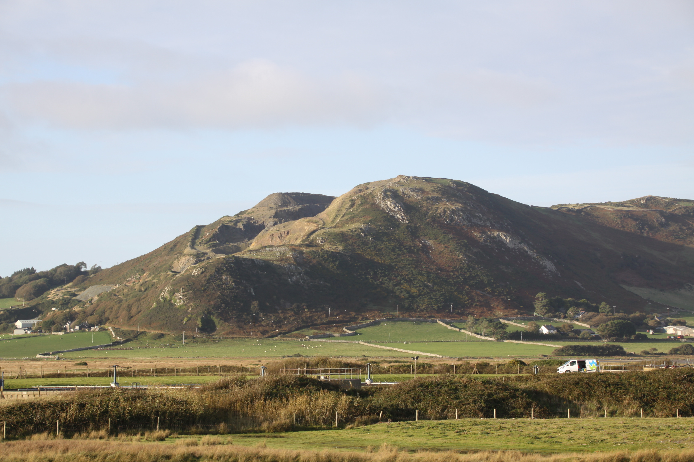
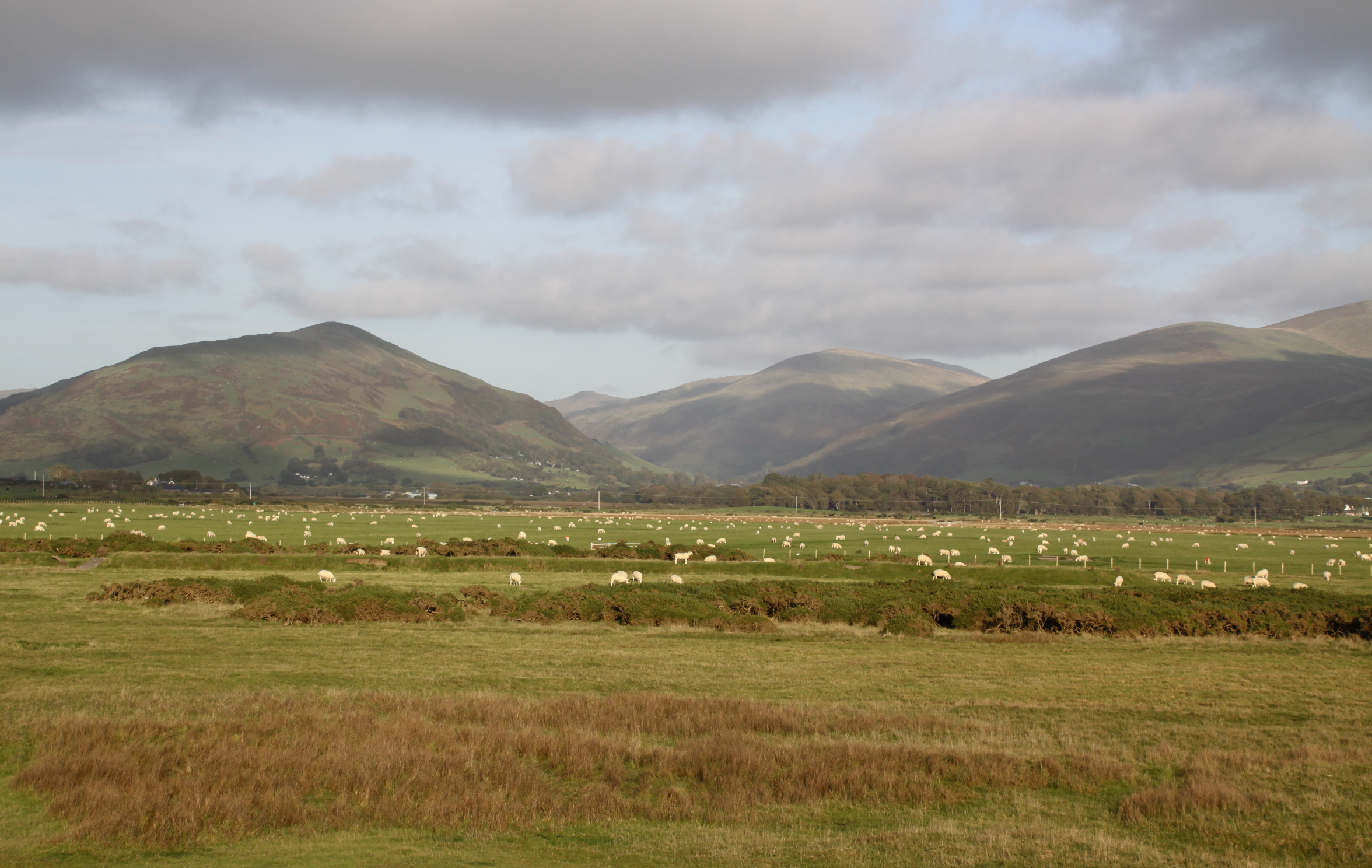
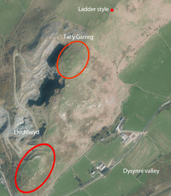
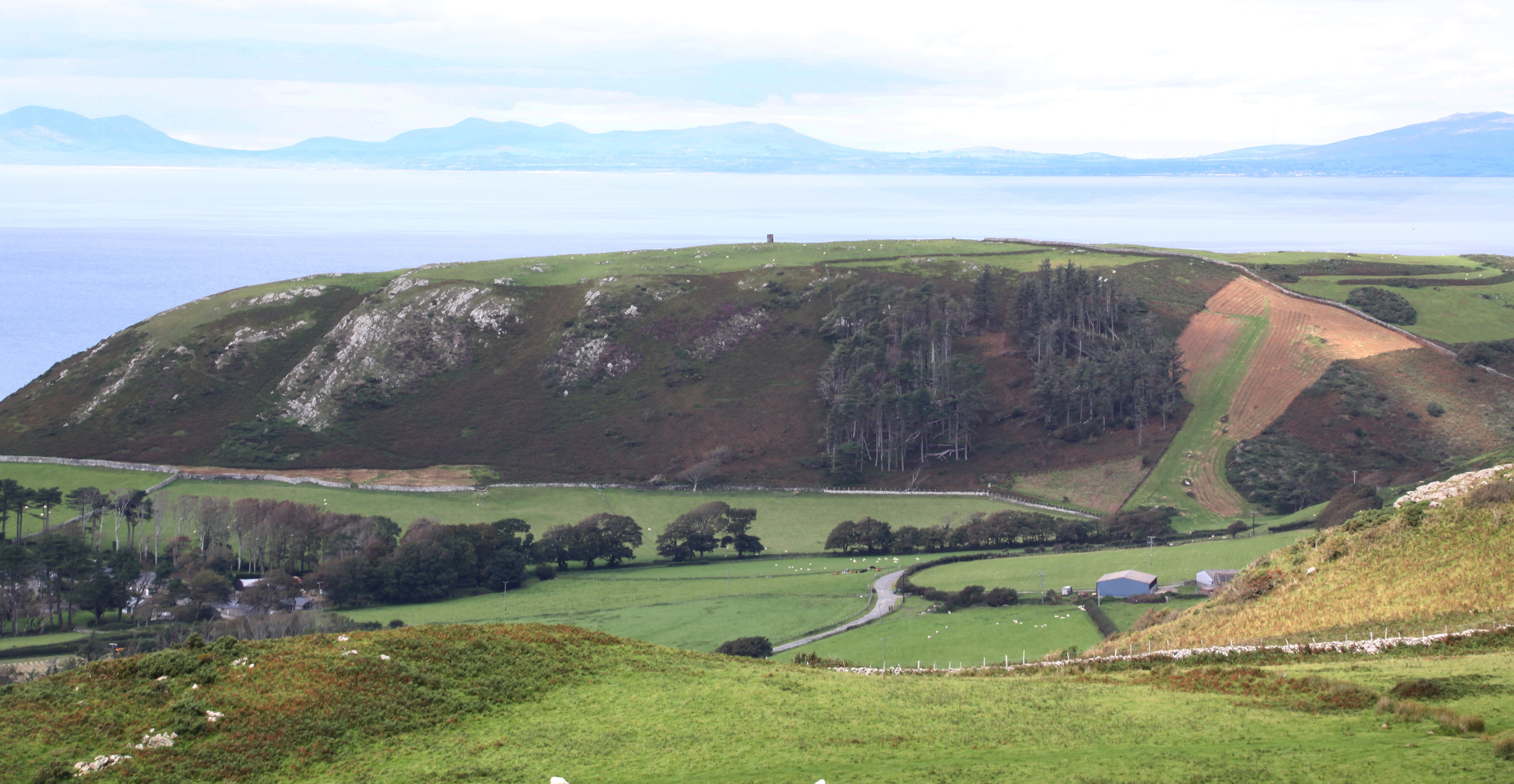
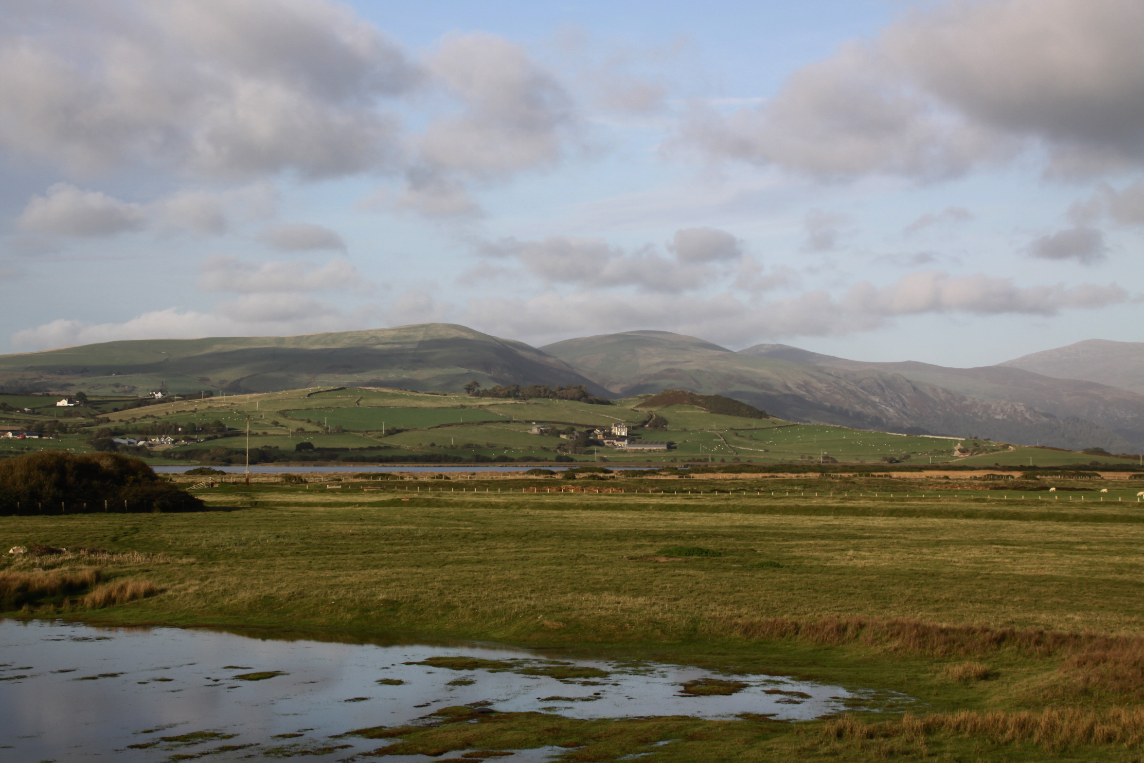 On a recent flying visit to Tywyn, walking along the beach towards the Dysynni, it was terrific to see the autumn light on the hills and water over the Dysynni valley, like Tal y Garreg, Llechlwyd and Craig yr Aderyn (Bird Rock). During the Iron Age some of these hills housed fortifications, implying that the landscape below was farmed at this time, just as it was further to the north. A beautiful place to live on a day like this, safe in the knowledge that the central heating waits back at the ranch, but it must have been a hard life during the Iron Age with the winter closing in.


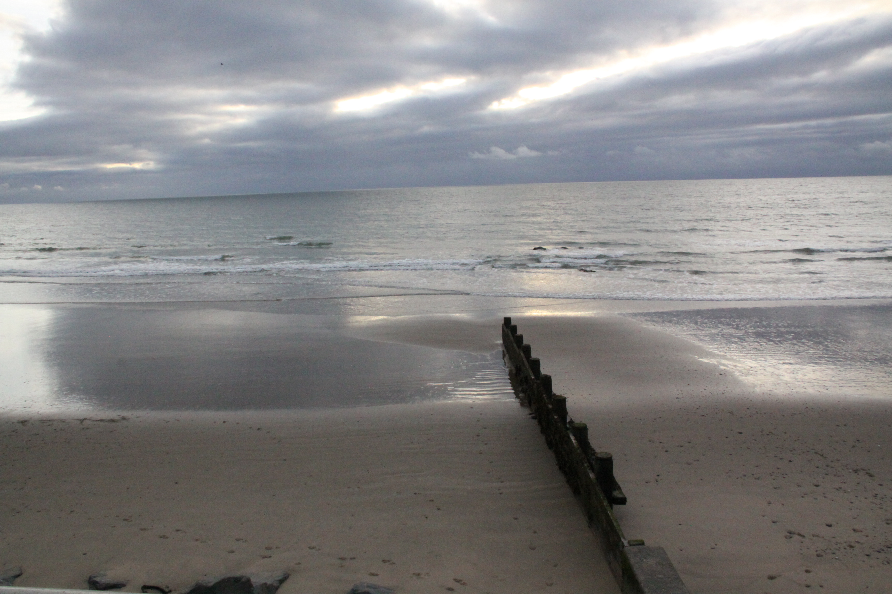
 My father and I decided to take a three-night break in the Aberdovey area. After leaving my home in Aberdovey and moving to the Chester area in February, I decided to take a break for a few months before going back for a flying visit. I wanted to find somewhere self-catering, and near the sea, and the place that ticked all the boxes was in Tywyn. I have taken 100s of photographs of the beach at Aberdovey, walking a long way towards Tywyn, but only rarely took photographs on the beach at Tywyn itself. The beach at Tywyn is so different from that at Aberdovey!
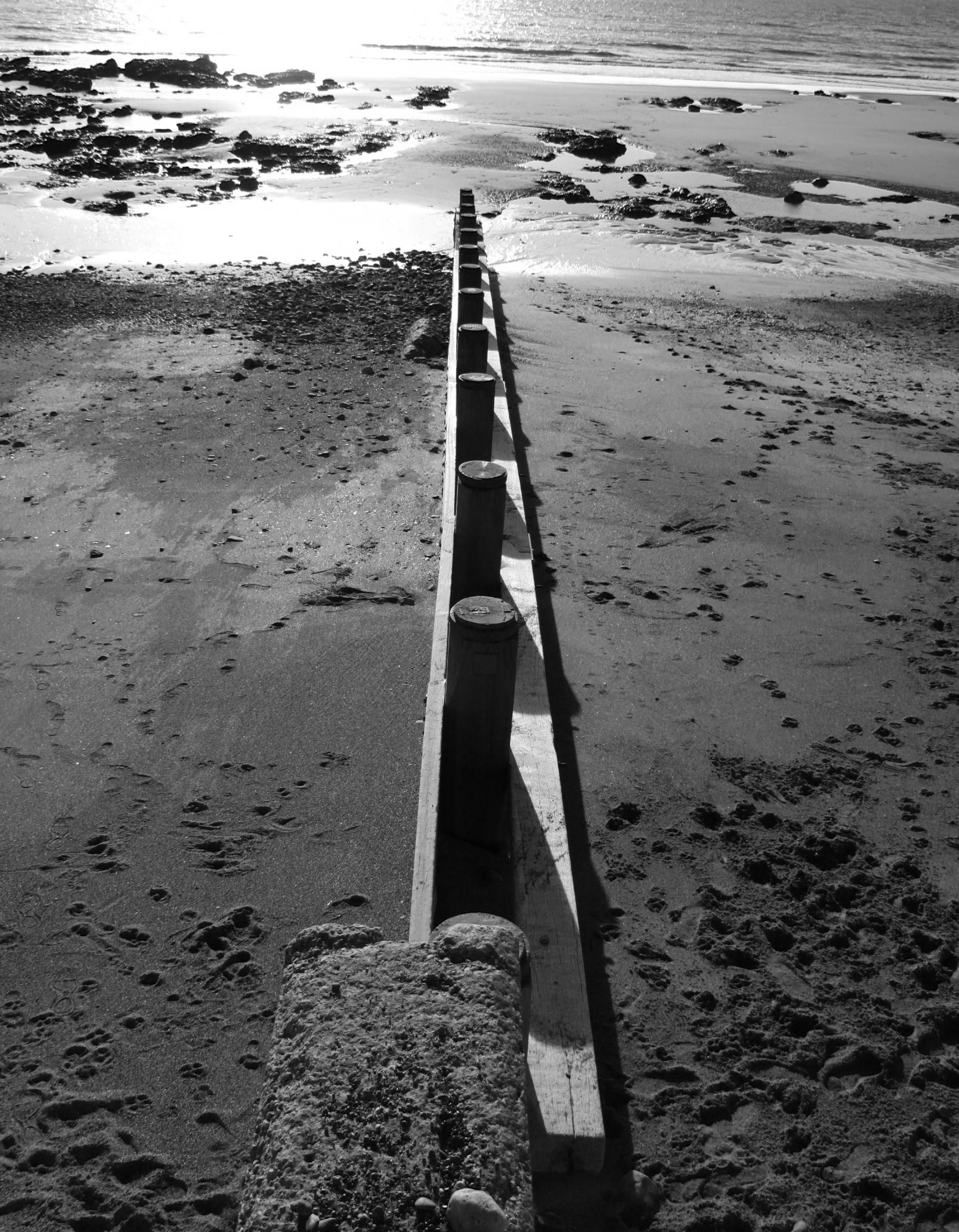
The most obvious difference is the presence of breakwaters, long wooden structures that run from the promenade down into the sea in order to lessen the erosive and carrying impact of waves and cross-currents on a sloping beach, effectively dividing the beach into multiple small sections. When the tide is very high it is impossible to walk along the beach without climbing over the breakwaters, but a promenade along the top of the beach means that the sea can still be enjoyed by dog-walkers, joggers and visitors.

Within these divisions, the differences continue to impress.
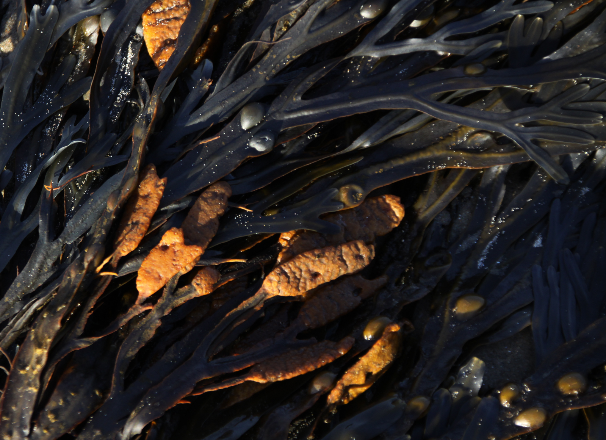
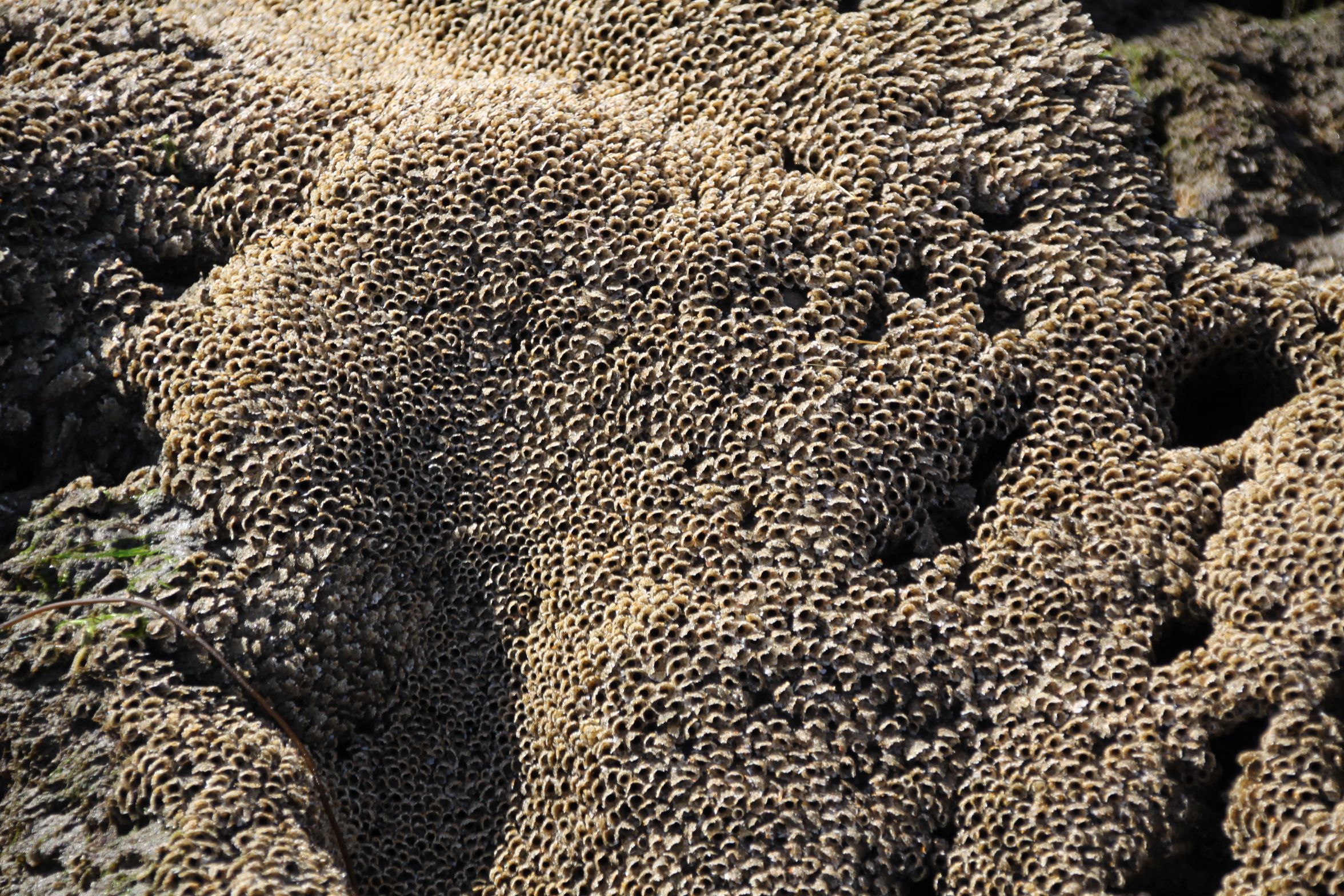
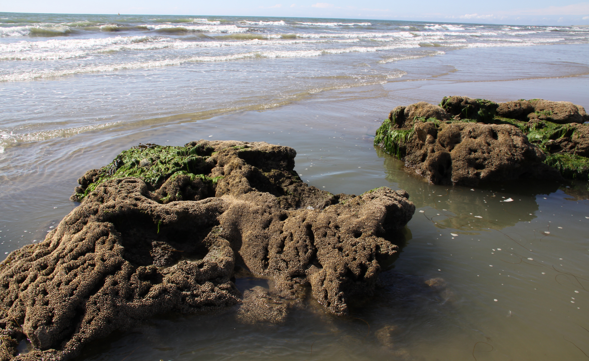
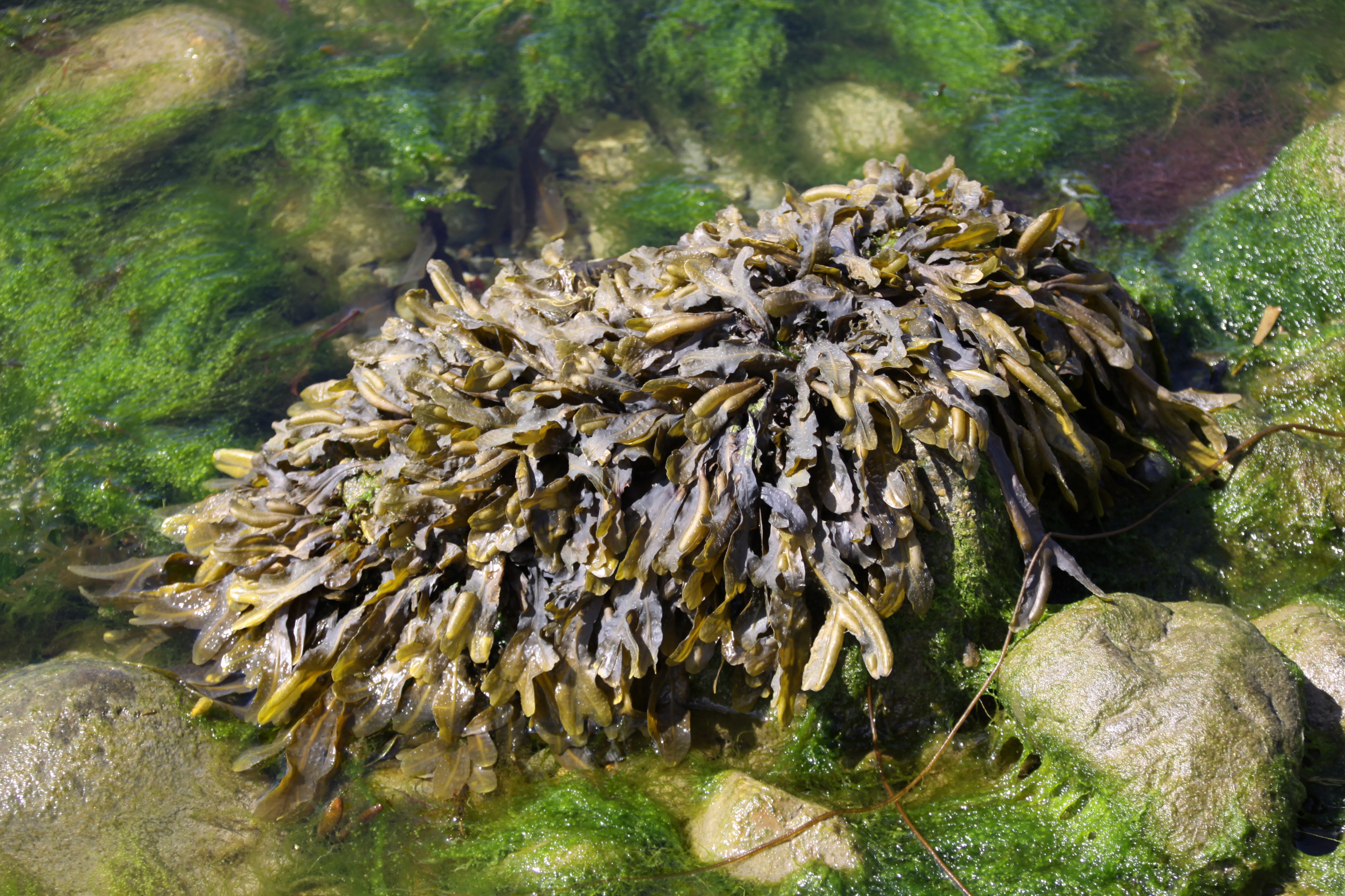
 There are lovely rock pools with superbly coloured seaweeds floating in them, the rocks sometimes housing colonies of tiny white barnacles. Beyond the rock pools are highly textured sand structures that look a little like coral but are honeycombe reefs, made by the Honeycomb worm (Sabellaria alveolata), which form colonies. The colonies form on hard substrates and they need sand and shell fragments for tube-building activities. They manufacture the tubes from mucus to glue the tiny pieces together. When the tide is out the worms retreat deep into the tunnels, but when the tide covers their reefs their heads protrude and they feed on micro-organisms in the water, including plankton.
 There are lots of pebbles, rounded by being rolled in the sea and over sand and other pebbles, a variety of shapes, sizes, colours and textures. There are almost no shells, but there are occasionally limpets, which are only rarely found at Aberdovey, probably due to the lack of rocks for them to cling to. Perhaps because of the breakwaters there is nothing in the way of a strandline capturing oddities from the sea, but this is good news for sun-bathers. The Tywyn beach very definitely has its own personality.
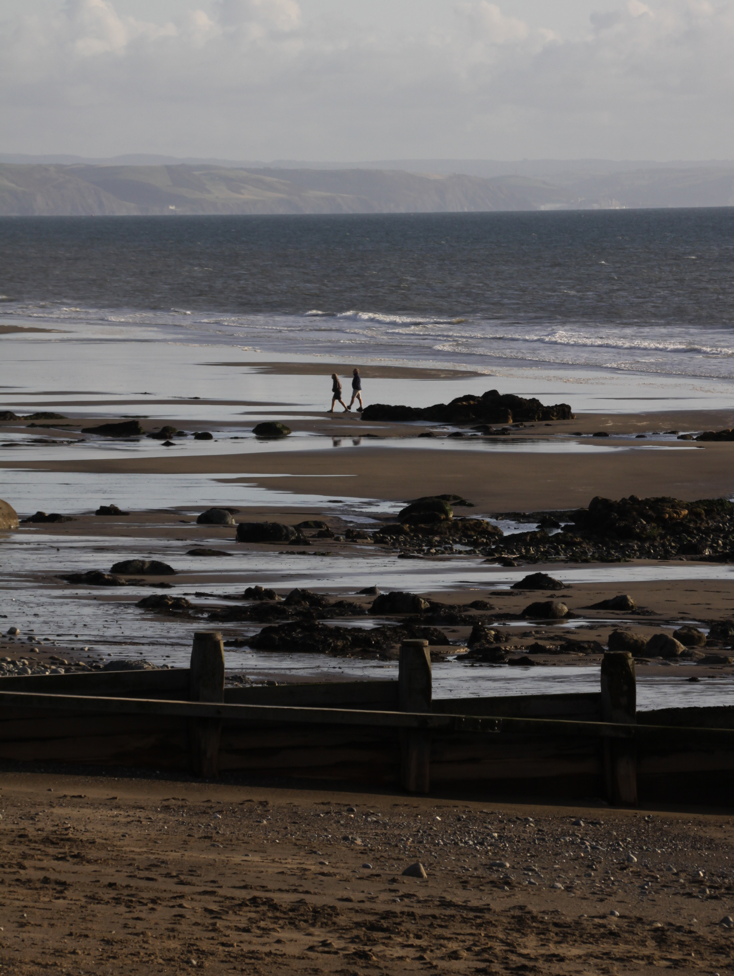
Staying so close to the beach meant that we could walk along it both first thing and last thing, which was a treat. We were so lucky with the weather, and the autumn sun, quite low in the sky, danced wonderfully on the waves. It was cold at each end of the day, but by staying on the move, hypothermia was avoided.
Here are a few of my late afternoon snapshots. There will be more to follow on future posts. The light was simply extraordinary. We’ll be back 🙂


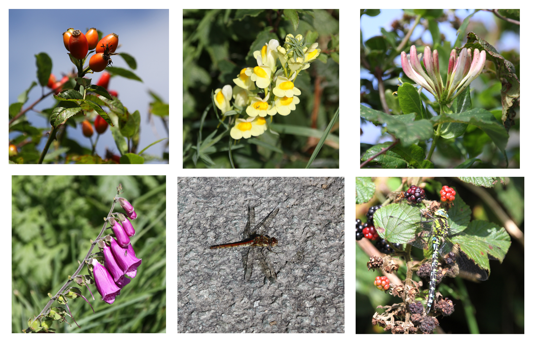
 Nearly every walk I’ve done around Aberdovey has been a riotous success, but on Saturday it all went slightly wrong in spite of the stunning sunshine. I was trying to scope out a route to another hillfort. I had already made the mistake of crossing a footpath through a field that turned out to be very boggy, so ended up with soggy socks and damp jeans, before turning onto a single track road for a couple of kilometers. Its hedges were so high that I couldn’t see much of the scenery and when I turned onto the footpath it was so overgrown with brambles that it was a struggle to get anywhere. There were a few nice flowers, including toadflax, lots of honeysuckle and a few late foxgloves, and a couple of damselflies and dragonflies, but otherwise it was just a fight against the increasingly vigorous thorny tendrils so eventually, when they were knee-high and seriously impeding progress, I gave up. Fortunately I was in jeans rather than my usual shorts, which saved my legs, but it was disappointing. There’s another approach that I’ll try on another day. I decided to return home, stopping first at the beach outside the crush in Aberdovey itself, parking up opposite the cemetery.
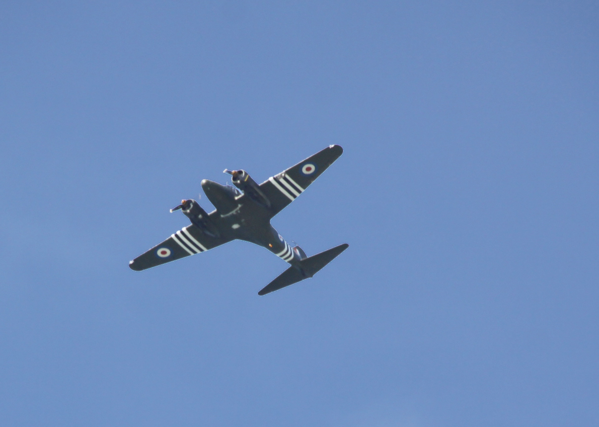
As I crossed the dunes and walked across the grey pebbles down onto the beach, the sight was rather bizarre – facing towards Aberdovey it looked as though several lines of humans in the distance, in silhouette, were moving in slow motion towards me. It was slightly eerie, shades of zombie invasion movies. Fortunately, they were just out to enjoy the sunshine, like me. There was a vintage RAF propeller plane overhead. Many thanks to Hugh Tyrrell for responding to my request for information about it. He says that it is a restored Avro Anson from Sleap airfield in Shropshire, painted in D Day colours. It is owned by a aviation enthusiast who takes passengers for local trips. This time he was further away from home and was probably flying back after visiting Llanbedr. It was a really marvellous sight, with a very distinctive engine sound. An elegant visitor and a contrast to the super-fast jets that we often have roaring overhead around here, also rather fascinating in their own particular way.


Stonechat in the sand dunes


Click to see the details of an amazing crush of shells, in a part of the beach that has an enormous amount of razor clam shells. Razor clam shells always give me real craving for Portuguese food!
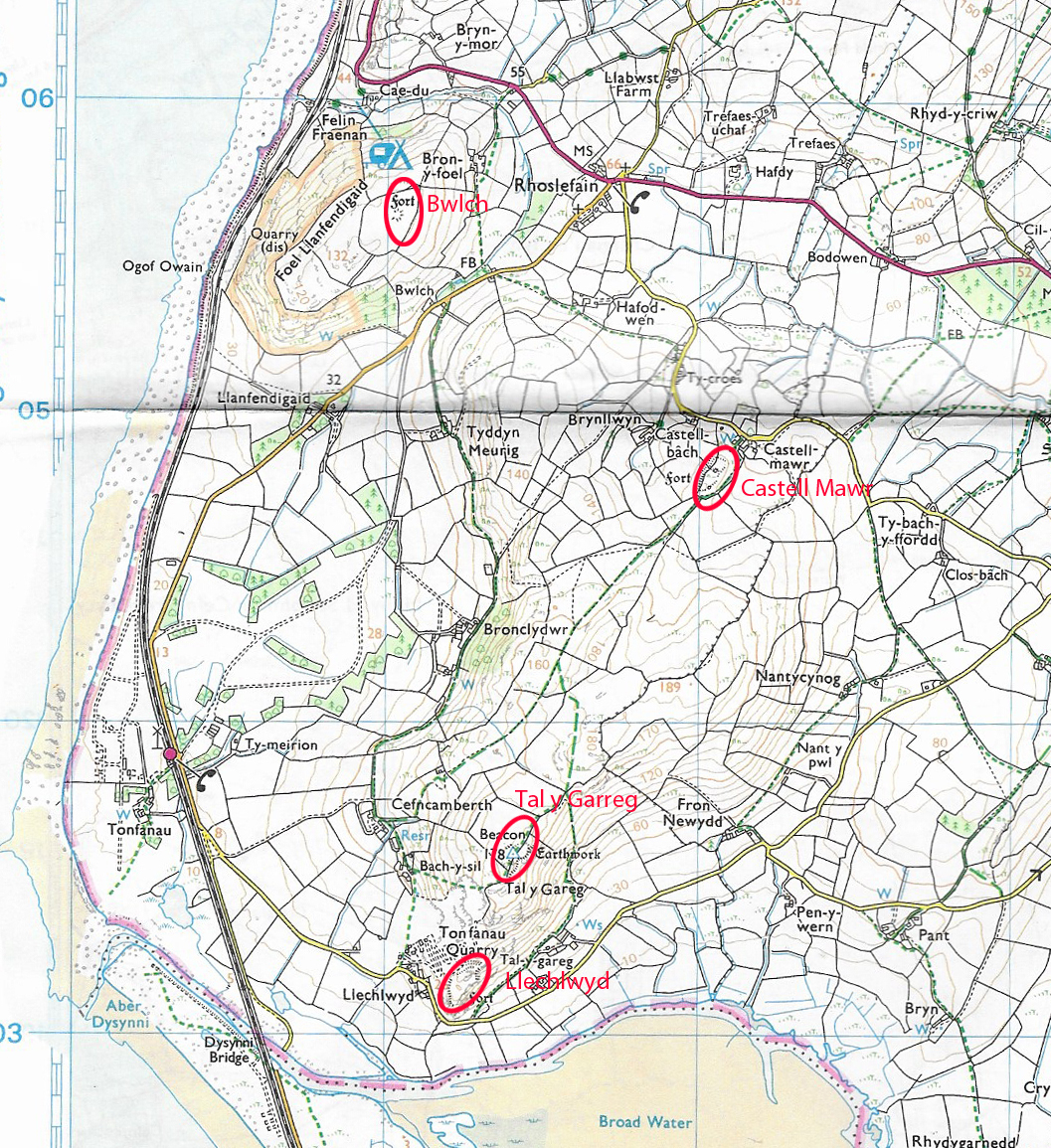
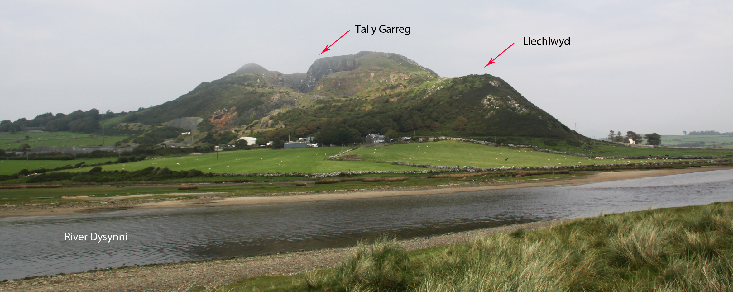 The location of the two hillforts above Tonfanau, with Llechlwyd on the promontory, right.
 Llechlwyd (sometimes referred to as Llechrwyd) hillfort is located on a long, narrow promontory that extends out from the hill above Tonfanau, Mynydd Garreg (Garreg hill), a short distance from Tywyn. Llechlwyd means “grey (lwyd) stone (llech).” At a height of 70m OD it is considerably lower than nearby Tal y Garreg hillfort (170m OD). If you have not read my post about Tal y Garreg hillfort I suggest you read that first, because this post makes frequent reference to it. Like Tal y Garreg, Llechlwyd has not been excavated, but it conforms to the basic design of an Iron Age hillfort, and is generally accepted to be of that period. Llechlwyd is only a short walk from Tal y Garreg, but is a rather more difficult hillfort to reach. The relative positions of the two hillfort are shown in the aerial photograph on the above left. The dark shadows to the left of both hillforts highlight parts of the Tonfanau stone quarry, which has cut away bits of both.
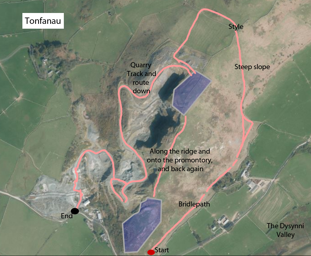
My route up and down Mynydd Garreg, above Tonfanau. The shading in purple shows Tal y Garreg at the top and Llechlwyd below. Source: Archwilio, with my route drawn in.
The routes up and down the hill that I took can by seen at the end of the post. Apologies for the legend “style” instead of “stile” in the photographs above and left, but I only realized after I had posted this piece. I parked by the Tonfanau bridge, on the Tywyn side, and walked to the bridle path, up the hill, over the stile, and back along the ridge towards the easily visible hillfort of Tal y Garreg, which makes excellent use of a natural rise in the topography. Then, instead of going through the fence to Tal y Garreg, I turned left and walked along the fence, passing Tal y Garreg on my right. This fence leads directly into Llechlwyd. On the aeriel photograph above it looks like a straightforward walk along the ridge, but in fact there’s a rather steep drop from the ridge to the promontory below, with a 100ft difference between the heights of the two hillorts. This can be seen clearly in the picture at the top of the post. The route down is along very indistinct sheep tracks through coarse gorse – very rough on the lower legs if you are wearing shorts! There’s no way through the fence, which is topped with barbed wire, and it splits the hillfort in two, so you have to retrace your footsteps towards Tal y Garreg when you want to return to the valley. I returned via the quarry track that leads down into the old quarry yard, which itself is part of a footpath that skirts the northern base of the hill.
The date range for Llechlwyd is unknown because the site has not been excavated. It has features typical of an Iron Age hillfort, but as the the Iron Age spans the period c.800/600BC – AD43, overlapping with the Roman occupation (AD43-c.410) that doesn’t narrow it down a great deal. Unfortunately the structural remains alone are not sufficient to establish a narrower time frame.
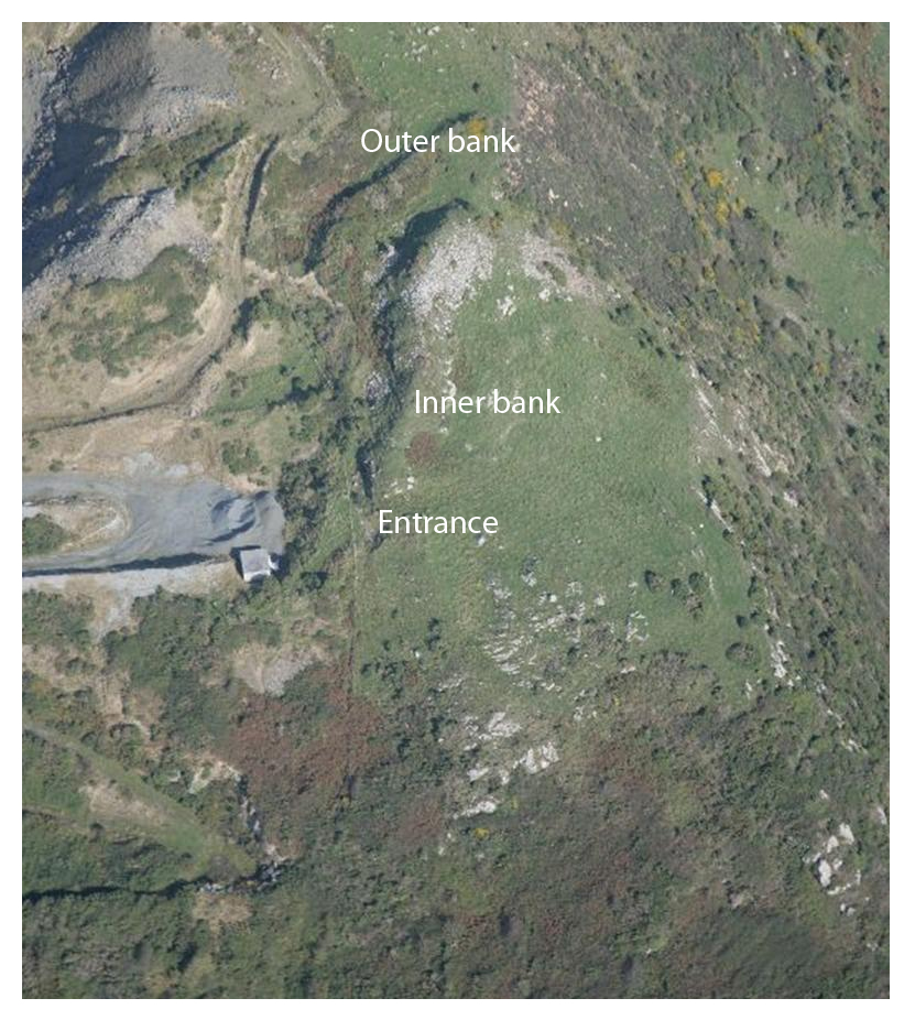
Aerial view of Llechlwyd, annotated. Source of photograph: Coflein
Llechlwyd is something of a curiosity. Although it has excellent views over the Dysynni valley and the coast to the north and south, it is in a very low position relative to the line of the hill above and behind it, with absolutely no visibility of anyone approaching along the ridge. Although there are two banks and ditches across the promontory, it would be incredibly difficult to defend if the promontory was approached from the rear. This would argue that either it was used in conjunction with Tal y Garreg hillfort, or that its purpose was not defensive. Tal y Garreg today is often hidden within low cloud, not an ideal feature for a site presumably located at least partially for its views over the surrounding landscape. In the Iron Age the temperature fluctuated, but was generally far more wet and cloudy than in the preceding Bronze Age. This might be a good reason for establishing a secondary, lower fort to maintain clear visibility even in bad weather. Unfortunately, it is not known whether Llechlwyd and Tal y Garreg were actually contemporary.
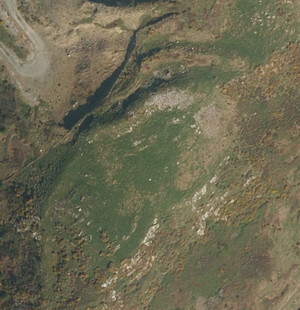
Another view of Llechlwyd. Source: Apple Maps
The quarry has removed part of the site, but the remaining banks and ditches are still visible and the aerial photographs above and left show where the large banks and entrance are located along the promontory. The big inner rampart, 3.6m high, consists primarily of stone. The outer rampart is 3.2m high and the ditch 1.9m deep. The entrance, at the west end, is in-turned and sits on a steep slope of the hill. The steep sides provided enough protection on three sides, and the banks and ditches were used to secure the access to the ridge. No excavation or geophysical survey have taken place, and the aerial photographs reveal nothing about what may lie beneath the surface of the hillfort, so we remain ignorant of any possible hut circles or storage structures.
 The hillfort has lines of sight to Bwlch hillfort on Foel Llanfendigaid, c.2km to the north, and Craig yr Aderyn (Bird Rock), c.8km to the east. Its main views are over the Dysynni valley immediately at its foot, as far as Craig yr Aderyn, and along the coast to the north and south. The modern quarry makes the lines of sight between Llechlwyd and Tal y Garreg difficult to assess. It is possible that the occupants of Llechlwyd would have been able to see a stretch of the ramparts of Tal y Garreg, and by the same token the occupants may have been able to see into Llechlwyd, but it is also possible that the topography blocked the line of sight completely. It is a marvellous spot for a look-out over the lowlands, but, as mentioned above, to its rear it is overlooked by a steep slope that links the promontory with the rest of Mynydd Garreg.
Looking down over Llechlwyd promontory hillfort, with the Dysynni and the sea beyond
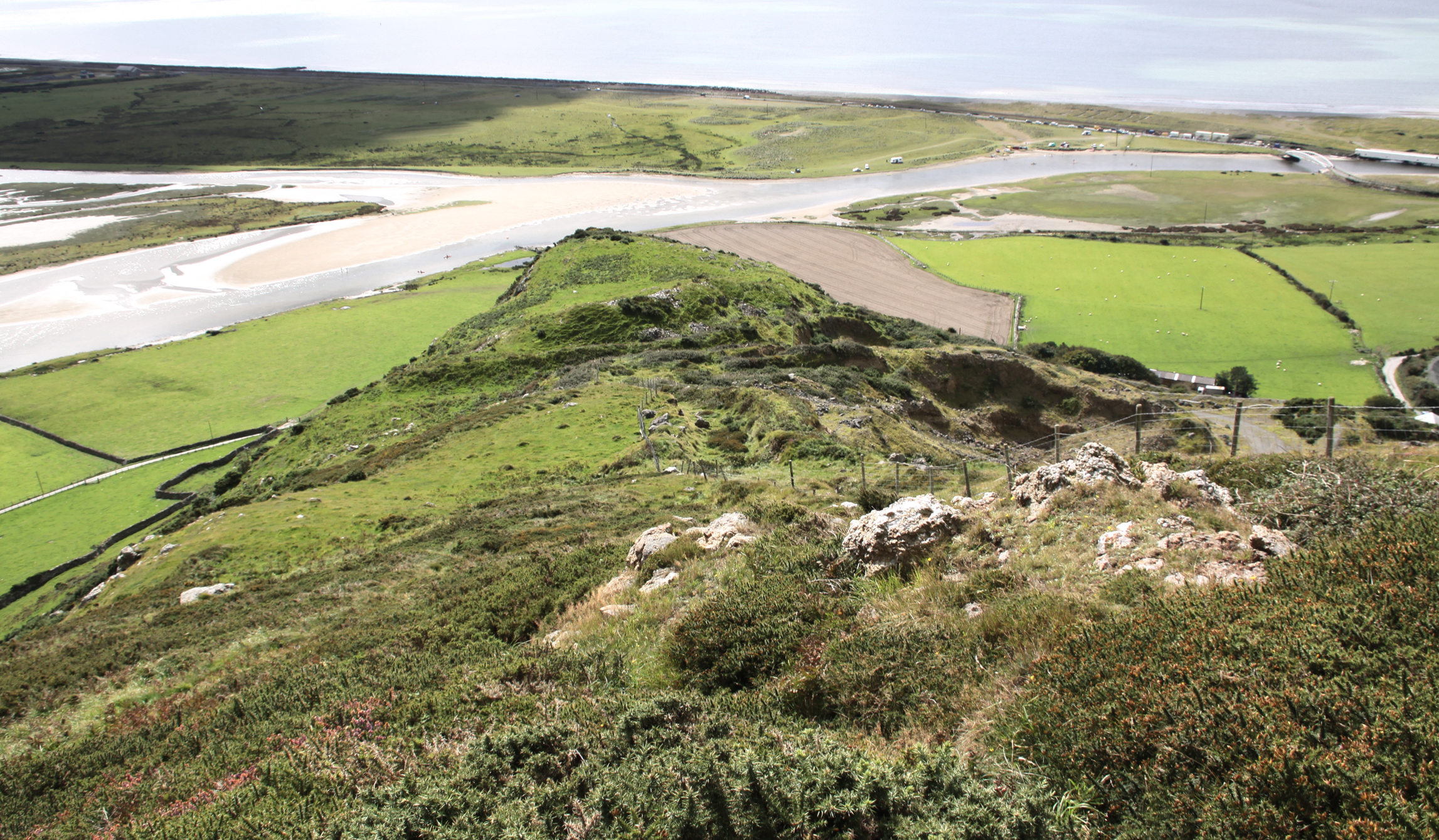
View over the Dysynni Broadwater. The valley will have had a different look to it during the Iron Age, but will have had a similar value for subsistence strategies

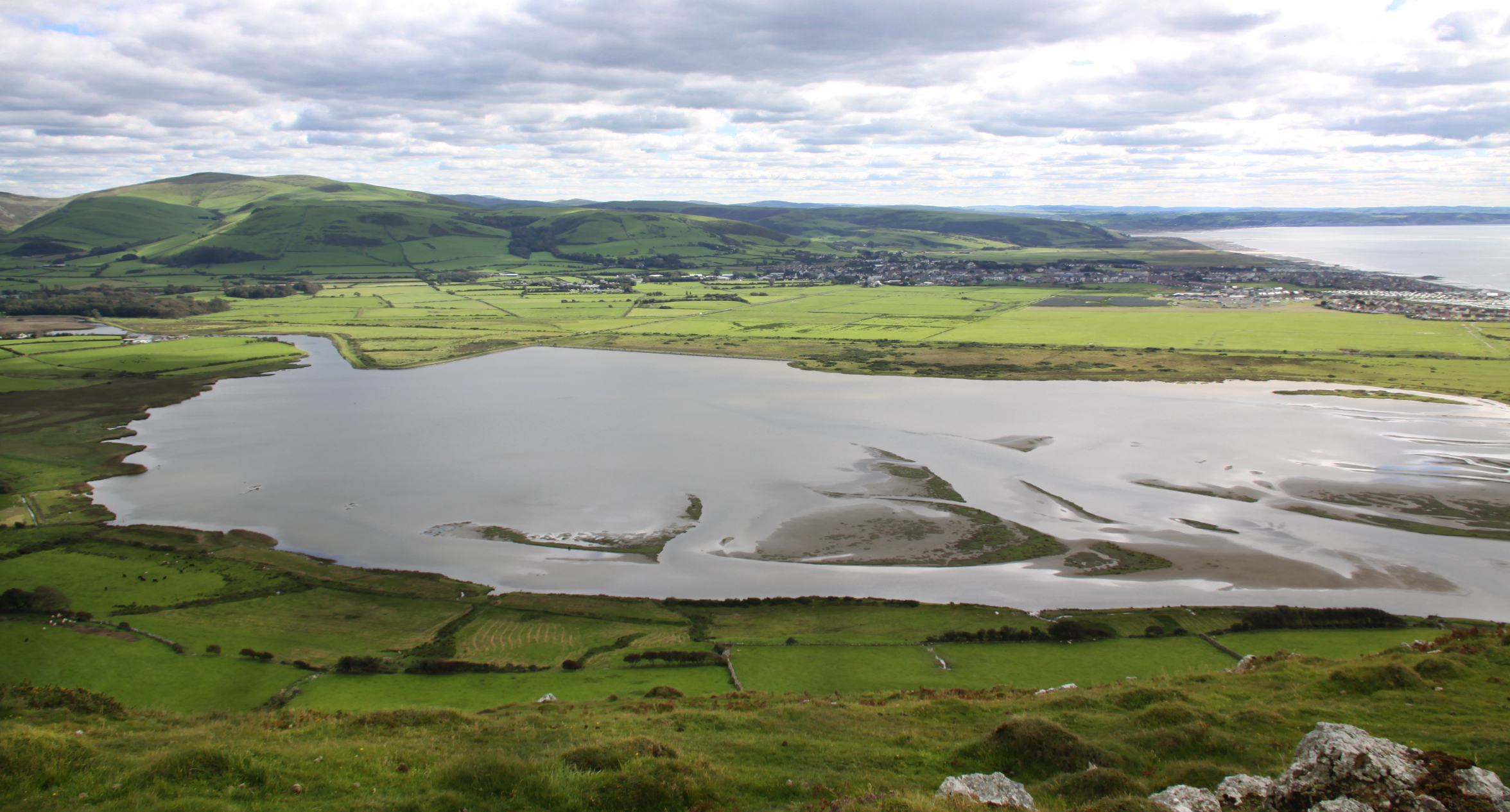
View across the broadwater towards Tywyn and over Cardigan Bay
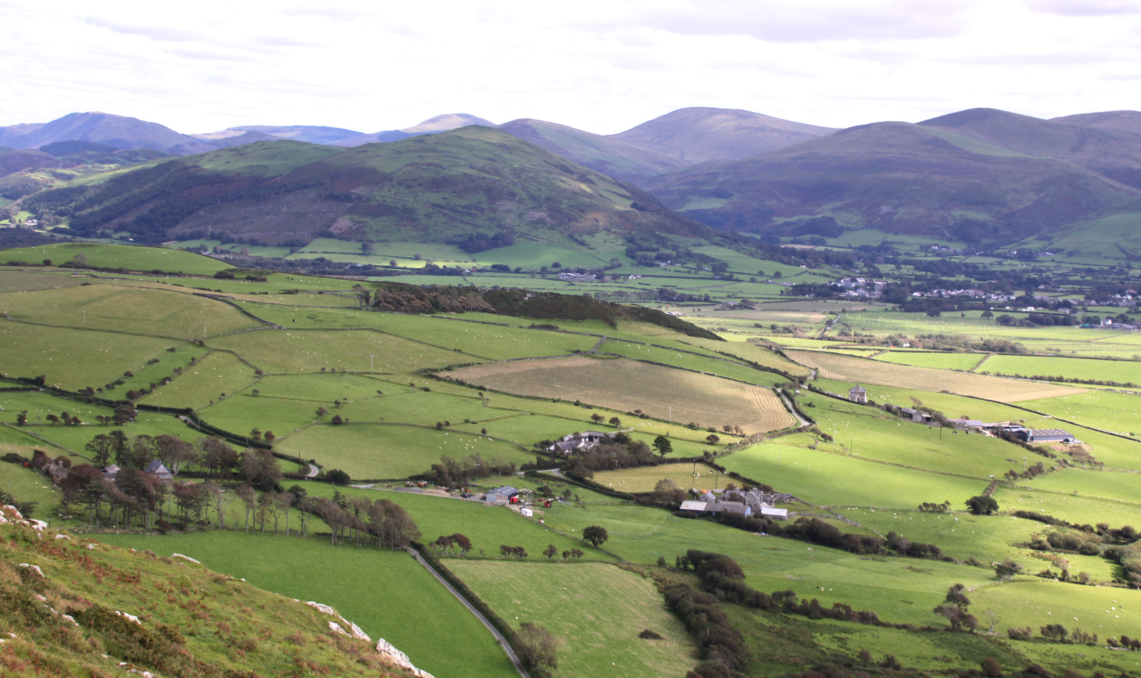
View to the east

A very murky view of Craig yr Aderyn (Bird Rock), upon which another hillfort was built, to the east of Llechlwyd and Tal y Garret
A view to Bwlch hillfort to the north, with the Llyn Peninsula visible on the horizon.
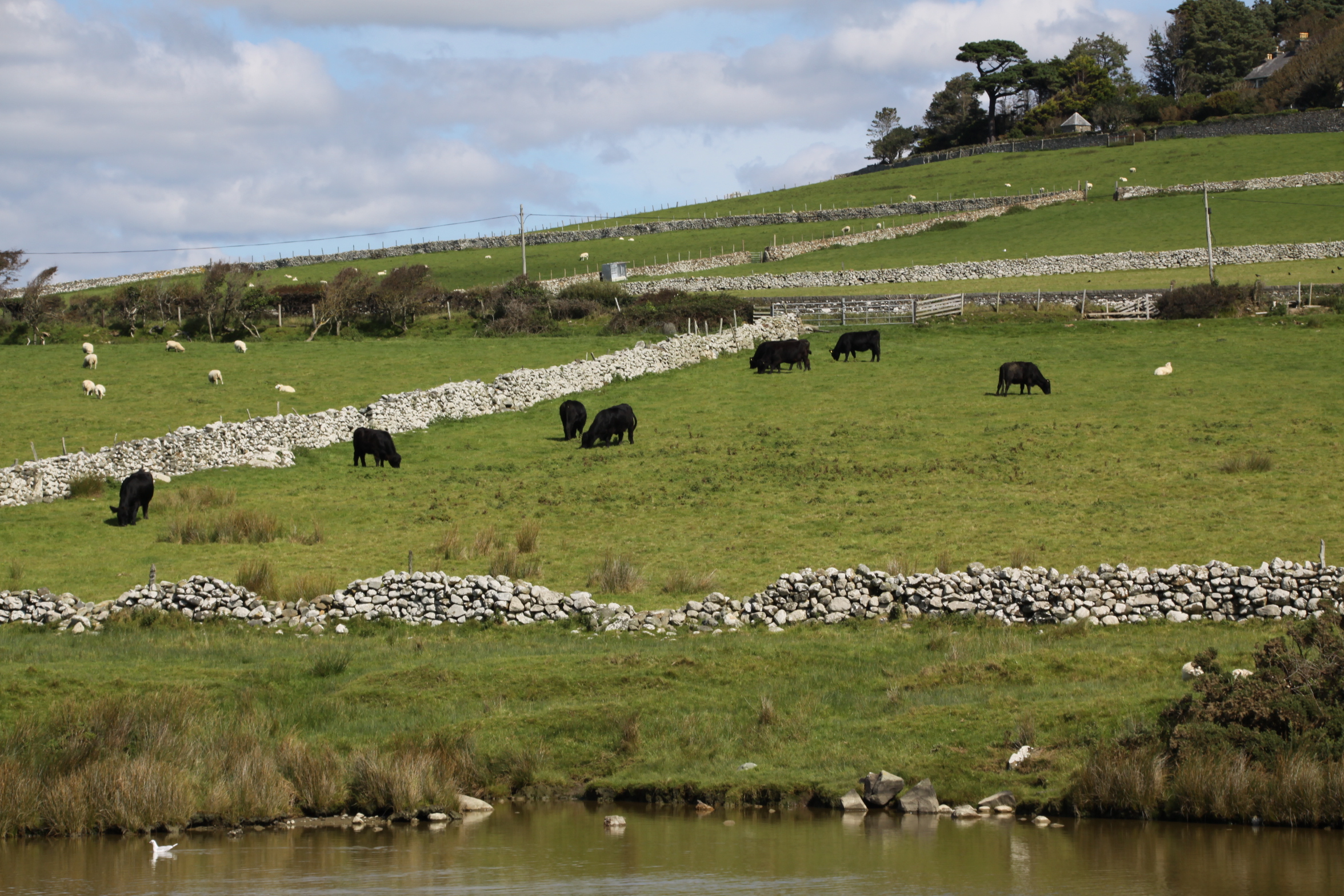 There are no signs of Iron Age domestic structures hereabouts, but they will have been somewhere in the valley, visible from the hillfort, distributed at a similar frequency to modern farmsteads. Livestock herding was probably the most practical subsistence activity, just as it is today.
At the other end of Mynydd Garreg, about 1.5km away, shown on the map above, is the hillfort Castell Mawr. It is not visible from Tal y Garreg or Llechlwyd, Castell Mawr has a secondary enclosure attached to it, which may have been used for corralling livestock. If the area’s hillforts were related and friendly, it may be that Castell Mawr was used as a local livestock trading point, or as the gathering point for moving livestock further afield. Without excavation such musings are pure speculation, particularly in view of the fact that it is not known if they were contemporary, but these are the sort of question that excavation might help to answer. Excavation could provide insight into construction methods and artefacts, both of which could give an idea of the date of construction and the usage of the site, and would help to establish the chronological relationship between neighbouring hillforts and between these and the hillforts of other areas.
Sources:
Bowen, E.G. and Gresham, C.A. 1967. History of Merioneth, volume 1. From the earliest times to the Age of the Native Princes. The Merioneth Historical and Record Society.
Gwynedd Archaeological Trust 2009. A visitor guide to the main Iron Age hill forts of Meirionnydd. Project No. G1770. Report No. 839
Sjöberg, K.S. 2014. Hidden possibilities. Possible uses of hillforts in southern Gwynedd, north-west Wales. Unpublished Masters thesis, Uppsala University, Department of archaeology and ancient history. http://www.diva-portal.org/smash/record.jsf?pid=diva2%3A799381&dswid=8151
Websites:
Archwilio
https://www.archwilio.org.uk/her/chi1/arch.html?county=Gwynedd&lang=eng
Coflein
https://www.coflein.gov.uk/
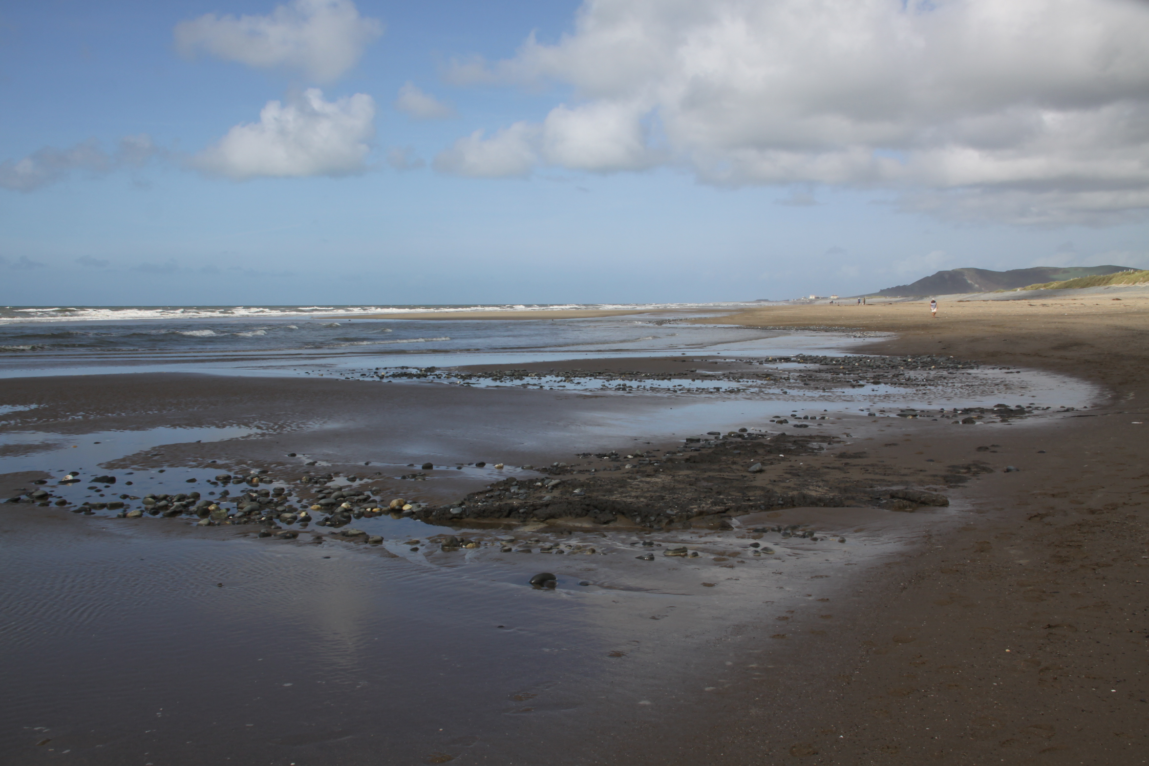
 After a walk along the Dysynni last week, I did a three point turn by the footbridge and drove back along the line of the railway. Instead of turning left to head back towards Tywyn I decided to turn right over the level crossing and park up to see if I could reproduce the picture from the Cardigan Bay Visitor that I posted last week. Unfortunately for that plan I had reckoned without the addition of a caravan park since the original illustration was drawn, and both the railway track and the village were completely hidden behind it. On the other hand, the beach at low tide was a complete revelation.
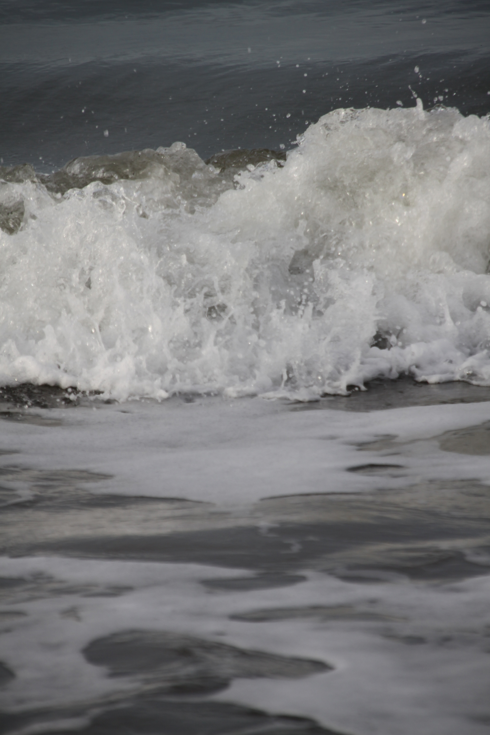
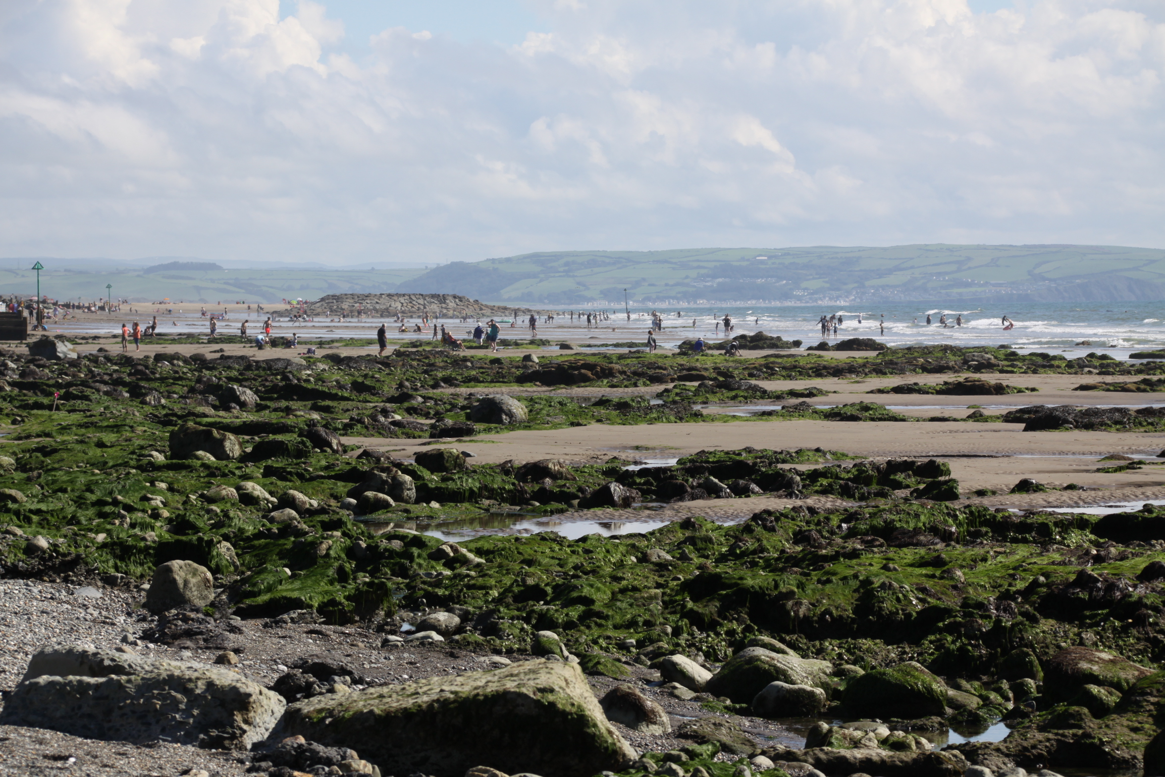 This part of Tywyn is apparently called Sandilands, but is something of a misnomer. There is certainly sand on the beach, but mostly it is a mixture of fine and coarse gravel, surprisingly harsh on the feet, with some swathes of pebbles around, all divided by wooden breakers. I had never seen it at low tide, and was amazed to see that the sloping beach ended in huge green-topped rocks and lovely weed-filled rock pools with sand between them, with an enormous stretch of wide open sea on the other side. The sea was splendid, with lovely white-topped waves chasing each other in, crashing on the rocks and pebbles and sounding just what a seaside should sound like.

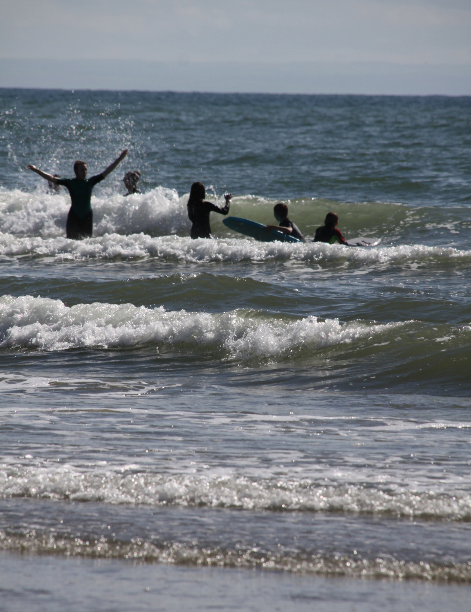
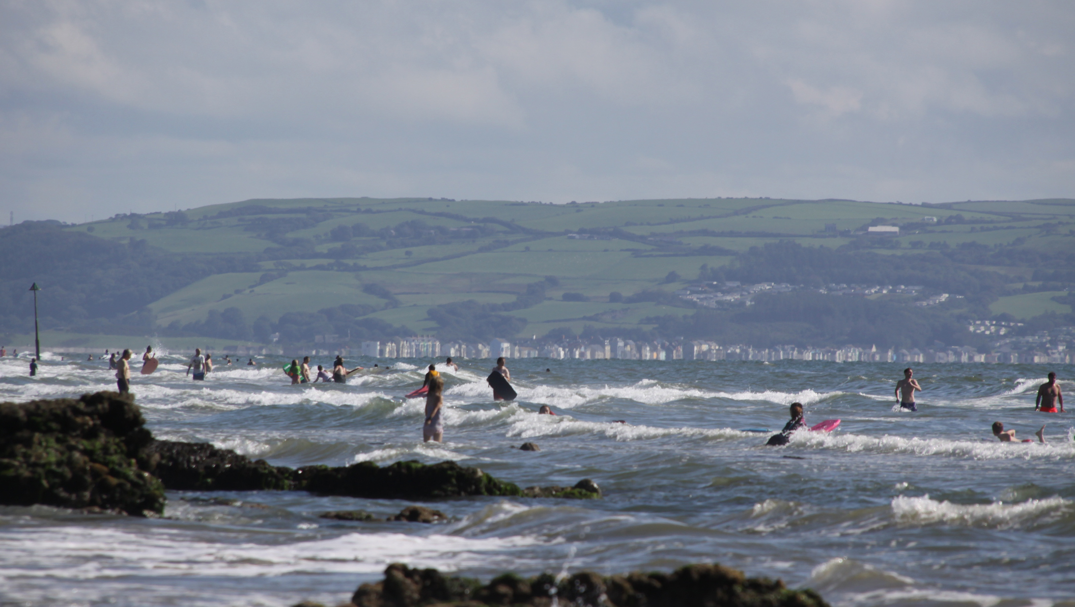 There were quite a few people around, most large family/friend groups, but not so many that social distancing was a problem, and it was all terribly civilized. I had really enjoyed having the Tonfanau beach all to myself, but it was also splendid to see people of all ages launching themselves into the waves and having a really great time. The caravan park overlooking the beach takes the edge off the beauty of the place, but keep your eyes facing seawards and there is nothing to disappoint.
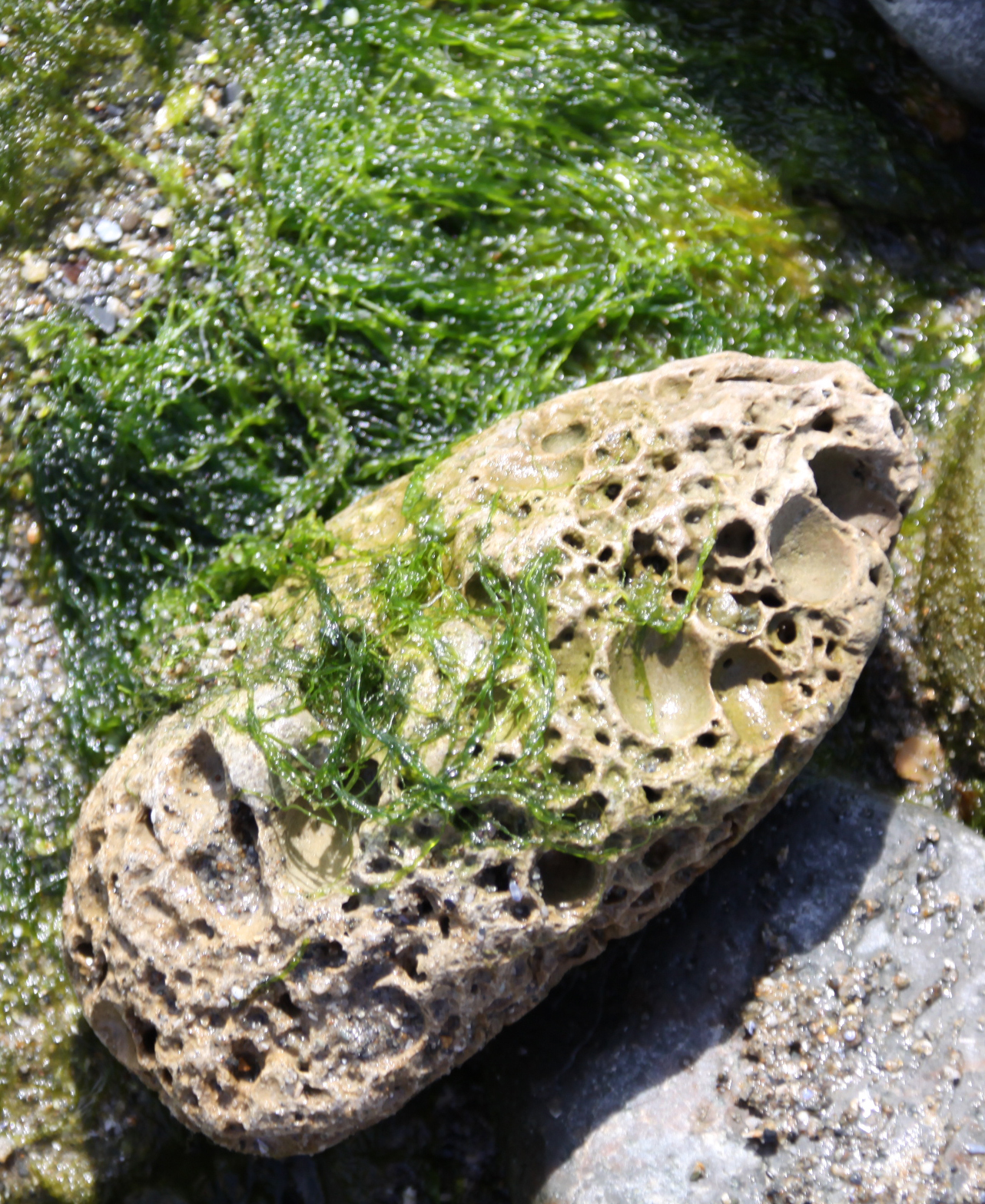
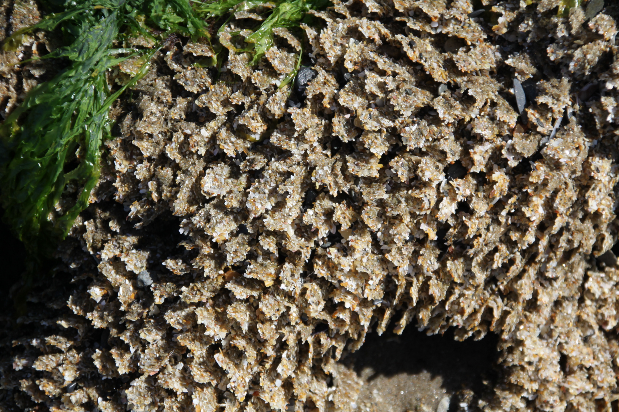 I was intrigued by what looked like huge boulders made of coral. When I stooped to touch one, it was clear that these rock-like structures were made of sand, and consisted of fine walls dividing thousands of tiny tunnels. The beach is full of them, and they are really very lovely. After a rumble round the web I found that they are Honeycomb worm (Sabellaria alveolata) colonies. The reef structures resemble honeycomb. The colonies form on hard substrates and they need sand and shell fragments for tube-building activities. They manufacture the tubes from mucus to glue the tiny pieces together. When the tide is out the worms retreat deep into the tunnels, but when the tide covers their reefs their heads protrude and they feed on micro-organisms in the water, including plankton.

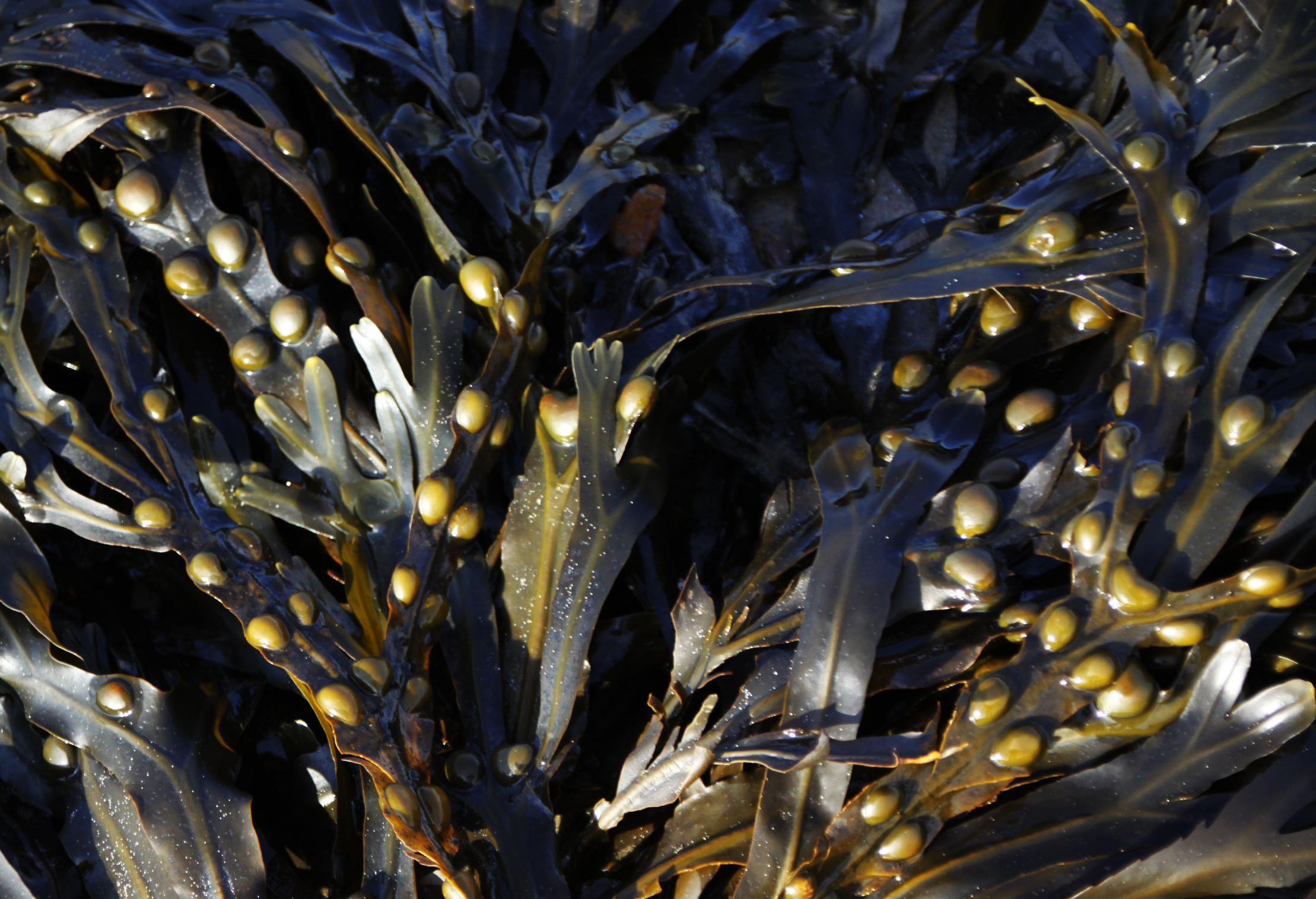
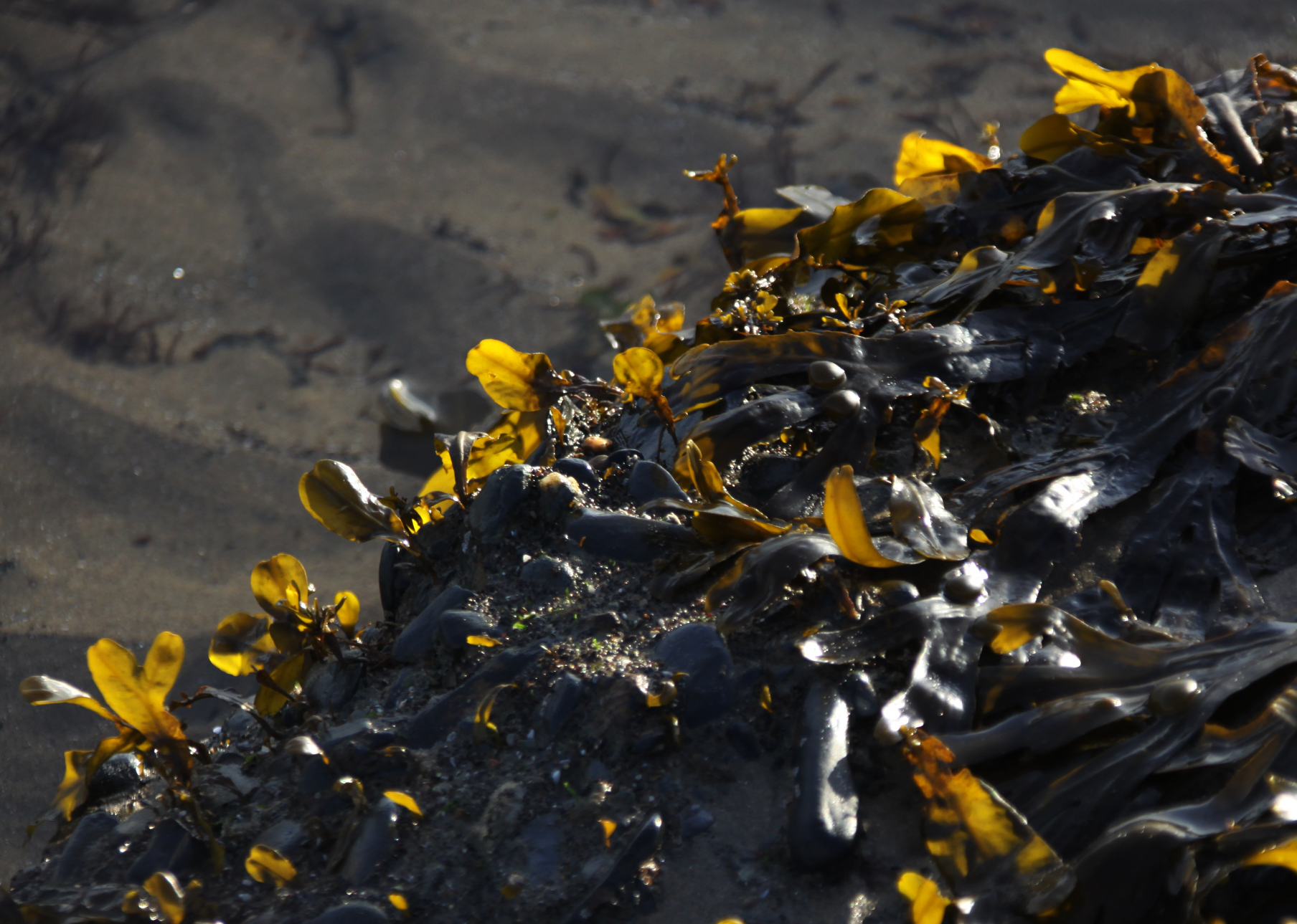
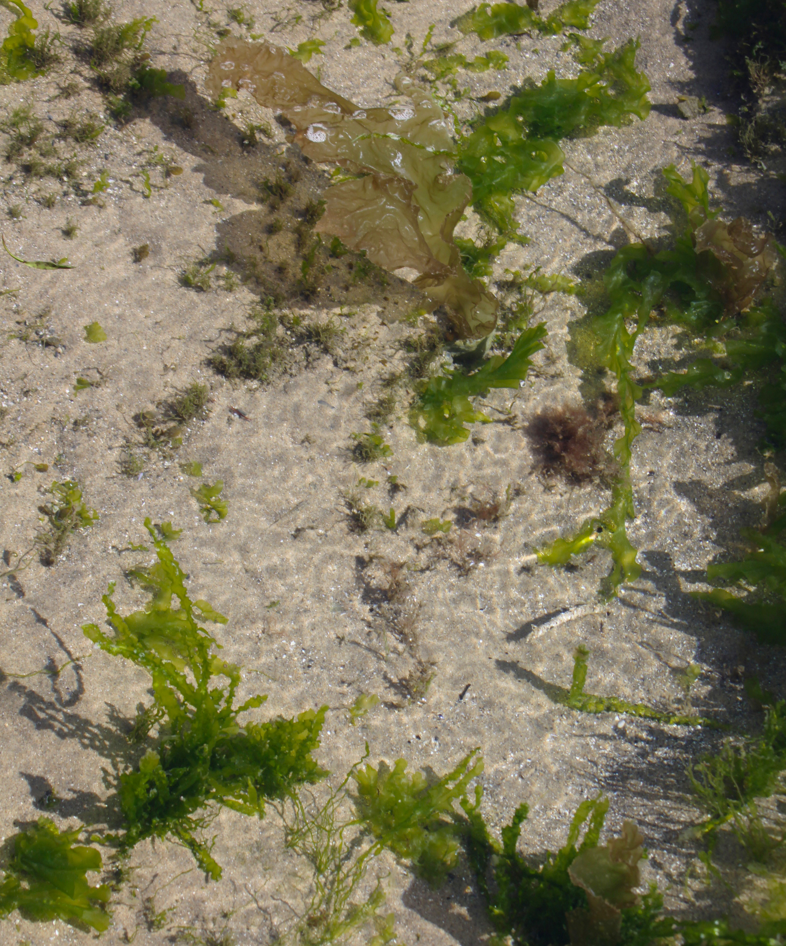
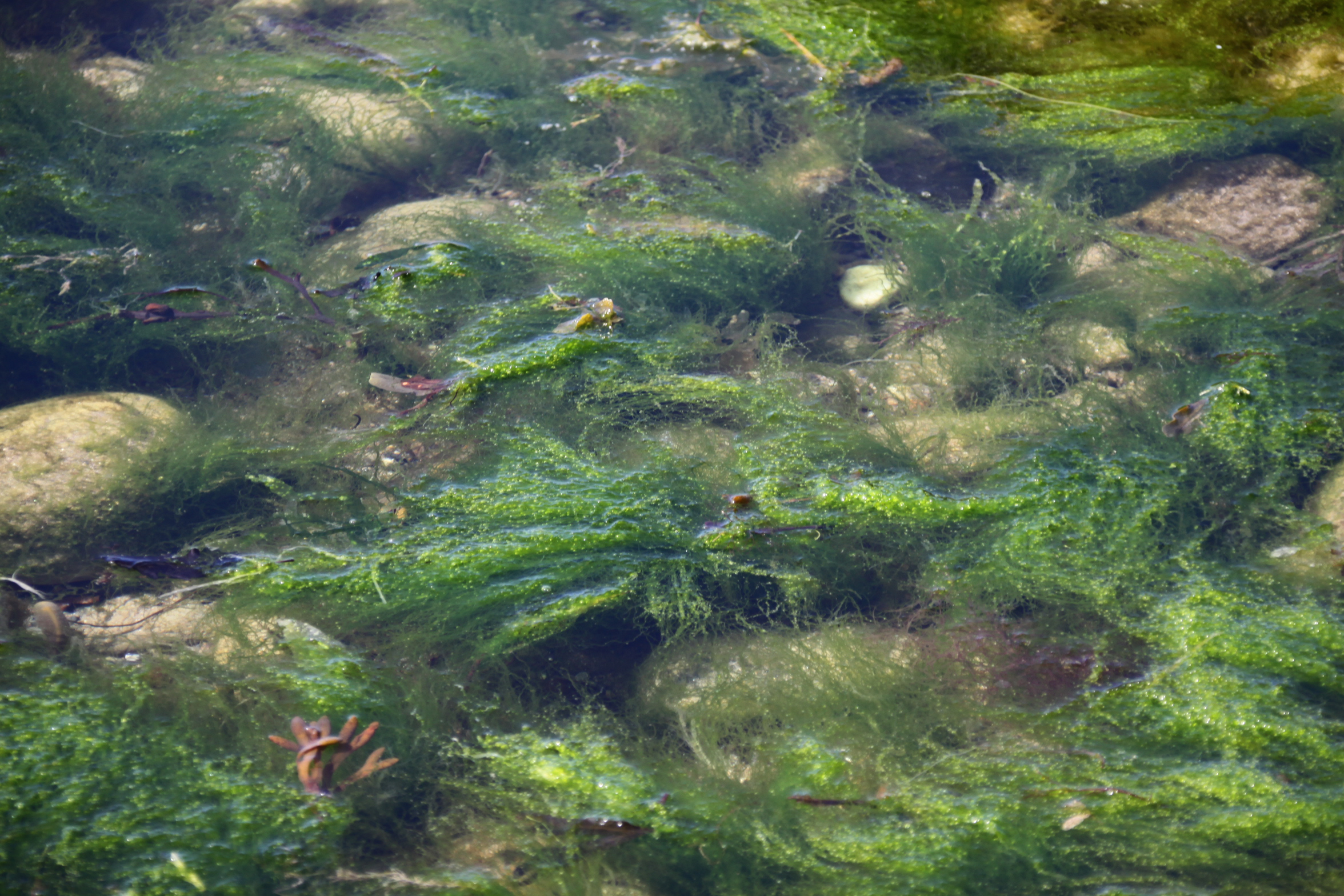
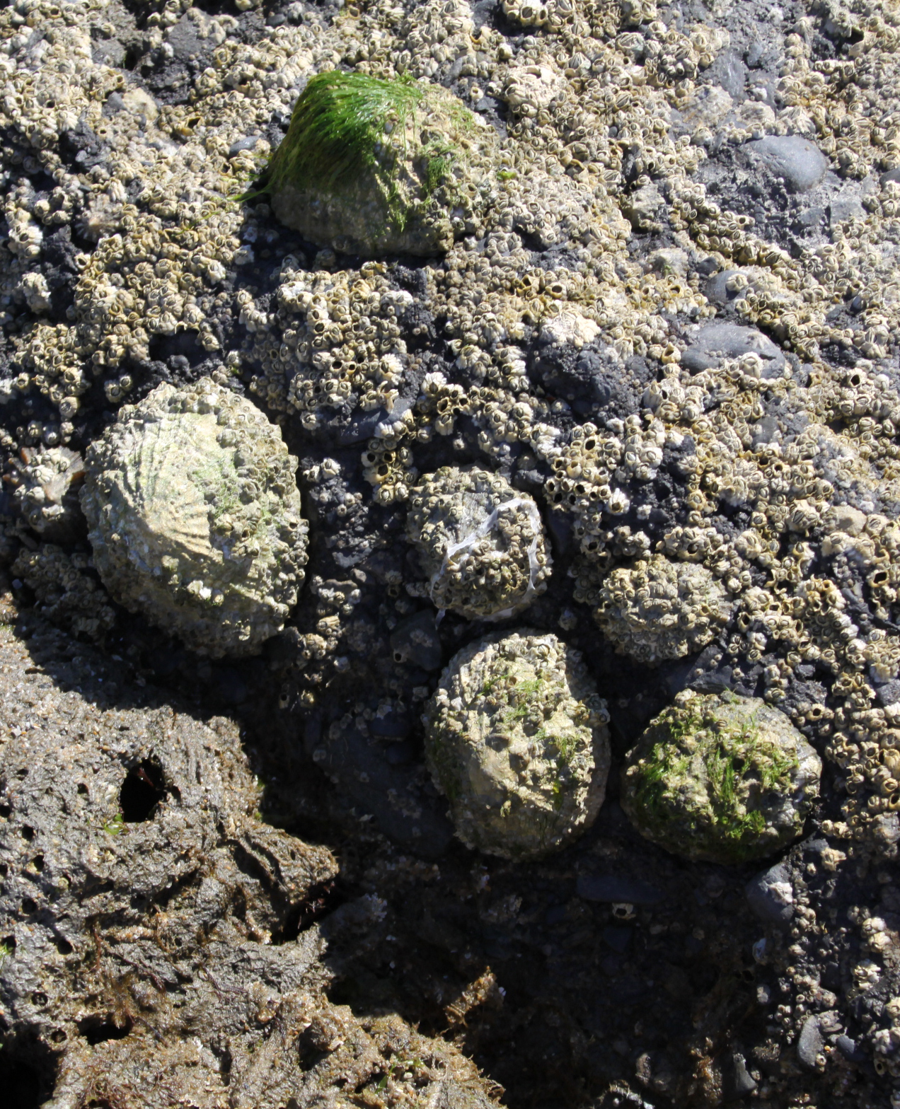 Because there are rock pools, it is possible to see various seaweeds in their natural habitat floating freely in the clear water, a lovely kaleidoscope of colour. In the pools themselves there were lots of tiny fish, which can be seen in the video. On the actual rocks (rather than the honecomb worm reefs) there were limpets, barnacles and various sea snails, none of which we have in Aberdovey due to the lack of rocks. Of course there are none of the shells that Aberdovey’s beach has in such profusion, because they get broken up on the rocks and pebbles but, together with the pebble beach at Tonfanau, it’s super that there are three such contrasting beaches such a short distance apart.
 I had a lovely long paddle, and would have loved to have had a swim, but even if I had gone in with my denim shorts and t-shirt, I had no way of drying myself off. Next time for sure, and I’ll start to keep a towel in the car!
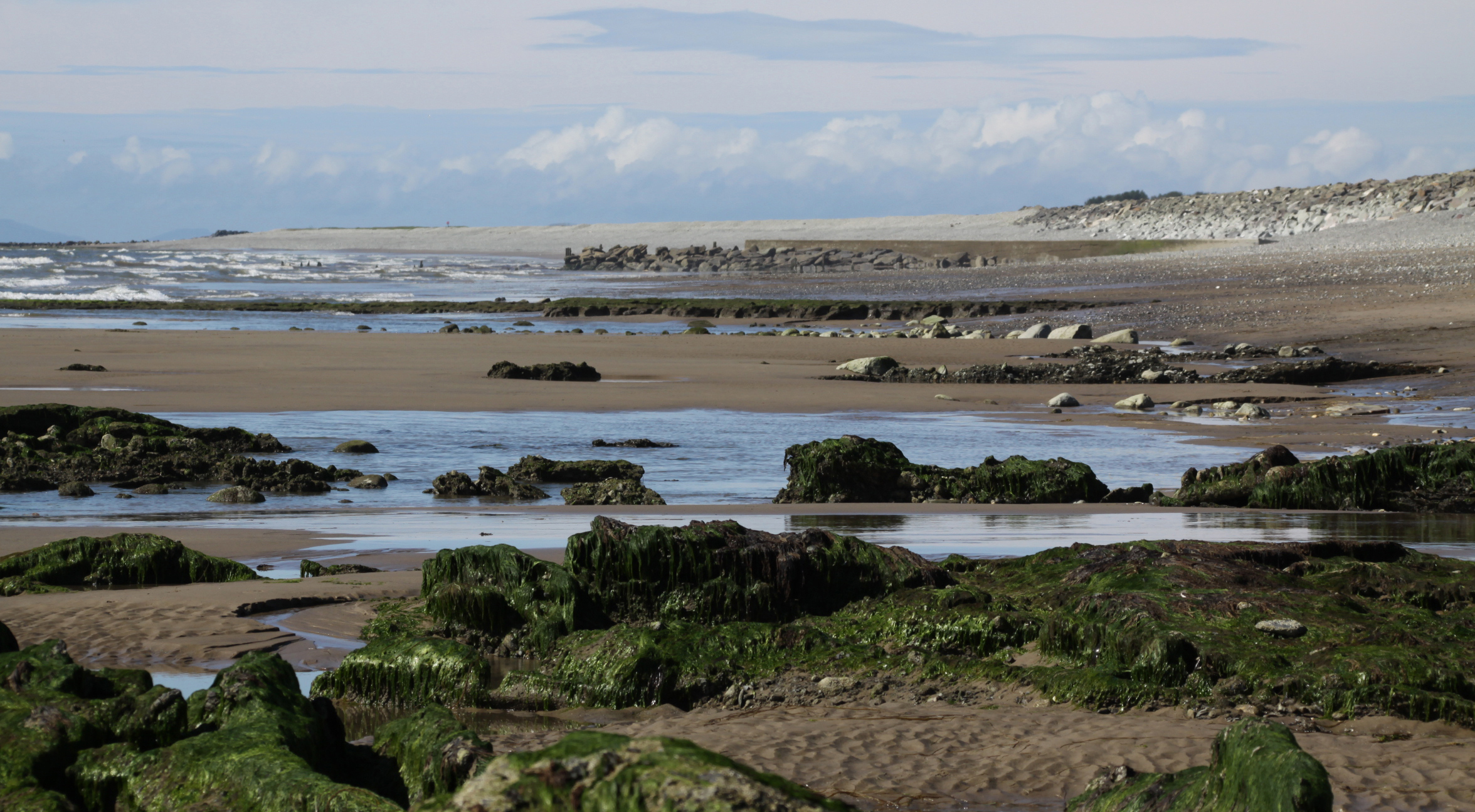
Looking to the north, beyond the caravan park and the breakers, the beach was quite, quite empty. That too is a walk for another day, but it must be a really peaceful way of walking up to the Dysynni.
The video below captures some of the contrasts of the beach – people swimming and enjoying the waves, lovely coloured seaweeds in rock pools, sections of empty sea with waves chasing each other onto the beach, and that fascinating honeycomb reef.
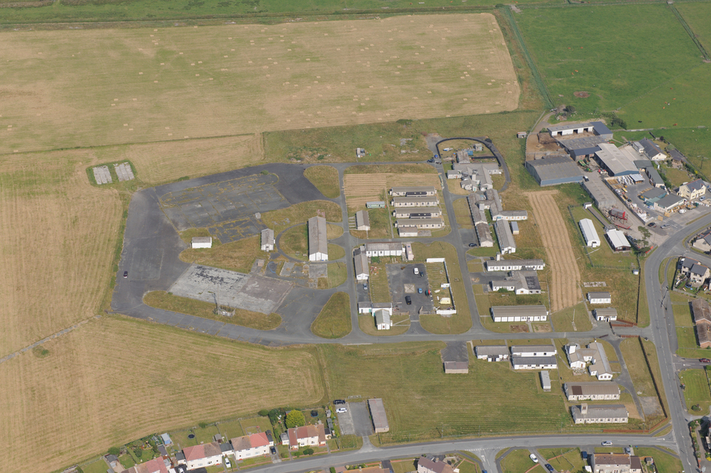
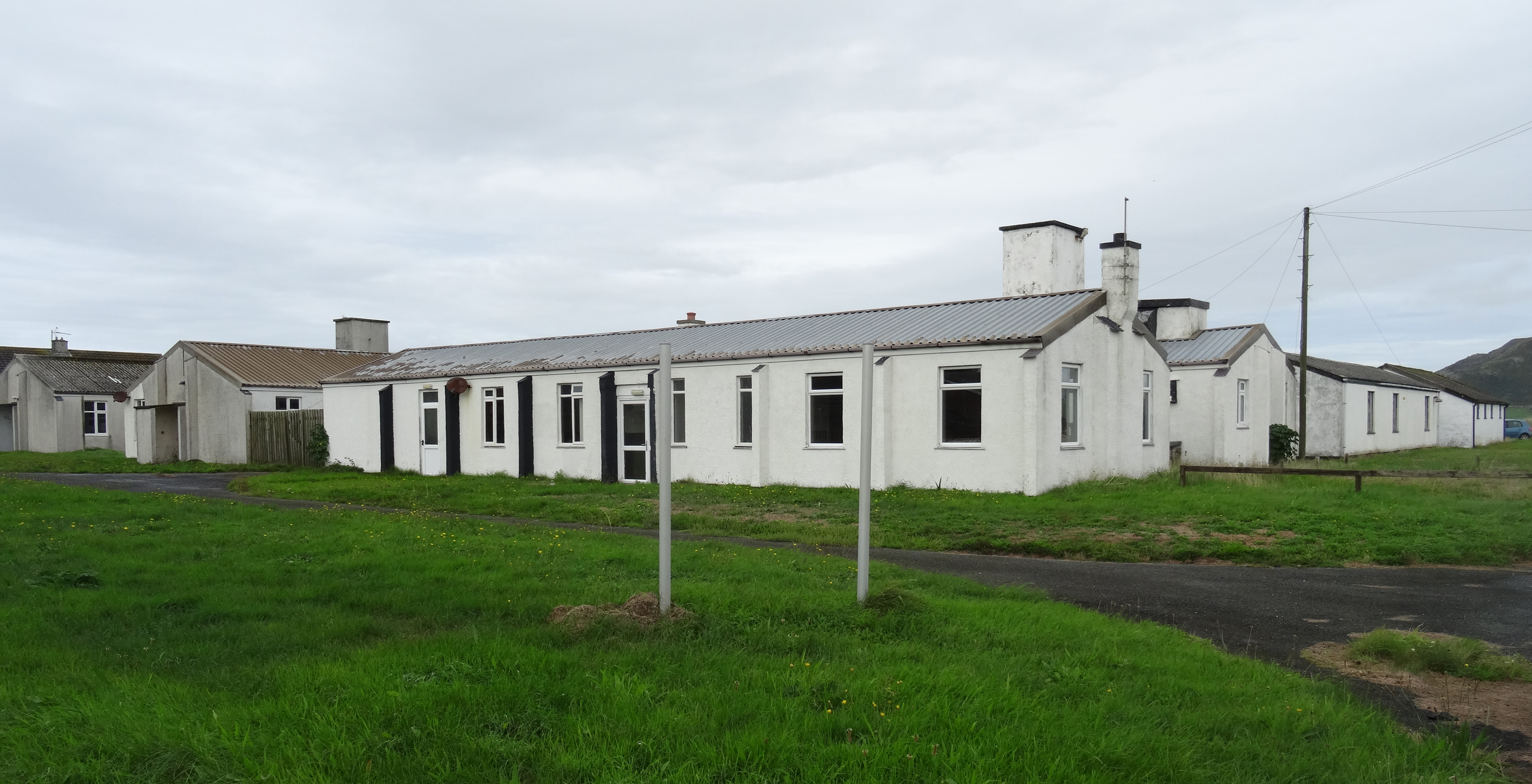
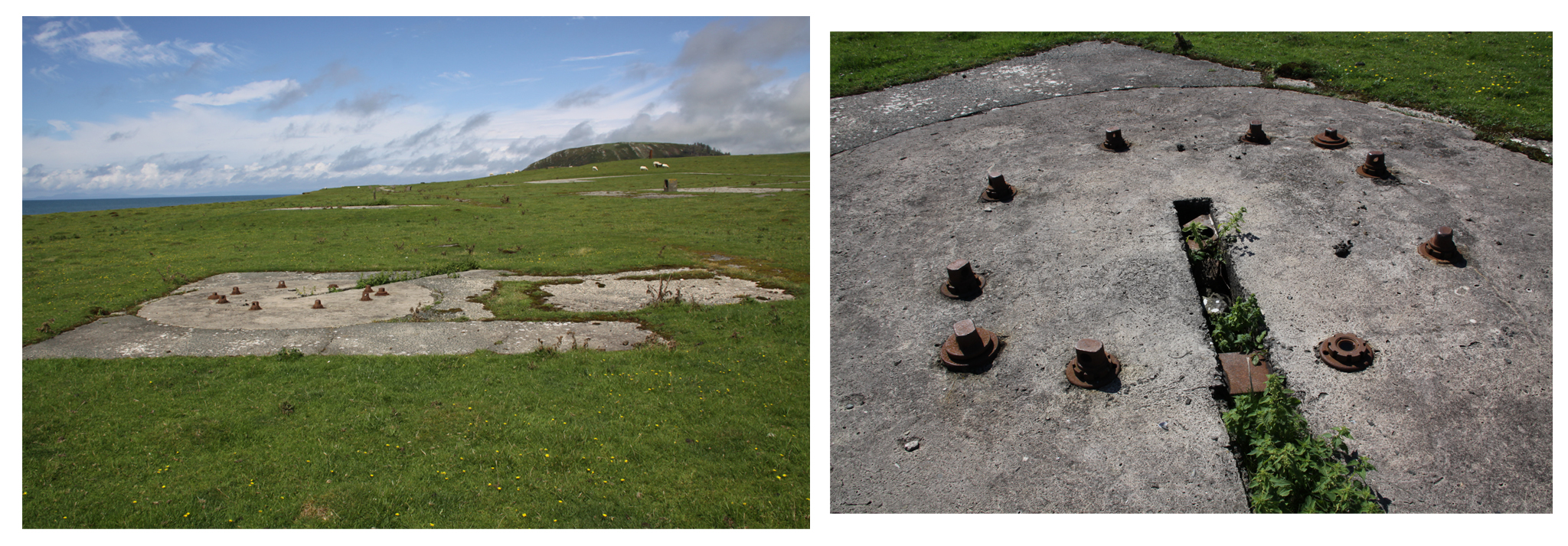
RAF Tywyn as it is today, near the beach off Sandilands Road. The concrete hard-standings are where two hangars once stood Source: Coflein, catalogue no. C679084
In Tywyn, if you head past Idris Villas and carry on down Sandilands Road towards the level crossing, you will pass what remains of RAF Tywyn, which comprised a camp, hangars, airfield, control tower and transmitter. It was built on a large piece of flat grassland belonging to Morfa Farm and later known as the Morfa Camp. Morfa means marsh/bog, and Roy Sloan reports that it flooded frequently, to the extent that damage was sometimes inflicted on planes as they attempted to take off and land, and the station’s aircraft occasionally had to be moved to RAF Llanbedr. The majority of the wartime buildings have been demolished. Most of the information in this post comes from Roy Sloan’s 1991 book Wings of War Over Gwynedd, full details of which are listed below under Sources, with my thanks to the author.
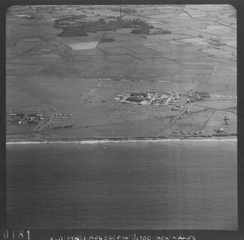
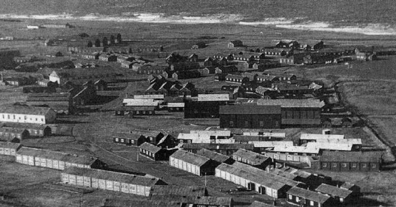
RAF Tywyn. Aerial Photograph 540/373/UK/3611/0181 from 1st July 1950 showing airfield and tented barracks. Source: Dyfed Archaeological Trust, Report 2015/32. Copyright National Monuments Record of Wales
The purpose of the camp was mainly to engage in anti-aircraft co-operation duties, which primarily involved supplying target practice for anti-aircraft training in Tonfanau Camp, which had been established on the coast a few kilometers to the north of Tywyn in 1938 (described on an earlier post).
The camp and airfield was built during the summer of 1940 and opened on 8 September 1940 as an air-cooperation base for the Royal Artillery Anti-Aircraft Practice Camp at Tonfanau. It was under the control of No.70 Group, Army Co-Operation Command, which was created in December 1940 to facilitate joint British Army and the RAF activities where air support to the Army was likely to be vital. Its Commanding Officer was Squadron Leader Irens, recently promoted from the position of Flight Lieutenant, and the personnel numbered 12 officers and 226 airmen. Two flights were assigned to RAF Tywyn. “Flights” were units that consisted of a small number of planes (usually no more than six), their aircrews and ground support. The two assigned to RAF Tywyn were from No.1 Ant-Aircraft Unit (AACU), called U-Flight and C-Flight.
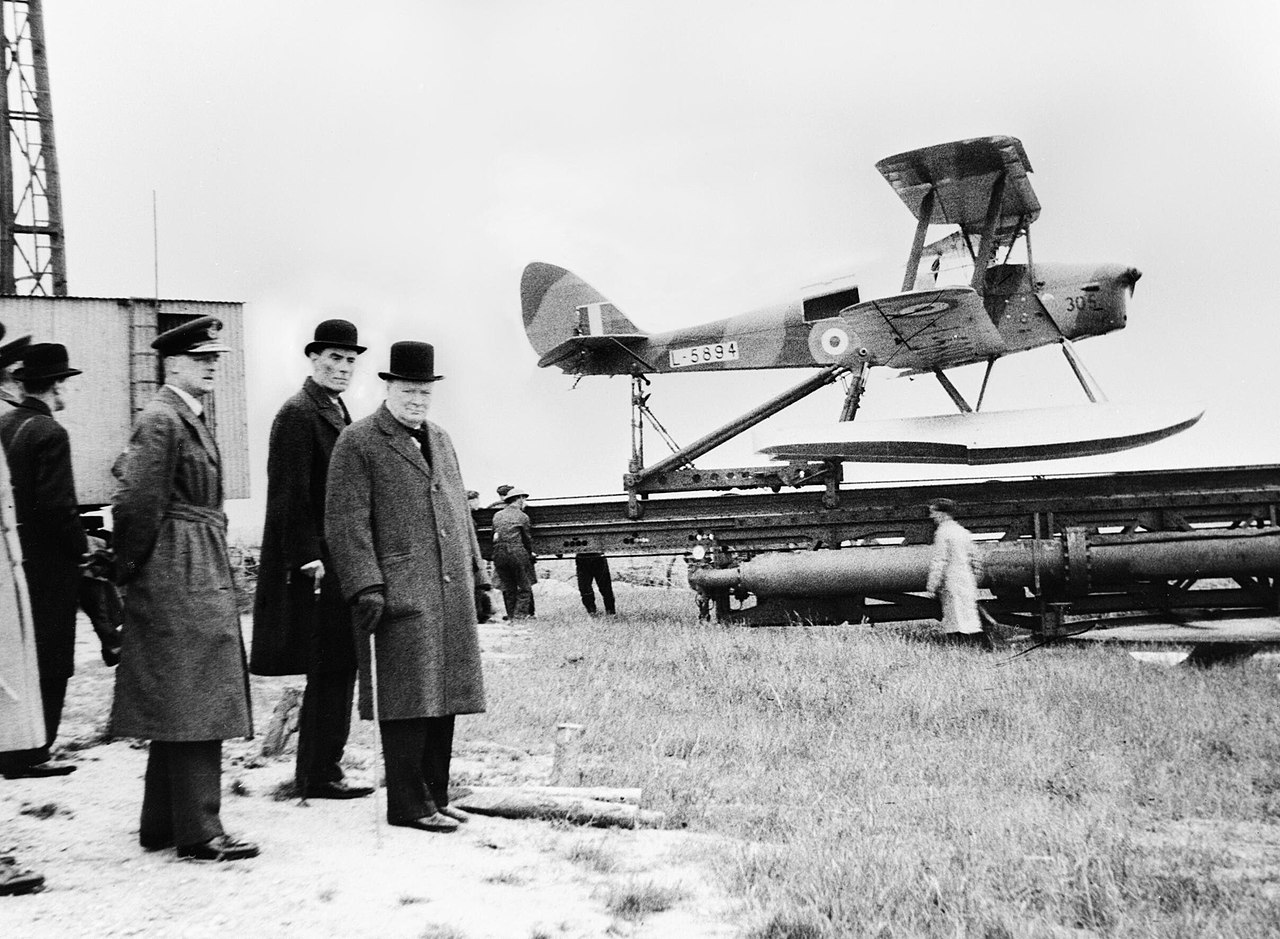
Winston Churchill, David Margesson and others waiting to watch the launch of a DH.82 Queen Bee target drone, 6 June 1941. By War Office official photographer, Horton (Capt) – Source: Imperial War Museums photograph H 10307
U-Flight specialized in de Havilland Queen Bee pilotless drones, the radio-controlled version of the Tiger Moth, and had relocated to Tywyn from RAF St Athan (Vale of Glamorgan, south Wales). C-Flight was equipped with Hawker Henleys, and had come from RAF Penrhos (Llyn peninsula, north Wales), arriving at RAF Tywyn in June 1941. In June 1942 these were joined by two Lysanders on detatchment from No.6 AACU. In November of the same year three Miles M.25 Martinet target tugs arrived when C-Flight became No.1605 Flight (all lettered Flights were to become numbered instead during the war). The unit lost one of this Henley’s, together with its pilot, in a crash in low cloud over hills at Penygroes at about the same time.
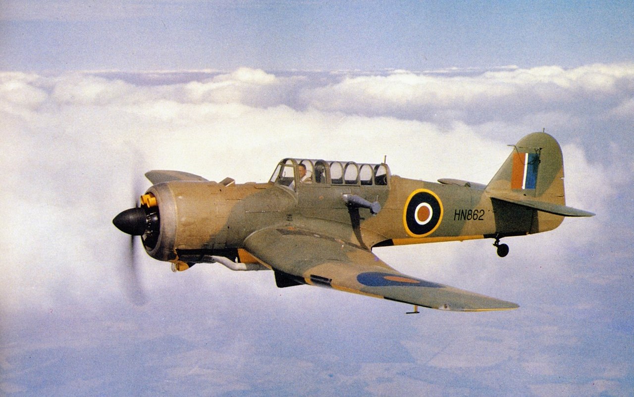
Miles Martinet TT Mark I in flight in c.1942. Source: Wikipedia
Maycrete hut, RAF Tywyn Morfa
The camp was built of pre-fabricated huts and hangars, plus a control tower. The Nissen huts were composed of corrugated iron sheets that form half-cylinders to create lightweight buildings. They looked like gigantic pig-styes, a half-tube of corrugated iron blocked at either end, one end containing a door for access. Maycrete huts are long single-storey rectangular buildings consisting of reinforced concrete posts supporting a pitched roof frame that supports corrugated asbestos roof panels. The hangars were all similarly made of prefabricated parts according to specific design standards and consisted of two Bellman hangars (walls and roof easily assembled from rolled steel sections),two Blister hangars (another pig-styie style arched structure made of corrugated metal on a wooden or metal frame, which does not need a solid base to be laid, and can be anchored with pegs), and two Bessoneau hangars (portable timber and canvas structures with a central ridge anchoring a slightly arched roof on vertical stanchions). Parts of the concrete aprons on which two of the hangars stood remain. The control tower was built to an RAF specification. A transmitter for control of the Queen Bee was installed in November 1940 but due to technical difficulties it was not operational until the end of February 1941.
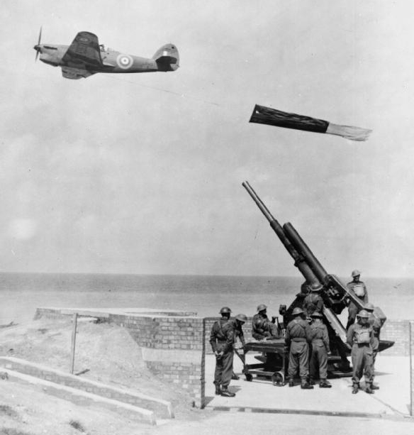
A Hawker Henley deploying a drogue target. Source: Ref: RAE-O 784a from the collections of the Imperial War Museums
When the station opened, the Queen Bee and the Henley were both used as targets for training. The Queen Bee was used as a direct target and the Henleys towed targets behind them. Offset aiming was supposed to protect the Queen Bee from destruction in these sessions, but when shot down, its controller would attempt to retrieve it. Unlike the Tiger Moth on which it was based, it had a light wooden fuselage that was a lot more buoyant that the Tiger Moth’s metal construction. Sloan says that the Queen Bee was quite sophisticated for its time, but was subject to fairly heavy losses when being used for target practice, as near-misses caused damage to its control system. The Henleys were manned by a pilot and drogue/towing operator. The drogue was a a canvas cylinder approximately 12 feet long and 4 feet in diameter. The Henley was not designed for use in target practice, and the drag of drogue towing often caused heavy engine strain. There were several accidents when engines malfunctioned or failed, and some deaths. Unlike the Henleys, the Martinets that arrived in 1942 were designed for towing, with a lot of attention having been invested into the cooling system to counteract the strain of towing heavy loads. In March 1944 two Hurricanes joined the station, and some of the Henleys were replaced by Martinets. Sloan says that by the end of December there were 21 aircraft at RAF Tywyn, 8 Hawker Henleys, 9 Miles Martinets, 2 Hurricanes, and an Oxford. The Queen Bees were no longer in use.
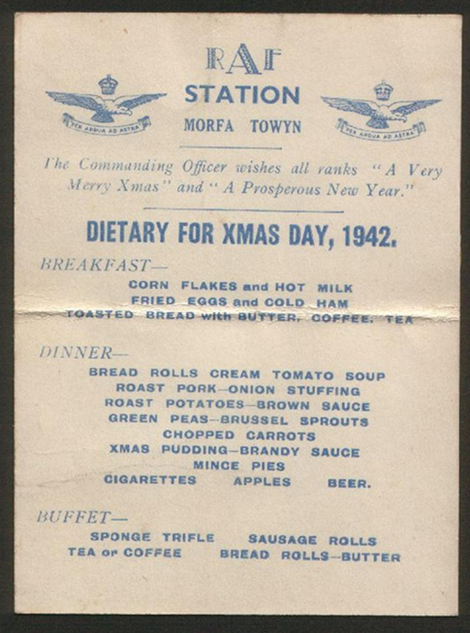
RAF Tywyn Christmas menu 1942. Source: Coflein, cataloge no.C554685
The Army Co-Operation Command was disbanded in 1943, as part of a general re-organization, and became part of the prestigious Fighter Command, which became responsible for the airfield in June of that year. In the December 1605 Flight, formerly C-Flight, was combined with 1628 Flight to become 631 Squadron, but it continued to be saddled with Henleys when most other towing squadrons were now using Martinets. Sloan says that by February 1944 the station’s complement was 16 officers, 25 non-commissioned officers (NCOs) and 185 airmen. In February 1944 one of the Henleys caught fire in the air and was ditched in the sea, very near the shore, with no loss of life. The plane was retrieved the next day by the Royal Army Service Corps (RASC) No.1 Amphibious Training Wing based nearby.
Sloan quotes pilot Bert Pudney as a source for what it was like to be a towing pilot. He had joined the RAF in 1937 at the age of 16. By 1944 he had the rank of Sergeant and was transferred to Tywyn in the May of that year to fly Henleys. The account covers two pages in Roy Sloan’s book, but here’s a short excerpt:
The were several types of target, the largest being red flag 40 feet long and 6 feet wide, which was towed at various heights at a distance of 2,000 feet from the beech at Tonfanau, where Royal Artillery units had their guns – 4.5s and 3.7s. We towed at 140 m.p.h. because anything faster would send engine temperatures up. Some of the shelling was erratic, sometimes the target was hit and it dropped into the sea, sometimes the wire was cut and we lost the flog, but quite often the RA gunners seemed to be aiming at me and not the flat. I remember my Target Towing Operator (TTO) once saying after a few shots surrounded us, ‘This is getting bloody dangerous, Skipper!’
We also used a variety of drogues, carrying about a dozen or so then streaming them with about 400 feet of tow for various bodies to shoot at, e.g. RAF Regiment, Commandos etc. Their bullets were dipped in various coloured paints and after a few passes the drogue was dropped to check which groups had hit the target. This was indicated, of course, by coloured hols in the white nylon.
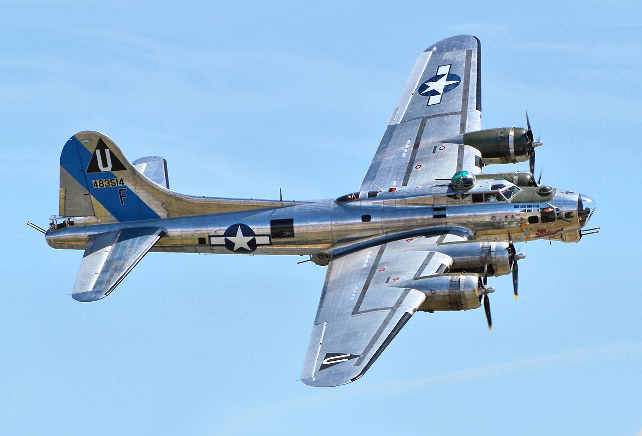
A B-17 at an airshow in 2014. Source: Wikipedia
Some excitement occurred in July 1944 when a USAAF (United States Army Airforces) B-17 Flying Fortress bomber returning from North Africa with the 390th Bomb Group became lost in bad weather and, short of fuel, the pilot identified the Welsh coastline and flew along it, deciding to attempt a landing at the Tywyn airfield. The bomber was huge, far bigger than anything that the airfield was designed to cope with, and the bomber not only overshot the airfield but crossed the railway line and ran into an air raid shelter. A fire in the wing was put out by the station’s fire tender and the local fire brigade. The occupants of the bomber were fine, but the aircraft itself was a write-off. The railway line was again a victim in February 1945 when one of two Hurricane crashes again crossed the line, again resulting in a write-off of the plane.
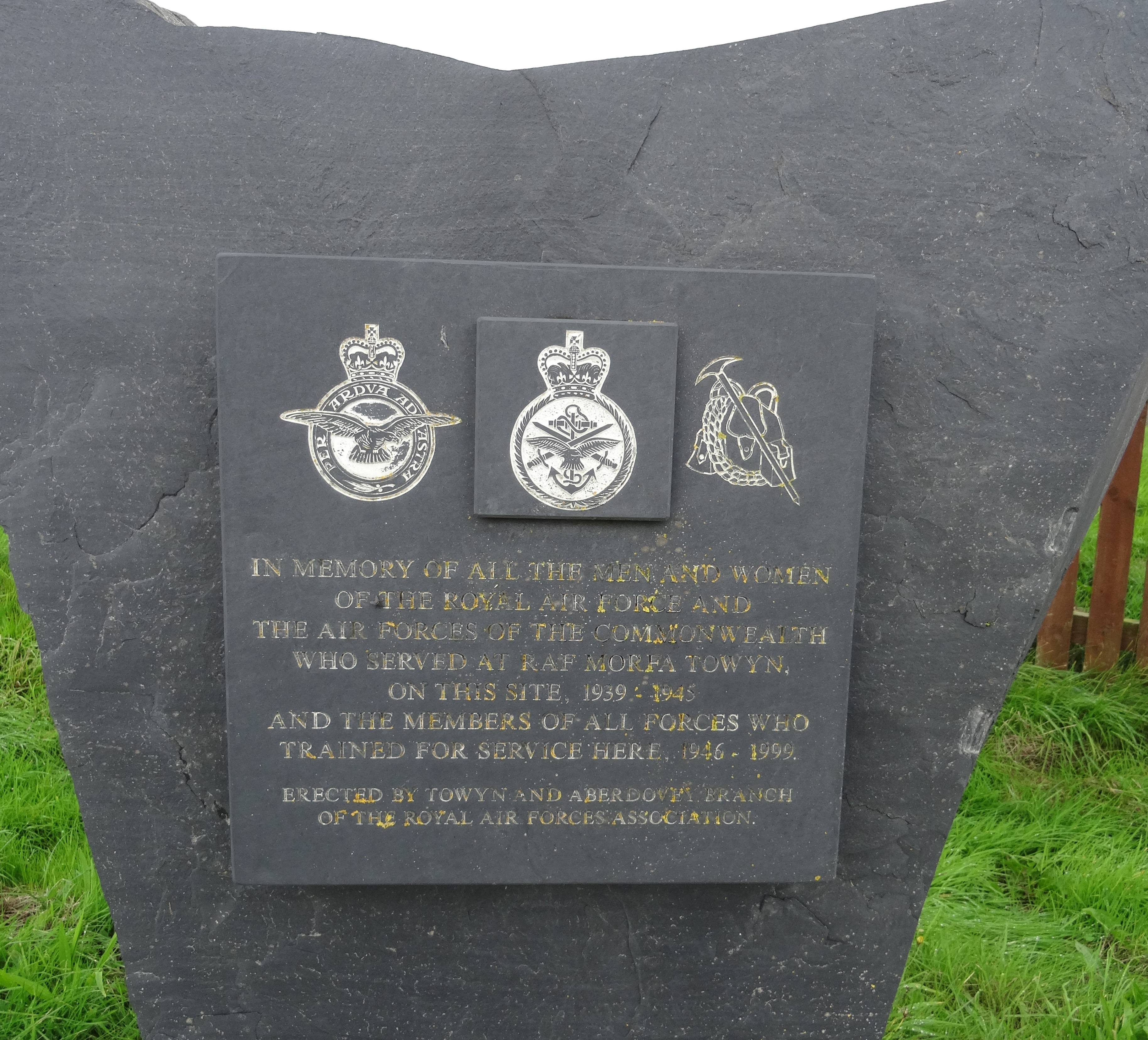
RAF Tywyn. The legend reads “In memory of the men and women of the RAF and the airforces of the commonwealth who served at RAF Morfa Towyn on this site, 1939-1945 and the members of al forces who traced for service here 1946-1999. Erected by Towyn and Aberdovey Branch of the Royal Air Forces Association
After the end of war 631 squadron were deployed to Llanbedr in May 1945 and were replaced by No.22 Group, Technical Training Command. On 25th July it was closed, but its life was not yet over. It was transferred to the War Office and became an army camp and Outward Bound school and then a Joint Service Mountain Training Centre, an Armed Forces training facility . The latter closed in 1999. The old airfield was turned into a sports field and following a number of feasibility studies in 2015, is now a solar farm. Morfa camp is now privately owned, and some of the buildings are apparently let out as storage units. There is a commemorative plaque mounted on a slate monument at the entrance to the former camp.
Sources:
Sloan, Roy 1991. Chapter 8, A Forgotten Airfield. RAF Tywyn. In Wings of War over Gwynedd. Aviation in Gwynedd during World War II. Gwasg Carreg Gwalch
I failed to get hold of the following book, but for anyone interested in finding out more, it might be worth tracking it down: Jones, Rees Ivor 2000. The Military in Tywyn 1795–1999: The Warlike Side of a Small Welsh Seaside Town.
Websites:
Airfields of Britain
https://www.abct.org.uk/airfields/airfield-finder/towyn
De Haviland Aircraft Museum – Queen Bee
https://www.dehavillandmuseum.co.uk/aircraft/de-havilland-dh82b-queen-bee/
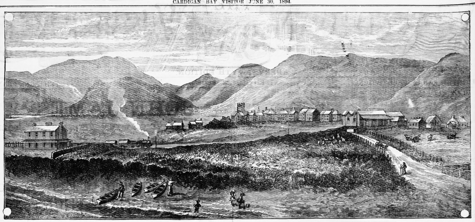 On the same page in The Cardigan Bay Visitor as the Aberdovey advertising feature that I posted about the other day, was this super illustration of Tywyn showing the steam train, 30 years after the railway opened, and boats pulled up on the beach. To get a better look, click the image to enlarge it, because the details cannot be seen clearly on the small image above.
Thanks to John Pughe for letting me know that the road in the picture is Pier Road.
It is sometimes easy to lose sight of the great surrounding views when in Tywyn itself, but as the illustration shows, Tywyn is nested at the base of some very fine hills, and it really is in a super location. A road now follows the railway on its far side, leading to the railway and foot bridges across the river Dysynni with great views over the hillsides. Much of the area just beyond the railway was eventually taken to build the RAF camp and airfield (that later became known as the Morfa camp), much of which still stands, although part of it was replaced with a solar energy farm.
The Cardigan Bay Visitor, 30th July 1894, courtesy of Welsh Newspapers online: https://newspapers.library.wales/view/3824070/3824072/7/
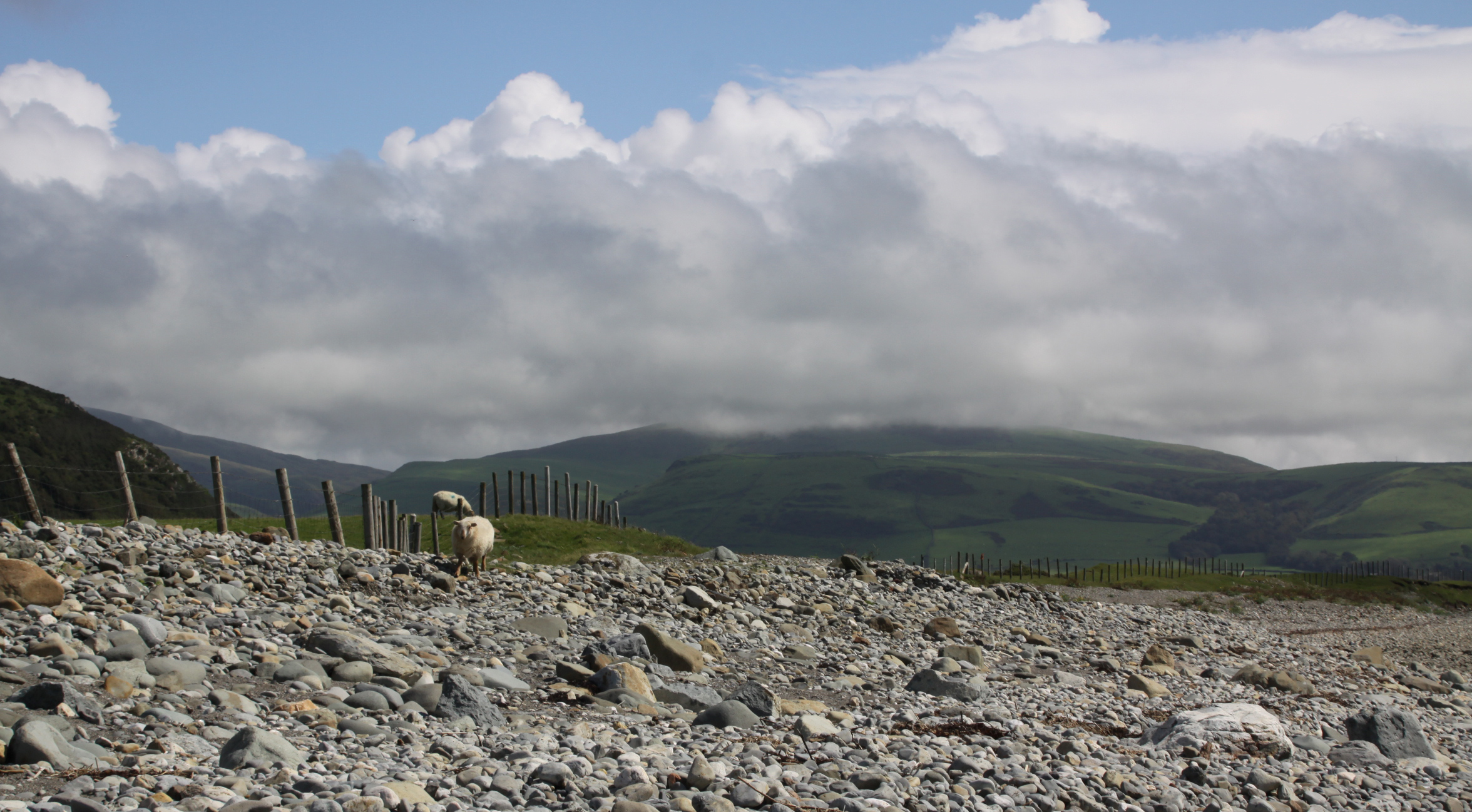
 My walk last Tuesday, the only sunny day last week, took me back to Tonfanau. Tonfanau railway station was added to the Cambrian Line to service the Tonfanau Army Camp, which opened in 1938 and was finally closed in 1973 after a 6 month stint as a refugee camp, before being demolished sometime in the 1980s or 90s. The camp extended both sides of the railway line, reaching the beach to the west and spreading part way up a slight slope to the east. I have posted about the camp here. When Tonfanau was at its height as an anti-aircraft training facility, with emplacements of enormous guns along the field at the top of the beach, it would have been anything but a peaceful place to go for a stroll. Today, however, it is probably the most quiet stretch of seaside in the Aberdovey and Tywyn areas.
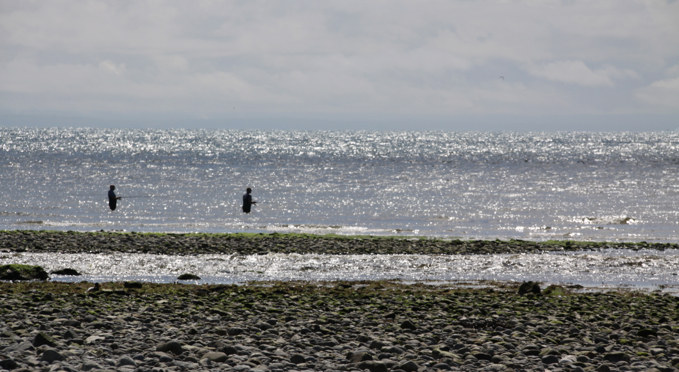
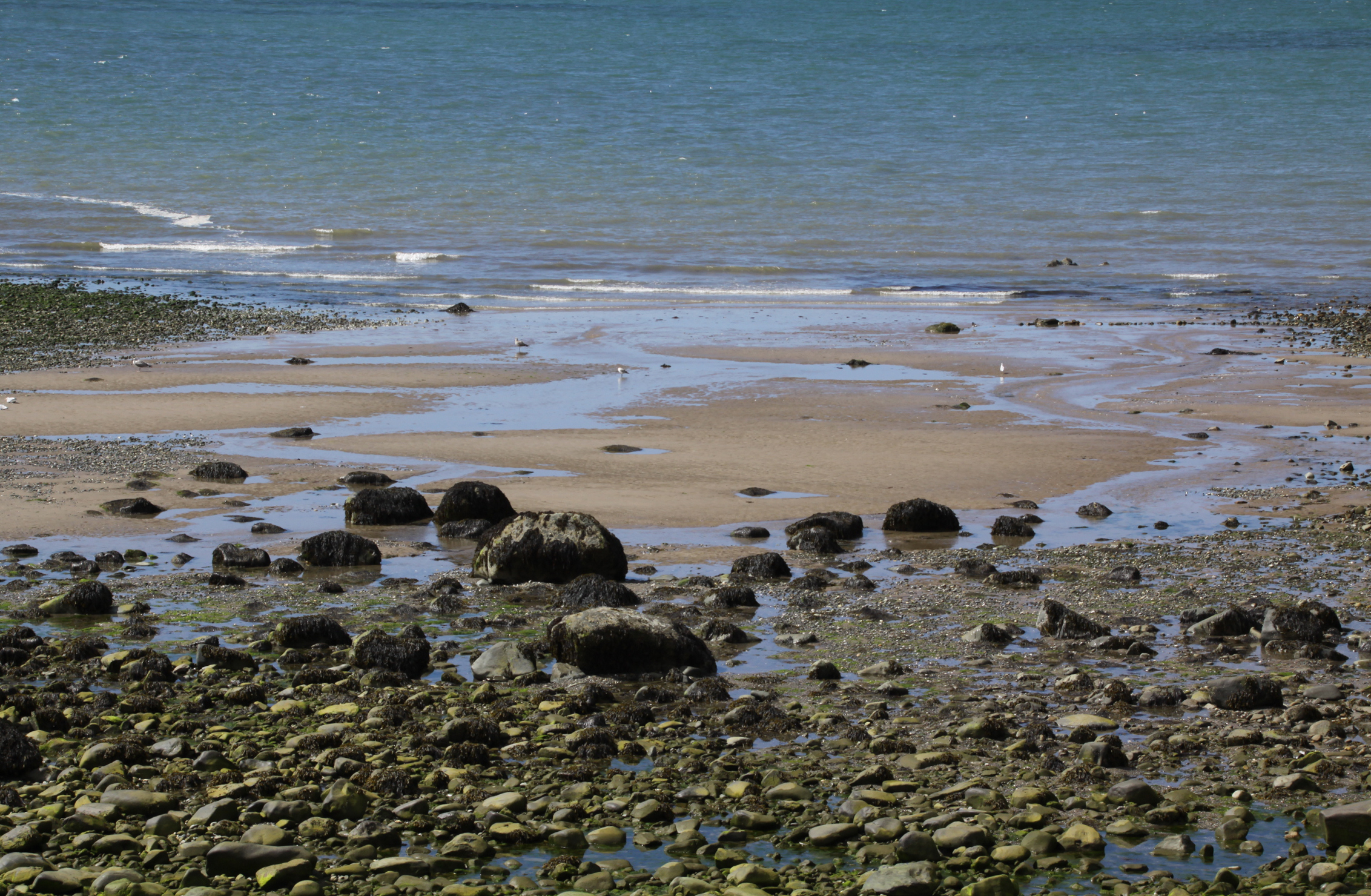
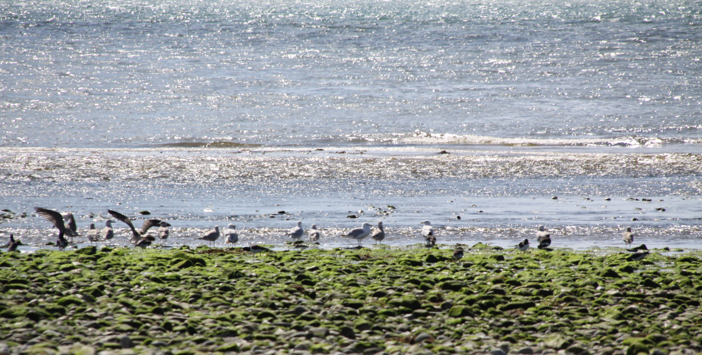
 The reason for the lack of human presence, other than fishermen some way out at sea in waders, is certainly because the beach is uncompromisingly uncomfortable to walk, sit or lie on. Apart from a few isolated islands of sand or gravel, it is a pebble beach running down a shallow slope into a rocky foreshore. Footwear is required. This, together with the complete absence of gift shops, public toilets and ice-cream stalls, makes it undesirable for most families, and there is rarely any more than a handful of people there even at the height of the tourist season. This makes it a very good retreat for sea birds, which line the water’s edge at a very safe distance from anyone who might be walking along the stony beach or investigating the rock pools. Oystercatchers, terns and various types of seagull are all in evidence at this time of year.
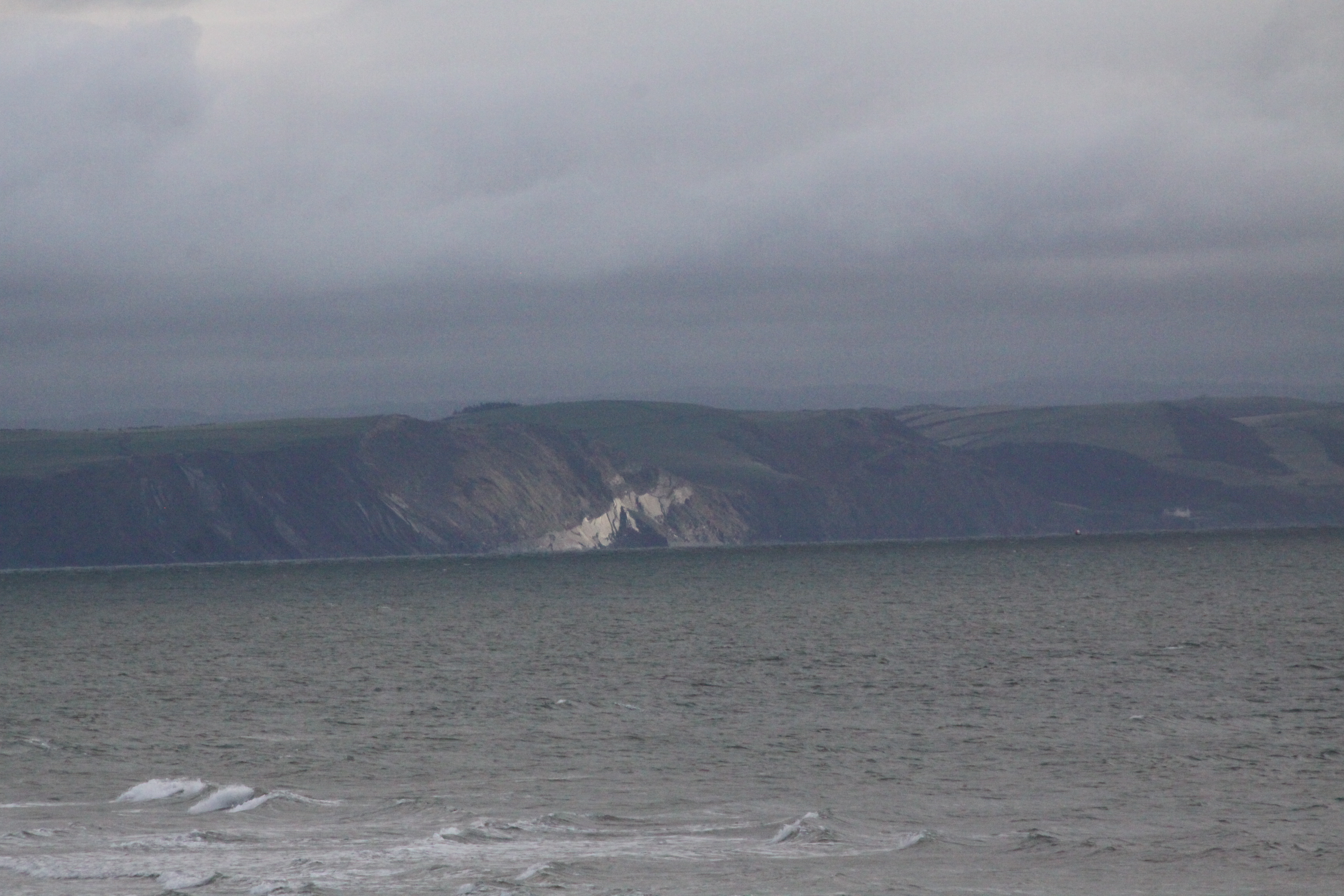
 The views along the beach are splendid. After the recent heavy rain the Dysynni charges at high speed through a surprisingly narrow mouth into the sea, fascinating to watch, and you can see it and hear its roar on the video at the end of the post. This understated but impressive meeting of the Dysynni with the sea is marked as Aber Dysynni (mouth of the Dysynni) on the Ordnance Survey map. The sea itself makes a lovely sound on the rocky foreshore and gravel, drawing the gravel back as it retreats, and colliding with the rocks as it advances. Above the sound of the sea and wind are the musical voices of sea birds. As you walk along it, the beach curves around a long corner promising more of the same untroubled vistas over an empty beach, rolling white horses and, in the distance, the Llyn peninsula. Behind the beach, looking east, are views of the major summits of Tonfanau and Foel Llanfendigaid, as well as the smooth green slopes of the hills between them.
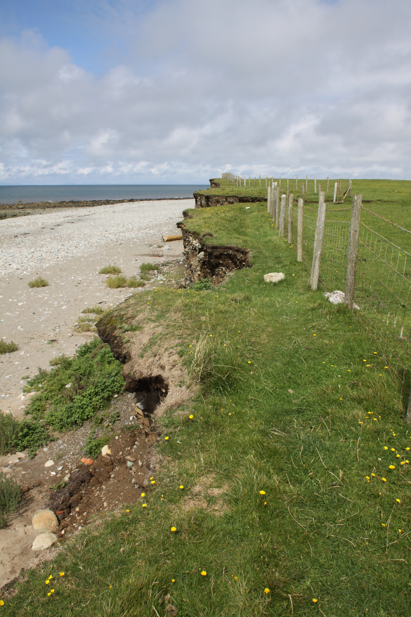 I started out walking along the top of the small “cliff” that runs along the top of the beach. It is only a couple of feet wide, drops only about eight foot or so above the beach below and stops where the publicly accessible land meets the fence of a farmer’s field after about 10 minutes of walking. It offers a terrific view down onto the beach, there are always some interesting wild flowers, and it is well worth doing if you are sure of your footing.
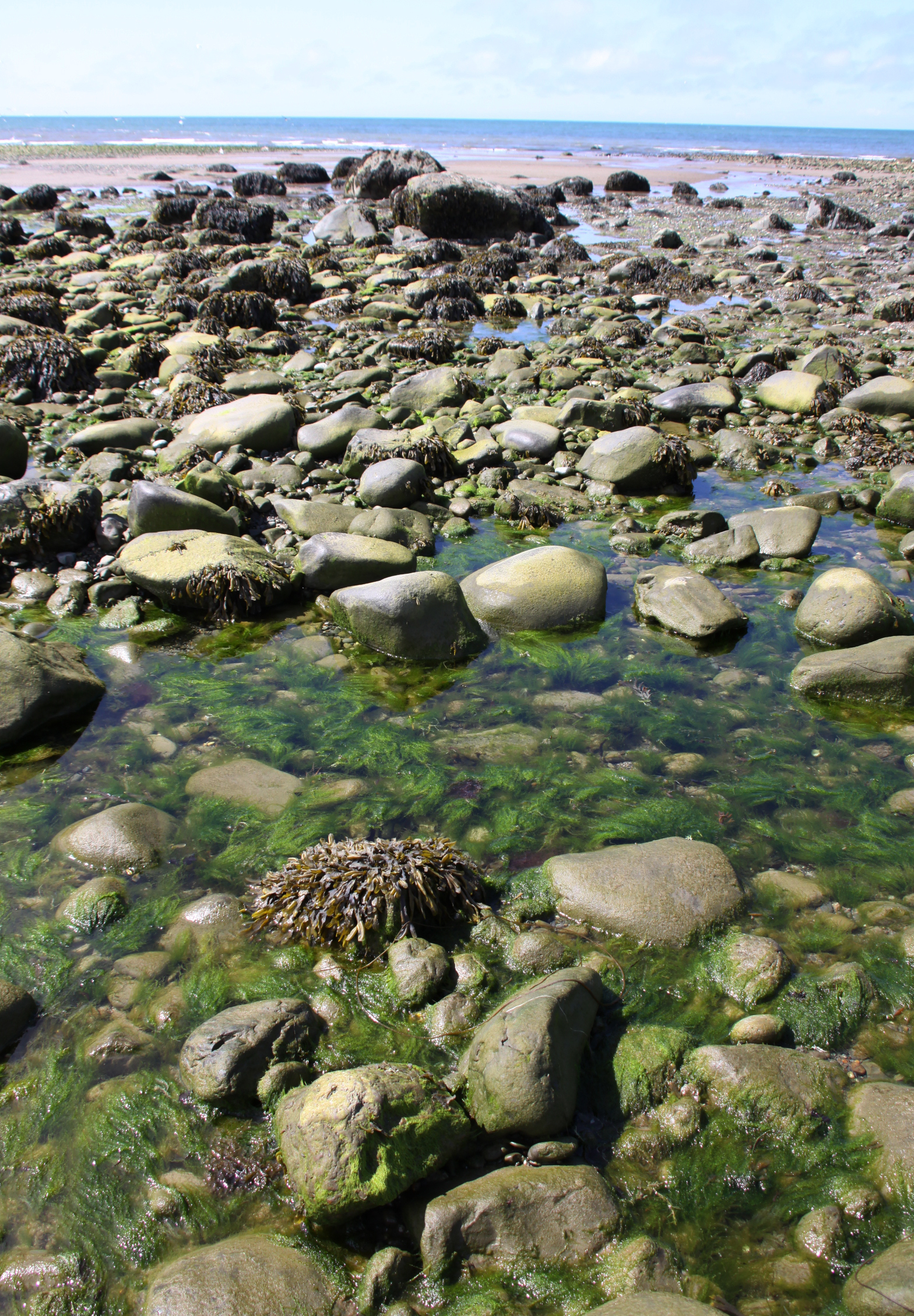
I then executed a controlled skid down a bit of the “cliff” that had collapsed into a sloping mound of earth, a quick way down onto the beach, and headed for the rocks. The lush green seaweed is glossy and lustrous, a great contrast to the darkness of the rocks in the bright sun. The overall effect was delightful. Water trickles through the multiple channels formed by the rocks, crossing the glistening gravel in a way that is quite unlike the sea flowing through channels in the sand at Aberdovey.
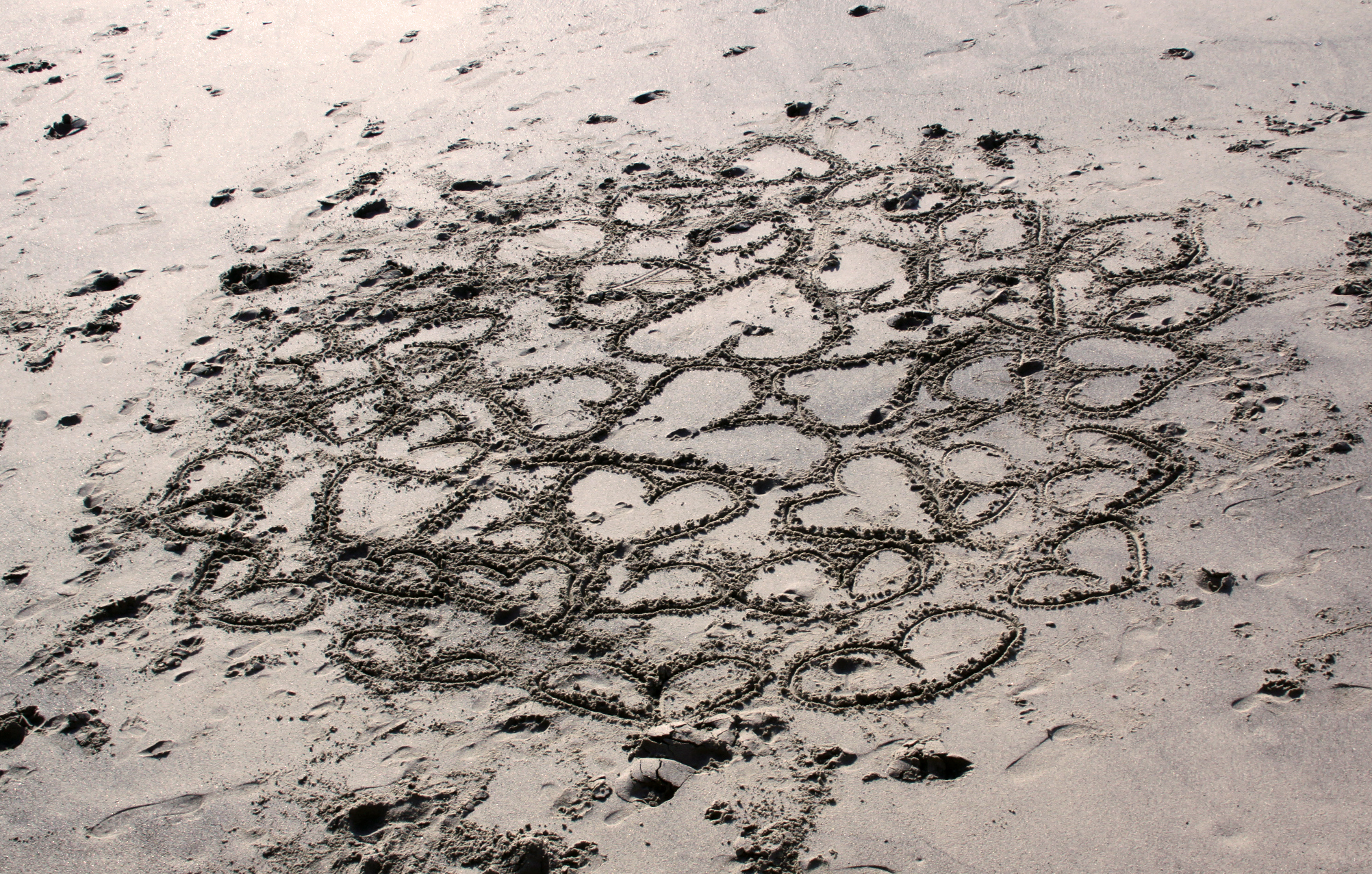
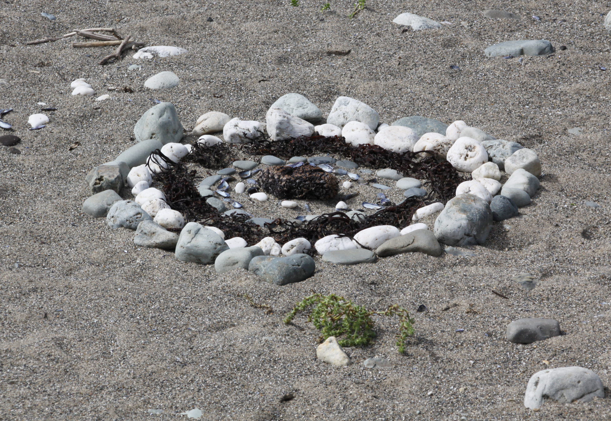
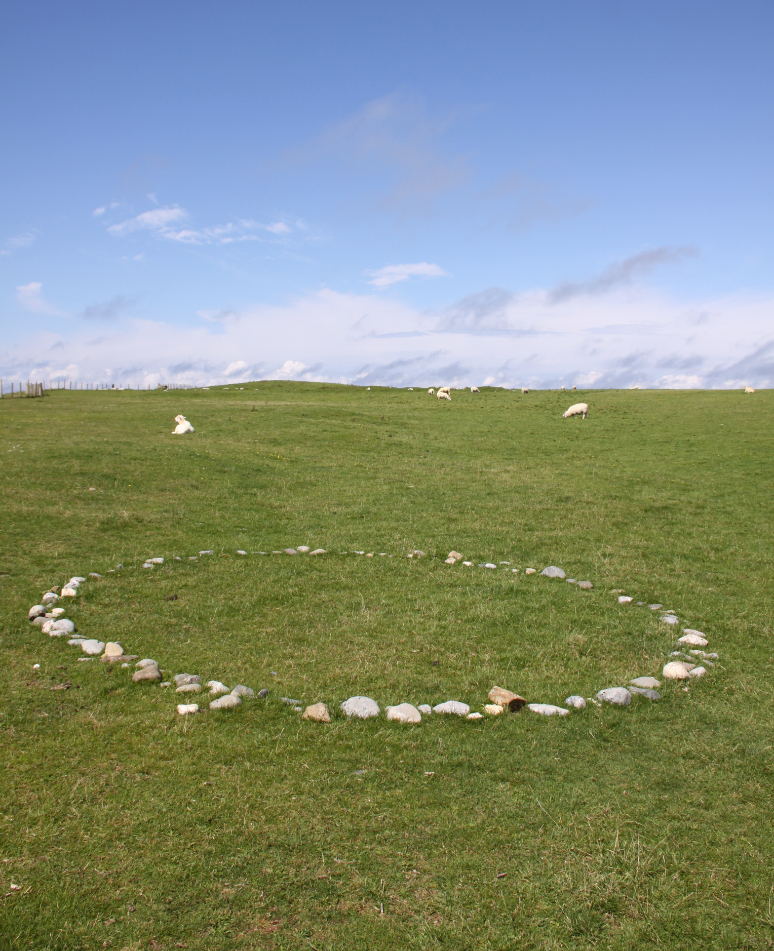
Someone has been having fun making pebble patterns in the sand and fields. Like most abstract compositions, it gives a curious sensation of something clearly created in the present taking on the character of something completely timeless.
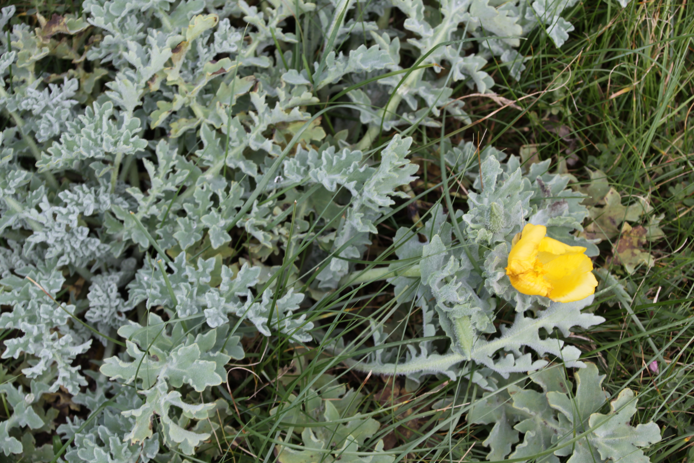 Yellow Horned-Poppy (Glaucium flavum)

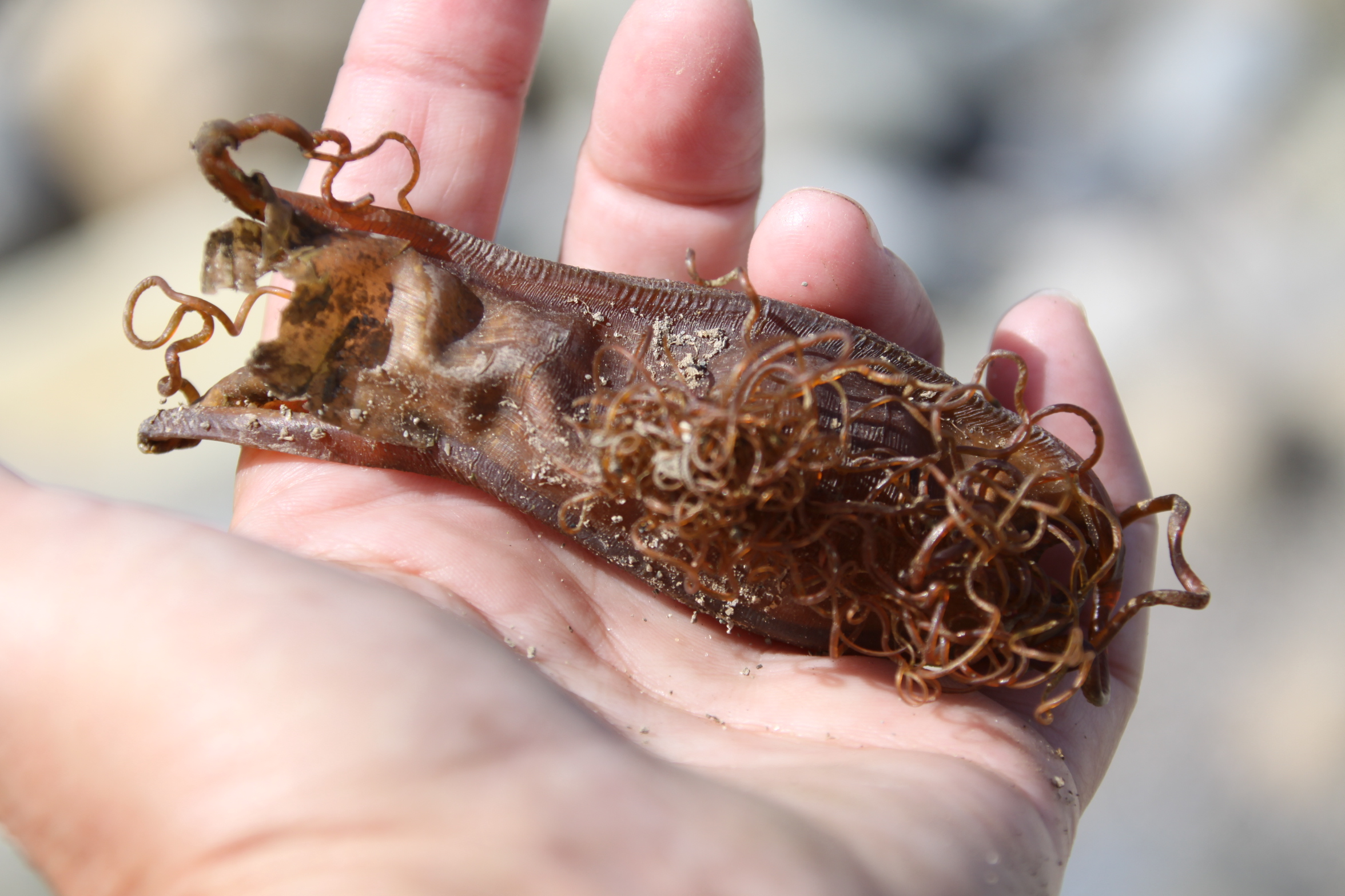
Small-spotted catshark eggcase (Scyliorhinus canicula), one of the smallest of all the mermaid’s purses. There were two of them, one right at the top of the beach and the other in the field behind the beach. They are so lightweight when empty that they travel on the wind. For details on the subject of eggcases and the Shark Trust, see my earlier post. The photos of the two eggcases have been uploaded to the Shark Trust Great Eggcase Hunt page.
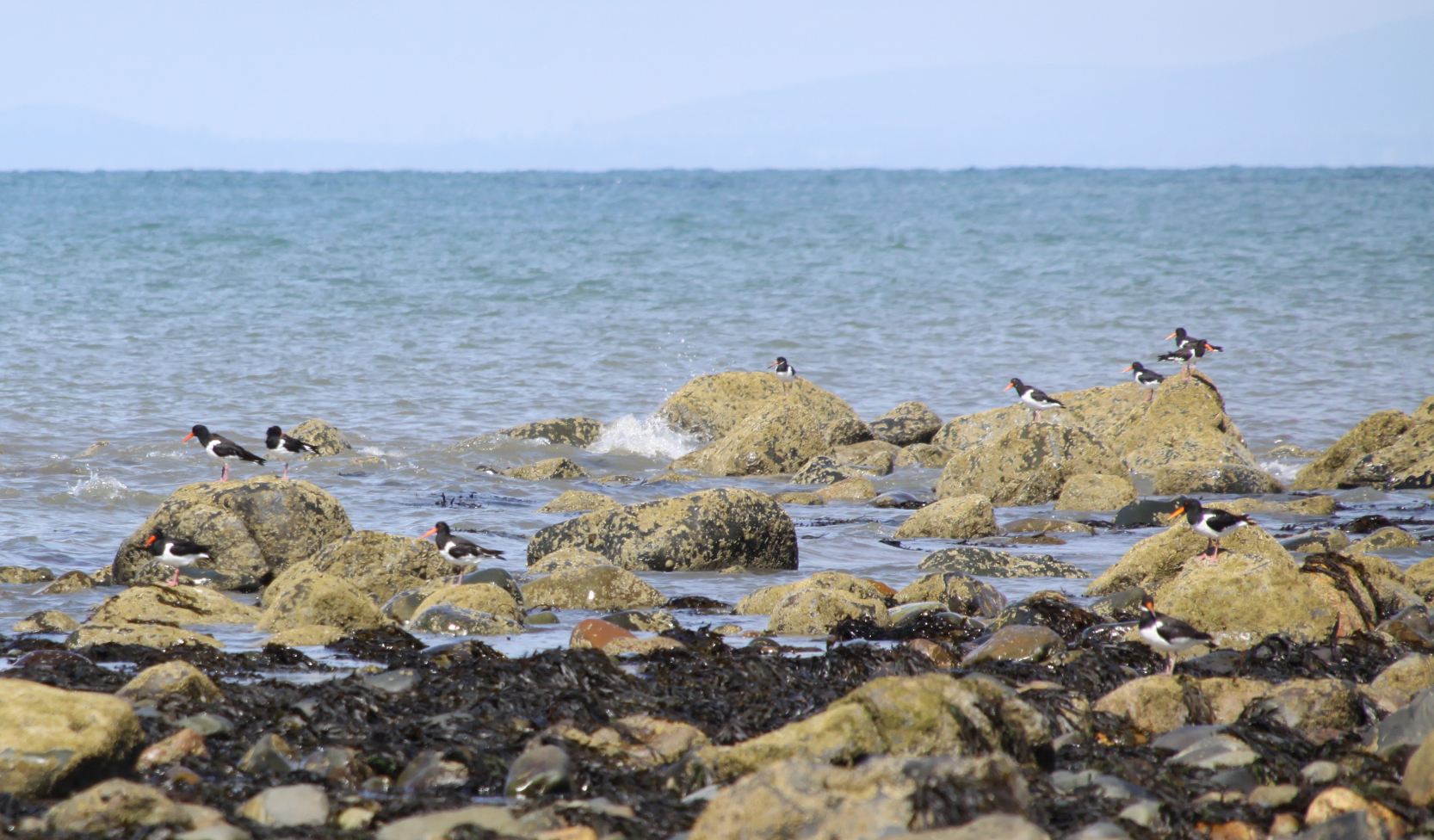
I walked out onto a spur of sand to watch the oystercatchers, getting as near as I dared. Unlike the video that I posted the other day, when what they were mainly concerned with was preening, today they were actually hunting for food and treating shells to merciless beak treatment. Trying to get a little closer I scared them into flight, and they congregated a little distance off on a few rocks, looking very striking.
 Oystercatchers at work
I’ve pulled a muscle in my shoulder, so the following video is not quite as steady as it might have been, but don’t miss out on the oystercatchers. They are sublime. The fast-moving water coming out of the Dysynni and churning into the sea is also truly impressive. The Dysynni originates in Tal y Llyn lake, makes an abrupt turn northwest at Abergynolwyn and then resumes a parallel course to the Tal y Llyn valley in the neighbouring valley. It passes the Ynysymaengwyn estate, finding its way through extensive reed beds, and emerges into the Broadwater, making its way around the low sandbanks before being funneled into the narrow channel into the sea.

Some of the few surviving remains of Tonfanau Army Camp today, behind Tonfanau station, complete with grazing sheep, the sea just out of sight in the background

Tonfanau in the past and recent present. Source of upper image: AAJLR.org, ref tonp_067. Source of lower image: Coflein.
The first time I heard the name Tonfanau was when I was researching the Ynysmaengwyn Estate. In the late 1870s John Corbett, who had purchased the estate, also invested in Tonfanau granite quarry to aid with his construction projects in Tywyn. Recently I have also been doing research into the hillforts on the hill behind Tonfanau. In both cases my searches came up with very little about either subject, but an awful lot of information about an army camp that I had known existed but knew nothing about. I became interested in the story of the camp.
The Tonfanau camp (pronounced ton-van-ow – the ow to rhyme with cow) was established in the 1930s as an anti-aircraft artillery training centre, but it underwent many changes in role over time, before being nearly entirely demolished in the late 1980s or 1990s. One of the most arresting aspects of the subject is the remarkable number of accounts and photographs available online by those who were stationed at Tonfanau. The camp is not merely a few ruins of the past, it is something that lives on in people’s memories, giving lie to the very few abandoned and desolate fragments that remain.

The impressive extent of Tonfanau camp shown on an Ordnance Survey map, circa 1960s. Source: AAJLR website, ref tonp_068
This is a short summary of why the camp was established, what it was used for at different times, how far it extended over the surrounding area, what it consisted of, and what remains today. Do have a look at the comments that follow this post, because over the years, many voices have been added, telling of their own memories or of how family members remembered their experiences at Tonfanau. These, rather more than my account written in 2020, bring the story to life.
I have made considerable use of the resources that I have found on the web, all of which are credited below in “Sources” with my sincere thanks. Particular thanks must go to the Tonfanau page on the AAJLR website and its many contributing volunteers for assembling such a magnificent collection of photos, many of which are reproduced here with permission.
In terms of visiting, if you are aiming to incorporate the remains of the camp into a walk, the easiest and most attractive way is to drive down Sandilands Road, turning right just before the level crossing. Follow the road to the Tonfanau footbridge, and it is about a 15 minute walk from there. In summer it is a particularly nice walk as the verges from the Dysynni footbridge to the station are filled with a profusion of wildflowers. Otherwise it is a matter of driving to Tonfanau station down bendy single track lanes and parking up there. You can cross the railway to go down to the emplacements on the beach, or walk up the road opposite the station to see some of the other remaining structures. Otherwise it’s a matter of wandering around the publicly accessible parts of fields to see more.
Tonfanau camp. Source: AAJLR.org
The remains of Tonfanau camp are interesting, but be warned that they are really very ugly, a thorough blot on the landscape. This sort of swiftly-built camp, of which there were several dotted around the country, must have been just as alien in their own ways as Roman camps imposed on an Iron Age landcsape, just as uncompromising and just as much as an imposition, but eventually becoming a fact of life. Unlike the Roman armies of occupation, these invaders of the landscape were British, and the camps were there to serve the nation, giving their sudden arrival, even if unwanted and unwelcome, a positive reason for being.
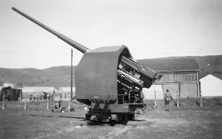
Heavy ackack anti-aircraft gun at Tonfanau, ref tonp_274. Source: John Mills, AAJLR.org
Throughout its existence the camp consisted of a series of fairly basic buildings, including brick-built huts, wooden huts, hangars and so-called Nissen huts. Nissen huts, like bailey bridges (of which more below) were assembled from pre-fabricated parts to enable very rapid construction. Corrugate iron sheets were used to form half-cylinders that created lightweight buildings, useful in a variety of situations. They looked like gigantic pigsties, half-tubes of corrugated iron blocked at either end, one end containing a door for access.
The camp was built beyond the immediate reach of the nearby villages, on a wide coastal plain beneath Tonfanau hill, spanning both sides of the railway line. The Tonfanau railway station was added on the existing Cambrian Railway line, which itself linked into the national rail network, to serve the camp . By train, the camp was a few minutes from Tywyn. By road, it was a matter of negotiating some bendy B-roads and passing through Bryncrug before reaching Tywyn, some 30 minutes or so later. The decision to put the site beyond the immediate vicinity of residential areas was probably connected directly to the noise that the camp would produce as an anti-aircraft gun range. Either that, or this was the biggest flat-ish area available in the vicinity for the construction of this sort of camp. Either way, the camp was neither a part of the village, nor completely isolated from it. At some point a bailey bridge was established at the crossing over the River Dysynni where the railway also crosses, substantially reducing the time taken to get into Tywyn. When an RAF camp was built at Sandilands in Tywyn in September 1940, partly to build on an existing relationship that the RAF already had with the Tonfanau camp, communication and visits between the two camps probably became quite frequent.

Anti-aircraft emplacements at Tonfanau camp from the air. Ref. tonp_067. Source: AAJLR.org
As an artillery training camp, Tonfanau had various sites to enable training on different types of weapon. The big anti-aircraft (AA) guns were mounted on permanent emplacements just behind the beach, as shown on the above photograph. The foundations of these can still be seen above the line of the beach, some of which are shown on the photographs at the end of this post. These pointed out to sea for target practice. The targets were initially supplied by RAF Tywyn’s, which had a camp in the Sandilands part of town and later became known as Morfa Camp, which is how it is usually known today. Disposable gliders were towed using Hawker Henley planes near to the position of the anti-aircraft emplacements, and these gliders were used as targets. All I can say is hats off to the pilots who took on that unenviable task! Eventually these were replaced with an unmanned remote-controlled version of the Tiger Moth known as the Queen Bee, which must have been a lot safer all round.

Anti-aircraft guns in action, ref tonp_028. Source: AAJLR.org
A first hand account of the Anti-Aircraft training is provided by Stanley Briggs, who found himself at Tonfanau in 1949 after initial training at Oswestry before shipping out to Egypt:
“After our initial training we were taken by train to Tonfanau on the West coast of Wales between Aberystwyth and Barmouth. This is the Cardigan Bay coastline area, the nearest town is Towyn. Only the beach, a railway line and a road separated us from the sea. We had the sea on one side and the Cader Idris mountain, inland, behind us.
That bay is massive and ideal for target practice for our 3.7 guns, but I have to say that I didn’t fancy the RAF pilots jobs of towing a sleeve behind their plane while National Servicemen were firing at them for practice with live rounds.
The Cader Idris was ideal for physical fitness too, which our physical fitness training instructor (PTI) put to good use, we were all eighteen years old and I have to say that personally I really enjoyed every minute of that part of it.

QF 3.7 inch anti-aircraft gun. Source: Wikipedia
The same discipline training continued at Tonfanau. It was here that we were confronted with the 3.7 gun, the Sergent in charge gave us all a good knowledge of how to maintain, dismantle and fire it. We all had to learn each others position on the gun in case one of the members of the team was killed in action (that was a sobering thought!)
The gun had a large barrel and was transported on a trailer consisting of four legs and wheels, towed by an AEC Matador lorry. Each leg had to be raised for the travelling position and lowered for the firing position. Other positions for the team of gunners were Traverse Operator, Elevation Operator, Tannoy Operator, and Ammunition Operator who had to lift a round up and put it in the breach and finally, the Sergeant who had the responsibility of firing. The first time I lifted a round of ammunition, my knees buckled as they were very heavy for a nine stone weakling, which I was at the time.”
There seems to have been a second level of artillery training at the site during this period, which took place after the heavy anti-aircraft guns had left, as described by Frank Yates who, at the age of 21, served with the Royal Artillery, Light Anti-Aircraft Battery and was attending the Officer Cadet course.

Aerial view of the remains of a small-bore firing range. Source: Coflein
“The camp was large, with brick and concrete hutments and purpose built dining halls, garages and the like, with the Garrison Theatre dominating the landscape. The camp had been Heavy AA before we moved in, but there were now two separate factions, the bulk of the Heavies had returned to their base Artillery depot at Oswestry, leaving a nucleus to run the firing camp. On the firing apron, between the sea and the railway, was an ex Naval 3” Gun, a weapon which fulfilled a dual role in the Navy. It had the reputation of producing the loudest ‘bang’ of any British gun and they once fired it for our benefit. It certainly lived up to its reputation! Before leaving the “Heavies” may I mention that they did not fire at a towed drogue, the tow plane would not have survived. There was talk of them using a radio controlled, unmanned target, a project easily arranged nowadays, but too unreliable in those days. . . .
After various demonstrations, witnessed from a head down position in the trench, the sticky bomb was shown. This was an anti tank weapon, although it would need a very brave or a very lucky man to get near enough to use it! It was a glass ball, like a small goldfish bowl, full of TNT and covered in stockinette which was impregnated with very powerful glue. The thing was provided with a handle, containing the fuse and firing mechanism. The bomb was smashed down onto the tank, deforming into a dome shape, a ‘shaped charge.’ The handle is released, the bomber runs away and the charge explodes in 4 seconds.”
Frank Yates goes on to describe what the camp was like to live in whilst he was there, and what sort of other training took place at the camp. It’s a very engaging read, so do have a look at his entry on the BBC WW2 website.

Bailey bridge over the Dysynni. Photograph by Edwin Lines 1990, ref. tonp_278. Source: AAJLR.org
I am assuming that the bailey bridge that used to cross the Dysynni dates to this period. It was still in situ in 1990 when former camp resident Edwin Lines took this photo. Bailey bridges were portable, pre-fabricated, truss bridges. The concept was developed between 1940 and 1941 by Sir Donald Bailey, a civil servant in the British War Office, for the military. It was a portable, pre-fabricated, truss bridge that was was made up of prefabricated panels and easily assembled parts. These could be carried by trucks and assembled by men without special equipment, using simple devices, such as ropes and pulleys, in a matter of hours. Once a bridge has done its job it can be disassembled, moved and rebuilt elsewhere. Bailey bridges proved their worth in the Second World War. The Tonfanau bridge ran parallel to the railway bridge, where today the railway bridge and the 2013 Tonfanau footbridge cross the Dysynni. As they were originally designed to be sufficiently robust to carry tanks, I assume that this one could carry light vehicles as well as pedestrians, which would have substantially improved access to the bright lights of Tywyn!

Entrance sign to the All Arms Junior Leader Regiment camp at Tonfanau. Source: 28 Days
The All Arms Junior Leaders’ Regiment (AAJLR) was established at Tonfanau in May 1959 and was disbanded in August 1966. Its purpose was to train boys aged between 15 and 17½ as future senior non-commissioned officers. Boys were sourced from various points within the British army.
My thanks to Ken Hart’s excellent AAJLR.org website as the source of the information on this page, which talks about the activities that they boys were engaged in on a term by term basis:

Entrance to Tonfanau Camp in about 1964, complete with postbox. By Brenda Keens, ref tonp_265. Source: AAJLR.org
“The year was split into 3 terms with a fresh intake of boys each term. The first term of each boys service was completely dedicated to turning these 15 and 16 year olds into disciplined soldiers. From the second term the prime emphasis was on education as all senior NCO’s were required to obtain the Army Certificate of Education [Class 1]. Alternate days were spent on Military Training which included Drill, Weapons Training, Driver Training, Map Reading and casually strolling over the gently rolling Brecon Beacons in wonderful Welsh weather fully equipped in thin denims, a poncho and carrying a webbing back pack. The boys final term included specialist training according to the arm or corps he intended to serve in as a senior soldier. Mixed in with all this there was sport, adventure training, outward bound courses and inter company competitions including the Rhyl cup.
Every boy also took part in the ‘Duke of Edinburgh’s Award scheme’ and to this end most evenings were spent doing a large number of hobbies. The rest of the time was spent cleaning the barracks or doing your personal kit whilst huddled round a coal burning pot-bellied stove in a futile attempt to keep warm.”
There’s a whole page on the AAJLR website dedicated memories of Lance Corporal Fagg who, in charge of the Guardhouse, was the terror of most of the boys at the site. These short accounts bring daily existence at the camp to vivid life. One contributor to the site, John Sabini, wrote the following, which is a nice introduction to an awe-inspiring individual. Other accounts are often a lot more earthy!

The idea of over-wintering in one of those flimsy huts makes my All Arms Junior Leaders Regiment plaque (Photograph by Peter Woolridge, ref. cphoto_153.) Source: AAJLR.org
L/Cpl Fagg re-joined 3 RGJ sometime around 1967 in Iserlon Germany. Due to a quirk of fate I was allocated to a room with him (thankfully for only a couple of nights) when I moved from a Rifle Company to the Battalion Signals Platoon.
Did you know his first name was Hermes (a bit like being a boy named Sue) which could explain his bad attitude to his fellow human beings! He was a cookhouse NCO orderly in charge of tea urns and spud bashing. His nickname in the battalion was ‘Dog-End’. He disappeared mid way through our tour in Germany and I am not sure where he went; this was my last sighting of L/Cpl Hermes (Dog-End) Fagg, 3rd Green Jackets, The Rifle Brigade.
As he is probably now in the great guard room in the sky, I am sure he would appreciate that he is immortalised (!) on the AAJLR website and that he made such a lasting impression on all those who had the misfortune to cross his path.
The idea of over-wintering in one of those flimsy huts makes my blood run cold!
In 1968 the camp was one of the designated sites for the PYTHON project, a plan for continuity of government in Wales in the event of nuclear war. There’s not much information on the web on the subject of PYTHON, and what is here comes from a Wikipedia article, the main source of which was the book The Secret State: Preparing For The Worst 1945 – 2010 by Peter Hennessy (Penguin 2014). The idea was to disperse government officials to various locations instead of centralizing them in one place. Sites were chosen on the basis of existing accommodation, independence from the national power and water grids, nuclear fallout protection and distance from likely targets. Tonfanau Army Camp was temporarily designated as the PYTHON location for Wales. Each PYTHON group would be supported by dispersed sections of the United Kingdom Supply Agency and the National Air Transport Agency. Aberystwyth University replaced Tonfanau as the preferred location soon afterwards, which is probably just as well as I don’t see government ministers surviving a mid-Wales winter in those huts, never mind a nuclear war!
Photograph of Ugandan Asian family at Tonfanau by Jim Arnould, Nova (April 1973). Source: Oxford University Press blog
The camp was re-opened very briefly to house Uganda-Asian refugees. Uganda had been a British colony, and while India was still also a British colony, the British government had encouraged Indian professionals to travel to Uganda to seek prosperity by helping with railway construction and the overall improvement of the economy. The offer was taken up with enthusiasm, with thousands of Indian families settling in Uganda and making good livings. Their successes were at first welcomed and then regarded with suspicion by Ugandan communities. In 1962, Uganda was granted independence and in 1971, military leader Idi Amin staged a coup and came into power. Only a year later, on August 5th 1972, Amin inaugurated a policy of economic reform, an “economic war” in his own words, that included the expropriation of properties owned by Asians and Europeans. He gave Ugandan Asians 90 days noticed to leave the country, calling them “economic bloodsuckers,” claiming that they were draining the wealth of the nation at the expense of native Ugandans. Their departure was hastened at gunpoint, giving them little doubt about their fate should they stay.
Of 80,000 Ugandan-Asian exiles, nearly 29,000 with UK passports came to Britain. The official Ugandan Resettlement Board (URB) had the thankless task of providing them with temporary accommodation until permanent resettlement could be arranged, and took the decision to place them in refugee camps. Tonfanau was one of sixteen refugee camps chosen for the task.

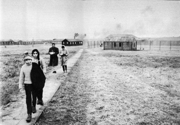
The entrance to the Cafe at the Tonfanau refugee camp, when the camp was in ruins. The bright, lively scene is very much at odds with the drab surroundings, and gives a sense of how hard it must have been to relocate to such a bleak place. Source: 28 Days website.
Tonfanau camp had been closed for nearly four years when it was suddenly dragged back into service to house over 3000 of these refugees for a period of six months, and must have been in somewhat poor condition. It was, in fact, only chosen as a last resort when other locations had been rejected. Captain Freddy Fuller was put in charge of the camp, probably very well qualified as he had spent 25 years running an Outward Bound school. Volunteers from the surrounding community formed a welcome group to provide the newcomers with essentials, including clothes and toys for the children, and each volunteer was instructed to assign themselves to individual families to assist them. However, there was very little furniture and most of the exiles had to sit on the floor. It must have been a freezing, bleak and worrying winter in those bare huts, and Jordanna Bailkin’s book Unsettled repeats James Hamilton-Paterson’s poignant report on the camp, seeing “miserable people in their gorgeous saris” huddling in Tywyn’s two fish and chip shops for warmth. Bailkin describes how donations of clothes resulted in some peculiar and probably difficult encounters: “Adding to the bizarre atmosphere, most of the clothes donated to Tonfanau through the WRVS [Women’s Royal Voluntary Service] were from the 1960s. Chandrika Joshi, whose family stayed at Tonfanau for five or six months when she was 14 years old, found herself dressed in a brown rubber minidress: “Such outfits went largely unnoticed in camp, where everyone was similarly attired, but more ‘out of place’ when she went to a school a few weeks later” (again quoted from Jordanna Bailkin’s book Unsettled – see Sources at end).
Fortunately, by the spring of 1973, all had been re-homed, hopefully in much better conditions, elsewhere in the UK.
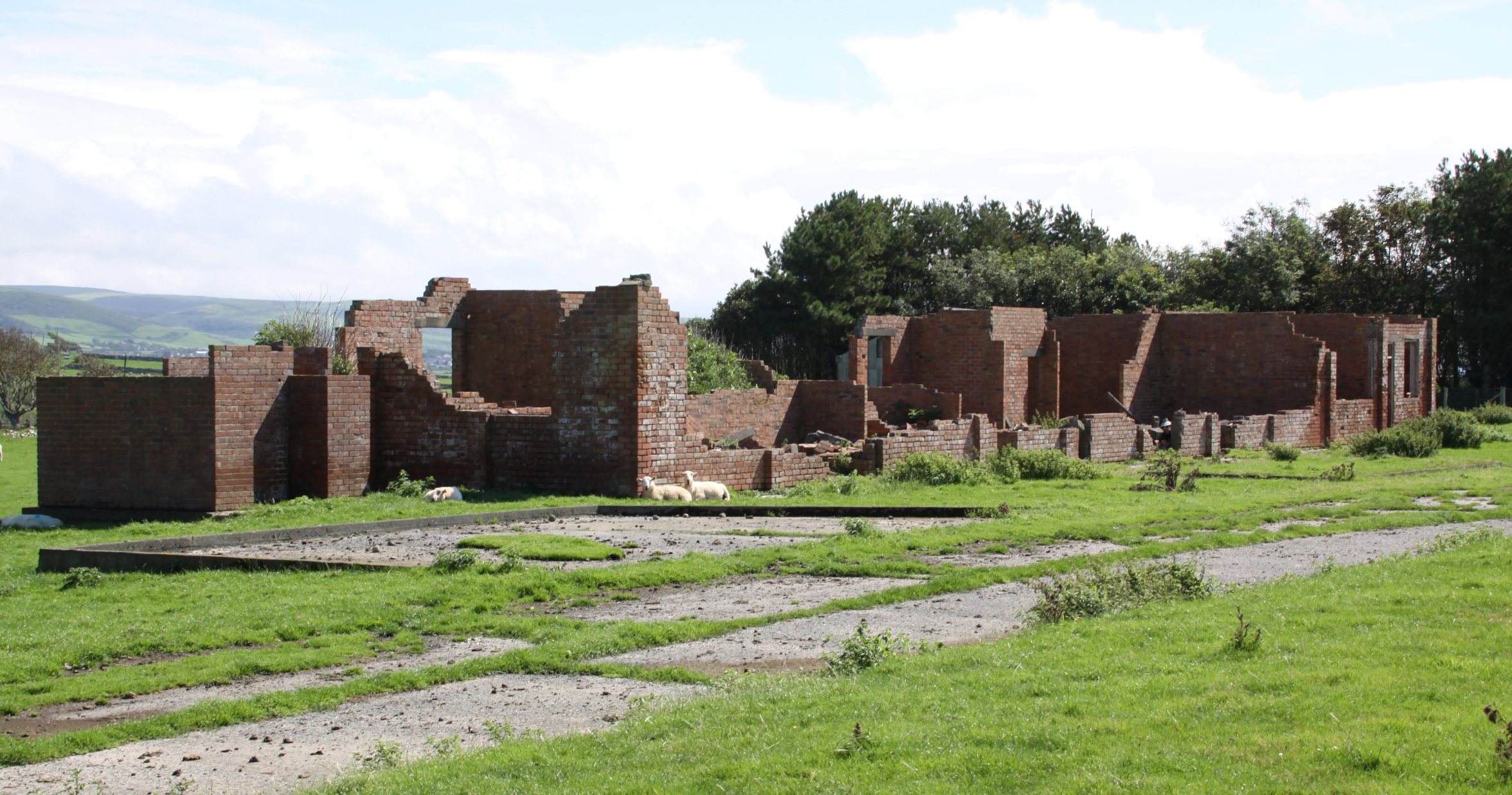
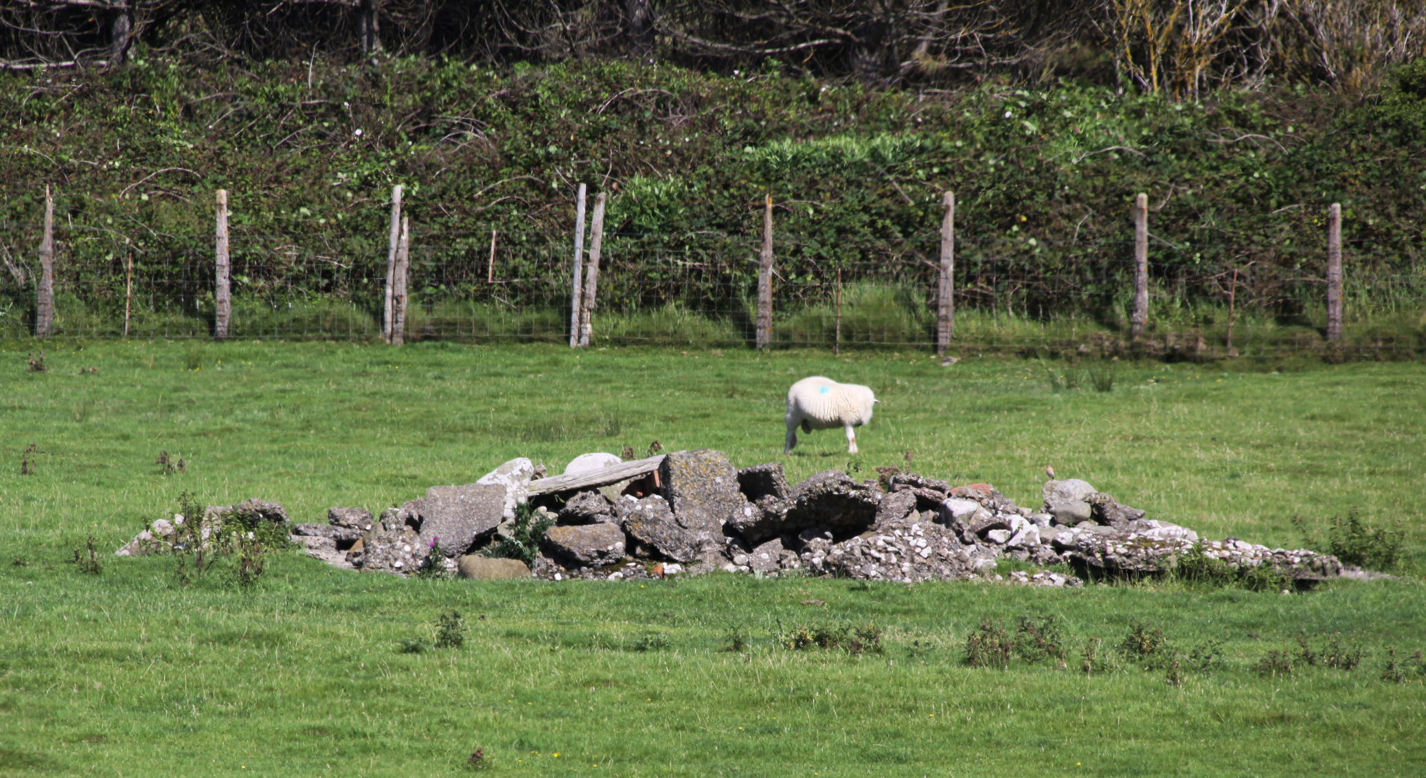
 I have been unable to find when the site was finally demolished, or why some buildings were left in tact. It was probably done between the late 1980s and early 90s. Apart from a bare handful of surviving buildings that survived the demolition, it was a pretty thorough job. What does survive gives a very good idea of both how ephemeral these buildings were intended to be, but also how enduring they proved to be before they were intentionally removed.
Part of the site is used, at the time of writing, by Tonfanau Road Racing for motorcycle racing on a 1-mile track during the summer, run by Crewe and South Cheshire Motor Club. A 2010 proposal to use the land for a new prison never came to fruition. Most of the land has been returned to farm use and sheep now roam freely over most of it.
Below are a couple more of my photographs of what’s left of the site today. For many more from all periods, see the substantial collection contributed by many volunteers on the All Arms Junior Leaders Regiment website.


Books and papers
Jordanna Bailkin 2018. Unsettled: Refugee Camps and the Making of Multicultural Britain. Oxford University Press
Becky Taylor 2018. Good Citizens? Ugandan Asians, Volunteers and ‘Race’ Relations in 1970s Britain. History Workshop Journal, Volume 85, Spring 2018, p.120–141
https://academic.oup.com/hwj/article/doi/10.1093/hwj/dbx055/4818096
Roy Sloan 1991. Wings of War over Gywnedd. Aviation in Gwynedd during the World War II. Gwasg Carreg Gwalch
Websites
28 Days Later Urban Exploration
https://www.28dayslater.co.uk/threads/tonfanau-military-camp-tonfanau-nr-tywyn-february-2015.94390/
40th Anniversary for Ugandan Asian Refugees in Wales
https://www.itv.com/news/wales/2012-07-31/40th-anniversary-for-ugandan-asian-refugees-in-wales/
Ken Hart’s All Arms Junior Leaders Regiment (AAJLR) website
About: http://www.aajlr.org/about/about_main.html
Tonfanau camp: http://www.aajlr.org/tonfanau/tonfanau_main.html
Memories of Frank Yates, Royal Artillery, Light Anti Aircraft Battery. Chapter 17, BBC World War 2 People’s War. Article ID A7375845
https://www.bbc.co.uk/history/ww2peopleswar/stories/45/a7375845.shtml
Stanley Briggs: Then and Now
http://www.stanleybriggs.com/art_nat_service1.html
Tonfanau Road Racing
https://www.tonfanauroadracing.co.uk/
Wikipedia article about PYTHON
https://en.wikipedia.org/wiki/PYTHON#Locations

.jpg)