After walking up Tonfanau to see the Iron Age hillfort I went along the road to Tonfanau station, crossed the tracks and passed part of the old military camp to go down to the pebble beach. It is an excellent place for watching the oyster catchers, and I was lucky to find some pottering around at the water’s edge, amongst the small rocks. Oystercatchers are lovely to look at. Their bright orange beak and pink legs make them stand out from any background, whilst their black and white plumage is particularly distinctive when the birds are in flight. They make a piercing peeping sound, which can be heard here on the British Birdsongs website. Oystercatchers feed on molluscs that the find on rocky shorelines, which they open by stabbing the sharp beak through linking muscles, and then hitting on stones and rocks to break them up, sometimes audibly. The video below shows a pair of them on the beach at Tonfanau. Duration: 1 minute, 33 seconds.
Due to the difficulty of walking on pebbles and the discomfort of lying on them, together with the rocky approach to the sea that challenges bare feet, there are rarely many other people there. Whilst Aberdovey was simply packed, there were only a handful of people along that stretch of the sea, two of them fishing in waders, quite a long way out. Walking back to the Tonfanau bridge over the Dysynni as it opens out into the sea, the path is flanked either side with verges full of wild flowers at the moment.
Tonfanau from the southwest. Tal y Garreg is immediately above the quarry
Ordnance Survey map showing the route taken up the hill, and the location of the two hillforts, marked by red dots. These two sites are also marked on an aerial photograph below.
I have wanted to see the Tal y Garreg Iron Age hillfort at the top of Tonfanau quarry, on Mynydd Garreg (rock hill), for some time, so on Sunday (9th August) I packed my rucksack and went along the route I had scoped out on Saturday, which had been made so enjoyable by the verges filled with wild flowers. I parked the car on the road leading up to the Tonfanau footbridge, as before and followed exactly the same route, but this time instead of stopping at the gate into the field at the end of the bridlepath, I followed the faint track of the footpath up the hill. The route is marked in dark green on the map to the left. There are two hillforts on Tonfanau, both of which are marked with red dots, Tal y Garreg at the summit overlooking the quarry, and Llechlwyd on a lower promontory to the east of the quarry. On this post I will talk about Tal y Garreg, but I covered Llechlwyd on another post, and the map above and an aerial shot below show the geographical relationship between the two. The walk up the side of the hill is very beautiful, and the views from all around the top of the hill are breathtaking. I should, however, make a couple of health and safety notes about this walk before I recommend it as a great one to do
First, the track starts to climb fairly easily, as in the photo on the right, but as you near the top, where the bracken gives way to open ground, it becomes steep. When you turn around to admire the view, the ground seems to drop sharply away beneath you, and falling would result in an unimpeded roll downhill. I am very sure-footed, but instead of tacking to reduce the effort, I went straight up, leaning forward, to reduce the risk of tripping. The views are stunning, just be careful. There are other public footpath approaches marked on the map, which might be easier. Second, the hillfort of Tal y Gareg sits above the quarry. Indeed, the quarry has removed a big part of the hillfort. When you climb to the brick monument on the summit of the hillfort you are getting near to the edge of the quarry, and at the edge there is almost nothing to prevent you falling the steep drop into the quarry should you lose your footing – just fence poles with a single run of wire to mark the edge. Perfectly okay if you’re aware of it, but do not let children loose up there.
Access over two sets of steps to the ridge at the top of the hill
The top of the hill is a ridge that extends 1.5km to the northeast, with terrific views either side. The ridge is enclosed today by a long, winding drystone wall that extends as far as the eye can see. A short wooden ladder on either side of the wall allows you to cross the wall easily, but take care – two of the steps on the ridge side are rotten, one completely broken. The inside of this drystone perimeter is divided up into separate enclosures by more drystone walling, but all of them have gates or are open so you can wander freely across the top. To the southwest is the river Dysynni, at the eastern end are views over the hills flanking the valley, including Craig yr Aderyn (Bird Rock).
I was up there partly for the views, but mainly because I am on a hillfort mission at the moment and wanted to check out what was left of one of two small Iron Age hillforts. In the area between the Mawddach estury and the Dyfi estuary are fifteen known hillforts. These fall into two distinct geographical groupings, a northern and southern group. Eight of the fifteen are in the southern group and I am hoping to walk all of those that are accessible by public footpath.
When the first hillforts were excavated during the late 19th Century, it was assumed that all hillforts were defensive, and some southern hillforts certainly were, but it is by no means clear if all hillforts were built as a response to conflict. Because so few hillforts have been excavated in northwest and mid Wales, it is impossible to establish exactly what they were designed to do, and most of them probably had multiple functions. I’ll be talking more about the roles of hillforts in this area on a future post.
It is almost impossible to photograph a hillfort sensibly at ground level, although some banks and ditches can usually be captured. Aerial photographs and excavation plans are the best ways of of visualizing individual hillforts.
Another view of the quarry. Source: Gwynedd Archaeological Trust
In fact, Tal y Garreg hillfort was very easy to spot from the ground, as the builders made use of a rise in the local topography and natural escarpments that face north. Tal y Garreg means “end of the rock/cliff” and probably refers to the rocky ridge on which it is built. It lies at the southwest end of a 1.5km ridge at c.170m OD. The natural lift in the land, shown on the above photograph at far right makes the hillfort highly visible from the ridge behind it. The composite image above (click to enlarge if required) shows Tal y Garreg hillfort from the air with the 1967 site plan (upside down in terms of the photograph – Bowen and Gresham 1967) and a view of it from the middle of the ridge. Another plan to the left offers a different view. Today, massive piles of rock from the quarrying activity are left lying around, so it is not immediately easy to see the structural features and it helps to have the plan to hand to locate them. There are two sets of banks and ditches, referred to as bivallate on the northeastern and southwestern sides. The banks, or ramparts, were probably pallisaded to make it even more impressive from a distance, and to make it easier to protect if needed. These ramparts contain an area around 45m long by 22m wide, small in hillfort terms. Still, it was clear that although the space it contained wasn’t large, it had been built on an impressive scale. The entrance was simple, inturned, and cut through the scarp to the north, facing the ridge. It’s worth walking along the the edge of the drystone wall that runs behind the fort so that you can get a feel for the banks and ditches shown on the far left in the aerial photo, but be careful how near you get to the quarry edge. One of the banks and ditches, cut into bedrock, is shown below, with the sea in the background. Tal y Garreg overlooks the Dysynni valley rather than establishing a good line of sight with hills to the east or the coast to the north, although a short walk along the ridge on an averagely clear day provides those views. The views have been radically changed by quarrying, but there were clearly good lines of sight across the sea, down into the Dysynni valley and back along the ridge.
Ditch at Tal y Garreg, excavated through the bedrock. Ramparts on the bank at this point would have given views over the Dysynni valley and Cardigan Bay.
The site has never been excavated, so any thoughts on its date or the number of phases involved in its construction are purely speculative. On both plans a 10m diameter “tower” is marked, and this was a circular structure, in front of which is a rock-cut ditch now full of stone, which may be the remains of the tower, suggesting that it was quite a substantial feature. One proposal is that the small primary bivallate hillfort may have been overlain by a smaller and later fort that made use of the earlier features, and that the tower may have been part of this later re-use, dating to a Roman or post-Roman/Early Medieval re-occupation. In fact, there is so little evidence of Roman presence in the area that it seems rather unlikely that a Roman fort was located here, so it is more likely that any second phase was post-Roman.
The Tal y Garreg hillfort is so small that I am not sure that it really qualifies for the title “hillfort,” when compared with more massive and impressive examples, that contained a number of other structures within their ramparts. It does, however, feature typical hillfort characteristics. It took advantage of strong strategic position that could be partially barricaded with banks and ditches on vulnerable sides, using steep sides to provide natural barriers to attack. Like most hillforts, although not all, it is on high ground overlooking good farming land or pasture. Although there are no known settlements in the area, farmsteads were almost certainly dotted around the landscape much as they are today, and the hillforts probably overlooked some of these in the valley. The ridge itself may have been used for grazing livestock, just as it is today. In the photograph below, the sheep were on top of the ridge and the horses were just outside the drystone wall at the top of the approach to the ridge.
The hillfort had no water supply other than rainfall. This small defended enclosure could not have sheltered large numbers of people against hostilities, and could not have been reached in a hurry from the valley below, so it was either designed to shelter a privileged few; to store important resources in a relatively inaccessible location; to segregate certain centralized activities in a single location; to be a visible symbol of territorial tenure – or a mixture of various roles.
Located both on the edge of the Dysynni valley and on the coastal plain, lines of communication could have extended both on a north-south axis and along the Dysynni valley, past Craig yr Aderyn (Bird Rock) hillfort, and into the Tal y Llyn valley heading northwest towards the hillforts near Corwen and Ruthin. The ridge itself would have provided a high-level route alongside the Dysynni valley for c.1.5km. At the other end of the ridge is another hillfort, Castell Mawr, which appears to have had a large annex that could have been used as a livestock corral.
Tal y Garreg is only a short walk from Llechlwyd hillfort, which also sits on the side of Tonfanau quarry, and I will be posting about in the future. Both are poorly understood, and it is not known if they were related to each other or were chronologically separate. They could have been contemporary but they may have been separated by anything from years or decades to one or more centuries. Until they are excavated this relationship will not be clarified.
I wanted to see if there was a clear line of sight from Tal y Garreg to the hillforts of Llechlwyd, also at the southwestern end of the ridge at the top of Tonfanau, Craig yr Aderyn (Bird Rock) c.8km to the east and Bwlch hillfort on the next hilltop, 2km to the north, Foel Llanfendigaid. As none of these sites have been excavated it is not known whether they were contemporary, but in the event that they were, having a clear line of sight might have had many benefits, irrespective of whether the occupants of the hillforts were friends or enemies. The nearest hillfort, Llechlwyd, is visible from Tal y Garreg, which has a view down into the much lower promontory fort. Craig yr Aderyn is visible from Tal y Garreg, although in the distance. If required, it would have been easy enough to set up a signal on a clear day. Bwlch is very easily visible, and looks like the perfect location for a hillfort. Between the two, a near-flat piece of coastal plain is divided today into fields and used for pasture.
Craig yr Aderyn (Bird Rock) c.8km from Tal y Garreg
View from Tal y Garreg to Foel Llanfendigaid, on top of which is the hillfort Bwlch
It was useful to see what could be viewed when outside the hillfort, but still along the ridge, and it was impressive how many broad views were available from the ridge beyond the hillfort, some of which are below, all overlooking good quality pasture, currently being grazed by sheep and cattle, and far into the distance in all directions including the sea. It was a hazy day so the views weren’t quite as spectacular as they might have been, but they showed enough to indicate that Tal y Garreg was a good site for watching movements for many miles around.
View from one side of the ridge to the other, taken from the stile.
Dysynni valley, looking east
A final though on the views available from the hillfort and visibility from below is that a couple of days later I went to walk along the Dysynni from Tonfanau bridge to Ynysymaengwyn, skirting the broadwater, and found that the entire of the top of Tonfanau was under a cloud, just where Tal y Garreg was built. It was impossible to see its location, and it would be impossible to see anything at all from the hillfort down into the valley. This could have been a distinct disadvantage in its location! The second hillfort, Llechlwyd, which is on the lower promontory at 70m OD, was not shrouded in cloud, so although it had no visibility of the ridge behind it, it did have the advantage of being less prone to cloud cover.
There’s a modern structure on top of the hill at this point, which is an Ordnance Survey trig pillar. There are also the foundations of an old shipping signal. Ordnance Survey trig pillars (or points) are part of the history of mapping in the UK. Trig is shorthand for triangulation, and in 1936 the first of c.6500 trig pillars were built as part of the project to retriangulate Britain. Most of them made of concrete but the Tal y Garreg trig pillar was made of local stone, and is shown on the right. The OS is still responsible for maintaining the pillars, of which around 6000 remain at similar locations. The project was designed to improve the accuracy of mapping, and although it has been surpassed by modern techniques and technologies, it revolutionized map-making in Britain. Here’s an excerpt from the Ordnance Survey page on the subject of the trig pillars:
Triangulation works by determining the location of a point by measuring angles to it from known points at either end of a fixed baseline and in this case, those known points were the 6,500 + trig pillars erected across the country. In practice, a theodolite would have been secured to the top mounting plate and made level. It would then be directly over the brass bolt underneath the pillar. Angles were then measured from the pillar to other surrounding points. For the highest accuracy primary points in the retriangulation, many rounds of angles would have been measured with the observations taking several hours.
I was expecting to have the hill to myself, but there was a group of around 10 people up there enjoying the view. We exchanged cheerful greetings, and when they left I noticed that they took the wide quarry track that runs on a shallow incline alongside the quarry scar. Out of curiosity I took the same route down, and it runs into the quarry yard, which is the same as the access point to the Wales Coast Path. A farm gate opens out onto the B-road. The quarry track is not a public footpath, but it is not barred in any way, is safe, and as the quarry is out of use it seems okay to use it. It’s a much easier, much shallower incline than the steep path that I took up. Although not as attractive, it gives remarkable and safe views over the quarry itself.
The quarry track
When you reach the quarry yard, you’ll find that it is a piece of industrial archaeology in its own right, with an abandoned control panel in a small building, and various bits of abandoned heavy-duty hardware lying around, plus various shallow concrete water holders, presumably for filtration purposes. One of them had a healthy population of bullrushes growing out of it. Gwynedd Archaeological Trust reports that the quarry was first used for extracting granite, which is unusual in this area:
The ridge has been quarried since at least the nineteenth century. A narrow-gauge link to the Cambrian Railways was put in c. 1898, superseded by a standard-gauge siding in 1906, around the time it was taken over directly by John Corbett of Ynysymaengwyn, working as Tonfanau Granite Quarries. In 1965 this became a subsidiary of Penmaenmawr and Welsh Granite Co., and operated as Kingston Minerals from 1965 to 1981. It was thereafter worked by Mr G.C. Evans of Aberllefenni.
The report goes on to say that latterly the quarry was used to exploit a sill of coarse dolerite and gabbro that is suitable for use as road surfacing material. Here are a few snaps of the quarry as I was on my way out, but I will be going back to explore in more depth.
Sources:
Bowen, E.G. and Gresham, C.A. 1967. History of Merioneth, volume 1. From the earliest times to the Age of the Native Princes. The Merioneth Historical and Record Society.
Gwynedd Archaeological Trust 2009. A visitor guide to the main Iron Age hill forts of Meirionnydd. Project No. G1770. Report No. 839
Bottom left of this map is the Dysynni rail bridge with the more recent Tonfanau foot bridge immediately alongside. The bridge was built in 2013, just north of Tywyn (see more about the bridge on an earlier post here). On Saturday, having escaped the truly appalling traffic carnage and the suicidal pedestrians in Aberdovey, I parked up just short of the bridge, hauled on some walking shoes and crossed over the bridge, pausing to admire the Dysynni river. The railway bridge that runs alongside, a nice bit of local heritage, is currently encased in white plastic. Heaven knows what is being done, but good to see that it is being cared for. The footpath beneath the railway bridge, by the way, is closed as a result. I had only very limited time, but yesterday I simply wanted to scope out the best way of getting to the top of the Tonfanau hill that dominates the Dysynni at this point, so was looking for the footpaths that would take me up on another day.
The walk along the Wales Coast Path extends towards Tonfanau station from the bridge, but turns back along a hairpin turn along the road until just past the main quarry gates, when it turns left through a farm gate into the quarry yard to proceed along the western edge of the hill, as shown on the above map. I ignored that turning and walked past the quarry until I reached a bridlepath sign on the left at Lechlwyd, also shown on the above map, which takes a route along the eastern edge of the hill. Along the bridlepath, the hill soars steeply above the track. It is beautiful, vibrantly green, and in places covered in dense swathes of glorious gorse and heather. At the point where a gate opened into a big field I turned back, but the footpath eventually leads up to the top of the hill and the Iron Age hillforts. I did that walk on Sunday, and I’ll post about that walk in a couple of days.
Although part of my walk was B-road, only two cars passed me, and there were plenty of verges onto which to retreat to let the occasional vehicle go past.
The walk offers some fine views over the Dysynni and the hills beyond, but perhaps the most remarkable aspect of it was the amazing density of wild flowers bursting up and out of the verges and reaching through the hedges. If you are looking for a short and very easy walk that requires no preparation or planning, and is easy on the legs, this one, at this time of the year, is a very good option.
Tonfanau footbridge
Tonfanau, with the scarring from the quarry
I’m not sure what this flock of birds consists of. My initial thought was that they are starlings, but although the shape and beak are right, they seem far too light, unless it’s a trick of the sun.
Field or common bindweed (Convolvulus arvensis). Visually similar to sea bindweed (Calystegia soldanella), which I have posted about from dune walks, but common bindweed has smaller flowers and different leaves, much longer and thinner. One of my books (Spencer-Jones and Cuttle 2005) says that once they begin to coil anti-clockwise around a support they grow so fast that a stem can complete one coil in less than two hours. As a result they spread fiendishly fast, colonizing whole hedges and shrubs.
Mugwort (Artemisia vulgaris) is liberally distribute throughout all the verges near the Dysynni.
It is very common on wastelands, and reaches 150cm, forming clumps. At the moment the bright white flowers on purple-red stems are particularly attractive.
Gatekeeper (Pyronia tithonus)
Bladder campion (Silene vulgaris) apparently smells similar to cloves at night. The leaves are edible when boiled and smell like fresh peas.
Hedge woundwort (Stachys sylvatica) grows on the wasteland and the edge of cultivated land and footpaths, with a preference for semi shade. The toothed leaves look rather like nettles. They grow up to 1m tall. It was renowned from the 16th Century for its healing properties, and it has proved to be mildly antiseptic. White markings on the lower lip of the two-lip flower guides bees to nectar.
A pink version of yarrow, which is usually white (Achillea millefolium). The name, meaning thousand leaf, refers to the feathery leaves. They thrive in coastal areas. I’ve posted about it before, but I love the story behind the name. spreads by underground stems, and is patch-forming. It is disease resistant, which can benefit neighbouring plants, and its small leaves prevent excessive moisture loss. It was named for Achilles, who used it to heal the wounds of his soldiers, and it retains its reputation as a good cure for cuts and bruises. It has a long history as a remedy for colds and fevers (as a tea) and for toothache (when the leaves are chewed). Its leaves and flowers are used in salads in small quantities, it can be boiled as a vegetable and served with butter, and it can be thrown into soups and stews. It has a slightly bitter taste. Flowers July to October.
Tufted vetch (Vicia cracca). A climber that uses long tendrils to scramble through hedges and shrubs.
Agrimony (Agrimonia eupatoria) – there were loads of these, which I had never seen before, and they were very pretty. When they have finished flowering a fruit forms, the calyx of which has hooked spines that attach themselves easily to animal fur for dispersal. A standard tool in the physician’s herbal remedy kit in the past, and still used as a component in solutions for catarrh and digestive problems.
The blackberries (Rubus fruticocus) are ripening! Not long now :-). Apparently there are nearly 2000 micro-species, so telling one from another is more of a challenge than I feel the need to get to grips with.
Common knapweed (Centaurea nigra), looking very like a thistle, but with long pointed leaves and no spines. The brightly coloured bee is a male red-tailed bumble bee (Bombus lapidarius)
Betony (Stachys officinalis)
Hemp agrimony (Eupatorium cannabinum). It produces white hairs to disperse its seeds, giving it a rather fluffy appearance. The name Eupatorium comes from Eupator Mithradates the Great of Pontus (which under Mithradates incorporated Turkey and various territories around the Black Sea). Mithradates allegedly used it for making antidotes to poisons.
The perennial Rosebay willowherb (Chamerion augustfolium) is everywhere hereabouts at this time of year. Because it has rhizomes, it forms in large patches that are actually a single plant. Each spear has a marvellous grouping of bright pink flowers with long white stamen, as below. When the seedpods open, seeds spreads by means of attached plumes, forming pretty fibrous masses, as shown below. The plant used to be known as fireweed due to its prevalence on WW2 bomb sites, and it is frequently found in wasteland and poor soils.
Rosebay willowherb seed pods and plumes
Perforate St John’s-wort (Hypericum perforatum)
Greater stitchwort (Stellaria holostea)
Common/yellow toadflax (Linaria vulgaris) looks so exotic, like an orchid, but is relatively commonplace. It is a perennial that flowers between July and October. Narrow leaves grow spirally up the stems. The flower is two-lipped and only large long-tongued bees can push the two closed lips apart to reach the nectar. Colloquial names include squeeze-jaw and bunny-mouth. It likes open fields and sandy soils.
Beautifully scented honeysuckle (Lonicera periclymenum) was in all the hedges
Sneezewort (Achillea ptarmica).
Update on a very wet Monday (10th August): I couldn’t find out what these are, but in reply to my request for help, Jean suggests that they may be bullace, wild plums. I’ll go back and pick one when it stops raining.
Sheep’s-bit (Jasione montana)
Sometimes called Sheep’s-bit scabious, this is actually a perennial member of the campanula family, even though it has no obvious resemblance to the usual bell-flowered character of campanulaceae and at first glace looks much more like a true scabious. Unlike scabious, it has small, alternate hairy leaves. and tiny narrow petals. According to the Wildlife Trusts website, pollinating insects, which see a different light spectrum to humans, find it highly visible under ultraviolet (UV) light, and use the patterns and colours on the petals to guide them to the nectar and pollen. It usually starts flowering in July, but thanks to the remarkably warm spring, a lot of species are flowering early. It likes a wide variety of environments, including dry grassland, and is often found in coastal areas. It is an excellent pollinator.
Heather and broom on the southern slopes of Tonfanau.
View from the bridlepath across the Dysynni to the hills beyond
Holly blue (Celastrina argiolus)
Lord and Ladies (Arum maculatum) fruit, what we used to call cuckoopint when I was a child.
Meadow vetchling (Lathyrus pratensis)
Red admiral (Vanessa atalanta)
Common fleabane (Pulicaria dysenterica). Pulix in Latin means flea, and the plant was used was used as a flea deterrent.
Small tortoiseshell (Aglais urticae) on Hemp agrimony.
Bittersweet, or woody nightshade (Solanum dulcamara). All parts of the plant are poisonous but in humans usually cause only upset stomachs. The latin species name “dulcamara” means sweet-bitter, which describes the bitter taste, followed by a sweet after-taste. In Germany physicians used it as a cure for rheumatism and it was hung around the necks of cattle to ward off evil. It flowers from June to September and is happy in hedgerows and woods. After flowering it produces egg-shaped berries that start off green, as above, and slowly become a bright, shiny red.
Hawthorn berries (Crataegus monogyna)
Red campion (Silene dioica). Campions are one of the flowers I remember very fondly from childhood.
A verge full of splendid colour.
An imposing farmhouse and fields int he foreground, with
Craig yr Aderyn (bird rock) and soaring hills beyond
The drive back into Aberdovey from Tywyn defies description. The road was lined with parked cars, often in places where I’ve never seen cars parked before (and in several places where cars simply shouldn’t be parked). It seems as though a lot of people who would normally be holidaying on the Mediterranean have decided to come to Aberdovey instead. I am sincerely happy for the Aberdovey businesses, but social distancing is non-existant, masks are few and far between, and the whole thing looks like a seething petrie dish for the transmission of nasties. After one experimental foray, I’m staying well out of it.
I was in the Tywyn Co-Op last week and spotted these two leaflets in the leaflet holder by the tills. Do pick one up if you’re there. Each of them consists of a fold-out map of Tywyn – Walk 1 is The Old Town and Walk 2 is The Seaside. The map is numbered, and brief details are given about each of the numbers, so that you can do a self-guided tour. Introductory paragraphs also give a short overview of the origins of Tywyn and its development. In something this size (A3, printed on both sides) not a huge amount of detail can be included, but it’s a great starting point for getting to know Tywyn a bit better, and a good jumping off point for future research. Devised and published by Tywyn and District History Society, their production was partially supported financially by the National Lottery Heritage Fund.
The image below is a scan of part of Walk 1, to give a flavour of the leaflets
Etching of a pig with spotted markings. Source: British Museum (Museum number 1871,0812.2907)
As the title indicates, the emphasis in this post is on Tywyn. There are also some fascinating references to the insalubrious dominance of pigs in Aberdovey, which I really must investigate further. The ongoing thread of pig-based conflict in Tywyn, lasting several decades, amused me at first. But the more I read about it, the more I realized that this was a very serious problem, a conflict between individual household needs and the demands of larger scale economic progress. Householders with a single pig were trying to supplement income and provide themselves with additional security. Smallholders with more livestock were trying to make a living. Both were keeping down overheads by using pigs as a low-cost but highly productive solution to impoverished circumstances. At the the same time, at the other end of the economic scale the town’s authorities were attempting to attract visitors to Tywyn, to improve the well-being of the town as a whole, to improve standards of living for everyone. These goals, both of which were legitimate and intelligent, were in long-term conflict.
In volume 2 of Lewis Lloyd’s 1996 A Real Little Seaport, Appendix VIII (full reference below) the author reproduces miscellaneous newspaper and other reports relating to Aberdovey and Tywyn. I was looking for ship-related topics, but noticed that the subject of unruly pigs popped up repeatedly. This post reproduces those reports and letters, and adds several others found on the National Library of Wales website. The reports tell their own story. Another world, and I do wish I could have seen it! But perhaps I should be thankful that I did not have to inhale it :-).
The first story that I have found dates to 1854, and provides the title for this post.
Wandering Pigs in Tywyn
Carnarvon and Denbigh Herald, April 8 1854
TOWYN – The Pig Nuisance. The local board of health have at last resolved that a stop shall be put to the nuisance of pigs strolling about the streets. Every one found after April 5th will be placed in a pinfold, and a fine levied on the parties owning the same.
Lloyd comments (p.266): “Tywyn was by no means alone in this regard. Foraging appears appear to have offended visitors rather than residents. The remedy was quite effective when strictly enforced.”
The establishment of a fair in Tywyn may have exacerbated the problem of locally raised pigs
The Aberystwyth Times Cardiganshire Chronicle and Merionethshire News, 23rd April 1870
The pig situation certainly continued to deteriorate, as this animated and somewhat adversarial piece from 1870 demonstrates. The Chairman and the Surveyor seem to be anything but close friends 🙂
Practice of Killing Pigs on the Highway – Towyn and Aberdovey Local Board
The Cambrian News and Merionethshire Standard, 10th December 1870
Practice of Killing Pigs on the Highway.—The Chairman: I have had complaints made to me about people killing pigs on the highway. —The Surveyor: They do kill them on the streets. The Chairman I know they do, and I was going to ask you. as surveyor, why you allow them?—The Surveyor: I don’t see them.—Mr Daniels, jun., said that the Board need not interfere, if harm was done to no one. — The Chairman said that the practice was one the Local Board had tried to stop at Aberdovey. Some time ago the Board would not allow pigs to be kept in Aberdovey. One member stated that he knew a man at Aberdovey who had turned the privy belonging to the house he occupied into a pigsty, and kept two pigs there. —The Surveyor: I didn’t know of it. —The Chairman: As surveyor, you are supposed to know by going round the place. Complaints are made to me repeatedly. —The Surveyor: Am I to go to every spot and corner in the place ? – The Chairman Of course; it is your duty. Pigs are springing up everywhere in Aberdovey, and they are kept in a most disgusting state. Some few years ago we would not allow pigs to be kept within some yards of a dwelling-house.— The Surveyor: Pigs have been very high lately. (Laughter.) Everybody that could would keep, one. – In the course of further discussion, the Chairman said he was in favour of building a public slaughter-house, to do away with the nuisance.—An allusion was then made to pigs having been killed on the highway by a member of the Board. – The Chairman said there had been complaints about it.—One member stated that the police knew of it, and blamed Mr Wm. Lloyd for killing his pigs in the street.—Mr Lloyd said he killed them upon his own premises in a passage.—The Chairman said the greater nuisance was caused by dressing the pigs in the street. -The Surveyor: They did it regularly before the Board was formed. (Laughter.)—The Chairman I should like to deal with this nuisance, but it is useless to talk about it.- Mr Daniel: Don’t break your heart, Mr Chairman.— The Chairman Oh no. But I really think that instead of getting better we shall get worse, as a Board of Health. —The subject then dropped.
The following two pieces from the same edition of the Cambrian News and Merionethshire Standard suggests that Aberdovey had become an even more chaotic local centre for pig-raising, possibly following the establishment of the market in Tywyn, and officials in Tywyn were seriously concerned that Tywyn could go the same way, and were urging that pigs should be kept to a minimum:
Suppressed Report – Filth in Aberdovey
The Cambrian News and Merionethshire Standard, 17th May 1872
The prosperity of towns on the Welsh Coast depends on their attractiveness and freedom from unpleasant sights and smells, and therefore no more suicidal policy can be adopted than to save the rates by neglecting drainage and the removal of nuisances. Aberdovey is one of the poorest places on the Coast, and the Chairman of the Towyn Local Board said, at the last meeting, that Aberdovey was quite a pig-breeding establishment, in fact they ‘possessed as many pigs as inhabitants’. Everybody knows, of course, that where pigs abound visitors are scarce, and if Aberdovey refuses to get rid of its notoriety for pigs, and consequently for filth, it must be content to see Towyn, Barmouth, Borth, and Aberystwyth eclipse it in prosperity. This unfortunate apathy at Aberdovey is all the more to be regretted, as Aberdovey, on account of its natural advantages, might easily be made a favourite resort for invalids who need a mild and equable temperature. We are pleased to see that Towyn by prompt action and wise expenditure of public money may still retain its position as a healthy and pleasant watering place
Pigs taking possession of the back streets of Aberdovey
The Cambrian News and Merionethshire Standard, 17th May 1872
The Chairman on Pigs – Application was made on behalf of Mr Pugh, ironmonger, Towyn, to make a pig-stye at the back of bis garden in High-street.—The Chairman I hope you will not get into the same condition at Towyn as Aberdovey is with regard to pigs. We have quite a pig- breeding establishment there In fact we have quite as many pigs as we have inhabitants. They (the pigs) have taken possession of the back streets, and perhaps they will have possession of the front streets shortly. They are constantly parading the back streets. (Laughter.) It is not the keeping of pigs that becomes a nuisance; it is on account of the disgracefully dirty state people allow them to remain in.-It was decided that, on account of the position of the proposed pig-stye, permission be not given for its erection.
Pigs and Other Nuisances
The Cambrian News and Merionethshire Standard, 18th May 1883
Pigs and other Nuisances – The Clerk read a letter from the Local Government Board calling attention to paragraphs in the Medical Officer’s report on nuisances caused by the keeping of pigs and the accumulation of manure as in the vicinity of Red Lion-street.—Mr Kirkby thought that pigs should not be kept in a town, and proposed that no pig should be kept within 100 feet of a dwelling house. —The Clerk stated that sixty feet had been adopted at Dolgelley, and it had had the effect of driving nearly all the pigs out of the town. —The Chairman and other members thought that 100 feet was too far, and on the motion of Mr John Williams, seconded by Mr William Lloyd, sixty feet was agreed upon.
By the late 1880s, the pigs, now no longer roaming the streets and now unable to be kept less than 60ft from a dwelling, were a thriving business, but their owners weren’t happy at some of the changes to Tywyn’s sanitation measures.
Pigs in Tywyn
Cambrian News July 19th 1889
TOWYN. PUBLIC SPIRIT – The remarkable success of the movement in favour of pig keeping has infused much additional courage into the hearts of the demonstrators, who now demand full restitution of all ancient privileges, one of which is the right of taking water from the sewers. The means of access to the sewers for this purpose were closed some years ago . . . and on Tuesday evening, the 16th of July, one of the the leaders in the recent demonstration took the law into his own hands and broke into the sewers at the place where water used to be drawn when the rill running along the street was not covered.”
Another two years passed, apparently without incident, and then another article was featured in Cambrian News, complaining once again about the prevalence of pigs, an echo of the grumbles of 1854.
Visitors, Pigs and Tywyn’s Limitations as a Seaside Resort
Cambrian News. May 22nd, 1891
Jesus exorcising the Gerasene demoniac, from the Hitda Codex manuscript. Source: Wikipedia
TOWYN. REGULAR VISITORS – Many of those who come yearly arrived with Whitsuntide on Saturday and Monday last. Some expressed their surprise on the little change that has taken place since this time last year. There is the broad esplanade, handsome in its loneliness, not a single additional house overlooking it. The remnant of the old pier stand still to remind people of the transient and illusory start which Towyn made some years ago. But the pigs remain and their unwholesome stench greets the nostrils of the visitors at all the entrances to and at many places in the town. It may be that beings which long ago rushed the swine to the lake of Gennesaret will oblige Towyn in the same way. It does not appear that this nuisance will be got rid of by the action of earthy authorities now in existence, therefore let us pray for assistance from another region.
You just have to love the Biblical reference and its accompanying optimism. It’s actually a rather sad story for pig enthusiasts. The Miracle of the Swine was, according to the New Testament, a miracle performed by Jesus. Jesus exorcised demons from a man, which were then transferred into a herd of swine. All of the animals in the herd launched themselves into the lake to drown themselves, thereby eliminating the demons. I am not entirely convinced that the artist who painted the scene in the Hitda Codex, above, had ever actually seen a pig.
Only a few days later, more was to follow (which is to say pig complaints, not exorcisms).
Nuisances at Tywyn: Chimney Firing and Pigs
Cambrian News, May 29th 1891.
TOWYN. NUISANCES – The police, with commendable zeal are dealing successfully and most impartially with the nuisance of chimney firing and there is a fair prospect that this remnant of Welsh savagery . . . will be stamped out in the near future. Is it not possible to have other nuisances as objectionable and dangerous dealt with in the same drastic manner? There is something hideous in the very though of the winds wafting the odours of foul piggeries even to the site of a town that is to be distinguished for cleanliness and sweetness. Some strong firm hand is required to deal in a prompt and determined manner with these pet nuisances.
Lewis Lloyd speculates that the complainant must be a newcomer, because any local would have been accustomed to the idea that “the family pig remained an essential part of the domestic economy of the domestic economy of the people at large,” and that “vagrant odours” were part of local life (p.364).
1891 continued to be a big year for pig debates, as the following lengthy heartfelt and anxious piece demonstrates so clearly:
Towyn Pigs
The Cambrian News and Merionethshire Standard, 3rd July 1891
The removal of pigs is one of the consequences of the growth and progress of a watering place. For years the pig question agitated Aberystwyth, and all sorts of reasons were advanced why pigs should be allowed to thrive in that town. They are not yet quite extinct, but the distance regulation makes it difficult to keep them, and with the exception of a few privileged per- sons nobody now keeps pigs in the town of Aberystwyth. Barmouth, again, has tried to reconcile pigs and visitors, but the attempt has failed, and the Barmouth pig is doomed, although after the manner of his kind he may die slowly and amid much noise. At the last meeting of the Towyn Local Board the pig-keepers of that town presented a. memorial in favour of erecting a piggery somewhere in the district where pigs °°could be kept without being a nuisance to visitors and without detracting from the sanitary condition of the town. The Towyn memorialists were very moderate in their representations, but we appeal to them whether it is not a fact that more than half the value of a pig depends on power to keep it quite close to the dwe ling so that, so to speak, it is almost one of the family. A pig kept at a piggery away from the town would cost more in time and labour than it would be worth. We fear the Towyn pig-keepers, who sent their modestly-worded memorial to the Local Board, are ingenious individuals who only seek to gain time and have no real intention of getting rid of their pigs until they are fat, and will then start young ones on whose behalf the same plea for time will be put in. Look at the Penyparke pig. He is still to the fore. He has survived all sorts of attacks and still grunts contentedly within a few feet of his owner’s front door. What could be more satisfactory than the following extract from the Towyn pig-keeper’s memorial. “We are all wishful that all nuisances should be abated and that our rising little town should be made as sanitary as any in the Kingdom.” This is a beautiful sentiment, but how can practical effect be given to it if all the Towyn pigs are to be allowed to live until they grow fat? The people of Towyn must choose between pigs and visitors. Visitors come from towns where pigs are not kept and where nuisances are removed, not abated. What a long and weary struggle has had to be waged against pigs, cesspools, rubbish heaps, and t5 other nuisances, and the struggle is not yet over. There are always memorialists who honestly believe that pigs are not a nuisance, just as there are always people who see no harm in dirty water, defective drains, accumulated filth, and other health destroyers. The time has gone by when advocates of municipal cleanliness can be hooted through the town, but there are scores of people who would not abstain from keeping a pig, which costs them half-a-crown a pound, to en- sure the permanent success of their town as a summer resort. We trust the members of the Towyn Local Board will be strong. However long the removal of pigs is delayed somebody will always plead for a little more delay. Let the law take its course, and Towyn will never have cause to regret its firmness. Not only must pigs be got rid of, but the inhabitants of watering places in this district must pay attention to order and beauty. Visitors like to see prettiness and order, and both public bodies and private residents should I aim steadily at getting rid of that raggedness and disorder which are so characteristic of some towns of considerable pretensions.
The Pig War
The Cambrian News and Merionethshire Standard, 26th June 1891
TOWYN. THE PIG WAR—The notices served on the Local Board of Health to have some obnoxious pigstyes removed have created intense excitement among the pig- keeping fraternity. Some men of no mean intellectual attainments, defend the practice of keeping pigs near dwelling-houses in a manner which savours of a hundred years ago. This does not augur well for Towyn-on-Sea.
The Pig Warfare
The Cambrian News and Merionethshire Standard, 18th November 1891
THE PIG WARFARE. The recent decision of the Local Board to prohibit the keeping of pigs within certain distances of dwelling houses at Towyn has caused quite a furor among a section of the inhabitants, but as the resolution was passed unanimously, with one exception, at a meeting at which all the members were present, it is probable that no more wavering and laxity will be shown.
I was seriously amused by the following insight into a measure of how times had changed in Tywyn. At the beginning of this post I started with a story about pigs roaming the streets. This paragraph in the of December 1991 refers to a time which such things were indications of a distant past.
Since the days pigs dwelt unmolested on the Streets
The Cambrian News and Merionethshire Standard, 11th December 1891
THE WEATHER.—Such weather, such continuous rains, such consequent mud on streets and roads, such complaints of cold and rheumatism, such general inertia and grumbling, and that so near Christmas have not existed, it is believed, since the days pigs, cattle and ducks dwelt unmolested on the streets of Towyn
This is a lovely report of a hearing at the Petty Sessions in November 1898, abbreviated with several references to laughter from the assembled company. It is an absolute treat:
Pigstyes and Prayers
Carnarvon and Denbigh Herald and North and South Wales Independent, 11th November 1898
PIGSTYES AND PRAYERS. — At the petty sessions on Friday, Robert Edwards1, of Vanegryn, was summoned in respect of a nuance caused! by a pig stye. The Clerk: Have you received the notice to abate the nuisance ? — The Defendant: Possibly (laughter).—The Inspector and Medical Officer said the stench was exceedingly annoying to the members of the chapel over the way.—The defendant said he had led the singing for 25 years and never realised any unpleasant odour from the stye, which, to his mind, was superior to many houses, in Dolgelley, the county town.—He cleaned the stye every morning, in fact. as often as he said’ his prayers (laughter).—A member of the Bench suggested that he did not say his prayers often (laughter).—An order to abate the nuisance was made, with costs amounting to 12s, against the defendant.
It is a truly interesting insight into the area’s past that pigs were such a fundamental part of the local economy, and that they were deemed to be counter to the interests of the development of the tourist industry in both Tywyn and Aberdovey. Whether people were for them or against them, they were important to individuals and smallholders as supplements to their incomes, an extension of the concept of the cottage industry. It is easy to understand why pigs were favoured over any other livestock, in spite of the fact that they do not produce milk for human consumption. For one thing, they gave birth to large litters, meaning that they were less expensive to purchase and could be used for breeding. Most importantly, they converted just about anything edible into meat, and were the mobile dustbins of many communities well back into prehistory. This made them almost cost-free to feed and raise. Pig manure could be used as an excellent source of nutrients for soil, if composted first. A pig could be sold for meat or slaughtered by its owner for consumption. In either case, it was an excellent source not only of fresh meat and fat, but of cured or smoked products that would last for a considerable time and could be eked out in times of hardship. Unfortunately, pig-keeping was in direct conflict with other economic demands. If Tywyn was to establish itself as a desirable destination and develop as a tourist resort, pig-keeping had to be moved out of the town itself, and confined to a respectable distance. This was not always easy to implement, but the necessary steps were taken, and the town did develop a successful tourist industry.
I will leave the last word with a Tywyn correspondent who expressed himself in a rather embittered piece entitled Towyn Characteristics (The Cambrian News and Merionethshire Standard, 13th June 1890):
As it was in the beginning it is now, and ever will be, pigs, smoke and talk.
Lloyd, L. 1996. A Real Little Seaport. The Port of Aberdyfi and its People 1565-1920. Volume 2. ISBN-10 1874786496 (Appendix VIII- Miscellaneous newspaper and other reports relating to the Harbour, town and Townspeople of Aberdyfi, to the Town and Parish of Tywyn generally, and to other relevant matters, 1823-1920)
An extraordinary book produced in the early to mid 19th Century by Samuel Lewis, A Topographical Dictionary of Wales, contains detailed topographical accounts of places, parishes, counties and key features in Wales, arranged alphabetically. The first edition was produced in 1833, followed by new editions in 1837, 1843, and 1849. The 1849 fourth edition, originally published in two volumes, has been digitized and is available in full on the British History Online website at: https://www.british-history.ac.uk/topographical-dict/wales. Copied below is the Aberdovey section, but there are also sections on Towyn and Machynlleth.
Aberdovey (Aber-Dyvi)
ABERDOVEY (ABER-DYVI), a sea-port and bathing-place, in the parish of Towyn, union of Machynlleth, hundred of Estimanor, county of Merioneth, North Wales, 4 miles (S. S. E.) from Towyn: the population is returned with the parish. This place is pleasantly situated on the northern side of the mouth of the river Dovey, which here empties itself into Cardigan bay, and from which it derives its name. It stands on the road from Machynlleth to Towyn, and is rapidly rising into estimation as a bathing-place: the beach is highly favourable for bathing, being composed of hard firm sand; and several respectable houses, and a commodious hotel, have been erected of late years, for the accommodation of visiters. In the year 1827, a new line of road was opened from Pennal, which, proceeding along the northern bank of the Dovey, among scenery beautifully picturesque, and embracing a fine view of the opposite coast of Cardiganshire, and the estuary of the river, passes through Aberdovey, and is continued along the shore to Towyn. For nearly the whole of its extent from Pennal to Aberdovey, it is cut through the solid rock, which, in many places, exhibits its naked side, of different elevations, forming a pleasing contrast to the wooded declivity of the hill, which, from the base to the summit, is thickly clothed with trees and shrubs of various kinds, presenting, in conjunction with the broad estuary of the river, and the vernal blossoms of the mountain heath, a scene of picturesque beauty. The ride from Aberdovey to Towyn, along the sands, at low water, is extremely delightful. The road from Pennal to Machynlleth has also been much improved, thereby increasing the facility of access to this rising place, which, for these and other advantages, is greatly indebted to the exertions of A. Corbett, Esq., of Ynysymaengwŷn, in the parish. A chapel has been erected, which is in the gift of the Vicar of Towyn; and there are places of worship for Calvinistic and Wesleyan Methodists, with Sunday schools attached. Petty-sessions for the hundred are held here, alternately with Pennal, once in two months.
The port, which is a member of that of Aberystwith, possesses a considerable coasting-trade: the imports are coal, culm, grocery, limestone, bricks, timber, &c., and the exports, timber poles for the collieries, bark, lead-ore, and slates. The harbour is excellent, but there is a bar on the north side of the entrance to it, which is said to have assumed its present position in consequence of the wind blowing so frequently from the south: two buoys, the outer black and the inner red, were fixed upon this bar by the Corporation of the Trinity House, in March 1831. The river, which is here crossed by a ferry to the opposite shore of Cardiganshire, is navigable up to Derwenlâs, within two miles of Machynlleth. There are extensive slate-quarries in the neighbourhood, and mines of lead and copper, but the latter are only worked in proportion to the demand. In making the new road, a considerable number of early English coins was found; and a vase of the Tuscan shape, capable of holding about two quarts, was picked up on the sands opposite to the port, in 1824: it is composed of burnt clay, and is nearly covered with an incrustation of oyster and other marine shells. The district called Cantrev Gwaelod, or the Lowland Hundred, traditionally reported to have been inundated by the sea, as commemorated in some of the Welsh poems, is said to have been situated between this place and Harlech: it was a tract of great fertility and beauty, containing sixteen fortified towns and cities, subject to a petty prince, called Gwyddno Goronhîr; and is stated to have been swallowed up about the year 500. Ieuan Dyvi, a celebrated bard, who flourished about the close of the fifteenth century, was a native of Aberdovey.
Amongst all the recent postcards, this is one of my favourites, mainly because it is so relentlessly prosaic. Straying out of Aberdovey, but not too far, it’s a peaceful view of cattle in the Dysynni valley with Bird Rock unmistakeable in the background, seen from the west near the coast. Numbered 36502, and dating to 1895 (courtesy of the Francis Frith Collection website for the date) it is characteristic of Francis Frith photographs, offering a slightly unusual take on the usual subject matter. Unlike other contemporary views of scenery which focus on the romantic this shot is particularly evocotive of the the landscape as I have seen it so often, with Bird Rock looking rather intimidating, and the lugubrious cattle waiting patiently for whatever weather is about to emerge from the clouds. Cattle stand in water to cool themselves down on hot days (in some states in America where summer temperatures are usually high, cooling ponds are often provided) so although the sky looks rather overcast, it was probably a hot, sunny day. There is a real sense of timelessness about this photograph.
In a part of the Dysynni valley to further to the east (with Bird Rock this time to the west) and below Castell-y-Bere are fields along the river Dysynni that are still used for pasturing cattle, as well as sheep. There are some lovely walks along the Dysynni valley, which is well worth exploring.
The card was completely unused. I like the “Post Card” font, which has panache. I instantly liked the little saying at the top of the reverse side, below, “T.N.T. – Today, Not Tomorrow!” At first it amused me because it could have been written for me, as procrastionation is probably my worst sin, and I could often do with a bit of explosive to move me in the right direction :-). But when I looked into it, it turns out to be a wartime slogan introduced by British Minister of Production, Captain Oliver Lyttleton, during September 1942, the thrust of which was that there was a new urgency to the production of war supplies. It gives one pause for thought. What is interesting here is that, as above, the photograph is listed in the Francis Frith archive as dating to 1895, but it is clear that the early photograph was re-used later for post-1902 postcard production (see below) and in at least one of its more modern iterations carried a 1942 slogan.
Francis Frith is probably the best name, amongst non-specialists of early postcard production. There is a lot about Frith and his photography business on the Francis Frith Collection website, which is a going concern and preserves an archive of his work. It is a really fascinating story. Frith was born into a Quaker family in 1822 in Derbyshire. He built up a thriving grocery business in Liverpool, which he sold in the 1850s, making him financially independent, in today’s terms a multi-millionaire. A founder member of the Liverpool Photographic Society, only 14 years after the invention of photography, be began to pursue his hobby on a full-time basis, travelling to the Middle East for fourteen years between 1856 and 1860. I was very familiar with his Egyptian photographs, having a particular interest in this field, but the Francis Frith Collection website gives a real insight into the scope of Frith’s intersets and abilities. Marketed by Negretti and Zambra of London, he became rich on the sale of his images as prints and steroscopic views. After he married and settled down in England, he opened his company F. Frith and Co to “create accurate and unromantic photographs of as many cities, towns and villages of the British Isles as possible and sell copies of the photographs to the public, who were travelling in ever greater numbers and looking for souvenirs of their travels.” He eventually retired and left the company to his sons, dying in 1898. His sons built on their father’s legacy, and when in 1902 the Post Office agreed the design for the postcard, with a picture on one side and a divided plain side on the other for message and addresss, the Frith brothers jumped on the bandwagon and became one of the market leaders in postcard production and distribution in the first half of the 20th Century, using the extensive archive of existing photographs.
Any research into the Tywyn and Aberdovey areas in the 18th and 19th Centuries runs into the landowning Corbets and the Ynysymaengwyn Estate, one of the top eight estates of Merionnydd in its heyday. The Ynysymaengwyn Estate owned much of the land in and around both Tywyn and Aberdovey well into the Twentieth Century.
The Ynysymaengwyn Estate, showing Ann Owen’s 18th Century house and the servants quarters and kitchens in a separate building to the right. Source: Coflein.
The few material remains of the Ynysymaengwyn Estate are located 1 mile from Tywyn on the road to Bryncrug. The name of the estate (pronounced Inis mine gwin) means island or river meadow (of) the white rock. In 1949 the piece of land that retained the last echoes of the estate was bequeathed to the people of Tywyn by Mary Corbett. Although it is now dominated by a mobile home park and campsite, parts of the former estate now contain woodland walks and some of the original features of the estate survive, although the house and most of the accompanying buildings were dismantled in the late 1960s. These remnants are discussed at the end of the post.
North wing at Ynysymaengwyn used in the 18th and 19th Centuries for kitchens and servants quarters
The Ynysymaengwyn estate included both highland and lowland areas, and extends down to the south bank of the river Dysynni, stretching along a portion of its valley. The Dysynni has silted up considerably and it is thought that it may have provided a natural shelter for small boats. One of the earliest buildings in the area is St Cadfan’s Church in Tywyn, parts of which date to the 12th Century probably developed out of the clas (a semi monastic church) that was founded near the shoreline. There was also a small settlement at Bryncrug, where most of the land belonged to Ynysymaengwyn. Llanegryn church is listed in the 1253 Taxatio, so must have been the centre for a small settlement before that time. The core buildings of the Medieval Ynysymaengwyn estate would have been much nearer the sea than today. A second estate that was present in the Medieval period was Peniarth, also on the Dysynni. Gwynedd Archaeological Trust observes that “these two houses and their associated parks, together with the villages of Bryncrug and Llanegryn and the town of Tywyn emerges as focal points of this area in late Medieval and Modern times.” There were also a number of early freehold properties such as Dolau Gwyn and Caer Berllan.
The history of the Estate can be traced back to the reign of Elizabeth I. It passed through a number of families. Like all these family histories, it is a bewildering succession of names that are quite meaningless to anyone not trying to trace their ancestry, and a substantial amount of this family history is captured in a well researched Wikipedia page dedicated to the Ynysymaengwyn Estate and and the Dictionary of Welsh Biography and will not be reproduced here, although some details are unavoidable. The first name linked with certainty to Ynysymaengwyn was was Gruffydd ab Adda in the early 14th Century. He was bailiff (legal custodian) in 1330 and 1334 of the Ystumanner cymwd (anglified as commote, an organizational division of an area into about 50 villages for the purposes of defence and justice). His daughter Nêst married Llywelyn ap Cyunrig ab Osbwrn Wyddel, and from there the estate passed through the male line for over 200 years.
The family were noted patrons of Welsh poets. Hywel, the great great grandson of Llywelyn was the subject of an elegy by Hywel ap Rheinallt when he died of the plague, and Hywel’s son Hwmffre ap Hywel ap Siencyn was in turn the subject of a famous cywydd (poem with a particular metrical form, in rhyming couplets) by Tudur Aled. In the poem Tudur Aled (c.1465–1525) takes on the role of a conciliator between kinsmen. Glanmor Williams describes the genre as follows: “Quite apart from any disputes kindled by faction and war, there might be serious splits between kinsmen in ordinary circumstances. Such quarrels could be more than usually bloodthirsty, ‘deadly feuds’ more dangerous than civil war . . . It was the intensity of such divisions that led poets to attach key importance to the role, which they shard with the priests, of being conciliators between kinsfolk.” He says that the most celebrated of all the poems of this kind was Tudur Aled’s cywydd to reconcile Hwmffre with his kinsmen “by urging them to remember the tragic futilities of past internecine differences, from which only the English had benefited at Welsh expense (p.109). I have been unable to find a translation of the poem, so please let me know if you have access to one. Hywel ap Siencyn’s grandson Arthur ap Huw became vicar of St Cadfan’s Church in Tywyn between 1555 and 1570, and was another patron of Welsh poets. He also translated Counter-Reformation literature into Welsh.
The raven at Ynysmaengwyn today
When Hwmffre died in 1545 his son John Wynn and then John’s son Humphrey each inherited the estate in turn. On Humphrey’s death the estate passed to his daughter Elizabeth and her husband Sr James Pryse of Goderddon, who was high sheriff of Merioneth (married in 1601). Both died in 1642 and and their daughter Bridget inherited. Bridget Pryse married Robert Corbet of Moreton Corbet, Shropshire, in about 1612, which was the beginning of the long association of the name Corbet with the Ynysymaengwyn Estate, which endured for the best part of the next two centuries. Robert Corbet was a passionate Royalist. During the English Civil War, to prevent Parliamentarians taking the property, the estate’s mansion was burned down in 1635 and had to be rebuilt. The coat of arms of the Corbets of Moreton, whose name means “little crow” was a black raven, and the name Corbet is itself French, derived from “corbeau,” from the Latin Corvus. It eventually gave The Raven Inn in Aberdovey its name. The family motto was Deus Pascit Corvos, God feeds the ravens.
The estate passed to their great granddaughter Ann Owen (1684-1741), who had married Athelstan Owen. Athelstan Owen clearly contributed new buildings to the estate, one of which is now the the Dovey Inn (formerly the Dovey Hotel and before that The Ship) built by Athelstan Owen in 1729. Above the door is a plaque inscribed “This house was built by Athelstain Owen Esq, Anno Dom 1729.” He died in 1755, leaving Ann with three children. She lived for another 30 years and did not re-marry. She was known locally as Madam Owen, a woman of considerable personality. Anne purchased the Caethle Estate in Tywyn from Richard and Margaret Braithwaite, absorbing it into the Ynysymaengwyn Estate. She also built the central block of buildings on the estate, added the dovecote for 800 birds that still stands and in 1717 donated almshouses for five widows in Tywyn. According to Barbara Middlemass, however, her business methods could be ruthless: “Her favourite method of adding to the estate was to lend money by way of mortgage to needy farmers and then, when she knew they could not pay, call in the mortgage and seize the land to swell the Ynys acreage.”
The two-storey house that Ann built in around 1758 was a built in a classic Eighteenth Century architectural style in local stone with details picked out in Portland stone, including an elegant pediment. It was an unusual sight in Wales. It was flanked by the two existing buildings, the north wing and the south wing, to make an impressive ensemble. The stone-built dovecote has a truncated pyramidal slate roof, a deep segmental arch in the front wall inset with a much smaller flat-headed doorway. She also appears to have been actively involved in building houses in Aberdovey. A house on Copperhill Street bears a plaque reading “Built By Anne Owen Widow AD 1733,” and this was probably Madam Owen. Although there’s a discrepancy on the dates (she could not have been a widow until 1755 if the date of Athelstan’s death is correct), the fanlight window on Anne’s plaque exactly mirrors the fanlights on the Dovey Inn, suggesting a close connection.
The Dovey Inn donated by Athelstan Owen and a row of three houses provided by Ann Owen
Richard Owen, second in line to inherit the estate after his elder brother Corbet, but both died childless so their younger sister Anne inherited. By Richard Wilson c.1748-50. Source: Richard Wilson Online
Of Anne and Athelstan Owen’s children, Corbet and Richard died childless so their daughter Ann Maurice (married to Pryce Maurice) inherited the estate. To comply with Ann Owen’s wishes, the estate then passed to Henry Arthur Maurice, who was Ann and Pryce Maurice’s younger son, presumably chosen because Ann Owen disapproved of the elder son Edward’s youthful activities, which included fathering at least two illegitimate children. An interesting twist in the tangle of family names is that when the property then passed to a male with a different last name (for example, where a daughter who inherited the estate married) those men were required in the terms of the bequest to change their last name to Corbet, ensuring that the name Corbet was always associated with Ynysymaengwyn. This was the case even when the estate passed out of the Corbet bloodline. Henry Arthur Maurice, grandson of Ann Owen, therefore changed his last name to Corbet. When he died childless in 1782, his elder brother Edward Maurice (1741-1820) inherited the Ynysymaengwyn Estate against his grandmother Ann Owen’s wishes, and Edward also changed his name to Corbet.
Although Ann Owen had disapproved of him in his feckless youth, to the extent of cutting him out of her will, the more mature Edward was not unlike her in terms of his urge to make improvements to the estate and to benefit its dependants. Lewis Lloyd says that he had travelled to London to learn from a physician “to acquire sufficient knowledge to dispense medicine to his tenants and others.” He was a loyal supporter of Britain’s role in the Napoleonic Wars, and was a captain in the local militia. During this period, much of the lowland and upland parts of the estate were enclosed and marshy areas were drained. Edward was noted for breeding horses, cattle and sheep, and beginning in 1788, the drainage of some 260 acres of peat land for conversion to hay fields for use as livestock fodder, eventually producing 500 tons of hay annually. This denied poorer members of the community access to peat cutting (turbary) and communal pasture, and many people left the area, some emigrating to the United States. The upland parts of the estate that Edward enclosed were of potential interest for their mineral content, and he established copper works and searched for coal. His loyalty to the English government and the crown led, at least in part, to his suspicion of Methodism, which he thought radical and borderline seditious, and which was growing fast in Wales. His persecution of Methodists in Aberdovey, for example, resulted in their eviction from their premises with bibles and benches thrown out onto the street, with fines imposed on anyone who gave them shelter for their meetings. Edward Corbet’s obituary records that he “was a cynic and a wit, a man of the world and when he pleased a very polished gentleman. he was by turns petulant and affable, entertaining everyone. With the flashes of his wit and the bitter but often just severity of his satire.”
Griffith Owen, butler and harpist to the Corbets at Ynysymaengwyn, portrayed in the last 1820s or early 1830s by Benjamin Marshall (1768-1835). Source: ArtUK
When Edward died in 1820, the estate passed to Edward’s nephew Athelstan Maurice, son of Edward (Maurice) Corbet and Henry’s brother Price Maurice, and he too changed his name to Corbet. Athelstan continued Edward’s work building enclosures and draining land. His main achievement was to invest in the local road network, which was in very poor condition. He built a new road between Pennal and Aberdovey that opened in 1827 and improved the road from Pennal to Machynlleth. This improved communications and soon stagecoaches began to arrive with passengers, some in the area on business, some visiting as early tourists. Interestingly, when the Wesleyan Methodists were looking for somewhere to build their chapel, it was rented from the Ynysymaengwyn Estate in 1828, suggesting that Athelstan did not share his uncle’s violent dislike of Methodists. The portrait to the right shows Griffith Owen (1750-1833) who fascinatingly combined the roles of butler and harpist to the Corbets before be became the landlord of the Raven Arms in Aberdovey.
Corbet Arms Hotel 1829. Source: Hugh M. Lewis, Pages of Time.
In 1829 Athelstan built the Corbet Arms Family Hotel and Post House at the western end of Aberdovey to cater to the needs of visitors. It was right on the edge of the sea before the construction of the sea wall. A bowling green was laid out in the front of hotel, and on the beach bathing huts were installed and donkey rides were available. Writing in 1833, Samuel Lewis described how horse races were held at Ynysymaengwyn every September by the side of the Dysynni, and one can imagine how perfect the wide flat floodplain would have been for this purpose. By the 1840s the estate comprised some 7201 acres, eighth in size of the 21 south Meiryonnydd estates. The nearest estate in size in the immediate area of Tywyn and Aberdovey was the Peniarth estate of 4421 acres.
Corbet Arms Hotel 1867. Source: Hugh M. Lewis, Pages of Time.
In his account of Ynysymaengwyn Lewis Lloyd says that from the mid 1850s the history of the estate “was increasingly troubled.” When Athelstan Maurice Corbet died, the estate passed to his sister Henrietta Maurice, who married Charles Decimus Williams with whom she had a daughter also named Henrietta. The younger Henrietta married John Soden of Bath, who duly changed his name to Corbet. In 1862 a Trust was established for running the estate and the trustees were given leave to raise £5000 for harbour improvements. In 1865 the harbour area, including the wharf and jetty, were leased to the Cambrian Railways Company. The Corbet Arms Hotel was rebuilt in 1867 to accommodate the visitors were anticipated would follow in the wake of the opening of the railway in the mid 1860s. The opening of the railway was discussed on a previous post.
Lewis says that most of the stewards of Ynysymaengwyn were local men until the late 1860s, examples being two former ship captains, after which English agents were apparently preferred, but he adds that not much is known about who they were and that this is research yet to be undertaken. In the 1860s the half-yearly rent audit of the estate was held in Tywyn and a dinner was given for the tenants in the Town Hall, and any important local issues were discussed. In 1863 this included the opening of the railway. It is quite clear that there is a lot of information about people who worked on the estate in various records held in the National Library of Wales and National Archives and elsewhere (see for example the results of a National Archives search on Ynysymaengwyn), so a major research project is awaiting someone.
John Soden Corbet died in 1871 and his son Athelstan John Soden Corbet inherited. Athelstan’s majority was celebrated lavishly in both Tywyn and Aberdyfi in July 1871, celebrations that were reported at length in the The Cambrian News and Merionethshire Standard on 7th July 1871. Reading the account with hindsight, the optimism and happiness with which he was greeted seem rather sad. Some highlights are copied here, but you can see the full account on the National Library of Wales website. The celebration shows just how important the Ynysymaengwyn Estate was to the local communities:
THE MAJORITY OF ATHELSTAN J. SODEN-CORBET, ESQ., YNYSYMAENGWYN. Towyn and Aberdovey were on Thursday the scene of long to be remembered rejoicings in honour of the attainment of the majority of Athelstan J. Soden-Corbet, Esq., of Ynysymaengwyn. The Corbets are one of the best known and oldest families of which the county of Merioneth can boast; their connection with Towvn, Aberdovey, and their neighbour- hood can be traced back for a good many generations, and, upon the whole of the extensive estate connected with the family property, the name of Corbet is never mentioned but with feelings of the greatest respect, for the Corbets have always been identified as liberal, go d-hearted land- lords, who are respected by their tenantry, and held in high esteem throughout the length and breadth of the county. Liberal sums were subscribed both in Towyn and Aberdovey, to celebrate the event in a manner be- fitting the occasion, and the hearty enthusiasm which was evoked cannot but have testified to the young heir the good wishes which his tenantry and numerous friends entertain for him. Towyn was quite en fete on Thursday; the demonstrations were of a varied and pleasurable character in honour of the young heir. The decorations were of the gayest, and bunting was profusely displayed from the residences of the principal inhabitants. Handsome arches spanned the roads and bore flags, banners, and mottoes wishing health, long life, and happiness to Athelstan John Soden Corbet, Esq.
Here’s the account of the venue:
THE BANQUET, or complimentary dinner, given by the Ynys estate, to the friends and tenantry, took place in a large tent erected on the grounds adjoining the Corbet Arms, Towyn. The tent, with the decorations, was supplied by Mr Andrews, of Shrewsbury, and was embellished in a most tasteful manner. The sides were of scarlet, relieved with white and the supports were entwined with pink, blue, and white draperies, and suspended from them were festoons of coloured flowers. Each support bore a banner and armorial bearings of the county families, the principal being the shield of the Corbet family with motto Deus Pascit Corvos.
The food served must have been something to behold:
Soup.-Mock turtle, ox tail, green pea. Fish.-Salmon and lobster sauce, turbot, filleted soles. Entrees.-Yeal Cutlets, sweetbread, patties, steak and oyster pie, stewed pigeons, curried rabbit. Champagne. Removes.-Haunch of venison, roast beef, boiled beef, roast mutton, boiled mutton, lamb, veal and ham, veal and pigeon pies, chicken and tongue, ducklings and green entremets, &c. -Sir Watkin’s pudding, plum pudding, strawberry, currant, and raspberry tarts, cheese cakes, jellies, blancmange, tipsy cake. Cheese and salad. Dessert.-Pine apples, grapes, strawberries, dried fruit. Claret, sherry, port.
The Corbet coat of arms, preserved today in the walls of the ballroom garden in the public area of Ynysmaengwyn today.
Athelstan married Mary Helen Annie Oldfied in 1873. The marriage failed very quickly and divorce followed. He was Justice of the Peace and became High Sheriff in 1875. In spite of all the high hopes of the community, Athelstan Soden Corbet’s poor management of the estate combined with expensive renovations to the house, new furnishings, the costs of the divorce and heavy expenditure by Athelstan and his wife on luxurious lifestyles resulted in serious debts. Lewis concludes that “he did not share the sense of duty and regard for his estate in Wales and its people which his predecessors had demonstrated.” In 1875 he decided to sell the 9347 acre estate, which earned an annual rent of £8241. Athelstan fled his responsibilities by going overseas, living a rich life, but his letters to his agent demonstrate that he was suffering increasing financial stress, and the estate was barely able to support him. Ynysymaengwyn was put up for sale in April 1876. In 1877, still living vastly beyond his means, Athelstan was forced to take out a series of mortgages on the estate, which by 1878 had reached £42,000 (around £2,779,757.40 today, according to theNational Archives Currency Converter).
Athelstan Soden Corbet must have been very relieved when John Corbett purchased the property for £51,000, which secured for Corbett the mansion, demesne and pleasure grounds. John Corbett (1817-1901) was, somewhat confusingly, no relation to the Ynysymaengwyn Corbets. He was a wealthy salt merchant who owned the Stoke Prior Salt Works near Droitwich, was the Liberal M.P. for Droitwich between 1874 and 1885 and the Liberal Unionist M.P. for Mid-Worcestershire between 1886-1892. In Droitwich he was known as The Salt King. He remained very involved with Worcestershire throughout his life, and like some of his predecessors did not live at Ynysymaengwyn on a permanent basis, although his wife moved there with their children. His Coat of Arms incorporated the symbol of the raven, an elephant and a castle. It can be seen on the gate posts at the entrance to Ynysymaengwyn and on the porch of the Aberdovey Literary Institute.
The main staircase at Ynysmaengwyn. Source: Coflein
The property when he bought it was described in detail in the Book of Sale of 1878, and this has been reproduced by Lewis Lloyd. Anyone wanting to see the full description should see Lloyd’s book, but here are some of the highlights, which also indicate the extent to which Athelstan Soden Corbet was living beyond his means. The mansion was described, in typical estate agent speak, as “a commodious stone-built residence of commanding elevation,” containing “a magnificent Central Hall, 42ft by 26ft, surrounded by the Reception Rooms, over which are the principal Bedrooms and in Two Detached Wings are the Secondary Apartments, Private and Domestic Offices, possessing all the conveniences necessary for a well-ordered establishment.” Athelstan’s renovations “in the most substantial manner and regardless of cost” were “in the purest feeling of the Adams’s time and school.” Furnishings were described as “of mediaeval style, most exquisite in design and unsurpassed in quality and workmanship. It is practically new, having been recently supplied to the owner, and is in admirable order, and in perfect harmony with the elegant surroundings.” A London upholstery firm had been imported to restore the fabrics. Outside it lauded the “gardens and pleasure grounds.” The estate itself was described as “a sporting estate” including pheasant, partridge, duck, widgeon, teal and snipe, and offered fishing in the river Dysynni with salmon, sewin and trout. Further attractions listed include yachting, sea-fishing, the seaside resorts of Aberystwyth, Aberdovey and Barmouth and “the unsurpassed beauty of the Welsh Mountain and River scenery.” Details of the farms attached to the property and the rent they paid were also detailed. The house was home to Belgian refugees during the First World War. The Gwynedd Archaeological Trust says that in 1879 the estate began to be sold off piecemeal, and that this resulted in a period of land-speculation and development. It would be interesting to know more about how this happened and took up the opportunities offered.
When John Corbett arrived at Ynysymaengwyn he made many improvements to the property, including connecting the south wing and the north wing, which housed the kitchens, via stone corridors to the main house, which underwent extensive improvements. Remnants of these walls still remain at the estate. The south wing was gutted and provided with a ballroom, stage, gallery and additional bedrooms. He also invested heavily in the gardens and by the 1880s the gardens were were thought to be amongst the finest in Wales. The estate was expanded by the purchase of additional estates, farms and the Tonfunau granite quarry.
Literary Institute Verandah, with the Corbett coat of arms showing an elephant carrying a tower or castle in red, with the black raven beneath
John Corbett became a significant investor in Tywyn’s physical, social and cultural infrastructure. His investments, most of which followed the sale of his salt business in 1888, included the development of Tywyn’s water and sewage system, the construction of the promenade in 1889 (at a cost of £30,000), the Intermediate School in 1894, improvements to the Corbet Arms Hotel (renamed the Corbett Arms Hotel) and the land for and £500 towards building of the new Market Hall as well as £70 towards the price for its clock. In Aberdovey he paid for the charming porch or verandah for the Literary Institute in 1897, topped with his crest showing a raven, an elephant and a castle. He continued to invest in the school, as this short report in the Weekly Mail describes: “A meeting of the local managers of the Towyn Intermediate School was held on Saturday evening, Mr. Haydn Jones, J.P., presiding. Mr. J. Maethlon James announced that Mr. John Corbett, Ynysymaengwyn and Impney, Droitwich, had generously subscribed a sum of £100 per annum for three years towards enabling the managers to secure the services of an additional teacher and to increase the number of John Corbett’s Scholarships. The Chairman remarked that Mr. Corbett had already given over £2,000 in cash, towards the school.” In January 1896 the Cambrian News and Merionethshire Standard reported “It is gratifying to find that Mr Corbett of Ynysymaengwyn, after having the matter brought under his notice, has given instructions that local tradesmen are to be allowed to lender for the work of constructing the Corbett Avenue and the Llechlwyd Tramroad. This gives a prospect of plenty of work for the spring and summer.”
John Corbett’s contributions to Ywyn. Top line, 1893 Assembly rooms (which he did not build, but to which he contributed) and the land and contribution to the building of the new Market Hall. Middle row: expansion and modernization of the Corbet Arms Hotel (renamed Corbett Arms Hotel) and its stables. Bottom row: plaque commemorating the new promenade and esplanade, and one of the gateposts into Ynysymaengwyn
Corbett’s convictions was completely consistent with 19th Century beliefs in philanthropy, public education, the promotion of healthy activities and the social obligation for the rich to invest on behalf of the relatively deprived. This tendency was particularly prominent in industrial cities, where manufacturers and merchants like John Corbett conducted business, but as these successful city entrepreneurs became landowners in their own right, many of these philanthropic ideas began to spread into more rural areas. It also did local landowners no harm to invest in infrastructure to improve the local economy and boost their own incomes. John Corbett died 22nd April 1901. The Towyn-on-Sea and Merioneth County Times reported on the funeral, listing estate workers who attended the funeral in Droitwich, stating that all flags in Tywyn were flown at half mast.
Rear aspect of Ynysymaengwyn mansion. Source: Coflein.
In John Corbett’s will, the estate was left to his brother Thomas Corbett, who besides Ynysymaengwyn inherited “Impney Hall and estates in the Droitwich district, brine baths and four hotels,” (Welsh Gazette and West Wales Advertiser). John had been alienated from his wife, from whom he was legally separated in 1884. The will was contested, but although financial compensation was provided for John’s children, Thomas retained the estate. It only passed to John and his divorced wife Anna’s son Roger (1863–1942) on Thomas’s death in 1906, on the fifth anniversary of John Corbett’s death. Roger and Anna moved back to the property in the same year, news received with considerable enthusiasm by the residents of Tywyn, although Roger only used it as a summer residence. Barbara Middlemass says that in 1908 the house and grounds were “maintained by a housekeeper, eight maids, a chauffeur, seen gardeners and two game keepers. Among the activities of the last mentioned were the rearing of 500 pheasants for a single season’s shooting” The Corbett Arms Hotel in Aberdovey, which had been rebuilt in 1867, burned down in 1914, remaining in ruins until it was knocked down to create space for a new primary school in 1968. In 1935 a Roman Catholic chapel dedicated to St David was established in a former Predbyterian Chapel in Brook Street. It has a rather fine stained glass window decorated with the Corbett raven. It only closed in 1989 when it was replaced with a new St David’s.
When Roger died in 1942 the estate passed to his sister Mary Corbett, who remained unmarried, and ended the line of inheritance at the Ynysymaengwyn Estate. During the Second World War the army occupied the Ynysymaengwyn Estate as a Royal Marines’ Camp, although I have not found a date for when they took it over. When the Ministry of Defence handed the estate back to Mary Corbett in 1949 she transferred it in trust to Merioneth County Council, together with £3300, suggesting it might be converted to an agricultural college for the county. The house was in a state of significant disrepair, with extensive dry rot, and there was insufficient income from the estate to pay for repairs, which the council could not afford either, and the theft of lead from the roofs added to the speed of decay. Given the extensive revamps carried out by Athelstan Soden Corbet in the 1870s and John Corbett in the 1880s, it is frightening how fast the property deteriorated. One wonders to what extent the occupation by the army was responsible, but it is also clear that the estate was no longer in any condition to pay for itself, perhaps because of the war, and perhaps because of changing economic and social processes from earlier in the 20th Century.
Mary died in 1951. In 1957, under the terms of the 1906 Open Spaces Act, Merioneth County Council transferred the property to the Urban District Council of Tywyn “for securing the enjoyment of the said open space.” New trees were planted between 1958 and 1962 and two fields were let out for livestock grazing. Initially the house was converted into a base for training and practice facility for the fire brigade and army, but was demolished in around 1965 (there is some disagreement about exactly when it was taken down). It was set on fire as an exercise by the Fire Service, and was finished off by the Royal Engineers who blew it up during a demolition exercise. It was a sad but far from prosaic end to its life. In 1966, part of the grounds were turned over to 115 static caravans, with an additional 4.5 acres developed as a campsite for tents, caravans, and campervans. This destroyed the mansion’s pleasure garden, of which according to the Gwynedd Archaeological Trust there are now no traces. In 1984 the local government organization of the area was changed, and the following year a dispute erupted between Bryncrug Community Council and Tywyn Town Council regarding the management of Ynysymaengwyn, with the result that Tywyn Town Council took over the Caravan site, with profits being re-invested into the estate for its maintenance. The ballroom wing was demolished in 1989. In 2008 Tywn Town Council, with a £47,000 contribution from Cydcoed (Woods for All) completed the restoration of the woodlands, which had become dominated by conifers and were replanted with broadleaf trees, which are far more friendly to other wildlife, letting in more light and providing good mulch following leaf fall.
The video below shows the remains of the ballroom and the walled ballroom garden, some of the walled kitchen garden, and local scenery that would have been enjoyed by the occupants of Ynysymaengwyn (February 2019 – and sorry it’s a bit jerky, I am still new to a camcorder).
Of the projects that John Corbett initiated in Tywyn and Aberdovey, the Assembly Rooms are still in use as a cinema, the market hall has been divided into three retail properties, the promenade is still going strong, the porch at the Aberdyfi Literary Institute is in excellent condition, but the Corbett Arms Hotel in Tywyn, a Grade 2 listed building, is in an appalling state of disrepair and is empty. I’ll talk about each of these buildings in more detail on future posts.
Finally, there are two puzzling carvings flanking the last surviving remnant of the north wing, its porch, shown in the image below. The one on the right is still well preserved, but although there was also one on the left this is now very difficult to make out. I have seen no suggestions about when they were added or what they were supposed to signify.
The carvings flanking the porch of the north wing. Source of photograph at left: Coflein
A rather depressing adjunct to the story of modern Ynysymaengwyn was reported in the Cambrian News. In 2016 the neighbouring Ysguboriau farm and campsite attempted to claim between five and seven acres of the bequeathed land, having grazed sheep there for sufficient time to attempt to legally sequester the land for themselves, planning to fence it off. As Tywyn town councillor and trustee of Ynysymaengwyn, Cllr John Pughe, said: “the land they are claiming should be for the benefit of everyone.” The dispute was still ongoing in 2018.
If you would like to visit, and I do sincerely recommend it, the surviving portion of the estate is open to the public as a woodland walk, with access to walks along the wonderful Dysynni river. Just drive through the gate posts on the A493 and head down the short lane, watching out for a left turn that will take you into the carpark. In the bottom left hand there’s a map that shows you three woodland routes, the longest of which takes 30 minutes, but you can lengthen this by doing a section of the Dynsynni.
On the right is a noticeboard showing the walks, which are positioned at strategic places around the woodland. I have annotated a Google map on the left with approximate locations of some of the features (you can click to expand the view). The porch of the servants and admin quarters is to the right of the ballroom, minus the Corbet coat or arms, which was spectacular and is now preserved in on of the remaining walls of the ballroom garden.
One of the twin gateposts of the Ynysymaengwyn Estate today, with part of John Corbett’s coat of arms
There are a few features of the 19th Century estate still visible, most notably the dovecote, the former vast kitchen garden (now just an enclosed area of grass, the remains of the former ballroom and its garden, the old entrance to the big block of servants quarters with figures carved into the stonework each side of the entrance, and several sections of wall. The snowdrops are splendid in February. Take a bag full of bird seed with you if you like bird life – the wild birds are borderline tame, and all expect to be fed, and yell vociferously if you stand there looking at them and don’t provide sustenance! Here’s the address:
Ynysymaengwyn Caravan & Camping Park
The Lodge, Ynysymaengwyn
Tywyn, Gwynedd
LL36 9RY
See the website for directions: https://www.ynysy.co.uk
References:
The starting points for this post, with my thanks, were Lewis Lloyd’s A Real Little Seaport, and the Coflein website, supplemented extensively by other information resources, all listed below.
Anon. 1829. Wanderings in Wales. Cambrian Quarterly Magazine and Celtic Repertory, vol.1, 1829. https://bit.ly/2DujYjq
Eade, S. 2017. Towyn on Sea, Merionethshire. Volume 2. Sara Eade
Gwynedd Archaeological Trust 2007. Ports and Harbours of Gwynedd: Aberdyfi. A Threat Related Assessment. GAT Project No.1824, Report No.671.1, April 2007
Gwynedd Archaeological Trust 2011. Conservation Area Appraisal: Aberdyfi, Gwynedd. GAT Project No.2155, Report No.956, June 2007
Lewis, H.M. 1989. Pages of Time. A Pictorial History of Aberdyfi. Published by the Author.
Lewis, S. 1833. A Topographical Dictionary of Wales. Brython Press
LLoyd, L. 1996. A Real Little Seaport. The Port of Aberdyfi and its People 1565-1920, Volume 1. ISBN-1874786488
Marshall, D. 2009. Local Walks Around Tywyn in the Snowdonia National Park. (Walk 17). Kittiwake Press
Middlemass, B. 2017 (second edition). John Corbett. Pillar of Salt 1817-1901. Saltway Press
Williams, G. 1987. Renewal and Reformation Wales c.1415-1642. Oxford University Press.
Yesterday’s walk along the beach was extraordinary. I had intended to park by the cemetery, but by accident parked opposite the row of houses at the foot of the road from the Trefeddian Hotel, crossed the golf course and emerged from the dunes at the Second World War pillbox. The sun was hazy and incredibly pale, but at the same time reflected off the wet sand, creating some beautiful colour and light combinations. I walked for far longer than intended, and it nearly became a case of walking into Tywyn and getting a bus or taxi back to my car! Instead I retraced my steps, and because of the light it was like doing an entirely different walk. It was lovely to see a pair of oyster catchers, obstinately refusing to do anything other than stand, preening in the sun! They are in the video at the end of this post.
I went over to Ynysymaengwyn today to take some photos for the article I’m writing about the history of the Ynysymaengwyn Estate. Although it is now a caravan and camping site, it used to be the biggest landholding property in the area, dating back to the reign of Elizabeth I. It is best known for its 18th and 19th Century history, when it owned most of Tywyn and Aberdovey, the fortunes of which were inextricably tied with those of the estate. A splendid house was built in 1758 by the widow Ann Owen, and this was still standing together with a ballroom wing, a servants’ and administrative, kennels, a dovecote and kennels, as well as a vast kitchen garden in the 1960s.
When the last owner of Ynysymaengwyn signed the buildings and the remaining 40 acres of the estate over to Merioneth council, and it was then handed over to Tywyn Town Council, it fell into increasing disrepair it was decided that the buildings should be disposed of.
Only very few remnants of the buildings remain, but some of the woodland has been preserved as a series of very beautiful short walks. I’ll write up full details of what is left of the original estate when I post the article, but in the meantime here are a few photos of the walks. The snowdrops today were absolutely stunning, the walk down the Dynsynni was beautiful with the reeds rustling in the breeze, and the views across the hills from the Dysynni were wonderful. The birds were all amazingly tame, and even a rabbit hopped across the path in sublime unconcern.
If you would like to visit, and I do sincerely recommend it, the surviving portion of the estate is open to the public as a woodland walk, with access to walks along the wonderful Dysynni river. Just drive through the gate posts on the A493 and head down the short lane, watching out for a left turn that will take you into the carpark. In the bottom left hand there’s a map that shows you three woodland routes, the longest of which takes 30 minutes, but you can lengthen this by doing a section of the Dynsynni. Take a bag full of bird seed with you if you like bird life – the wild birds are borderline tame, and all expect to be fed, and yell vociferously if you stand there looking at them and don’t provide sustenance!
Here’s the address:
Ynysymaengwyn Caravan & Camping Park
The Lodge, Ynysymaengwyn
Tywyn, Gwynedd
LL36 9RY
See the website for directions: https://www.ynysy.co.uk

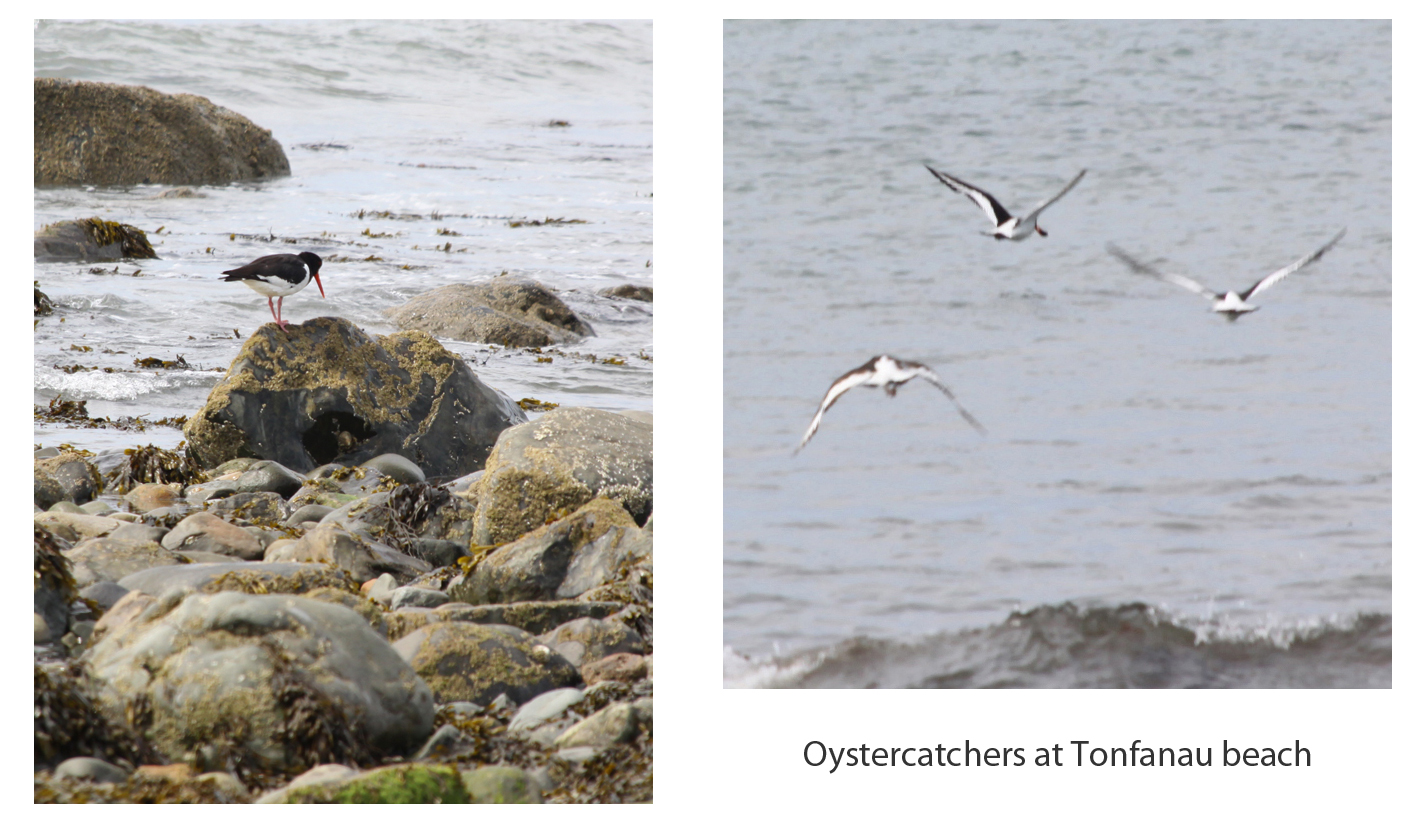 After walking up Tonfanau to see the Iron Age hillfort I went along the road to Tonfanau station, crossed the tracks and passed part of the old military camp to go down to the pebble beach. It is an excellent place for watching the oyster catchers, and I was lucky to find some pottering around at the water’s edge, amongst the small rocks. Oystercatchers are lovely to look at. Their bright orange beak and pink legs make them stand out from any background, whilst their black and white plumage is particularly distinctive when the birds are in flight. They make a piercing peeping sound, which can be heard here on the British Birdsongs website. Oystercatchers feed on molluscs that the find on rocky shorelines, which they open by stabbing the sharp beak through linking muscles, and then hitting on stones and rocks to break them up, sometimes audibly. The video below shows a pair of them on the beach at Tonfanau. Duration: 1 minute, 33 seconds.
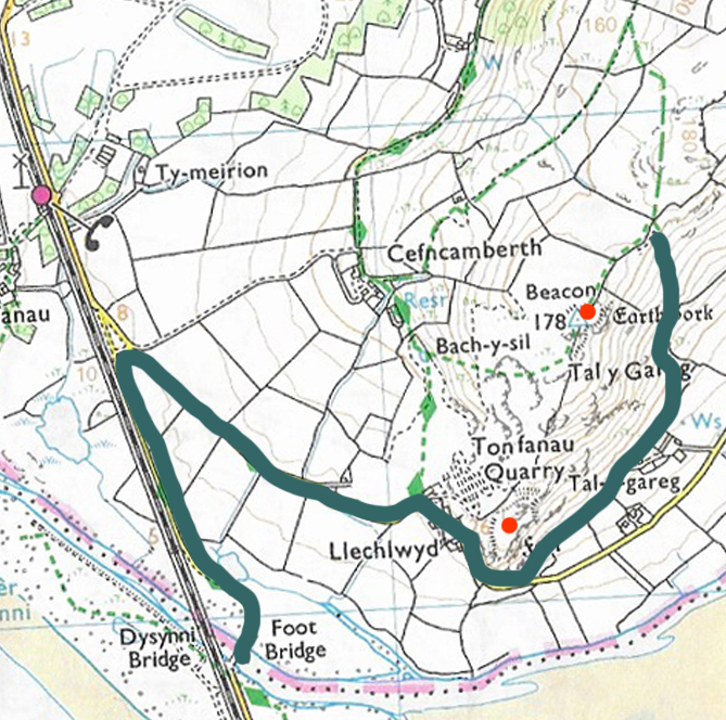
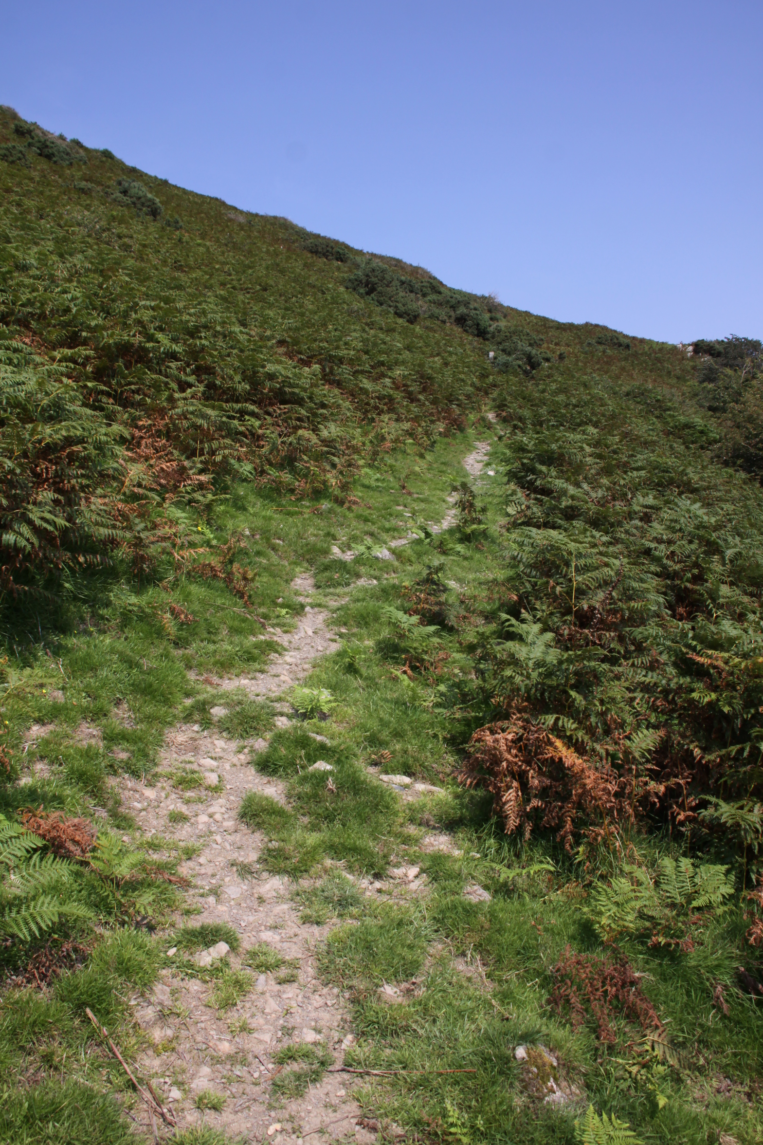


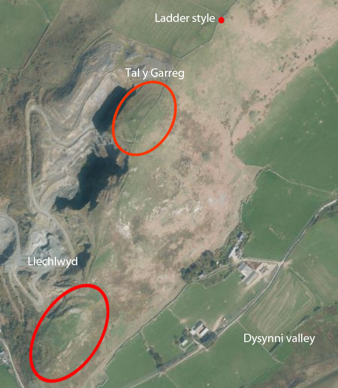
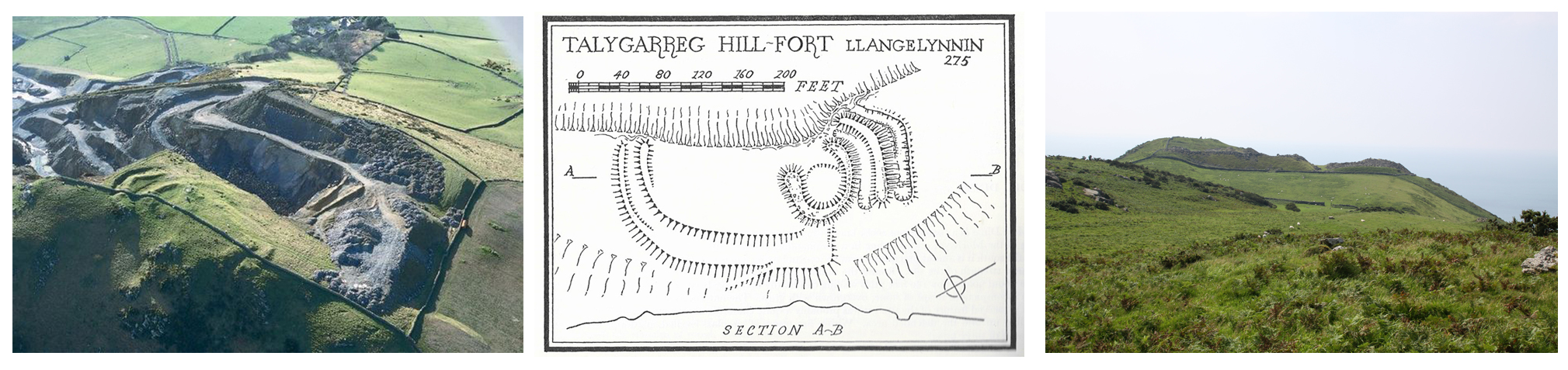
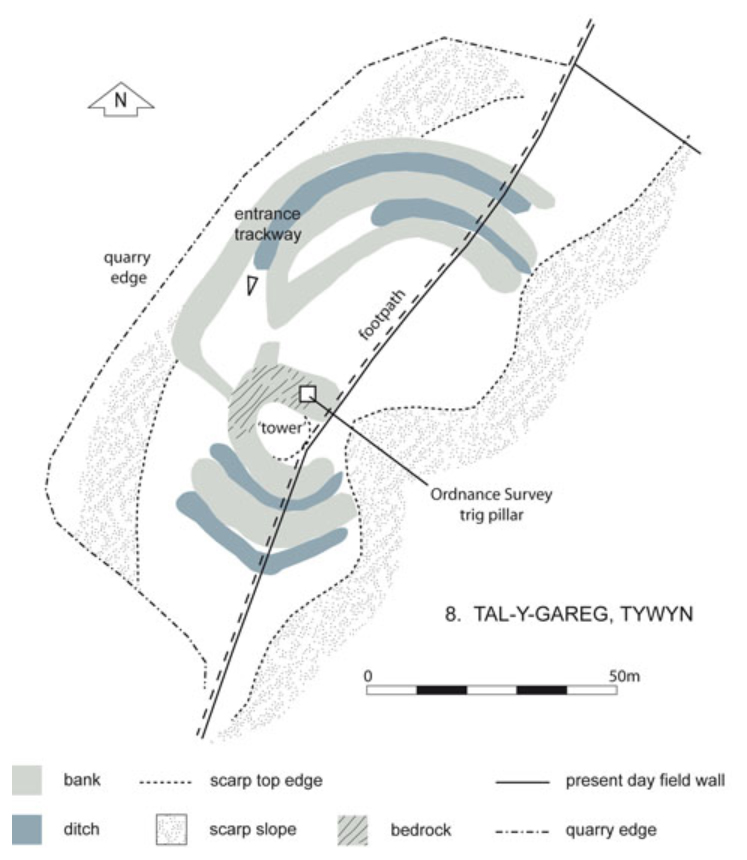
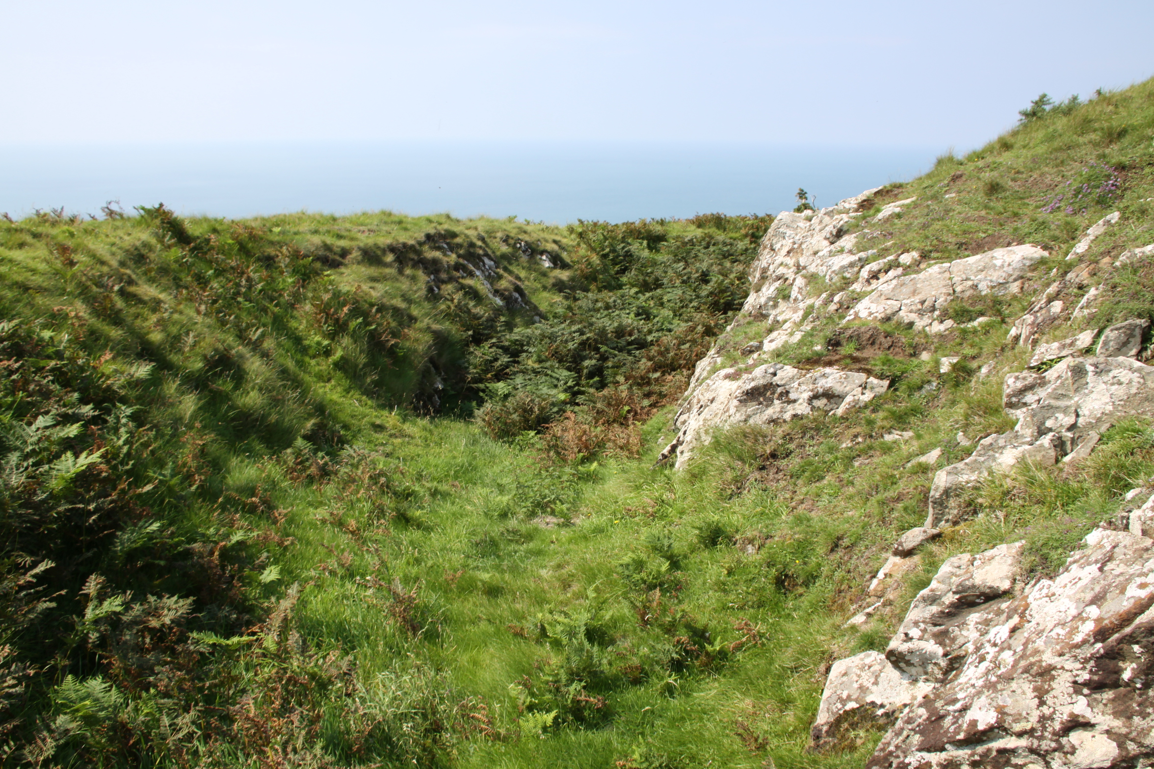
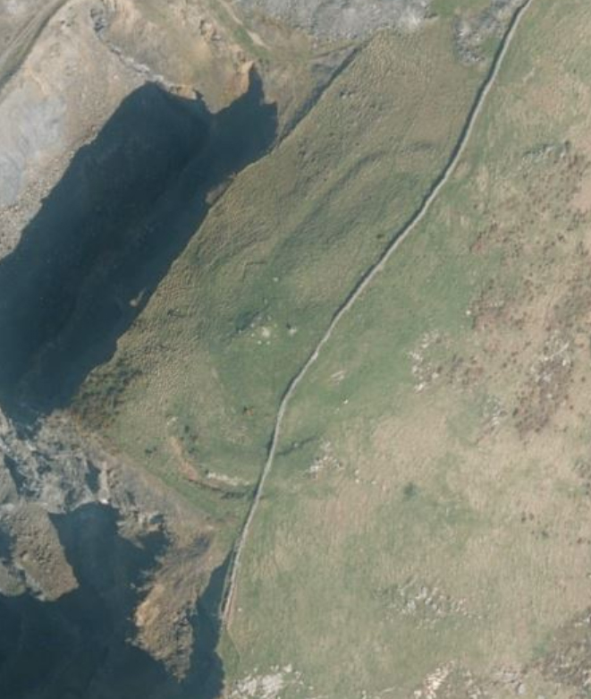
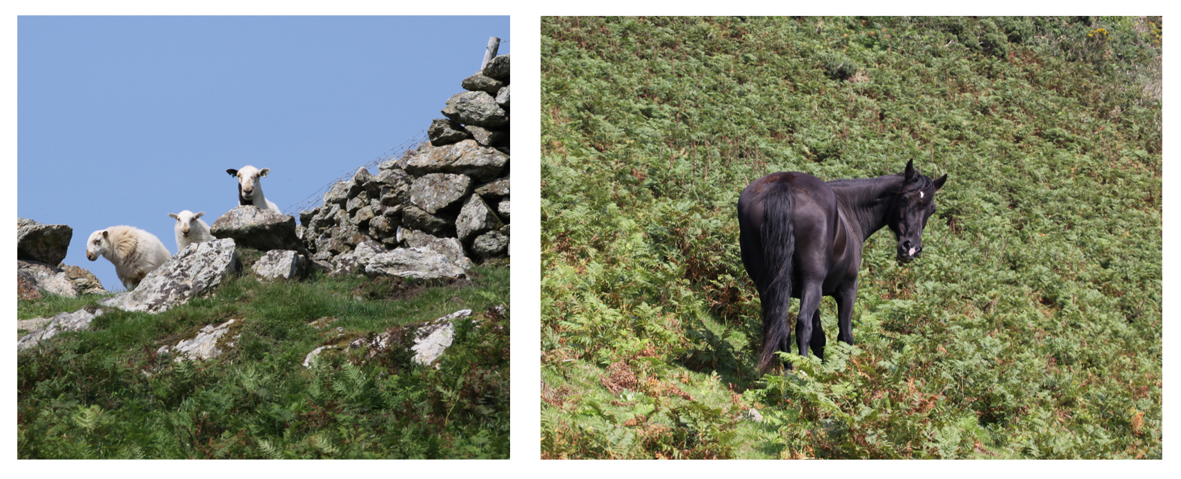
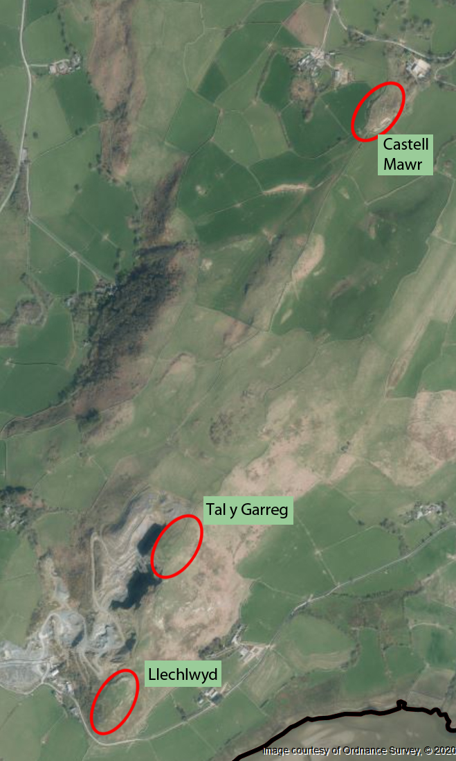
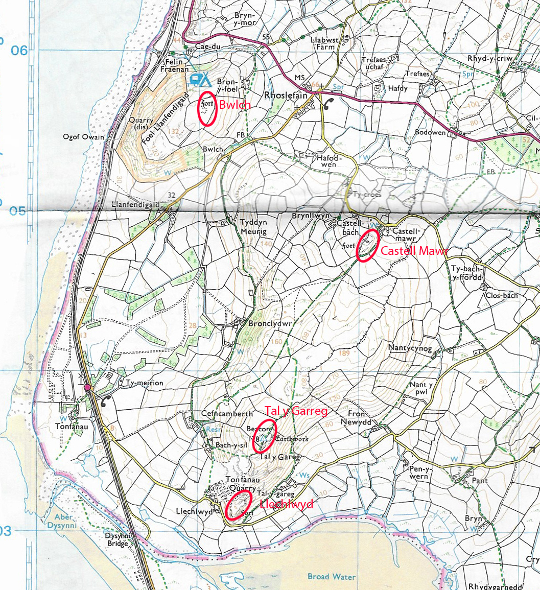
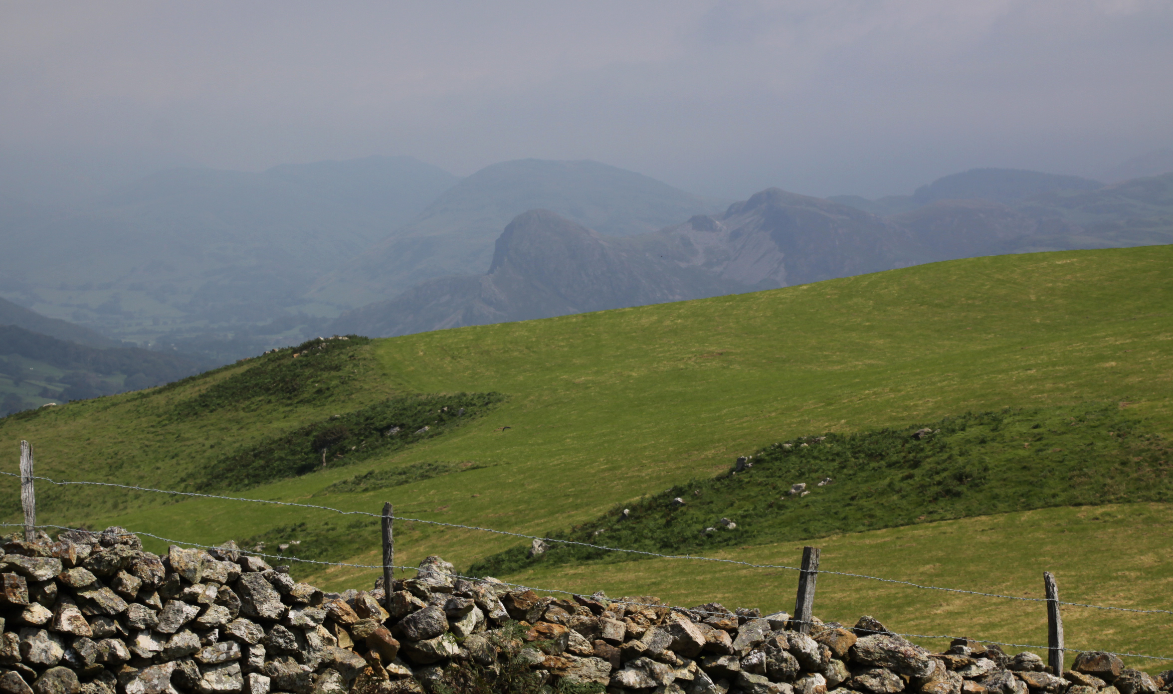
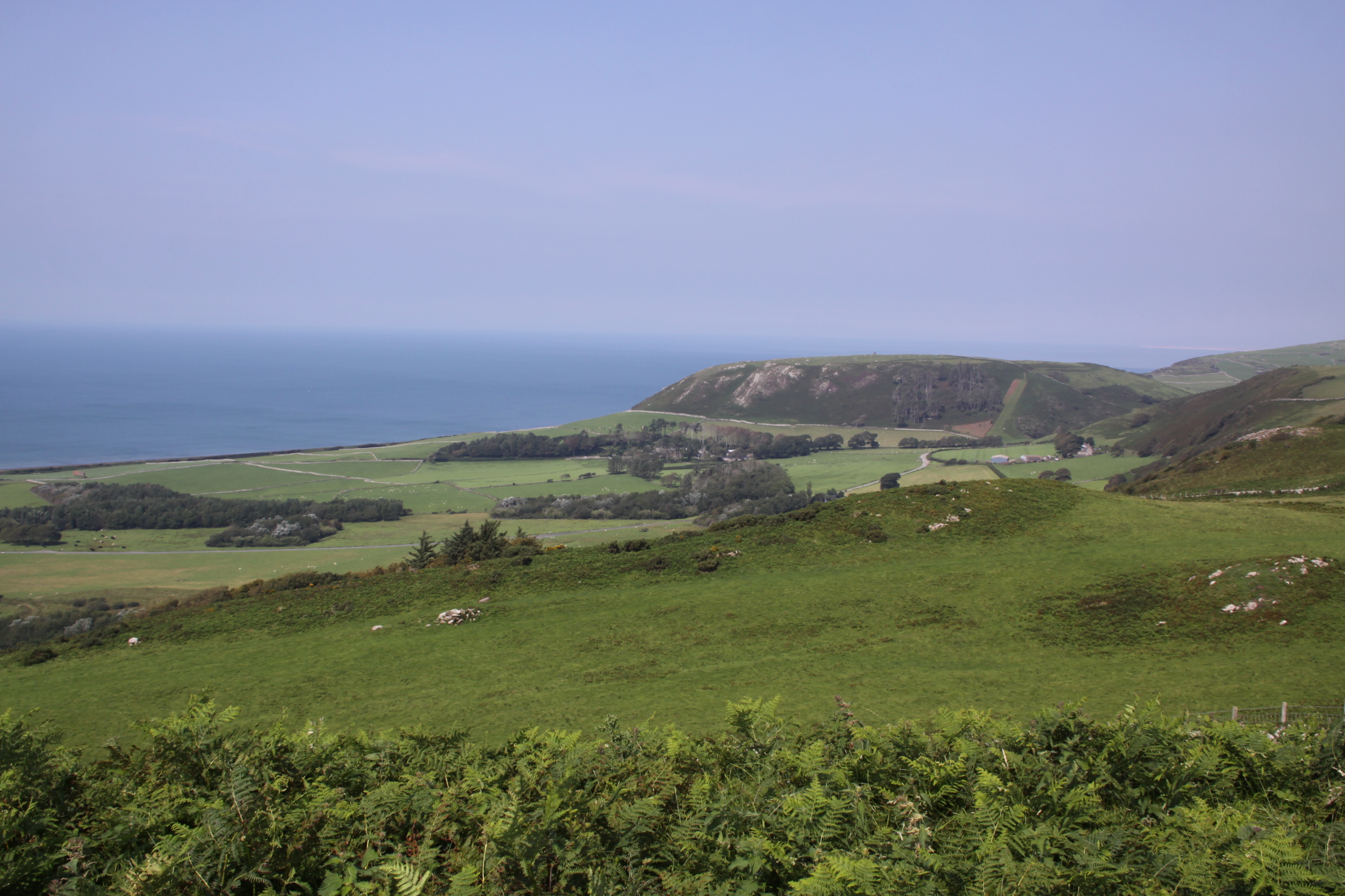
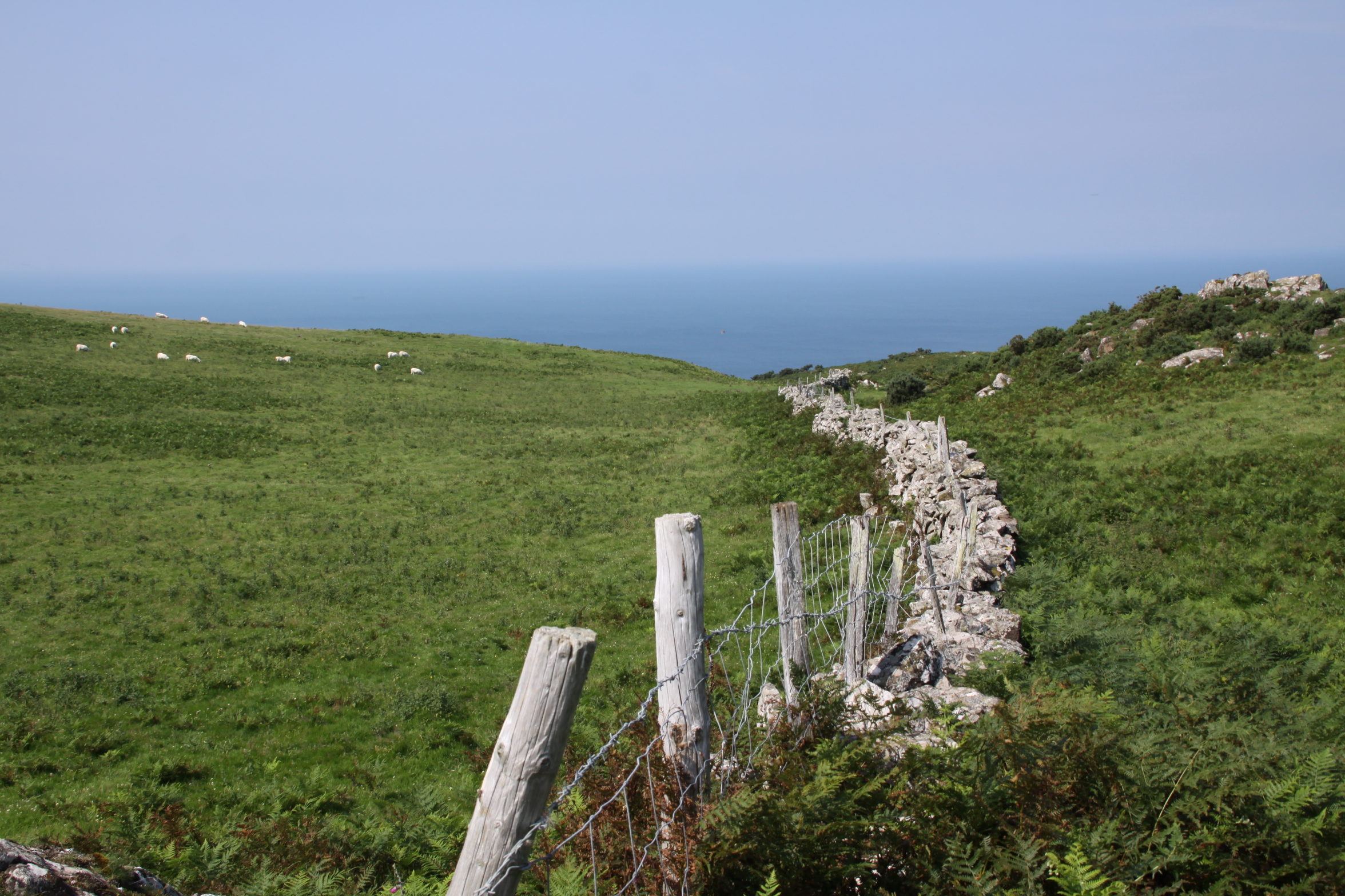
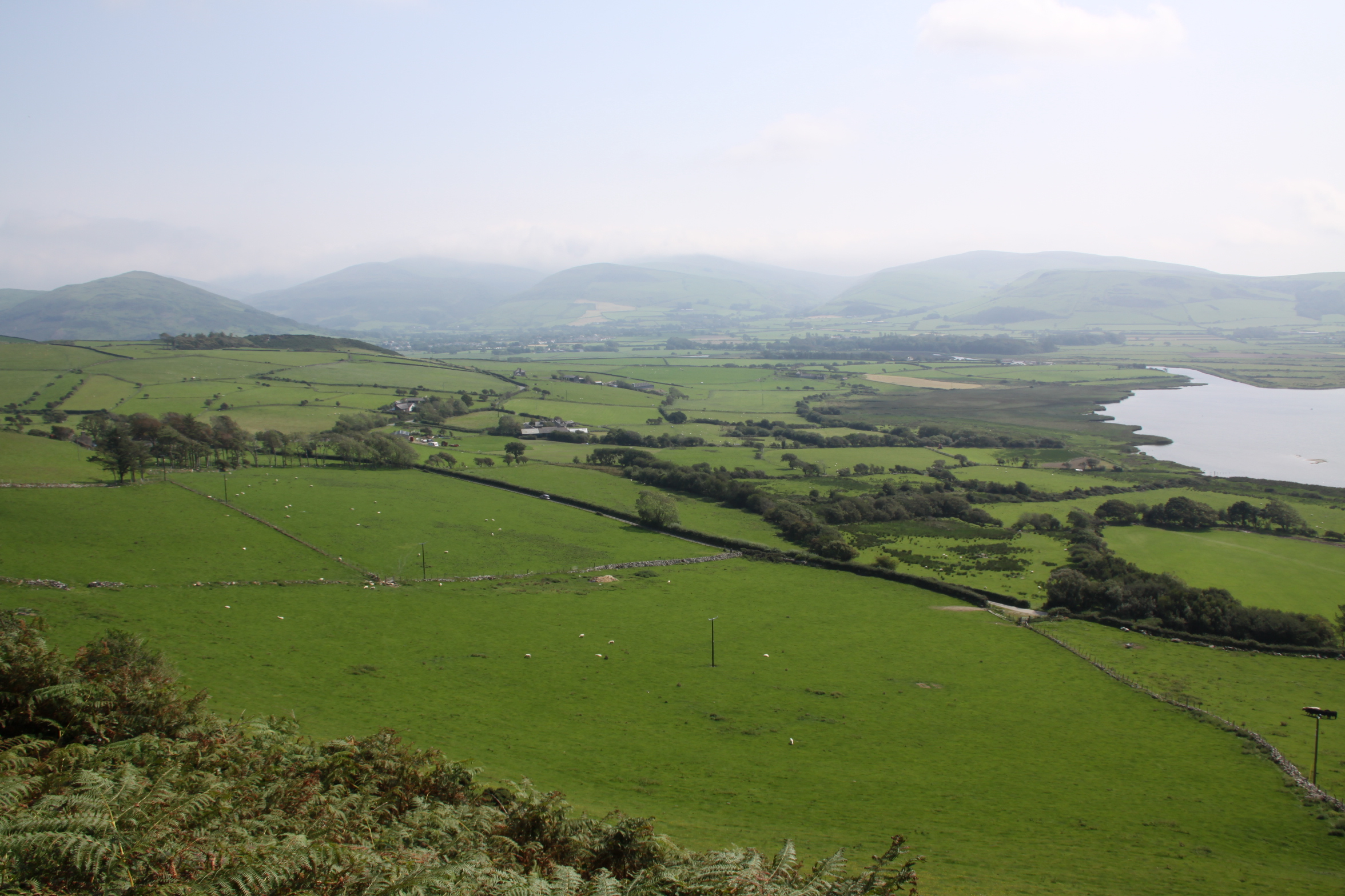
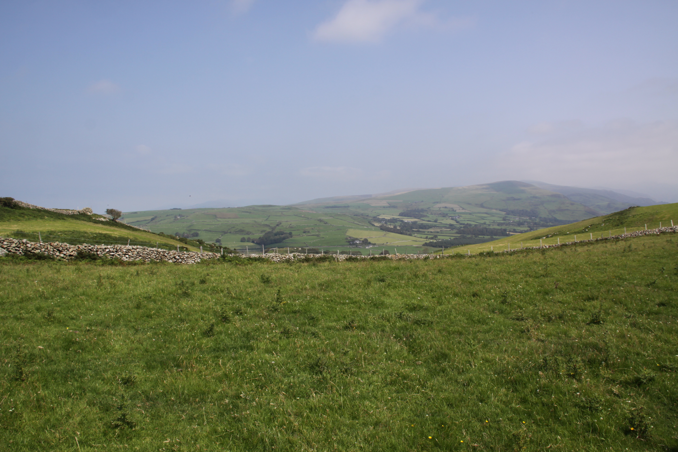

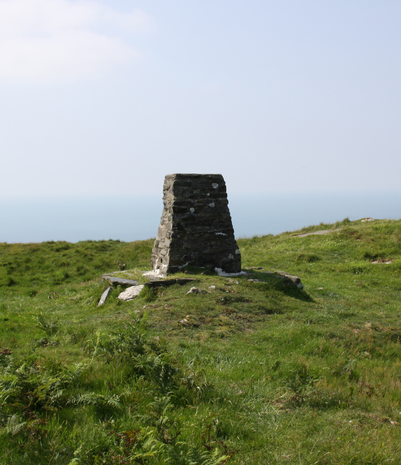
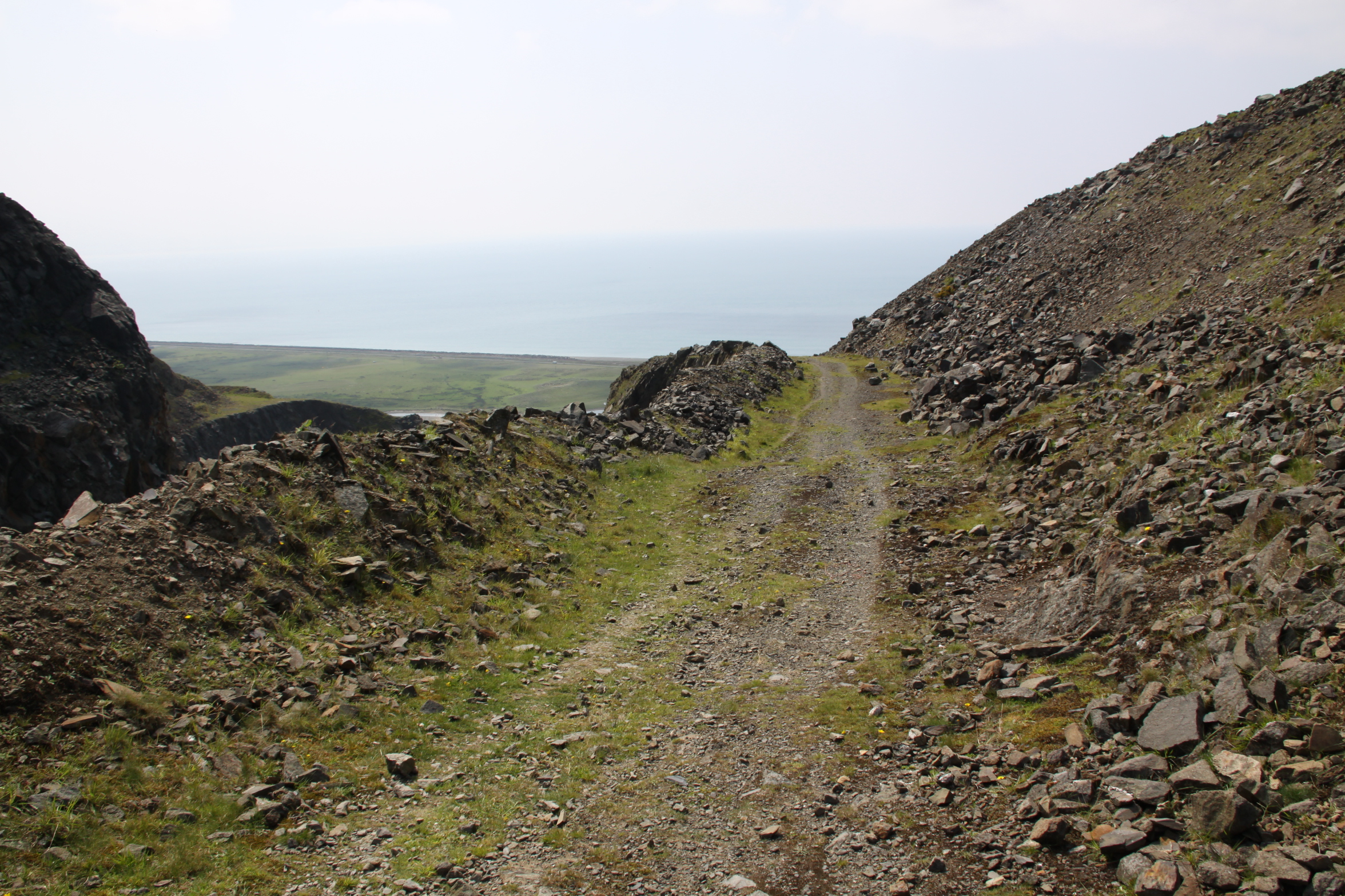
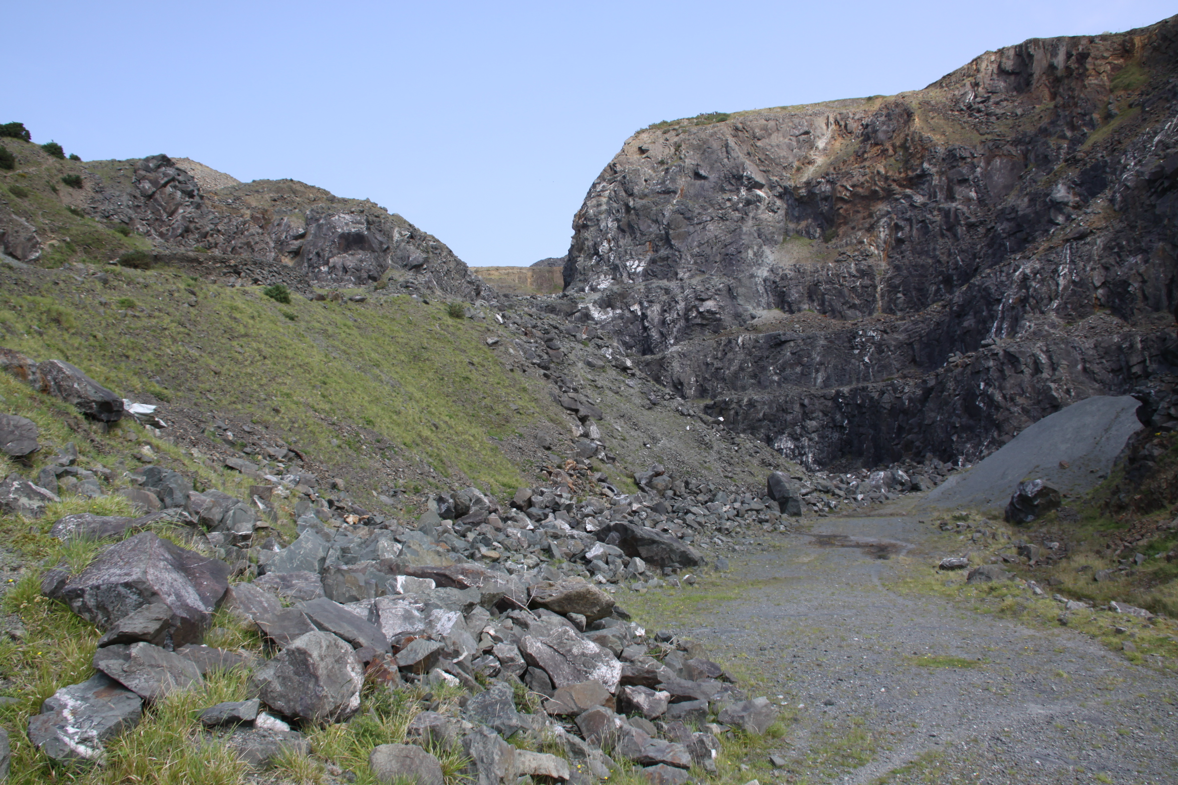

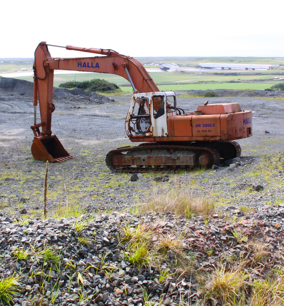
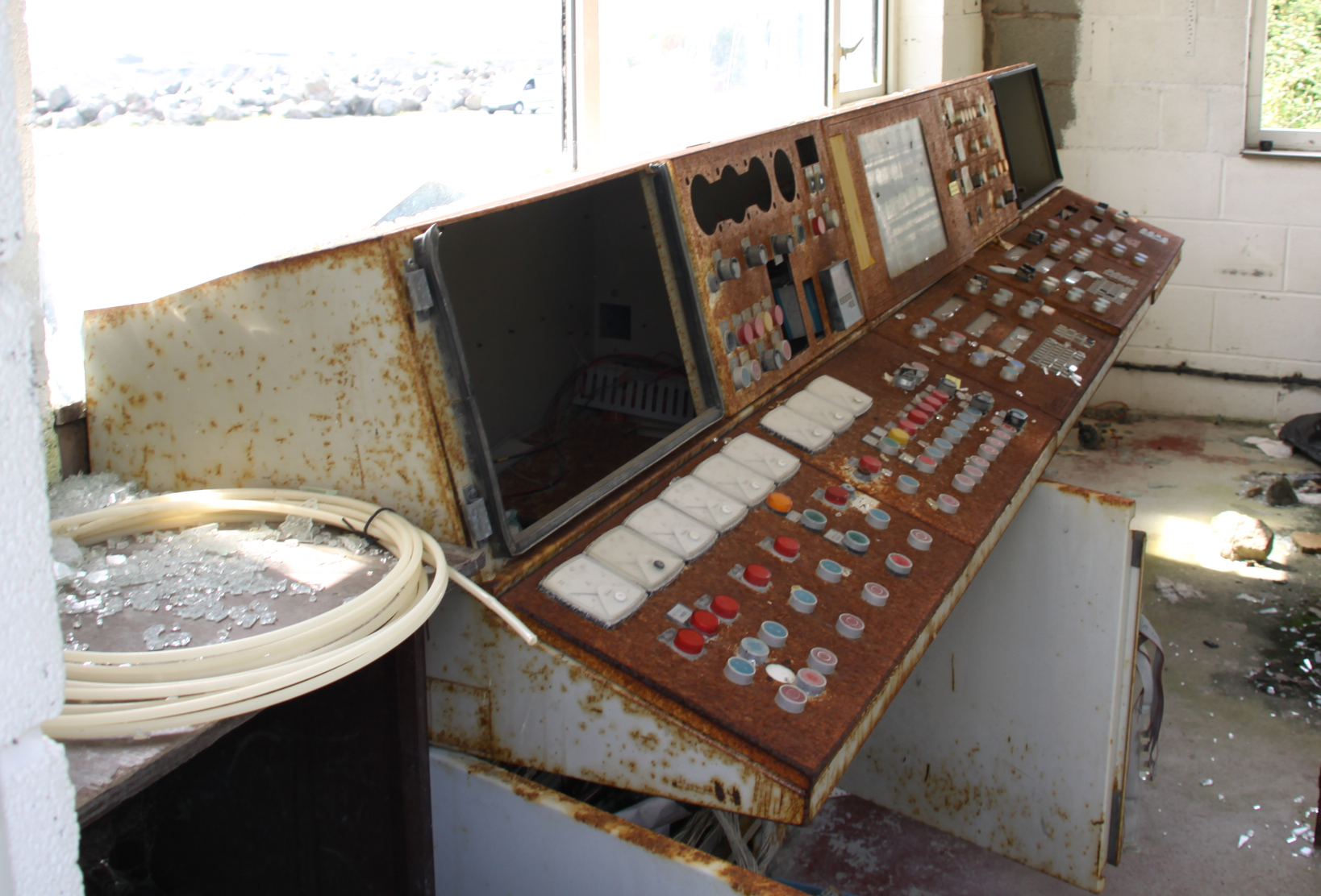
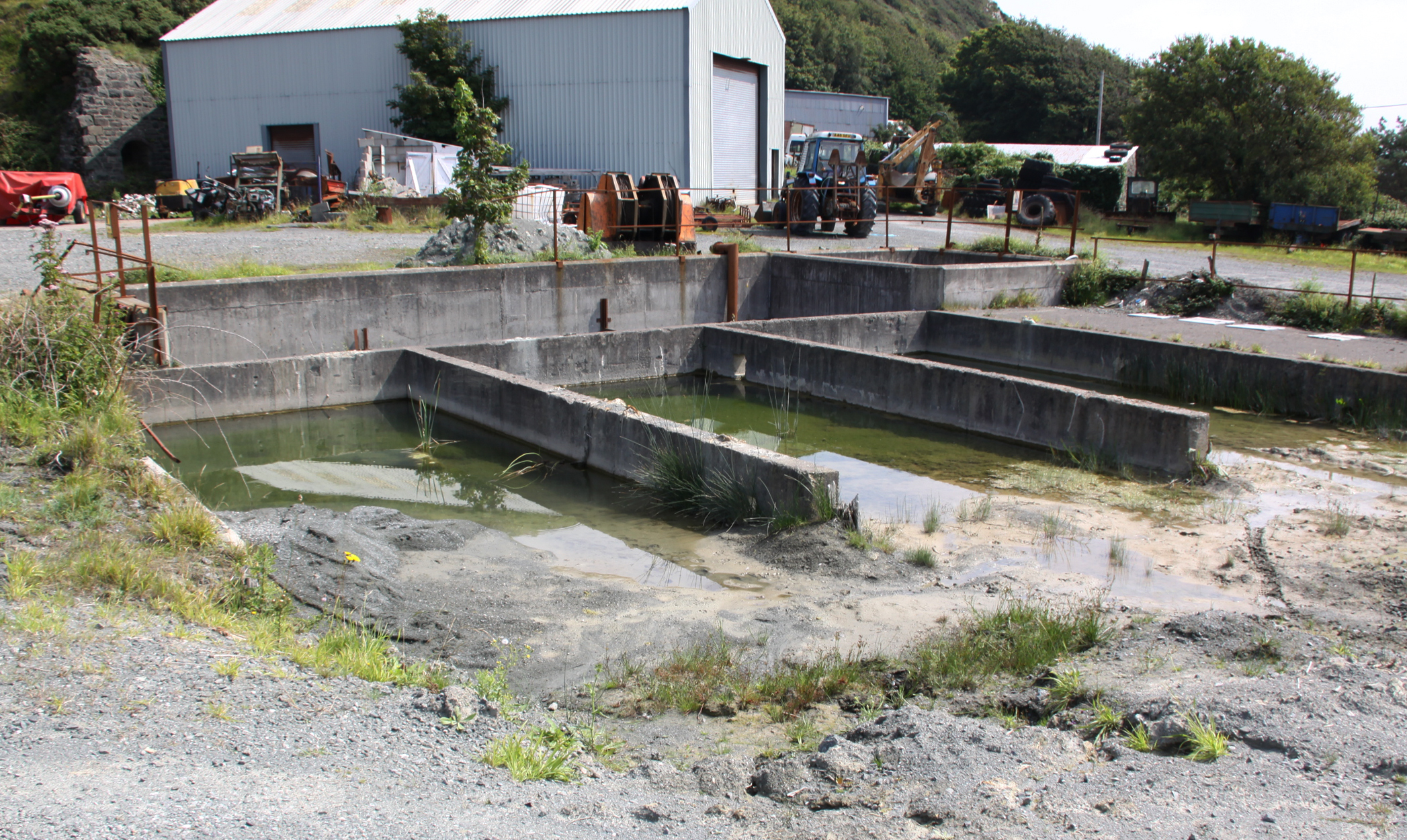
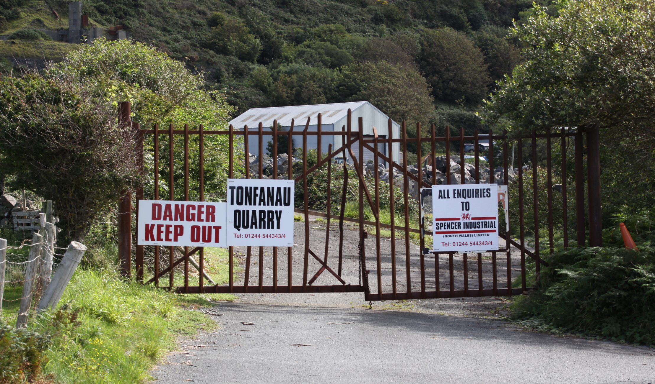
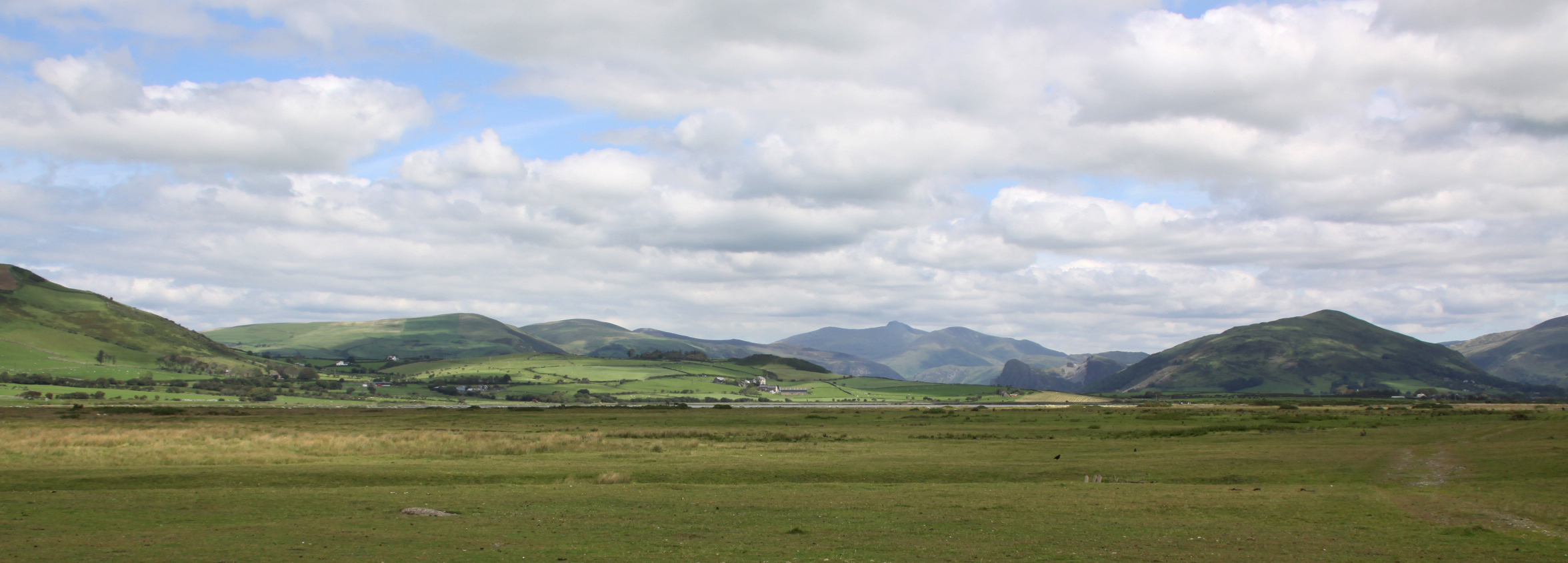
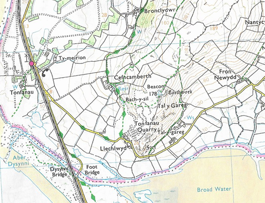
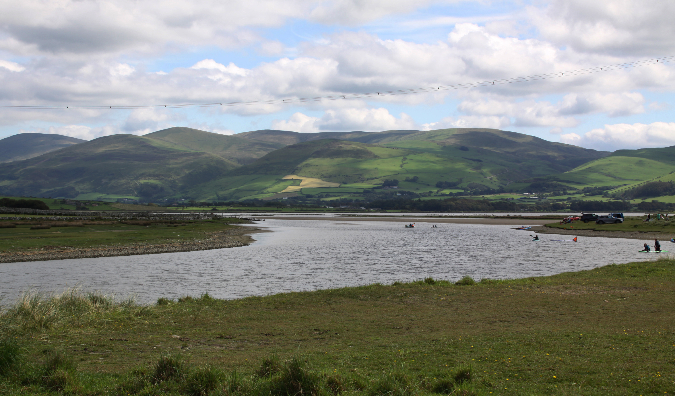
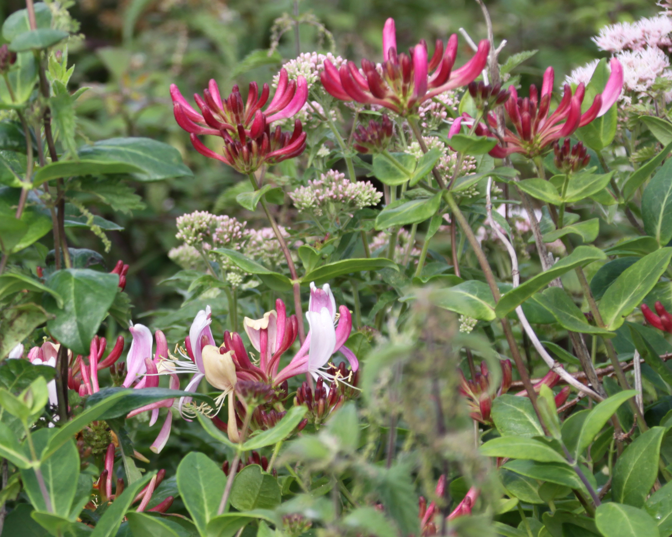
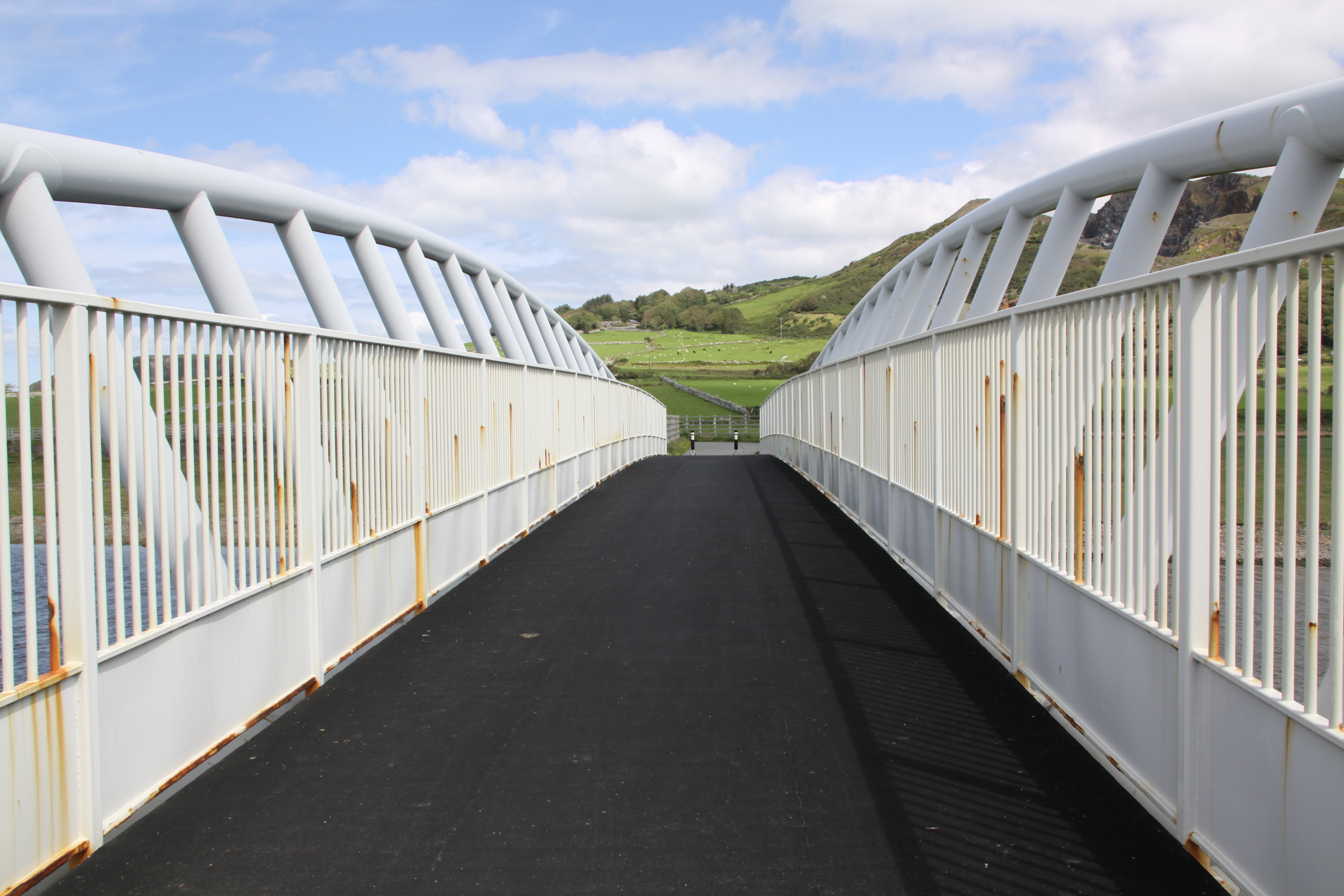
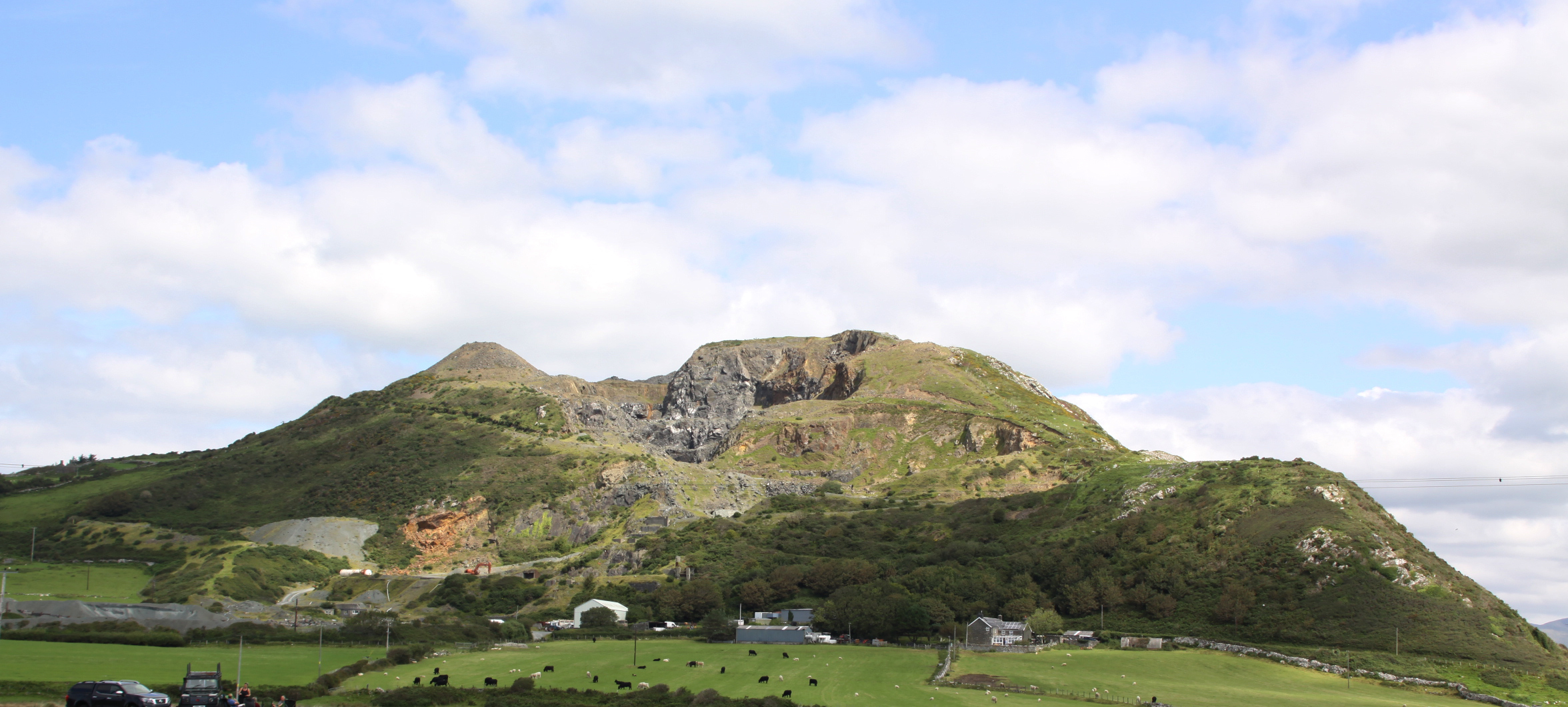
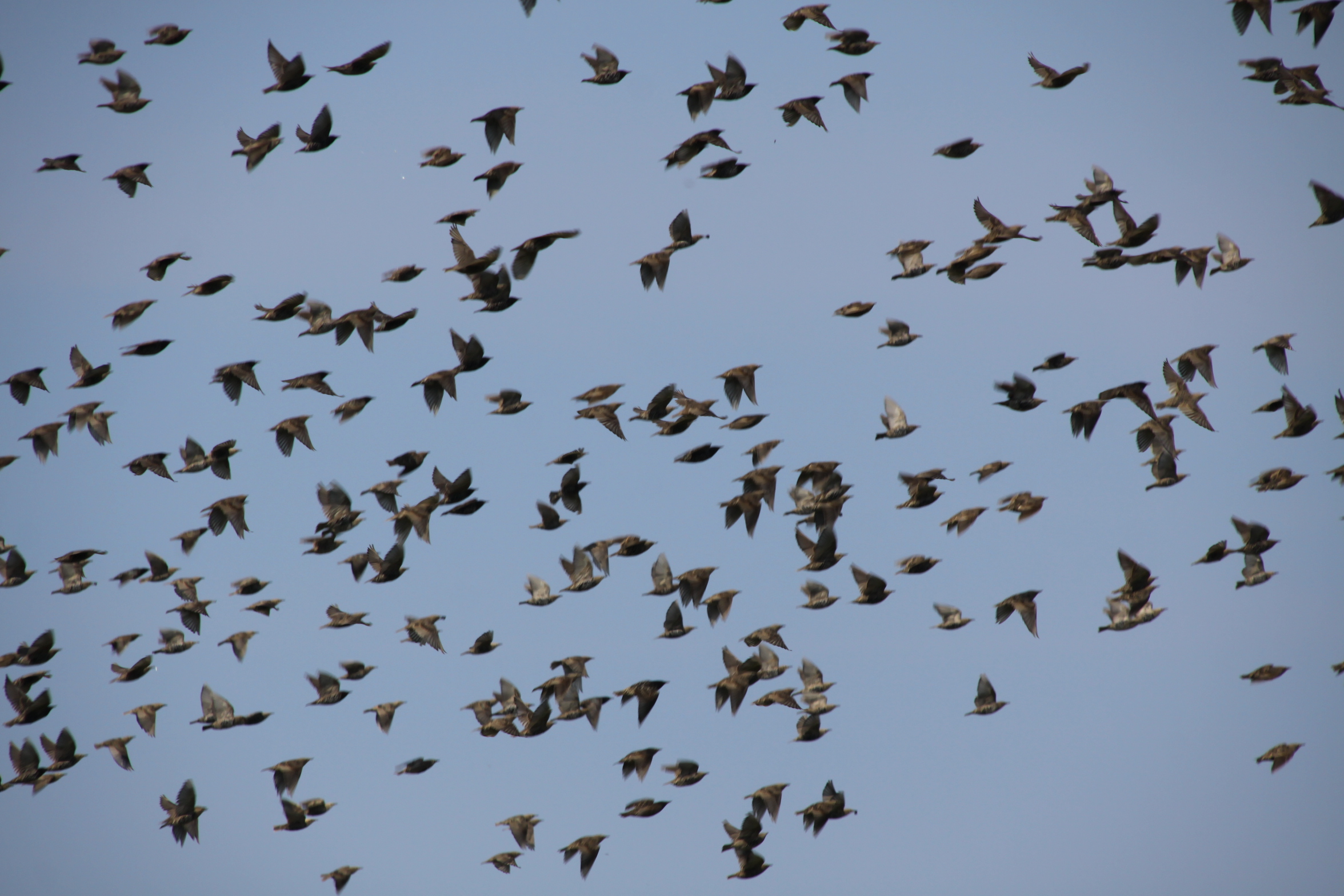
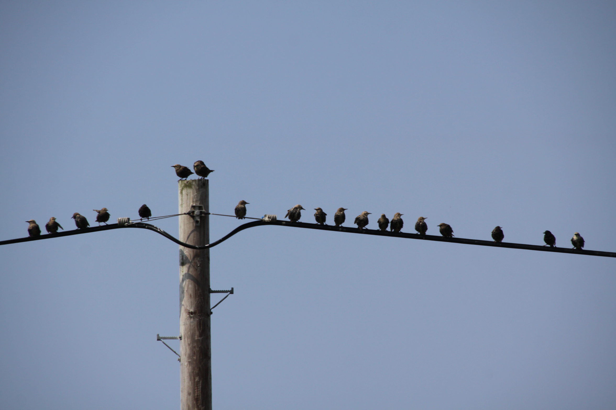

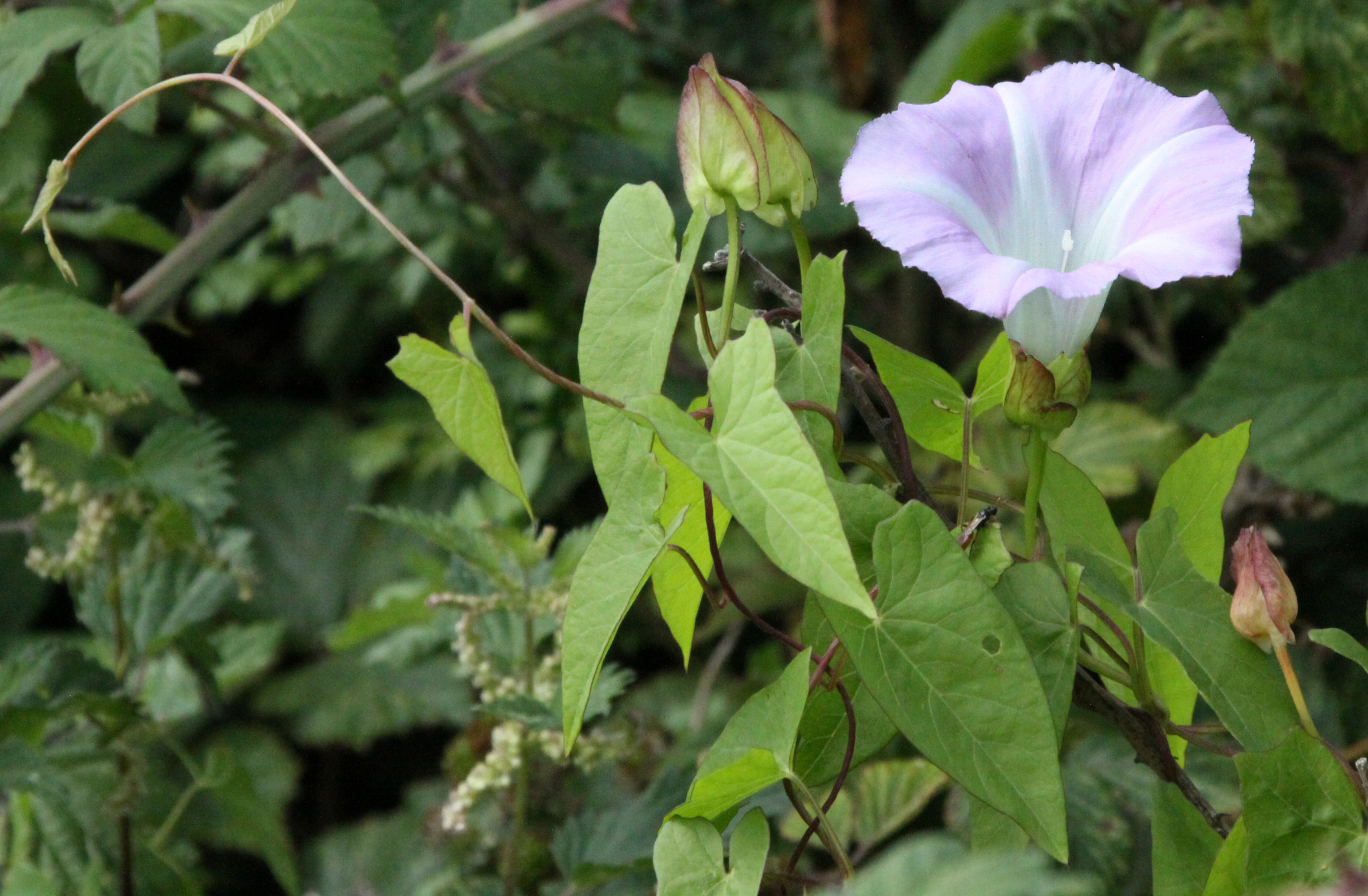
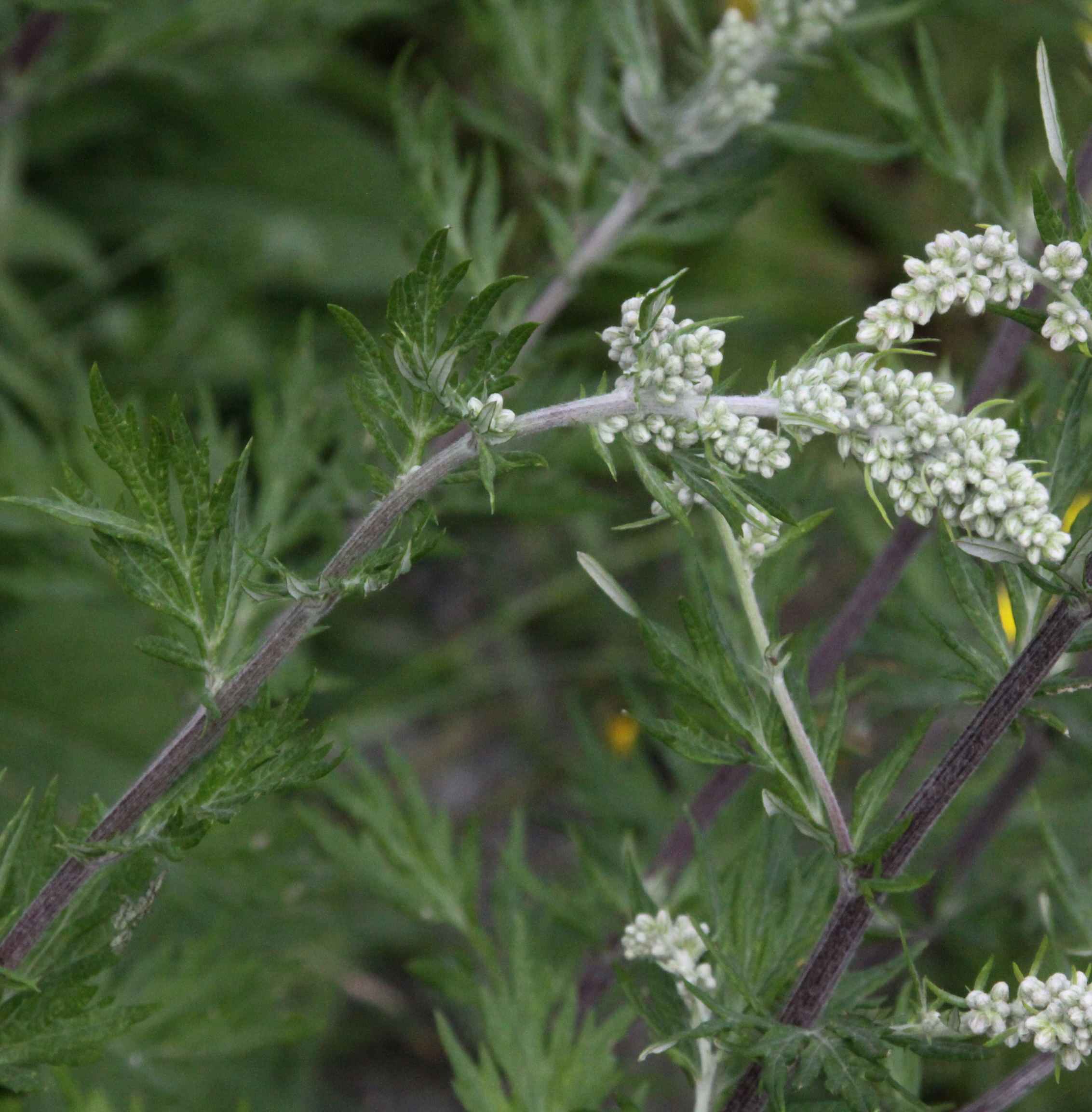
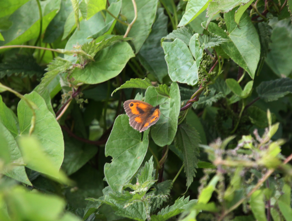
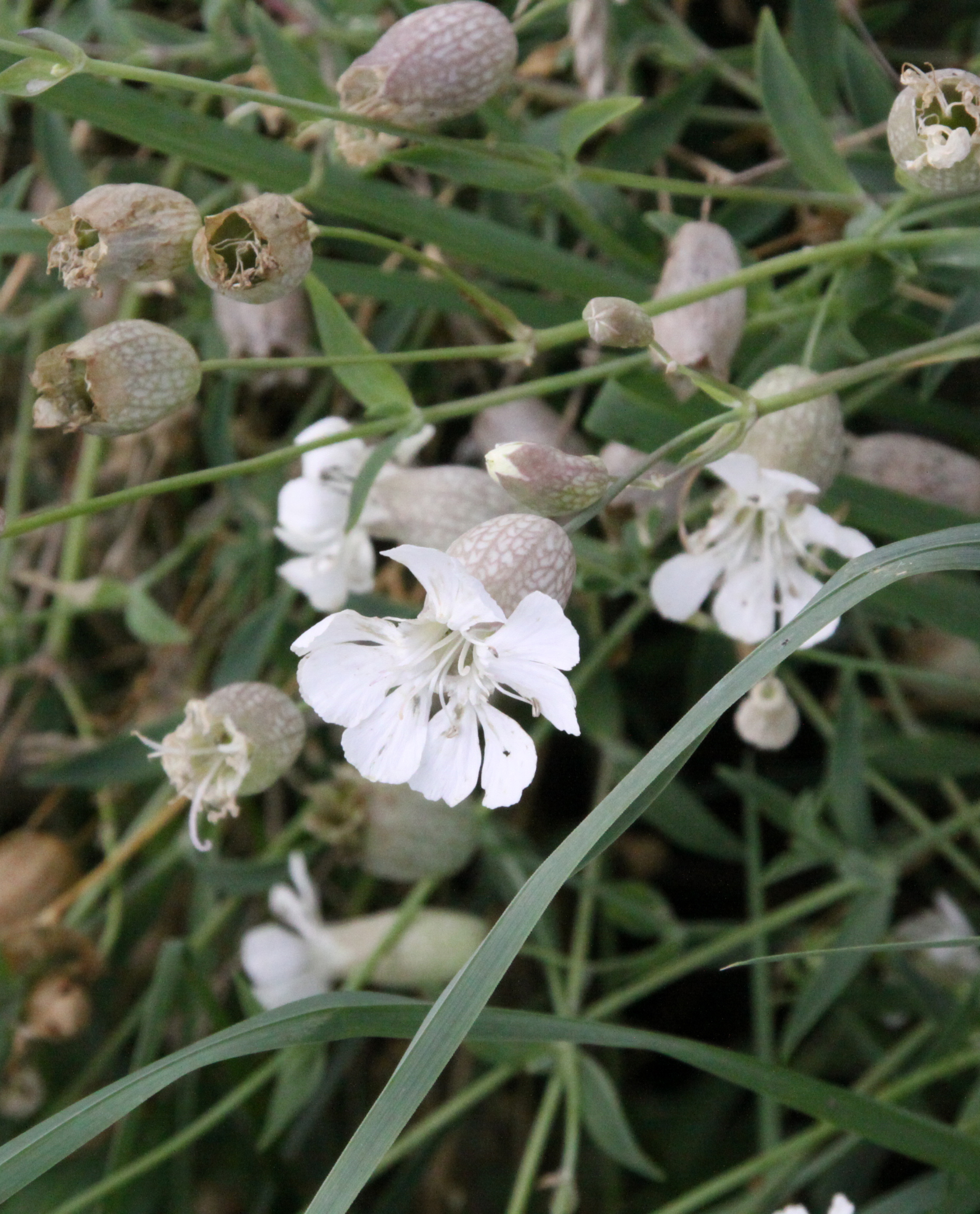
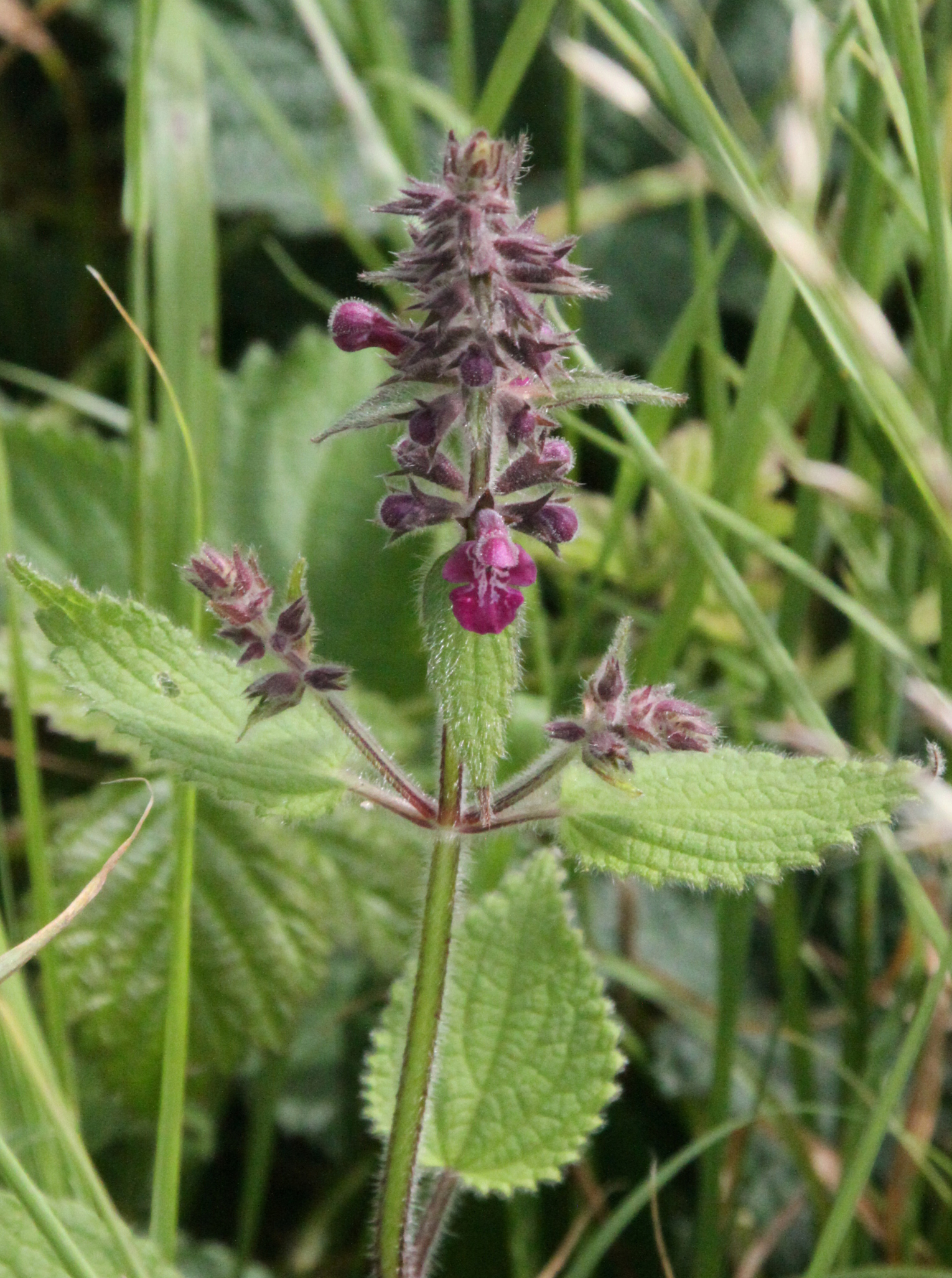
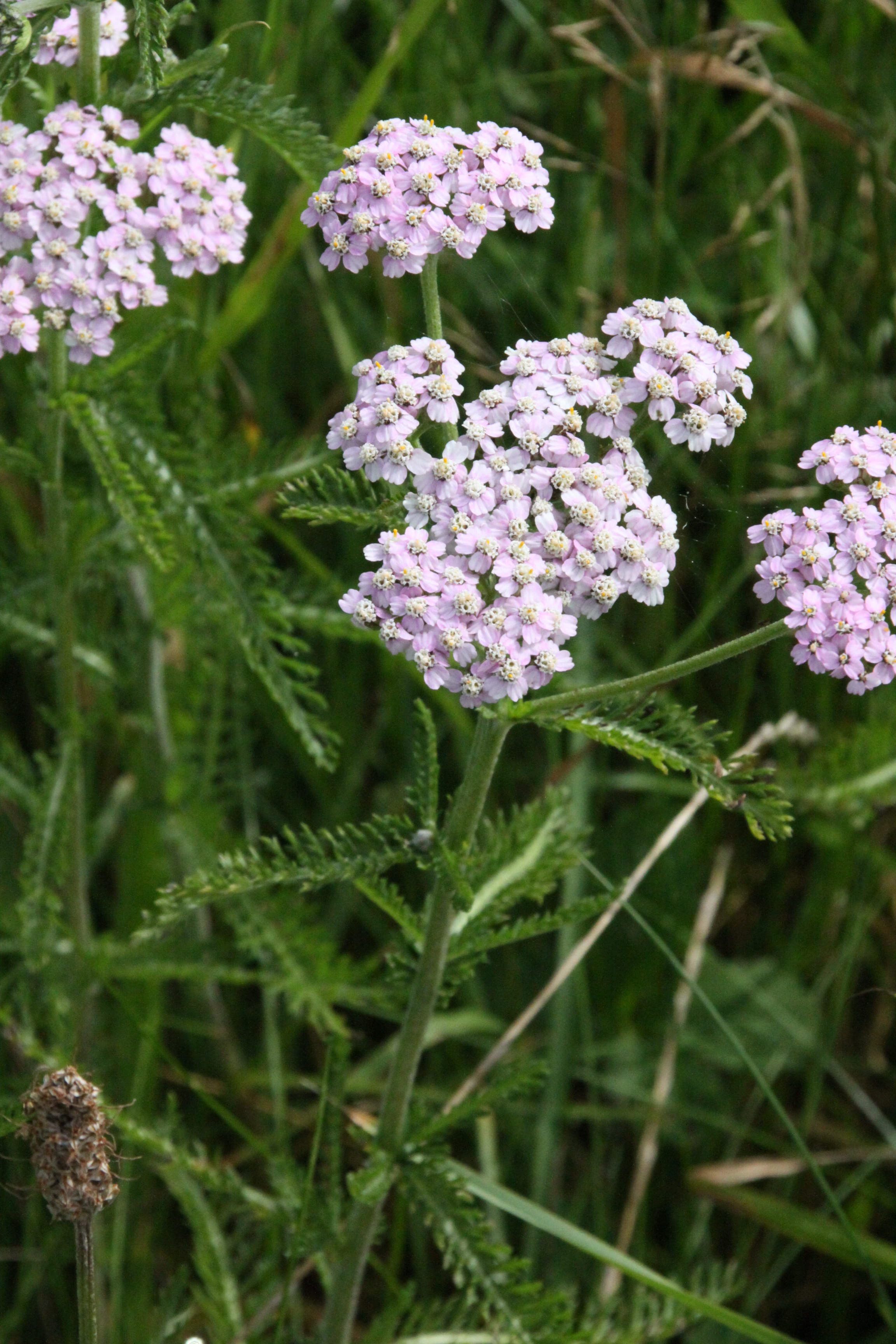
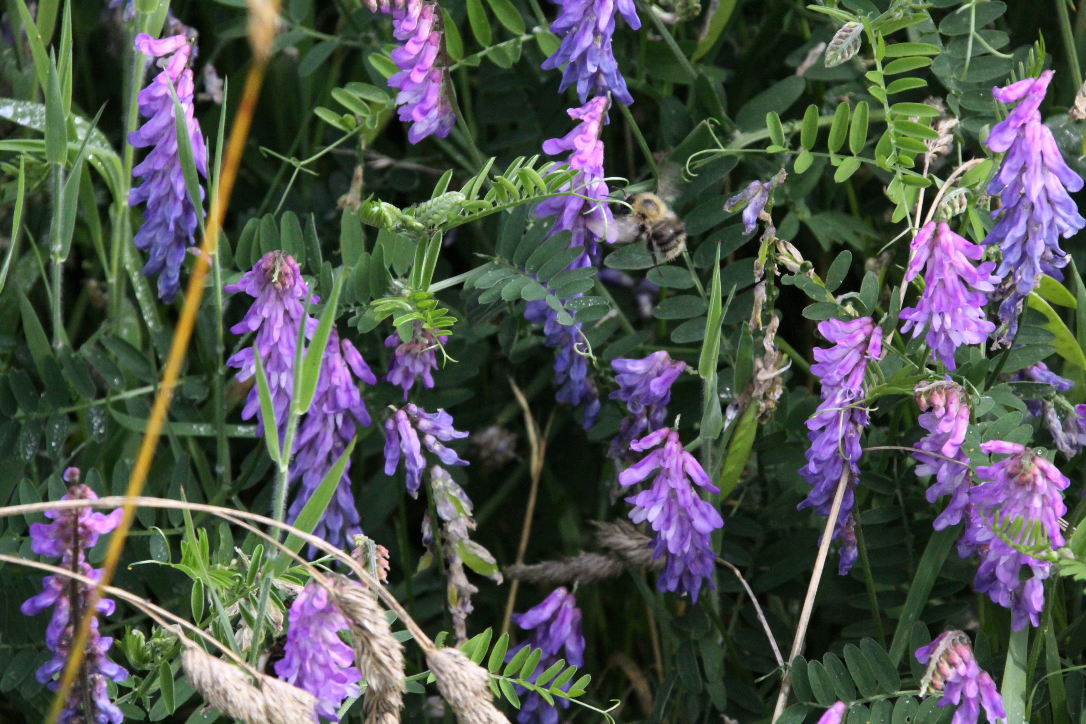

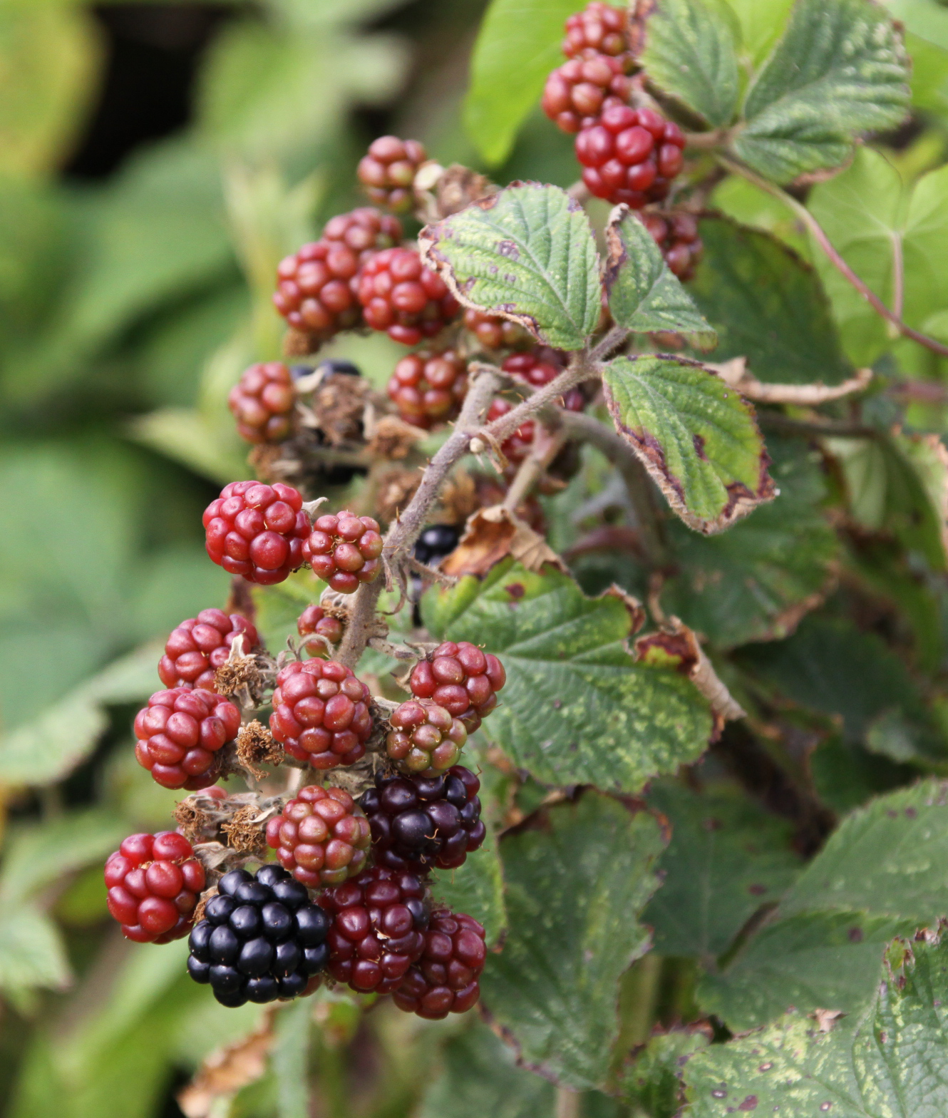
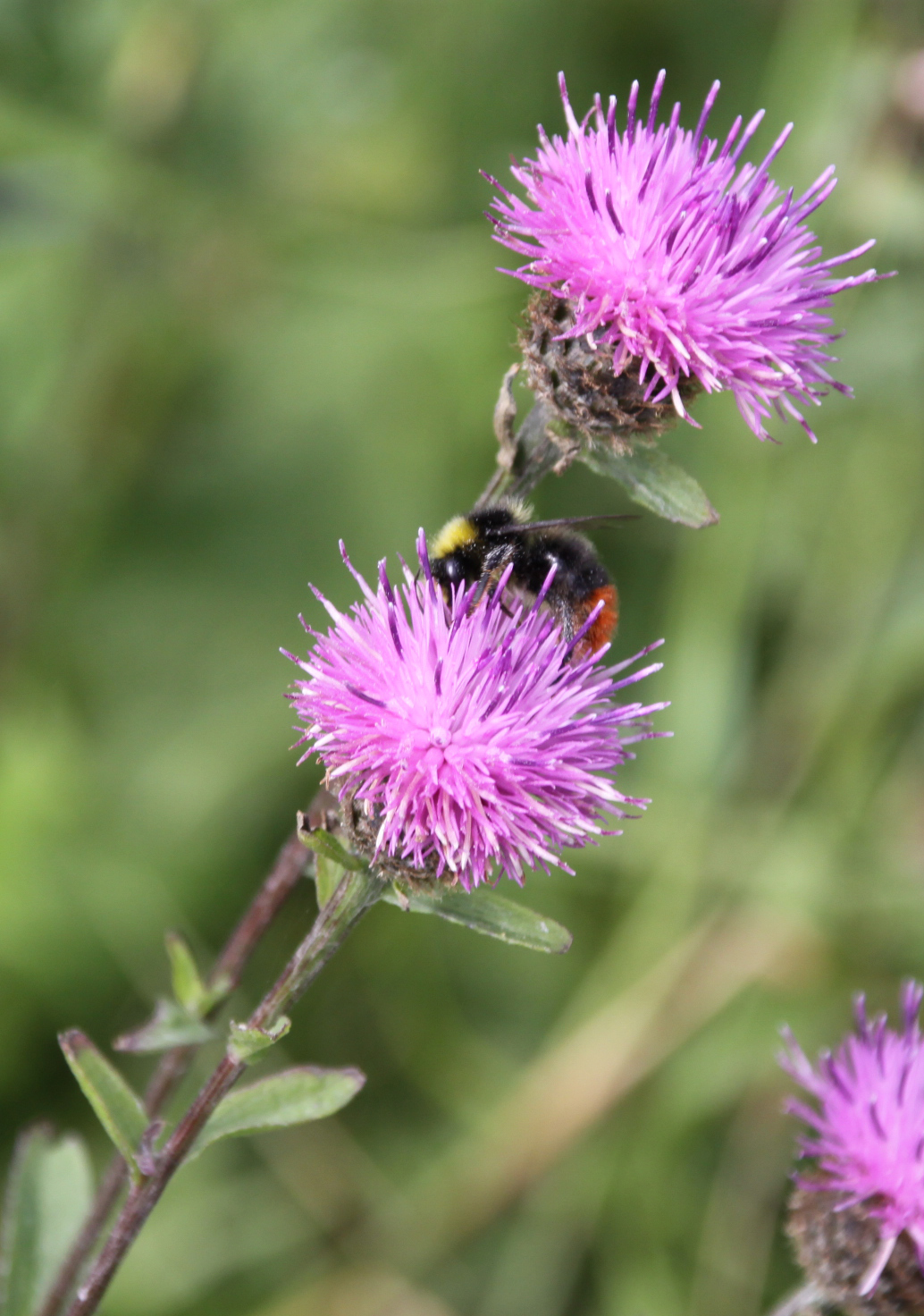

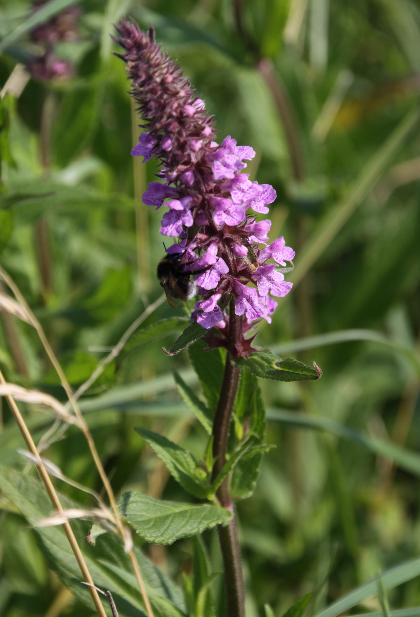
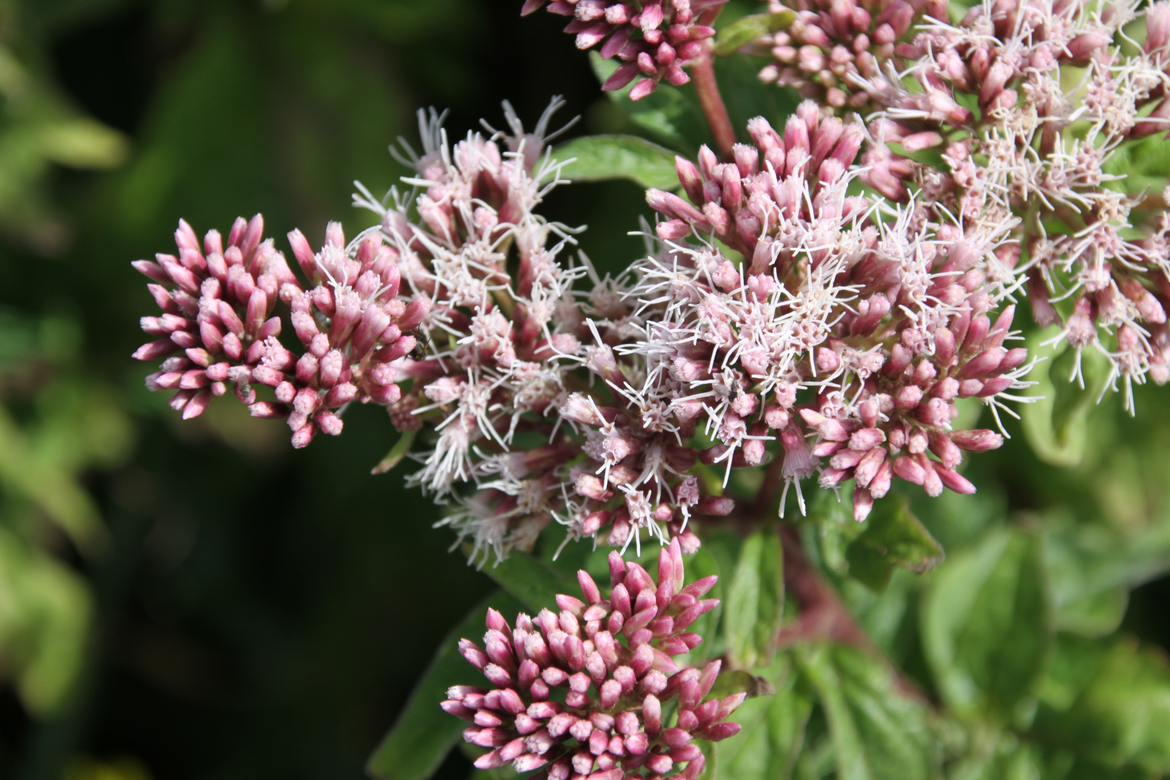
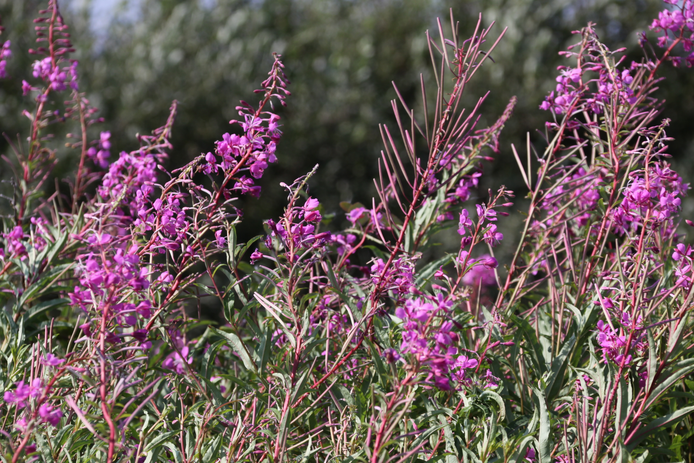
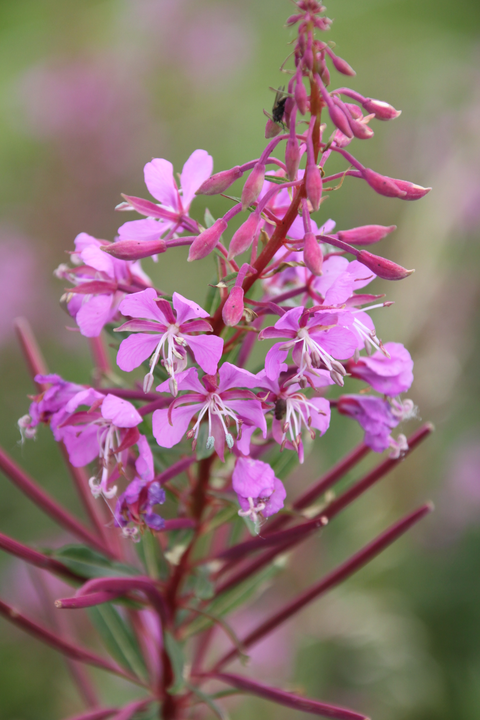
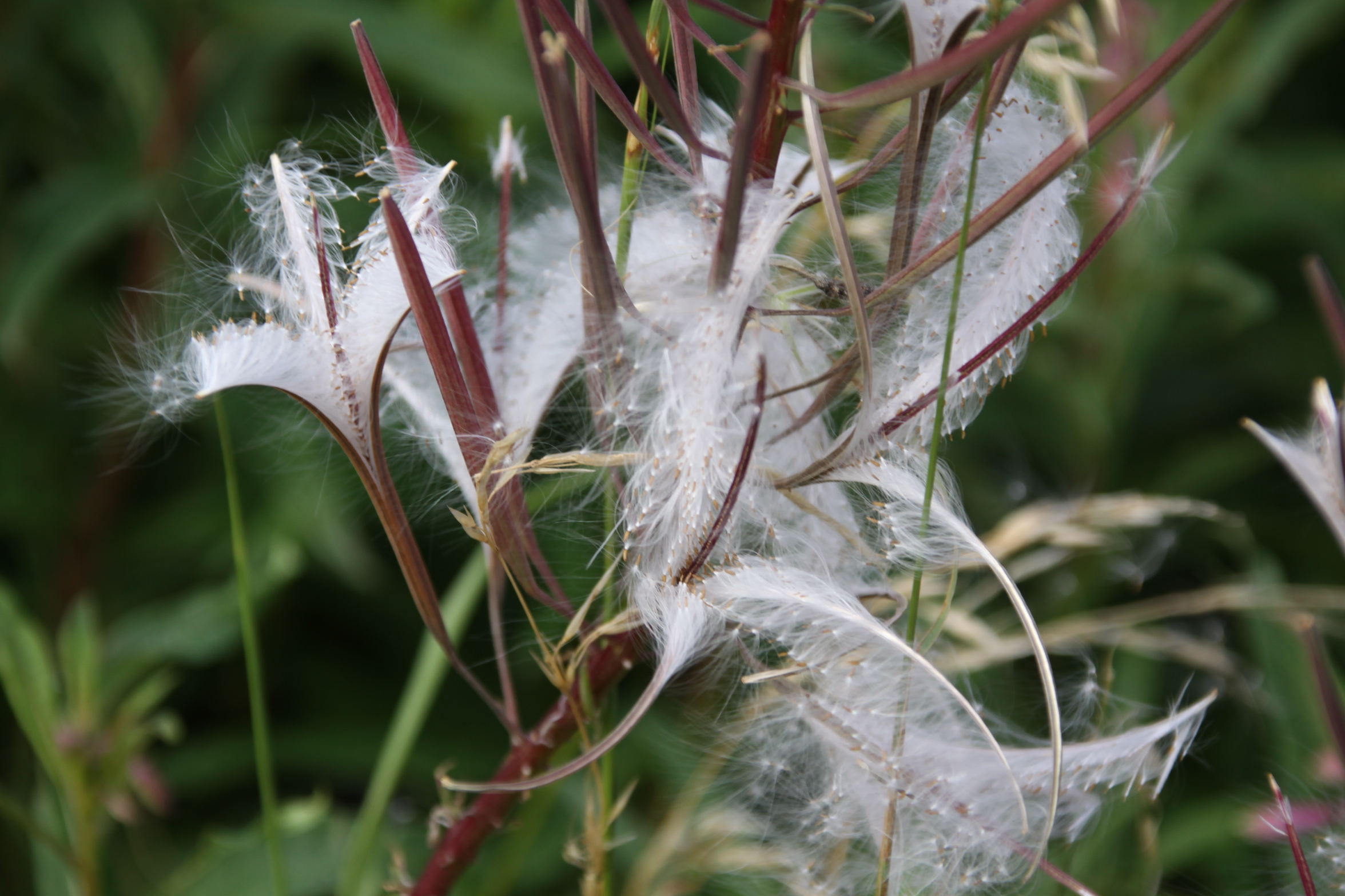
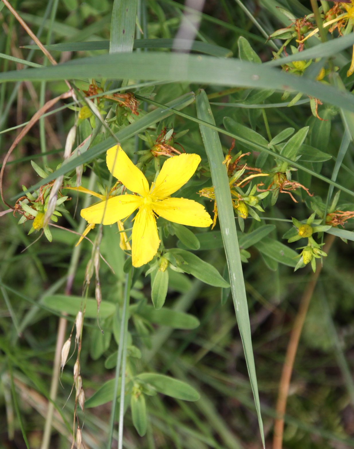
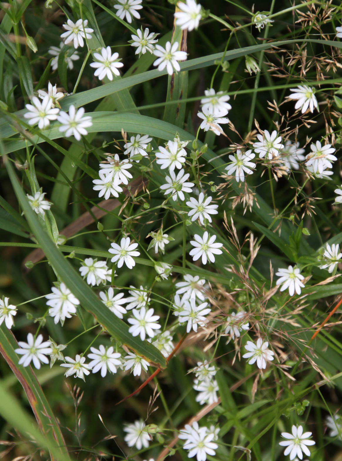

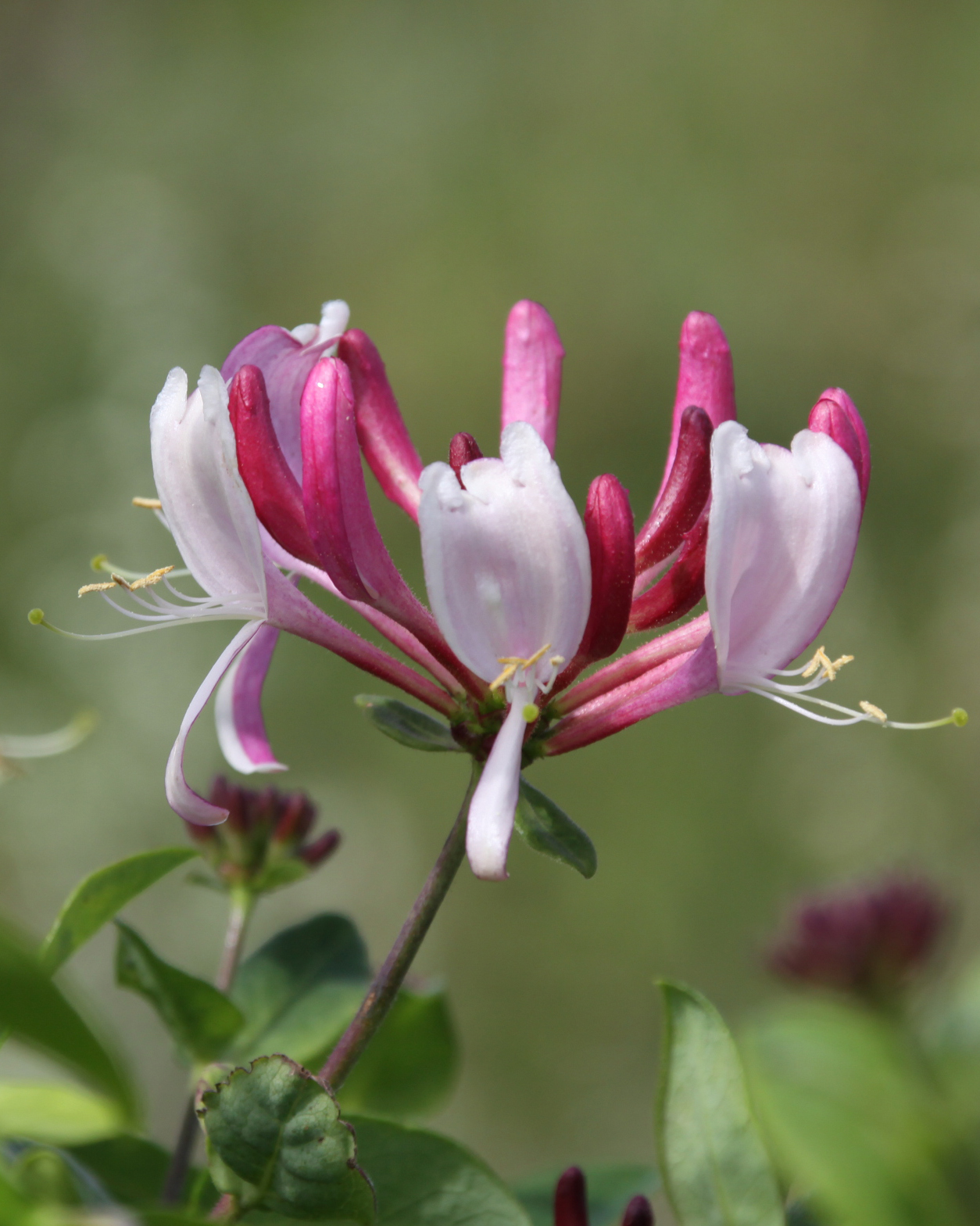
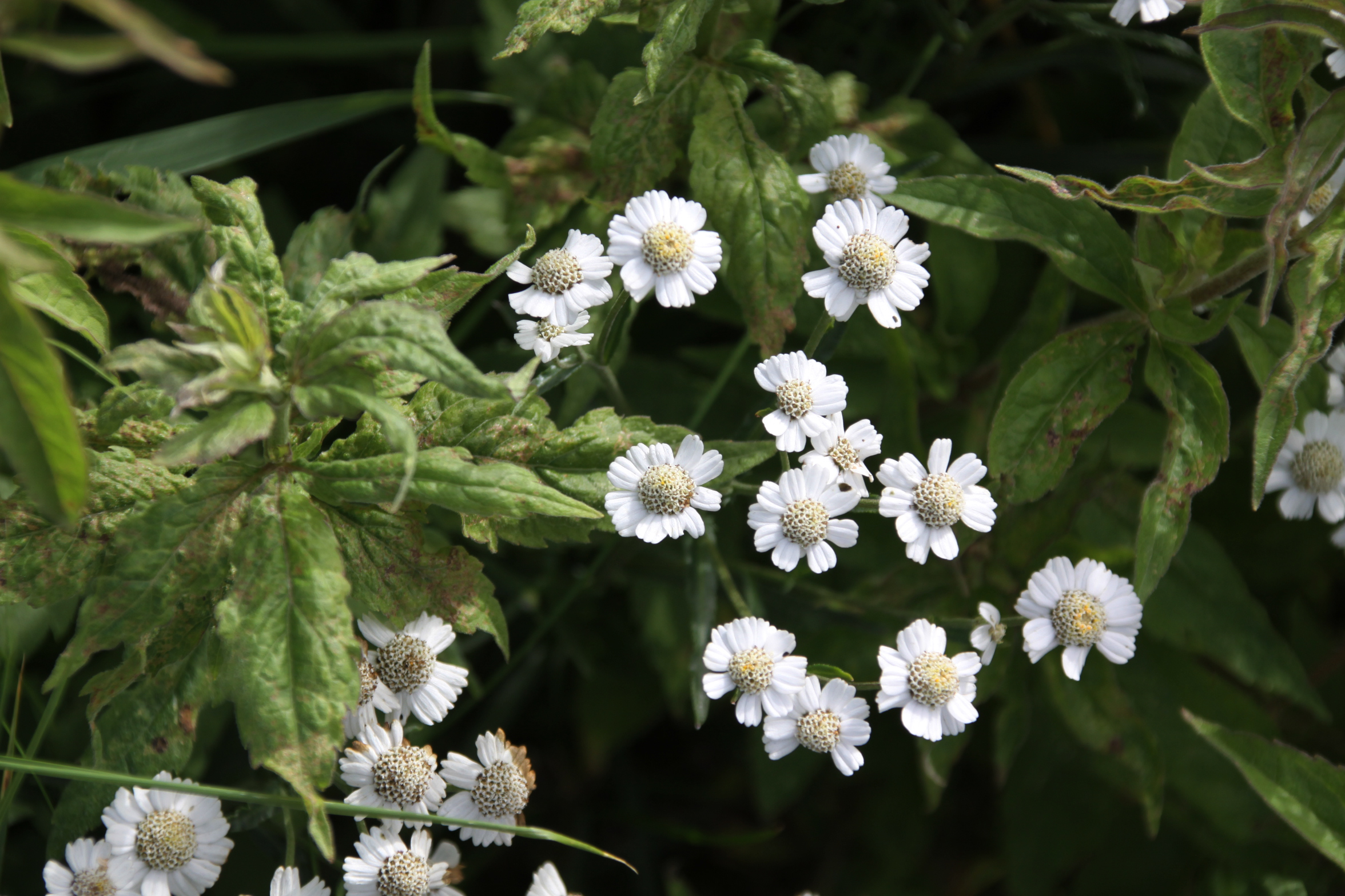
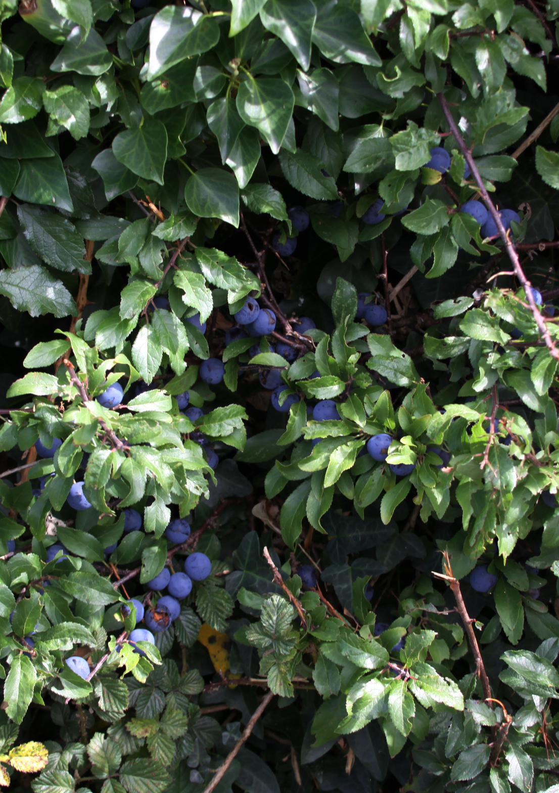


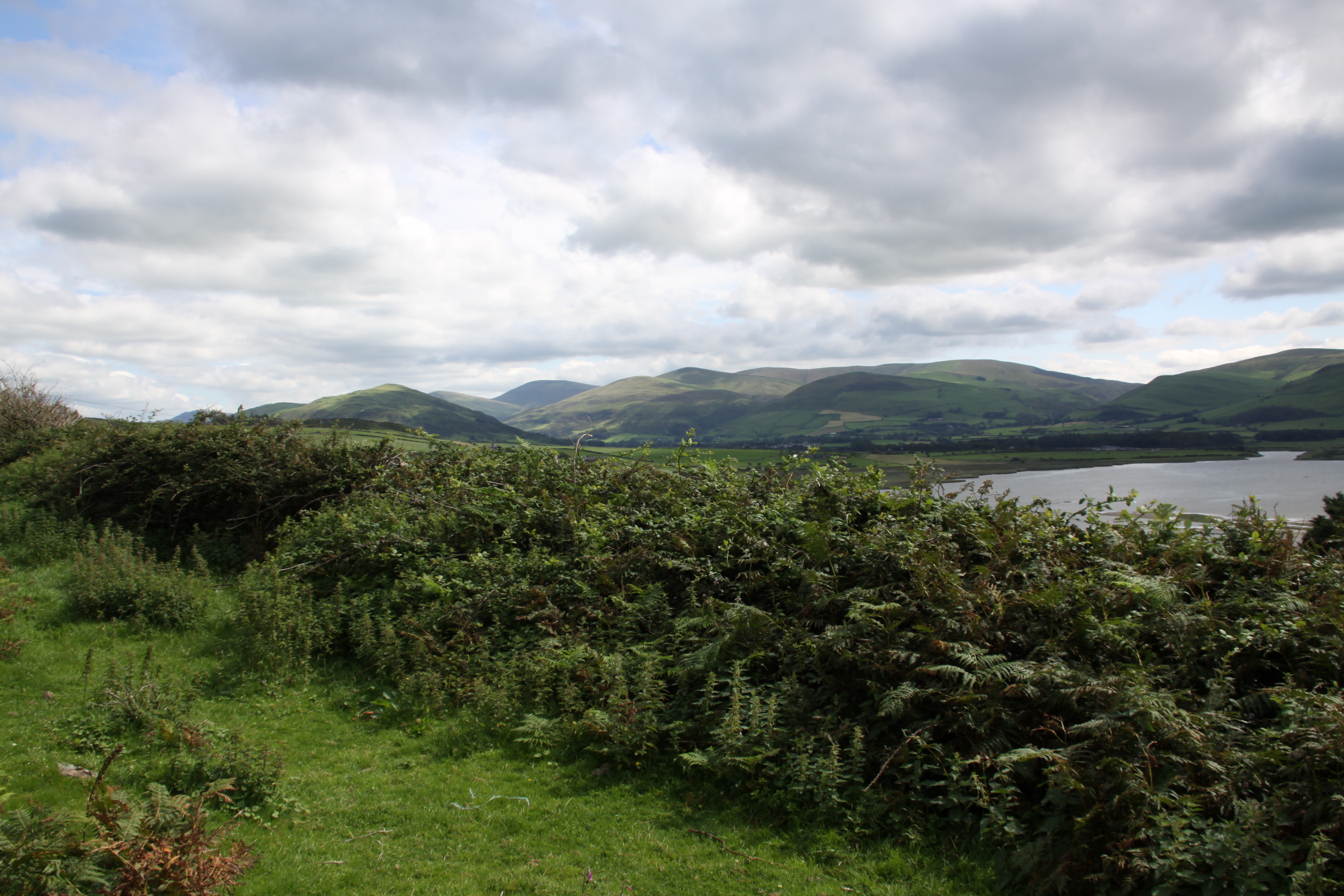
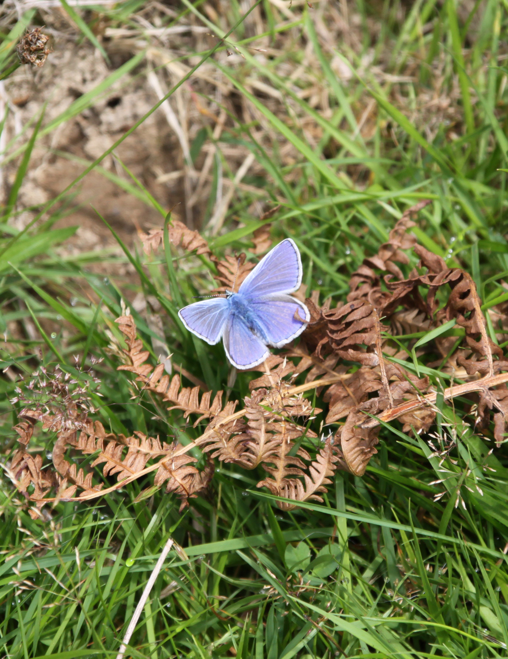
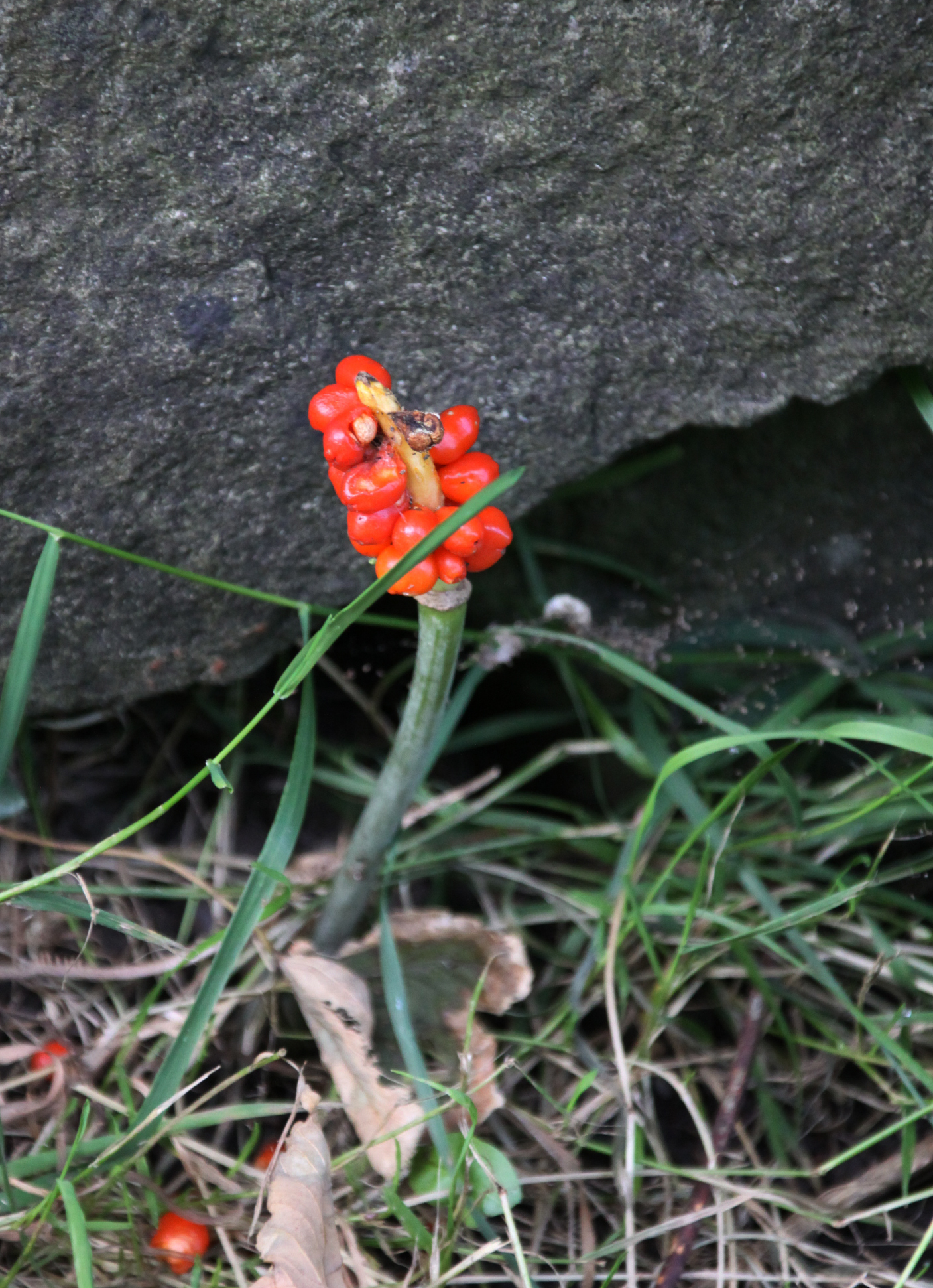
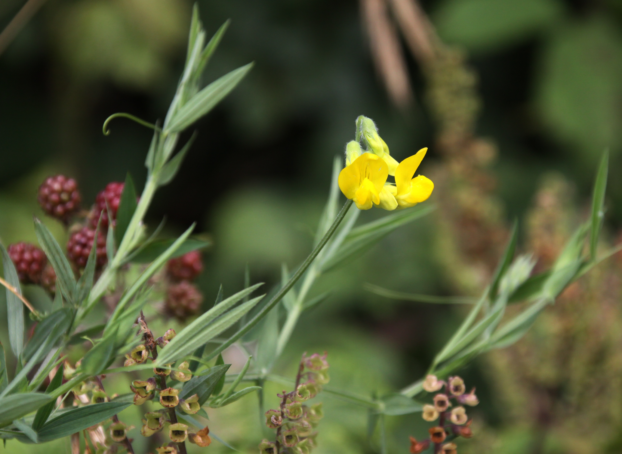
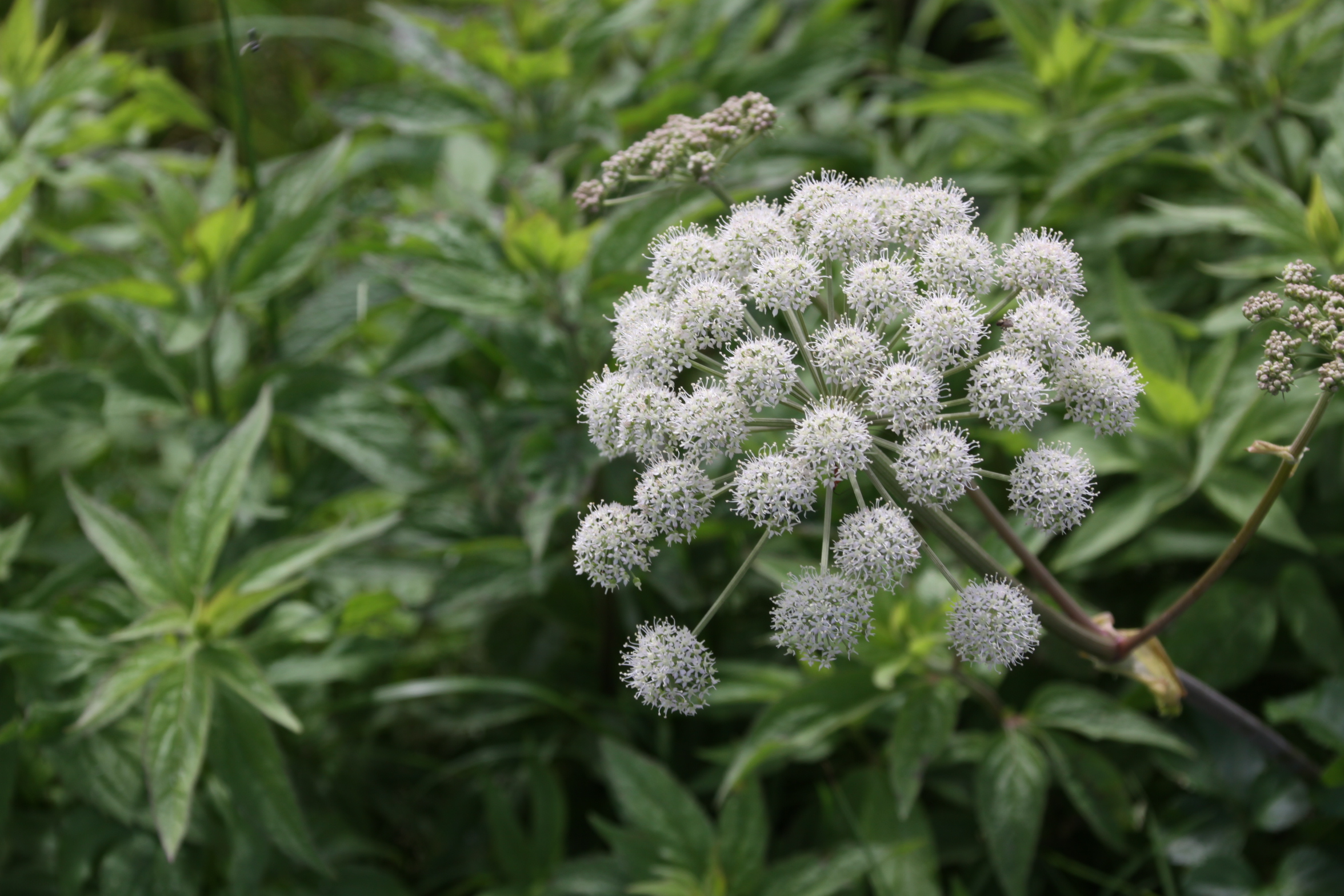
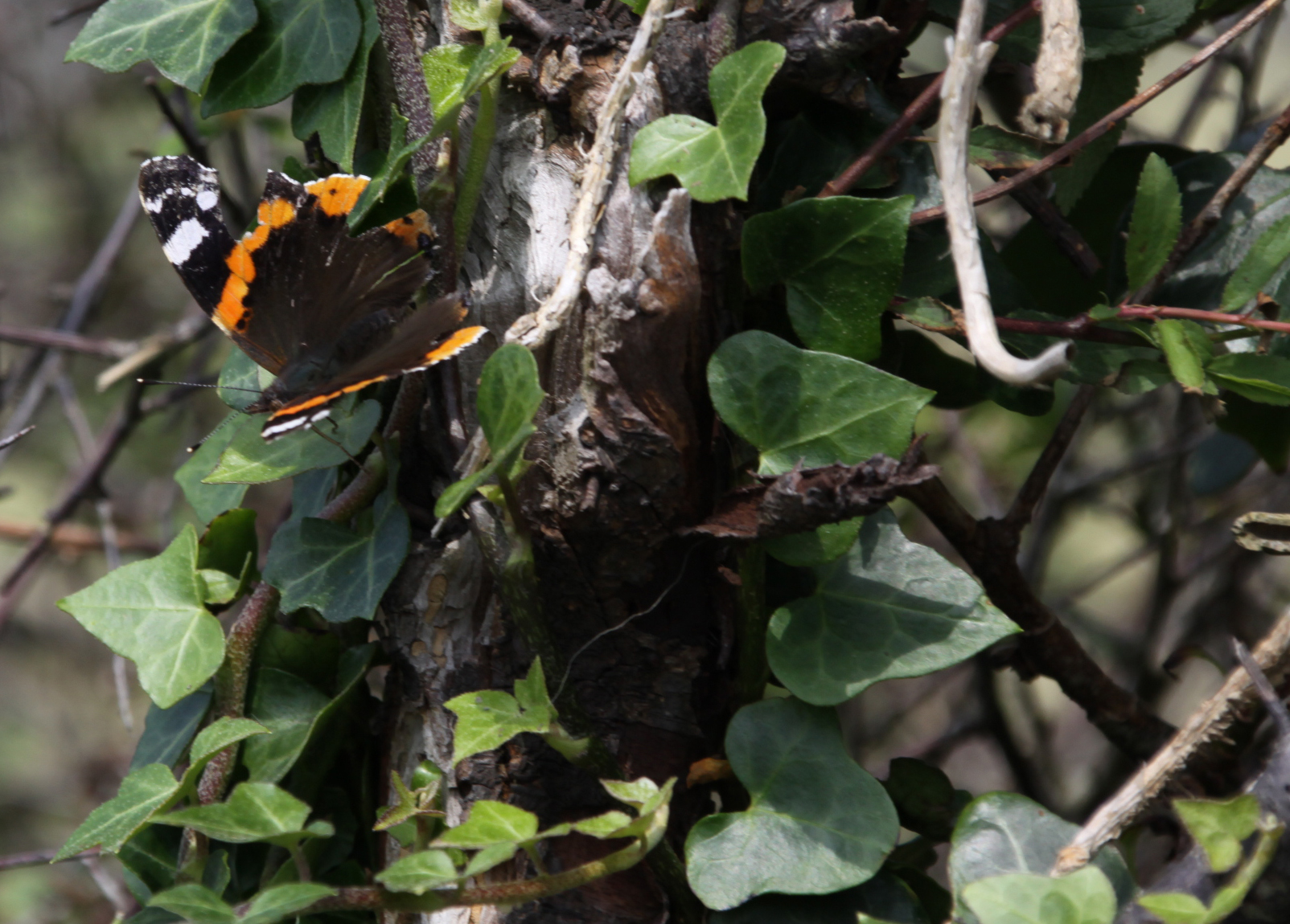
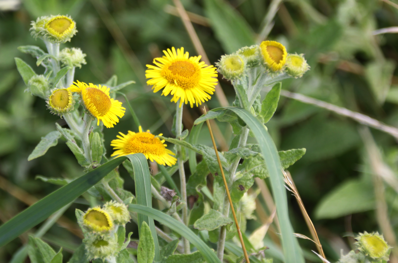
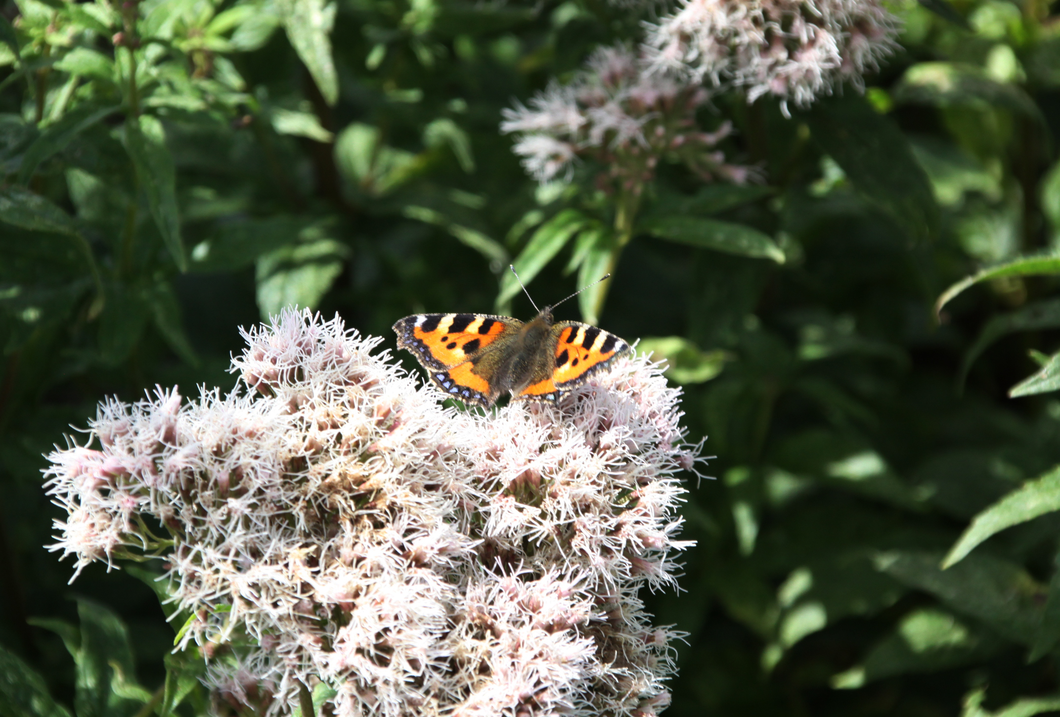
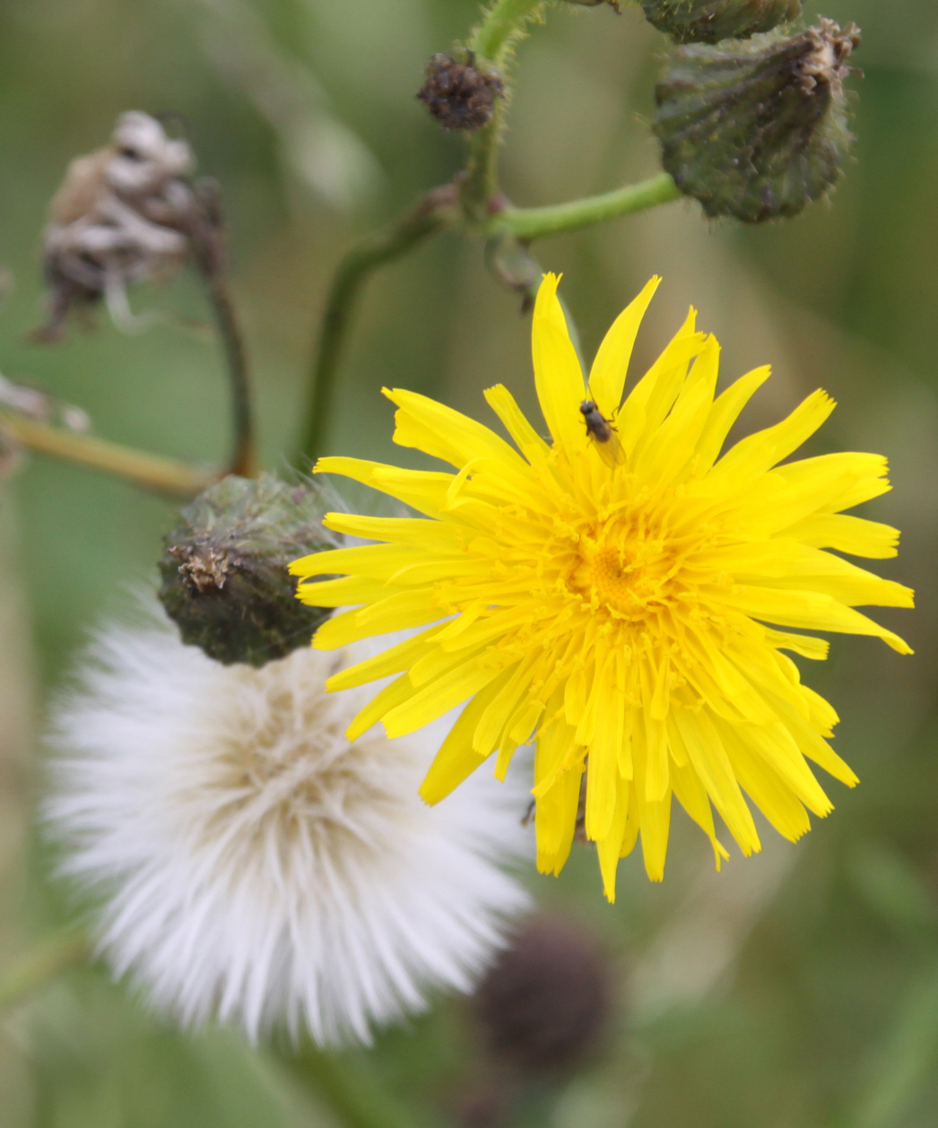
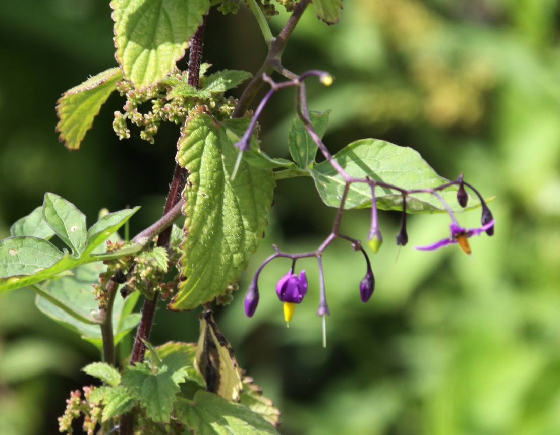
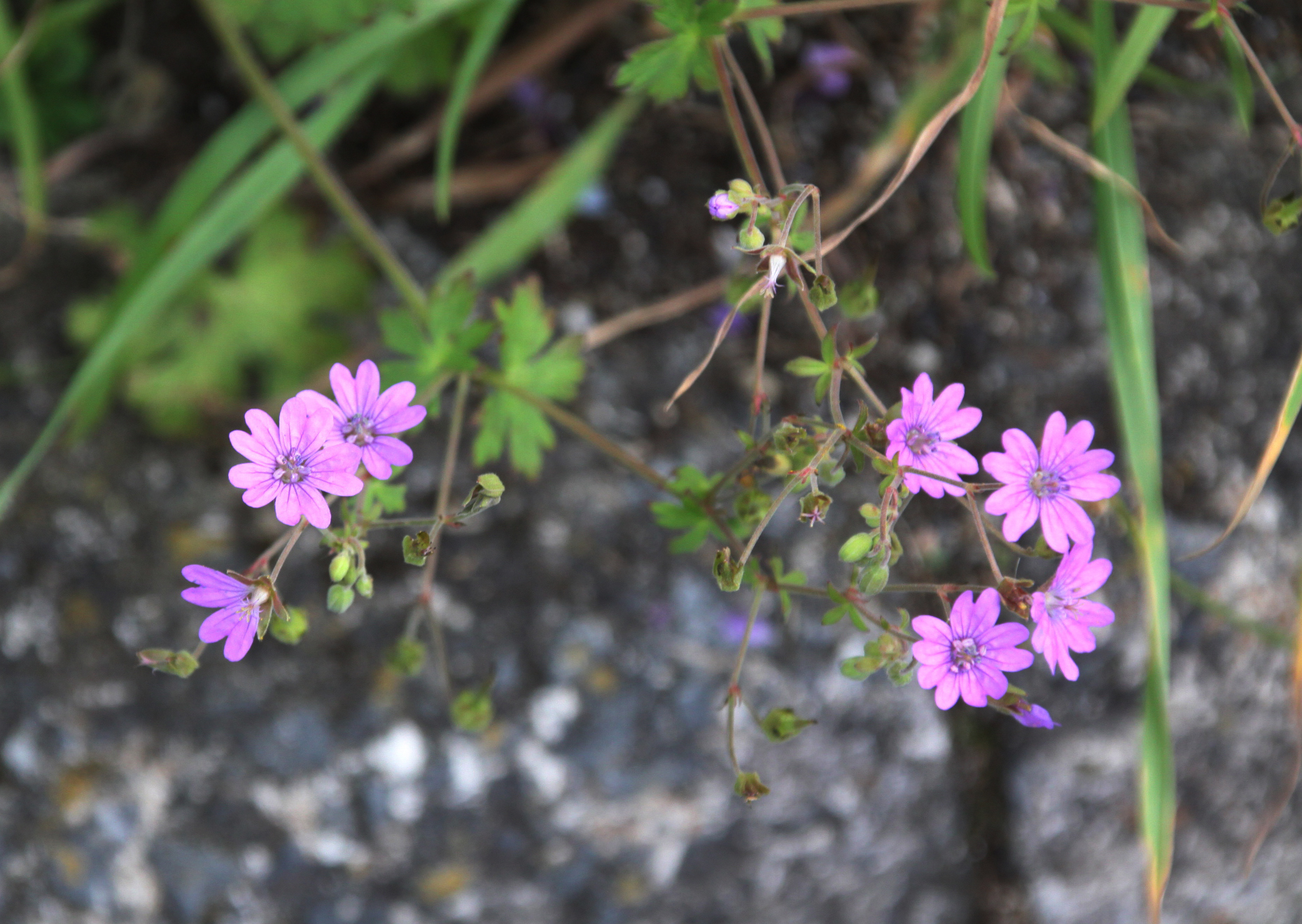
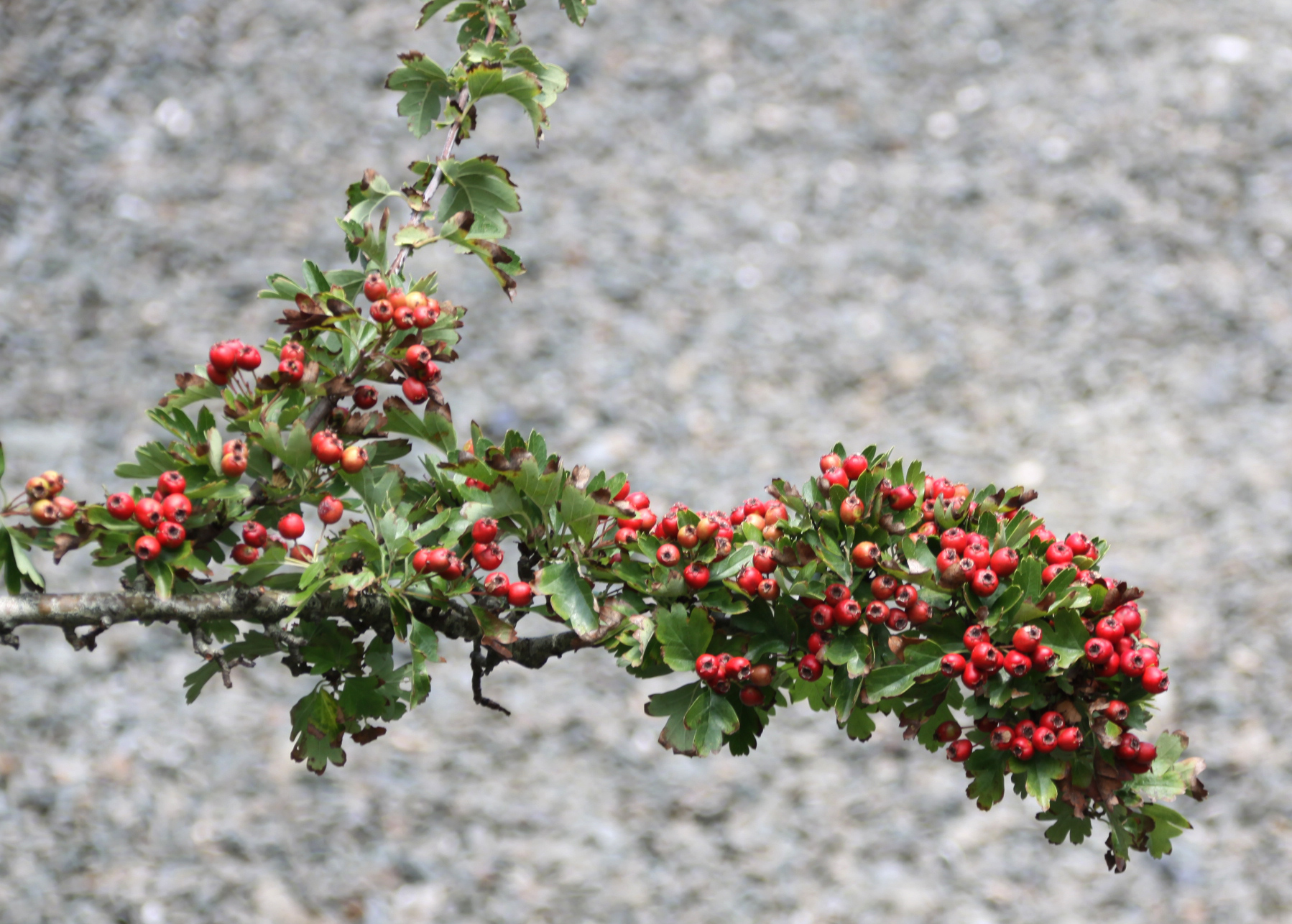
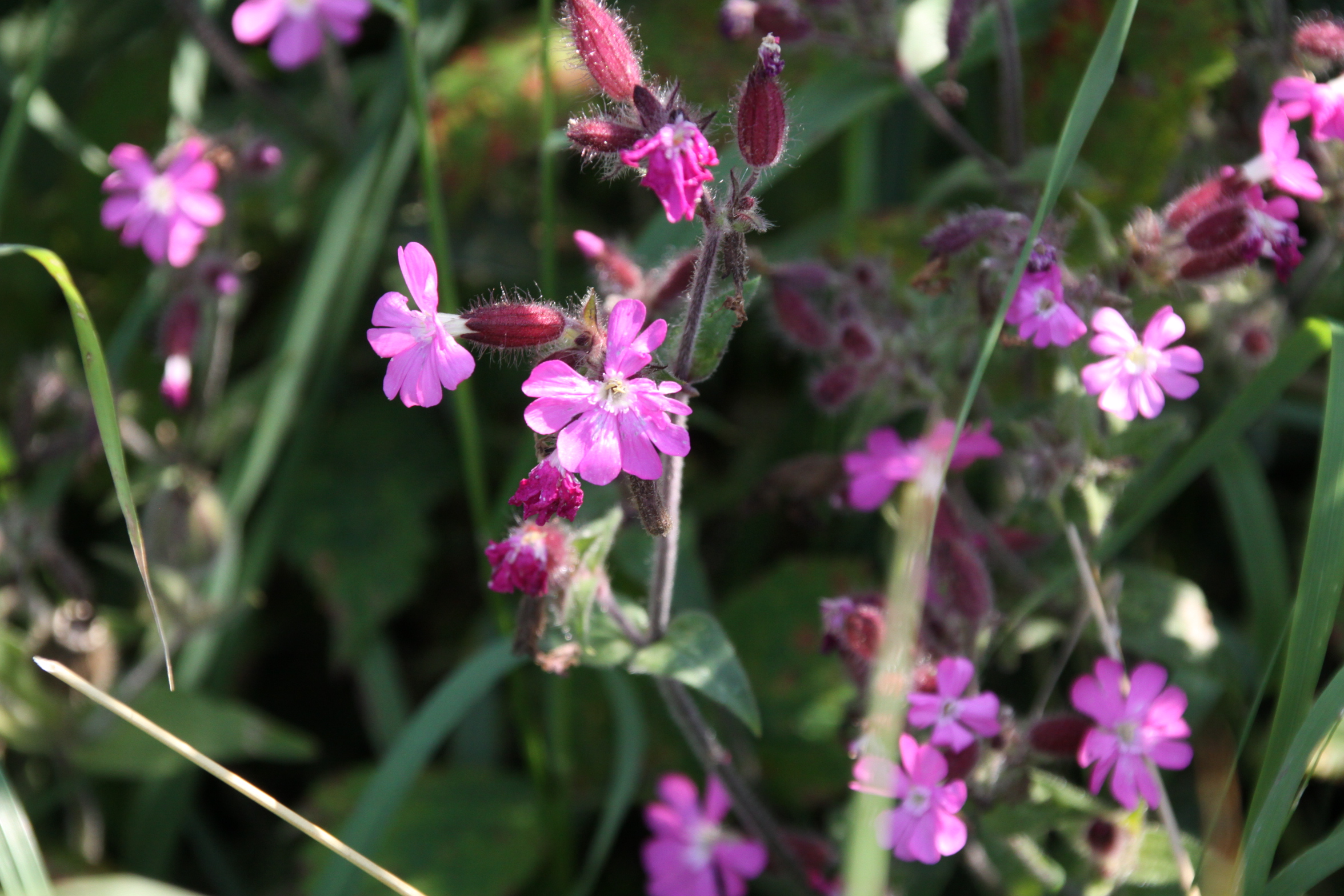
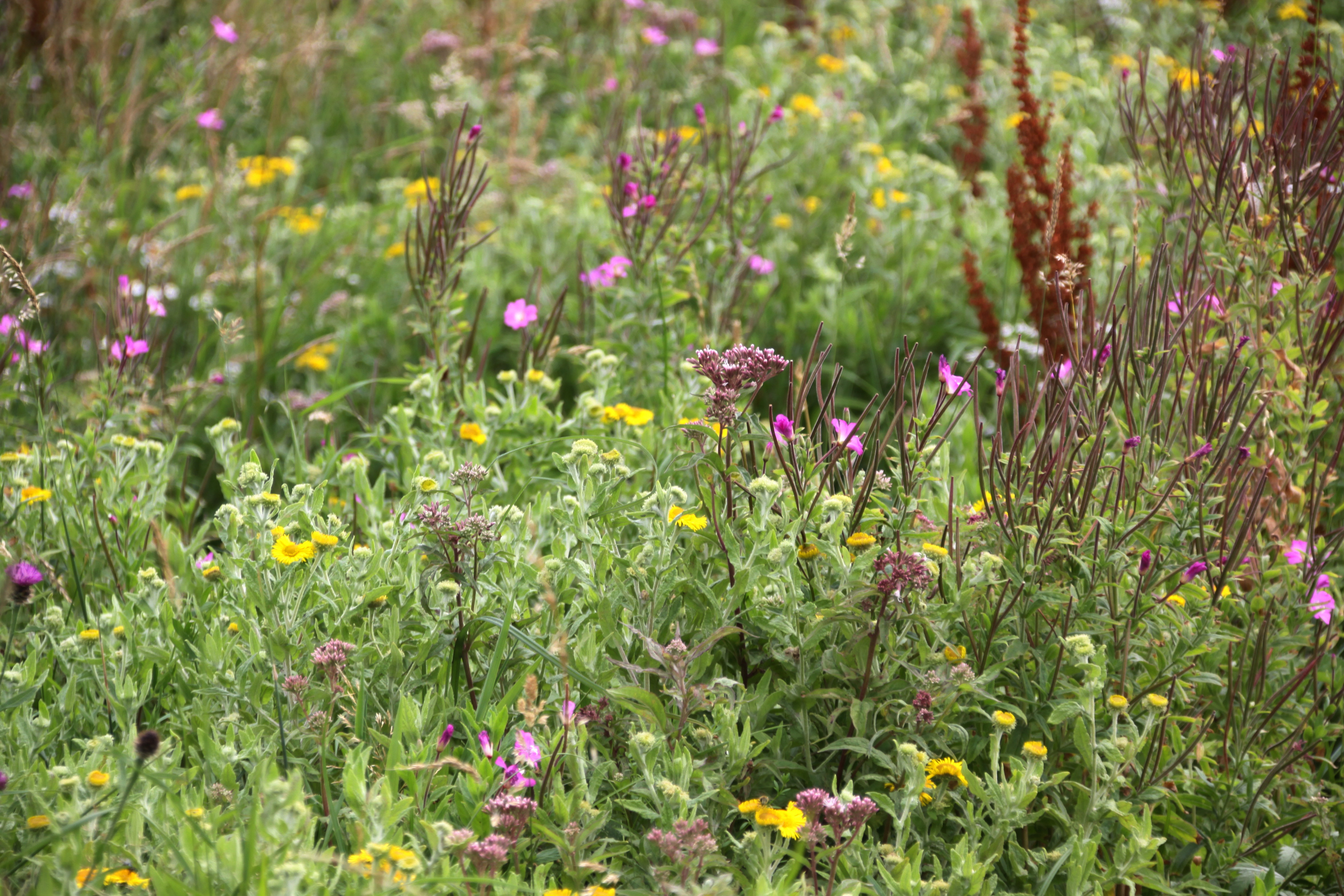
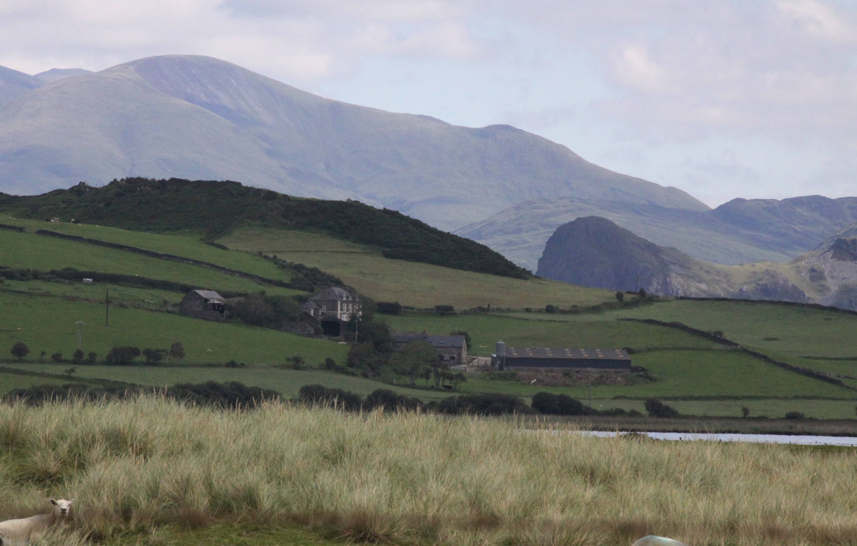
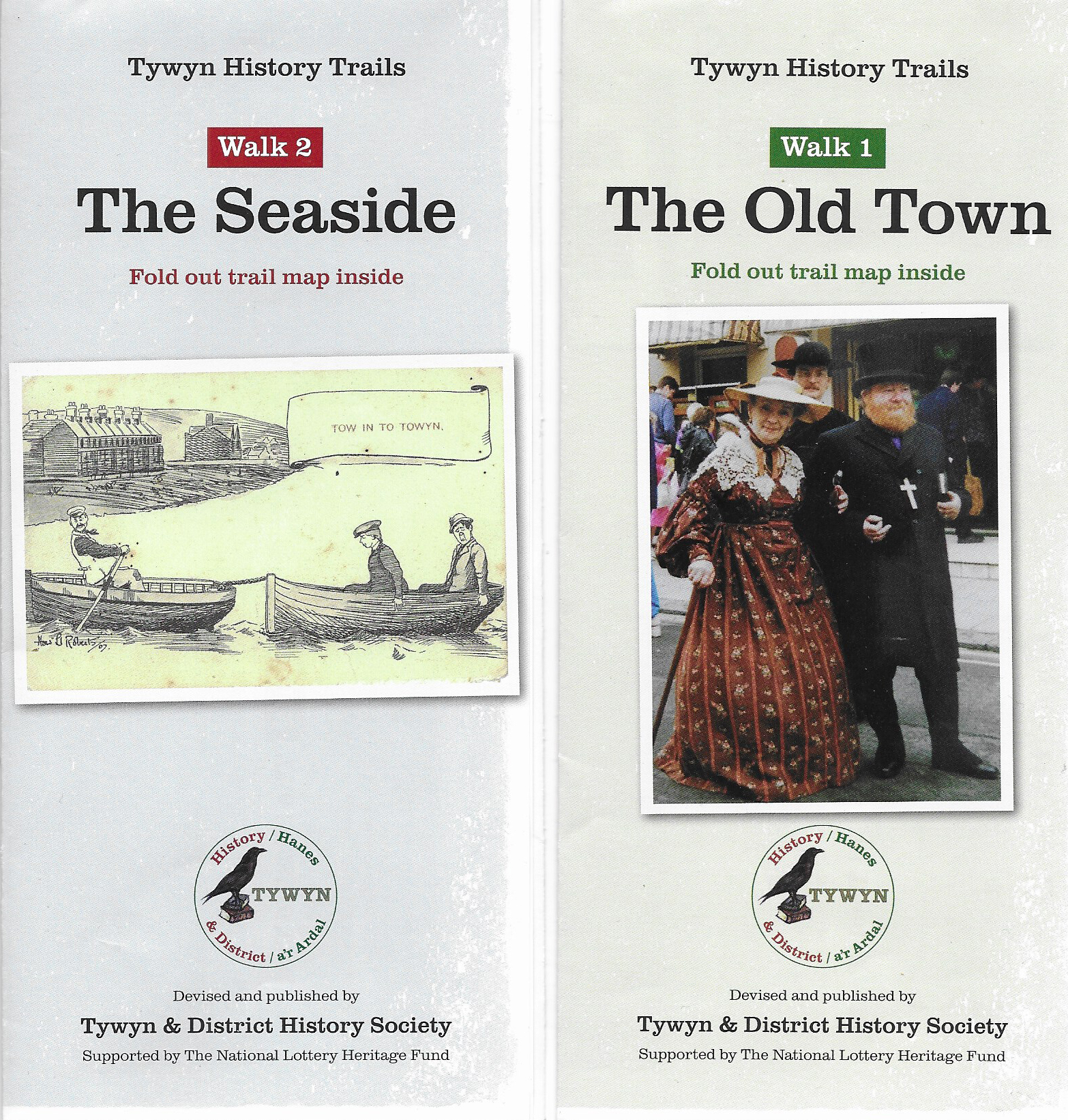

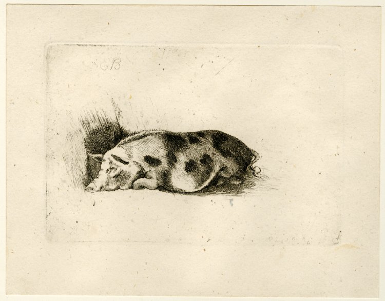
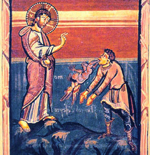
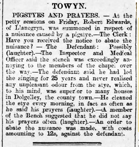
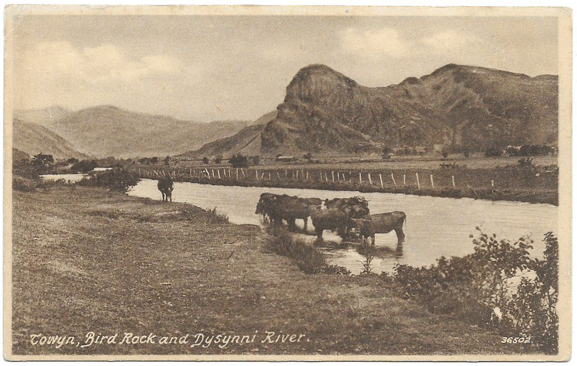
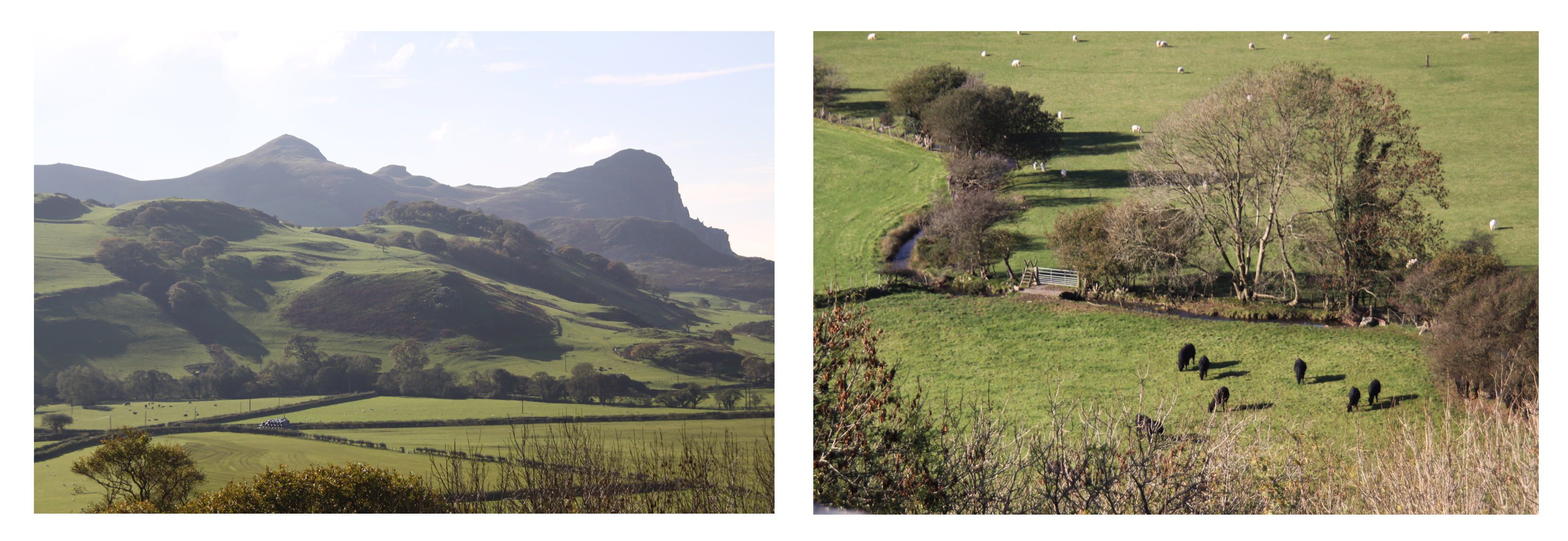
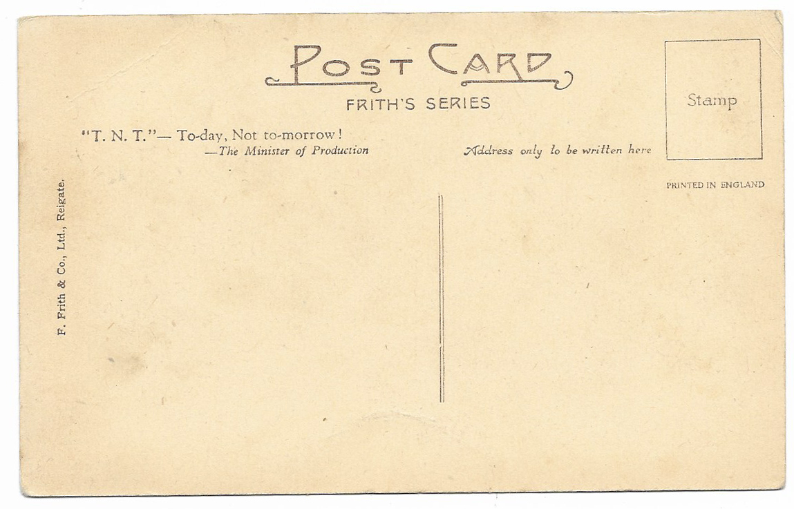


