Category Archives: Heritage

The railway arrives in Aberdovey in 1864

Welsh Coast Line. Source: Wikipedia, where you can see it as a single image, without rather than being split into two, as it is here.

Today the Cambrian Line runs from Shrewsbury (Shropshire) to Pwlleli (Gwynedd) with a branch just after Dovey Junction to Aberystwyth.  The section from Dovey Junction (to the southwest of Derwenlas) to Pwlleli in the north is known as the Cambrian Coast Line.  There are two stops in Aberdovey, one at Penhelig and the other at the far side of the village, behind the bowling club.  The arrival of the railway in the 1860s had a significant impact on Aberdovey, altering the economy and physically reshaping parts of the town.  The excellent legend to the left shows the final form of the railway line, complete with information about which stations remain in use.  I have split it into two to fit on the page, and Morfa Mawddach appears twice as a result.

The Aberystwith and West Coast Railway was authorised by a Private Act of Parliament on 22nd July 1861.  The spelling of Aberystwyth as Aberystwith was the name in which the company was registered.  To put this date into perspective, by the 1860s Aberdovey had a very successful shipbuilding industry, it was an important port for the transhipping of slate exports and was important for the import of grain and other goods.  Copper mines had been established in the hills around the village and a growing tourist industry based on the beach was flourishing even without a railway.  There were two Nonconformist chapels dating from the late 1820s and St Peter’s Church had been established for nearly two decades.

The railway routed around the back of the village, rather than along the seafront as originally planned. Source: Hugh M. Lewis.  Aberdyfi, A Glimpse of the Past.

The railway was intended to link north and mid Wales, to improve efficiencies in the export of local slate and to enable Aberdovey and Aberystwyth to serves as Irish ferry termini, linking Ireland with the Midlands.  These were boom years for Aberdovey, and it must have seemed like more in the way of progress.  Local people were not, however, blinded by the coming of the railway and significant disputes between Aberdovey residents, the owners of the land (the Ynynsymaengwyn Estate in Tywyn) and the representatives of the railway company over exactly where the railway should run and how the harbour would be developed.  The original plan was to send the line along the sea front but extensive disputes with Aberdovey business leaders and villagers, who were concerned about the impacts on shipping, ship building and tourism, lead to it being routed around the back of the village, an expensive compromise that required tunnelling through rock.  The dispute is described in Lewis Lloyd’s account on the subject in A Real Little Seaport.   The need for the tunnels meant that the railway’s contractor Thomas Savin’s estimate for the cost of the railway was unrealistically low, and this contributed to his personal bankruptcy in  1866.

Thomas Savin (1826-1889) was a well known railway engineer,  who built several railways in Wales.  Although the contractors for the new railway are listed as Thomas and John Savin, Thomas was clearly the driving force.  He had multiple business interests and often invested in his railway projects, meaning that he was far from impartial when local interests impacted business decisions, as happened in Aberdovey when villagers contested his plans to run the railway along the sea front and develop the harbour in ways that would have been harmful to local shipping and tourism interests.  Savin represented the railway company in most of his dealings with the villagers. A lot more about Savin can be found on a page dedicated to him on the Llanymynech Community Project website.

Penhelig shortly after the railway was laid, and before Penhelig Terrace was built, showing the railway tunnel and the shipyard just in front of the Penhelig Arms. Source: Hugh M. Lewis.  Aberdyfi, A Glimpse of the Past.

Savin had originally intended to build a bridge across the Dyfi to connect Aberdovey and Ynyslas by rail, and this remained the plan for some time, but due to the local geomorphology, civil engineers decided that the bridge could not be built and an additional 12 miles of rail had to be laid to go around the estuary, crossing the river just north of Gogarth instead. This meant that until the new stretch was built, southbound passengers had to cross the river by ferry between Aberdovey and Ynyslas, where a line had been built.  All the necessary materials for construction of the railway were carried into Aberdovey by ship, except for the locomotive and carriages that were carried from Ynyslas over the river Dyfi to Aberdovey.  Aberdovey served as the depot for most of the equipment and materials, including plant, sleepers and rails.  The construction work on the Aberystwith and West Coast Railway began at Aberdovey in April 1862, and was built in a number of stages,as follows:

  • By early September 1862 the line reached the river Dysynni and the first locomotive with 10 carriages was launched in South Merioneth and undertook the short trip from Aberdovey, stopping to pick up more passengers, to the river Dysynni and back again, carrying dignitaries and holiday makers.  In the evening a firework display celebrated the achievement.
  • In 1863 a track was laid down between Aberdovey and Llywyngwril to the north along the Welsh coast, including the three-span steel plate girder bridge over the Rivery Dysynni. This section of the line connected with the narrow gauge TalyLlyn slate quarry railway at Tywyn.  Before the railway, slates were offloaded from the TalyLlyn single gauge railway, loaded on to the new line and taken to Aberdovey for loading on to ships.
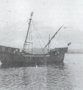
  • Before the section of line was built around the estuary, the s.s. Elizabeth was purchased to carry railway passengers across the river at Aberdovey to Ynyslas.  The Elizabeth was a 30 horse-power Blackwall paddle steamer that was rigged for sail.  She arrived in October 1863, and was captained by a Machynlleth resident Captain Edward Bell who was succeeded by his younger brother Captain John Bell.  But she was not a success.  At c.125ft long she was too long, and small boats had to be used to supplement the ferry service.  The Elizabeth was owned by Thomas Savin, who sold it in 1869 to an agent in Londonderry.
  • The section of railway between Machynlleth and Aberystwyth was completed by July 1864.
  • The stretch from Aberdovey to Pwllheli was completed in August 1867, the delay caused by the building of the viaduct across the estuary at Barmouth.  The line was originally intended to go along the Lleyn Peninsula to Porthdinllaen, but this plan was abandoned and the terminus was established at Pwllheli. This section of the line linked at Afonwen Junction to the Caernarfonshire Line to Caernarfon.
  • In 1867 the railway was also extended along the north bank of the river to Machynlleth.  The line split at Dovey Junction with two branches, one going to Machynlleth and one going to Aberystwyth.

Photograph of the Temperance Hotel in Chapel Square, showing the bridge over Copper Hill Street in the background in 1867. Source: Hugh M. Lewis. Pages of Time.

As the Newtown and Machynlleth Railway had opened at the beginning of 1863 and absorbed into Cambrian Railways the following year, the two lines were now linked.  Newtown was linked to the Oswestry and Newtown Railway (which opened in 1860), which in turn linked at Welshpool to the Shrewsbury and Welshpool Railway (which opened in 1862) and the Shrewsbury and Birmingham Railway (opened in 1847), the Shrewsbury to Hereford line (opened in 1853) and the Newport, Abergavenny and Hereford Railway (also opened in 1853) thereby linking mid and north Wales with the borders, south Wales the Midlands.

In 1866 the line had been integrated with Cambrian Railways under the Cambrian Railways Company, which was created by an Act of Parliament in July 1864 in order to amalgamate a number of companies operating in Wales.  The Aberystwith and West Coast Railway was still under construction at the time of the Act, so was not included in the original amalgamation, but was incorporated two years after the first part opened.  Cambrian Railways was head-quartered at Oswestry, where there is now a heritage museum celebrating the railway, the Cambrian Railways Museum (which has a website here).

Railway Tunnel on the other side of Penhelig

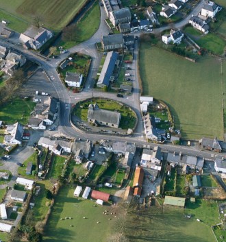
Heading to Aberdovey from Machynlleth, the line enters Aberdovey from the southeast at Penhelig Halt (added in 1933) where it emerges from a tunnel and is then carried over the road and follows a track through the back of the village before crossing the road again at the far end of Aberdovey, to continue along the coast to Tywyn.  The spoil from the tunnelling operation that was required to run the railway at the back of the village was deposited in Penhelig, on land cutting into a former shipbuilding yard, and this was the site of the future Penhelig Terrace, which was built c.1865.  Two tunnels were required to carry the railway through the hillside alongside the estuary, and four bridges were erected to carry it over the coast road  at Penhelig, under Church Street, behind St Peter’s Church, over Copper Hill Street and at the far end of Aberdovey by the modern fire station.  As soon as the line between Aberdovey and Machynlleth opened, the Corris and Aberllefenni slate carried on the Corris narrow gauge railway ceased to be loaded onto boats for transhipping onto seagoing vessels at Aberdovey, and was now transported instead by rail into Aberdovey.  Much of it the Welsh Coast Railway is raised only a few feet above sea level and it follows the coastline very closely for much of its length, making it one of the most scenic coastal railways in the UK.

The GWR Railway advert for Penhelig Halt. Source: Hugh M. Lewis. Aberdyfi, A Glimpse of the Past.

Aberdovey (Aberdyfi) Station was built in a location that was at that time just outside the main village.  It was equipped with two platforms flanking the tracks, and a fairly substantial single-storey railway building that survives in good order, but has been converted for residential use.  It is a charming red brick-built building with a slate roof, finished in stone around its doors and windows.  The front of the station has decorative black engineering bricks around the porch’s archway and in a parallel linear arrangement in the walls.  The porch is also equipped with twin stone columns.  Penhelig Station was added in 1933, by which time the railway was operated by the Great Western Railway, which absorbed Cambrian Railways in 1922, and was equipped with a single platform and an attractive little wooden shelter that remains today.

The railway clearly improved the economic stability of Aberdovey in some ways, but it also had negative impacts.  In its favour, it made it much easier for the evolving tourist industry to develop.  Efficiencies in cargo handling improved, and international trade continued to be important.  Cargoes that were not time sensitive still travelled by local ships, because their freight rates were so much lower, meaning that slate continued to travel by sea.  However, it a number of shipbuilding yards had to be destroyed for the railway to be completed, and over the two decades after the railway arrived the shipbuilding industry went into permanent decline, aggravated by the Great Depression in Britain between 1873 and 1896).  The last locally built ship was launched in 1880.  Derwenlas, which was an important inland port and shipbuilding centre, was cut off from the river by the railway embankment, almost completely closing it down.  Although transhipping to seagoing vessels still took place at Aberdovey for international trade, ships were no longer needed for national transportation.  It was was much more efficient to carry goods and livestock by train than by boat, so the previously coastal trade faded fast. The promised Irish ferry port never arrived, and as the railways expanded and improved, minor ports lost out to big ports with better facilities and connections.

A Cambrian Railway steam engine shunting down at the modernized wharf in 1887. Source: Hugh M. Lewis. Pages of Time.

In spite of the Great Depression, the wharf and jetty were given a major overhaul in the early 1880s, and were provided with a tiny branch track that led into the wharf area and out on to the jetty.  The new wharf and jetty were built on land acquired by Cambrian Railways for the purpose, opening in 1882.  Two large buildings were used for the storage of cargo and building materials, the jetty was around 370ft long and allowed ships to be loaded and unloaded at both high and low tides and animal pens were erected on the foreshore to hold livestock that was offloaded from ships. Railway tracks linked the jetty and wharf to the railway so that the transhipping process was far more fluid than it ever had been before.  Exports included slate from local quarries.  Imports included limestone, coal and cattle from South Wales, potatoes and cattle from Ireland, grain from the Mediterranean, timber from Newfoundland, and phosphates and nitrates from South America.  This will be covered in detail on a future post.

Penhelig Halt as it is today

Both Penhelig and Aberdovey stations remain open today.  Penhelig Station retains its 19th Century wooden shelter in an excellent state of repair, but no other station buildings. The platform is reached by a fairly long flight of steps.  Aberdovey Station is at ground level, retaining the original single-storey long brick structure on the one remaining platform.  It has been converted into three cottages, with the rear facing on to the platform and the front now overlooking the football pitch and adjacent to the golf cub.  The short branch to the harbour that was added in the 1880s was later built over.  Neither of the stations is staffed.  Tickets are purchased on the train itself and there is an electronic display containing information about the next trains due to arrive.  Because the platform is very low, built before platform heights were standardized, in 2009 a raised section made from reinforced glass-reinforced polymer was added.  This type of solution is called a Harrington Hump after the first station to have one installed, and Aberdovey was only the third UK station to receive one, after a period of consultation with local residents.  It was funded by the Welsh Government.  The BBC website says that instead of the usual £250,000 to raise the level of a platform the Harrington Hump costs a mere £70,000.  In 2014 part of the embankment was washed away, with the Daily Post reporting that the track was left hanging in the air.  A photo gallery on the site shows repairs being carried out.

Penhelig Lodge is to the left and below the level of the railway track and the tunnel in about 1865.  The photograph also shows the newly built Penhelig Terrace, which is end-on in this photograph. Source: Source: Hugh M. Lewis. Pages of Time.

The following video was shot in the 1920s and shows a steam train on the Aberdovey section of track:

Main sources:
The main source for information about the railway and its relationship to Aberdovey is Lewis Lloyd’s excellent A Real Little Seaport.  The Port of Aberdyfi and its People 1565-1920. Volume 1, which makes extensive use of local newspaper reports and contemporary records.  For anyone interested in learning more, there is much more information about the disputes, issues and accidents concerning the railway in his section “The Advent of the Coastal Railway” in chapter 7.  Hugh M. Lewis also has some information in his book  Aberdyfi – Portrait of a Village and other invaluable Hugh M. Lewis publications provide super photographic records.  For more general background information two well-researched Wikipedia pages were useful sources: Aberystwith and West Coast Railway and Cambrian Railways.

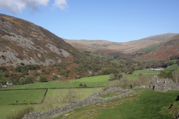
Railway track as it leaves Aberdovey for Machynlleth


The Wesleyan Methodist chapel in Chapel Square, Aberdovey (built 1829, rebuilt 1868)

Wesleyan Chapel

The Wesleyan Chapel, or Capel Bethel, is located in Chapel Square, which was then called Copperhill Square.  It was only a few doors away from the Calvinist Methodist Chapel or Tabernacle that had opened the year before (described on a previous post).  Wesleyan preachers arrived in Aberdovey in November 1804, fourteen years after the Calvinist Methodists first arrived, to hold an open-air meeting in the square, a common device used by early preachers to convey their message and acquire followers.  They were sufficiently successful for a small Wesleyan movement to become established in the village, a real achievement as Calvinistic Methodism had spread much more rapidly throughout Wales.

John Wesley (left), Charles Whitefield (top) and Charles Wesley. Source: Welsh Religious Buildings Trust

I have described the origins of the Wesleyan Methodists on an earlier post about Aberdovey’s first Calvinistic Methodist chapel, and if you read that post you may want to scroll down to the next paragraph as I am repeating some of it here.  Methodism, or Wesleyan Methodism  began at Oxford University, where Charles Wesley (1707-88) and George Whitefield (1714-1770) formed a group to discuss religious ideas and methods, particularly the power of evangelism.  It was joined by Charles’s brother John Wesley (1703-91) and became known as the Holy Group, and later, based on the importance of procedures and methods in their approach, Methodists.  The three went to America in 1735 to  become missionaries, but George Whitefield returned a year later to focus on doing religious work in England, preaching extensively in indoors and out, making himself very unpopular with the established church.

Wesleyan Methodist Chapel in the Nineteenth Century. Source: Photograph in the Literary Institute

John Wesley returned three years after his departure to bring his ideas into the Church of England in an attempt at Anglican reform.  Like Whitefield, he found himself unpopular with the Church of England authorities and was not permitted to preach in Anglican churches, so began preaching out of doors, and began to travel extensively to spread his message and organize those who followed him.  Wesley and Whitefield parted ways in 1741 over Whitefield’s  belief in Calvinist predestination, foreshadowing the later split between the Wesleyan Methodists and the Welsh Calvinistic Methodists.   The key difference was that John Wesley retained the Arminian (as opposed to the Calvinistic) belief that salvation is available to all.  In Wesleyan Methodism, the living of a good, altruistic, and selfless lives and absolute belief in and dedication to God is not a means of winning salvation but is actually a product of salvation.  Salvation is therefore by God’s grace alone, rather than something that can be achieved by human endeavour.  This is one of the core differences between Methodism and the Church of England.  The personal experience of God, and of revelation were also key to his beliefs.  He had, himself, underwent a conversion experience in 1738, when he felt his “heart strangely warmed.”  He also believed in the importance of Scripture, a strong emphasis on the delivering of God’s message far and wide, the pre-eminence of high moral standards, and the need to raise awareness of the dangers of alcohol and gambling.  Wesley organized groups of lay preachers in a “connexion” across Britain, whose members helped to spread the Methodist message, and from 1744 annual conferences of lay preachers helped to formalize their activities.   It was only after John Wesley’s death in 1791 that Methodism withdrew from the Church of England and became a movement in its own right.

Wesleyan Methodist Welsh Distribution Map, on the left pre-1800 and on the right pre-1851,showing how much they progressed in just 50 years. Source: Welsh Religious Buildings Trust

The Wesleyans made slow progress in Wales during the 18th Century, where Welsh Calvinist Methodists had a foothold.  In spite of 35 visits into Wales, John Wesley was unable to make much of an impact, partly because he and most of his followers spoke no Welsh and Wesleyan Methodism was slow to recruit Welsh speakers.  By the end of the 18th Century they only had  around 600 followers in Wales, none of whom were in Meirionnydd.  In 1800 the British Wesleyan Conference decided to send Welsh-speaking preachers into Wales, resulting in a notable upturn of Welsh-speaking converts, and wherever English Wesleyans settled in the wake of the Industrial Revolution, wherever quarries and mines were to be found, congregations rose.  In the 1851 religious census there were 499 places of worship in Wales and congregations numbering 53,730 individuals.

6 and 7 Copperhill Street

The Wesleyans had no dedicated premises when they first arrived in Aberdovey and gathered at houses in the village, first at numbers 6 and 7 Copper Hill street (formerly called Dan y Graig) opposite today’s Wesleyan chapel, and then a few years later they moved to a house named Tan y Castell (“Below the Castle”) in Prospect Place.  Their final meeting house before the chapel was built was Cegin Arthur (“Arthur’s Inn”), the front room of which served as a drinking establishment and was on the site later replaced by Xanthus House, the building immediately to the left/west of the big 1864 Calvinist Tabernacle on Sea View Terrace.  Hugh M. Lewis describes the disadvantages of this venue:  “This was a most inconvenient and embarrassing for the worshippers, who had to pass through the front room  on their way to the kitchen at the rear of the house.”  In 1828 they rented a piece of land from the Athelstan Maurice Corbet of Ynysymaengwyn Estate on New Street at the top of Chapel Square (then called Copperhill Square) and built their first chapel, the Bethel, in 1829.  The Bethel was located at the top of the upward sloping New Street and now dominated the square, rising above the level local buildings, including the Calvinist Methodist chapel, and was visible from most higher parts of Aberdovey, as shown in the 19th Century/early 20th Century photograph at the end of the post.

Addoldy y Wesleyaid (Wesleyan sanctuary), 1829, 1868

The Bethel, unlike the Congregational Chapel on Glandyfi Terrace or the English Presbyterian chapel on Sea View Terrace, is instantly recognizable as a 19th Century chapel, with the gabled façade, stuccoed features, lancet windows with plain glass and a plaque stating BETHEL ADDOLDY Y WESLEYAID (“Bethel, Wesleayan Place of Worship”) and the two dates of its construction and rebuild, 1829 and 1868.  It is an imposing building, set slightly above the square, in a commanding position.  The Wesleyans rented a piece of land in Chapel Square (at that time Copper Hill Square) in 1828 from Mr Athelstan Corbet of Ynysymaengwyn (the big land-holding estate based just outside Tywyn), and their first chapel was built in 1829, with a congregation of around 30.  It was extended to twice its original size in 1841 to accommodate a growing congregation of around 60 worshippers.   The expanding population again led to the chapel being over-crowded and it was rebuilt in 1868, “a mixed sub-Classical and simple Gothic style of the gable-entry type”  (Coflein website), to accommodate 300 worshippers, at a cost of £704.00, the equivalent to 102 horses/150 cows or, in today’s money, £61,427.73 (National Archives Currency Converter).  An inscription facing the pulpit used to read “COFIWCH-Y-MORWYR” which translates as “remember the seamen,” a reminder to the minister that a large number of families in Aberdovey were attached to the sea in some capacity and should be referred to in the sermon.  Renovations and improvements in 1924 included the installation of a pipe organ, and in 1926 a huge vestry was added on the site of an old bakehouse.

The interior of the chapel is absolutely splendid.  Today entry is via the large 1926 vestry, which is laid out with rows of comfortable chairs facing a podium, and this is used today for many of the chapel’s meetings.  It is a very warm and inviting space.  The 19th Century chapel, reached via a side door, is beautiful.  There are no monuments on the wall, nothing to distract from the structure of the chapel.  Straight wooden pews are organized in three rows facing the pulpit, divided by two aisles.  The pulpit area is an imposing structure with a small stage behind it.   At the front of the pulpit is a large, curved pew, which is very fine indeed, and this was retained for visiting dignitaries.  Flanking this across the aisles are two sets of boxed pews that face across the chapel.  It is a magnificent space, given a lot of light from the tall lancet windows, and the lack of any form of decoration, embellishment or other distraction gives a very real sense that this is about the message from the pulpit, the relationship between the congregation and the preacher.  I was completely taken with it.

Wesleyan Methodist Chapel Interior

The chapel is still very active today, with weekly meetings, weddings and funerals all held on the premises.  There is a Facebook page with details, in both English and Welsh, of services and other activities, which may be in Welsh, English or both.  For security reasons, the chapel is not open outside these times.  I visited by appointment, with my sincere thanks to Ceri Jones for making the arrangements and, together with Gerald Grudgings, for guiding me around the building.  I have been invited to a service to see what the chapel is like when it is doing what it was designed for, and very much look forward to attending.

The Wesleyan Methodist chapel’s Facebook page

Main sources:
Wesleyan Methodism is usefully described on the Welsh Religious Buildings website, the BBC Religion web pages and the Oxford Concise Dictionary of the Christian Church.  Hugh M. Lewis, local resident and collector of Aberdovey information and images, is an invaluable source of information about the pre-chapel history of the Wesleyan Methodists in his book Aberdyfi, Portrait of a Village.  Lewis Lloyd’s A Real Little Seaport was also useful, and Hugh M. Lewis’s Aberdyfi, Pages of Time added some additional information.  My sincere thanks to Ceri Jones and Gerald Grudgings for providing me with many more details about the chapel.

The Calvinist Methodist Tabernacle, Sea View Terrace, Aberdovey (built 1864)

Sea View Terrace Tabernacl

When the Calvinist Methodists left their 1828 premises in Chapel Square, now occupied by Dovey Marine (described on an earlier post together with a brief background to Calvinistic Methodism), they moved into new purpose-built premises in 1864 on Sea View Terrace, which were much more ambitious than their 1828 chapel in Chapel Square, which was somewhat overshadowed by the Wesleyan chapel that had been built in 1829.  In its new position it was sufficiently further up the hill to give it a dominant position.

Set back from the sea front, the new chapel was imposing, cut into the side of the hill with a high revetment wall and was reached via a long flight of steps.  The new building was much bigger than their former chapel, accommodating a congregation of 650 worshippers.  It was on a level with St Peter’s Church, which can be seen in some of the photos below, and one does have to wonder if the desire to put the Tabernacle on a level with the church wasn’t a significant factor in the decision to locate the chapel where it was, up a long flight of stairs that would have made it very difficult for some members of the community to reach.

Instantly recognizable as a Nonconformist chapel, the 1864 Calvinist Methodist building is a gable-entry type chapel with four bays, round-headed windows featuring radiating tracery, and doorways topped with fanlights that echo the design of the windows.  It was built from stone and rendered, has a slate roof, and the steps that lead up to the entrance from the seafront are also made of slate.  The iron gates at the base of the steps with spearhead finials were manufactured by the Coalbrookdale Company in Shropshire.  There are two inscribed tablets on the façade.  The one beneath the gable reads Tabernacl Adeiladwyd 1864 (Tabernacle built 1864) and the lower one reads Tabernacl ir Methodistiadd Calfinaidd yn y Flwyddyn 1828 (Calvinist Methodist Chapel established in the year 1828).  Before its conversion into flats the interior had a gallery with raked seating supported on  cast-iron columns.  The organ chamber was preceded by a segmental arch flanked by fluted Corinthian pilasters.    The scale of investment involved was quite clearly considerable.  The chapel was renovated in 1910 following a religious revival in Wales, which included the addition of heating, ventilators in the roof and the addition of a pipe organ.  The photograph below, loaned to me with great kindness by Dai and Helen Williams, shows something of the interior, including the decorative features at the top of the wall above the organ, the organ itself, the pews and the underside of the gallery at the left.

Calvinistic Methodist Tabernacl, 1864

It closed as a chapel in 1988 but the exterior of the building was preserved when it was converted to flats, some of which are rented out for holiday accommodation.  The building is Grade 2 listed.

The Calvinist Tabernacle in 1873, nine years after it was built. Source: Hugh M. Lewis 1989, Pages of Time, plate 3.

View of the Aberdovey seafront from Ynys Las, showing the prominent position of the Tabernacle, with St Peter’s at the far left and the English Presbyterian church at far right.

Side view of the Tabernacle from St Peter’s churchyard, showing the rooflights that were added when the church was converted into apartments in the 1980s.


The Calvinistic Methodist Tabernacle is set back from the seafront houses, reached via a steep flight of slate steps

If you have any more information, including information about and photographs of the interior, it would be great to hear from you.

The Calvinistic Methodist Chapel, Chapel Square, Aberdovey (established 1828)

Methodist chapel (now Dovey Marine), Copper Hill Street front entrance

The Calvinistic Methodist Chapel (or Tabernacle) in Chapel Square, now occupied by Dovey Marine, has had a rich history, as did the Calvinistic Methodists who built it.   The chapel was their first dedicated premises, before which they used a number of temporary meeting places around the village, their lives made somewhat difficult by anti-Methodist persecution from the important Corbet landowners of Ynysymaengwyn (just outside Tywyn) who owned most of Aberdovey in the 18th Century.

Having arrived in the Aberdovey area in around 1790, it took the Calvinists nearly 30 years to a built a chapel, a significant accomplishment.  They were the first denomination to build a chapel in Aberdovey, although the Wesleyan Methodists were only a year behind them. It isn’t the prettiest or most impressive of the chapels in the village, but the Aberdovey Calvinistic Methodists have a very interesting history.

Portrait of John Calvin (1509-64)

The Calvinistic Methodists were a mainly Welsh movement that built on the 18th Century revivals of 17th Century Protestantism.  Calvinistic Methodism sounds like a bit of an oxymoron.  Methodism, or Wesleyan Methodism, began at Oxford University, where Charles Wesley (1707-88) and George Whitefield (1714-1770) formed a group to discuss religious ideas and methods, particularly the power of evangelism.  It was joined by Charles’s brother John Wesley (1703-91) and became known as the Holy Group, and later, based on the importance of procedures and methods in their approach, Methodists.  The three, all of whom were ordained, went to America in 1738 to  become missionaries, but George Whitefield returned a year later to focus on doing religious work in England, preaching extensively indoors and out, making himself very unpopular with the established church.  John Wesley returned three years after his departure to America to bring his ideas into the Church of England in an attempt at Anglican reform.  Like Whitefield, he found himself unpopular with the Anglican authorities and was denied preaching  access to some churches, so followed Whitefield’s example and began preaching out of doors, and began to travel extensively.  Wesley and Whitefield parted ways in 1741 over Whitefield’s  belief in Calvinist predestination, foreshadowing the later split between the Welsh Calvinistic and Wesleyan Methodists.  It was only after John Wesley’s death in 1791 that Methodism withdrew from the Church of England and became a doctrine in its own right.  The key difference was that John Wesley retained the Arminian (as opposed to the Calvinistic) belief that salvation is available to all.  In Wesleyan Methodism, the living of a good, altruistic, and selfless lives and absolute belief in and dedication to God is not a means of winning salvation but is actually a product of salvation.  Salvation is therefore by God’s grace alone, rather than something that can be achieved by human endeavour.  This is one of the core differences between Methodism and the Church of England.  In Wales a group of Welsh reformers had very similar ideas

The founders of Calvinistic Methodism. Clockwise from top left: Griffith Jones, Howell Harris, WIlliam Williams Pentycelyn and Daniel Rowland

The reform movement in Wales is thought to have begun in Carmarthenshire with Griffith Jones, the rector of Llanddowror, who was responsible for establishing circulating schools in 1731.  These schools taught the Welsh to read by studying the Bible and other Christian scripture.  Griffith Jones became something of a legend and an inspiration to other influential early preachers, like Howell Harris (1714-1773), Daniel Rowland (1730-1790) and William Williams Pantycelyn (1717-1791), all of whom had experienced spiritual awakening and became evangelists for a reformed church that had a high level of evangelism and an emphasis on hard work, moral behaviour and education of the poor.  William Williams became famous for his hymns, song and prayer being important in the religious practices of Calvinistic Methodism.

When the two groups met up they had so much in common that they initially joined forces under the heading of Methodism.  They shared belief in the burden of sin, the need for personal knowledge of God and the ability to feel him, assurance of salvation, recognition when or if sins have been forgiven and the knowledge that this had been felt.  They also believed that rebirth on Earth in the form of a better way of living life was fundamental.  There was, however, a fundamental point of doctrine on which the two branches differed.  Whereas Wesleyan Methodists believed that all people could be redeemed by faith, spreading the word of God and good deeds, the Welsh preachers followed Calvin, the radical French Protestant, who believed that the original sin of Adam made it impossible for people to redeem themselves, and only those who had been selected by God before Christ was sent to redeem them, the elect, would be raised to Heaven.  Because they still retained many of the other Methodist ideas about doctrine and felt just as strongly as the Methodists about the way in which religions should be practised, disseminated and organized, the Calvin followers separated from the Wesleyans and became Calvinistic Methodists.

Distribution of Calvinist Methodists pre-1851, showing the low levels of representation in Meirionnydd. Source: Welsh Religious Buildings Trust

Calvinistic Methodists put enormous emphasis on itinerant preaching, either indoors or in the open, considered song and active prayer to be important to developing a personal relationship with God, and believed that God would arise and display his glory. Hard work was a core component of their religion because only by hard work and business success could the elect be known and recognize themselves.   By 1750 there were over 400 gatherings of converts who became groups or fellowships known as “seiadau.”

Hugh M. Lewis describes Aberdovey as suffering “a certain amount of religious deprivation” prior to the last decade of the 18th Century.  The main centre of social and economic activity in the area was Tywyn, where St Cadfan’s Anglican Church, dating back to the 14th Century, was the main centre of religious life.  Even itinerant nonconformist preachers who were very active in other parts of Meirionnydd did not reach Aberdovey.   In about 1790, however, a group of Calvinistic Methodists established themselves about a mile outside Aberdovey at a building called Hen Felin, which has since become a ruin.  They next moved to lodgings in a building that belonged to the Raven Arms called The Store House on Sea View Terrace, which was used as a warehouse facility and had an upper room that could be used for Calvinistic meetings.  Unfortunately, Edward Corbet who “feared them as radicals if not revolutionaries” (Lloyd, A Real Little Seaport) was informed of their activities and evicted them, throwing all their property including benches and bibles out onto the road.  The Calvinists were lucky to find a sympathizer in Mr Scott, the owner of the row of three cottages now known as Penhelig lodge, who from 1796 gave them the use of an outbuilding called Ty Coch on the edge of the ravine where there is now a road called Nantiesyn, in Penhelig.  In 1811 the Calvinist Methodist movement established its (Yr Hen Gorff – The Old Body) formally, detached itself from the Anglican Church, and became the leading nonconformist Meiryonnydd religion, giving the Aberdovey preachers a solid foundation.

Calvinistic Methodist Chapel, New Street rear entrance

Aberdovey’s population increased in the late years of the 18th Century and the early years of the 19th Century.The discovery of copper and lead in the mid-18th Century and the importance of the port for handling imports of wheat, barley and corn significant contributors to the growth the the village. As Aberdovey prospered, the Calvinist congregation also grew, making it necessary to look for premises that was not owned by the Ynysmaengwyn estate.  In 1827, recognizing the growth of Aberdovey, the Turnpike Trust finished a road that linked Aberdovey with Machynlleth, raising its importance, and increasing the number of visitors.

In 1828 a plot of land in what is now Chapel Square was acquired on a 99 year lease, and volunteers built their chapel to seat 124 worshippers in 1828, at a cost of £400.00 (c. £27,120.52 in today’s money, or 26 horses/74 cows, according to the National Archive’s Currency Convertor website).  It did so well that in 1855 a gallery was added at a cost of £120.00 (c.£8,136.16). The Coflein website says that the new chapel, which they named Tabernacle, was designed by Reverend Richard Humphreys of Dyffryn.   The façades are characterized by large rectangular windows beneath dripstones (mouldings to shelter windows from dripping water), a line of three on the first floor on the Copper Hill Street (front) side and two on the ground floor and two on the first floor at the New Street (rear) side.  The arched Copper Hill Street doorway is lined with stone blocks and a keystone.  The New Street entrance door has a stucco frame.  Stuccoed quoins (masonry corner blocks) are on all four corners of the building and there are wide recessed strips in the gables of both frontages.  A plaque reads: “Tabernacl/adeiladwyd ir Methodistiaid Calfinaidd yn y flwyddin 1828” (Tabernacle / built by Calvinistic Methodists in the year 1828).  Once they had established their chapel the Calvinist Methodists set up a Sunday school.

Calvinistic-Methodist Chapel of 1864

In 1864 the Calvinists left the building in favour of new, much larger premises on Sea View Terrace, also called Tabernacl, which will be covered on future post shortly.  The original 1828 building was immediately adopted as a temporary school whilst a new school was being built.  When it was again vacated the former chapel was renamed the Assembly Rooms and became a resource for villagers and a central location for village activities.  Shops were later established on the ground floor, the first floor was used for meeting space, and the building became know as the Market Hall.  In 1920 it was renamed the Imperial Hall.  In 1931 Roman Catholics, who had no premises of their own in the village, used one of the meeting rooms.  During the Second World War the building became the headquarters for the Home Guard.  Today, the has been occupied for over two decades by the excellent Dovey Marine.


Main sources:
Welsh Calvinist Methodism is usefully described on the Welsh Religious Buildings website.  Wesleyan Methodism and some of the features that distinguish it from Calvinistic Methodism are described in straight forward terms on the Welsh Religious Buildings website and on the BBC Religion web pages.  Hugh M. Lewis, local resident and collector of Aberdovey information and images, is the source of most of the information in this post about the early activities of the Aberdovey Calvinistic Methodists, telling the fascinating story of the establishment of the chapel in his book Aberdyfi, Portrait of a Village (his best book, in my opinion).  Lewis Lloyd’s A Real Little Seaport was also useful, and Hugh M. Lewis’s Aberdyfi, Pages of Time added some additional information.

The Bear of Amsterdam, a ship of the Spanish Armada on the Dyfi in 1597

The story of the Bear of Amsterdam is probably the best known of all local stories, apart from the Bells of Aberdovey.  Unlike the Bells, this is not a matter of myth but a slice of Elizabethan history.

Philip II at his marriage to Mary I in 1552. Elizabeth I in 1592

The Bear of Amsterdam was a ship in the Third Spanish Armada, which took place between October and November 1597 during the Anglo-Spanish War of 1585–1604.  The war, which consists of a series of naval episodes over this period, had its origins in both religious and commercial disputes.  Philip II, King of Spain, defender of the Catholic faith, was under pressure to tackle the rise of Protestantism in Spanish territories in the southern Netherlands, Belgium, Luxembourg and northern France, collectively referred to as the Low Countries.   At the same time Queen Elizabeth had reinstated the Act of Supremacy that established the Church of England as the national religion, detaching England from Catholic Papal authority.  This was naturally a source of tension between England and Spain.  This relationship became even more strained when the English crown supported the activities of English ships trading with Spanish outposts in the West Indies.  Spain held a trading monopoly on these colonies and English activities were condemned as smuggling.   Spanish retaliation at the Battle of San Juan de Ulúa resulted in the capture and sinking of English ships under the command of Sir Francis Drake.  The English retaliated with an escalation of privateering, which not only aimed to undermine the Spanish monopoly, but to line the pockets of the crews involved.  When England came out in support of the Dutch against Spanish military action to squash the rise of Protestantism in 1585, Spain considered this a declaration of war.  A number of skirmishes took place, but the final straw came with Elizabeth’s execution of Mary Queen of Scots in February 1587, leading to Philip II’s decision to invade England in order to place a Catholic monarch on the English throne, a plan for which he received papal authority in July 1587.

Spanish ships in a storm

On 28 May 1588 the first Spanish Armada (armada meaning a fleet of warships) set sail for the English Channel and were met by the English fleet.  A battle of attrition succeeded in preventing the Spanish from reaching any English port and the Spanish withdrew to Calais to regroup. The English pursued them, using fireships to break through the defensive formation, forcing another battle on the Spanish, who were defeated and forced to retreat.  The second Spanish Armada took place in 1596, Philip II’s next attempt to tackle England, this time by invading Ireland, but the fleet hit a storm that annihilated it, and it never reached the English channel.

The third and final Armada took place between October and November 1597, aiming to surprise the English fleet in the English Channel as it returned from a failed expedition to the Azores, whilst another part of the Armada would land an invasion force in Falmouth or, if this proved impossible, Milford Haven, both of which were important Elizabethan ports.  136 ships set out from Spain with 8,634 soldiers, 4,000 sailors, a total of 12,634 men and 300 horses, but storms again led to the failure of Spanish plans.  With their fleet dispersed, only a few ships were able to land troops in England and Wales.  The returning English ships had also been disrupted by the storm, but still managed to capture several Spanish ships.  The third Armada was again defeated and remaining Spanish ships were captured.

Spanish caravels.  Source: Encyclopedia Britannica

The last ship from the third Armada to be captured was the c.120 ton caravel, The Bear of Amsterdam.  Having headed for Milford Haven she overshot and eventually weighed anchor in the middle of the river Dyfi on 26 October 1597, probably to acquire stores.  The prevalence of Westerlies stranded the ship for until 5th November.  Aberdovey was very isolated at this time, with only a few houses that served the ferry from Aberdovey to Ynyslas.  A survey of ports, creeks and other landing places on the Welsh coast from earlier in the century stated that only during the herring season when fishermen arrived from elsewhere was there any activity in Aberdovey where there were only three houses, and no local boats.  Local militia from both sides of the river gathered on the banks of the Dyfi and prepared themselves for a fight, but there were no suitable boats with which to board The Bear of Amsterdam, and no canons with which to hole her.  Muskets had some impact, killing three and wounding others on board the ship, but the ship moved out of range during the night.  D.W. Morgan (Brief Glory) quotes a contemporary document that describes how the ship landed about six men ashore in a cockboat (a small rowing boat used as the ship’s tender), with two more remaining in the boat, but these were ambushed by the Merionethshire Militia, with two killed and four captured.  The Vice Admiral visited the camp of the Cardiganshire militia “but could do nothing except helplessly watch the Spaniard swinging to his anchor in midstream. Of little avail were the plans of the Merionethshire men.”  A plan by the Merionethshire militia to build wooden fire rafts and float them down the river on an outgoing tide in the hope that it would set fire to the ship failed when the wind turned.  In spite of intentions to capture The Bear of Amsterdam, the ship left without challenge or further incident when the winds changed.

Dartmouth Castle as it is thought to have looked in c.1550.  Source: English Heritage.

The Bear of Amsterdam headed south, but she did not manage to return to Spain.  Rounding the Cornish peninsula The Bear of Amsterdam suffered damage in another storm and surrendered on the 10th November to an English squadron.  She was led into Dartmouth with no ammunition on board and almost no supplies.  The crew consisted of 62 Spanish sailors, 3 Flemish and 2 English (one acting as a pilot, the other a known pirate who was immediately gaoled).  Morgan says that the Captain of The Bear of Amsterdam “was a man of note and was sent up to London under guard to be exchanged for 2 Englishmen who were Spanish prisoners.”

Back in Aberdovey, Morgan describes how the local magistrate was in trouble.  Ednyfed Griffith found himself under investigation when complaints were lodged against him about his handling of the Bear of Amsterdam affair:  “Although he lived within a mile of the scene he failed to repair thither with any men, arms or weapons;  nor did he raise any manner of force to resist the Queen’s enemies.  He, being remiss, slack and careless thus greatly discouraged those that were eager.”  It does not seem to have done him much harm, because in 1608 he was appointed Sheriff of Gwydgwian.

The reconstruction of The Bear of Amsterdam built for the Coronation of Elizabeth I, 1953. Source:  Hugh M. Lewis 2001. The Past Recalled. Dinas.

As with all good history, an unverifiable story emerged from the incident, which is that a handful of Spanish sailors swam ashore after dark, vanished into the hills and eventually integrated with Welsh inhabitants.  Unless they were fluent Welsh speakers, which is improbable, it seems unlikely that the presence of foreign accents in the area would have gone unnoticed in a period of heightened awareness and fear of Spanish invasion, but it is a nice story.

In 1953 both the coronation of Queen Elizabeth II and the Elizabethan story of The Bear of Amsterdam were celebrated by fitting out a local ship to represent the Spanish caravel.  She was moored mid-river and set on fire.

Today the episode is preserved in a popular restaurant on the sea front in Aberdovey named The Bear of Amsterdam.

The Congregational Chapel, Aberdovey (established 1880)

The Congregational Chapel, Aberdovey

The little Congregational chapel opposite the Snowdonia Tourist Information Centre on Glandyfi Terrace is a bijou little place, quite one of my favourite buildings in Aberdovey.

The Congregationalists (or Independents) arrived in Aberdovey in 1839, and found premises at 6 Evans Terrace where the minister preached their first sermon on 9th March 1840.  From there they moved to 50 Copperhill Street, and where there until 1845 until they established a small chapel called Capel Bach (Low Chapel) on the slopes of Pen y Bryn, the small hill with the folly on top, near today’s Prospect Place.

By the 1870s Aberdovey was becoming prosperous, and in 1882, two years after the chapel opened, the new wharf and jetty were built, improving transport links between sea and the decade-old Cambrian railway for the import of timber, livestock and unprocessed grain and the export of slate and milled grain.  As Aberdovey became more affluent, new people took up residence, both Welsh and English, and their spiritual needs were catered for by a remarkable number of chapels for such a small community.  The chapel was built in the late 1870s, and opened in 1880 to seat a congregation of 250 worshippers.

The chapel has a steeple with its own entrance, an octagonal spire, Gothic Revival clerestory windows, and a large pointed arch window that dominates the stone-dressed façade, featuring attractive traceries with four quatrefoils and stained glass.  The Gwyneth Archaeological Trust states that the unrendered stone is from Penrhyndeudraeth, probably from the Garth quarry in Minffordd, which opened in 1870 and is still in use. the stone dressings and quoins are of Anglesey limestone.  The slender painted iron columns in the interior are absolutely in proportion to the rest of the building, and a very distinctive feature.  The first service was held in the new chapel in 1880, when the village’s first harmonium was introduced.  A few years later the village’s first pipe organ was installed.   The welshchapels.org website indicates that a major renovation took place in 1905, at the cost of £1950.00.  It closed in 1998, when it was purchased and converted for residential use in 1999 by the present owner (with my sincere thanks to him for showing me around the absolutely super interior).

English Presbyterian Church of Wales, Aberdovey c1900. Source: Hugh M. Lewis 1989, plate no.8, Pages of Time

The choice of architectural design is interesting because far more than the other Aberdovey chapels, it borrows directly from the Catholic and Anglican paradigms of church architecture.  A photograph of it in the late 19th Century in Pages of Time by Hugh M. Lewis shows it with the surviving boundary walls and rails and two gateways opening directly onto the road with a gas light opposite, with no pavements (see above).  St Peter’s Anglican Church is clearly visible further down the road.

Congregationalism dates back to the 16th and 17th Centuries. The Congregationalists, together with the Baptists, are two of the oldest Nonconformist religions, and Geraint Evans credits the Congregationalists with being the “seedbed of Welsh Protestant Dissent” in Llanfaches, established in November 1639.  It was given a major boost during the Evangelical Revival of the 19th Century, and in 1832 the Congregational Church of England and Wales was established, a national organization of independent Congregational churches.  Many Congregationalists agree on a number of doctrines, which may include the principle of sola scriptura (the idea that all knowledge required for a spiritual life and to achieve salvation is contained in scripture) and that adult conversion to the faith is a requirement for spiritual salvation.  They all reject the episcopal concept of Holy Orders that are conferred by a religious leader (usually a bishop), adopting professional clergy and an active laity instead.  Finally, Congregationalist churches and chapels are independent of other doctrines, and are self-governing.

Aberdovey c.1900. Source: Hugh M. Lewis. Aberdyfi: A Glimpse of the Past.

The above photograph, this time from another booklet by Hugh M. Lewis, Aberdyfi: A Glimpse of the Past, shows the village in about 1900, with the chapel at the far end, giving a good impression of the stretch of road from the corner of Copper Hill Street down as far as the chapel.   Fishing nets are out to dry in the foreground, and there is a two-masted ship moored against the jetty, and the architecture along that stretch of road preserves many of the terraces from the 17th Century village.

Capel Tegid, Bala. Source: https://tinyurl.com/y6wydxtg

Looking around for anything similar in the area with a view to trying to identify who the architect of Aberdovey’s Congregational Chapel might have been, I stumbled across the larger Capel Tegid at Bala, a Calvinist Methodist church (reconsecrated as a Presbyterian church in the 1930s) that has a lot in common with the Aberdovey chapel, including painted iron columns.  I have no idea if it was built by the same architect, but it is not entirely implausible that William Henry Spaull of Oswestry, who built Capel Tegid and a number of Wesleyan Methodist chapels in  Wales, was also responsible for the Aberdovey Congregationalist chapel.

The 1999 conversion of the Aberdovey Congregationalist Chapel to residential use by a Welsh citizen was absolutely in tune with the existing architecture, retaining all the key features including the wonderful slender painted cast iron columns and the stained glass windows, and all the furnishings complement the original features beautifully.  It is beautifully maintained, inside and out, and is a credit to its owner.  The perfectly manicured hedge in front of the chapel is evergreen myrtle, the leaves of which have a wonderful aromatic scent when rubbed, and it produces a plethora of tiny white flowers in the summer.

I won’t mention the owner’s name, to preserve his privacy, but when I first moved into the area I had not realized that it had been converted and thought that it was still either in use as a chapel or was empty.  When I saw someone emerging from the building I therefore had no hesitation in asking if it would be possible to see around it at some stage.  He was so kind that he invited me in there and then.  I was expecting dusty recesses and cobwebs, and instead stepped through the door to find that I had invited myself into what was clearly someone’s very beautiful home!  To say that I was mortified barely touches the surface.  But I am so glad that I made that particular mistake, because it was super to see how stunning it is.

Some restoration work was carried out to the steeple in 2018.

It should be noted that although the Coflein website has a photograph of the Congregational Chapel under its entry for the English Presbyterian Church of Wales, this is a case of mistaken identity.  The Presbyterian chapel is the yellow building at the opposite end of the village (and shown in this blog’s header).   Elsewhere on the site, the Coflein website has the chapel listed as an Independent chapel (nebo), the Welsh-speaking term for Congregationalism.  The Coflein website lists many photographic records of the interior prior to its conversion in its catalogue, but these are not currently available online.

A visit to St Peter Ad Vincula Church, Pennal

There are six churches in the Bro Ystumanner Ministry Area, which covers the Dyfi Estuary and Dysynni Valley.  I intend to write about all six of the churches, which include St Peter’s in Aberdovey and St Cadfan’s in Tywyn, but am starting with St Peter ad Vincula in Pennal.  The story of St Peter ad Vincula comes in three parts:  1) as a piece of architectural and ecclesiastical heritage in its own right, 2) as the site at which Owain Glyndŵr’s Llythyr Pennal (Pennal Letter) was signed, and 3) as a modern, fully functioning community church.  I was lucky enough to be given a full tour of the church by church warden Hugh Ramsbotham, to whom my sincere thanks.

The unusual name of the church refers to a story in the Acts of the Apostles XII.  St Peter ad Vincula translates as St Peter in Chains and refers to an event when St Peter was jailed in Jerusalem by Herod.  The night before his trial he was asleep, flanked by two soldiers and chained in irons, awaiting trial for preaching about Jesus.  An angel is said to have woken him on the night before his trial, releasing him from his chains with a touch, guiding him out of the prison past unseeing guards.  Today, the chain is kept in a reliquary under the main altar of the Basilica di San Pietro in Vincoli (Rome), which was built in the 5th Century to house the chains.

Aerial view of Pennal, with the church of St Peter ad Vincula surrounded by an oval wall. Source: Coflein website

The village of Pennal lies on the River Pennel, which runs into the River Dyfi, and it is probable that this was the main Dyfi river crossing throughout the Roman and Mediaeval periods.  The village was occupied from at least the Roman period, if not earlier, with a small fort, Cefn Gaer, established near to the river.  The site of the church itself had probably been occupied by a pre-Christian structure, suggested by the oval perimeter wall of the churchyard.  Oval and circular churchyard walls are often associated with a number of early structures including Roman era churches that survived the departure of the Romans, early burial grounds, pre-Christian shrines and Anglo-Saxon defended sites.  Such circular and oval churchyards are common in Wales.

The first church was established in around the 6th Century by Saint Tanwg and Saint Eithrias, missionaries from Armorica (modern Brittany).  There are no signs of either that wooden structure or any that followed it.  Pennal was the site of one of 21 llysoedd, or royal court compounds, and the motte that stands some 300m to the south-west of the church may have been part of the contemporary complex.  The church was re-dedicated at the end of the 11th Century by the Normans and it is possible that it was first rebuilt in stone during the 1130s when Gruffydd ap Cynan initiated a programme to rebuild ancient churches of Gwynedd.  Throughout the Mediaeval period it was located within the cantref (similar to a county) of Meirionnydd and the smaller administrative unit of the cwmwd (commote) of Ystumanner.  Throughout the Middle Ages the church  was one of three Chapels of Ease (subsidiary churches) under St Cadfan at Twywyn, along with Llanfinhangel-y-Pennant and Llanfair (Tal-y-Llyn).   The church is recorded as having served several of the Welsh tywysogion (princes) and is mentioned in the Norwich Taxatio (records of assessments of English and Welsh ecclesiastical wealth) of 1253.  It is probable that it was designated a Chapel Royal of the Princes of Gwynedd under Owain Glyndŵr. In the 1284 in the Statute of Rhuddlan the cantref of Merionnydd was combined with other cantrefs to form Merionethshire.

The Pennal Letter. Source: British Library. Archives nationales de France, J//516/A/29 J//516/B/40. Copyright © Archives nationales de France

The presence of a llys here partially accounts for the presence of Owain Glyndŵr in the early 15th Century.  The connection with Owain Glyndŵr concerns an important moment in Welsh history, which could have turned the tide in favour of Welsh independence from England. In 1404 Glyndŵr held a Parliament at Machynlleth where he was, according to tradition, crowned Prince of Wales, having organized the previously very fragmented opposition to Henry IV.  At the time he had backing from Scotland and Northumbria, but by the end of 1405 this support had been eroded by Henry’s armies.  In 1406 Glyndŵr assembled a formal meeting of his nobles and clergy at Pennal, including the Archdeacon of Meirionnydd Gruffydd Young, to discuss the options for making a strategic alliance with Charles VI of France.  During this period there were two papacies, the traditional papacy base in Rome and a new breakaway papacy in Avignon, France.  Charles VI was loyal to the Avignon papacy, whilst the English king Henry VI was loyal to Rome.  Glyndŵr hoped to take advantage of the breach within the Roman Catholic Church as a bargaining chip to gain the support of Charles VI.  As a result, a letter was written by Glyndŵr in Latin to Charles VI offering allegiance to Pope Benedict XIII in return for military support.  It was signed by Glyndŵr and provided with his great seal, which was probably done at the church.  Although the hoped-for support never arrived, the letter remains a vital historical document recording Glyndŵr’s intentions, a strategy for the future of Wales, which included the development of a Welsh church with its own Archbishopric at st David’s, an independent Welsh government and the establishment of two universities.  The letter is preserved today in France at the Archives Nationales de France in Paris, and a copy is on display in the church at Pennal.  A translation of the letter is available in English on the Canolfan Owain Glyndŵr website.  The letter was carried to France by Hywel Eddoyer and Maurice Kelly.  A 1996 painting by Ceredigion artist Aneurin Jones (1930 – 25 September 2017) that reconstructs the assembly hangs in the church, showing members of the parish at the time it was painted.

The Aneurin Jones reconstruction of Glyndŵr’s assembly at Pennal

The earliest of the clearly dated parts of the building belong to the 16th Century, with Roman red sandstone brickwork from the fort incorporated into the walls of the church and churchyard walls, which were otherwise built of locally sourced stone.  The church was a chapel of ease in the Tywyn parish in the Middle Ages, but became a parish church in 1683 under its first rector, Maurice Jones.  The 19th Century renovations were radical, but incorporated aspects of the 16th and later century features into the structure.  16th Century survivors include roof timbers that were incorporated into the new roof, oak pews, the oak altar and possibly the carved pulpit.

The church was rebuilt in 1700 and 1761.  In the 18th Century Pennal acquired particular importance when an east-west turnpike was built following the Merioneth turnpike act of 1775, which ran from near Pennal through Cwm Maethlon (Happy Valley) to Tywyn, completely bypassing Aberdovey.  By the mid 19th Century the wharf at Pennal became important for transporting slate downriver to Aberdovey for loading onto coastal vessels and in 1865 the Cwm Ebol slate slab quarry, about a mile to the northwest of Pennal, built a tramway to the village after several years of using horses to transport the slates.

During the 19th Century the church was again rebuilt in 1810 and 1872-3.  It is to the 19th Century that most of the current form and character of the church belongs.  St Peter ad Vicula is Grade II listed (listing number 23314, listed on 25th May 2000).  The interior layout of the church is a single unit incorporating both chancel and nave with a slate roof. There is also a south porch added in 1880 and made of stone from Llugwy Quarry, a north vestry added in 1890 and short square bell tower with two bells at the east end, with a fully functioning clock is set into the exterior just below the tower.  The original gallery was removed in 1873 (and was replaced with a modern version in 2010).  The internal floor area was lowered by two feet and six inches c.1901.  Wonderful 19th Century quarry tiles cover the floor of the chancel and the step leading up to it, as well as the floor of the vestry.  The modern slate floor at the west end replaced more quarry tiles, of which only one tiny patch survives.  The roof is a very nice open tie-beam arrangement, with re-used older timbers as well as contemporary Victorian ones.

The church has five lovely stained glass windows, all dating to the late 19th and early 20th Centuries.  The earliest belongs to 1872 (by Holland and Holt of Warwick) and the latest, which replaced 1872 windows in the nave, date to the early 1920s and commemorate members of the community.  The themes are The Ascension (1872 by Holland and Holt); the IHS monogram, the abbreviation of the Greek spelling of Jesus, “ΙΗΣΟΥΣ” (1872, by Holland and Holt); Christ Blessing Children Brought by the Mothers (1893, Ward and Hughes); The New Jerusalem (c.1923, by Powell and Sons, designed by Ernest Penwarden), and Charity (1928).  The Ascension, which dominates the church at its eastern end, is a particularly colourful and lively piece, with a depiction of the the Green Man presiding over fruit and vegetable at its base, the only known representation of the Green Man on stained glass known in Wales.  The Green Man is usually a sculpture, either surrounded by or made of leaves, probably pagan in origins but frequently depicted in church sculptures, perhaps connected with ideas of earth-bound seasonal renewal and the harvest.  Most of the windows are commemorative, some with inscriptions below the them, or within the glass itself.  The Ascension window, for example, was dedicated to the memory of William Hodson Lloyd, who died in 1871.

The provenance of the three striking Flemish oak plaques showing the martyrs St Jude, St Andrew and St Paul on the north wall is unknown.  There used to be four of them, all dating to around 1700, but one was stolen.  A brass plaque, a rare example dating to the mid 19th Century, commemorates three Thruston sisters, one of whom held the first school in Pennal in the church’s gallery.  The date of the fretwork pulpit is uncertain.  The lovely little organ was built by John Smith of Bristol, c.1840 and still plays perfectly.  Underneath the altar, church documents record that Lleucy Llwyd (Lucy Lloyd) was interred following her tragic death.

The story of Lleucy Llywd belongs to the mid-14th Century, but is more legend than history.   Lleucy lived on Dolgelynnen Farm near the Dyfi river and fell in love with a young court poet called Llywelyn Goch.  Lleucu’s father refused to let them marry, and kept the two apart.  When Llywelyn Goch had to go away for a period of time, promising to return, Lleucy’s father told her that Llywelyn had married another woman. Lleucu died of a broken heart and Llywelyn returned to her on the day of her funeral. The story has been immortalized in Llywelyn Goch’s famous Welsh elegy Marwnad Lleucu LLwyd.  Copies are available online in Welsh (e.g. on Wikisource), but I have been unable to find an English translation – please get in touch if you know of one!

In 1991 a road widening scheme removed part of the churchyard, to the south. It was done sympathetically, so that the sense of the space being a clearly defined oval is retained.  The graves were moved to a new site outside the village, and ninety one tomb stones were recorded and moved to lean against the walls within the churchyard.  Unsurprisingly, some Roman tiles were found at the same time.  The churchyard was converted into a Heritage Garden in 2004 to commemorate the 600th anniversary of Owain Glyndŵr’s Parliament and this incorporated many of the headstones into its design.  It was designed by Peter Styles and was constructed by a Pennal, William Rees, with funding from Cyngor Gwynedd,with funds from the EU and the Welsh National Assembly, the Snowdonia National Park fund for sustainable development (CAE) and numerous local supporters.  Its aim was to provide a place of peace and tranquillity, incorporating native species of tree, shrub and flower, including some lovely pieces of topiary, emulating monastic gardens.  The dominant theme is of repeated curvilinear motifs, reminiscent of Welsh stone circles and Celtic themes.  Key features are memorial plaques, a statue of Owain Glyndŵr by sculptor David Haynes and circular oak benches that act as a textural bridge between the grey stone that makes up most of the garden and the delightful shrubbery that sits within it.  The sculpture, about 4ft tall, shows a man ready for action, a cloak held in place with a dragon clasp, and a suit of armour showing the faces of men who lost their lives, their bereft mothers and widows, and themes that bring Wales to mind, like buzzard, hare, oak tree, raven and harp.

Memorial to Charles Thomas Thruston of Pennal Tower

It is easy to think of churches merely in terms of their physical architecture and history, but of course churches were built by people for their communities.  Perhaps more than any other church I can remember visiting in the last couple of years, St Peter ad Vincula gives the sense of how it has been tied up with village life and the key families who helped to support and maintain it.  The monumental inscriptions on the walls, the earliest of which dates to 1717, all commemorated key contributors to the church, and captured some of the sense of pride and involvement that these people had invested in the community and in their country.  The number of memorials to those who died in wars alone is remarkable.  All these families, the Anwyls, Thrustons, Edwards, Talgarths and Rucks have died out now in the Pennal area, but there is a sense of continuity between them and the church’s current guardians.  Each of these family histories merit research in their own right as mirrors of local heritage.

Today the church is one of six in the Bro Ystumanner Ministry Area in the Archdeaconry of Meirionnydd and the Diocese of Bangor.  The other churches in the Ministry Area are St Cadfan in Tywyn, St Peter in Aberdovey, St David in Abergynlowyn, St Michael in Llanfihangel-y-Pennant and St.s Mary and Egryn in Llanegryn.  The Reverend Ruth Hansford presides over the Ministry Area, supported by both clerics and lay personnel.  The village is tiny and being sandwiched between Tywyn and Aberdovey in the west and Machynlleth in the east does not have a vast catchment area, and of course congregations fluctuate throughout the year as locally-based holiday visitors come and go, but the church still manages to hold a congregation at 9.30 every Sunday and holds commemorative services, concerts and festivals, with song a running theme through all their activities.  The gallery upstairs is a space for meetings, social gatherings, small events and quiet contemplation, whatever your denomination.  Involvement with the local school, with its 18 pupils, is important, and evinced in the Remembrance Day exhibit at the west end of the church, and in an earlier project to interpret the Green Man, upstairs in the gallery.  The church is full of charm and interest, and above all warmth, with dozens of community stories embedded in every feature.

Location of St Peter ad Vincula in Pennal. Courtesy Google Maps.

The church is literally on the A493 that links Aberdovey in the west to Machynlleth in the east.  It is a small village, and parking may be difficult during the summer but is easy out of season.  Through the main door and to the left you will see a small metal box on the wall above a table with leaflets about the church’s history.  Feed a pound coin into it and it turns on all the lights for 20 minutes, transforming the interior.  Such a great idea.

Address:
Church of St Peter ad Vincula
Pennal
Machynlleth
SY20 9DW
Contact details are on the Church of St Peter ad Vincula website at: http://pennalchurch.org.uk

My many thanks again to Hugh Ramsbotham for the excellent guided tour, as well as to David Inman for introducing us.

References

British Listed buildings. Church of St Peter ad Vincula.
https://britishlistedbuildings.co.uk/300023314-church-of-st-peter-ad-vincula-pennal#.VwbTR3arSM8
Canolfan Owain Glyndŵr.  Pennal Letter.
http://www.canolfanglyndwr.org/pennal-letter.php
Gwynedd Archaeological Trust 2007. Ports and Harbours of Gwynedd: Aberdyfi. A Threat Related Assessment. GAT Project No.1824, Report No.671.1, April 2007
http://www.walesher1974.org/her/groups/GAT/media/GAT_Reports/GATreport_671.1_compressed.pdf
Gwynedd Archaeological Trust 2011.  Conservation Area Appraisal: Aberdyfi, Gwynedd. GAT Project  No.2155, Report No.956, June 2007.
http://www.walesher1974.org/her/groups/GAT/media/GAT_Reports/GATreport_956_compressed.pdf 
Leighton, D. 2015. Cym Ebol slate/slab works. RCAHMW, 26 January 2015
http://www.coflein.gov.uk/en/site/286681/details/cwm-ebol-slate-quarrycwm-ebol-slab-works
St Peter ad Vincula Church Leaflet: A Guide to the Church.
St Peter ad Vincula Church Leaflet: The Heritage Garden at Pennal.
Stained Glass in Wales. Church of St Peter ad Vincula, Pennal, Gwynedd. http://stainedglass.llgc.org.uk/site/284 
Visit Mid Wales.  Local Legend – Lleucu Llwyd at Dyfi Valley and Coast.
http://www.visitmidwales.co.uk/Machynlleth-Local-Legend-Lleucu-Llwyd/details/?dms=3&feature=1002&venue=1124365 
Vousden, N. 2012. St Peter ad Vincula.  RCAHMW, April 2012
http://www.coflein.gov.uk/en/site/415/details/st-petersst-peter-ad-vinculas-church

Castell-y-Bere (1221-1295) in the Dysynni Valley

Ordnance Survey map showing Abergynolwyn, shaded red at bottom right and Castell y Bere in the red square (OS Explorer OL23 Cadair Idris and Llyn Tegid)

Castell-y-Bere is at Grid Reference SH6676908547, overlooking the Dysynni valley near the village of Llanfihangel-y-Pennant.  It is maintained by Cadw (Cadw number ME023 ).  It is a splendid place to visit.  Its remains are substantial, accessed via a short and easy walk, offering spectacularly scenic views over the Dysynni valley that it protected, and is far enough off the beaten track to be wonderfully peaceful.  There are various routes to Castell-y-Bere, but if you are not fond of single track roads, the easiest, and almost certainly the quickest, is to go along the B4405 from Bryncrug to Abergynolwyn, turn left in the middle of the village and follow the brown signs to Castell-y-Bere for about 15 minutes.  For those that don’t know the roads, they are very good quality with plenty of passing places, and the hedges are kept cut right back, but you do have to resign yourself to the fact that you are almost certainly have to do some backing to passing places before you get to your destination, particularly during the summer when the castle has a lot of visitors.  It is very well worth it, however. 

There’s a parking area, and an information sign before you pass through a kissing gate and head along the path.   The walk takes you through trees.  The stone-cut path is well defined but quite uneven.  Although it qualifies as an easy walk and there are no particularly steep bits, there are some fairly sharp drops to the side of the path, so you do have to be sure of your footing. This is even more the case with the castle itself.  There are a number of flights of stairs within the castle, some of which terminate at the edge of a steep drop with no barriers.  If you walk around using a bit of common sense (particularly if you have children in tow) it is perfect, and so much better than the usual ugly tubular metal barriers that disfigure most heritage sites today. 

Castell y Bere aerial photograph with my annotations showing key components of the castle (Source of photograph: Coflein website)

Approaching its original entrance, the castle offers a gloomy and imposing welcome to the building that requires a climb up wooden steps, emulating the original sense of entering into an intimidating stony eyrie,dominated by walls and gate towers, with pits beneath the wooden drawbridges so that when the two drawbridges were raised and each portcullis was dropped there were formidable barriers to entry.  The castle itself provides uninterrupted views over the entire landscape surrounding it, which was strategically invaluable in the 13th century when it was built.  I was expecting a far more dilapidated structure, but what survives is sufficient to make the reconstruction shown on one of the signs traceable on the ground with very little effort, although it helps to have the aerial photograph to refer to.  I have added labels to my photograph of the reconstruction and the Coflein aerial photograph of the castle as it is today, so that my photographs can be related to the original layout of the castle. 

The castle was built in 1221 by Llywelyn ab Iorwerth (also known as Llywelyn Fawr, or the Great, c.1173-1240). Llywelyn, prince of Gwynedd, was a remarkable character, a landmark personality in Welsh history whose reign is characterized by military action to extend his power and attempts at diplomacy to retain it.  It was one of several that he built, including the important castles at Dolwyddelan in southwest Conwy and Dolbadarn at the foot of Snowdon’s Llanberis Pass.

Cattle grazing at the foot of Castell-y-Bere in the Dysynni valley.

The land that Llywelyn chose for his castle was owned by Llywelyn’s illegitimate eldest son Gruffud ab Llywelyn and was taken from him by Llywelyn for the construction of the castle.  The glacial Dysynni valley is wide and flat-based, providing unusually wide tracts of fertile pasture.  Cattle was one of the principal sources of wealth for the Welsh princes in Gwynedd in the 13th Century, and by controlling the pastures surrounding Castell-y-Bere, Llywelyn was able to protect his herds and provide year-round pasture.  Cattle are still herded in the valley, and there were plenty of Welsh black cattle in the fields below the castle when I visited. 

The river Dysynni at the foot of Castell-y-Bere

The castle had political as well as economic value.  From Llywelyn’s point of view, establishing a realm over the entire area of Merionnydd was part of a much more ambitious plan to extend his control over substantial of Wales that were not yet dominated by invaders from England.  Castle building was a relatively new tradition for the Welsh who established undefended courts called llysoedd, which would not have stood up to much in the way of determined attack.  At Dolwyddelan Castle, for example, the remains of the earlier llys survive.  The Norman advances into Wales from the 11th Century put a different complexion on Welsh strategic thinking.  The Norman lords who established their territory in the southeast of Wales, along what is now known as the Welsh Marches, demonstrated how vulnerable the Welsh were to potential hostilities from the east. Timber and earthwork motte and bailey castles were the first defensive structures, but stone castles soon followed.

A photograph of the Cadw sign showing a reconstruction of Castell-y-Bere by Chris Smith. I have added annotations to identify key features of the castle.

View from the middle tower towards the north tower

Llywelyn’s castle was built on a rock outcrop and incorporates much of the bedrock into its construction.  As clearly shown in the aerial photograph from the Coflein website above, it was a contour fort, following the line of the rock.  The castle’s current substantial form reflects various additions to Llywelyn’s original structure.  Its original walls were not as substantial as Edward I’s later additions, and the surviving walls of the original structure demonstrate that this was a much less durable structure than those built by the English.  English castles consisted mainly of straight walls connected by either square or round towers.  In Wales contour forts were common, and apisidal D-shaped towers were characteristic.  Castell-y-Bere has two D-shaped towers, one at each end of the castle, together with a round tower the middle rectangular tower.  K. Steele of the RCAHMW describes how the southernmost of these D-shaped towers differs from typical design “being isolated from the main castle structure, overlooked by the rectangular keep, and accessible from the ground floor, thus rendering it defensively weak.”  The castle was constructed of the ubiquitous local stone.   When the castle was excavated in 1851 some high quality carved stonework was discovered, suggesting that Castell-y-Bere was one of the elaborately decorated of Llywelyn ab Iowerth’s castles. 

The following section looks at the history of Gwynedd up until Castell-y-Bere was abandoned in 1295, for which the following family tree might be of assistance:

Llywelyn ab Iowerth family tree for the period during which Castell-y-Bere was occupied


Llywelyn the Great on his deathbed, with his sons Gruffydd and Dafydd in attendance. By Matthew Paris, in or before 1259.  Source: Wikipedia

Castell-y-Bere remained in Llywelyn’s possession during his lifetime.  Between 1218 and 1240, when Llywelyn ab Iowerth died, peaceful relations were maintained between Llywelyn and Henry III, but the situation deteriorated after his death.  Llywelyn ab Iowerth died in April 1240 of natural causes, leaving two sons, his illegitimate eldest son Gruffud and his legitimate younger son Dafydd by his wife Joan.  Llywelyn had disinherited Gruffud in 1220 to ensure that Dafydd ab Llywelyn would succeed him, an arrangement that was rubber-stamped by the Pope, thanks to the intercedence of Henry III.  When Dafydd ab Llywelyn inherited his father’s seat, Henry re-organized.  Dafydd’s disinherited half brother Gruffud was handed over to Henry for imprisonment in the Tower of London to prevent any attempt to oust Dafydd and destabilize Gwynedd, and Dafydd’s own rights were undermined. Gruffud died at the Tower in an escape attempt in 1244.  Dafydd died of natural causes without an heir in 1246.

Stairs leading up to the rectangular middle tower

The power vacuum allowed Henry III to enter Gwynedd and establish Crown control over the most powerful of the strongholds in Wales, now under the leadership of Owain and Llywelyn ab Gruffudd, two of Gruffud’s sons.  A third brother, Dafydd, was also a beneficiary.  They inherited a Gwynedd under siege, and peace was purchased with the provision of knights and foot soldiers.  Wales remained subjugated until the three brothers came into conflict with each other, Llywelyn ab Gruffudd emerging triumphant and proceeding to take over large tracts of Wales.  From 1258 until 1262, whilst Henry was busy with a rebellion of the barons under Simon de Montfort, he consolidated his new territory, securing its borders.   However, in 1262 he was on the march again, claiming new territories in the far south.  He formed an allegiance with Simon de Montfort in 1265, formalized in the Treaty of Pipton, and although Simon de Montfort was defeated and killed in battle only weeks later, Henry III chose to honour the Pipton agreement in the Treaty of Montgomeryshire in 1267.  The principality of Wales was formed, with Llywelyn ab Gruffudd officially recognized as Prince of Wales, with the right to homage of all the Welsh lords, for which privilege he paid 25,000 marks and became a vasal of the king.

Entrance into the building providing access to the north tower.

Llywelyn ab Gruffudd had made a lot of enemies, particularly in the Marches.  In 1271 he attacked Caerphilly castle and extended his realm even further.  Davies says that his authority “extended from Anglesey to Machen, from the outskirts of Chester to the outskirts of Kidwelly.  He was lord of about three quarters of the surface area of Wales and of as somewhat lower proportion of its inhabitants.  He had perhaps two hundred thousand subjects.” However, the powerful Marcher houses of Clare, Bohun and Mortimer came into direct conflict with Llywelyn, and in 1274 both his brother Dafydd and his chief vassal abandoned him, going to England.  Henry III had died in 1272, but his heir Edward I was away on the Crusade and did not return to claim the crown until August 1274.

One of the rectangular structures in the courtyard

The relationship between Llywelyn and Edward I was strained from the very beginning, caused partly by Llywelyn’s marriage to Elinor, the daughter of Simon de Montfort and by Llywelyn’s refusal to travel to the English court to pay homage to the king.   Edward retaliated by abducting Elinor and in 1276 Llywelyn was labelled a rebel.  Permission was given to the Marcher Lords to reclaim territories that they had lost and the king himself prepared for war against the prince and took an army of 800 knights and 15,000 foot soldiers into Gwynedd.  Llywelyn, cut off from food supplies in Anglesey, submitted in  November 1277.  The Treaty of Aberconwy in 1277 swept away Llywelyn principality in all but name.  Much of eastern Wales was lost to Norman control and castles were established to maintain control in key areas of  Gwynedd, giving Edward nearly complete control by 1280.

Oak bucket bound with hazel, with hazel pegs, found in the well. Source: National Museum of Wales. 53.123/4.

More uprisings followed, in particular the war of 1282-3 that spread after an attack by Llywelyn’s brother Dafydd ab Gruffudd on Hawarden and Rhuddlan Castles.  Llywelyn ab Gruffud had little choice but to participate but all these attempts were ultimately futile.  Llywelyn ab Gruffud was killed in battle on 11th December in 1282 and Dafydd assumed the title Prince of Wales but by early 1283, Edward I’s vast English army had the Welsh heartland hemmed in.  Dafydd based himself at Dolwyddelan Castle in southwest Conwy whilst the English took Bangor, Caer-yn-Arfon and Harlech, building vast castles as they went.  Castell-y-Bere was the last of the Welsh strongholds to withstand Edward’s armies, falling in April 1283.  Dafydd was captured in June 1283.  He was tortured and put to a grizzly death in Shrewsbury in October 1283, whilst Edward’s programme of castle building continued uninterrupted.

The rubble interior of the walls, in a section probably reinforced by Edward I.

Castell y Bere survived the 1283 battle and under Edward I a number of improvements were made.  It received additional fortifications, in particular thick walls linking the south and middle towers.  The large rectangular keep overlies a rock-cut ditch suggesting that it had the adjoining D-shaped tower are additions to the original castle may be from this time.  Edward wanted to establish an English borough and a charter was granted, extending from Abermaw to the Dyfi, but the site never prospered.  In 1284 the Statute of Wales, or the Statute of Rhuddlan, was initiated.  The three counties of Anglesey, Caernarfon and Merioneth were created and placed under the management of English sheriffs, effectively splitting Gwynedd into manageable administrative chunks and ending the dreams of Llywelyn ab Iorwerth.  A last ditch Welsh uprising during 1294-5 ended Castell-y-Bere.  Madog ab Llywelyn attempted to take the castle from the English.  He failed, but the castle was very badly damaged in the process and was abandoned.  The 1850 excavations found extensive charcoal, suggesting that it may have been burned.

View along the castle towards the pastures in the Dysynni valley

The 1850 clearance of the site produced some other interesting discoveries.  One of the excavators W.W.E Wynne describes opening the excavations in an article in Archaeologia Cambrensis “in the year 1850, we commenced our excavations, not with the expectation of discovering any object of superior interest, but for the purpose of tracing as accurately as possible the circuit of the walls and making a plan of the building.”  It was during these excavations that the ornamental stonework and other masonry fragments were found. Other items discovered were pieces of chain-mail, corroded arrowheads, part of a crossbow, several knives, one retaining a wooden handle, part of a bone comb and large amounts of pottery, mainly glazed in green or olive.  Animal bones bearing signs of butchery included roe deer and boar. 

Plate from Wynne’s 1861 report of the 1850 excavations.

Views from Castell-y-Bere over the pastures that are used today for grazing cattle and sheep


References:

Stonework from Castell-y-Bere, held at Criccieth Castle Museum. Source: Hchc2009 under CC-BY-SA-3.0 licence

Avent, R. 2010. Dolwyddelan Castle, Dolbadarn Castle, Castell y Bere. Cadw

Davies, J. 2007.  A History of Wales. Penguin

Glamorgan-Gwent Archaeological Trust http://www.gatehouse-gazetteer.info/Welshsites/510.html

Jenkins, G.H. 2007. A Concise History of Wales. Cambridge University Press

Steele, K. 2008.  Castell-y-Bere. RCAHMW, 4 November 2008 http://www.coflein.gov.uk/en/site/93719/details/castell-y-bere.

Wynne, W.W.E., 1861. Castell y Bere, Merionethshire.  Archaeologia Cambrensis Vol. 16 p. 105-10 https://archive.org/stream/archaeologiacam07moorgoog#page/n121/mode/1up


A brief history of 1-3 Penhelig Lodge Cottages, Penhelig

One of the oldest 19th Century buildings remaining in Aberdovey, resembling earlier 18th Century vernacular architecture, is the lovely little row of homes now known as Penhelig Lodge, on the left after you pass the Penhelig Arms public house and walk under the railway bridge on the way out of Aberdovey towards Machynlleth (grid reference SN6211696171).  It all looks to be in excellent condition, much-loved, and has been grade 2 listed since 1994 (Cadw 14963).

Penhelig Lodge, both around 1837. Source: Hugh M. Lewis M.B.E. Aberdyfi. A Glimpse of the Past.

Engravings of Penhelig Lodge survive dating to around 1837, some twenty five years years before the coming of the railway, which transformed both the appearance and the economy of Aberdovey and Penhelig.  Hugh M. Lewis says that it was originally fisherman’s cottages.  When it was built it comprised three terraced houses.  The engravings show a low, long two storey building with four chimneys, the lower storey protruding out onto the very edge of the road itself.  Made of local stone with a slate roof, It is thought that the three small windows retained in the central terrace  were the original design, the middle one set immediately over the front door, whereas the more obviously Georgian taller sash windows in the flanking homes that reach into the eaves were later 19th Century replacements.   There appear to have been three of these taller windows on the left hand building (no.1), but the central one was bricked up at some time in the past, perhaps to avoid the 1696-1851 window tax.  No.3, at the right end only ever seems to have had two.  Looking at the 1837 engraving, there is a clear delineation between no.2 and no.3, perhaps suggesting that no.3 was in fact a later addition and that the original building only consisted of the two homes. This needs checking against other engravings of this part of Penhelig, if there area any.  At this time Aberdovey and Penhelig were closely related but still maintained their own identities.  The three terraced houses overlooked a sloping beach that became a shipyard.  The beach came right up to the road, which was only changed when work on the railway began in the early 1860s.

In 1844 the leader of the local branch of Plymouth Brethren, Dr John Pughe (Ioan ap Hu Feddyg), came to stay in the terrace, convenient for assembling in their chapel on the beach, the former bath house, which in turn became the Aberdyfi Literary Institute in 1882.  I’ll add more about Dr John Pughe when I have found out more about him.

Penhelig Lodge is to the left of the railway track, in about 1865, now separated from the sea by the railway and the newly built Penhelig Terrace, which is end on in this photograph.  Source:  Hugh M. Lewis, Pages of Time.

The arrival of the railway in the late 1850s and early 1860s, eventually opening fully in 1867, cut Penhelig Lodge off from the beach and the shipyard that operated there, inserting a raised railway embankment between the road and the beach.  On the other side of the railway a new set of houses began to be built in 1860 on part of the shipyard and using quarrying refuse from the tunnelling for the railway as a base.  This new row of houses is now known as Penhelig Terrace and the shipbuilding yard became a ship repair yard instead, a common fate for shipbuilding premises from the early 1850s onwards, as steam took over from sail and rail took over from shipping.  If you click on the photograph and look at Penhelig Lodge, you can see that the upper storey of Penhelig Lodge has had half-timbering applied to the outside walls, giving it a mock Tudor appearance, presumably to make it look older than it actually is.  If you look at the railway tracks, you will not that there is no station here at this stage.  Penhelig station was only added in 1933.

In 1882 the terrace became an exclusive boarding school for young ladies, set up and run by Mrs Sarah Scott.  In his booklet Pages of Time Hugh M. Lewis quotes its mission statement, which says that its aim was to “impart sufficient culture, etiquette and deportment to the public to enable them to assume their proper places in society.”  Presumably in such a remote area its emphasis there was little opportunity to but these skills into practice locally.  The school apparently endured for two decades and there is a memorial to Mrs Scott in St Peter’s Church.   I will add a photograph of this when I have had chance to visit the church.

Penhelig Lodge in the early 20th Century. Source: Coflein. “Digitised postcard image of 1, 2 and 3 Penhelig Lodge, Aberdovey, G. Williams, London House, Aberdovey. Produced by Parks and Gardens Data Services, from an original item in the Peter Davis Collection at Parks and Gardens UK. We hold only web-resolution images of this collection, suitable for viewing on screen and for research purposes only.”

In the early 20th Century it became the lodge for Plas Penhelyg (Penhelig House), built in 1903-6, and was occupied by the head coachman and head gardner.   Thanks to Dai and Helen Williams for telling me that Plas Penhelyg used to be a hotel but is now in private ownership.  This photograph shows it in the early 20th Century with the half-timbering still in place.  The extension to no.1 was already added in the above 1837 engraving, but appears to have had a prominent bay window added, which survives today.

Today 1, 2 and 3 Penhelig Lodge has been restored to three terraced houses.  It is lucky to have maintained much of its original appearance, although as discussed above the windows have clearly been altered over the years.  In at least one of the houses, no.3 Penhelig Lodge, the room used today as a kitchen has natural bedrock exposed as part of the rear wall of the building.

The Coflein website describes its current appearance as follows:

The terrace is two storeys, with a band course between floors and a slate roof with 4 small rendered chimneys. The left house has two windows with small-pane sashes set at the eaves. The central house has, on the first floor, three 9-pane hornless sash windows; and a central doorway flanked by small-pane sash windows. The right house has two windows with first floor small-pane sashes set at eaves; the ground floor has 2 tripartite casement windows to the front. To rear of the left house, there is an extension with a gabled half-timbered oriel window.

Horns, if you are unfamiliar with the term, are the bits of wood that extend down from the top piece of many two-part Georgian sash windows.

It bears a remarkable resemblance to Yr Ysgwrn, farmhouse and home to Welsh poet Hedd Wyn (the bardic name of Ellis Humphrey), a mile to the east of Trawsfynydd.  It is now owned by the Snowdonia National Park and preserves the interior as a museum.  You can see a photograph here.

An advert for the sale of 3 Penhelig Lodge on 15th November 2018 shows a view of the house and the interior with the exposed bedrock in the kitchen, which is absolutely superb.

Estate Agent Advert for 3 Penhelig Lodge in Cambrian News 15/11/2018

If you know more about this building, wish to make corrections, or have photographs that you would not mind sharing, I would love to hear from you.

References:

Aberdyfi Chamber of Trade 2018.  Aberdyfi Aberdovey Walks.
British Listed Buildings website
Coflein (National Monuments Record of Wales) website
Gwynedd Archaeological Trust 2007.  Ports and Harbours of Gwynedd: Aberdyfi. A Threat Related Assessment.  GAT Project  No.1824, Report No.671.1, April 2007
Gwynedd Archaeological Trust 2011.  Conservation Area Appraisal: Aberdyfi, Gwynedd. GAT Project  No.2155, Report No.956, June 2007
Lewis, H.M. 1989.  Pages of Time.
Lewis, H.M. Aberdyfi. n.d. A Glimpse of the Past.

Where was Aberdyfi Castle?

Glan-Dovey Terrace with Pen-y-Bryn behind and the white 19th Century shelter on top.

Overlooking Aberdovey’s sea front is a little white shelter on a small hillock, a popular destination with tourists and dog walkers known in the 19th Century as Pen-y-Bryn, which translates as Head of the Hill.  The original name of the hill may have been Bryn Celwydd, Hill of Lies, which is recorded on a chart of the Dyfi Estuary dating to 1748.   A number of guides to Aberdovey place Aberdyfi Castle on that spot.  For example, in Aberdyfi: The past Recalled by Hugh M. Lewis has a page describing the castle, “possibly a motte and bailey castle or more probably a castle of wattle and daub which was defended by a stockade,” locating it at Pen-y-Bryn.  However, although it is recorded that certain historical events clearly took place at a castle of this name, and it receives particular mention in the late 12th-early 13th Century Brut-y-Tywysogion (Chronicle of the Princes) compiled at Strata Florida abbey, the identification of the castle with the bandstand hill, and even with Aberdovey itself, is very doubtful.

To begin with, Pen-y-Bryn always seemed to me a most improbable as the site of a castle, even a small one, even allowing for substantial alteration of the profile of the hill over time.  In a motte and bailey arrangement a fortification sits on a natural or artificial mound with an accompanying settlement in a walled/fenced area at its foot, sometimes surrounded by a moat or ditch.  Pictures of ruins and artistic reconstructions based on excavations indicate that the motte might support a fortification that was little more than an elaborate shed, as this reconstruction from the Dorling Kindersley Find Out website suggests.  That nothing substantial could have been built on the Pen-y-Bryn site does not rule it out of being Aberdyfi castle, but the events that are described below would indicate that a large structure would have been required to defend an important fortified settlement, particularly one selected for the vital political assembly that established the primacy of a Welsh prince as ruler of most of Wales.

Dorling Kindersley reconstruction of a motte and bailey castle showing the main features. Fortifications could be very small. Source: Dorling Kindersley Find Out website.

The Aberdyfi Castle was twice used as a base for important documented meetings of Welsh rulers, first in the 12th and then in the 13th Century, but the name is also connected with a much less secure event that allegedly took place in the 6th Century.  A rather more plausible alternative to Pen-y-Bryn for the castle is the site of Dolmen Las on the south bank of the Dyfi at Glyndyfi in Ceredigion, suggested by a number of authors.

What is clear is that wherever the castle was located, it was a Welsh one, rather than an English one captured by the Welsh.  The Norman invaders were innovators of the use of castles in Wales, but it was not long before Welsh leaders, observing and suffering the effects of this new powerful strategic device, were able to learn from it and build their own versions.  Rhys ap Gruffudd the powerful 12th century ruler of Deheubarth was amongst the first to take to castle building, and in his biography of Rhys, Turvey suggests that this castle was one of his.

Aberdyfi is first connected with Maelgwyn Fawr (Maelgwyn the Great, Maglocunus in Latin), descendant of Cunedda, and ruler of Gwynedd.  This is mentioned by Davies who says that “according to tradition it was at Aberdyfi that the suzerainty of Maelgwyn Fawr had been recognized seven hundred years earlier.”   This apparently endowed Aberdfyi with a certain status as a place associated with the triumph of a Welsh ruler in achieving a status approaching that of a king.

Effigy of Rhys ap Gruffudd from St David’s Cathedral. Source: Wikipedia

According to Turvey, Aberdyfi Castle itself seems to have been founded by Rhys ap Gruffydd (1132-1197) in 1156, the ruler of Deheubarth, the second most important region in Wales, in order to counter the expansionist policies of  Owain Gwynedd (or Owain ap Gruffudd, 1100-1170), ruler of the most important region at the time, Gwynedd.  Rhys and his brothers had invaded Ceredigion in  1153, having already consolidated their position in Dyfed and Ystrad Tywi, and by the time Henry II came to power, John Davies says that Owain Gwynedd’s realm “extended almost to the walls of Chester,” taking in much of the earldom of Chester and the kingdom of Powys.  The northern frontier of Deheubarth and the southern border of Gwynedd met at the river Dovey, making the river strategically significant.  Rhys was continually at war with the Norman Marcher lords to the east, and in 1158 Roger de Clare captured the castle in but was ousted by Rhys in the same year. 

Llywelyn the Great with his two sons, by the Benedictine monk Matthew of Paris (1200-1259). Source: Wikipedia

In 1216 an important meeting took place at Aberdyfi Castle, 15 years after the death of Rhys.  Its purpose was to formalize the position of Llywelyn ab Iorwerth (c.1173-1240), grandson of Owain Gwynedd who became known as Lywelyn Fawr (Llwelyn the Great), to receive the homage of other Welsh rulers and to divide Deheubarth among the descendants of Rhys ap Gruffudd.  Llywelyn ab Iorwerth was born in Gwynedd, which throughout the early Middle Ages had shown the most promise for becoming the leading territory in Wales and a unifying force for the various regions that made up Wales.  The assembly was intended to reinforce the position of Llywelyn as pre-eminent ruler in Wales.   At the Aberdyfi castle gathering minor rulers of the Deheubarth territory confirmed their homage to Llywelyn, and in return Llywelyn divided Deheubarth amongst the descendants of its deceased ruler Rhys ap Gruffudd.   Aberdyfi Castle was probably chosen for the meeting partly because of the Maelgwyn Fawr connection, lending historical gravitas and integrity to the event.

The location of Domen Las

So where was Aberdyfi Castle?  Even though it has been claimed that there may have been a Welsh fortification on the bandstand site, it is clearly not a suitable venue for the types of assembly described above.  Instead, a far more probable venue is Domen Las, which appears to be the remains of a motte at Ysgubor y Coed near Glandyfi (translating as bank of the river Dyfi) on the south side of the river Dyfi in Ceredigion, map reference SN68729687.  This fits in with the identification of Rhys as its builder and its location in his Ceredigion territory in Deheubarth.  The name Aberdyfi simply means “mouth of the Dyfi” and although Glandyfi is not at the mouth of the estuary, it is located at the point at which the river begins to open out into the estuary and may have been a crossing place. More significantly, Domen Las faced the mound of Tomen Las near Pennal in Gwynedd (SH697002), which may have been a motte established by one of the Gwynedd rulers, and possibly in use at the time that Aberdyfi Castle was built.  In addition, from Owain Gwynedd’s point of view, there would have been an obvious strategic link between Gwynedd and Deheubarth.  Dividing up Deheubarth from a point within Deheubarth but just over the border from Gwynedd and in sight of it would have been a powerful message to the descendants of Rhys.  Finally, although the 6th Century Maelgwn association with Aberdyfi pre-dates Rhys’s castle by five centuries, it may have had something to do with the castle’s name.

Domen, meaning mound, and las meaning green in old Welsh (blue in modern Welsh) describes the site perfectly.  It is an overgrown mound on the edge of the river Dyfi.  John Wiles describes it as follows on the excellent Coflein (The online catalogue of archaeology, buildings, industrial and maritime heritage in Wales) website:

The medieval castle of Domen Las is represented by a castle mound or motte. This is notable for the way that it is fitted into the natural topography and for the remarkable configuration of its ditch.

The castle faces north-east across the upper Dyfi estuary towards Pennal, the court of the Princes of Gwynedd in Merioneth (see NPRN 302965), and was built in 1156 to counter those Princes’ ambitions in Ceredigion. It may then have been the sole castle in Geneu’r-glyn commote, as Castell Gwallter at Llandre is not heard of after 1153 (see NPRN 92234). Domen Las is probably the castle of Abereinion mentioned in 1169 and 1206.

Domen Las in the bird sanctuary Ynys Hir. The small wooden building is a bird hide. Source: Castles of Wales website. Photograph by John Northall, copyright John Northall

The castle mound is set near the northern tip of an isolated straggling rocky ridge rising from the marshes. It is a circular flat-topped mound roughly 34m in diameter and 5.0m high. It is ditched around except on the south-east, where the ground falls steeply into the marsh. On the west side a rocky ridge serves is co-opted as a counterscarp. On the north side the ditch has the appearance of a regular basin, closed on the east side by a wall of rock pierced by a narrow gap. This could be a pond or cistern, and is surely an original feature.

There are no traces of any further earthworks. The castle mound was probably crowned by a great timber-framed tower and it is likely that a princely hall and associated offices stood nearby. These could have occupied the irregular platform on the northern tip of the spur above the river, although there is a more a more amenable location on the south side of the motte, where a level area is sheltered by the rocky ridge. A little to the south a small bank cuts across the ridge. This was probably a hedge bank and may be comparatively recent.

The identification of Domen Las as Abereinion castle by Wiles and others is interesting and muddies the waters more than somewhat.  The River Einion flows into the Dovey very near Domen Las but there is also a River Einion to the south, and in The Welsh Chronicle it is listed as having been built by Malgwn in 1205 and is sometimes identified with the mound at Cil y Graig in Cardigan as Abereinion Castle.  It is entirely possible, of course, that both names were applied to the same castle.  If that were the case, the Domen Las site is the most plausible location as it is both at the mouth of the river Dovey, where it spreads into the estuary, and at the mouth of the river Einion, where it joins the Dovey.

Location of Tomen Las (click to expand the image). Sources: Main map from Google Maps; Insert from the Coflein website.

Another candidate for Abyerdyfi Castle is Tomen Las near Pennal.  This is actually within Gwynedd with clear views over the estuary to Ceredigion and to Domen Las.  At the south of Gwynedd, near the borders with Deheubarth, this is yet another plausible site.  The Coflein website suggests that it was a former court (llys) of the princes of Pennal and describes the surviving remains as a circular mound 26m in diameter that rises 3.0m from the traces of its ditch with a level summit 15-17m across. There are no traces of further earthworks.

The short answer to the question posed in the title of this post is that there is no definitive location for Aberdyfi Castle. I have searched for but failed to find any records that the Pen-y-Bryn or Domen Las sites have been excavated, but it would certainly be interesting if future research into the question were to extend beyond analysis of the late Medieaval texts and into the field.  If I had to put money on it, I would go for the Domen Las site, mainly because of the political significance of the location just over the border of Gwynedd in Ceredigion, a good location from which to make a statement about the dominance of  Llewelyn ab Iowerth over both Gwynedd and the Deheubarth territories to its south.

Finally, returning to Pen-y-Bryn, a booklet by the Aberdyfi Chamber of Trade says that the castle on the hill was built by Rhys ap Gruffydd in 1151, when it was called Bryn Celwydd and was destroyed in 1157 by the Norman Earl Robert de Clare.  The little shelter at its top was a gift from a local landowner in 1897.  It can be approached from a footpath on the left as you head up Copper Hill Street, or from the seafront road just on the town side of the railway bridge, along a track that has recently been restored after several years of closure.  It looks as though you are heading into someone’s garden, but the steps that lead up on the far right are part of the footpath.  From the shelter there are beautiful views over the Dovey estuary and Cardigan Bay.

References

Aberdyfi Chamber of Commerce 2003.  Aberdyfi Aberdovey Walks.
Davies, J. 2007 (revised edition of the 1990 and 1992 editions). A History of Wales.  Penguin
Jenkins, G.H. 2007.  A Concise History of Wales.  Cambridge University Press
Lewis, H. M. 2001. Aberdyfi: The past Recalled. Dinas
Turvey, R. 1997. The Lord Rhys: Prince of Deheubarth. Gomer.
Wiles, J. 2008.  Domen Las or perhaps Abereinion Castle. Coflein. http://www.coflein.gov.uk/en/site/303600/details/domen-las-or-perhaps-abereinion-castle