Monthly Archives: November 2019

The canalized section of Afon Leri and West Wharf Boatyard, Ceredigion

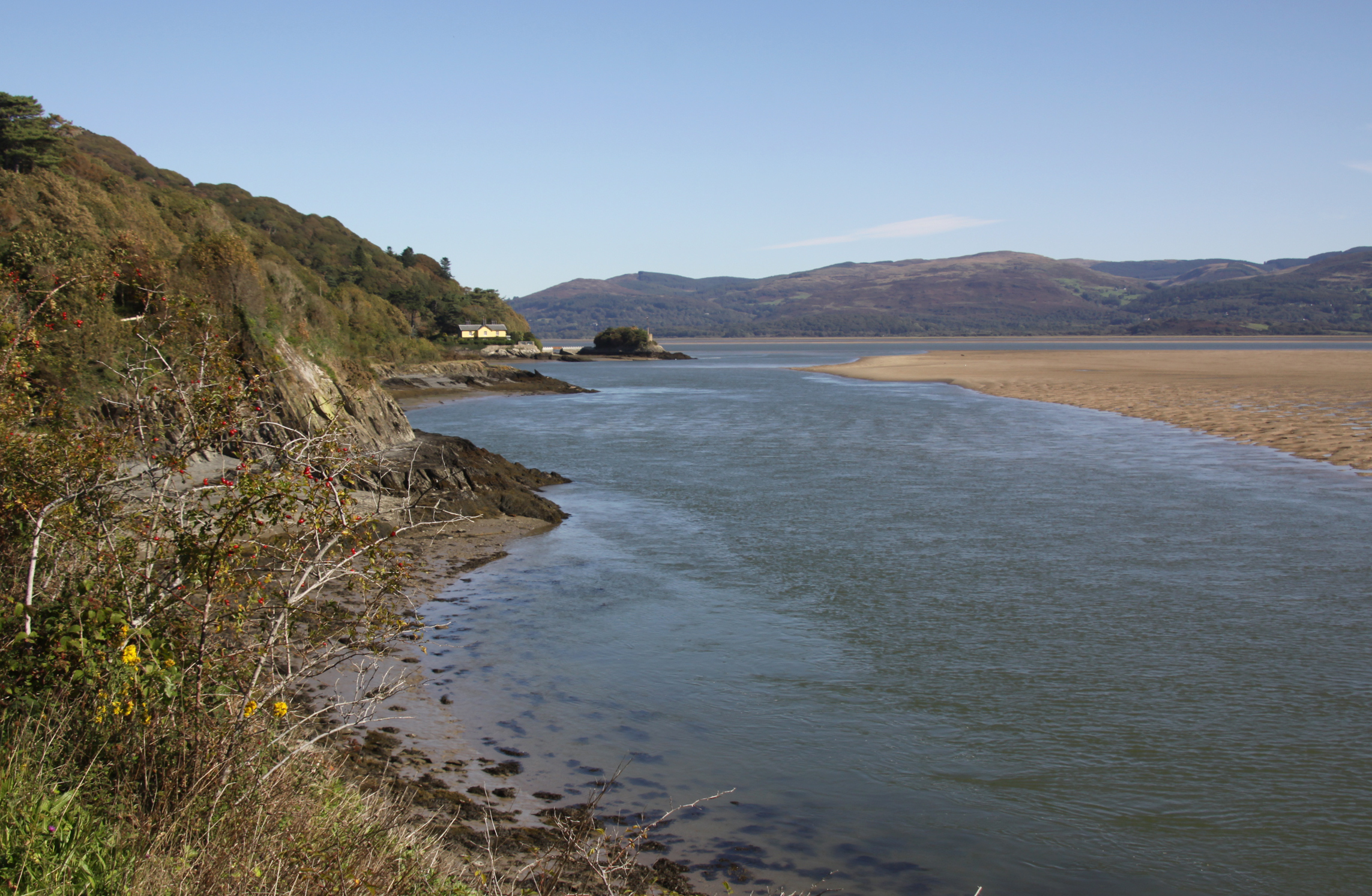
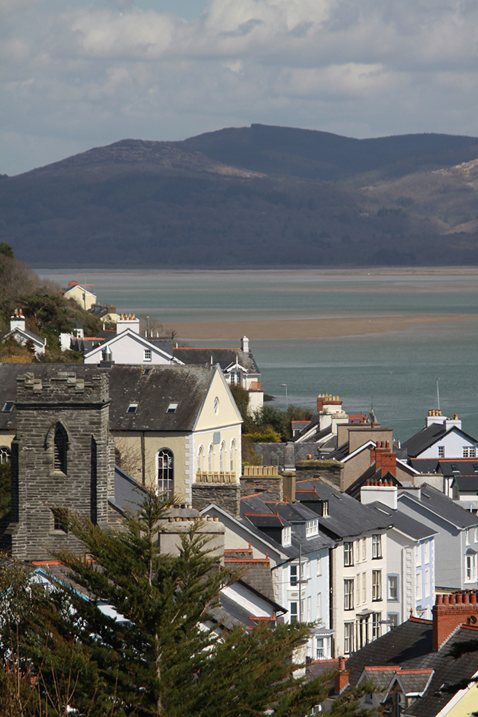
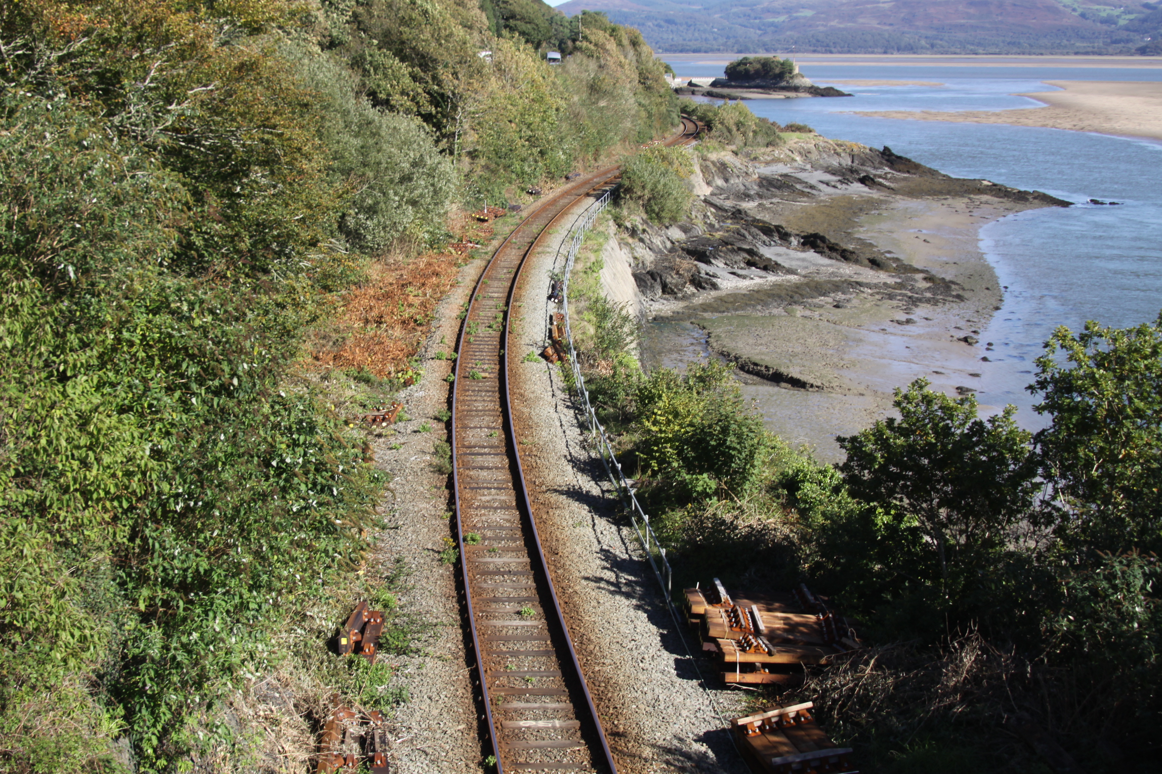
Afon Leri from the Panorama Walk behind Aberdovey, showing the railway bridge and the boatyard. The road bridge is between the two, but difficult to see in this photograph.

I have been fascinated by Afon Leri ever since I first visited Aberdovey some twenty years ago.  From my living room window it is an unwavering slender scar on the flat landscape to the east of Ynyslas.  From up on the hill its opening is clearly perpendicular to the banks of the Dyfi estuary, and one can see the bridges that carry the road and railway over the river towards Ynyslas, next to a small boatyard.  The river’s course across this topmost corner of Ceredigion is obviously canalized, an engineered artifice, but why?  What was its purpose?

Cors Fochno c.1790, before the route of the Afon Leri was changed. Source: National Library of Wales (where there is a zoomable version of this image)

The Leri rises at Llyn Craig-y-Pistyll below Pumlimon and passes through Talybont, (on the main road between Machynlleth and Aberystwyth) where it meets the Afon Ceulan before flowing behind Borth. The canalized section is 3.35km long and c.35m wide and runs from Ynysfergi in the south to Pont Leri in the north, crossing the low-lying Cors Fochno.  Cors Fochno is a Special Area of Conservation and one of the largest remaining examples of a raised peat bog in Britain, which started to form from c.5500BC.  Afon Leri now opens out into the Dyfi estuary at Pont Dyfi in Ynyslas.   Work on the canalized section had begun by 1790 when the above map was created by T. Lewis, marked as the Pil Newydd.

Excerpt from the above map of Cors Fochno showing the former course of the Afon Leri at far left.  The Leri begins at Borth and meanders along the coastline to the west of Cors Fochno up to the point where it emerges into Cardigan Bay at Aberlery (which means the mouth of the Lery).  Source: The National Library of Wales (where a zoomable version can be found)

In the early 19th Century local landowners and neighbours Pryse Pryse of Gogerddan and Mathew Davies of Cwmcynfelin were incentivized by the General Enclosure Act of 1801 to reclaim land from the bog in order to develop it for pastoral agrarian use.  Land reclamation would require the waterlogged land to be drained.  There was little recorded opposition from parishioners, and royal assent was granted on June 22nd 1813.  The land surveyor Charles Hassall saw the advantages of enclosing the 5106 acres but warned the landowners against contractors who were either duplicitous or ignorant of the task ahead.  His words were almost premonitionary as successive problems plagued the project.  Disagreements between land owners, contractors and commissioners, together with serious and ongoing financial problems, caused major delays.

Charles Hassall’s plan was to divert a number of streams that entered the bog to drain away spring floodwaters and build embankments along the Dyfi estuary to prevent salt-water transgressions.  He recommended an experienced contractor called Anthony Bower, who was employed in 1815.  Bower suggested that using the river Leri to drain water from the land was the most viable solution, but there were problems.  The course of the Leri ran along the far western edge of Cors Fochno and emptied a little further up the coast at Aberlery into Cardigan Bay.  It was insufficiently deep and fast-moving to serve as a drain for the bog, so Bower suggested that the best solution was to deepen, widen and straighten the river.  As Professor Moore-Colyer describes it:  “A sluice was to be constructed at the river mouth from which a main drain would run through the centre of the bog. This would be accompanied by a catchwater drain which would follow the course of the Lerry to the foot of the hills and then along the south-eastern boundary of the bog to join the River Cletwr.  By this means, Bower believed, water from the hills would be prevented from entering the bog while an embankment on the southern side of the Dyfi would preclude the entry of salt-water.”  Sluices and catchwater drains would be employed to control water levels.

In 1815, an alternative proposal was put forward by Griffith Parry of Penmorfa, and which carried an estimated cost of £10,000.  Griffith Parry had trained under the great engineer Andrew Rennie on the construction of the London Docks.   He also favoured diverting the Leri, but from the west end of Ynys Fergi in a straight line to Pont Afon Leri, and he too believed that deepening, widening and straightening the river was the solution, which he thought should be embanked with clay.  In addition, he suggested deepening, widening and embanking surrounding ditches and streams to improve the drainage potential offered by canalizing the Leri.

Gogerddan estate, the seat of Sir Pryse Pryse. Source: Parks&Gardens

Hassall died in 1816 and was replaced by co-commissioners Robert Williams of Bangor and David Joel Jenkins of Lampeter.  Williams was staggered by the estimated total cost of £30,000 proposed by Bowers which, with the widening and deepening of other existing drains, would absorb over 1000 acres, and would create a total landmass with a value of only £20,000.   Bower and Williams fell out over both this and more personal reasons.  For the next two years the parties vied for position, with Jenkins supporting Bower and Williams supporting Parry.  Parry’s plan eventually won out.  Contractors, to be paid £2500.00 in instalments, were appointed.  A final payment of £250.00 was to be withheld until two years after the project was completed, to provide insurance against post-completion problems. Additional costs, including raw materials, were provided by the Aberystwyth Bank after Pryse Pryse of Gogerddan provided security of £6000.00 for the loan,  the balance of the cash was raised by selling land on the peripheries of the marsh for over £2340.00 initially.  However, financial problems and disputes plagued the drainage scheme, particularly in respect of the contractors not building various elements to specification.   Williams resigned and in 1822 Richard Griffiths of Bishop’s Castle, with three successful enclosures under his belt, was appointed in his stead.  After the change in commissioner, the appointment of the surveyor Charles Mickleburgh of Montgomery, a new Act of Parliament in 1824, the chaos of further financial difficulties, escalating debts and a court case, the project was eventually completed by 1847, and a small  harbour was provided for the local shipbuilding industry.  It is difficult to see how the project could ever have seen a return on its investment.

Google map of Afon Leri

The above map from the 1790s, the Google map to the left and the Ordnance Survey map below show the former and present courses of the river. 

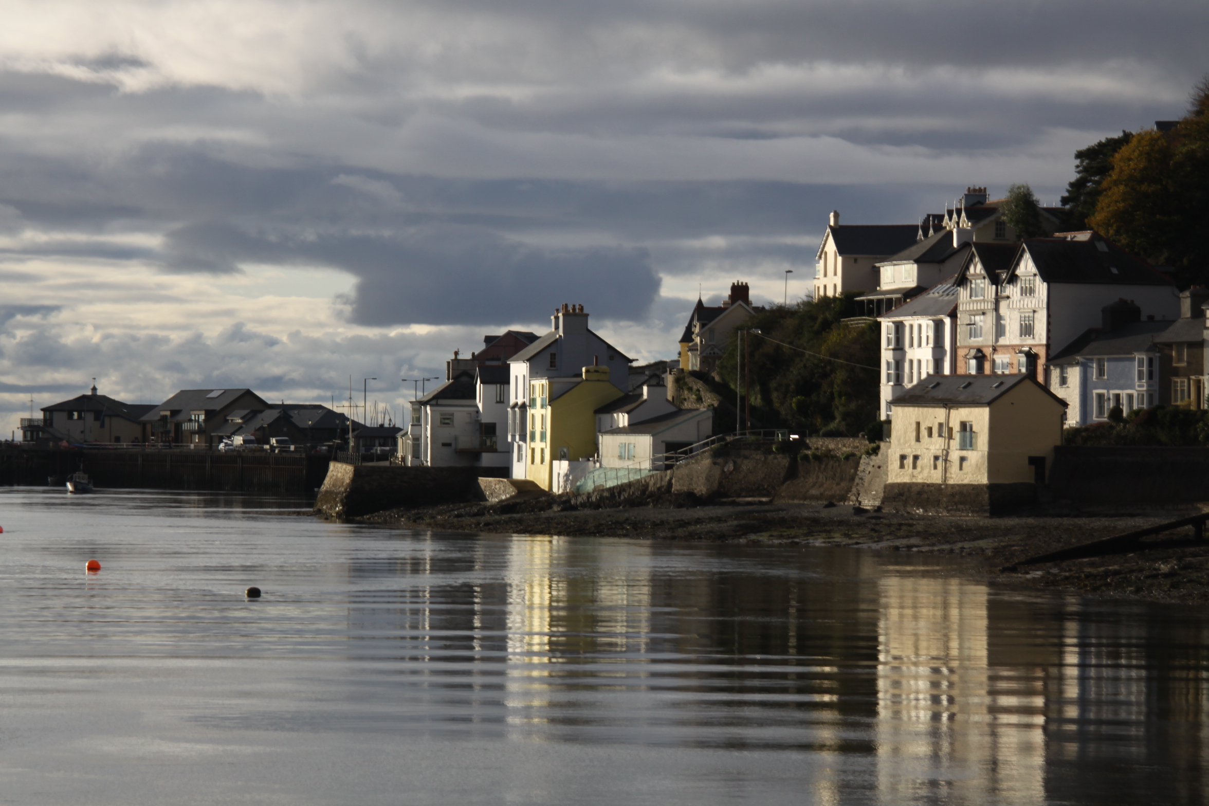
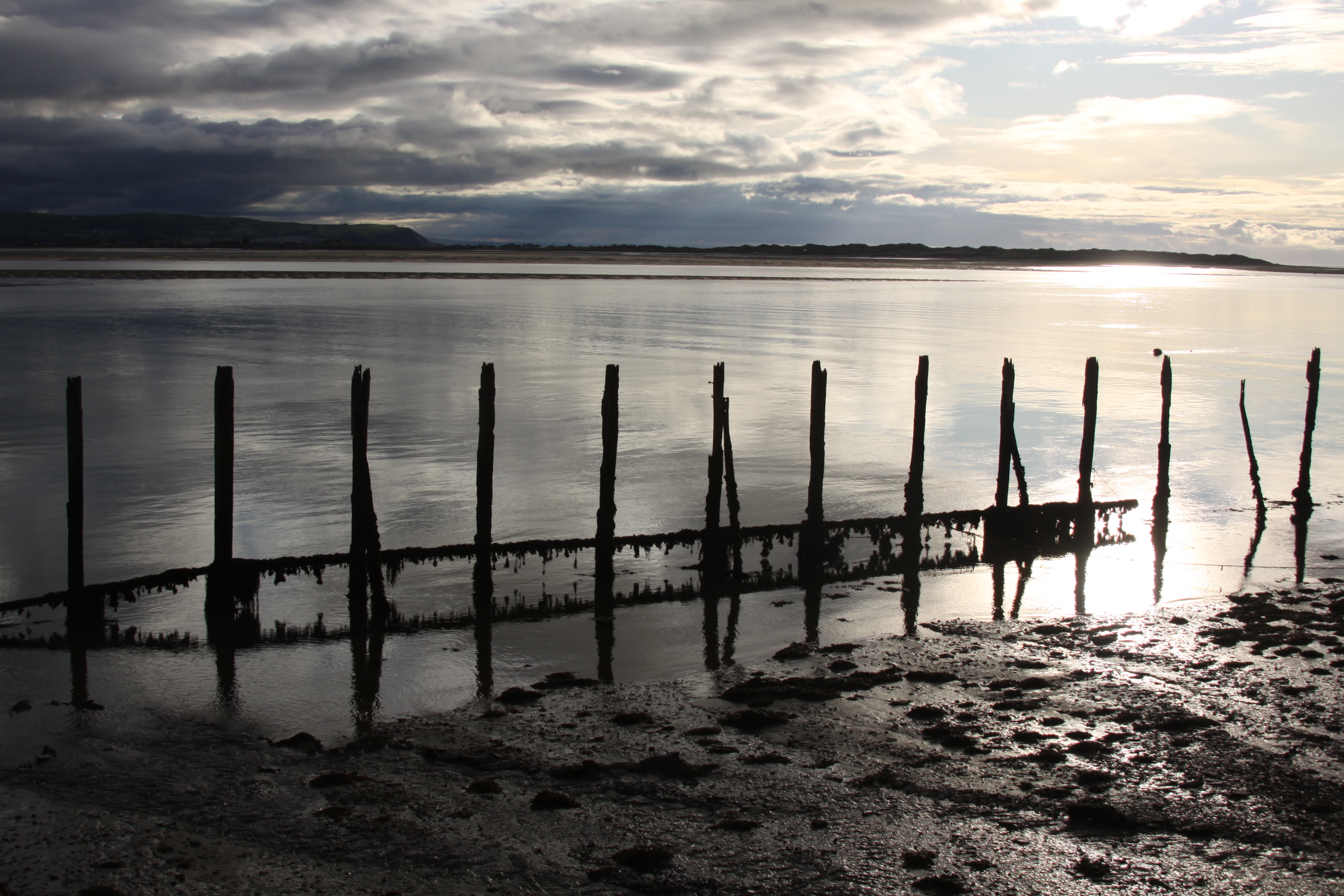
A road bridge, Pont Afon Leri,  carries the B4353 over the river at Ynys Tachwedd, connecting Ynyslas with the A487.  A small boatyard is located on the western side of the road bridge.  The Cambrian Coast Line crosses just to its south on a 7-pier railway bridge that was built in 1863.  The river is tidal along the length of the cut, and a footbridge over the Leri where the river meets the Wales Coast Path marks the boundary between the tidal cut and the non-tidal river.

The West Wharf boatyard at Pont Afon Leri has a history dating back to the 19th Century.  Here’s the description from the Coflein website:

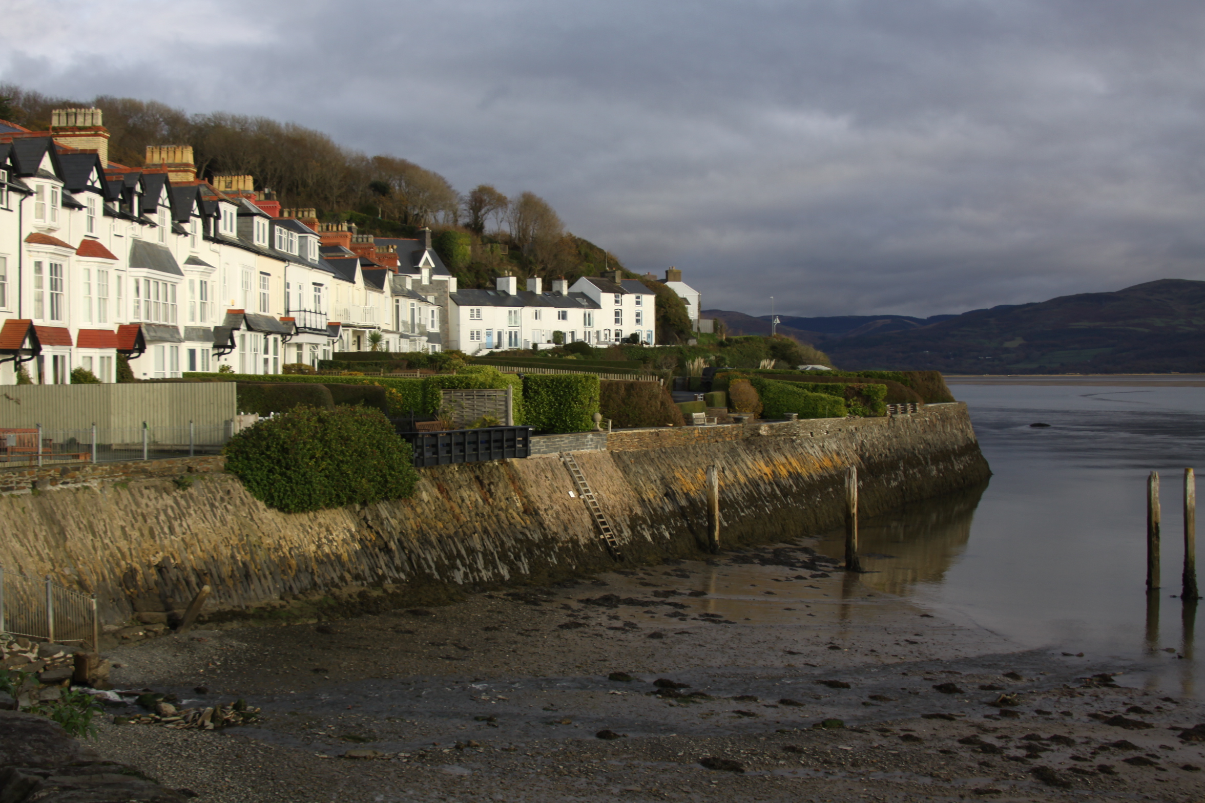
Afon Leri from the hill behind Aberdovey, showing the boatyard by the Pont Afon Leri road bridge

Remains of timber-fronted quay on the west side of the entrance of the river Leri constructed by the railway company. The northern end of the quay frontage is degraded and the quay material has been washed out from behind the piling. The section in front of the boatyard has been repaired and remodelled to accommodate a modern boat lift. Sales particulars dating to 1862 reveal that short section of wharf already existed close the road before the coming of the Welsh Coast Railway. The wharf was part of the land holdings belonging to Issac Ll. Williams Esq under the Geneur’rglyn Inclosure Act. The railway company subsequently undertook the development of the wharf to act as a landing point for a new steamer working the Aberdovey ferry. The paddle steamer ELIZABETH started service on 24 October 1863, the day that the railway line between Aberdovey and Llanwyngwril opened on the northern side of the opened. The vessel was to operate every hour and to charge 6d per head for the crossing. Maintaining the service was extremely difficult as the ELIZABTH was frequently stuck fast on the Dyfi sandbanks. On 5 July 1867, George Owen, the Cambrian railway engineer reported that if the railway line to the north side of the Dyfi could not be fully opened soon, then the wharf would need to be piled. The line subsequently opened in August 1867. The ferry’s use of the West Wharf might have ended then, but the railway inspectors required more work to be undertaken on the tunnels. Whilst passengers were taken round by road, goods continued to be shipped across the Dyfi by the tug JAMES CONLEY. The use of the ELIZABETH on the route was abandoned and the vessel sold in 1869. In 1893, it was proposed that that the barges transhipping slate from the Plynlimon and Hafan Tramway would be charged for using the railway company’s West Wharf. Two years later, in May 1895, Mr I Hughes Jones, owner of the East Wharf sawmill proposed the transfer of the business to the other side of the Leri. This was accomplished soon after April 1896 when a new railway siding was opened to service the transferred sawmill. Also in 1896, is appears that the Hafan Sett Quarry (Plynlimon and Hafan Tramway) were still proposing to use the wharf, as they contacted the railway company with regard to installing a level crossing for the tramway. It is likely that the piling for the wharf was extended around this time to facilitate these new developments. The saw mill continued to occupy the wharfside through to the First World War.

Today the boatyard is still a functioning business, offering boat storage, slipway launching and repairs and has a 16-ton slipway hoist.

The Ceredigion Coast Path follows part of the course of the canalized section of the river, and intersects with the Wales Coast Path just east of Borth where the canalized stretch of the river begins, as shown on the above map.  The Ceredigion Coast Path website has more details, and for those wanting to walk the Leri, there’s a good outline of how it can be approached by Ben Fothergill on the UKRGB website.  An official walk across Cors Fochno can be found on the Natural Resources Wales website.

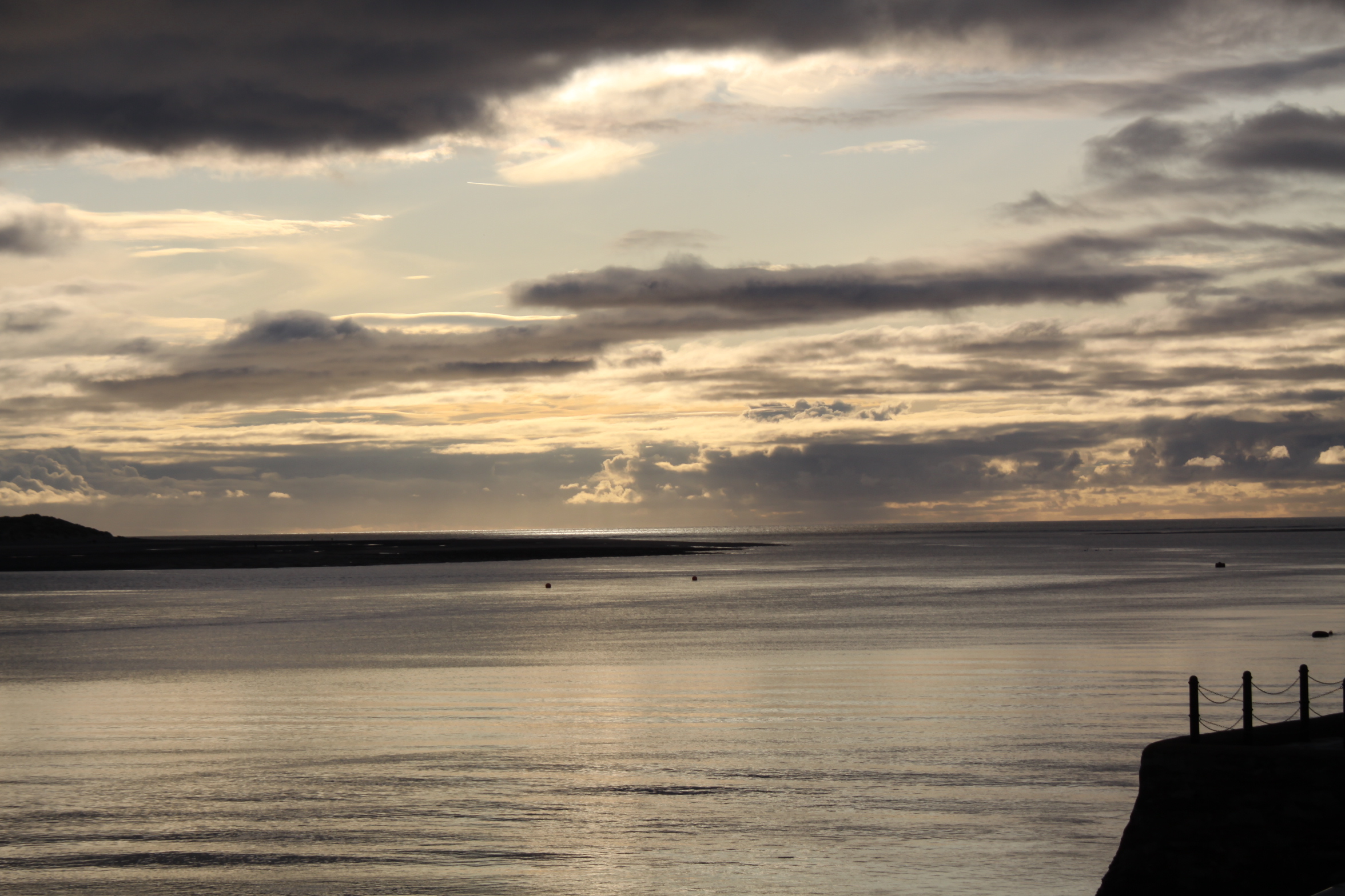
View of the Afon Leri as it approaches the Dyfi estuary. Photograph by Chris Denny (under Creative Commons licence).

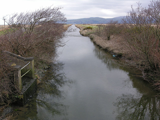
Afon Leri from the footbridge where the tidal section of Afon Leri meets the non-tidal section. Photograph by Nigel Brown, used under Creative Commons licence.

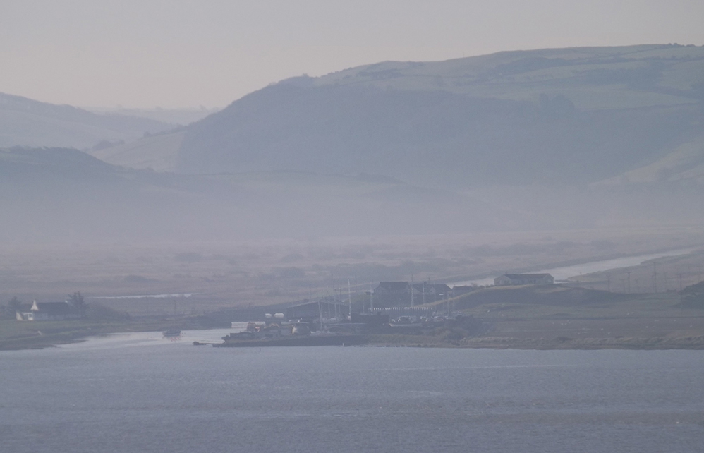
Afon Leri in the mist, seen from Aberdovey

Main source for this post and a lot more information, particularly about the financial problems, land sold for financing the drainage, and allotments of land to the poor, with my thanks:

Vintage postcards #5: Terrace Road in the moonlight

I love this postcard.  It shows Terrace Road in Aberdovey by moonlight, with a slightly overcast sky, the silver sheen reflecting off slate roofs and casting a bright glow over the estuary.  The most prominent building in the picture is the little structure on the beach, a purpose-built lifeboat house to provide a home for the village’s first lifeboat, Victoria, in 1837 and now called Traeth Dyfi (Dovey Beach), it had an entrance for the lifeboat under the west gable and a pedestrian entrance opening out on to the road. Victoria was replaced with two newer and bigger vessels in 1856 and 1865, each kept in the same building, but it went out of use as a lifeboat house when a bigger lifeboat was needed in 1886.  A slipway, which does not appear in the above postcard, was added on this side of the old lifeboat house in 1903 and can still be seen today, although the lifeboat now has its own dedicated building that it shares with the yacht club near the jetty. After the lifeboat moved, Traeth Dfyi became a cake shop and tea room and in the 1960s was converted for residential use.  It is currently available as a holiday let, with pictures on the website of the modern interior, and a history of the building (from which most of the above details are taken) for those interested in more information.  The building seen as a silhouette in side view in the postcard and, in the photograph, as a white-painted building beyond the old lifeboat house is the three-storey Georgian house Plas Dyfi, which is currently for sale.

The above photograph shows the view as it is today, taken on 17th November 2019.  It attempts to reproduce the viewpoint but I couldn’t get the elevation.  The picture was clearly taken from the hillside.  The yellow building on the beach is the old lifeboat house, and the four-bay white house to the right is Cliffside.

The Dovey Belle topsail schooner. Source:  Lewis Lloyd 1996, A Real Little Seaport, volume 2 (plate between pages 120 and 121)

Cliffside is also at the far right of the postcard, a terrace of four very fine four-storey houses.  Before the construction of Cliffside, in the mid 1880s, the site was the site of a lime kiln, employed to turn imported limestone into powder for spreading on lime-starved land.  In 1901 no.2 Cliffside was home to Master Mariner Captain John Williams (1865-1937).  Captain Williams was born in Aberdovey and had served on his father’s ship, eventually becoming Master of the Aberdovey-built Dovey Belle.  He had lived at No.35 Copper Hill Street in 1900 when he was aged 35, but in c.1901 seems to have moved to Cliffside. He became Master of the schooner 1867 Aberdovey-built topsail schooner Dovey Belle, built by Thomas Richards at Aberdovey registered No. 9 in 1867 at Aberystwyth.  According to the well-researched Williams Family Tree website “she became the last locally built sailing vessel to ply to and from Aberdovey on a regular basis.”  No.4 Cliffside was the home of Hugh M. Lewis M.B.E., who lived his entire life in Aberdovey, wrote several memoirs of the village and was awarded an M.B.E in 1993 for his service to the community.

There’s no stamp or postage mark, even though there is a message and a Birmingham address, apparently ready for posting.  It was sent in lieu of a birthday card, and I hope it brought a lot of pleasure to the recipient, Miss Eliza Hodgkins, if she ever received it.  Out of curiosity I looked up the postal address but although St Martin’s Road still exist, half the road is a building site and the other half is dominated by a huge multi-screen cinema and other modern block-like structures.

I can’t read the print under the handwriting.  There is a code on the front of the card, (46845 J.V.), which could indicate that this was manufactured by James Valentine.  If so, the Valentine postcard dating page on the Historic Coventry website puts that code at 1905.  In the picture masted ships are shown just round the corner, there is gas lighting (installed in 1868; electricity was not installed until 1945) and a horse pulls a small cart.  These are all consistent with 1905 being a plausible date but the design and colour printing on the back seem more modern.  It is possible that a newer printing run used an older image.  It would be good to get an idea of a possible date range from other postmark or  from other cards, so I’ll keep an eye open.


Vintage Postcards #4: The Roman Road

The Roman Road as it is today from a similar viewpoint to the first postcard, with Trefri in the background

The Roman Road is a nice local myth.  It forms part of a popular low-tide walk along the estuary to Picnic Island (which I have written about here) and is a truly remarkable sight, cut out of the black Aberystwyth series shales, which in places are so smooth that the rock looks polished and glistens in the sun.

Although there is a Roman fortlet at Pennal 11km away, there are very few indications that the Romans did anything more than pass through Aberdovey, if they even did that.  Trying to find out what it was built for I first looked to Hugh M. Lewis, who wrote several histories of the village, but he was unable to shed any light on the subject.  My original guess was that it was built in the 1860s, part of the works for the building of the railway, but that failed to address the question of the purpose of such a track.  In his description of a 6-mile walk that incorporates the road, the author David Roberts, an Aberdovey resident, states that the track was built in 1808 for horse and carriage, but he doesn’t expand on this observation.  I then found a publication by the Gwynedd Archaeological Trust (GAT Ports and Harbours of Gwynedd, 2007) that contains the following statement, and which appears to confrim what David Roberts says and provides sources for identifying this as a road designed to connect to a stretch of road that already linked Pennal to Machynlleth:

Fenton remarks in 1808 that a new road was under construction from Aberdyfi to Machynlleth but implies that the section from Pennal to Machynlleth was already in being, that an extension west and north to Tywyn ‘by way of the sands’ was contemplated if not actually under construction. This road, known as ‘hen ffordd Corbet’ was not a success, being built so low that it was frequently covered by the tides. Its course is marked on the plans for the replacement road dated 1823 and prepared by Thomas Penson (DRO: Z/CD/168).  This is probably Thomas Penson junior (1790-1859), county surveyor of Montgomeryshire, a versatile and able architect-engineer, rather than his father. Lewis states that this road was completed in 1827

I am still unsure if this is the correct answer, as the track barely seems wide enough for horse-drawn vehicles, and in places would have been lethal underfoot for horses.  One would need to see Penson’s plans for the replacement road mentioned by the Gwynedd Archaeological Trust’s report.  Whatever its original purpose, it is invaluable today as a ready-made footpath for walkers.  The note about the road being unpopular due to being submerged by tides holds true today.  The walk is impossible without wading through water at high tide.  I note that the second of the two postcards does not commit itself on the subject and states merely that the scene shows “The Rocks.”

The first postcard was unused, so there are no helpful postmark or stamp details to give an indication of date.  It was manufactured by Lilywhite Ltd of Triangle, Halifax.  Lilywhite was set up by Arthur Frederick Sergeant (1882-1952) in around 1910 and produced postcards at least until 1931 when their factory burned down, destroying both prints and negatives.  They took over Arrow Series Postcards in the 1920s and as well as retaining the Arrow name for some of their postcards, re-released some earlier Arrow postcards under the Lilywhite name.  I’ll keep an eye open for a used version of this postcard to see if I can find a date or at least a date range.

The second postcard has a Edward VII stamp and an Aberdovey postmark dated August 7th 1904.  Edward VII reigned from 1902-1910, and this particular shade of blue-green was issued between 1902 and 1904.

I loved the brevity of the message, which also contained the brilliant information that the sender had been staying at Glandwyr in Aberdovey. 115 years later it is owned by a very nice local holiday company, Dyfi Cottages, that lets out properties in the village and also runs the Visit Aberdovey Facebook page.  There’s a lovely sense of continuity in those details.  I suppose that postcards were, and still are, a form of social media, a way of maintaining communication with people far away.  The postcard was sent to the beautiful village of Luccombe, which now lies in Exmoor National Park in Somerset.  The house to which it was sent, Wychanger, was a manor house now Grade 2 listed and converted to semi-detached homes.  It is fun to have the full breadcrumb trail.

Photograph showing the location of Glandwr, used with permission, copyright Dyfi Cottages and Aberdyfi Holidays

Evelyn Wrench, from an article in
‘The Pictorial Magazine’, January 2nd 1904. Ref: Wr D 48/65.  Source: The University of Nottingham’s Manuscripts and Special Collections blog

The 1902 Post Office regulations are provided as simple instructions on each half of the back of the card, leaving no room for any confusion!  The title Gwladgarwr at the front of the card is a puzzle, appearing on a lot of Wrench’s Welsh postcards.  It means “patriot” and was the title of a Welsh language newspaper (Yr Gwladgarwr), but the newspaper appears to have no connection with the postcard manufacturer.  The card is in the Wrench Series, no.8006, and was printed in Berlin.

Sir John Evelyn Leslie Wrench (1882-1966) was a British author and journalist.  While in Germany after leaving school, Wrench was impressed with the popularity and high quality of German postcards and decided to shelve his plans to become a dimplomat and instead set up a British business producing high quality postcards in sepia, black and white, and colour.  He had his resort postcards printed in Dresden (Saxony) and Berlin from where they were shipped in bulk to London.  Although it remained in business for only a few years, the postcard company was a initially a phenomenal success and Wrench himself became something of a media darling.  Based in Haymarket in London Wrench’s postcard company had over 100 employees and sold in the region of 50 million cards, all before he had reached 21 years of age.  Wrench went out of business in 1904, having sunk too much capital into the company, leaving him unable to repay loans but he went on to have a very successful career.  He was founder of the Royal Over-Seas League, became editor of The Spectator and was knighted by George V in 1932.

Video of Aberdovey in the 1920s

A  very battered piece of black and white footage that I stumbled across on YouTube, from Huntley Film Archives (catalogue number 1092610), showing scenes of Aberdovey and the estuary in the 1920s.  There’s no information about the video, so just watch and enjoy.  The footage of the steam train is particularly evocative, with the trail of steam flowing like cotton wool behind the locomotive.

There is some amazing footage on the Huntley Film Archives on all manner of subjects.  It is worth going to their home page (https://www.huntleyarchives.com) and browsing randomly through their categories.  I particularly liked their Quirky and Rare categories.

Vintage postcards #3 – Penhelig Beach

Not quite as vintage as postcard #1 and postcard #2, which were dated to 1910 and 1903 respectively, this view of Penhelig Beach has an Aberdovey Merioneth postmark dated 19th August 1962 and features two Queen Elizabeth II stamps (a blue 1 penny and a green 1 1/2 penny).  Elizabeth had been on the throne for 10 years when this postcard was sent to Harborne in southwest Birmingham.  The big carpark on the sea front and the modern developments at the top of Copper Hill Street, along Mynydd Isaf and Maes Newydd and related roads had not yet been built and the village must have had a very different character.

A view of Penhelig today taken from a very similar viewpoint:

Unlike the 1903 and 1910 postcards, this is immediately recognizable and familiar, and apart from the boats, which immediately indicate that this is not a modern photograph (I particularly like the one furthest from the camera), it looks much the same as it does today.  Penhelig Terrace, immediately behind the beach, was built on the spoil-heap from the tunneling works for the railway in 1864,  which was routed round the back of the village to prevent it impinging on tourism and ship-building activities.

A picture hanging in Aberdovey’s Literary Institute shows the same scene in 1837 before either the railway or Penhelig Terrace were built, with the Penhelig Arms visible at the far left. In this view the low and long Penhelig Lodge (about which I have posted) dominates the scene and looks out over the beach.  It was probably still fishermen’s cottages at this time, although it had various roles afterwards, including a stint as an exlusive school for young ladies.  Penhelig Lodge is now a row of three cottages on a busy bend where the railway crosses the road, hidden behind Penhelig Terrace and the railway, on the edge of Nantiesin car park and overlooked by Penhelig Station, but as a building it has lost none of its charm.

Aberdovey 1837. Source: Photograph of picture hanging in the Literary Institute.

A photograph from Hugh M. Lewis’s book Aberdyfi, A Glimpse of the Past, below, shows Penhelig as it was just after the railway was established and just before the terrace was built in the mid-1860s, with a large vessel moored on a high tide in the days when the beach was a shipyard, with Penhelig Arms just behind it.  In the above postcard Penhelig Arms is out of sight, a few houses to the left and across the road.

Penhelig shortly after the railway was laid, and before Penhelig Terrace was built, showing the railway tunnel and the shipyard just in front of the Penhelig Arms. It is clear that at least two houses were taken down to route the railway round the back of Aberdovey.  Penhelig Station was added in 1833 Penhelig Station was added in 1933, by which time the railway was operated by the Great Western Railway, which absorbed Cambrian Railways in 1922, and was equipped with a single platform and an attractive little wooden shelter that remain today.  Source: Hugh M. Lewis’s book Aberdyfi, A Glimpse of the Past

The row of houses behind the memorial park to the right of Penhelig Terrace on the main road through Aberdovey has changed dramatically since the 1860s photo in Hugh M. Lewis’s book, but not much since the 1962 postcard.

The row of houses behind the memorial park to the right of Penhelig Terrace on the A493.

Penhelig Terrace today, seen from the memorial park

The postcard producer, Valentine’s (J. Valentine and Co.), opened in 1866 in Dundee, at first specializing in photographs of Scotland, and continued to make postcards for a century.  According to the Jisc Archives Hub, “much of the collection contains views associated with the leisure market, subjects such as fishing were regarded as attractive, agriculture less so, and industry was rarely portrayed. The main features are stately homes, historic ruins, great open spaces, beaches, the grandeur and curiosity of nature and great engineering feats.”  The company stopped producing postcards in 1967 because they failed to make the switch to colour printing for postcards soon enough to be competitive, and they had found that greeting cards were more lucrative anyway.

Vintage Postcards #2: Sheep herding on Trefri Road in 1903

Like the postcard #1, which was a 1910 sepia photograph, this 1903 scene really throws one back to a previous era where the threat of being run over by one of the hundreds of cars that use the A493 estuary road simply didn’t exist.  The mid-1850s Trefri Hall is again visible in the background, but this postcard gives a real sense of rural isolation.  This sense of isolation is, however, quite misleading.  An east-west turnpike was built following the Merioneth Turnpike Act of 1775, which ran from near Pennal through Cwm Maethlon (Happy Valley) towards Tywyn, and although it bypassed Aberdovey it was still an important link between the coast and the interior of mid Wales.  Most importantly, the railway was established in 1864, connecting Tywyn, Aberdovey and Machynlleth with other parts of north Wales and England.  The industrial revolution and the demand for raw materials such as copper, silver and lead, as well as the slate trade had made Aberdovey an important port and shipping was a major activity, both via river and sea, and the tourist industry was becoming increasingly important.  By the turn of the century, Aberdovey had at least six places of worship, at least one pub, a literary institute and several hotels.

1903 postcard

The stamp shows Edward VII who reigned from 1902-1910, and this particular shade of blue-green was issued between 1902 and 1904.  The stamp is postmarked Stowmarket and is dated 9.30AM, June 26th 1903.  Perhaps the purchaser bought it in Aberdovey and took it home to post.

The postcard was produced by Raphael Tuck and Sons, “fine art publishers to their majesties the King and Queen” in their “Art” series.  Queen Victoria had granted them the Royal Warrant in 1883.  According to the TuckDB website, Raphael Tuck was a Prussian who had trained as a graphic artist and started his picture frame and graphic design business with his wife Ernestine in Bishopsgate (London) in 1866.  It became one of the world’s biggest postcard producers, all based on art works, but produced a number of other products as well, as shown on the 1901 advert below.  Most of the postcards were printed in Germany up until the First World War, and this card is marked “Printed in Berlin.”  The Aberdovey card, by artist Frederick William Hayes, was sold as one of a set of six Welsh scenic views, the others showing Cader Idris, Bala, Harlech, the Dolgellau Precipice Walk and  Llyfnant Valley, Aberystwyth (all of which you can see here, on the TuckDB website).  Later, the a postcard was issued showing the same painting in full, extremely bright colour.

The artist, Frederick William Hayes (1848-1918), was born on the Wirral, trained first as an architect and then as a painter in Liverpool and London before returning to Liverpool where he established a watercolour society.  He was an Associate of the Royal College of Art.  Hayes exhibited at the Royal Academy of Arts between 1872 and 1891.  He was a prolific painter, working in pencil, watercolour and oil.  His paintings are usually very picturesque in theme, and he painted a lot of landscape and seascape scenes in Wales and Scotland.

The House of Tuck – an advert from 1901. Source: TuckDB website.

Trefri Hall today. I lacked the courage to dodge the cars in any attempt to reproduce the exact viewpoint in the postcard!


Photographs of Aberdovey, late afternoon today

Some snapshots of Aberdovey this afternoon.  It was a particularly beautiful day, and although I was up to my ears in stuff I really ought to be getting on with this morning, I wanted to take some particular shots to match up with my vintage postcards so I made my escape and went down to the seafront.  At this time of year it’s mad to ignore good weather when it’s available.  I was lucky to find that the light was truly remarkable.


Photograph of Aberdovey in the 1895 book “Round The Coast”

Aberdovey 1895, from the book Round The Coast

On my previous post I mentioned that as well as postcards, I had bought a page with a photograph of Aberdovey that comes from a book dating to 1895, so here it is.  Welcome to page 133 of the book Round the Coast – An Album of Pictures from Photographs of the Chief Seaside Places of Interest in Great Britain and Ireland published in 1895 by George Newnes Ltd (no author credited).  The photograph must predate the publication by several years, as the tiny chapel at the far right of the photograph was replaced in 1894 by a large school.

Round the Coast, 1895

There is an awful lot to love in both the cover of the book and the photograph itself, which must been taken from the hill behind Copper Hill Street, but what makes it stand out for me is the array of masts that rise above the buildings on the seafront.  There are seven in total, and I desperately wish that it was possible see what they were attached to!

The Aberdovey leg of the Cambrian railway was 31 years old at this time.  Don’t miss the beautiful semaphore signal at the bottom left corner of the photograph.  Although it was generally agreed that the coming of the railway would offer huge benefits to the economy of the village, the exact route was a subject of considerable disagreement between the representatives of the railway company on the one hand and Aberdovey residents and the owners of the land (the Ynynsymaengwyn Estate in Tywyn) on the other.  The railway company planned to run the railway along the sea front, which would have been shorter and cheaper than the route eventually agreed upon.  Aberdovey business leaders and villagers argued that this would have a negative impact on shipping, ship building and tourism, and their determination lead to the track being routed around the back of the village, an expensive compromise that required tunnelling through rock and contributed to the bankruptcy of the major investor.  Read more about the establishment of the railway in Aberdovey in 1864 on an earlier post.

St Peter’s Church and the Tabernacl from the footpath to Pen Y Bryn today

Fanning out below the photographer’s feet are what appear to be gardens or allotments, one of Britain’s happier social institutions.  Behind the railway and running all the way to the tracks are more gardens or allotments.  Any space that didn’t have a building seems to have been highly valued for cultivation.  Surprisingly, given the value of land for housing, there are still allotments in Aberdovey today, running to the south of Gwelfor Road.

Aberdovey’s remarkable religious mix is amply represented.  St Peter’s Church (built 1842) dominates the village from this angle, partly because it is so out of keeping with the surrounding architectural styles.  The Calvinist Methodist Tabernacl (1864) at its side was built on a rise, and replaced the earlier and smaller Wesleyan Methodist chapel in Chapel Square at the foot of Copper Hill Street.  The deliberate juxtaposition of the chapel with the pre-existing Anglican church, the two biggest religious structures in the village, really tells its own story but I wish I could have heard the ecclesiastical debate and the the village gossip as the new chapel went up.  I bet that there were a lot of ruffled feathers.  Three other chapels are also clearly identifiable.  At the foot of Copper Hill Street in Chapel Square are the Calvinist Methodist chapel (1828, now Dovey Marine) and the Wesleyan Methodist chapel (1868), and at the far right of the photograph on the seafront is another chapel that no longer stands.  In a postcard that I have from the early 20th Century this chapel has been expanded and became quite substantial.  I have no information about it so if anyone can tell me anything about it, I would be grateful.

The caption says that at low tide it was possible to walk across to Borth from Aberdovey.  Is that true?  I have seen some seriously low tides, but nothing to suggest that one could ever walk from one side of the estuary to the other.

The caption is a really lovely piece of text that should be enjoyed, and here it is:

Aberdovey – This lovely resort takes its name from its unrivalled position at the mouth (in Welsh, “Aber”) of the River Dovey. It is a delightfully situated port and watering-place on Cardigan Bay. The chief attractions are its firm sands, which extend for five or six miles, and the mild and equable climate, which rivals that of Torquay or Bournemouth. Aberdovey faces the west, and the air is so balmy, yet invigorating, that the tender myrtle will grow out of doors all the year round. In the season, pleasure boats are in great demand among visitors for sailing and rowing on the estuary of the Dovey, which affords one of the most convenient and safe places in Wales for boating. This is because the beach from the harbour to Penhelig Point – a distance of over half a mile – enables one to land at all states of the tide. At low water, by the way, Borth may be reached across the sands. Charming walks abound in the neighbourhood, the Happy Valley being the most frequented; and we have no hesitation in saying that this particular spot is matchless for beauty, even in picturesque Wales. The ever-enterprising Cambrian Railways Company brings many other delightful excursions within the reach of visitors making Aberdovey their head-quarters; and the company has spent a considerable amount of money in providing harbour and pier accommodation for all kinds of vessels. We hold no special brief for the Cambrian Railways, but we can confidently recommend the lovely places on their system to the notice of those who contemplate a new departure in the way of holiday-making, and who are desirous of sojourning cheaply and well in the very heart of the most beautiful scenery in the United Kingdom.

I cannot argue with any of that.  On the reverse side, page 134. is a photograph of Freshwater Bay on the Isle of Wight, with a similar caption.

Vintage postcards of Aberdovey #1 – Trefri

I was looking on eBay for something completely unrelated and noticed a small job-lot of vintage sepia and black-and-white postcards of Aberdovey for a bargain price, so I bought them.  It is fascinating to see past views of the village.  Some of the buildings look so crisp and fresh and it is truly interesting on the one hand to see the changes and, on the other, to be surprised at how much remains the same.  The subject matters that were offered by the postcard companies, and which people chose to buy, are often quite different from those that one can buy in the village today.  It feels like invading the privacy of past visitors to read the messages that they wrote to friends and family, but it is also a rather nice way of connecting with the past.  Separately, I bought a page from a book dating to 1895, which is a real treasure.  I thought that others might be interested in this little haul, so as I scan them I’ll post them here.  You can click on the images to see a bigger version.

Postcard of Trefri, Aberdovey

The picture on the card shows Trefri, the area just outside Aberdovey which includes the mid 19th Century Trefri Hall right on the edge of the estuary with its own island, currently painted English-mustard yellow.  I don’t know the house on the hill, but I am sure that other residents will recognize it.  If it still stands, it is no longer in splendid isolation.  Aberdovey has spread both out and up.  The 1864 railway is clearly visible and telegraph polls indicate that Aberdovey had been connected to the rest of Britain in more ways than one.  Today one wouldn’t take one’s life in one’s hands by walking down the middle of that stretch of road, and it is difficult to visualize an Aberdovey where bicycles were more numerous than cars.

Reverse side of Trefri postcard sent in 1910

The postmark says that the postcard was sent from Pennal on May 22nd 1910, and the address indicates that it was going to Birmingham, then as now the main source of tourists for the mid-Welsh coast.   The green half penny stamp, which was issued between 1902 and 1910, shows Edward VII, who died on 6th May 1910, and was succeeded by George V.

Trefri Hall today

Railway track as it leaves Aberdovey for Machynlleth, with Trefri Hall’s island visible where the rails vanish around the bend