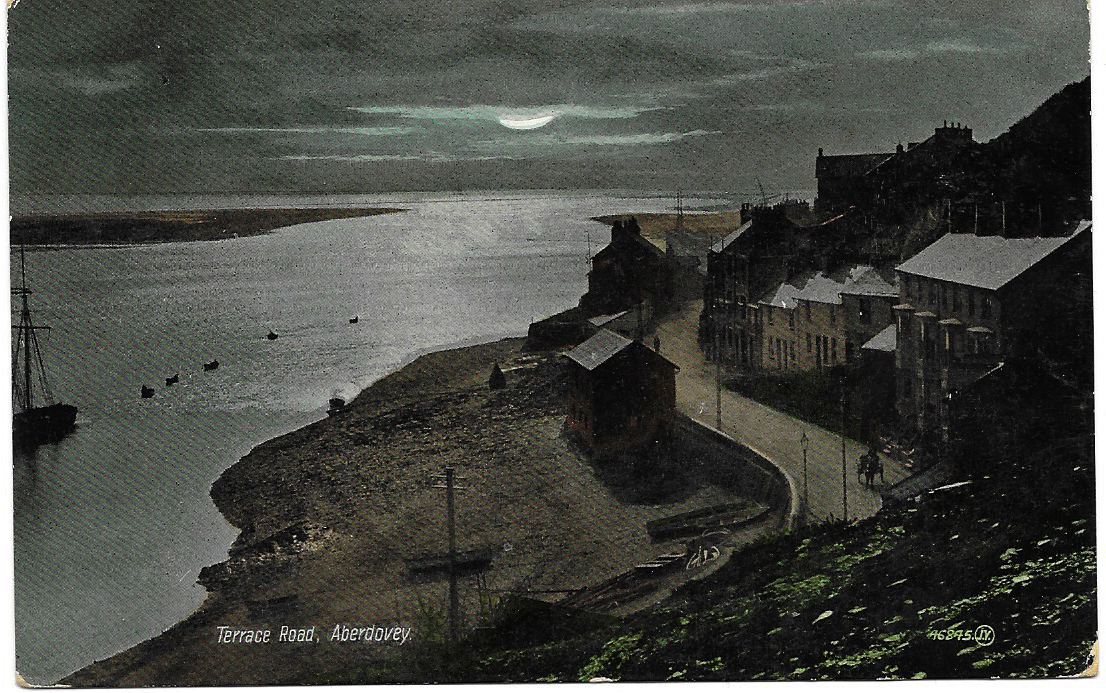
I love this postcard. It shows Terrace Road in Aberdovey by moonlight, with a slightly overcast sky, the silver sheen reflecting off slate roofs and casting a bright glow over the estuary. The most prominent building in the picture is the little structure on the beach, a purpose-built lifeboat house to provide a home for the village’s first lifeboat, Victoria, in 1837 and now called Traeth Dyfi (Dovey Beach), it had an entrance for the lifeboat under the west gable and a pedestrian entrance opening out on to the road. Victoria was replaced with two newer and bigger vessels in 1856 and 1865, each kept in the same building, but it went out of use as a lifeboat house when a bigger lifeboat was needed in 1886. A slipway, which does not appear in the above postcard, was added on this side of the old lifeboat house in 1903 and can still be seen today, although the lifeboat now has its own dedicated building that it shares with the yacht club near the jetty. After the lifeboat moved, Traeth Dfyi became a cake shop and tea room and in the 1960s was converted for residential use. It is currently available as a holiday let, with pictures on the website of the modern interior, and a history of the building (from which most of the above details are taken) for those interested in more information. The building seen as a silhouette in side view in the postcard and, in the photograph, as a white-painted building beyond the old lifeboat house is the three-storey Georgian house Plas Dyfi, which is currently for sale.
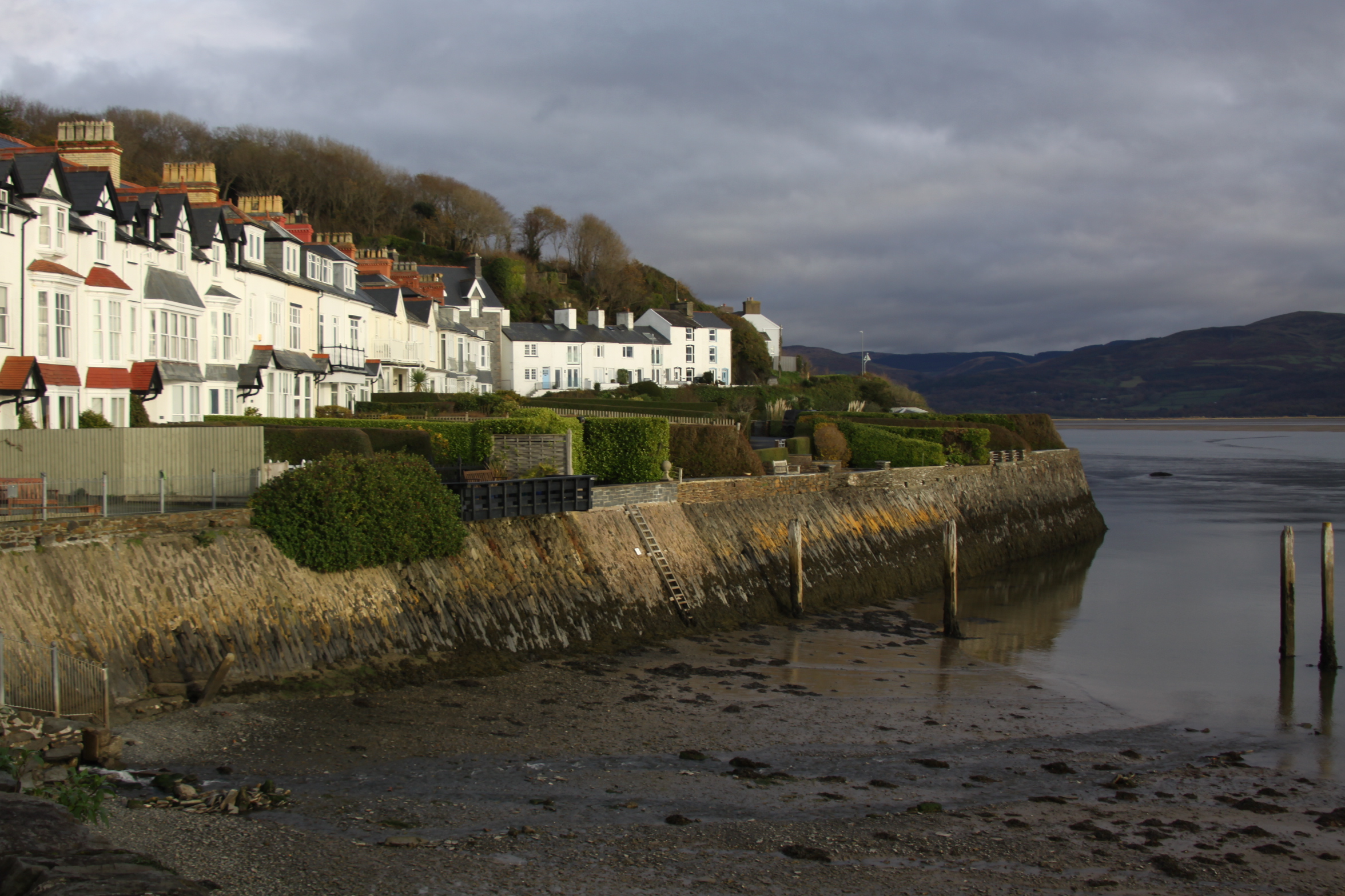
The above photograph shows the view as it is today, taken on 17th November 2019. It attempts to reproduce the viewpoint but I couldn’t get the elevation. The picture was clearly taken from the hillside. The yellow building on the beach is the old lifeboat house, and the four-bay white house to the right is Cliffside.
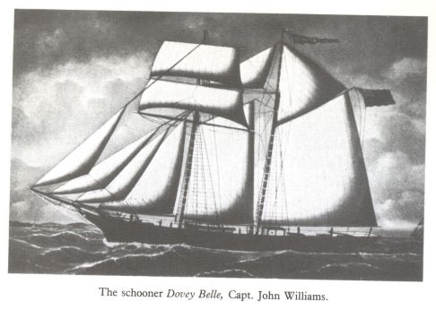
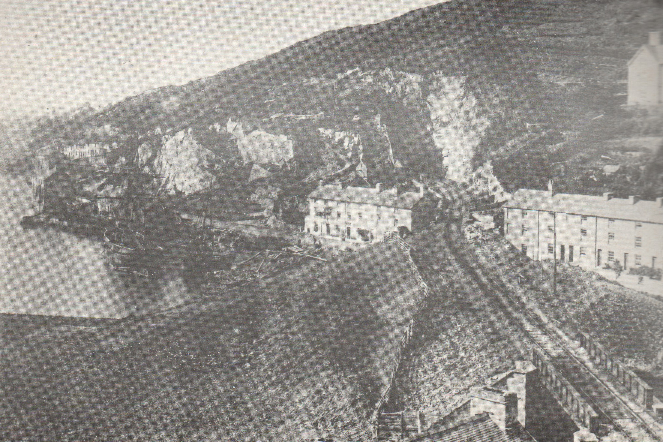
The Dovey Belle topsail schooner. Source: Lewis Lloyd 1996, A Real Little Seaport, volume 2 (plate between pages 120 and 121)
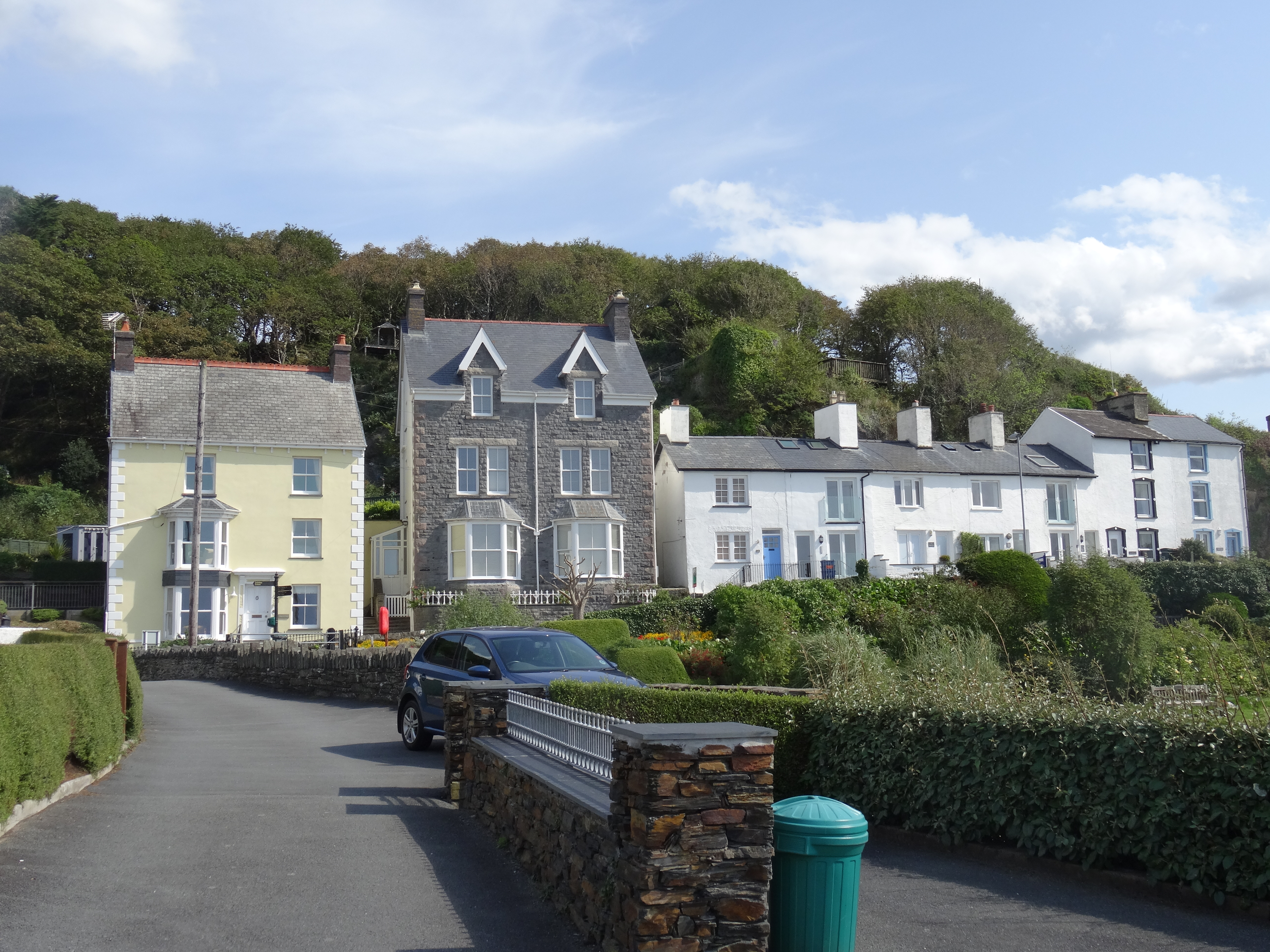
Cliffside is also at the far right of the postcard, a terrace of four very fine four-storey houses. Before the construction of Cliffside, in the mid 1880s, the site was the site of a lime kiln, employed to turn imported limestone into powder for spreading on lime-starved land. In 1901 no.2 Cliffside was home to Master Mariner Captain John Williams (1865-1937). Captain Williams was born in Aberdovey and had served on his father’s ship, eventually becoming Master of the Aberdovey-built Dovey Belle. He had lived at No.35 Copper Hill Street in 1900 when he was aged 35, but in c.1901 seems to have moved to Cliffside. He became Master of the schooner 1867 Aberdovey-built topsail schooner Dovey Belle, built by Thomas Richards at Aberdovey registered No. 9 in 1867 at Aberystwyth. According to the well-researched Williams Family Tree website “she became the last locally built sailing vessel to ply to and from Aberdovey on a regular basis.” No.4 Cliffside was the home of Hugh M. Lewis M.B.E., who lived his entire life in Aberdovey, wrote several memoirs of the village and was awarded an M.B.E in 1993 for his service to the community.
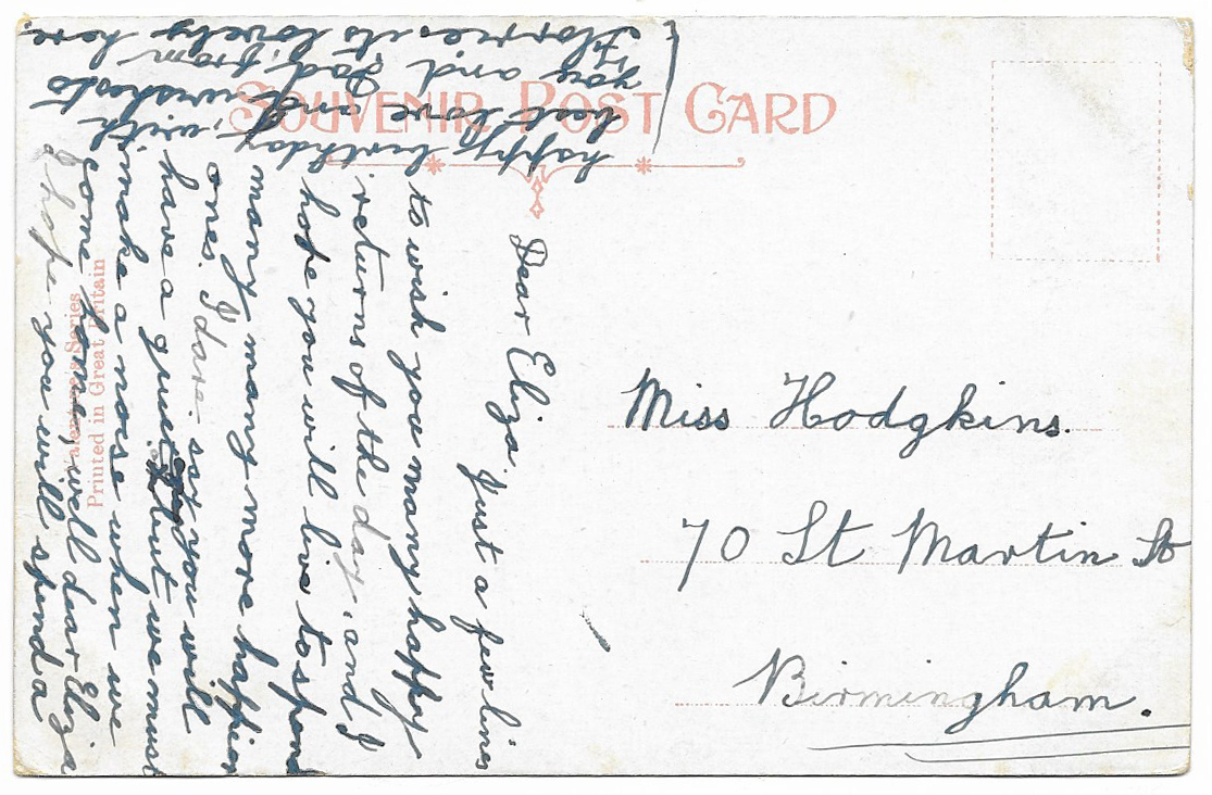
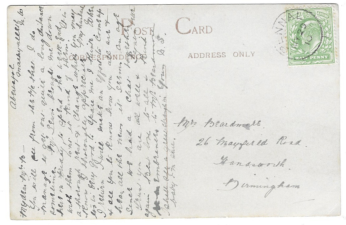
There’s no stamp or postage mark, even though there is a message and a Birmingham address, apparently ready for posting. It was sent in lieu of a birthday card, and I hope it brought a lot of pleasure to the recipient, Miss Eliza Hodgkins, if she ever received it. Out of curiosity I looked up the postal address but although St Martin’s Road still exist, half the road is a building site and the other half is dominated by a huge multi-screen cinema and other modern block-like structures.
I can’t read the print under the handwriting. There is a code on the front of the card, (46845 J.V.), which could indicate that this was manufactured by James Valentine. If so, the Valentine postcard dating page on the Historic Coventry website puts that code at 1905. In the picture masted ships are shown just round the corner, there is gas lighting (installed in 1868; electricity was not installed until 1945) and a horse pulls a small cart. These are all consistent with 1905 being a plausible date but the design and colour printing on the back seem more modern. It is possible that a newer printing run used an older image. It would be good to get an idea of a possible date range from other postmark or from other cards, so I’ll keep an eye open.
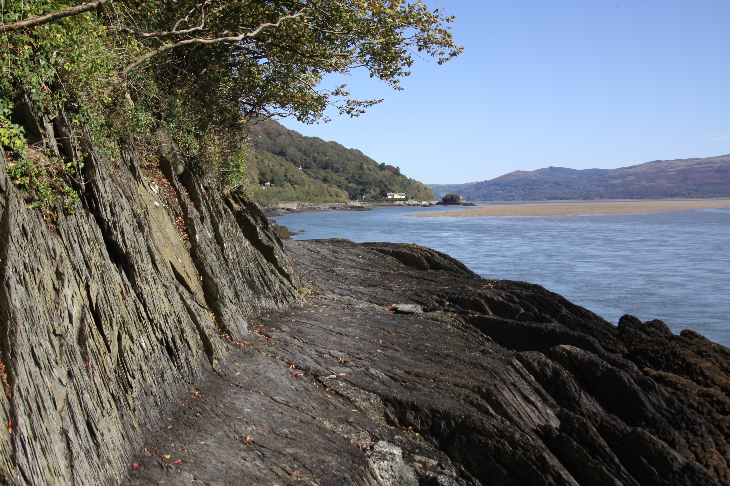
The Roman Road as it is today from a similar viewpoint to the first postcard, with Trefri in the background
The Roman Road is a nice local myth. It forms part of a popular low-tide walk along the estuary to Picnic Island (which I have written about here) and is a truly remarkable sight, cut out of the black Aberystwyth series shales, which in places are so smooth that the rock looks polished and glistens in the sun.
Although there is a Roman fortlet at Pennal 11km away, there are very few indications that the Romans did anything more than pass through Aberdovey, if they even did that. Trying to find out what it was built for I first looked to Hugh M. Lewis, who wrote several histories of the village, but he was unable to shed any light on the subject. My original guess was that it was built in the 1860s, part of the works for the building of the railway, but that failed to address the question of the purpose of such a track. In his description of a 6-mile walk that incorporates the road, the author David Roberts, an Aberdovey resident, states that the track was built in 1808 for horse and carriage, but he doesn’t expand on this observation. I then found a publication by the Gwynedd Archaeological Trust (GAT Ports and Harbours of Gwynedd, 2007) that contains the following statement, and which appears to confrim what David Roberts says and provides sources for identifying this as a road designed to connect to a stretch of road that already linked Pennal to Machynlleth:
Fenton remarks in 1808 that a new road was under construction from Aberdyfi to Machynlleth but implies that the section from Pennal to Machynlleth was already in being, that an extension west and north to Tywyn ‘by way of the sands’ was contemplated if not actually under construction. This road, known as ‘hen ffordd Corbet’ was not a success, being built so low that it was frequently covered by the tides. Its course is marked on the plans for the replacement road dated 1823 and prepared by Thomas Penson (DRO: Z/CD/168). This is probably Thomas Penson junior (1790-1859), county surveyor of Montgomeryshire, a versatile and able architect-engineer, rather than his father. Lewis states that this road was completed in 1827
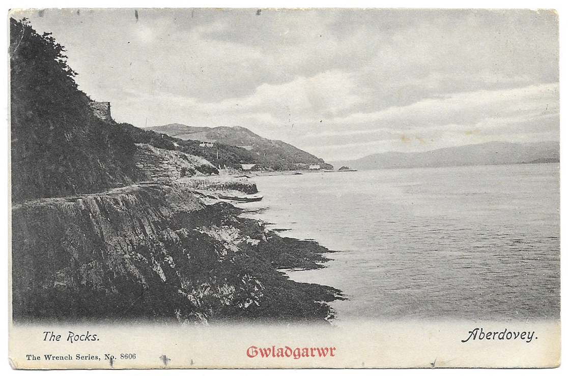
I am still unsure if this is the correct answer, as the track barely seems wide enough for horse-drawn vehicles, and in places would have been lethal underfoot for horses. One would need to see Penson’s plans for the replacement road mentioned by the Gwynedd Archaeological Trust’s report. Whatever its original purpose, it is invaluable today as a ready-made footpath for walkers. The note about the road being unpopular due to being submerged by tides holds true today. The walk is impossible without wading through water at high tide. I note that the second of the two postcards does not commit itself on the subject and states merely that the scene shows “The Rocks.”
The first postcard was unused, so there are no helpful postmark or stamp details to give an indication of date. It was manufactured by Lilywhite Ltd of Triangle, Halifax. Lilywhite was set up by Arthur Frederick Sergeant (1882-1952) in around 1910 and produced postcards at least until 1931 when their factory burned down, destroying both prints and negatives. They took over Arrow Series Postcards in the 1920s and as well as retaining the Arrow name for some of their postcards, re-released some earlier Arrow postcards under the Lilywhite name. I’ll keep an eye open for a used version of this postcard to see if I can find a date or at least a date range.
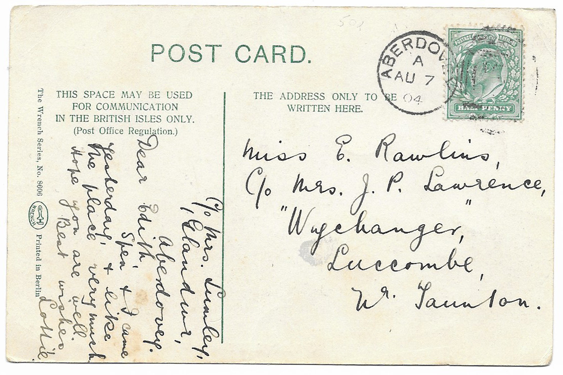
The second postcard has a Edward VII stamp and an Aberdovey postmark dated August 7th 1904. Edward VII reigned from 1902-1910, and this particular shade of blue-green was issued between 1902 and 1904.
I loved the brevity of the message, which also contained the brilliant information that the sender had been staying at Glandwyr in Aberdovey. 115 years later it is owned by a very nice local holiday company, Dyfi Cottages, that lets out properties in the village and also runs the Visit Aberdovey Facebook page. There’s a lovely sense of continuity in those details. I suppose that postcards were, and still are, a form of social media, a way of maintaining communication with people far away. The postcard was sent to the beautiful village of Luccombe, which now lies in Exmoor National Park in Somerset. The house to which it was sent, Wychanger, was a manor house now Grade 2 listed and converted to semi-detached homes. It is fun to have the full breadcrumb trail.
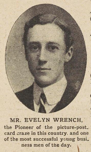
Evelyn Wrench, from an article in ‘The Pictorial Magazine’, January 2nd 1904. Ref: Wr D 48/65. Source: The University of Nottingham’s Manuscripts and Special Collections blog
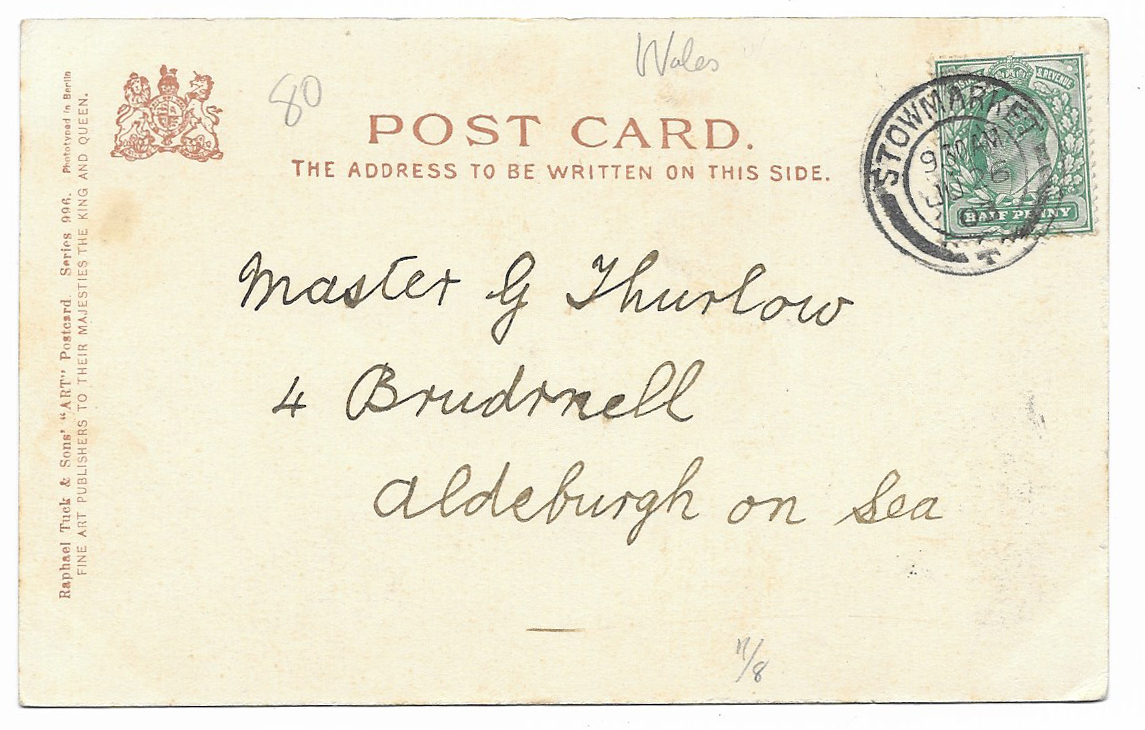
The 1902 Post Office regulations are provided as simple instructions on each half of the back of the card, leaving no room for any confusion! The title Gwladgarwr at the front of the card is a puzzle, appearing on a lot of Wrench’s Welsh postcards. It means “patriot” and was the title of a Welsh language newspaper (Yr Gwladgarwr), but the newspaper appears to have no connection with the postcard manufacturer. The card is in the Wrench Series, no.8006, and was printed in Berlin.
Sir John Evelyn Leslie Wrench (1882-1966) was a British author and journalist. While in Germany after leaving school, Wrench was impressed with the popularity and high quality of German postcards and decided to shelve his plans to become a dimplomat and instead set up a British business producing high quality postcards in sepia, black and white, and colour. He had his resort postcards printed in Dresden (Saxony) and Berlin from where they were shipped in bulk to London. Although it remained in business for only a few years, the postcard company was a initially a phenomenal success and Wrench himself became something of a media darling. Based in Haymarket in London Wrench’s postcard company had over 100 employees and sold in the region of 50 million cards, all before he had reached 21 years of age. Wrench went out of business in 1904, having sunk too much capital into the company, leaving him unable to repay loans but he went on to have a very successful career. He was founder of the Royal Over-Seas League, became editor of The Spectator and was knighted by George V in 1932.
A very battered piece of black and white footage that I stumbled across on YouTube, from Huntley Film Archives (catalogue number 1092610), showing scenes of Aberdovey and the estuary in the 1920s. There’s no information about the video, so just watch and enjoy. The footage of the steam train is particularly evocative, with the trail of steam flowing like cotton wool behind the locomotive.
There is some amazing footage on the Huntley Film Archives on all manner of subjects. It is worth going to their home page (https://www.huntleyarchives.com) and browsing randomly through their categories. I particularly liked their Quirky and Rare categories.
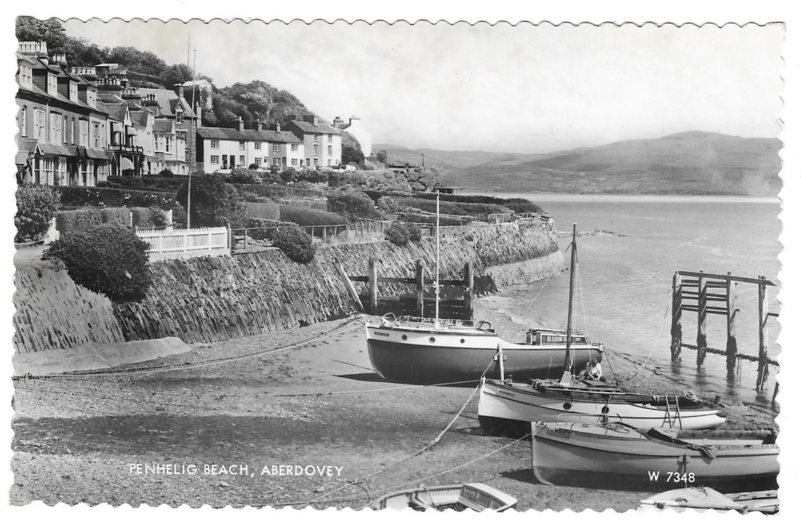
Not quite as vintage as postcard #1 and postcard #2, which were dated to 1910 and 1903 respectively, this view of Penhelig Beach has an Aberdovey Merioneth postmark dated 19th August 1962 and features two Queen Elizabeth II stamps (a blue 1 penny and a green 1 1/2 penny). Elizabeth had been on the throne for 10 years when this postcard was sent to Harborne in southwest Birmingham. The big carpark on the sea front and the modern developments at the top of Copper Hill Street, along Mynydd Isaf and Maes Newydd and related roads had not yet been built and the village must have had a very different character.
A view of Penhelig today taken from a very similar viewpoint:
Unlike the 1903 and 1910 postcards, this is immediately recognizable and familiar, and apart from the boats, which immediately indicate that this is not a modern photograph (I particularly like the one furthest from the camera), it looks much the same as it does today. Penhelig Terrace, immediately behind the beach, was built on the spoil-heap from the tunneling works for the railway in 1864, which was routed round the back of the village to prevent it impinging on tourism and ship-building activities.
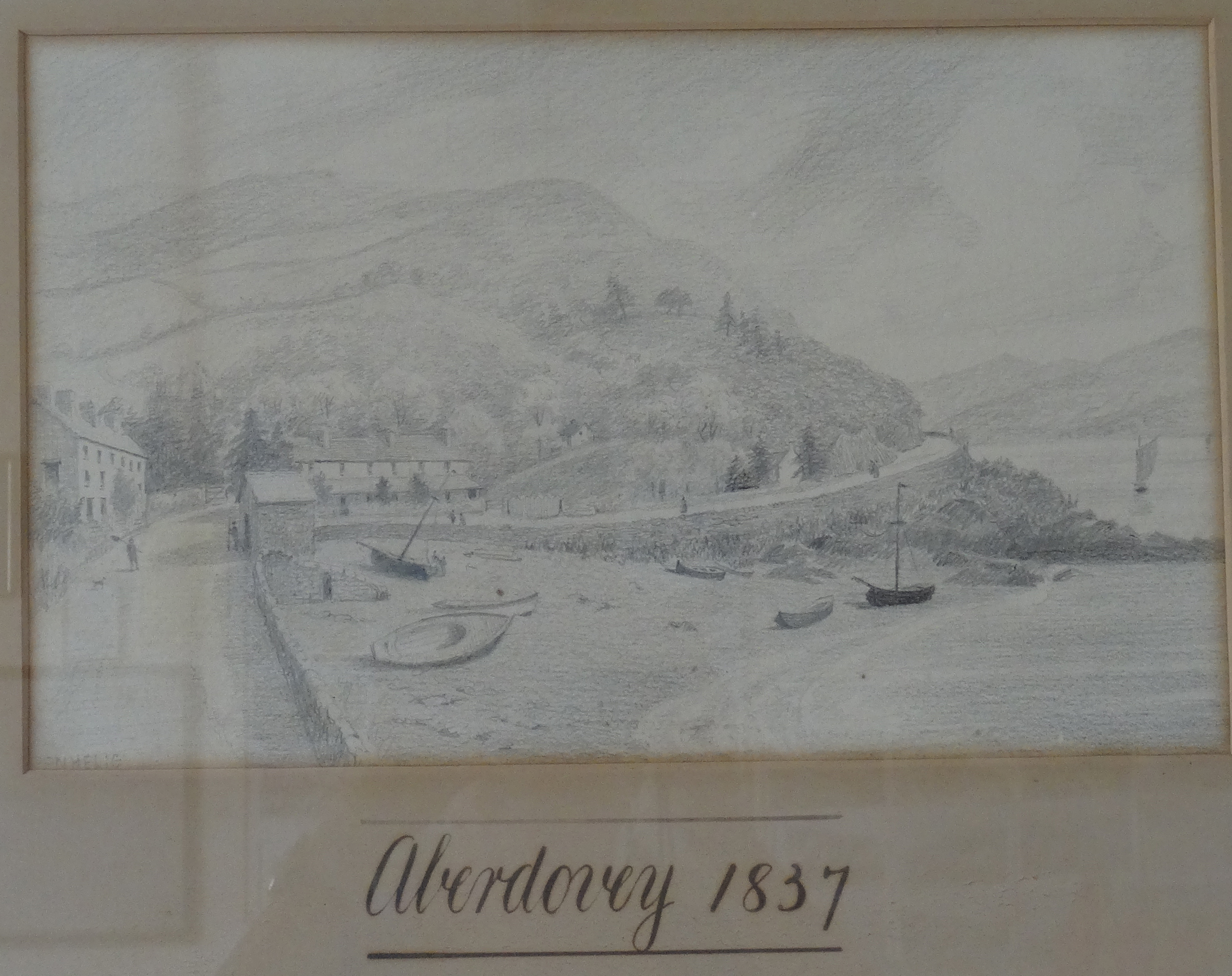
A picture hanging in Aberdovey’s Literary Institute shows the same scene in 1837 before either the railway or Penhelig Terrace were built, with the Penhelig Arms visible at the far left. In this view the low and long Penhelig Lodge (about which I have posted) dominates the scene and looks out over the beach. It was probably still fishermen’s cottages at this time, although it had various roles afterwards, including a stint as an exlusive school for young ladies. Penhelig Lodge is now a row of three cottages on a busy bend where the railway crosses the road, hidden behind Penhelig Terrace and the railway, on the edge of Nantiesin car park and overlooked by Penhelig Station, but as a building it has lost none of its charm.
Aberdovey 1837. Source: Photograph of picture hanging in the Literary Institute.
A photograph from Hugh M. Lewis’s book Aberdyfi, A Glimpse of the Past, below, shows Penhelig as it was just after the railway was established and just before the terrace was built in the mid-1860s, with a large vessel moored on a high tide in the days when the beach was a shipyard, with Penhelig Arms just behind it. In the above postcard Penhelig Arms is out of sight, a few houses to the left and across the road.
Penhelig shortly after the railway was laid, and before Penhelig Terrace was built, showing the railway tunnel and the shipyard just in front of the Penhelig Arms. It is clear that at least two houses were taken down to route the railway round the back of Aberdovey. Penhelig Station was added in 1833 Penhelig Station was added in 1933, by which time the railway was operated by the Great Western Railway, which absorbed Cambrian Railways in 1922, and was equipped with a single platform and an attractive little wooden shelter that remain today. Source: Hugh M. Lewis’s book Aberdyfi, A Glimpse of the Past
The row of houses behind the memorial park to the right of Penhelig Terrace on the main road through Aberdovey has changed dramatically since the 1860s photo in Hugh M. Lewis’s book, but not much since the 1962 postcard.
The row of houses behind the memorial park to the right of Penhelig Terrace on the A493.
Penhelig Terrace today, seen from the memorial park
The postcard producer, Valentine’s (J. Valentine and Co.), opened in 1866 in Dundee, at first specializing in photographs of Scotland, and continued to make postcards for a century. According to the Jisc Archives Hub, “much of the collection contains views associated with the leisure market, subjects such as fishing were regarded as attractive, agriculture less so, and industry was rarely portrayed. The main features are stately homes, historic ruins, great open spaces, beaches, the grandeur and curiosity of nature and great engineering feats.” The company stopped producing postcards in 1967 because they failed to make the switch to colour printing for postcards soon enough to be competitive, and they had found that greeting cards were more lucrative anyway.
Like the postcard #1, which was a 1910 sepia photograph, this 1903 scene really throws one back to a previous era where the threat of being run over by one of the hundreds of cars that use the A493 estuary road simply didn’t exist. The mid-1850s Trefri Hall is again visible in the background, but this postcard gives a real sense of rural isolation. This sense of isolation is, however, quite misleading. An east-west turnpike was built following the Merioneth Turnpike Act of 1775, which ran from near Pennal through Cwm Maethlon (Happy Valley) towards Tywyn, and although it bypassed Aberdovey it was still an important link between the coast and the interior of mid Wales. Most importantly, the railway was established in 1864, connecting Tywyn, Aberdovey and Machynlleth with other parts of north Wales and England. The industrial revolution and the demand for raw materials such as copper, silver and lead, as well as the slate trade had made Aberdovey an important port and shipping was a major activity, both via river and sea, and the tourist industry was becoming increasingly important. By the turn of the century, Aberdovey had at least six places of worship, at least one pub, a literary institute and several hotels.
1903 postcard
The stamp shows Edward VII who reigned from 1902-1910, and this particular shade of blue-green was issued between 1902 and 1904. The stamp is postmarked Stowmarket and is dated 9.30AM, June 26th 1903. Perhaps the purchaser bought it in Aberdovey and took it home to post.
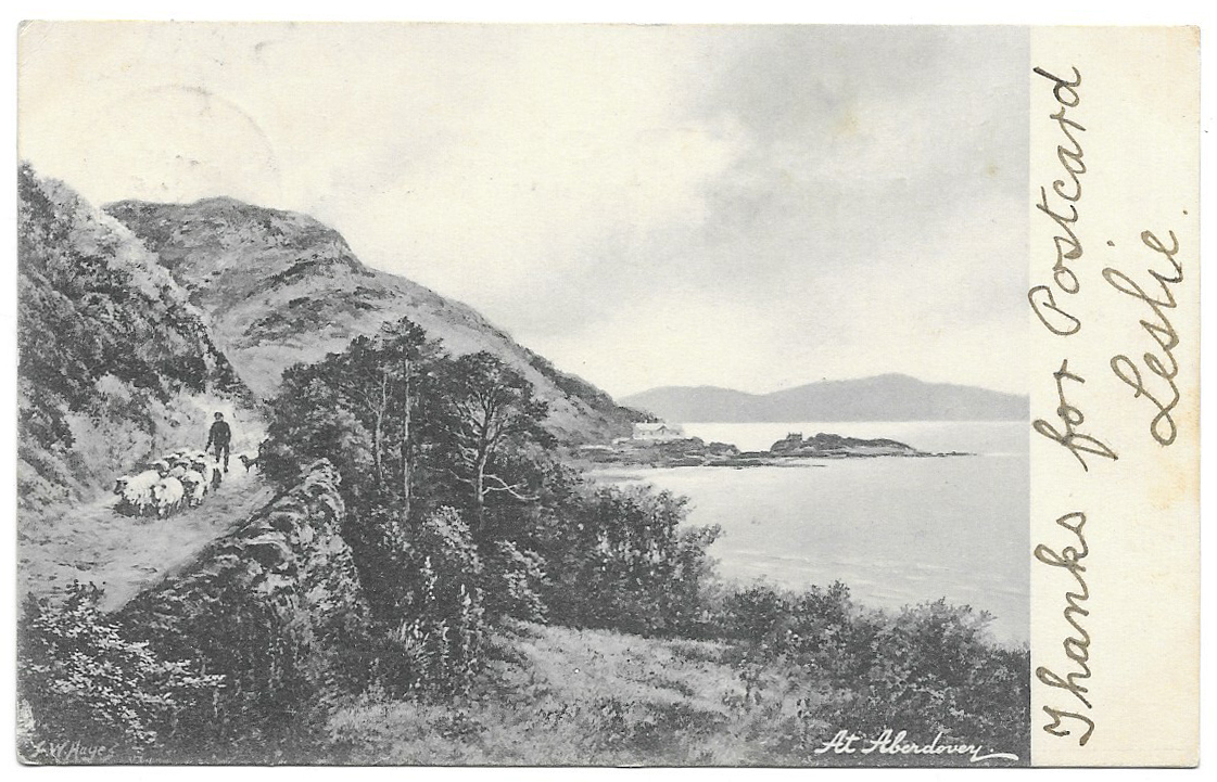
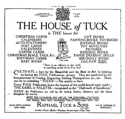
The postcard was produced by Raphael Tuck and Sons, “fine art publishers to their majesties the King and Queen” in their “Art” series. Queen Victoria had granted them the Royal Warrant in 1883. According to the TuckDB website, Raphael Tuck was a Prussian who had trained as a graphic artist and started his picture frame and graphic design business with his wife Ernestine in Bishopsgate (London) in 1866. It became one of the world’s biggest postcard producers, all based on art works, but produced a number of other products as well, as shown on the 1901 advert below. Most of the postcards were printed in Germany up until the First World War, and this card is marked “Printed in Berlin.” The Aberdovey card, by artist Frederick William Hayes, was sold as one of a set of six Welsh scenic views, the others showing Cader Idris, Bala, Harlech, the Dolgellau Precipice Walk and Llyfnant Valley, Aberystwyth (all of which you can see here, on the TuckDB website). Later, the a postcard was issued showing the same painting in full, extremely bright colour.
The artist, Frederick William Hayes (1848-1918), was born on the Wirral, trained first as an architect and then as a painter in Liverpool and London before returning to Liverpool where he established a watercolour society. He was an Associate of the Royal College of Art. Hayes exhibited at the Royal Academy of Arts between 1872 and 1891. He was a prolific painter, working in pencil, watercolour and oil. His paintings are usually very picturesque in theme, and he painted a lot of landscape and seascape scenes in Wales and Scotland.
The House of Tuck – an advert from 1901. Source: TuckDB website.
Trefri Hall today. I lacked the courage to dodge the cars in any attempt to reproduce the exact viewpoint in the postcard!
Some snapshots of Aberdovey this afternoon. It was a particularly beautiful day, and although I was up to my ears in stuff I really ought to be getting on with this morning, I wanted to take some particular shots to match up with my vintage postcards so I made my escape and went down to the seafront. At this time of year it’s mad to ignore good weather when it’s available. I was lucky to find that the light was truly remarkable.
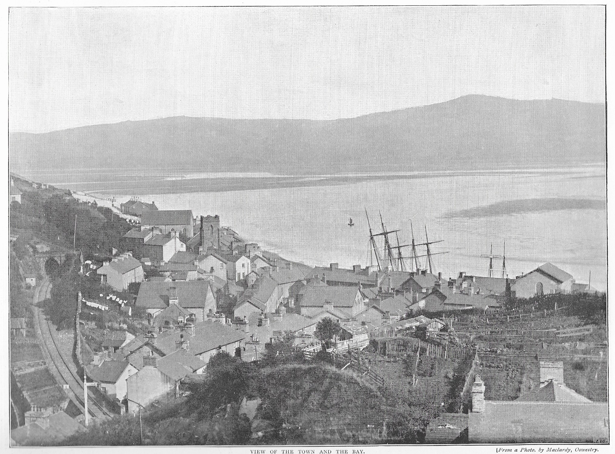
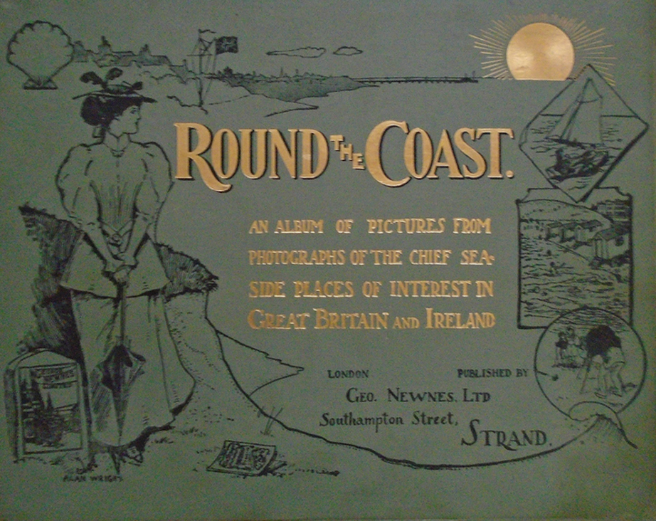
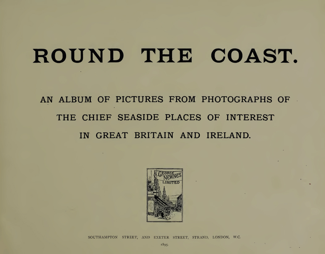
On my previous post I mentioned that as well as postcards, I had bought a page with a photograph of Aberdovey that comes from a book dating to 1895, so here it is. Welcome to page 133 of the book Round the Coast – An Album of Pictures from Photographs of the Chief Seaside Places of Interest in Great Britain and Ireland published in 1895 by George Newnes Ltd (no author credited). The photograph must predate the publication by several years, as the tiny chapel at the far right of the photograph was replaced in 1894 by a large school.
Round the Coast, 1895
There is an awful lot to love in both the cover of the book and the photograph itself, which must been taken from the hill behind Copper Hill Street, but what makes it stand out for me is the array of masts that rise above the buildings on the seafront. There are seven in total, and I desperately wish that it was possible see what they were attached to!
The Aberdovey leg of the Cambrian railway was 31 years old at this time. Don’t miss the beautiful semaphore signal at the bottom left corner of the photograph. Although it was generally agreed that the coming of the railway would offer huge benefits to the economy of the village, the exact route was a subject of considerable disagreement between the representatives of the railway company on the one hand and Aberdovey residents and the owners of the land (the Ynynsymaengwyn Estate in Tywyn) on the other. The railway company planned to run the railway along the sea front, which would have been shorter and cheaper than the route eventually agreed upon. Aberdovey business leaders and villagers argued that this would have a negative impact on shipping, ship building and tourism, and their determination lead to the track being routed around the back of the village, an expensive compromise that required tunnelling through rock and contributed to the bankruptcy of the major investor. Read more about the establishment of the railway in Aberdovey in 1864 on an earlier post.
St Peter’s Church and the Tabernacl from the footpath to Pen Y Bryn today
Fanning out below the photographer’s feet are what appear to be gardens or allotments, one of Britain’s happier social institutions. Behind the railway and running all the way to the tracks are more gardens or allotments. Any space that didn’t have a building seems to have been highly valued for cultivation. Surprisingly, given the value of land for housing, there are still allotments in Aberdovey today, running to the south of Gwelfor Road.
Aberdovey’s remarkable religious mix is amply represented. St Peter’s Church (built 1842) dominates the village from this angle, partly because it is so out of keeping with the surrounding architectural styles. The Calvinist Methodist Tabernacl (1864) at its side was built on a rise, and replaced the earlier and smaller Wesleyan Methodist chapel in Chapel Square at the foot of Copper Hill Street. The deliberate juxtaposition of the chapel with the pre-existing Anglican church, the two biggest religious structures in the village, really tells its own story but I wish I could have heard the ecclesiastical debate and the the village gossip as the new chapel went up. I bet that there were a lot of ruffled feathers. Three other chapels are also clearly identifiable. At the foot of Copper Hill Street in Chapel Square are the Calvinist Methodist chapel (1828, now Dovey Marine) and the Wesleyan Methodist chapel (1868), and at the far right of the photograph on the seafront is another chapel that no longer stands. In a postcard that I have from the early 20th Century this chapel has been expanded and became quite substantial. I have no information about it so if anyone can tell me anything about it, I would be grateful.
The caption says that at low tide it was possible to walk across to Borth from Aberdovey. Is that true? I have seen some seriously low tides, but nothing to suggest that one could ever walk from one side of the estuary to the other.
The caption is a really lovely piece of text that should be enjoyed, and here it is:
Aberdovey – This lovely resort takes its name from its unrivalled position at the mouth (in Welsh, “Aber”) of the River Dovey. It is a delightfully situated port and watering-place on Cardigan Bay. The chief attractions are its firm sands, which extend for five or six miles, and the mild and equable climate, which rivals that of Torquay or Bournemouth. Aberdovey faces the west, and the air is so balmy, yet invigorating, that the tender myrtle will grow out of doors all the year round. In the season, pleasure boats are in great demand among visitors for sailing and rowing on the estuary of the Dovey, which affords one of the most convenient and safe places in Wales for boating. This is because the beach from the harbour to Penhelig Point – a distance of over half a mile – enables one to land at all states of the tide. At low water, by the way, Borth may be reached across the sands. Charming walks abound in the neighbourhood, the Happy Valley being the most frequented; and we have no hesitation in saying that this particular spot is matchless for beauty, even in picturesque Wales. The ever-enterprising Cambrian Railways Company brings many other delightful excursions within the reach of visitors making Aberdovey their head-quarters; and the company has spent a considerable amount of money in providing harbour and pier accommodation for all kinds of vessels. We hold no special brief for the Cambrian Railways, but we can confidently recommend the lovely places on their system to the notice of those who contemplate a new departure in the way of holiday-making, and who are desirous of sojourning cheaply and well in the very heart of the most beautiful scenery in the United Kingdom.
I cannot argue with any of that. On the reverse side, page 134. is a photograph of Freshwater Bay on the Isle of Wight, with a similar caption.
I was looking on eBay for something completely unrelated and noticed a small job-lot of vintage sepia and black-and-white postcards of Aberdovey for a bargain price, so I bought them. It is fascinating to see past views of the village. Some of the buildings look so crisp and fresh and it is truly interesting on the one hand to see the changes and, on the other, to be surprised at how much remains the same. The subject matters that were offered by the postcard companies, and which people chose to buy, are often quite different from those that one can buy in the village today. It feels like invading the privacy of past visitors to read the messages that they wrote to friends and family, but it is also a rather nice way of connecting with the past. Separately, I bought a page from a book dating to 1895, which is a real treasure. I thought that others might be interested in this little haul, so as I scan them I’ll post them here. You can click on the images to see a bigger version.
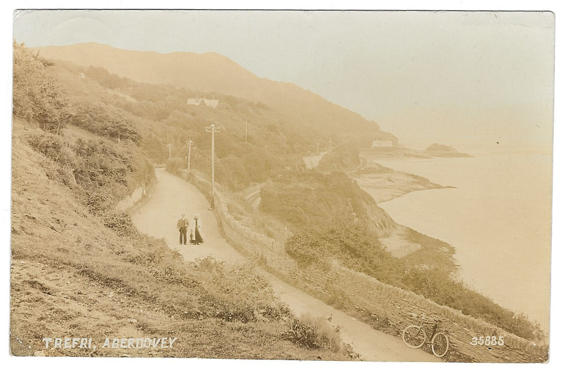
Postcard of Trefri, Aberdovey
The picture on the card shows Trefri, the area just outside Aberdovey which includes the mid 19th Century Trefri Hall right on the edge of the estuary with its own island, currently painted English-mustard yellow. I don’t know the house on the hill, but I am sure that other residents will recognize it. If it still stands, it is no longer in splendid isolation. Aberdovey has spread both out and up. The 1864 railway is clearly visible and telegraph polls indicate that Aberdovey had been connected to the rest of Britain in more ways than one. Today one wouldn’t take one’s life in one’s hands by walking down the middle of that stretch of road, and it is difficult to visualize an Aberdovey where bicycles were more numerous than cars.
Reverse side of Trefri postcard sent in 1910
The postmark says that the postcard was sent from Pennal on May 22nd 1910, and the address indicates that it was going to Birmingham, then as now the main source of tourists for the mid-Welsh coast. The green half penny stamp, which was issued between 1902 and 1910, shows Edward VII, who died on 6th May 1910, and was succeeded by George V.
Trefri Hall today
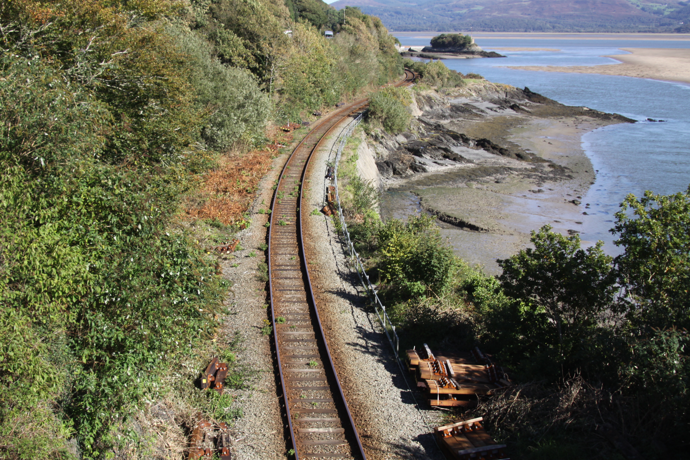
Railway track as it leaves Aberdovey for Machynlleth, with Trefri Hall’s island visible where the rails vanish around the bend
With many, many thanks to Dai and Helen Williams for getting in touch and lending me this superb photograph of the interior of the Calvinist Methodist Tabernacl on Sea View Terrace, built in 1864 to replace their earlier chapel in Chapel Square. I have updated my earlier post about the chapel with this photograph, but for those who have already read it, it seemed a good idea to post the photograph separately as well. It shows not only the organ and the pews, as well as some of the decorative features, but also, to the left, the gallery. It quite clearly had a magnificent interior, now converted to apartments.
Any research into the Tywyn and Aberdovey areas in the 18th and 19th Centuries runs into the landowning Corbets and the Ynysymaengwyn Estate, one of the top eight estates of Merionnydd in its heyday. The Ynysymaengwyn Estate owned much of the land in and around both Tywyn and Aberdovey well into the Twentieth Century.
The Ynysymaengwyn Estate, showing Ann Owen’s 18th Century house and the servants quarters and kitchens in a separate building to the right. Source: Coflein.
The few material remains of the Ynysymaengwyn Estate are located 1 mile from Tywyn on the road to Bryncrug. The name of the estate (pronounced Inis mine gwin) means island or river meadow (of) the white rock. In 1949 the piece of land that retained the last echoes of the estate was bequeathed to the people of Tywyn by Mary Corbett. Although it is now dominated by a mobile home park and campsite, parts of the former estate now contain woodland walks and some of the original features of the estate survive, although the house and most of the accompanying buildings were dismantled in the late 1960s. These remnants are discussed at the end of the post.
North wing at Ynysymaengwyn used in the 18th and 19th Centuries for kitchens and servants quarters
The Ynysymaengwyn estate included both highland and lowland areas, and extends down to the south bank of the river Dysynni, stretching along a portion of its valley. The Dysynni has silted up considerably and it is thought that it may have provided a natural shelter for small boats. One of the earliest buildings in the area is St Cadfan’s Church in Tywyn, parts of which date to the 12th Century probably developed out of the clas (a semi monastic church) that was founded near the shoreline. There was also a small settlement at Bryncrug, where most of the land belonged to Ynysymaengwyn. Llanegryn church is listed in the 1253 Taxatio, so must have been the centre for a small settlement before that time. The core buildings of the Medieval Ynysymaengwyn estate would have been much nearer the sea than today. A second estate that was present in the Medieval period was Peniarth, also on the Dysynni. Gwynedd Archaeological Trust observes that “these two houses and their associated parks, together with the villages of Bryncrug and Llanegryn and the town of Tywyn emerges as focal points of this area in late Medieval and Modern times.” There were also a number of early freehold properties such as Dolau Gwyn and Caer Berllan.
The history of the Estate can be traced back to the reign of Elizabeth I. It passed through a number of families. Like all these family histories, it is a bewildering succession of names that are quite meaningless to anyone not trying to trace their ancestry, and a substantial amount of this family history is captured in a well researched Wikipedia page dedicated to the Ynysymaengwyn Estate and and the Dictionary of Welsh Biography and will not be reproduced here, although some details are unavoidable. The first name linked with certainty to Ynysymaengwyn was was Gruffydd ab Adda in the early 14th Century. He was bailiff (legal custodian) in 1330 and 1334 of the Ystumanner cymwd (anglified as commote, an organizational division of an area into about 50 villages for the purposes of defence and justice). His daughter Nêst married Llywelyn ap Cyunrig ab Osbwrn Wyddel, and from there the estate passed through the male line for over 200 years.
The family were noted patrons of Welsh poets. Hywel, the great great grandson of Llywelyn was the subject of an elegy by Hywel ap Rheinallt when he died of the plague, and Hywel’s son Hwmffre ap Hywel ap Siencyn was in turn the subject of a famous cywydd (poem with a particular metrical form, in rhyming couplets) by Tudur Aled. In the poem Tudur Aled (c.1465–1525) takes on the role of a conciliator between kinsmen. Glanmor Williams describes the genre as follows: “Quite apart from any disputes kindled by faction and war, there might be serious splits between kinsmen in ordinary circumstances. Such quarrels could be more than usually bloodthirsty, ‘deadly feuds’ more dangerous than civil war . . . It was the intensity of such divisions that led poets to attach key importance to the role, which they shard with the priests, of being conciliators between kinsfolk.” He says that the most celebrated of all the poems of this kind was Tudur Aled’s cywydd to reconcile Hwmffre with his kinsmen “by urging them to remember the tragic futilities of past internecine differences, from which only the English had benefited at Welsh expense (p.109). I have been unable to find a translation of the poem, so please let me know if you have access to one. Hywel ap Siencyn’s grandson Arthur ap Huw became vicar of St Cadfan’s Church in Tywyn between 1555 and 1570, and was another patron of Welsh poets. He also translated Counter-Reformation literature into Welsh.
The raven at Ynysmaengwyn today
When Hwmffre died in 1545 his son John Wynn and then John’s son Humphrey each inherited the estate in turn. On Humphrey’s death the estate passed to his daughter Elizabeth and her husband Sr James Pryse of Goderddon, who was high sheriff of Merioneth (married in 1601). Both died in 1642 and and their daughter Bridget inherited. Bridget Pryse married Robert Corbet of Moreton Corbet, Shropshire, in about 1612, which was the beginning of the long association of the name Corbet with the Ynysymaengwyn Estate, which endured for the best part of the next two centuries. Robert Corbet was a passionate Royalist. During the English Civil War, to prevent Parliamentarians taking the property, the estate’s mansion was burned down in 1635 and had to be rebuilt. The coat of arms of the Corbets of Moreton, whose name means “little crow” was a black raven, and the name Corbet is itself French, derived from “corbeau,” from the Latin Corvus. It eventually gave The Raven Inn in Aberdovey its name. The family motto was Deus Pascit Corvos, God feeds the ravens.
The estate passed to their great granddaughter Ann Owen (1684-1741), who had married Athelstan Owen. Athelstan Owen clearly contributed new buildings to the estate, one of which is now the the Dovey Inn (formerly the Dovey Hotel and before that The Ship) built by Athelstan Owen in 1729. Above the door is a plaque inscribed “This house was built by Athelstain Owen Esq, Anno Dom 1729.” He died in 1755, leaving Ann with three children. She lived for another 30 years and did not re-marry. She was known locally as Madam Owen, a woman of considerable personality. Anne purchased the Caethle Estate in Tywyn from Richard and Margaret Braithwaite, absorbing it into the Ynysymaengwyn Estate. She also built the central block of buildings on the estate, added the dovecote for 800 birds that still stands and in 1717 donated almshouses for five widows in Tywyn. According to Barbara Middlemass, however, her business methods could be ruthless: “Her favourite method of adding to the estate was to lend money by way of mortgage to needy farmers and then, when she knew they could not pay, call in the mortgage and seize the land to swell the Ynys acreage.”
The two-storey house that Ann built in around 1758 was a built in a classic Eighteenth Century architectural style in local stone with details picked out in Portland stone, including an elegant pediment. It was an unusual sight in Wales. It was flanked by the two existing buildings, the north wing and the south wing, to make an impressive ensemble. The stone-built dovecote has a truncated pyramidal slate roof, a deep segmental arch in the front wall inset with a much smaller flat-headed doorway. She also appears to have been actively involved in building houses in Aberdovey. A house on Copperhill Street bears a plaque reading “Built By Anne Owen Widow AD 1733,” and this was probably Madam Owen. Although there’s a discrepancy on the dates (she could not have been a widow until 1755 if the date of Athelstan’s death is correct), the fanlight window on Anne’s plaque exactly mirrors the fanlights on the Dovey Inn, suggesting a close connection.
The Dovey Inn donated by Athelstan Owen and a row of three houses provided by Ann Owen
Richard Owen, second in line to inherit the estate after his elder brother Corbet, but both died childless so their younger sister Anne inherited. By Richard Wilson c.1748-50. Source: Richard Wilson Online
Of Anne and Athelstan Owen’s children, Corbet and Richard died childless so their daughter Ann Maurice (married to Pryce Maurice) inherited the estate. To comply with Ann Owen’s wishes, the estate then passed to Henry Arthur Maurice, who was Ann and Pryce Maurice’s younger son, presumably chosen because Ann Owen disapproved of the elder son Edward’s youthful activities, which included fathering at least two illegitimate children. An interesting twist in the tangle of family names is that when the property then passed to a male with a different last name (for example, where a daughter who inherited the estate married) those men were required in the terms of the bequest to change their last name to Corbet, ensuring that the name Corbet was always associated with Ynysymaengwyn. This was the case even when the estate passed out of the Corbet bloodline. Henry Arthur Maurice, grandson of Ann Owen, therefore changed his last name to Corbet. When he died childless in 1782, his elder brother Edward Maurice (1741-1820) inherited the Ynysymaengwyn Estate against his grandmother Ann Owen’s wishes, and Edward also changed his name to Corbet.
Although Ann Owen had disapproved of him in his feckless youth, to the extent of cutting him out of her will, the more mature Edward was not unlike her in terms of his urge to make improvements to the estate and to benefit its dependants. Lewis Lloyd says that he had travelled to London to learn from a physician “to acquire sufficient knowledge to dispense medicine to his tenants and others.” He was a loyal supporter of Britain’s role in the Napoleonic Wars, and was a captain in the local militia. During this period, much of the lowland and upland parts of the estate were enclosed and marshy areas were drained. Edward was noted for breeding horses, cattle and sheep, and beginning in 1788, the drainage of some 260 acres of peat land for conversion to hay fields for use as livestock fodder, eventually producing 500 tons of hay annually. This denied poorer members of the community access to peat cutting (turbary) and communal pasture, and many people left the area, some emigrating to the United States. The upland parts of the estate that Edward enclosed were of potential interest for their mineral content, and he established copper works and searched for coal. His loyalty to the English government and the crown led, at least in part, to his suspicion of Methodism, which he thought radical and borderline seditious, and which was growing fast in Wales. His persecution of Methodists in Aberdovey, for example, resulted in their eviction from their premises with bibles and benches thrown out onto the street, with fines imposed on anyone who gave them shelter for their meetings. Edward Corbet’s obituary records that he “was a cynic and a wit, a man of the world and when he pleased a very polished gentleman. he was by turns petulant and affable, entertaining everyone. With the flashes of his wit and the bitter but often just severity of his satire.”
Griffith Owen, butler and harpist to the Corbets at Ynysymaengwyn, portrayed in the last 1820s or early 1830s by Benjamin Marshall (1768-1835). Source: ArtUK
When Edward died in 1820, the estate passed to Edward’s nephew Athelstan Maurice, son of Edward (Maurice) Corbet and Henry’s brother Price Maurice, and he too changed his name to Corbet. Athelstan continued Edward’s work building enclosures and draining land. His main achievement was to invest in the local road network, which was in very poor condition. He built a new road between Pennal and Aberdovey that opened in 1827 and improved the road from Pennal to Machynlleth. This improved communications and soon stagecoaches began to arrive with passengers, some in the area on business, some visiting as early tourists. Interestingly, when the Wesleyan Methodists were looking for somewhere to build their chapel, it was rented from the Ynysymaengwyn Estate in 1828, suggesting that Athelstan did not share his uncle’s violent dislike of Methodists. The portrait to the right shows Griffith Owen (1750-1833) who fascinatingly combined the roles of butler and harpist to the Corbets before be became the landlord of the Raven Arms in Aberdovey.
Corbet Arms Hotel 1829. Source: Hugh M. Lewis, Pages of Time.
In 1829 Athelstan built the Corbet Arms Family Hotel and Post House at the western end of Aberdovey to cater to the needs of visitors. It was right on the edge of the sea before the construction of the sea wall. A bowling green was laid out in the front of hotel, and on the beach bathing huts were installed and donkey rides were available. Writing in 1833, Samuel Lewis described how horse races were held at Ynysymaengwyn every September by the side of the Dysynni, and one can imagine how perfect the wide flat floodplain would have been for this purpose. By the 1840s the estate comprised some 7201 acres, eighth in size of the 21 south Meiryonnydd estates. The nearest estate in size in the immediate area of Tywyn and Aberdovey was the Peniarth estate of 4421 acres.
Corbet Arms Hotel 1867. Source: Hugh M. Lewis, Pages of Time.
In his account of Ynysymaengwyn Lewis Lloyd says that from the mid 1850s the history of the estate “was increasingly troubled.” When Athelstan Maurice Corbet died, the estate passed to his sister Henrietta Maurice, who married Charles Decimus Williams with whom she had a daughter also named Henrietta. The younger Henrietta married John Soden of Bath, who duly changed his name to Corbet. In 1862 a Trust was established for running the estate and the trustees were given leave to raise £5000 for harbour improvements. In 1865 the harbour area, including the wharf and jetty, were leased to the Cambrian Railways Company. The Corbet Arms Hotel was rebuilt in 1867 to accommodate the visitors were anticipated would follow in the wake of the opening of the railway in the mid 1860s. The opening of the railway was discussed on a previous post.
Lewis says that most of the stewards of Ynysymaengwyn were local men until the late 1860s, examples being two former ship captains, after which English agents were apparently preferred, but he adds that not much is known about who they were and that this is research yet to be undertaken. In the 1860s the half-yearly rent audit of the estate was held in Tywyn and a dinner was given for the tenants in the Town Hall, and any important local issues were discussed. In 1863 this included the opening of the railway. It is quite clear that there is a lot of information about people who worked on the estate in various records held in the National Library of Wales and National Archives and elsewhere (see for example the results of a National Archives search on Ynysymaengwyn), so a major research project is awaiting someone.
John Soden Corbet died in 1871 and his son Athelstan John Soden Corbet inherited. Athelstan’s majority was celebrated lavishly in both Tywyn and Aberdyfi in July 1871, celebrations that were reported at length in the The Cambrian News and Merionethshire Standard on 7th July 1871. Reading the account with hindsight, the optimism and happiness with which he was greeted seem rather sad. Some highlights are copied here, but you can see the full account on the National Library of Wales website. The celebration shows just how important the Ynysymaengwyn Estate was to the local communities:
THE MAJORITY OF ATHELSTAN J. SODEN-CORBET, ESQ., YNYSYMAENGWYN. Towyn and Aberdovey were on Thursday the scene of long to be remembered rejoicings in honour of the attainment of the majority of Athelstan J. Soden-Corbet, Esq., of Ynysymaengwyn. The Corbets are one of the best known and oldest families of which the county of Merioneth can boast; their connection with Towvn, Aberdovey, and their neighbour- hood can be traced back for a good many generations, and, upon the whole of the extensive estate connected with the family property, the name of Corbet is never mentioned but with feelings of the greatest respect, for the Corbets have always been identified as liberal, go d-hearted land- lords, who are respected by their tenantry, and held in high esteem throughout the length and breadth of the county. Liberal sums were subscribed both in Towyn and Aberdovey, to celebrate the event in a manner be- fitting the occasion, and the hearty enthusiasm which was evoked cannot but have testified to the young heir the good wishes which his tenantry and numerous friends entertain for him. Towyn was quite en fete on Thursday; the demonstrations were of a varied and pleasurable character in honour of the young heir. The decorations were of the gayest, and bunting was profusely displayed from the residences of the principal inhabitants. Handsome arches spanned the roads and bore flags, banners, and mottoes wishing health, long life, and happiness to Athelstan John Soden Corbet, Esq.
Here’s the account of the venue:
THE BANQUET, or complimentary dinner, given by the Ynys estate, to the friends and tenantry, took place in a large tent erected on the grounds adjoining the Corbet Arms, Towyn. The tent, with the decorations, was supplied by Mr Andrews, of Shrewsbury, and was embellished in a most tasteful manner. The sides were of scarlet, relieved with white and the supports were entwined with pink, blue, and white draperies, and suspended from them were festoons of coloured flowers. Each support bore a banner and armorial bearings of the county families, the principal being the shield of the Corbet family with motto Deus Pascit Corvos.
The food served must have been something to behold:
Soup.-Mock turtle, ox tail, green pea. Fish.-Salmon and lobster sauce, turbot, filleted soles. Entrees.-Yeal Cutlets, sweetbread, patties, steak and oyster pie, stewed pigeons, curried rabbit. Champagne. Removes.-Haunch of venison, roast beef, boiled beef, roast mutton, boiled mutton, lamb, veal and ham, veal and pigeon pies, chicken and tongue, ducklings and green entremets, &c. -Sir Watkin’s pudding, plum pudding, strawberry, currant, and raspberry tarts, cheese cakes, jellies, blancmange, tipsy cake. Cheese and salad. Dessert.-Pine apples, grapes, strawberries, dried fruit. Claret, sherry, port.
The Corbet coat of arms, preserved today in the walls of the ballroom garden in the public area of Ynysmaengwyn today.
Athelstan married Mary Helen Annie Oldfied in 1873. The marriage failed very quickly and divorce followed. He was Justice of the Peace and became High Sheriff in 1875. In spite of all the high hopes of the community, Athelstan Soden Corbet’s poor management of the estate combined with expensive renovations to the house, new furnishings, the costs of the divorce and heavy expenditure by Athelstan and his wife on luxurious lifestyles resulted in serious debts. Lewis concludes that “he did not share the sense of duty and regard for his estate in Wales and its people which his predecessors had demonstrated.” In 1875 he decided to sell the 9347 acre estate, which earned an annual rent of £8241. Athelstan fled his responsibilities by going overseas, living a rich life, but his letters to his agent demonstrate that he was suffering increasing financial stress, and the estate was barely able to support him. Ynysymaengwyn was put up for sale in April 1876. In 1877, still living vastly beyond his means, Athelstan was forced to take out a series of mortgages on the estate, which by 1878 had reached £42,000 (around £2,779,757.40 today, according to theNational Archives Currency Converter).
Athelstan Soden Corbet must have been very relieved when John Corbett purchased the property for £51,000, which secured for Corbett the mansion, demesne and pleasure grounds. John Corbett (1817-1901) was, somewhat confusingly, no relation to the Ynysymaengwyn Corbets. He was a wealthy salt merchant who owned the Stoke Prior Salt Works near Droitwich, was the Liberal M.P. for Droitwich between 1874 and 1885 and the Liberal Unionist M.P. for Mid-Worcestershire between 1886-1892. In Droitwich he was known as The Salt King. He remained very involved with Worcestershire throughout his life, and like some of his predecessors did not live at Ynysymaengwyn on a permanent basis, although his wife moved there with their children. His Coat of Arms incorporated the symbol of the raven, an elephant and a castle. It can be seen on the gate posts at the entrance to Ynysymaengwyn and on the porch of the Aberdovey Literary Institute.
The main staircase at Ynysmaengwyn. Source: Coflein
The property when he bought it was described in detail in the Book of Sale of 1878, and this has been reproduced by Lewis Lloyd. Anyone wanting to see the full description should see Lloyd’s book, but here are some of the highlights, which also indicate the extent to which Athelstan Soden Corbet was living beyond his means. The mansion was described, in typical estate agent speak, as “a commodious stone-built residence of commanding elevation,” containing “a magnificent Central Hall, 42ft by 26ft, surrounded by the Reception Rooms, over which are the principal Bedrooms and in Two Detached Wings are the Secondary Apartments, Private and Domestic Offices, possessing all the conveniences necessary for a well-ordered establishment.” Athelstan’s renovations “in the most substantial manner and regardless of cost” were “in the purest feeling of the Adams’s time and school.” Furnishings were described as “of mediaeval style, most exquisite in design and unsurpassed in quality and workmanship. It is practically new, having been recently supplied to the owner, and is in admirable order, and in perfect harmony with the elegant surroundings.” A London upholstery firm had been imported to restore the fabrics. Outside it lauded the “gardens and pleasure grounds.” The estate itself was described as “a sporting estate” including pheasant, partridge, duck, widgeon, teal and snipe, and offered fishing in the river Dysynni with salmon, sewin and trout. Further attractions listed include yachting, sea-fishing, the seaside resorts of Aberystwyth, Aberdovey and Barmouth and “the unsurpassed beauty of the Welsh Mountain and River scenery.” Details of the farms attached to the property and the rent they paid were also detailed. The house was home to Belgian refugees during the First World War. The Gwynedd Archaeological Trust says that in 1879 the estate began to be sold off piecemeal, and that this resulted in a period of land-speculation and development. It would be interesting to know more about how this happened and took up the opportunities offered.
When John Corbett arrived at Ynysymaengwyn he made many improvements to the property, including connecting the south wing and the north wing, which housed the kitchens, via stone corridors to the main house, which underwent extensive improvements. Remnants of these walls still remain at the estate. The south wing was gutted and provided with a ballroom, stage, gallery and additional bedrooms. He also invested heavily in the gardens and by the 1880s the gardens were were thought to be amongst the finest in Wales. The estate was expanded by the purchase of additional estates, farms and the Tonfunau granite quarry.
Literary Institute Verandah, with the Corbett coat of arms showing an elephant carrying a tower or castle in red, with the black raven beneath
John Corbett became a significant investor in Tywyn’s physical, social and cultural infrastructure. His investments, most of which followed the sale of his salt business in 1888, included the development of Tywyn’s water and sewage system, the construction of the promenade in 1889 (at a cost of £30,000), the Intermediate School in 1894, improvements to the Corbet Arms Hotel (renamed the Corbett Arms Hotel) and the land for and £500 towards building of the new Market Hall as well as £70 towards the price for its clock. In Aberdovey he paid for the charming porch or verandah for the Literary Institute in 1897, topped with his crest showing a raven, an elephant and a castle. He continued to invest in the school, as this short report in the Weekly Mail describes: “A meeting of the local managers of the Towyn Intermediate School was held on Saturday evening, Mr. Haydn Jones, J.P., presiding. Mr. J. Maethlon James announced that Mr. John Corbett, Ynysymaengwyn and Impney, Droitwich, had generously subscribed a sum of £100 per annum for three years towards enabling the managers to secure the services of an additional teacher and to increase the number of John Corbett’s Scholarships. The Chairman remarked that Mr. Corbett had already given over £2,000 in cash, towards the school.” In January 1896 the Cambrian News and Merionethshire Standard reported “It is gratifying to find that Mr Corbett of Ynysymaengwyn, after having the matter brought under his notice, has given instructions that local tradesmen are to be allowed to lender for the work of constructing the Corbett Avenue and the Llechlwyd Tramroad. This gives a prospect of plenty of work for the spring and summer.”
John Corbett’s contributions to Ywyn. Top line, 1893 Assembly rooms (which he did not build, but to which he contributed) and the land and contribution to the building of the new Market Hall. Middle row: expansion and modernization of the Corbet Arms Hotel (renamed Corbett Arms Hotel) and its stables. Bottom row: plaque commemorating the new promenade and esplanade, and one of the gateposts into Ynysymaengwyn
Corbett’s convictions was completely consistent with 19th Century beliefs in philanthropy, public education, the promotion of healthy activities and the social obligation for the rich to invest on behalf of the relatively deprived. This tendency was particularly prominent in industrial cities, where manufacturers and merchants like John Corbett conducted business, but as these successful city entrepreneurs became landowners in their own right, many of these philanthropic ideas began to spread into more rural areas. It also did local landowners no harm to invest in infrastructure to improve the local economy and boost their own incomes. John Corbett died 22nd April 1901. The Towyn-on-Sea and Merioneth County Times reported on the funeral, listing estate workers who attended the funeral in Droitwich, stating that all flags in Tywyn were flown at half mast.
Rear aspect of Ynysymaengwyn mansion. Source: Coflein.
In John Corbett’s will, the estate was left to his brother Thomas Corbett, who besides Ynysymaengwyn inherited “Impney Hall and estates in the Droitwich district, brine baths and four hotels,” (Welsh Gazette and West Wales Advertiser). John had been alienated from his wife, from whom he was legally separated in 1884. The will was contested, but although financial compensation was provided for John’s children, Thomas retained the estate. It only passed to John and his divorced wife Anna’s son Roger (1863–1942) on Thomas’s death in 1906, on the fifth anniversary of John Corbett’s death. Roger and Anna moved back to the property in the same year, news received with considerable enthusiasm by the residents of Tywyn, although Roger only used it as a summer residence. Barbara Middlemass says that in 1908 the house and grounds were “maintained by a housekeeper, eight maids, a chauffeur, seen gardeners and two game keepers. Among the activities of the last mentioned were the rearing of 500 pheasants for a single season’s shooting” The Corbett Arms Hotel in Aberdovey, which had been rebuilt in 1867, burned down in 1914, remaining in ruins until it was knocked down to create space for a new primary school in 1968. In 1935 a Roman Catholic chapel dedicated to St David was established in a former Predbyterian Chapel in Brook Street. It has a rather fine stained glass window decorated with the Corbett raven. It only closed in 1989 when it was replaced with a new St David’s.
When Roger died in 1942 the estate passed to his sister Mary Corbett, who remained unmarried, and ended the line of inheritance at the Ynysymaengwyn Estate. During the Second World War the army occupied the Ynysymaengwyn Estate as a Royal Marines’ Camp, although I have not found a date for when they took it over. When the Ministry of Defence handed the estate back to Mary Corbett in 1949 she transferred it in trust to Merioneth County Council, together with £3300, suggesting it might be converted to an agricultural college for the county. The house was in a state of significant disrepair, with extensive dry rot, and there was insufficient income from the estate to pay for repairs, which the council could not afford either, and the theft of lead from the roofs added to the speed of decay. Given the extensive revamps carried out by Athelstan Soden Corbet in the 1870s and John Corbett in the 1880s, it is frightening how fast the property deteriorated. One wonders to what extent the occupation by the army was responsible, but it is also clear that the estate was no longer in any condition to pay for itself, perhaps because of the war, and perhaps because of changing economic and social processes from earlier in the 20th Century.
Mary died in 1951. In 1957, under the terms of the 1906 Open Spaces Act, Merioneth County Council transferred the property to the Urban District Council of Tywyn “for securing the enjoyment of the said open space.” New trees were planted between 1958 and 1962 and two fields were let out for livestock grazing. Initially the house was converted into a base for training and practice facility for the fire brigade and army, but was demolished in around 1965 (there is some disagreement about exactly when it was taken down). It was set on fire as an exercise by the Fire Service, and was finished off by the Royal Engineers who blew it up during a demolition exercise. It was a sad but far from prosaic end to its life. In 1966, part of the grounds were turned over to 115 static caravans, with an additional 4.5 acres developed as a campsite for tents, caravans, and campervans. This destroyed the mansion’s pleasure garden, of which according to the Gwynedd Archaeological Trust there are now no traces. In 1984 the local government organization of the area was changed, and the following year a dispute erupted between Bryncrug Community Council and Tywyn Town Council regarding the management of Ynysymaengwyn, with the result that Tywyn Town Council took over the Caravan site, with profits being re-invested into the estate for its maintenance. The ballroom wing was demolished in 1989. In 2008 Tywn Town Council, with a £47,000 contribution from Cydcoed (Woods for All) completed the restoration of the woodlands, which had become dominated by conifers and were replanted with broadleaf trees, which are far more friendly to other wildlife, letting in more light and providing good mulch following leaf fall.
The video below shows the remains of the ballroom and the walled ballroom garden, some of the walled kitchen garden, and local scenery that would have been enjoyed by the occupants of Ynysymaengwyn (February 2019 – and sorry it’s a bit jerky, I am still new to a camcorder).
Of the projects that John Corbett initiated in Tywyn and Aberdovey, the Assembly Rooms are still in use as a cinema, the market hall has been divided into three retail properties, the promenade is still going strong, the porch at the Aberdyfi Literary Institute is in excellent condition, but the Corbett Arms Hotel in Tywyn, a Grade 2 listed building, is in an appalling state of disrepair and is empty. I’ll talk about each of these buildings in more detail on future posts.
Finally, there are two puzzling carvings flanking the last surviving remnant of the north wing, its porch, shown in the image below. The one on the right is still well preserved, but although there was also one on the left this is now very difficult to make out. I have seen no suggestions about when they were added or what they were supposed to signify.
The carvings flanking the porch of the north wing. Source of photograph at left: Coflein
A rather depressing adjunct to the story of modern Ynysymaengwyn was reported in the Cambrian News. In 2016 the neighbouring Ysguboriau farm and campsite attempted to claim between five and seven acres of the bequeathed land, having grazed sheep there for sufficient time to attempt to legally sequester the land for themselves, planning to fence it off. As Tywyn town councillor and trustee of Ynysymaengwyn, Cllr John Pughe, said: “the land they are claiming should be for the benefit of everyone.” The dispute was still ongoing in 2018.
If you would like to visit, and I do sincerely recommend it, the surviving portion of the estate is open to the public as a woodland walk, with access to walks along the wonderful Dysynni river. Just drive through the gate posts on the A493 and head down the short lane, watching out for a left turn that will take you into the carpark. In the bottom left hand there’s a map that shows you three woodland routes, the longest of which takes 30 minutes, but you can lengthen this by doing a section of the Dynsynni.
On the right is a noticeboard showing the walks, which are positioned at strategic places around the woodland. I have annotated a Google map on the left with approximate locations of some of the features (you can click to expand the view). The porch of the servants and admin quarters is to the right of the ballroom, minus the Corbet coat or arms, which was spectacular and is now preserved in on of the remaining walls of the ballroom garden.
One of the twin gateposts of the Ynysymaengwyn Estate today, with part of John Corbett’s coat of arms
There are a few features of the 19th Century estate still visible, most notably the dovecote, the former vast kitchen garden (now just an enclosed area of grass, the remains of the former ballroom and its garden, the old entrance to the big block of servants quarters with figures carved into the stonework each side of the entrance, and several sections of wall. The snowdrops are splendid in February. Take a bag full of bird seed with you if you like bird life – the wild birds are borderline tame, and all expect to be fed, and yell vociferously if you stand there looking at them and don’t provide sustenance! Here’s the address:
Ynysymaengwyn Caravan & Camping Park
The Lodge, Ynysymaengwyn
Tywyn, Gwynedd
LL36 9RY
See the website for directions: https://www.ynysy.co.uk
References:
The starting points for this post, with my thanks, were Lewis Lloyd’s A Real Little Seaport, and the Coflein website, supplemented extensively by other information resources, all listed below.
Anon. 1829. Wanderings in Wales. Cambrian Quarterly Magazine and Celtic Repertory, vol.1, 1829. https://bit.ly/2DujYjq
Eade, S. 2017. Towyn on Sea, Merionethshire. Volume 2. Sara Eade
Gwynedd Archaeological Trust 2007. Ports and Harbours of Gwynedd: Aberdyfi. A Threat Related Assessment. GAT Project No.1824, Report No.671.1, April 2007
Gwynedd Archaeological Trust 2011. Conservation Area Appraisal: Aberdyfi, Gwynedd. GAT Project No.2155, Report No.956, June 2007
Lewis, H.M. 1989. Pages of Time. A Pictorial History of Aberdyfi. Published by the Author.
Lewis, S. 1833. A Topographical Dictionary of Wales. Brython Press
LLoyd, L. 1996. A Real Little Seaport. The Port of Aberdyfi and its People 1565-1920, Volume 1. ISBN-1874786488
Marshall, D. 2009. Local Walks Around Tywyn in the Snowdonia National Park. (Walk 17). Kittiwake Press
Middlemass, B. 2017 (second edition). John Corbett. Pillar of Salt 1817-1901. Saltway Press
Williams, G. 1987. Renewal and Reformation Wales c.1415-1642. Oxford University Press.


